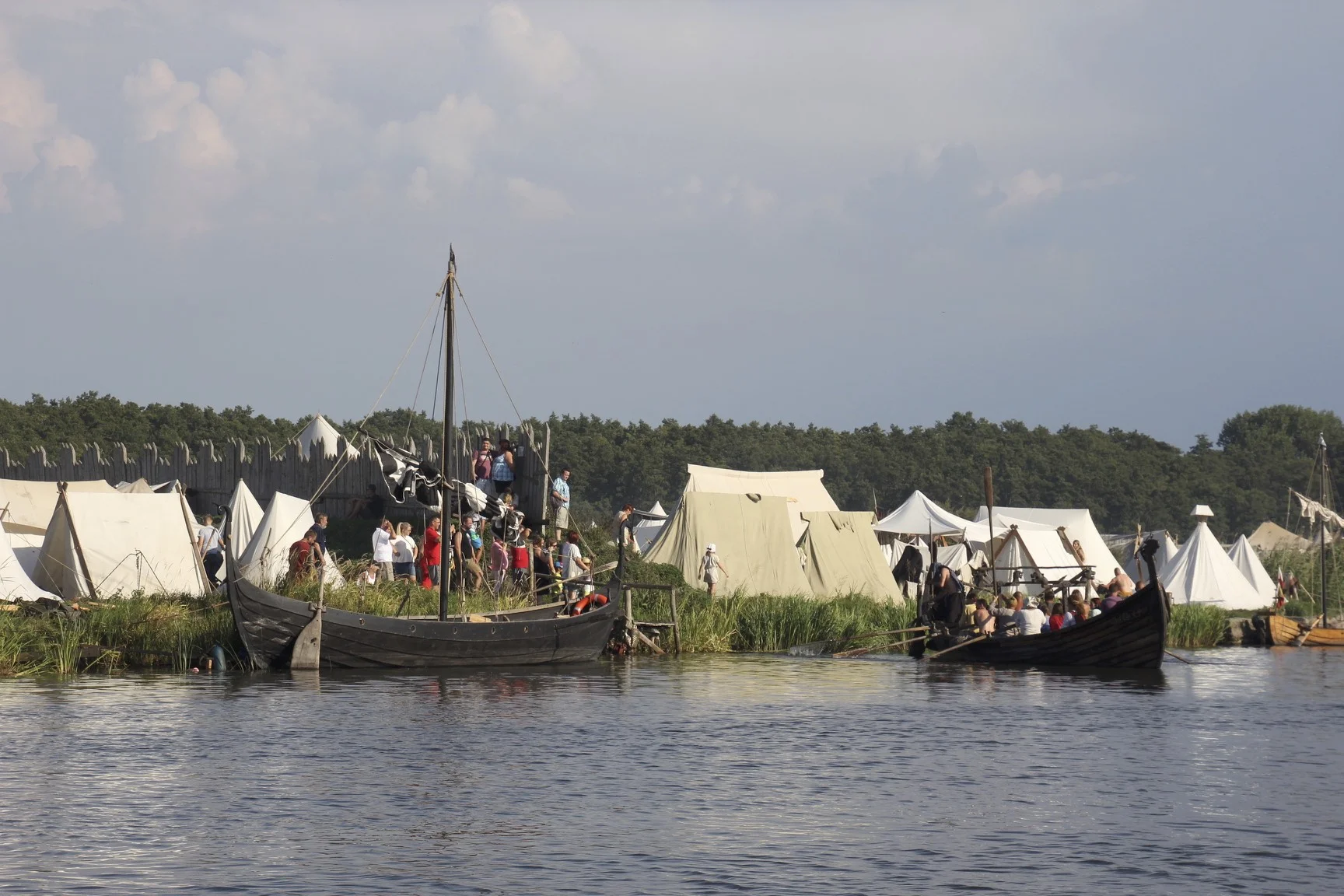
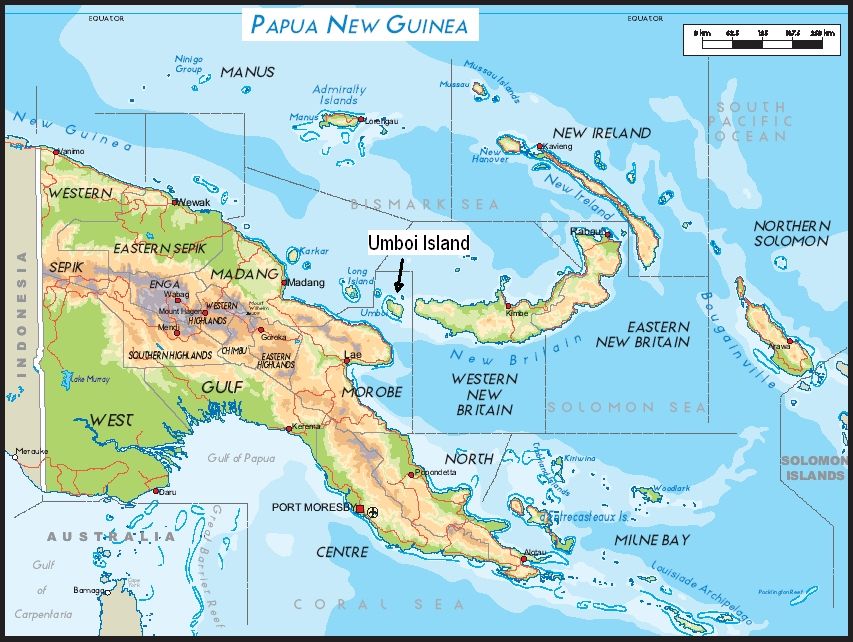
Location of Wolin - north of Szczecin and about 20 km from the Baltic Sea
Iceland
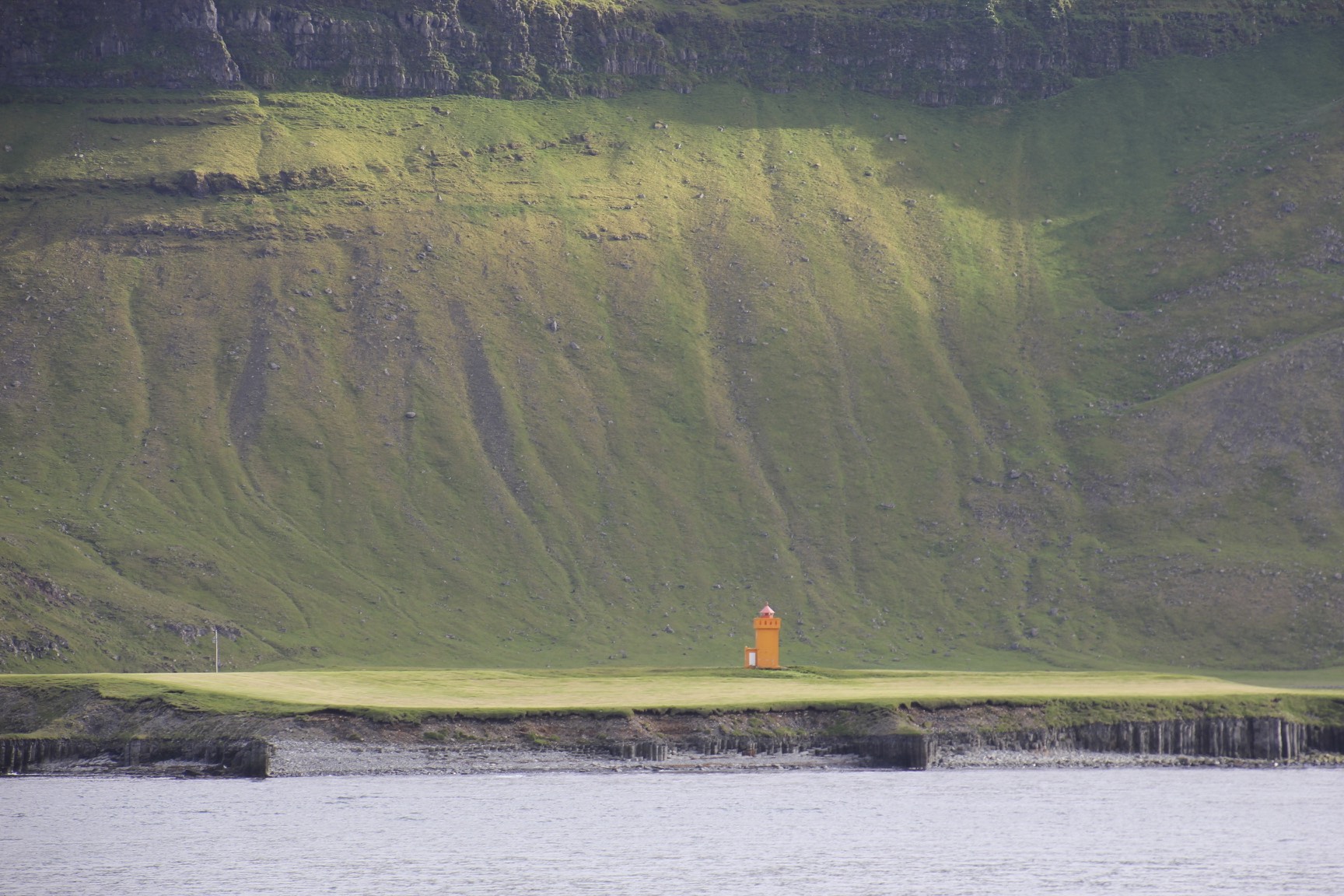
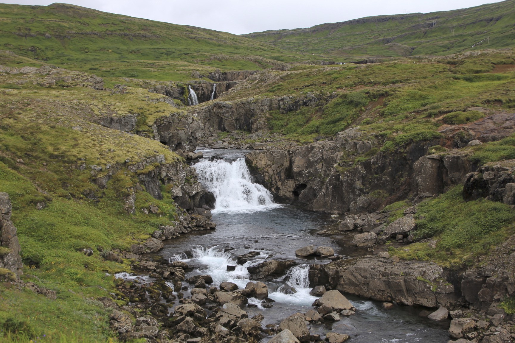
Sejdylsfjordur in the east part of Iceland
Sejdylsfjordur
Grundarfjordur
Grundarfjordur
Hiking up one of the mountains around Grundarfjordur
Grundarfjordur
Grundarfjordur
Grundarfjordur
Grundarfjordur
Near Gullfoss
Near Gullfoss
Near Gullfoss
Near Gullfoss
Near Gullfoss
Sejdylsfjordur
Sejdylsfjordur
Grundarfjordur
Grundarfjordur
Grundarfjordur
Grundarfjordur
Grundarfjordur
Grundarfjordur
Grundarfjordur
Grundarfjordur
Grundarfjordur
Grundarfjordur
Grundarfjordur
Grundarfjordur
Grundarfjordur
Gullfoss
Gullfoss
Gullfoss
Gullfoss
Gullfoss
Gullfoss
Bolivia Cordillera Real and Sajama National Park
For information about climbing in Condoriri Area see here.
Photo by Eduardo from the Bolivian Mountain Guides
Huayna Potosi and an old cemetery of miners
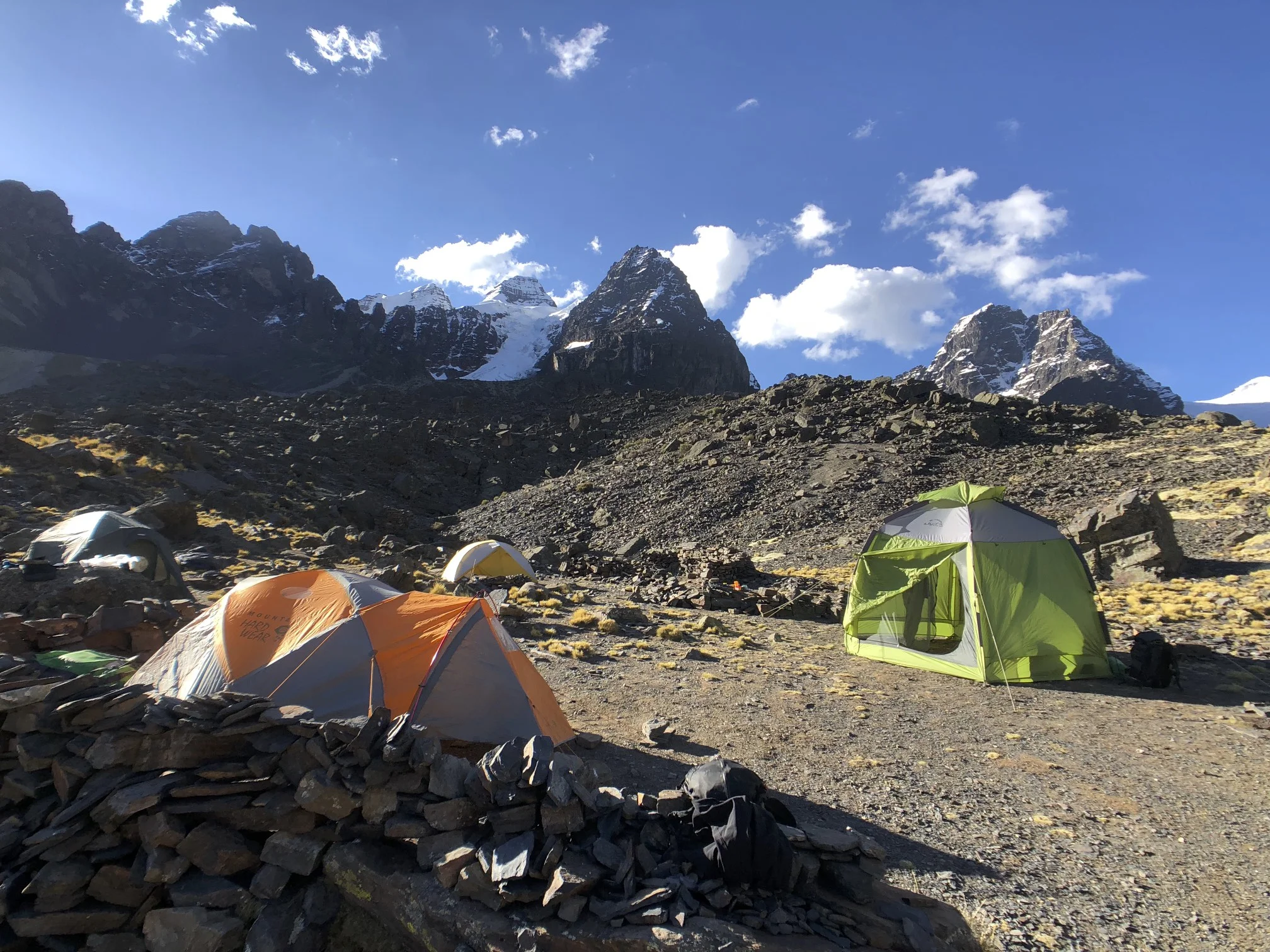
Basecamp for Pequeno Alpamayo and Condoriri
Looking towards Lake Titicaca and the Cordillera Real from Peak Austria
The top pf Pico Austria
Huana Potosi
Condoriri
Condoriri 5,648m from Pico Austria 5,350 also known as the Matterhorn of Bolivia.
View from Pico Austria with annotations
Our team at BC
sunrise on the Pequeno Alpamayo 5,434m.
Sunrise from Pequeno Alpamayo
Pequeno Alpamayo - direct route
The summit of Pequeno Alpamayo
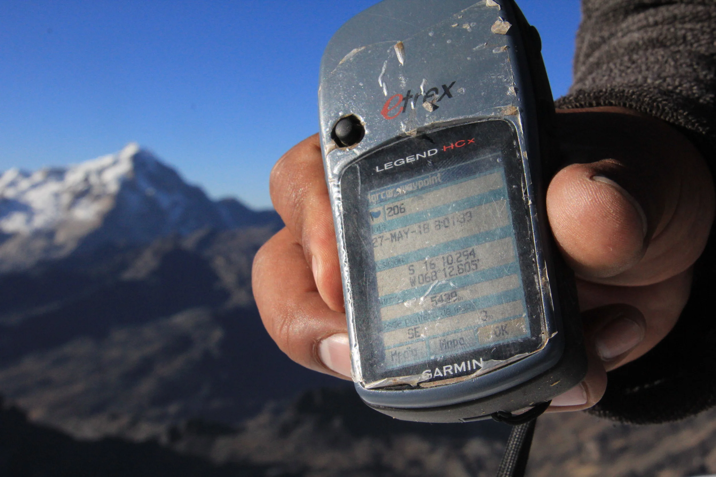
Summit of Pequeno Alpamayo 5,438m
Acohuma and Chachacomani from the summit of Pequeno Alpamayo.
The large bulky mountain is Chachacomani 6,074m fromt the summit of Pequeno Alpamayo.
Innominado 5,320m seen from the summit of Pequeno Alpamayo.
View of the Cordillera Real looking north from Pequeno Alpamayo.
Approaching the top!
Gregorio and me on top
Huana Potosi
Huana Potosi and Ilimani in the distance
The summit ridge of Pequeno Alpamayo 5,434m.
Pequeno Alpamayo 5,434m - a fine isolated peak
En route to Sajama National Park
Volcan Sajama 6,520m
Sajama and interesting volcanic formations of the Altiplano
Volcanoes Parinacota and Pomerade on the border between Bolivia and Chile
Sajama - the highest peak in Bolivia
Laguna Atla in Lauca National Park in Chile
Volcan Sajama
Sajama Village with Volcan Sajama in the background
Volcan Acotango from Sajama Village and the Bolivian Altiplano
The base camp of Volcan Sajama at 4,800m
The road to the trail head on Acotango. The road was built and is maintained by the government owned sulfur mine.
Volcan Sajama and sunrise on Acotango
Volcanoes Parinacota and Pomerade and Chungara Lake in Chile from Acotango
Sajama from Acotango
Volcan Acotango
Sajama
The trail to the BC of Sajama. I met Cholitas Escaladoras who were climbing Sajama.
Cholitas Escaladoras - Bolivian women mountaineers
On the border of Chile and Bolivia - exploring the Sajama NP
Sajama NP
Sajama NP - great geothermal formations
Geothermal formation of the Sajama NP
Sajama NP
Sajama NP
Volcan Sajama
Bienvenidos a Bolivia!
Bolivia - Tiwanaku and La Paz
The ancient ruins of Tiwanaku are located in Bolivia, near Lake Titicaca, at an altitude of almost 13,000 feet (4,000 meters) above sea level, making it one of the highest urban centers ever constructed. The city reached its peak between roughly A.D. 500 and A.D. 1000 and had at least 10,000 people living in it. At this point only a small portion of the city has been excavated.
Some remarkable artifacts have been discovered and examined at Tiahuanaco, not the least of which was a large monolithic Sun Gate which must have been an important part of the Kalasasaya, the chief temple of the ancient city. Its upper part is covered with an intricate sculpture that has been described as a calendar almost as long as the monolithic gateway. In fact, the Sun Gate has also been called the Calendar Gate. This calendar sculpture depicts a solar year, but not one that fits into the solar year as we know it.
Togo and Benin
Benin
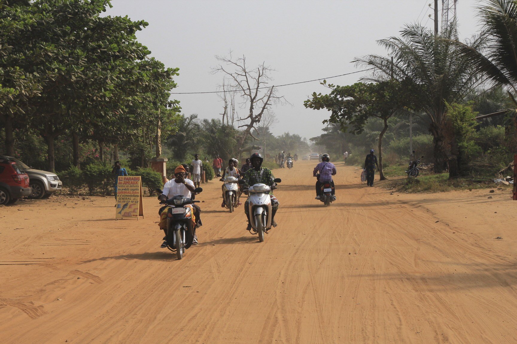
Sokode, Togo
Lome, Togo
Street Vendor Lome
Lome, Togo
Lome, Togo
Lome, Togo
Togo
Gas/petrol Station
Gas/petrol station
Togo
Togo
Sokode, Togo
Petrol station in Sokode serving small motorbikes and mopeds
Kola nuts - the currency of Sahel
Sokode food stand
Sokode, Togo
Sokode, Togo
Local market in Sokode, Togo
Sokode, Togo
Sokode, Togo
Main square in Sokode, Togo
Sokode, Togo
Sokode, Togo
Dental office in Sokode
Sokode, Togo
Sokode, Togo
Sokode, Togo
Sokode, Togo
Sokode, Togo
Sokode, Togo
Sokode, Togo
Togo
Togo
Ouidah, Benin
Togo
Sokode, Togo
Sokode, Togo
Sokode, Togo
Sokode, Togo
Sokode, Togo
The Royal Palaces of Dahomey, Togo
Ouidah, Benin
Benin
Ghana
Mother and son in Northern Benin
Ouidah, Benin, the road of no return
Ouidah, Benin
Benin
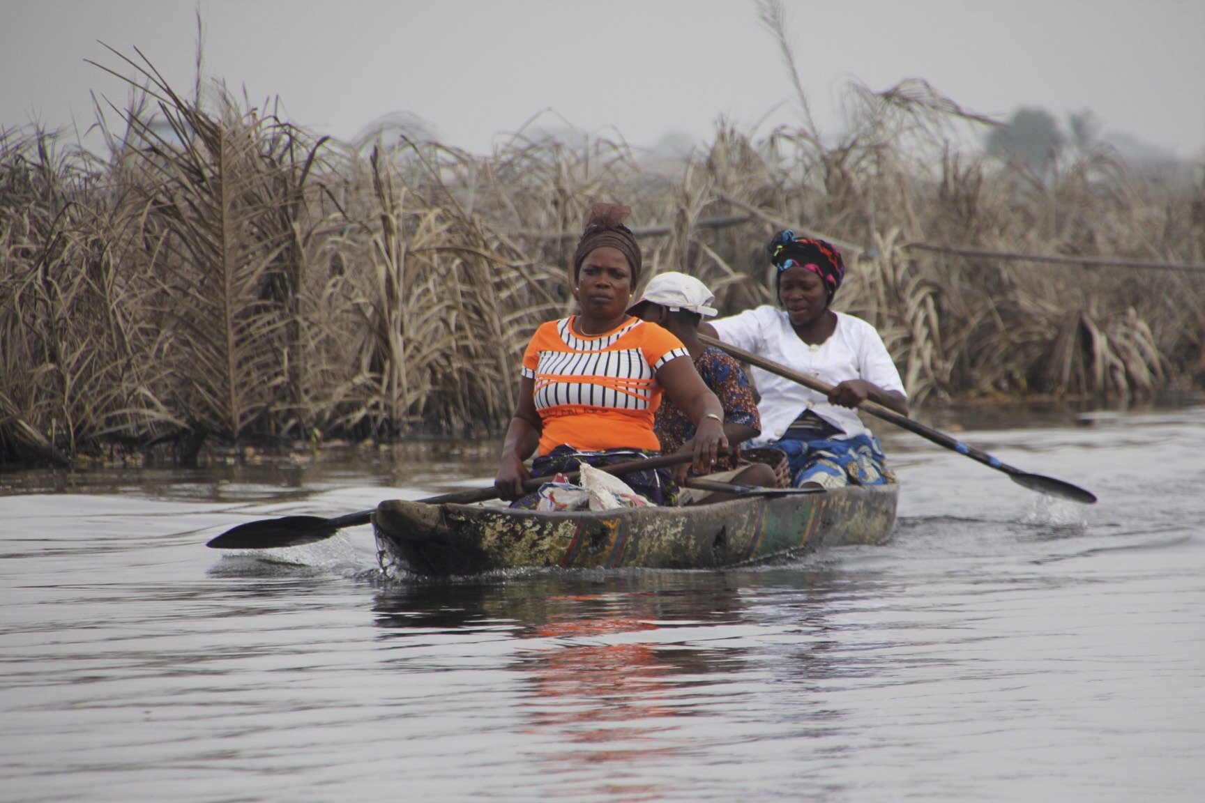
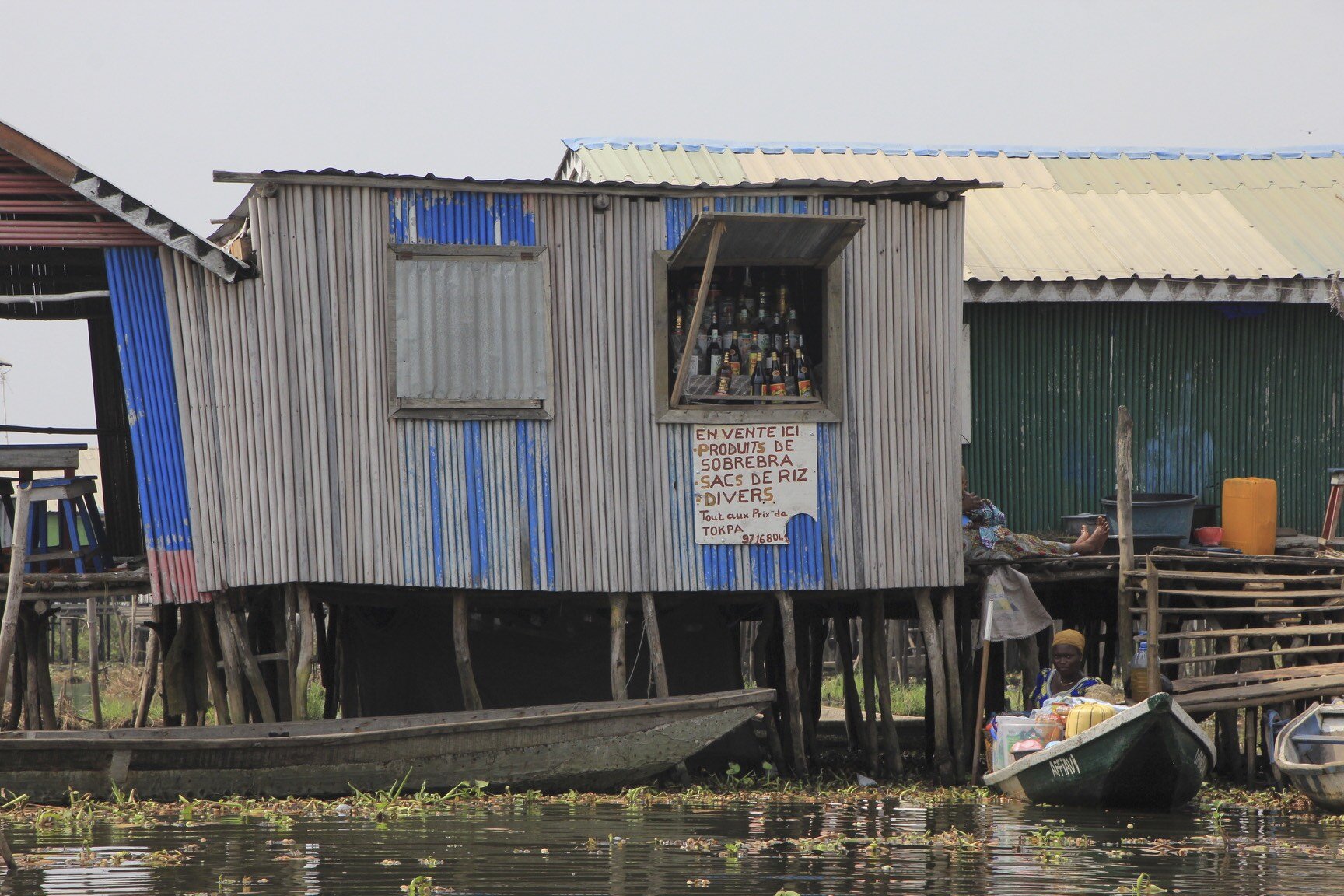
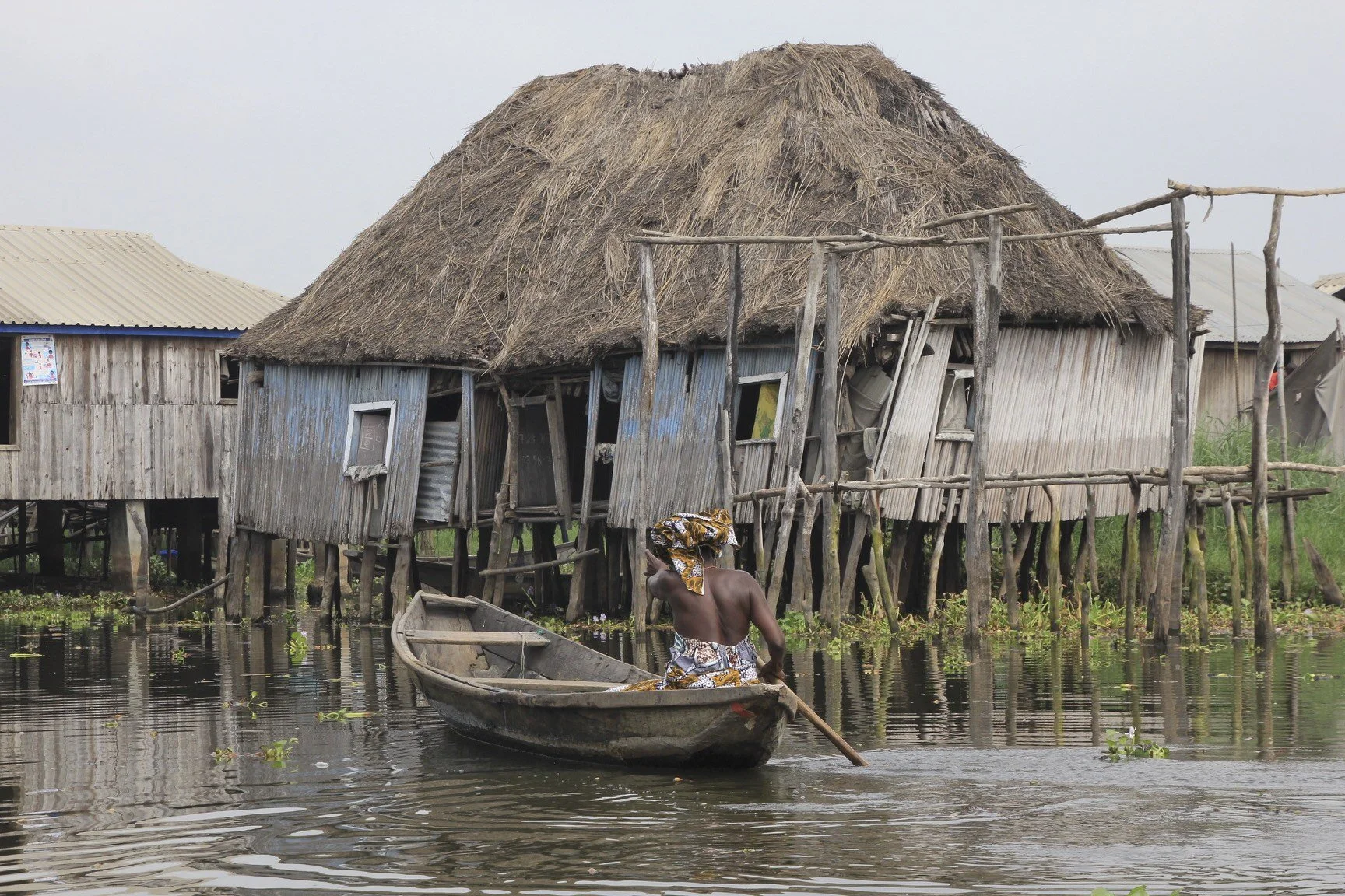
Gamvie, Benin
Gamvie, Benin
Gamvie, Benin
Benin
Benin
Benin
The sand of the African Gold Coast
Kumasi, Ghana
Volta River, Ghana
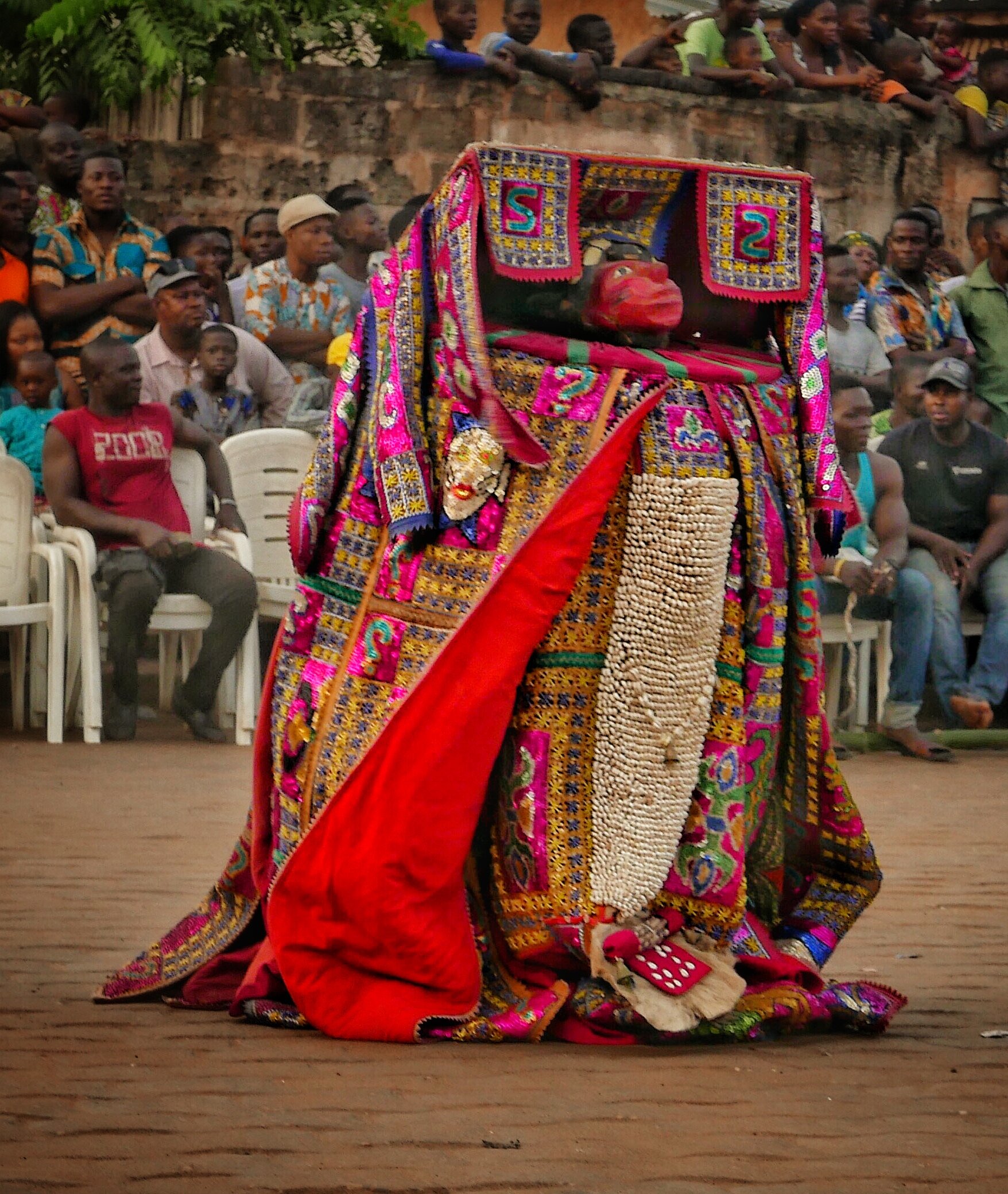
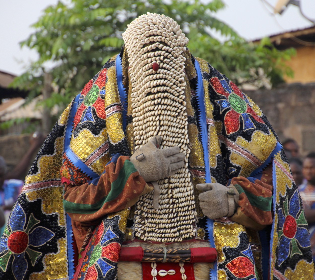
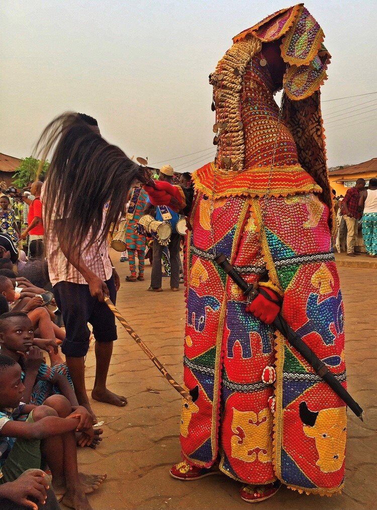
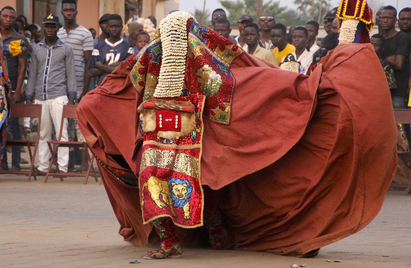
Benin - Egungun Masquerade
The Egungun is a secret society of masqueraders of the Yoruba People who live in the area of Western Nigeria and Eastern Benin. The Egungun worship the ancestors and provide a means of contact with the ancestral spirits. The masks worn by the Egungun represent a spirit of a particular person.
This is a good summary of the ceremony by James Dorsey (www.perceptivetravel.com):
To the adherents of traditional African voodoo there is no difference between the waking world and that of spirits, they are the same, co-existing in what a westerner might call a parallel universe. The living and the dead are in constant communion, aiding each other just as they did in physical life. It is the job of the mambo, or griot, the West African version of a priest, to oversee this union, to guide it using established traditions that allow the living to navigate among the dead without being totally drawn into that void. While they believe the deceased are constantly among us, they also believe a living person can enter the twilight world for brief periods if under careful guidance, and of course depending on the personal power of the metaphysical traveler. The witch doctor or shaman are nothing more than spiritual guides who facilitate communication between those who have gone before and those who still occupy the material world.
The ceremony is presided over by a council of griots, or mambos as they are known locally; there are usually several in attendance, but the uninitiated will not know who they are. They are secret masters of ceremony, making sure all goes according to plan, and ready to make judgment calls if things get out of hand, as I was about to find out.
The Egun Gun are a secret society of men who spend most of their adult life learning an archaic set of rituals, prayers, and ceremonial traditions, that include their own private language and dances. They spend great amounts of time creating surreal looking outfits that hide not only their true identity, but emphasize the fact that the wearer is in a special place and not of this world.
They are so secretive that fellow tribal members do not know who is a member or not, and that days before a ceremony an Egun Gun dancer secrets his homemade ceremonial costume in the woods and makes excuses to disappear so no one will know where he is going and no one will ask why. During this time he prepares himself through fasting and prayer. Even more fascinating is the fact that once the ritual begins, he becomes the living dead. The Egun dance is tradition and religious rite simultaneously, as much theater as ceremony, part Kabuki and part melodrama, but deadly serious.
Once in costume and mask the dancer is no longer a member of the material world. He enters a trance like state, becoming a conduit for a deceased relative to enter his body. When this is achieved the dancer will begin to gyrate and contort in ways not normally doable in a waking state. The idea is that the dancer mimics all he has seen from his fellow tribesmen during the period since the last dance, showing the spirit inside him what everyone has done lately. This in turn allows the spirit to know who has been good or bad and who needs to be punished or rewarded. Ancestors, who are never far away, are the keepers and arbitrators of how their families should live and this dance is their periodic checkup. But being spirits, benign or not, they all hold a "terribelita" that once unleashed could wreak havoc if not properly controlled by ceremony.
Having any contact whatsoever with an Egungun can prove deadly for both the Egungun and the other person, so each Egungun is accompanied by a 'minder', also a member of the Egungun society, who carries a long stick to drive individuals away. It is believed that even seeing a part of a body of the dancer can result in death.
Egungun is a dance performance that opens a portal between the realm of the dead and the living. During the dance, the ancestors send blessings to the spectators and the entire community.
An Egungun man has an elaborate flowing coat which is sewn all the way to the top over his head with beads and shells. Masqueraders enter in a state of ecstasy when they perform and their anonymity is of the upmost importance in the Egungun. Once wearing the costume, the performer ceases to be himself and become the ancestor. The Yoruba concept of spirit is that it exists before birth and continues after death. The corporal life is therefore a temporary state. The spirit can be evoked as it exists independent of the body.
Bata drums are associated with Sango - the god of thunder - and they are usually played during celebrations held in honor and praise of him. The drums have different uses and functions in Yoruba society; some of these functions include enriching and vitalizing certain traditional practices and ceremonies such as Egungun festivals. One of the most important parts of Egungun dancing is "communication and the language of the drums.” Dance in Yoruba religious traditions is of utmost importance because it is one of the methods through which the gods can be contacted and engaged with. For instance, during Egungun ceremonies, the Bata drums are used to communicate with Sango.
The Egungun conceal their faces with layers of cloth, animal skin and strange structures of shells and baubles. Their many layers of colored cloth, embroidery, leather, animal skin, shells and beads, and their masks, completely obliterate the human form. It is through concealment of the human body that the spirit is revealed.
The dancers dress elaborately to reflect the prestige of the ancestor they portray, and exquisite cloth is used in their distinctive outfits to honor the grandeur of those the represent. On many of their draperies animals are embroidered into the fabric as part of their representation of the dead.
Egungun are escorted by other members of the Egungun society who act as crowd controllers. People try to hide or run away from them because they fear that if touched they will die shortly after.
Egungun wear a base layer made of Aso-Oke, which resembles the shroud in which the dead are wrapped. They also wear netting for the face and hands, which hides features which may reveal their identity. Only men can participate as masked ancestors, although women still play an integral role in dancing and helping to create the costumes.
The layering is a mark of the owner’s prestige; it also makes the transformation of the dancer possible. Skilled and energetic dancing results in the cloth panels flaring out, exposing the multiple layers and coloured under-surfaces, and completely transforming the appearance of the Egúngún. The movement of these cloths generate what researchers have termed a ‘breeze of blessing’ through the crowd.
When the performance is completed, the performers as Egungun give messages, warnings and blessings to the assembled spectators. Here a man uses a stick packed with animal fur to waft the knowledge of the dead and his blessings onto a townsman.
The identity of the dancer is concealed – Egúngún can be translated as “powers concealed” – the work of the performer is to bring the costume to life and in doing so, to lose his identity in that of the ancestor whose powers will be brought forward.
Men perform the Egúngún; women participate in the ritual dances and sing praise poems.
‘Believed to be the embodiment of ancestral sprits, an important context for these masks is to provide a farewell visit following the death of any senior men in families that belong to the mask society. A few weeks after the burial, a mask will emerge from the dead man’s room, dressed in his old clothes, to rebuke any quarrelling family members, say farewell to his wives and children, and perhaps accuse someone of responsibility in his death. Other Egúngún perform at an annual town festival, parading thorough the streets with a gang of followers, often surrounded by a posse of excited young men, with sticks who chase and beat each other and youths in the crowd. As embodiments of the ancestors, the more important of these masks are thought by many to have healing powers and often women who are having problems, especially relating to fertility, will kneel and supplicate the spirit for assistance. Small gifts of money are made to the mask’s attendants, and if the problem is subsequently resolved a chicken or some other sacrifice may be given. Certain masks will achieve reputations for successful intercession and ay accumulate a growing power, visibly represented on the mask itself by a growing encrustation of black sacrificial residues.’ (D. Clarke 1998)
There are different types of Egungun masquerades: onidan, idomole, and alubata. Onidan can be said to mean “owner of miracles.” The masquerades within this category exist mainly for entertainment purposes. They usually depict a wide variety of characters including priests, policemen and prostitutes. Idomole, on the other hand, translates to something which pleases the eye. Idomole masquerades can be considered as Egungun’s children. Their purpose is to honor the ancestors and their spirit(s). Finally, Alubata translates to "the one who plays the Bata drum."
This title can be said to refer to the Bata drummers who are present at the ceremonies where alubata masquerades perform. The alubata masquerades often wear very colorful shrouds and are the highest ranking masquerades. That they rank the highest and have a name which is associated with Bata drummers can be considered as being quite significant. Perhaps it implies that the collaboration between the alubata masquerades and Bata drummers is necessary for effective communication with the spirits and gods through vibrant sounds and elaborate movements.
A Egungun chases men around the square, with his minder trailing behind holding a massive stick to ensure that order is preserved. The Egungun chase people throughout the ceremony. Once you show fear, the tribesman will hold and scare you till you give them some money.
Benin - Voodoo Festival
Voodoo or vodun is officially a national religion in the coastal West African state helmed between Nigeria and Togo. During Matthew Kerekou’s Marxist military rule of 18 years which ended in 1991, voodoo was suppressed and outlawed in the country, even though about 60% of Beninese are devotees of the faith.
With the exit of Kerekou from power, the practice began to thrive freely again. Following his return to power as a democratic elected President in 1996, Kerekou capitulated to the people’s wish when taking his oath of office by acknowledging ancestral spirits, and the government declared January 10th as public holiday in celebration of Fête du Vodoun (Voodoo Festival).
In times past, Ouidah served as a major port where African slaves were shipped to the Americas and Caribbean. The festival often starts with the slaughter of a goat to the python spirit at the Temple of Python. This is followed by a 3km trek from the old slave auction block down to the harbor as devotees are led by the voodoo pope (voodoonou) who stops to offer prayers at specific points on the way.
Vodun means ‘spirit’ in the local Fon and Ewe languages. The divine creator in voodoo is Mawu or Mahou. She is an older woman, a mother, gentle and forgiving. She is the god who owns all other gods.
Mawu’s masculine counterpart is Legba, believed to be a very old wise man who walks with crutches. In statues and images, he is represented as a phallus or as a man with a prominent phallus. Legba is the most powerful of all voodoo divinities. He is the guardian of the door of the spirits so it is only through Legba that it’s possible to contact other gods.
There are about 100 other voodoo divinities who all represent different phenomena. For example, there is Gou, the god of war and blacksmiths, and Sakpata, the god of illness, healing and earth.
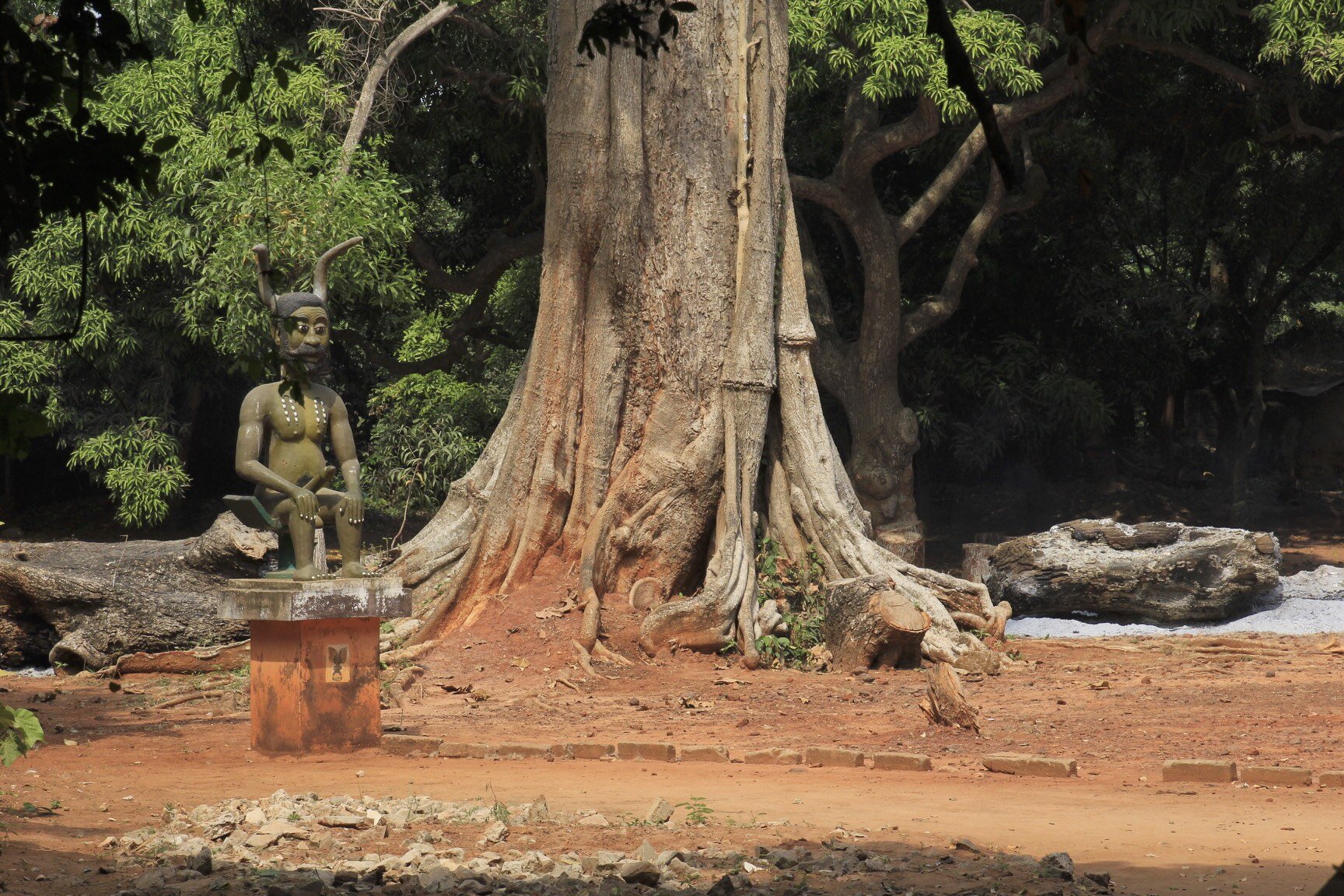
There is a legend that King Kpasse, the first king of Ouidah, turned himself into a tree. Over the centuries, this tree has gained religious and spiritual significance. In 1991, ahead of the first International Voodoo Festival, the area around the tree was landscaped and statues of voodoo gods were erected. It is now a place of pilgrimage for adherents of voodoo from Benin and further afield.
Zangbeto - the guardians of the night in the Voodoo religion. According to the Yoruba tribe tradition, there are no people under the haystack costume, only the spirits of the night. Zangbeto are a source of wisdom and continuity.
Zangbeto guarantees protection against bad spirits and malicious people. The spinning movement of the mask symbolizes the spiritual cleaning of the village and Zangbeto also performs miracles to prove its powers.
Zangbeto and his minder
The King of Allada and his wives
Voodoo priestess
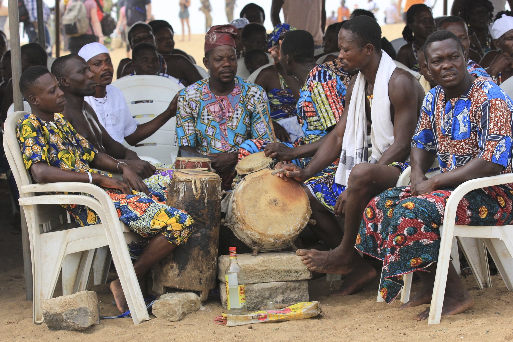
Drummers waiting for their turn in the voodoo ceremony
The Voodoo Pope
Voodoo priest
Vodun talismans (statues, human and animal body parts), called fetishes, are often combined in the construction of shrines or altars used to call forth specific deities and their associated powers. These shrines often ooze with candle wax, palm oil, feathers and the blood of sacrificed animals. The fetish origins of worship which form the basis of voodoo, predate most religions by as much as 10,000 years.
Voodoo priests ask the divinities to intervene on behalf of ordinary people. They sometimes ask for offerings to sacrifice to the god; a chicken, a goat, or a sheep, perhaps. Each animal is used for a specific ceremony. Other more mundane objects are also used in religious ritual. This is explained by the fact that all creation is considered divine and, therefore, contains the power of the divine. This is how herbal remedies are understood. No object possesses any sort of power, though, until it has been blessed by a voodoo priest.
Followers of voodoo hire a voodoo priest once every seven years to perform a good fortune ritual for themselves and their family.
Some spirits are maleficent, and speaking with the spirit world is quite dangerous unless you take necessary precautions. Most of the time, the only people allowed to communicate with the spirits are Vodun priests, who surround themselves with protective fetishes/amulets, but sometimes ‘lay people’ are invited to join a ceremony. In this case, the priest will often either anoint the attendee with water, or get them to drink some out of a suitably protected bottle.
Twins, dwarves and albinos are amongst the most revered people in voodoo and are feted wherever they go. Twins, in particular, are considered a huge blessing for a family. People who have lost a twin sibling gather together to remember their brother or sister and give thanks for their lives. It is thought that, that many women lie about losing a twin.
Each of the Vodun spirits is invoked by means of a ‘fetish’, or specific object, and each spirit has their own specific object, which relates in some way to what they do. This may sometimes be a anthropomorphic representation of the spirit in question, or it could be an object that relates to their remit in some way. However the fetish itself is usually not enough – a ‘preparation’ has to be applied. This is a special ‘mix’ of liquid, powder, and detritus that is either smothered onto the fetish, poured into a vessel atop the spirit’s representative form, or otherwise ingested, applied, or burned as necessary.
The possessed
The use of talcum powder in Vodou rituals is used to embody or summon spirits.
Ghana - The Gold Coast and the Land of the Ashanti
Street furniture store in Accra, Ghana
Fancy coffins made to order in Ghana - this one is for a photo enthusiast
A coffin for a beer enthusiast
One of many colourful street vendors in Accra, Ghana
Accra, Ghana
Accra ocean front
Accra, Ghana
Accra Street
Ghana, the land of smiles
Accra, Ghana
Strong core in Accra, Gahana
Street vendor in Accra
Largest recycling dump in the world. All sorts of appliances, computers, cars etc are taken apart and resold for scrap. It is a toxic and tedious job.
Recycling 101
The workers burn plastic cables to separate copper wiring for scrap. Toxic and dangerous.
Accra water front
Fishing boats in Accra
Mending the nets
Local girls getting water in the morning from the River Volta
Volta River
Volta River
Morning water duty at the Volta River
Religious signs like this one are everywhere in Gahana
The Land of the Ashanti in Kumasi, Ghana
The King of Ashanti
At the audience with the Ashanti king
An Ashanti chief with a big umbrela
An Ashanti elder
Ashanti chiefs, the bigger the umbrella, the more important the chief.
Chiefs and the Kente cloth
The King's musicians
? (a walking salad bar) ?
Ashanti King's procession, the keys to the kingdom
The King is coming - the horn blowers
King's advisors
The King has the biggest umbrellas!
King's guard
King's gold
Chewing gum for the chiefs
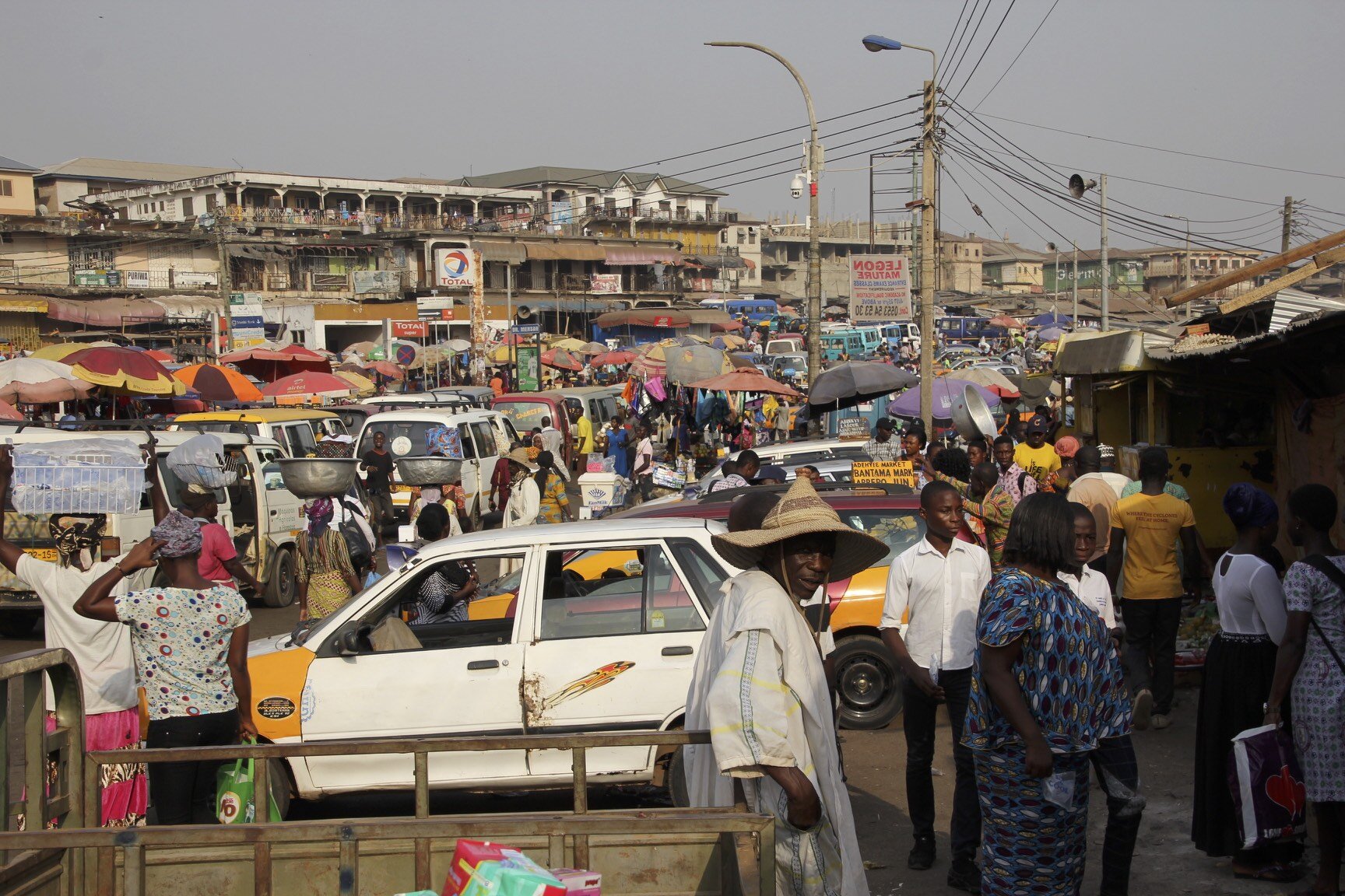
The largest market in Africa is in Kumasi
Local barber shop
After hours, the streets of Kumasi turn into one huge open market. Recycled clothing from Europe and the USA is everywhere.
Trying to make a living by selling used clothing in Kumasi
Kakum National Park Canopy walk
Bush meat for sale by the road side
Bech sports in Elmina
The Gold Coast of Ghana, the source of slaves for 400 years. A beautiful coast but too dangerous for swimming due to strong currents and sharks.
Finishing is a big business in Elmina, Ghana
Drying fish in Elmina, Ghana; the Elmina slave castle is in the background
The Elmina slave castle built by the Portuguese in 1481
The slave castle of Elmina. It was used as a set in the movie "Cobra Verde" by Werner Herzog.
Koffi, our leader
The cell of death where rebellious slaves were starved to death in the Elmina slave castle
Slave holding cells from where they were led to waiting ships in the Elmina slave castle
Salve holding cells in the Elmina slave castle
Salve branding iron, Cape Coast slavery museum
Elmina
Elmina
Elmina
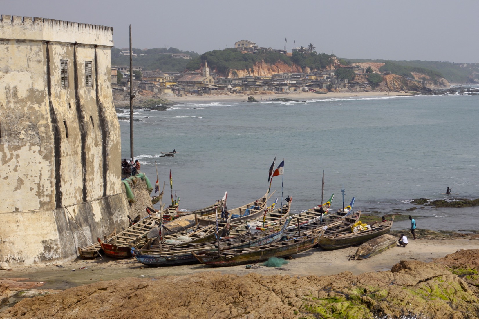
The slave castle of Cape Coast built and operated by the British
Cape Coast
Cape Coast
The slave castle of Cape Coast
Cape Coast
Cape Coast
Kids doing acrobatic tricks
Elmina
Elmina fishing port
Elmina fishing port
The fishing port on the market day in a busy place
A balancing act
Business women
St. James Castle in Elmina
St. James Castle in Elmina
The view of Elmina Fort from the St. James Castle in Elmina
Ghana - the land of smiles
Bossman or Bad Man haircut?
The beautiful coast of Ghana
Annapurna Basecamp and Annapurna Sanctuary Photos
Thanks to Kumar and Rajendra from www.mountainsunvalley.com who made this adventure a great success!
See the link for annotated photos of the Annapurna Himal
Annapurna from space. The South Annapurna BC is on the right side of the photo. Frozen Tilicho Lake is at the top centre of the photo.
The entire Annapurna Range from the south
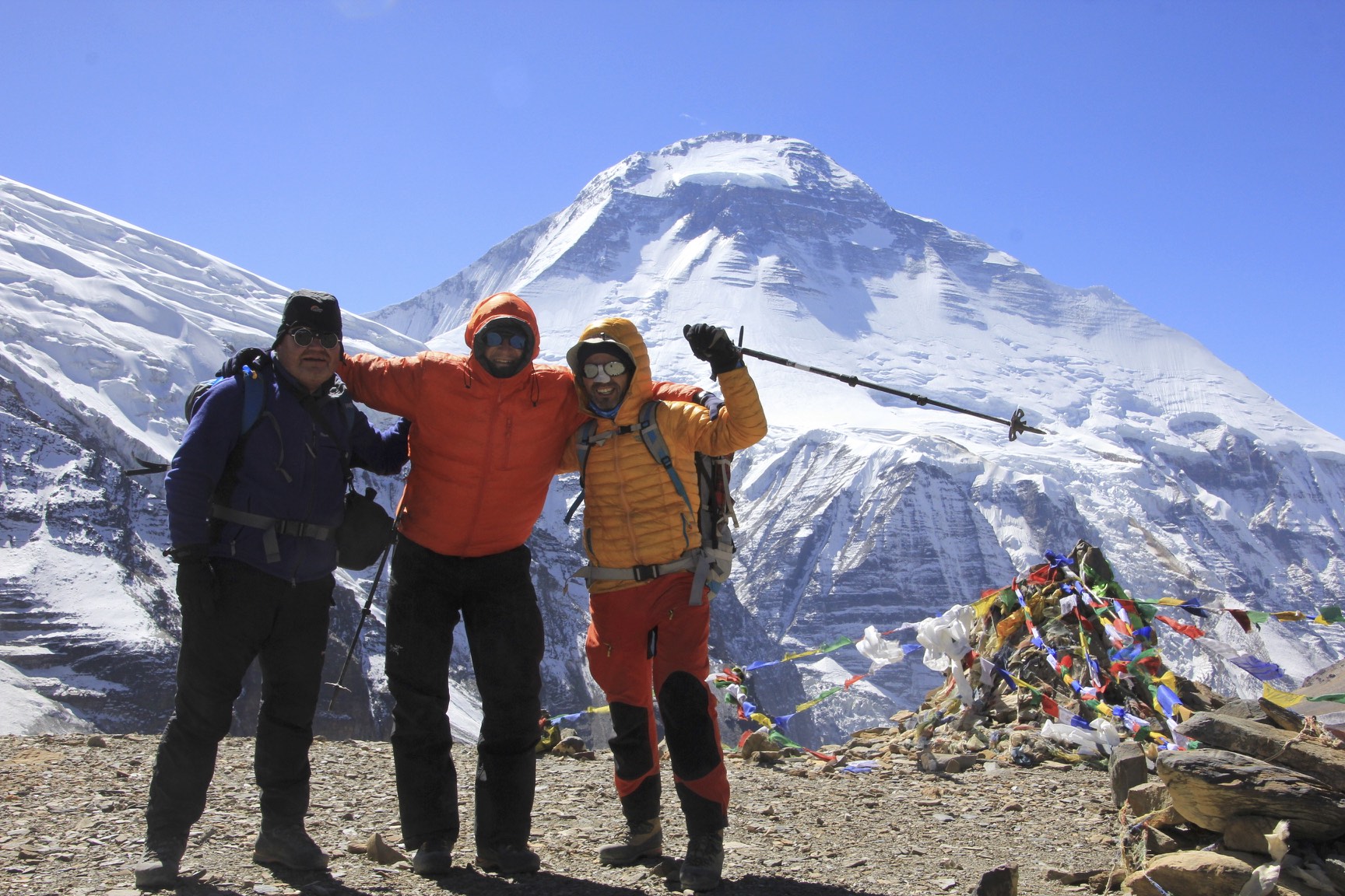
On the way to the start of the trek we passed under the Dhaulagiri east wall and east icefall. Notice the cave dwelling - reminiscent of Mustang.
Dhaulagiri
Dhaulagiri
Start of our walk from Trisulli Bazar
Going places!
Dhaulagiri at sunrise
Dhaulagiri
Dhaulagiri II
Annapurna South
Annapurna South
The Fang
Annapurna South
As we climbed out of the Kali Gandaki gorge, the spectacular panorama of Dhaulagiri and Annapurna ranges unfolded before us.
The sunrise over the eastern hills of Nepal
A book about Alex Macintyre who died on Annapurna I (great book by the way)
En route to Annapurna BC - Siduwa Teahouse, nice people and good food. Most importantly it serves cold beer.
Typical accommodations along the trail. No stars but no tent either :-)
The trail to the Annapurna BC follows a deep gorge with spectacular waterfalls all around. This is the lower wall of Machapuchare.
Lower flank of Hinchuli, the site of a deadly avalanche in 2019 which killed 3 people.
Hinchuli - the south east flank
The last teahouse before the ABC. from here to ABC is only a 3 hour walk.
Machapuchare
Machapuchare
Machapuchare
Annapurna South
Annapurna I in all its splendour - 10,000ft of steep wall
Looking down the Annapurna Glacier. The pointy peak on the right is Machapuchare.
Annapurna BC, the actual climbing BC is at the foot of the mountain - another day’s walk from here.
Annapurna I and the Annapurna Glacier
Annapurna South
The icefall of Annapurna South and Himalchuli
Annapurna 3
Annapurna 3
The Fang
One of the memorial plates at the ABC. Another sad story so common in these high mountains.
Prayer flags
The Heliport at the Annapurna BC. Due to recent changes and restrictions by the Gov, tourist flights to the ABC are no longer allowed.
Look what I found! Among flags from all over the world.
The elevation of the Annapurna BC
It was great to do this trek with Kumar - we shared so many adventures
Annapurna I
Machapuchare
Annapurna I at sunrise
Our ride! The helicopter brings people from Pokhara for a short stay at the ABC. We managed to get a ride around the glaciers and then down to Pokhara for a very good price (it was impossible to say no :-)).
Hiunchuli
Hiunchuli
Annapurna South from the helicopter. On the far right is the Fang.
Himalchuli and the icefall - what a different perspective!
Annapurna 1
The Roc Noir. Gangapurna is on the far right. See the Mesocanto La Trip photos for the photos of these peaks from the other side! They do look very different.
Gangapurna - the triangular peak at the top of the photo
Gangapurna - this peak is very prominent from the Annapurna Circuit trail
Annapurna III - the mountains on the horizon are on the border of Nepal and Tibet (China). Apparently the ridge visible in the photo on Annapurna III has not been climbed.
Machapuchare
Machapuchare
The north face of Machapuchare - absolutely spectacular from the helicopter at the altitude of almost 6,000m. This mountain looks awesome from all sides.
Annapurna II - almost 8,000m high
Annapurna 4 and Annapurna 2
Lamjung
Pokhara Airport
Machapuchare from Pokhara. Pokhara is a beautiful city and very different from the capital of Nepal.
A few photos of the Annapurna Range from the KTM-DOH flight:
The flight over the Himalaya is always exciting! The mountains look different from 36,000ft. It is also fun to see the valleys and trails from above. The perspective is totally different as it is hard to see the lay of the land while trekking when the giants are towering above you!
Annapurna 2
Annapurna 2 (left) and Lamjung Himal (right)
Annapurna 4 (the pointy peak) and Annapurna 2 on the right
Annapurna 1 and the Annapurna Sanctuary
Annapurna 1
Gangapurna and Annapurna 3 (right)
Hiunchuli. Behind is Rock Noir and Gangapurna (on the right). The Annapurna BC is directly behind Hiunchuli.
Annapurna 3 and Machapuchare. We flew in the helicopter between the Annapurna 3 and Machapuchare at the altitude of 6,000m.
Annapurna 3 and Machapuchare
The Fang and Annapurna 1
The Fang and Annapurna 1
Annapurna 1, The Fang and Annapurna South
Nirgili Peak (left), The Fang, Annapurna 1 and Annapurna South
Nilgiri South (6,839m), Nilgiri Central (6,940m) and Nilgiri North (7,061m), The Fang and Annapurna 1. The “flat” land on the left is Mustang. The Annapurna North West face (the route of first ascent) is accessed from the valley between Nilgiri North and Annapurna. The valley on the extreme left is Kalli Gandaki - the deepest gorge in the world between the massifs of Annapurna and Dhaulagiri.
Annapurna Sanctuary Trip Summary
See photos of the Annapurna Sanctuary taken from a helicopter flight
October 31, 2017 Marfa Tatopani 1,190m – Shita 1,935m
We hired a jeep in Marfa to take Walid, Diana, Kumar and me to Tatopani and to take David and Gilles to Pokhara. We left Marfa early in the morning and arrived in Tatopani around 12.30 pm. We drove through the Kali Gandaki gorge, which is the deepest gorge in the world. We had fantastic views of the Dhaulagiri east face and the spectacular icefall that I saw from the Mesocanto Pass in 2011. We also had dramatic views of the gorge with steep drop-offs to the raging river below.
We reached the dusty and dumpy Tatopani where we had a good lunch and some decent pastry. After lunch, Diana, Walid and I hugged and said tearful goodbye to David and Gilles, then started our Annapurna Sanctuary trek. I was not in the mood for more walking as my body was in the “relaxation mode” already. Without doing any prior research, I was anticipating an easy stroll to the Sanctuary, 3 days max on a flat trail, as it was one of the most popular treks in Nepal. No problem! I could do it in my sleep without trying. Just a side hop to the Sanctuary and back. Right…
My naïve assumptions were shattered fast. After lunch we started walking up to Shita. It was hot, shirt-drenching humid, overcast and muggy. We walked passed the really dumpy Tatopani hot spring (Tatopani in Nepalese means hot water). We walked up some shortcuts between the twists and turns in the road for 700 vertical meters. I was drenched in sweat. The walk was rather boring but some of the late afternoon views were nice. We could see higher peaks obscured by the afternoon clouds. We arrived in Shita in late afternoon to a busy teahouse. The teahouse was packed and the place had a completely different feel from the Dhaulagiri circuit that I just finished. It was a busy, commercialized and very touristy part of Nepal. Kind of Shitty, Shita style.
November 1, 2017 Shita – Ghorepani 2,900m
We walked up for another 900m on a stone staircase all the way to Ghorepani. Step after step, stairs all the way. There was not much to see, although we did walk through some nice villages with friendly locals. Overall the place was very clean and well-marked. The beautiful Dhaulagiri massif dominated the skyline. Had this been my first trek in Nepal, I would probably be very impressed. Given my recent experience though, it was just a place to walk through. A good example of hedonic adaptation.
The walk to Ghorepani was very fast for me as I was well acclimatized. I covered the distance in 2.5 hours and had to wait for Walid and Diana for almost an hour. In Ghorepani we passed the time by sitting around in the crowded teahouse with a couple from Spain and watching Walid entertaining the patrons. Ghorepani is a collection of modern large teahouses or hotels targeting mass tourism. The village is only a one-day walk from the road to Pokhara and thus it is very popular.
In the teahouse, I made a mistake of eating a fresh salad and got quite sick. Since I did not feel well, I did not have the energy to walk up to Poon Hill for the fabled sunrise view. It turned out that it was a good thing, as Poon Hill was crawling with people like an anthill. There were hundreds of people in a small space competing for a photo of the same view. So far this trek had too many people but it was to be expected.
November 2, 2017 Ghorepani – Torapani 2,710m
I got up this morning to walk to Poon Hill but I could not do it. I turned around and walked back to the hotel against the mass of humanity making their way up the hill. The stomach affliction drained the energy out of me completely. After Diana returned from the Poon Hill, we set off to Torapani, 5 hours away.
I was wondering how on earth I would be able to do it as I was operating at 15% capacity. First, the crowds heading out of Ghorepani were overwhelming: shoulder to shoulder in a long lineup of hikers so tightly packed that it was impossible to pass any of them.
It was horrible walking up the hill feeling sick and weak. I had to stop often as I was completely drained of energy. The views were nice and pastoral but compared to what we saw in Dhaulagiri, it was nothing special. I was hoping that the Annapurna basecamp was worth the trouble of getting to. I wanted to do this trek for a long time to cross it off my list. I started to realize that it was not really a wilderness experience but an experience in crowd walking with crowded teahouses, souvenir stalls and so-so views.
We arrived in Torapani in late afternoon. In Torapani we stayed at the Annapurna Guest House, a dumpy place but with a bed and that was all I needed. I slept well all night and I regained most of my energy.
November 3 2017 Torapani – Sinuwa 2,375m
The walk started with a beautiful sunrise over the hills of eastern Nepal. It was very special to see the sun emerge from behind the hills on the horizon. We had a 1,000m descent right off the bat. Then we crossed a small river and climbed a large hill for lunch at Chumrung. At Chumrung, the trail joined the main Annapurna Sanctuary trail.
Immediately from Chumrung, the views improved. The Annapurna Gorge that we would walk through was directly in front of us. The valley is flanked by steep walls and dotted with villages. What was not good, was a steep descent to the bottom of the valley (1,900 steps) and a massive immediate climb to the village called Sinua just across from us. In the heat of midday I had to get my umbrella out again to avoid melting away in the sun.
The walk up to Sinua was up the never-ending stone staircase. This trek has turned out to be quite a challenge (so much for an easy stroll I was expecting): from the start point we ascended 1,000m to 3,300m, then down to 1,950m, then up to 2,370m, etc. Up and down all the time.
Now we are in Sinuwa looking at a beautiful sunset over the Annapurna 3, Machapuchare and Hinchuli. The Modi River valley will take us all the way to the Annapurna Sanctuary. We sleep in another basic, borderline grubby place.
November 4, 2017 Sinuwa – Durali 3,200m – Annapurna BC 4,130m
The walk from Sinuwa to Durali was fast and uneventful. Nice views of the gorge. In Durali we sat around in a very crowded guesthouse for 7 hours until bedtime. I got a head cold from someone. I guess that after three weeks of continuous walking my body is just depleted. I shared the room with Walid and Diana as there was a shortage of beds. We got up at 6am to go to the basecamp at 7 am. The walking was again easy and fast to 4,130 m (1,000 ascent). I did it in 2.2 hours, mainly thanks to the acclimatization from Dhaulagiri. As I walked higher up the valley, the view opened up and the scenery became absolutely awesome. The gorge hides a great cirque of high peaks that form a perfect circle with Annapurna 1 (8,030m high) standing grand at the end of a glacier.
Past the Machapuchare base camp (Piss Tail Peak as Kumar called it), the trail turned sharply left and followed a moraine of the Annapurna Glacier all the way to the Annapurna BC (or ABC). The entire Annapurna Sanctuary is quite incredible. So close to Pokhara and yet so breathtaking. Standing at the basecamp, the Annapurna 1 dominates the view. Immediately next to the cluster of guesthouses at the basecamp, Annapurna South rises steeply to an altitude of over 7,000m. Next to Annapurna 1 is a mountain called the Fang. A massive glacier flows from Annapurna 1 and is flanked by two icefalls. To the right of Annapurna 1 is Mount Rock Noir, Mount Gangapurna and Annapurna 3. Next to it is the pointy Machapuchare, which looks totally different from the base camp. The entire cirque is magnificent, grand and majestic. It is really a special spot that requires a few days of boring walking to get to but once here, Wow! What a view!
Numerous memorials of many climbers that died on the slopes of Annapurna 1 dot the moraine close to the base camp. There are many Korean names but the most famous victims of this mountain are Anatoly Boukreev and Alex MacIntyre. All in all, a special place that is worth the time and effort to get to.
In summary, we walked 70 km so far and ascended from 1,000m to 3,300m, then walked down to 1,950m and back up to 4,300m. So much for an easy 3 day hike.
As we were sitting in the dining room of the Annapurna Guest House, I negotiated a 20-minute helicopter ride around the Sanctuary first thing the following morning. I was very excited but anxious as I witnessed a helicopter crash in 2010 on Ama Dablam. This altitude is at the very end of helicopter’s ability to fly. I always wanted to do a helicopter flight over the Himalaya and this was a perfect opportunity in such a spectacular place. The helicopter was already here and we did not need to waste time to fly over the lowlands before the high Himalayas. Helicopters come here regularly bringing wealthy Chinese tourists for a short time at the base camp. We negotiated this in front of all the porters and all the people in the dining room. I just dropped a healthy sum for a 20-minute flight without blinking an eye. I felt horrible to be doing this in the company of all the onlookers as this amount of money is a fortune to the locals. I did not want to come across as some white jerk throwing money around. But I did not have a say in where and how the deal was discussed.
November 6, 2017 Annapurna BC Pokhara
We went to bed at 8pm and I could not sleep until midnight and then I got only mediocre two hours of sleep. The cold and the chest infection were really bothering me. In addition I was sharing the room with Walid and Diana again. I was coughing and sniffling all night and I am sure that it bothered them, too. I felt really horrible to be such a bad companion. Since I had all the time during the sleepless night, I was busy imagining all the possible problems with the flight just a few hours away. I hate flying at the best of times. This was, however, an opportunity not to be missed.
Finally the morning came and everyone was up before sunrise to watch the spectacle on Annapurna 1 south wall. The sunrise on Annapurna is a famous thing to do on this trek and many people come here specifically for this reason. Last night we had a spectacular sunset on Annapurna as well and then on Machapuchare. The entire range was glowing gold and then red.
I was full of anticipation about the flight and I was very excited. I do not remember the last time that I was that excited about something (maybe in Antarctica in 2010). The helicopter flew in at 7 am with the Chinese. I could see it approach the landing pad of the BC from far away by its front light. The noise and the entire operation of the helicopter is very exciting for me as well. I just love watching them take off and fly away and hear the engine rev up before the lift-off. I find these machines graceful and a marvel of human ingenuity capable to get to impossible places.
I took the front seat, put on the headset, adjusted the seat belt and before I realized, we were off – so smooth and effortless. The minute we lifted up my anticipation about the flight evaporated and I became enveloped in the grandeur of the scenery unfolding before us. At first we flew down the Annapurna glacier and gained some altitude. The plan was to circle the Sanctuary. The Sanctuary is huge. It does not seem like it but the distances here are so deceiving. We did a 180-degree turn and flew by the sharp ridges of Himchuli and over the icefields separating Himchuli from Annapurna 4, gaining altitude as we progressed. The icefield between Himchuli and Annapurna South looked broken and dangerous from the helicopter. We could see down into the deep crevasses of the massive glacier. We turned north and flew towards the Fang and the huge wall of Annapurna 1 that was now illuminated by the morning light. We were gaining altitude as the pilot announced that we would reach 6,000m, an upper limit of the flying ability of the helicopter. The day was perfect though, no wind, blue sky and still air. The flight was smooth and I could concentrate on the scenery that was rolling on before me all too fast. The views were absolutely SPECTACULAR! It was absolutely stunning and my excitement level was off the charts. The massive wall of Annapurna 1 was directly ahead, then Rock Noir, Gangapurna and Annapurna 3. I saw all these peaks from the other side at the Tilicho Lake in 2011. The mountains looked so close yet I knew that they were far away and 1 to 2 km higher. The illusion was that we were above or at least at the same level as them though.
The pilot then approached the razor sharp ridge linking Machapuchare with Annapurna 3 and flew just hundred meters above it. It was exhilarating. The drop offs were massive and the scale of the terrain was overwhelming. To the left of the helicopter was the 7,000m high Machapuchare north wall invisible from the Annapurna BC or Pokhara. It was plastered with snow and ice, extremely steep and foreboding. The view just got 100% better from already SPECTACULAR view before. I was in heaven.
We flew around Machapuchare and did a 90-degree turn towards the BC. We flew right over the trail that we walked on just two days before. It was by far the most spectacular thing I have ever done in the Himalayas. I wanted to do such a flight for a very long time but I never had an opportunity to do so. Such flights are usually much more expensive: $5,000 US or more as the helicopter has to fly to the high peaks (usually from Kathmandu) that takes an hour of flying one way. This adds the cost of two hours of flying time over the lower hills to the mountain flight. In the Annapurna Sanctuary, the helicopter was already in the middle of the high mountains, the best mountain scenery, the weather was perfect and the light was fantastic for photos. I also had two willing companions to share the cost with. It all came together in perfect harmony.
During the flight, the Nepalese pilot offered to take us to Pokhara for a small fee saving us two or three days of waling back on the same trail we came on. Thankfully Walid agreed. We had a few minutes to throw our bags together and get them back to the helicopter. The Helicopter was waiting for us with its rotor running and all the people gathered to look on. I gathered my stuff, said my goodbyes to Suba and sat back in the helicopter. We took off for another spectacular 20-minute flight back to the civilization. We flew over the trail again. We passed Machapuchare and Himchuli. We could also see Annapurna 2 and Manaslu in the distance. It was all very exciting. The pilot offered us the flight to Kathmandu but we declined.
I was happy to skip the final two days of walking. I did not want to retrace the same trail with its huge ups and downs and with hundreds of people. The trial was rather unpleasant with all the stone staircases and crowds. I was tired, I felt sick with the cold and frankly, I was done. It was the best option and allowed us to relax lower down. The entire Annapurna Sanctuary took me by surprise. I was expecting a stroll in the park and it was a long slog with a lot of ups and downs. This trek was the opposite of Dhaulagiri (except the Annapurna Sanctuary itself) but I have to admit that the Helicopter ride made it for me. It was worth the effort to come here and have this experience. I will remember it for a very long time.
November 7, 2017
We landed in Pokhara. It was relatively hot since we were dressed for the 4,000m altitude. We made it to the hotel, took a long hot shower and cleaned up. We walked on the main street, had good food and beer. Pokhara is very nice compared to Kathmandu. It is more relaxed and it is clean.
The following day we took a 10 hour-long bus ride from Pokhara to Kathmandu. Due to some road construction and traffic we got stuck for a few hours.
We arrived in Kathmandu in the evening and took a car from the bus to Thamel. We then transferred our luggage from the car to the rickshaw and ended up in the Nirvana Garden Hotel where it all started. We had a nice supper at the Tibetan restaurant.
I went to see Kumar’s sister and her kids: Ashok and Annupa. I wanted to go and see them in their school. The school was very nice and the kids have made an impressive progress. They speak good English and we had a nice conversation. I was very happy to see them again after 3 years.
After the visit, we went to the Fire and Ice Restaurant. Kumar invited me for a pizza and beer. It was very nice of him to do so. After lunch we went to the Pashupatinath Temple to take photos with the Sadhus. I like this place. It is a very old and large Hindu temple. Apparently, it is very well known and revered in the world of Hinduism. The temple is always full of people. The funeral pyres are in constant use cremating bodies of the deceased. The temple is also full of devotees.
Kumar and I had some time to talk and one of the topics was the Nepalese concern about financial planning for the future. Kumar said that it is difficult if not impossible due to unpredictable work situation. This forces him to live in the moment and leave the future to unfold as is does. He believes in karma. It is very different from the western way of thinking where the planning for the future overshadows living in the present. In the West, we never have enough and the goal post just keeps moving further and further. It makes us work longer and harder. We are never satisfied and always afraid that we will not have enough.
November 9, 2017 Kathmandu – Doha
My last day in Kathmandu was very busy. In the morning I took a taxi to the Tibetan quarter. I wanted to see whether the Buddhist stupa has been rebuilt after the earthquake. I had a lassie on the roof top patio and watched the pilgrims walk around the now rebuilt stupa. I also visited one of the monasteries to listen to chanting monks. It was very atmospheric.
Later, Kumar and I went to Patan looking for a knife. There were no knives in Patan, only hundreds of very expensive statues. I am not sure who can afford a statue for thousands of dollars when the locals make $30 per month. Kumar said that it was the monasteries that were buying them with the money they get from the westerners. It would be similar to the Catholic Church where the altars drip with gold and the devotees scramble for basic goods. We saw this in India, in Ladakh when the Rinpoche showed up in a $100,000 Toyota Land cruiser and the poor Ladakhis lined up to see him. The Rinpoche ignored the poor and zeroed in on the white tourists probably hoping for a generous donation to his cause.
Kumar and I had a nice coffee to finish our stay in Patan. The café was across the main square that was in bad shape after the earthquake but in the process of being rebuilt with Japanese donations.
On the 10th of November, we said final goodbyes and I was off to the airport. From the flight, the view of Annapurna and Dhaulagiri were spectacular. I could see our Dhaulagiri route very clearly.
I always ask the same question: will I return to Nepal and the Himalaya? Yes, of course. The Himalaya are one of a kind. Kathmandu is like an old shoe that fits perfectly and I love it. I like it here. It suits me. I love the mountains. I love the people (despite how unbearable their daily grind is). I always leave with humility and humbleness. I admire their resilience and toughness and I appreciate their openness. I have been coming here for the past 10 years and Nepal became a part of my life in some strange way. So until next time…
The following is the summary of the Dhaulagiri trek:
Start elevation 800m
Italian BC elevation 3,600m
Hike in Italian BC 4,300m
Basecamp 4,600
Hike in BC 5,500m
French Pass 5,300m
Hidden Valley 5,000m
Dhampus Pass 5,300m
Elevation gain 6,400m and the distance 90 km
The following is the summary of the ABC trek:
Day 1 8.6 km 354 meters elevation gain
Day 2 8.7 km 780 m
Day 3 8.9 km 400 m
Day 4 14.1 km 714 m
Day 5 11.7 km 858 m
Day 6 9.9 km 700m
Day 7 6.7 km 50m
Total distance 68.6 km and 3,537m
Total for the trip (Dhaulagiri and Annapurna treks):
Elevation climbed 9,937m climbed on the Dhaulagiri and Annapurna treks
Distance traveled on Dhaulagiri and Annapurna treks: 158.6 km + 14km (Marfa to Jomsom) =172.6km
Dhaulagiri Basecamp Trek, Dhampus Pass - Trip Summary
Participants: David, Gilles for Dhaulagiri with Siam the guide and his brothers as crew.
October 12, 2017
Sitting here at the airport in Calgary. It is hard to depart as it always is. The departure is definitely the least pleasant part of the trip. It is not getting easier for anyone including me. I was very busy at work right up to my departure.
October 13, 14, 15 2017 Calgary – Kathmandu
The flight from London to Doha was very nice. Only 6.5 hours. I could not sleep. We flew over the Zagros Mountains of Iran. It is great to see the green waters of the Gulf again. The Gulf always feels very exotic to me.
The flight from London landed in the new airport in Doha. The new airport is very impressive. It is huge and very modern. Since I had business class seats on the Qatar Airways flight to Kathmandu, I could use the business class facilities at the airport. The experience starts with a separate check in; very posh. The passport control is also separate for the business class passengers, no lineups, no hassle. I spent my time in the business class lounge where I had a shower, a good lunch, and a snooze. It was a great experience and very convenient after two intercontinental flights. The upgrade was very much worth it for the access to the facilities alone. After six hours at the airport I boarded the flight to Kathmandu. The reclining seats, good food and excellent service made it a very nice experience. Four hours later we landed in Kathmandu where Rajendra was waiting for me at 8 pm. Since I was in the business class I was out of the plane right away, taken to the empty arrivals hall where I moved through the visa formalities in warp speed.
So here I am again in Kathmandu after a three year break from my last trek. A lot has happened during this time. One year after my last trip, there was a huge earthquake that devastated Nepal and Kathmandu. The remnants of the disaster were visible right away. Cracked and destroyed buildings, piles of rubble on the streets, dust everywhere. Kathmandu got hammered and did not yet recover. We arrived at the Nirvana Garden Hotel after 9 pm. The hotel did not change much. The same guys were working there as three years ago. Everything in Thamel, the tourist district, was closed. I met with David and Gilles, we paid Rajendra for the trip, had a coke and called it the day. I had to repack as we left a few things behind in the hotel. We would leave first thing the next day for a two- day drive to the trailhead.
October 15, 2017
I got up at 5 am and went for a walk to the Dubar Square. I wanted to see the devastation from the earthquake. The street leading from the Nirvana Garden Hotel was very dusty with piles of rubble allover as if the earthquake happened last month. It looked like war-torn Aleppo. The Dubar Square was devastated and I was shocked to see it. The beautiful Newari temples are gone, all gone. Only the brick platforms remain and piles of rubble exposed to the elements with beautiful old wooden carvings just rotting away. The few buildings left standing were cracked, propped by wooded posts and in a bad shape. The entire scene was very sad to see. It all feels as if no effort was made to rebuild anything and the recovery is many decades away. It was all very sad and heart breaking. The place was still full of the locals selling produce first thing in the morning. Despite the devastation that took Kathmandu a few decades back, the spirit lives on.
I walked back to the hotel through dusty streets and had breakfast. After a quick breakfast, we met with Siam, piled into a jeep and departed for Pokhara. I did not have any time to do anything in Kathmandu. We drove for five hours to Pokhara on a dusty and crowded “National Highway”. From Pokhara we proceeded to Tatopani. We wanted to reach the trailhead in one day but once it got dark, the 4x4 only road became too treacherous to negotiate for the driver. We could not see the read very well as it was all up and down with numerous blind spots. Once we reached Tatopani, we decided to spent the night in a small but nice Himalaya Guesthouse and resume our drive the following day. We were all tired after 12 hours in the jeep.
October 17, 2017 Darban 800m
We got up at 6 am and resumed our jeep ride. The low hills of Nepal were green and vibrant. The sun rose from behind the hills illuminating the rice fields and the banana trees in a brilliant light. We had great views along the river in a deep gorge all the way to Darban. We got to our destination after one hour. We met with the rest of the crew who arrived there the day before on a bus from Kathmandu with all the gear. This is a camping trek and we need to bring everything with us. Dhaulagiri is considered as one of the most difficult treks in Nepal as it ventures into a wild and remote area. It also crosses some high passes with no easy escape route from them. We had a good breakfast in a local soccer field while the crew sorted out the loads for the porters. The weather was hot and sunny. I am finally getting excited about being here and I am eager to start the walk. The company is great, David of course and Gilles who is a very positive always smiling fellow from Montreal that we met on the K2 trip in 2016. We could see some tall snow covered mountains behind the ridge. The Himalayas were calling us again!
We started walking on a jeep road that was blocked by a big landslide. It was a very short day – only 2.5 hours. Before we really warmed up, we had to stop. The campsite was beside a small wooden bridge spanning a small river. As it was very hot and humid, we took a refreshing dip in that river as the locals were doing. We hung out for the rest of the day.
In the evening, although tired from the jetlag, we committed to watching the local performance of song and dance. The locals sang the same tune 50 times, shook their bodies (dancing?), and hit us up for a generous donation (for a school) at the end. The whole thing was a well-honed shakedown for cash. But since we agreed, we had to oblige. David and Gilles danced with the locals and did a valiant job. I just watched them dance, as the tunes were not grabbing me. We went to bed quite tired.
October 18, 2017 Passed Muri 1,540m 18 km from the trailhead
The Dhaulagiri trail is not very touristy. We have not seen any Westerners all day. We got up before 6 am and started walking at 7:30 am. It takes a little longer to get going, as we need to pack up the entire camp that includes the kitchen tent and the toilet tent! (I never had this luxury before). We started with a lot of enthusiasm and got ahead of our guide and porters. We took a wrong turn somewhere among the many variations of the main trail, asked the locals for directions (confirmed by the husband and negated by the wife), then made our own educated guess and went on. The trail climbed up to a wonderful pass with fantastic panorama of the high mountains ahead including Dhaulagiri. At the foot of the massive peaks were many villages and terraced rice fields in a kaleidoscopic mix of yellows and greens. We sat and admired the panorama for a while, met some locals and took photos. On the way down from the pass we stopped at a house of a local teacher (he told us that his school has 1,200 kids) and had a nice cold beer. His family has two really beautiful sisters one of which wants to become a commercial pilot (although she has never been in an airplane).
We continued our descent from the pass through rice fields and by now were clearly lost. We assumed that the main trail runs by the river so we proceeded going down. It was quite hot at 30C. From our analysis of the map we needed to get to a village located on the hill across from us. We started walking in that direction, climbing steeply up the hill. We climbed 250m before we realized that we were now hopelessly lost. We stayed put, pulled out the map, the guidebook and looked for our porters in the valley below. Finally, using my zoom lens, I spotted the orange pack cover used by one of our porters down in the valley below. We quickly descended and regained the main trail. We arrived at the camp at 4.30 pm and our poor guide was away looking for us. We apologized profusely and accepted our ignorant ineptitude. We camped in the village of Naure in a deep canyon by a raging river.
October 19 2017 Boghara 1,950m
Today was a spectacular day, sunny and hot. We started at 7:30 am. We traversed a steep, almost vertical, mountainside on a narrow trail. From the trail we had a great view of Mt. Jirbang 6,062 m that towered in front of us in a shape of a perfect pyramid. The mountainside dropped steeply to the river below us for a few hundred meters. It was a very hot day. The heat was relentless with no shade. I had to pop up the rainbow coloured umbrella I bought on the way from Kathmandu. We arrived at a campsite at 12:30 pm. The walking was relatively easy and the views were spectacular with waterfalls along the way. Some of the waterfalls were multi-layered a few hundred meters high. We topped off the hot day of walking with a cold beer. I am starting to get into the walking now. I was reluctant to come here but now, approaching the high mountains, I feel at home.
October 20, 2017 Boghara – Doban 2,550m
Last night, the villagers of Boghara were celebrating the end of Diwali Festival with a night of dancing and drinking. They decorated their homes with candles and burned incense. It was very atmospheric and beautiful. We were tired though (still from the jetlag) and retired to the tent at 8 pm. I am sharing the four persons tent with David; Gilles has his own smaller tent. This arrangement works well as I like David’s company and we get along very well. I was so tired that I fell asleep right away despite the noise from the festivities. The loud music right outside the tent did not bother me.
We got up at 5:45 am to another beautiful sunrise. We had breakfast at 7 am outside. It was my last day of being age 46. We started walking at 7:45 am and the trail started climbing right out of the campsite. It was another spectacular walk along steep cliffs and great vertical drops straight down to the river below. Above the trail that was just hanging above the valley, we saw honeycomb discs hanging in the cliffs. The same honey pods that the “Last Honey Hunters of Nepal” book by Eric Valli was about. The trail climbed steeply, hugging a vertical cliff and it dropped all the way down to the river below with a shaky walkway built from bamboo rods and branches. In the raging river, great large yellow boulders were shaped by the force of the runoff. From the river, the trail climbed back up on a tenuous path that was challenging for the porters. The trail continued rolling up and down through the shaded but boring forest that reminded me of the trail to South Kanchenjunga. Finally we arrived at Doban at 12:45 pm at the elevation of 2,550m quite tired. We had an excellent Tuborg beer in the shade and a good lunch. The evening’s views of Dhaulagiri peaking from behind the ridge were wonderful and a harbinger of things to come.
October 21, 2017 Doban – Sallabhari 3,150m
Great day again, I got up at 5:45 am on a clear morning although it rained all night. I opened a wonderful surprise from my wife - a small bottle of Kahlua for the morning coffee. The walk today was short but quite dramatic. There were many landslides along the way.
Right after we left the camp, we crossed a small hanging bridge and then traversed a dicey large landslide with massive boulders stuck in the mud above the path. We walked fast as the path was on a steep and very loose slope, which was a little scary. I hate these landslides as the rocks can dislodge from above at any time. I run up the hill to get out from this shaky path loosing my breath in the process. The trail continued through a bamboo forest with massive ancient trees. The forest was punctuated by massive landslides with large amount of debris of large tree trunks and boulders. The landscape was very dramatic and dynamic, making a great backdrop for the photos. After climbing about 600 m on the long trail, we arrived at a lovely camp surrounded by huge trees. Right around the corner from the camp's stone hut, Dhaulagiri 1 vertical west face rose dramatically from the green forest in the valley. The face was huge, covered in snow and in sharp contrast to the green beneath it.
The cold, crystal clear stream cascaded down the valley directly from the face of Dhaulagiri. Soon after I took a few photos, the clouds obscured the view and thicker clouds rolled up the valley. It started to rain. Gilles and I opted for a simple room in the stone shelter to avoid camping in the wet tent that did not have had a chance to dry off from the night before. We paid $4 for the room and it was a nice break from camping.
October 22 Sallabhari – Italian basecamp 3,650m
It was a short and cold walk to the Italian base camp. The trail was in the shaded forest and a deep dark valley between Dhaulagiri on one side (8,000 m) and another 6,500 m peak. Once we arrived at the Italian basecamp we walked above the tree line. A beautiful panorama of high peaks was surrounding us with Dhaulagiri West Face dominating the skyline. The West Face of Dhaulagiri was very steep and high; it was hard to believe that the point we could see was not the true summit that was another 1,500 m above it.
Since today's section of the trek was so short, Giles and I went for a reconaissance walk to an icefall descending from the col between Dhaulagiri and another mountain to the south of it. The camp was very busy with Germans, Americans, and a large Canadian group from Vancouver. All the foreigners went up the same trail before us. In no time, we passed the fellow Canadians without much effort. We also passed the Americans who were struggling with the altitude. As we climbed higher, the clouds started to obscure the view to the point of total fog. The wind also picked up and I was not prepared for it. I was concerned about getting lost in the fog, that would not be a good thing without a jacket. I turned around short of the icefall at 4,300m and descended. We returned to the camp for a great lunch. The clouds started to move with full force and it got foggy at the camp in the evening. Hopefully, the weather will improve as we are heading into the snow zone higher up.
October 23, 2017 Italian basecamp 3,650
Today was a scheduled rest day to acclimatize to the altitude. David and I went for a short walk up the hill towards the Dhaulagiri wall. We spotted a few memorials to the fallen climbers (Chinese and Korean). The day looked promising with the white glaciers glittering in the sun. It was not to last though and as soon as we returned to the shelter, it started to rain. It rained and snowed all day and into the night. We vacated the cold and leaky damp tent and moved into a wooden windowless rat hole beside the kitchen. It was primitive and cold but sure beats camping in the rain and snow. One of the main reasons that we did that was the fact that our tents were taking on water and soon after it started to rain, I found myself in the puddle. The kitchen soon filled up with smoke and at least we were dry. It was a long day of doing nothing but reading and listening to music. I downloaded the forecast on the Inreach that indicated a sunny day for tomorrow. All the other groups left before us, in the rain and snow, so we were left in the basecamp by ourselves.
October 24, 2017 Italian basecamp Japanese basecamp 4,150m
We started early and immediately descended via a very steep and loose moraine to the glacier below. The glacier was small but had steep drop offs to the river flowing under it. The glacier was flowing from the West side of Dhaulagiri. We crossed it quickly and ascended up a steep and very loose moraine on the other side to a narrow exposed trail that provided the entrance to the valley leading to the Dhaulagiri basecamp proper. The views were phenomenal and the recent snow just made the entire scene so much more photogenic (instead of the normal brown grass that we saw two days before). As we progressed further up the valley, the views and our surroundings got even better. We were now in the realm of the High Himalaya. Tall waterfalls were falling form icy seracs above us (although invisible, the amount of water falling from them made us believe that they were quite huge). We finally reached the main glacier of Dhaulagiri and had to cross a river that originated from under the ice. The snout of the glacier was covered in brown sand, rubble and fresh snow. The river crossing was ice cold as expected and the snow did not provide any reprieve. We needed to cross this river to gain the glacier in order to reach the Japanese base camp. The Japanese base camp was on the glacier itself at an altitude of 4,150 m. It was a desolate but very dramatic spot. There were the other groups camped there as it is one of their scheduled acclimatization days. As soon as we arrived, the clouds moved in from behind us and blocked the view. We were now camped in a thick fog for the rest of the day. The music on the phone came in handy, as it was a clod spot with nothing to do. We had a cold lunch outside and quick dinner in the kitchen tent. For the most part the rest of the time was spent inside the sleeping bag where it was warm and cozy. I was not very hungry and I did not eat much for dinner. The first night above 4,000 m was sleepless but without the headache or the annoying dry mouth.
It is a very unpleasant fact of the trek in the high mountains that it gets dark by 6 pm. It forces us to bed by 7 pm and the wake up call is usually at 5 am. This makes for way too many hours in the dark usually in the small tent. This was a long, cold sleepless night. The cold was especially acute as we were now camped on the glacier and the ice just permeates the air mat. The glacier ice really chills the motionless body.
October 25 Japanese basecamp Dhaulagiri basecamp 4,600m
I am sitting outside in the sun right in front of the Dhaulagiri drinking tea with Gilles and David. We just finished a good lunch. We have an awesome campsite with absolutely fantastic views. In front of us is the so-called Eiger Wall of Dhaulagiri - a 5,900 m vertical wall of granite that rises straight up from the glacier. Above the wall, the main bulk of Dhaulagiri raises to the heaves above in a series of icefalls and ice fields. To the left of the Eiger Wall, the main Dhaulagiri icefall makes its way in form of broken ice towers to the main glacier below. The entire scene is very wild and photogenic. We are camped on the glacier itself. Since this is the proper main basecamp for all Dhaulagiri expeditions, there is a fair amount of garbage left behind by various climbing parties.
Our day started early in the shadow of Dhaulagiri ascending through the glacier. The walk up was phenomenal again and it was very much like Pakistan's Karakoram Mountains. On the right hand side, the main peak of Dhaulagiri, that is just massive, dominated the entire way. The wall is full of icefalls and glaciers and is very stunning. We ascended up the glacier to 4,600 m to the basecamp.
From the basecamp, looking south, we can see Dhaulagiri II that is over 7,000 m high and a series of other peaks all connected to form a continuous wall of mountains. Numerous glaciers descend from the ice fields above all around us. The landscape is very rugged and dramatic carved by years of glacial action. This is by far one of the best treks in Nepal. The variety of views and the technical challenge make it absolutely first class.
October 26, 2017 Dhaulagiri basecamp 4,780 m
Today we decided to take a day off and enjoy the wonderful weather and the spectacular surroundings. I asked Siam to go on a hike with me. I wanted to climb a hill behind our camp as high as I could. It all looks so doable from down below, the small summit within an easy reach. Once I start climbing though, it becomes very tough. Once above 5,500 m the going gets really hard and each step is an effort.
The hill that we wanted to ascend is a part of a higher mountain that is over 6,500 m high. I would love to go to the top, but the altitude a makes it impossible in one day. So we decided just to go as far as possible for me, for Siam it was not a problem. The initial approach to the trail looked sketchy (up a rotten moraine) so David and Gilles pulled out before they even started. I was more determined so I plowed up. Once we passed the initial part, the walking up was very easy. We made it to the first knob and the views were already impressive. The massive bulk of Dhaulagiri towered above the glacier and the icefall below. The weather was perfect, sunny and with no wind. From the first knob at 5,000 m we decided to move up to the next visible knob and hopefully to the summit. Initially, the going was easy up loose scree then the grade got steeper. I could feel my pace and breathing getting slower. The loose scree at 45 degrees became nasty with three steps forward and two back. At the altitude, it tired me out pretty fast. I got to 5,500 m and I by that time I was really tired. The knob at 5,500 m was like a grand viewpoint perched above the valley. Across, the face of Dhaulagiri was gargantuan; we were almost even with the top of the Eiger Wall now. We could also see well above the icefall with the climber’s trail over the white ice field.
I was trying to pinpoint the spot where Polish climber Piotr Morawski fell into a crevasse at 5,800m. There was no obvious easy way up Dhaulagiri. Down below, the glacier snaked its way down the valley to the Japanese basecamp that was also visible in the distance. The distances here are very deceiving as the scale of the peaks is so massive. We could see all the way to the narrow gorge that we came from. To the right of the main Dhaulagiri glacier, was the massive Dhaulagiri 2 that is almost 8,000 m. The valley was now 1,000 m below us. We sat down and soaked in the vista and watched the clouds roll up from the valley below. We were above the cloud level so the peaks remained visible even after the fog moved in. It was magical.
After a short rest, we continued across the scree slope to a promontory with views of a cascading icefall (one of many in the valley). Another fantastic view. On the way down, the going was much faster as the scree is your friend now. We basically slid all the way in no time. We had to do a small detour and further down we went. I felt quite tired especially right before reaching the camp. I was hoping very much not to hit the wall (like on the Amphu Labtsa) as we were planning to climb Dhampus Peak in a few days, a 6,000 m mountain by the Dhampus Pass.
Near our camp on the moraine, there is another spot considered a basecamp proper. In 2014, in this spot an avalanche buried five people there after the earthquake. In that spot, there is a cluster of memorials to the climbers that lost their lives on Dhaulagiri. It is so sad to see that, as most of those people were healthy and young in the prime of their lives when they died. One of the memorial plaques had a photo of an unborn child (ultrasound photo) attached to it. Very sad. It must be difficult to die in such a lonely and inhospitable place. Faced with all these memorials, one has to wander what is the point of putting your life on the line for a hobby like mountain climbing? It is a cold, remote, lonely and unforgiving place. I could not find the memorial to the fellow Pole Piotr Morawski, his is also such a tragic story. He fell in a crevasse on the way to camp 1 on Dhaulagiri not far from the base camp where we were. Being here brings all these stories closer to heart and the ghosts of these people still live in the glaciers above. You can feel their presence.
Jerzy Kukuczka, another famous Polish climber, also walked across the French Pass into Jomsom when he climbed Dhaulagiri in winter. We were to walk in his footsteps.
In the evening we had a glorious light and cloud formations for photography. It is such a majestic spot. The night here at the basecamp is very cold. I woke up and had to put on the down jacket. The icy wind was flapping the tent all night long. We could also hear rumblings of distant avalanches all around but we were safe perched on the top of the glacier far away from the seracs and icefalls. The night was miserable, sleeping on ice and with the cold wind. In the morning, the tent was in the shadow of Dhaulagiri and the Eiger Wall. The temperature was -10C. It was not a place to linger, as the sun would not come until 9-10 am from behind the bulk of Dhaulagiri.
October 27, 2017 Dhaulagiri base camp – Hidden Valley camp at 5,050m via French Pass at 5,380m
We got up early anticipating a long day. It was cold in the shadow of the mountains in the morning. I started walking in my down jacket up a side glacier leading to the French Pass. The Pass was a very long way away although we could see it in the distance. We walked up a giant moraine and continued on its crest to the slope leading to the French Pass. The area was remote and desolate with great views all around. It is a high altitude desert: brown shale, very windy and barren. I was ahead of David and Gilles by an hour. I walked up to the Pass and as soon as I cleared the ridge, strong wind hit me with full force of a gale. The prayer flags on the pass were arching and flapping violently in the air.
On the pass itself, there was the memorial to Piotr Morawski that I was looking for. The memorial had an inscription from his wife and children: “You died doing what you loved leaving behind those who loved you”. A very sad story. I waited for 45 minutes for David and Gilles and took photos and video of them approaching the pass. The view of Dhaulagiri from the distance was very impressive. The entire mountain stood desolate towering above the valley. The slopes of Dhaulagiri are littered with many dead bodies as indicated by the numerous memorials we passed along the way.
Looking the other way, the entire Hidden Valley spread before us. It was barren and desolate. There were no trees and it looked like Mars: red and brown. The red valley floor was flanked by brown hills 6,000 m high with glaciers flowing gently from their round summits.
We walked down to the distant camp that was visible from the top of the pass. The descent was quite fast in brilliant clear weather under a cobalt blue sky. Once we got to the camp, relentless wind started to blow flapping the tents around. The camp is located at 5,050 m and it was cold, desolate and very windy. That night, the altitude made it impossible to sleep. I went to bed at 7pm, tossing and turning until midnight, some light sleep until 4 am, then awake until getting up at 5:45 am.
In the morning, the sky was clear, the wind was blowing hard and the place was cold! It was minus 20C outside and not much warmer in the tent. The wind was making the temperature feel even lower. My hands were frozen in seconds when I took my gloves off; the tent was completely covered in frost inside. We all had a shitty night with minimal sleep. The original plan was for Gilles, Siam, and I to climb the Dhampus Peak and to meet David and the porters at a high camp on the slope below on the other side of the pass. Although the weather seemed perfect, we decided to skip the Dhampus Peak, which later turned out to be a very good decision.
October 28, 2017 Hidden Valley camp 5,050m to Yak Kharka 3,820m via Dhampus Pass 5,380m
We got up early to the freezing temperature of minus 20C. Although it was sunny, the clouds started rolling over the pass early, which was unusual, as they normally do not come up this high until mid afternoon. We started walking to the Dhampus Pass in bright sunshine and it was a short way to the top. Again, I was there first and waited for everyone. The views of the Annapurna side were barely visible at this point as the thick clouds obstructed the panorama. The Thukche Peak next to the pass was visible through rolling clouds. As we descended to the other side, the clouds became thicker and blacker. Great for photos but it soon became apparent that we were walking into a raging tempest at 5,000 m. There was a clear demarcation line between the brown hill we were on and snow-covered slope ahead.
Once we crossed this snow line, the wind picked up, the blowing snow covered the track behind me in seconds. Initially, I walked with Gilles and we soon caught up to David and Siam. The wind was raging; it was a full on blizzard with horizontal snow and cold temperature. We could see nothing around us and the trail behind us got covered by snow very fast. The terrain became steep and the narrow icy path we were on became treacherous. At times, the blowing snow and ice (hail) would pelt my face like a sand blaster. The storm went on for the rest of the day and we walked right through the thick of it. Thank God for my down jacket and good gloves. Otherwise, I would be a frozen popsicle. We had no views except of this whiteout at 5,000 m. We did not want to linger as the snow accumulation would make avalanches possible later on making this route quite dangerous. Had we climbed the Dhampus Peak and separated from the others, it would have been impossible to find them and it would make our descent even more dangerous.
It was a long, tiring and a dangerous day. Gilles assisted some Americans with their descent, as they were completely unprepared, putting him two hours behind us. It turned out later, that it was their first time trekking in Nepal (and possibly the last). Gilles was in his element as he was praying for snow all along. He also found out how incompetent some of the Nepalese guides are since he basically had to guide the Americans down to the camp himself while the American guide ran off ahead of his group.
We arrived in Yak Kharka at 3,850 m after a long and steep descent from the snowy and windy slopes above. Soon after, the storm caught up to us in the camp and continued on with violent gusts of wind and horizontal snow. It was comfortable in the tent and the sleep was much better at this lower altitude than the day before.
October 29, 2017 Yak Kharka – Marfa 2715m
In the early morning the storm subsided and the magnificent panorama revealed itself from behind the swirling clouds. The fresh white snow blanketed the entire region. The sun was coming up from behind the Mesocanto Pass across the Kali Gandaki Valley in front of us. Across the valley, the wind was blowing plumes of fresh snow off the ridges of the magnificent Annapurna Group with the Nilgiri Peaks and the Annapurna itself right across from us. It was special for me to see the Mesocanto Pass from this side and it marked a completion of another installment of the Great Himalayan Trail for me. After a wonderful breakfast outside, we hiked up to a viewpoint at 4,000m for a great panorama extending from Tibet in the north to the Annapurna massif in the south. We could see Mustang, Thorong La, Mesocanto La, Tilicho Peak, Jomsom, and the peaks of Annapurna. We could also see down below, small planes coming to land in Jomsom air strip. After an hour or so, we continued down to Marfa. The descent from Yak Kharka to Marfa was a long 1,000 m of down, down, down. As we were descending, black clouds on the horizon looked ominous and threatening again.
We made it to the hotel just before the downpour started. It rained for a couple of hours. We ate, had a shower, dropped our bags and, after the rain, took a stroll to Marfa. It is a lovely, atmospheric town that managed to maintain its character and charm. It has a large well-maintained gompa (convent) in the middle with only 16 monks in residence. The gompa and the town have a good vibe and a positive feel about them. We came across a small bakery that makes a delicious apple crumble from the local apples. We had two pieces each.
In the evening, we had a party. Gilles bought two bottles of local Marfa brandy (a potent and strong brew). We had a dinner with formal tips ceremony, a make-feel-good speech by our resident good-will ambassador David, hand shaking, much drinking of apple brandy, and male- only dancing to Nepalese music played on a mobile phone. Stuff of my dreams. The Nepalese tunes were playing as loud as the phone would allow and the porters let loose by dancing together (this would never happen in the West where men must maintain their manly dignity in front of others). The levelled bed felt mighty good after many days of camping. It was a good rest and a mid point before I would continue on the Annapurna Sanctuary trek.
The following is the summary of the Dhaulagiri trek:
Start elevation 800m
Italian BC elevation 3600m
Hike in Italian BC 4300m
Basecamp 4600
Hike in BC 5500m
French Pass 5300m
Hidden Valley 5000m
Dhampus Pass 5300m
Elevation gain 6400m and the distance 90 km
Dhaulagiri Circuit Photos - Nepal
Thanks to Rajendra and his team at the www.mountainsunvalley.com
His awesome team made this trip possible and a great success. Like every other trek in Nepal for the past 10 years that he organized, our satisfaction was 110%.
For annotated photos of the Dhaulagiri Himal see HERE.
Dhaulagiri from space. The French Pass and Hidden Valley are at the top centre of the photo.
Dhaulagiri I from the south
Dhaulagiri II-Vi from the south
Dhaulagiri west side and the valley from the Italian bc
South-west side of Dhaulagiri
South-east side of Dhaulagiri
At the very start of the trek. Hot, humid and green :-)
The Dhaulagiri range can be seen in the distance. The main mountain of the range, Dhaulagiri I, is on the right not visible in the photo. Our route was down from here and then into the valley on the right towards the barely visible white peak on the right.
Gurja Himal
Rice fields down below.
An idol placed by the trail for the protection of passers-by
The trail is quite spectacular with huge drop offs.
Living it up! This is called the “British Colonial” style of trekking. With our resident Englishman we would not do it any other way.
The trail is washed out in sections. This “bridge” has to be replaced every year.
South-west face of Dhaulagiri I
Above Italian BC
Dhaulagiri 1
Descending onto the glacier
Negotiating the glacier with the massive west wall of Dhaulagiri directly above us
En route to the Japanese BC - we had to cross a short but steep glacier. Rock fall is the main issue here.
Of course we got snowed on. It did make the scenery more alpine though. Awesome waterfalls on all sides. The section of the trail between the Italian and Japanese basecamps.
Approaching the main Dhaulagiri glacier. The white ridge in front of us is the west ridge of Dhaulagiri II. The main mountain,Dhaulagiri I, is on the right side. The recent snowfall made the scenery quite spectacular!
Crossing the drainage of the Dhaulagiri Glacier
Japanese BC is located on the glacier and cold. It does not get much sun. The sun sets around 2.30 - 3 pm and it gets progressively colder as the evening approaches. Then off to the cold tent with some hot Nalgene bottles inside the sleeping bag.
Trying to enjoy the fresh air as long as we can before it gets too cold.
Early in the morning we just wanted to start moving to warm up. The valley is very narrow in this spot and the sun does not come until much later in the day.
Looking back from the Dhaulagiri glacier.
North-west ridge of Dhaulagiri II.
The spectacular icefall of Dhaulagiri I west face.
Dhaulagiri BC proper. The summit in the clouds is Dhaulagiri II.
The Dhaulagiri BC in front of the Dhaulagiri I icefall.
The panorama of the Eiger and the Dhaulagiri Icefall
Our camp on the Dhaulagiri Glacier.
Tukche Peak from about 5,500m. Shyam and I hiked up the hill behind the BC during the rest day. At about 5,500m, the going got tough. Without prior acclimatization to the altitude, each step was a major effort until at 5,800m, I just hit the proverbial wall. This was our high point for the day.
Dhaulagiri I and the Dhaulagiri Glacier seen from 5,800m above the basecamp. You can see to where we came from. The Japanese BC is visible at the bottom of the glacier (on the right). These valleys look straight on the map but in reality they twist and turn.
Our camp is directly below us, some 1,000m down.
The icefall of Dhaulagiri I - the route to camp 1on the normal Dhaulagiri climbing route goes up the icefall - you can see the trail in the photo! Piotr Morawski (a young climber from Poland and a rising star of Polish Himalayan mountaineering, died somewhere in the middle of the icefall along the visible trail). He fell into a hidden crevasse while descending from Camp 1 to the BC along the trail he travelled on many times in the days prior to his death.
The view to Dhaulagiri II.
Lower section of Dhaulagiri II and the surrounding glaciers.
Dhaulagiri 2
The panorama of Dhaulagiri I and the Dhaulagiri Glacier.
Cold morning en route to the French Pass. The Tukche Peak is behind us.
The rocky outcrop below Dhaulagiri is called the Eiger. It is quite high but looks small in front of the giant bulk of Dhaulagiri I.
Approaching the French Pass - we had a spectacular day but windy!
French man on the French Pass with Dhaulagiri I behind.
French Pass at 5,300m - a very windy and desolate place. The memorial to late Polish climber Piotr Morawski is here. He was 33 years old when he died. He was a Polish climber who died on Dhaulagiri by falling into a crevasse below camp 1. Another sad Himalayan story. The basecamp is full of memorials to young people who died on the mountain.
On the French Pass, happy to be here!
The elevation of the French Pass. The elevation of the Dhampus Pass is almost the same.
The memorial to Piotr Morawski who perished on Dhaulagiri 1
Hidden Valley - the trail from the French Pass to Hidden Valley. The Dhampus Pass is between the two mountains, in the centre.
Dhampus Pass
Our camp for the Dhampus Pass in Hidden Valley at 5,000m - a barren, windy and a very cold place!
Hidden Valley and Tukche Peak
The French Pass can be seen in the distance with a cover of clouds. We had a very cold night here!
Dhampus Pass
Descending into the storm on the Dhampus Pass. They say that the view is quite nice from here. We went into a full-on blizzard with zero visibility and horizontal snow. Someone told us: do not get caught in bad weather on the Dhampus Pass. We did exactly that. Thanks to one of the porters we could find our way down.
Descending from the Dhampus Pass into the horizontal snow as on the video below.
Sunrise behind Nilgiri Peak after the storm. We are looking at the Annapurna massif across the deepest valley in the world: Kali Gandaki. Imagine a valley with two 8,000m peaks on both sides (Annapurna I and Dhaulagiri)!
Annapurna 1 massif and the Kali Gandaki valley (the deepest valley in the world). Annapurna I is on the right side obscured by clouds.
Nilgiri South 6,839m in the Annapurna Range - the ABC of Annapurna I is my next objective. It was supposed to be a short hike. I would not come to Nepal just to do it but since I was close by, it made sense to add it on to the Dhaulagiri trek. It turned out that the trek to the Annapurna BC was longer and harder than I expected (See the Annapurna BC Photos page and Trip Report). We started from the Kali Gahandaki valley which made the trek much longer than the standard route from Pokhara. This also added a lot of elevation gains and losses. During the first two days we climbed 1600m! It turned out that this “add-on” was almost as long as the Dhaulagiri trek.
Thorong La
Mesocanto Pass on the centre right - I crossed this pass as part of the Manaslu/Annpurna trek in 2011 (see the photos and the trip report). The pass is quite steep on the descent. The view from he pass to the Dhaulagiri massif is spectacular. The Manaslu/Annapurna trek was 300km long. I did it with Kumar, Kam and Suri. The Dhaulagiri circuit “connected the dots” for me making both treks into one spectacular route of more than 400km through almost half of Nepal’s high Himalaya (See the Mesocanto La Photos and Trip Summary).
As of 2017, my goal continues to be finishing the walk through the High Himalaya of Nepal: Kangchendzonga, Makalu, Everest region, Rowaling, Langtang, Manaslu, Annapurna and Dhaulagiri. By 2017, I did most of those treks. I will finish the Tilman Pass trek in 2018. As a Nepali crow would fly, the distance from Kangchendzonga to Dhaulagiri is 600km. The walking distance is closer to 1,500kms.
Mesocanto Pass
Mesocanto Pass
The valley of Kali Ghandaki
Almost done! Great company of great friends!
Nilgiri Peak - part of the Annapurna massif
Goofing off with junior monks in Marfa
Marfa
Marfa - one of the nicest small towns in Nepal
Cave dwellings above Marfa
Nilgiri Peak from the road between Marfa and Jomsom
Between Marfa and Jomsom
Dhaulagiri from Kali Gandaki
East wall of Dhaulagiri - climbed by Voytek Kurtyka and Tomas Humar
The spectacular drive in the Kali Gandaki gorge
Peru Central - Huaraz, Cordillera Blanca and Chavin de Hauntar
A carving from the archeological site of Chavin de Hauntar
The TransAmerican Highway along the coastal desert of central Peru
The Trans-American Highway
Cordillera Blanca above Huaraz
Huaraz
Huaraz
Huaraz
The streets of Huaraz
Guinea Pig for sale in Huaraz
Lunch
Huaraz
Huaraz main market
A photographer waiting for clients in the main square of Huaraz
Hills above Huaraz
Ancient ruins above Huaraz. The ruins are from the Wari Culture - a pre-Inca culture of the coastal Peru.
Wari culture ruins near Huaraz
Wari culture ruins near Huaraz
Wari culture ruins
Cordillera Blanca forma he hills near Huaraz
Cordillera Blanca forma he hills near Huaraz
Cordillera Blanca forma he hills near Huaraz
Cordillera Blanca forma he hills near Huaraz
Our crew
The valley of Quillcayhuanca
The ancient Wari culture ruins in the valley of Quillcayhuanca
Our basecamp fro exploration in the valley of Quillcayhuanca
Our basecamp area from he hills above
Nevado Huantsam 6,385m
Nevado Huantsan 6,385m
Pucaranra 6,150m
Pucaranra 6,150m
Crossing the Andes not he way to Chavin de Hauntar
The village of Chavin de Hauntar
The archeological site of the Chavin de Hauntar
Chavín de Huántar is an archaeological site in Peru, containing ruins and artifacts constructed as early as 1200 BCE, and occupied until around 400–500 BCE by the Chavín, a major pre-Inca culture. The site is located in the Ancash Region, 250 kilometers (160 mi) north of Lima, at an elevation of 3,180 meters (10,430 ft), east of the Cordillera Blanca at the start of the Conchucos Valley. This archeological site is a large ceremonial center that has revealed a great deal about the Chavín culture. Chavín de Huántar served as a gathering place for people of the region to come together and worship. The transformation of the center into a valley-dominating monument made it a pan-regional place of importance. People went to Chavin de Huantar as a center: to attend and participate in rituals, consult an oracle, or enter a cult.
The ceremonial center of Chavin - the ancients did use hallucinogenic substances and practice cannibalism. When in the XIVth century a monk Fray Antonio Vasquez de Espinoza came to that place, local residents told him that pilgrims from the remotest places of Peru used to come to Chavin. As it was noted by the monk, that place was as significant for them as Rome or Jerusalem for Christians. Pilgrims used to perform some ritual actions and made offerings to their gods. And in the period of flourishing of Chavin, offerings would come from such distant places like modern cities of Peru - Trujillo, Cajamarca, Lima, Huanuco, Paracas. And in its turn, the handmade goods from Chavin – ceramics, fabric, golden items – were found hundred kilometers away from it. Chavin was, if one can say like that, in fashion on the vast territory of Peru, where traces of its style in architecture and art were found.
In the III-IVth century B.C. due to some unknown reasons Chavin ceased to be a ceremonial centre (maybe some crisis of ancient religion took place) and in the beginning of our era local peasants started to settle down on top of the previously majestic ruins.
Copy of the stone inscriptions from the Chavin temple compex
The underground caverns of Chavin - the realm of high priests and drug induced ceremonies. Archaeological excavations enabled to restore some details of the life of ancient Chavin. As long as it was a religious centre, sacrificers, naturally, were its main characters, who used all means of influence on psychic. Sessions of hypnotism where hundreds of people participated were regularly held at the central Square Plaza. Charming dances under the accompaniment of majestic sounds of huge seashells, incomprehensible noise of water from the underground canals, all this served the sacrificers.
Canals, more than 3 km long, were the height of engineer art of the Chavinians, they were laid even under the underground tunnels. Canals served the two purposes: practical – as drainage, overflow system (it was especially important for deep areas) and ritual – for psychologic influence on the audience that did not understand the origin of the powerful sound and conceived it as something supernatural.
While performing the ritual, sacrificers used different hallucinogens. The hieratic plant is cactus San Pedro, the image of which, including in the hand of a sacrificer – is a widespread subject in the Chavin art. Cactus San Pedro contains mescaline – alkaloid that causes optical and acoustic hallucinations. With its help the sacrificers would fall into a trance, transforming into a totem animal – jaguar, condor, snake, cayman, and when believed, it helped the sacrificers to contact the higher powers, learn the mysteries of being and possibly to influence the current of events. This process is described in the Chavin art in detail. During excavations they found small delicate pipes made of birds' bones, which, according to archaeologists, were used to inhale drugs through the nose.
It is interesting but the galleries were not illuminated by anything. Unlike all other underground structures on the planet, here they did not find any traces of torch soot or anything like that. It also might be the means for «brainwashing» during the ceremonies. When a drugged newcomer, was blindly taken along the dark underground tunnels under the accompaniment of obscure sounds of running water, meeting with the main deity Lanzon, unexpectedly illuminated by a single ray of light from the top, should act as a lightening bolt. In the tunnels there are small rooms (2x2 m) where the initiation or psychologic preparation of sacrificers to rituals might have taken place.
The feline head on one of the temples in Chavin
There were very unusual stone heads on the outer wall of the complex at the height of 12 m (39.37 feet). Unfortunately only one of them remained at its place, but in the storage you can see more than a dozen of these heads. All of them bear the zoomorphic features. The one on the wall is a half-man-half-jaguar; there are heads with features of birds, etc. There are also very strange heads – with secretions from nose. It is thought that they depict different stages of transformations after using the drugs: from the phase of nausea, bleeding from the nose that can be the result of sniffing the powder, to complete transformation into a totem animal.
The obelisk of Lanzon. The god for whom the temple was constructed was represented in the Lanzón, a notched wedge-shaped stone over 15 feet tall, carved with the image of a supernatural being, and located deep within the Old Temple, intersecting several galleries.
Lanzón means “great spear” in Spanish, in reference to the stone’s shape, but a better comparison would be the shape of the digging stick used in traditional highland agriculture. That shape would seem to indicate that the deity’s power was ensuring successful planting and harvest.
The Lanzón depicts a standing figure with large round eyes looking upward. Its mouth is also large, with bared teeth and protruding fangs. The figure’s left hand rests pointing down, while the right is raised upward, encompassing the heavens and the earth. Both hands have long, talon-like fingernails. A carved channel runs from the top of the Lanzón to the figure’s forehead, perhaps to receive liquid offerings poured from one of the intersecting galleries.
Huaraz market
Huaraz
Rabbits for sale in the market in Huaraz
Huaraz
The main market in Huaraz
Huaraz
Lima
Lima
Lima - Church of San Francisco
Oratorio in the Church of San Francisco
Catacombs in the Church of San Francisco
Lima
Lima
Lima
Lima
Lima
Peru South, Sacred Valley - the Land of the Incas, Rainbow Mountain and Lima
The Sacred Valley is a region in Peru's Andean highlands. Along with the nearby town of Cusco and the ancient city of Machu Picchu, it formed the heart of the Inca Empire. Stretching roughly 60 kilometers, it’s an area of fertile farmland and Spanish colonial villages like Pisac and Ollantaytambo. Pisac is known for its Sunday handicraft market and hilltop Incan citadel. Ollantaytambo is an old Inca town preserved in its entirety.
Welcome to Peru!
Cusco - the church de la compana de Jesus was built upon the palace of Huayna Cápac, the last Inca to rule an undivided, unconquered empire, the church was built by the Jesuits in 1571 and reconstructed after the 1650 earthquake.
Old Inca wall in Cusco with the famous 12 angled stone
Church de la compana de Jesus in Cusco's main square
The Cusco Cathedral was built 1560 on the lot of Kancha, the palace of Inca Wiracocha. The actual Cathedral was declared built in 1664, more than a century after.
The main square of Cusco
Koricancha, the Golden Temple of the Sun in Cusco. Koricancha’s construction is believed to have been initiated by the first Inca, Manco Capac circa 1200AD.
Koricancha, the Golden Temple of the Sun in Cusco. Koricancha is built with many construction mechanisms used by the Incas, such as the vertical inclination of walls, trapezoidal shape of the structures, irregular shapes and rounded edges. Increased breadth on the bottom coupled with 3 to 5 degree inclination gives the walls stability that has withstood many earthquakes, which are common to the area.
The 12 angled stone
Bull Frogs on offer at the Municipal Market in Cusco
Fried Guinea Pigs at the Cusco Market
Refreshing beverages at the Cusco market
Cusco
Temple of the Sun, Cusco
Inca fortress of Saksaywaman above Cusco
The monolithic walls of Saksaywaman
The Inca ruins of Pisac
Inca ruins of Pisac
Pisac
Pisac seen from the ruins
Old Inca town of Ollantaytambo
Ollaytaytambo
Ollaytaytambo
Ollaytaytambo
Ollaytaytambo
Ollaytaytambo
Streets of Cusco
Streets of Cusco
Siesta in the Cusco market
Tasty treats at the Cusco market
Ollaytaytambo
The town of Pisac with the Inca ruins in the hills above town
The Inca citadel of Ollantaytambo. The Ollantaytambo Fortress on the outskirts of the settlement in a section known as the Temple Hill. It was originally built for purposes of worship. The fortress served as the last Inca stronghold against the Spanish Conquistadors and it was the site of one of the only battles in which the Inca successfully repelled Spanish forces.
The Ollantaytambo Fortress
The Ollantaytambo Fortress
Ollaytaytambo
The Ollantaytambo Fortress. the Wall of the Six Monoliths, a towering section of wall.
Ollaytaytambo
The Ollantaytambo Fortress
The Ollantaytambo Fortress
The Ollantaytambo Fortress
The Ollantaytambo Fortress
The Ollantaytambo Fortress
The Ollantaytambo Fortress the Wall of the Six Monoliths.
The Ollantaytambo Fortress
The train to Machu Picchu
The top of Huayna Picchu
The view from the summit of Huayna Picchu
The spectacular surroundings of Machu Picchu
Intihuatana - the Hitching Post of the Sun - an Astronomical clock of the Inca or a sacrificial altar?
Hiking around Machu Picchu
The Temple of the Sun at Machu Picchu
The Sacred Puma Rock - a stone altar of unknown purpose
Fantastic views to the Urubamba Valley
The view from Huayna Picchu
The approach valley to the Painted Mountain alt 5000m
A small village near the trail to the Painted Mountain
The trail to Apu Winicunca - The Painted Mountain
Mt. Ausangate (Vicanota) 6,384m
Ausangate 6,384m
Painted Mountains and the Red Valley
The Painted Mountain
The Red Valley
Mario Testino's take on the Inca traditional wears
The magic of Mario Testino
Mario Testino museum
Mt. Brazeau and Maligne Lake in Jasper National Park in Alberta, Canada
Sunwapta Peak
Mount Alberta
On the Brazeau Glacier, approaching Mt. Brazeau
The view from the summit of Mt. Brazeau 3,470m
Mt. Warren 3,362m from Mt. Brazeau
On the left is Mt. Henry MacLeod 3,315m
Mt. Brazeau
Approaching Mt. Henry MacLeod 3,315m
Mt. Warren and Mt. Brazeau from Mt. Henry McLeod 3,315m
Lower Brazeau Glacier
Mt. Warren and Mt. Henry Macleod from Maligne Lake
Maligne Lake
Approaching Mt. Warren from the north from the south end of the Maligne Lake
On the Maligne Lake
Spirit Island - not actually an island
Maligne Lake


