

The overview of the Wapta Icefiled area.

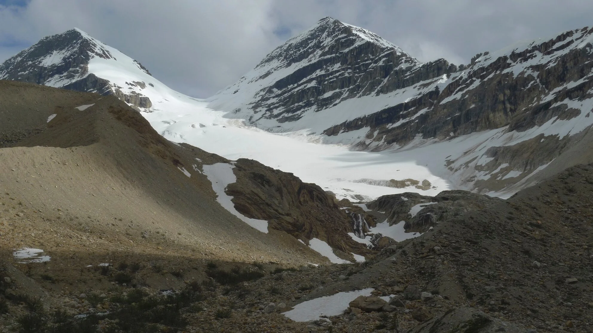
Peyto Peak and Peyto Glacier

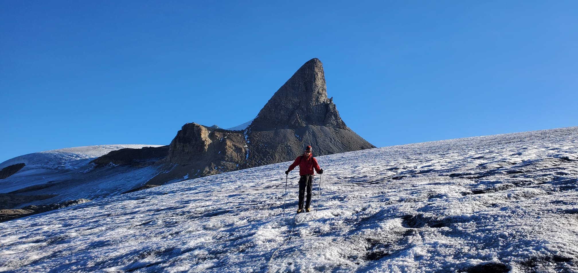
Peyto Peak

Peyto Lake Below. Observation Peak is on the horizon.

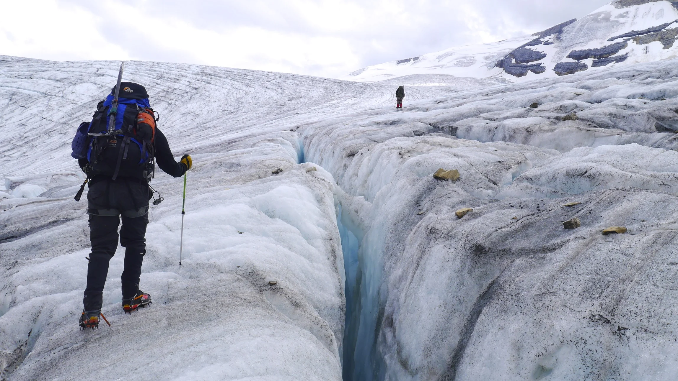
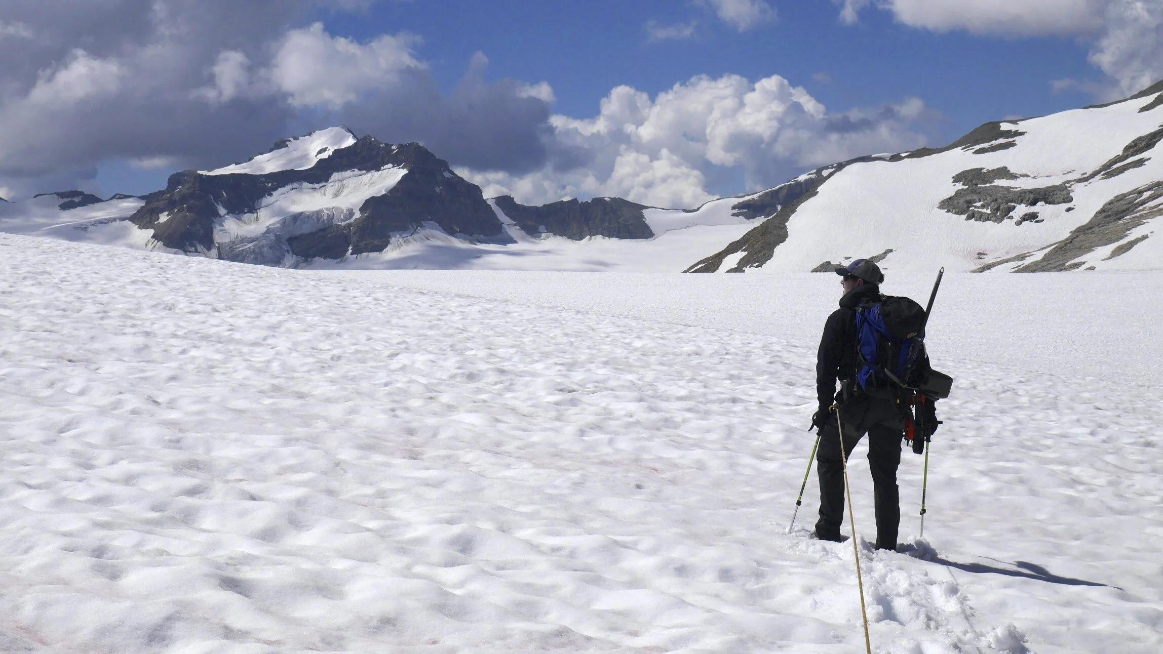
On Peyto Glacier

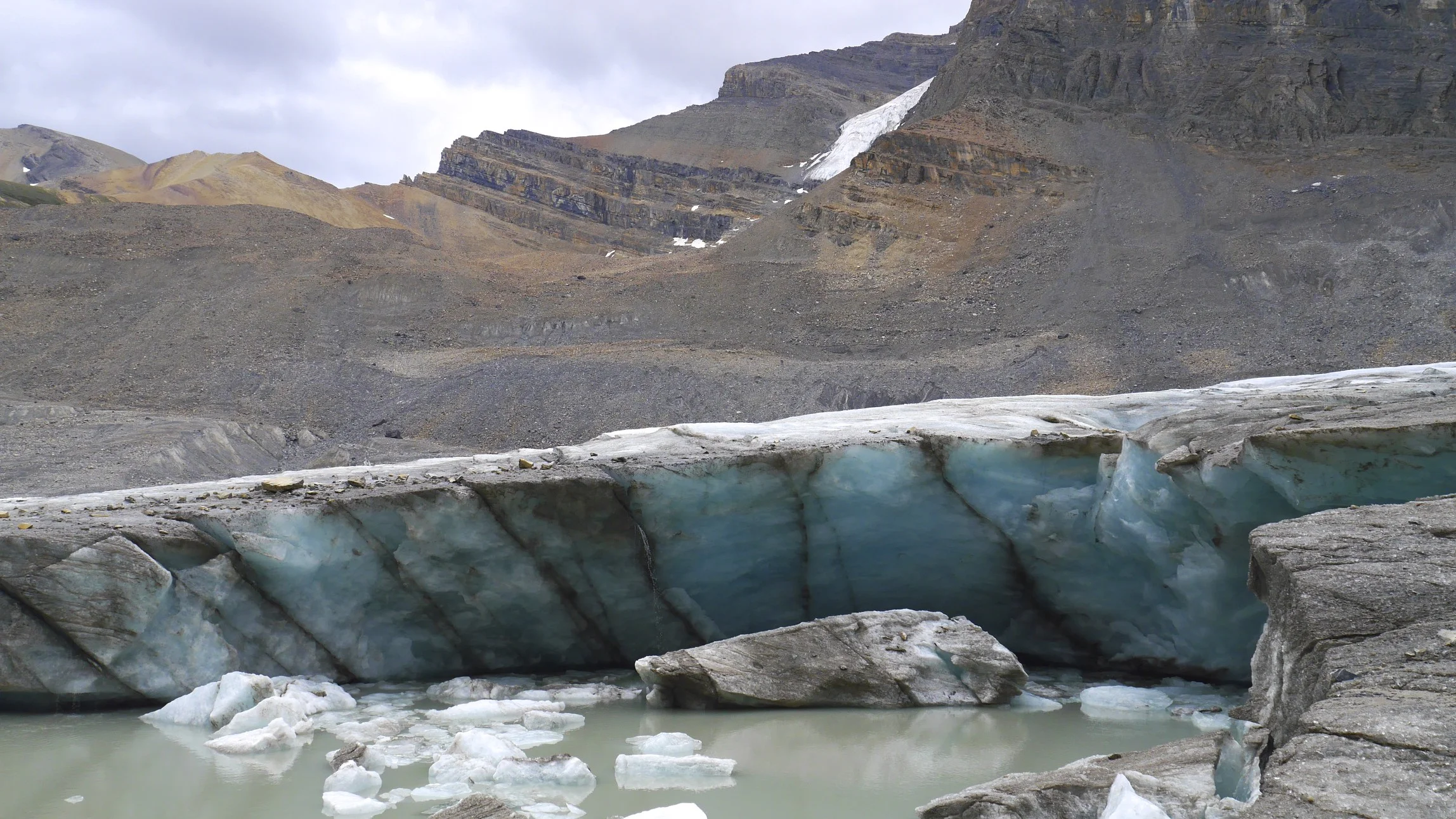
Peyto Glacier

Peyto Glacier

Dolomite Alpine Circuit - in the distance is Mt. Hector


Mount Hector


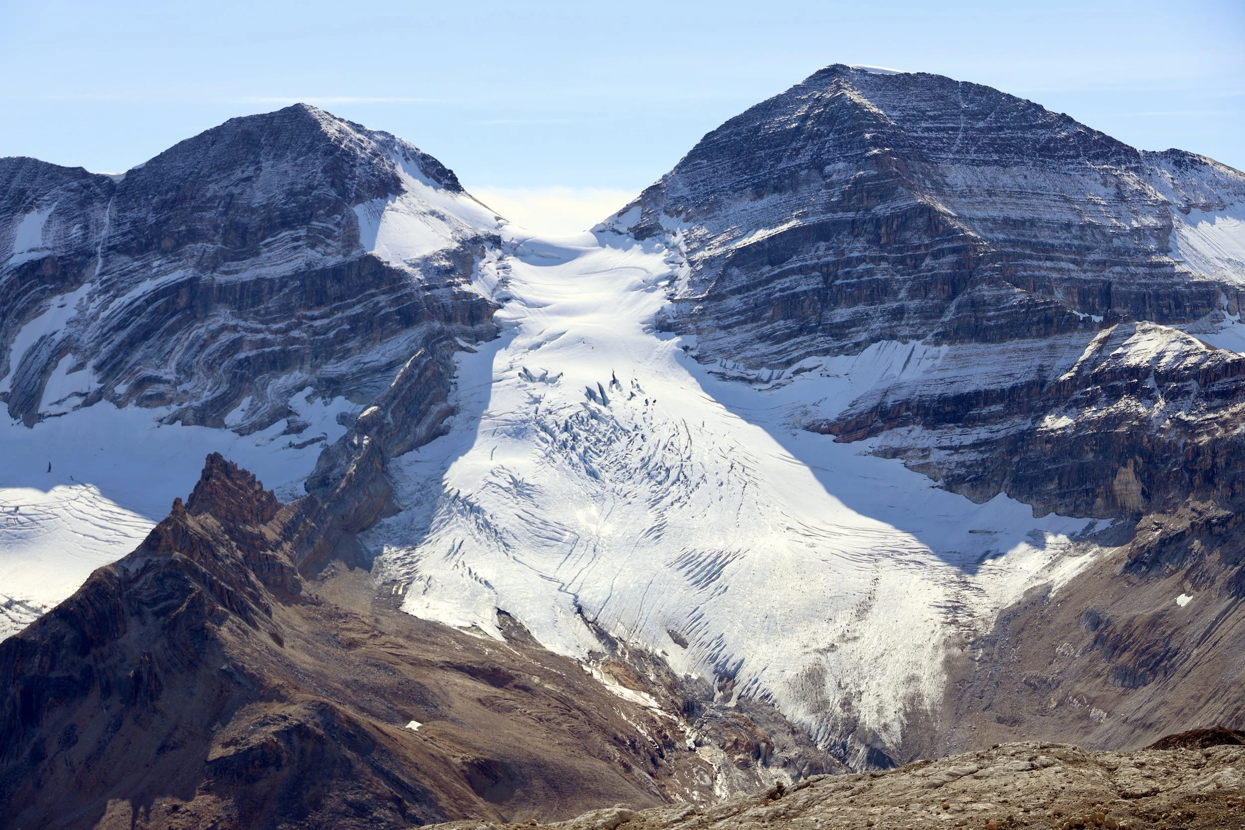
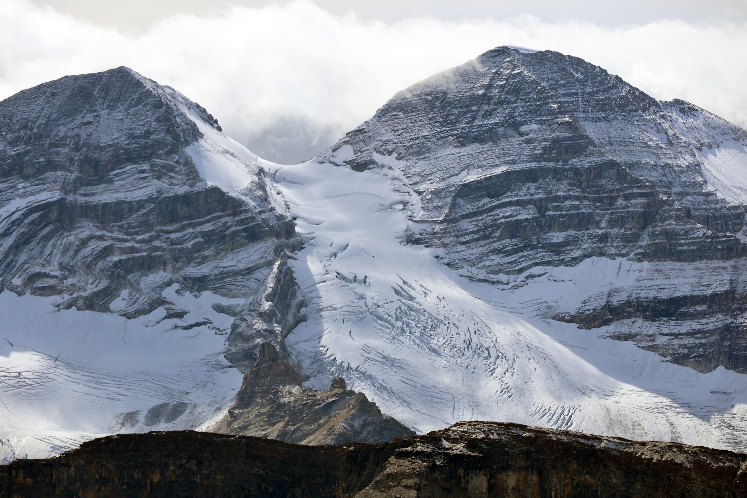
Mt. President and Vice President. These two peaks are the highest in the Yoho Valley. We traversed the glacier and climbed the peaks from Emerald Lake side and descended to the Stanley Mitchel ACC Hut.

Approaching the Presidents from Emerald Lake

On Mt. President from Emerald Lake

On Mt. President. The approach from Emerald Lake.

Emerald Lake is visible in the distance

High on Mt. President. The glacier is becoming more and more dangerous as large crevasses are opening up due to melting.

Approaching the President /VP col

The col between Mt. President and Vice President where we bivied Mount Pollinger is visible behind the tent.

The summit of Mt. President 3,138m. Emerald Lake is below.

On the summit of Mt. President 3,138m. The Lake Louise group is on the horizon.
The Presidents from Whaleback

The Presidents Glacier and the col where we camped
The Presidents

Iceline trail. East slopes of Mt. President

Lake Louise group from the Iceline trail

Along the Iceline Trail

Iceline Trail

Takakkaw Falls from the Iceline Trail

Peyto Lake

On the way to the Peyto Glacier

Peyto Glacier

Peyto Glacier
Peyto Glacier

Peyto Glacier

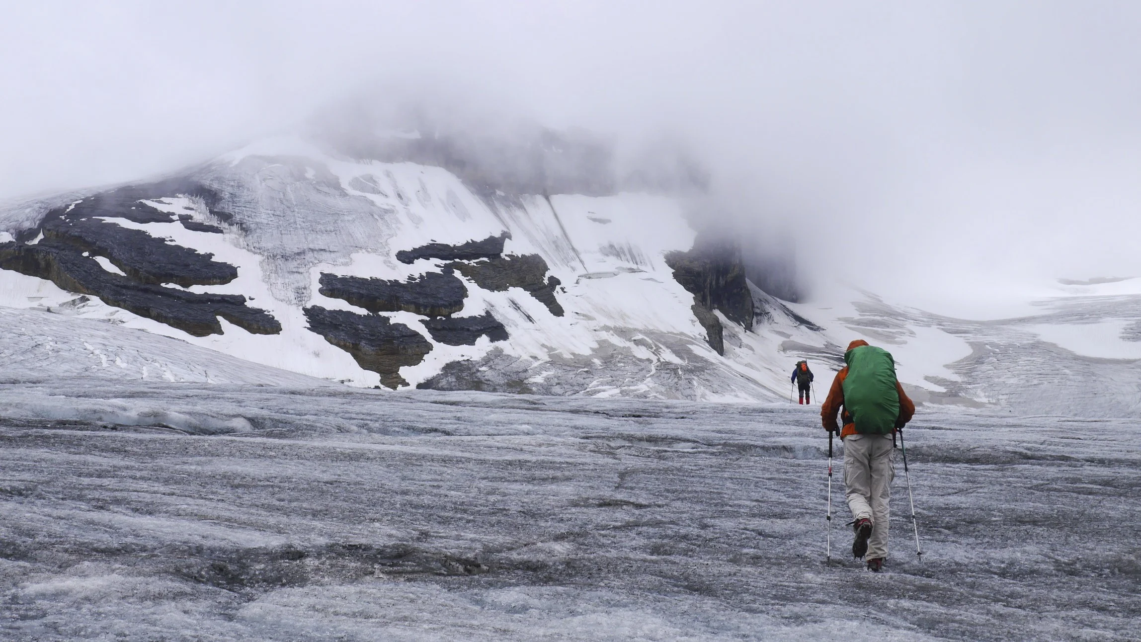
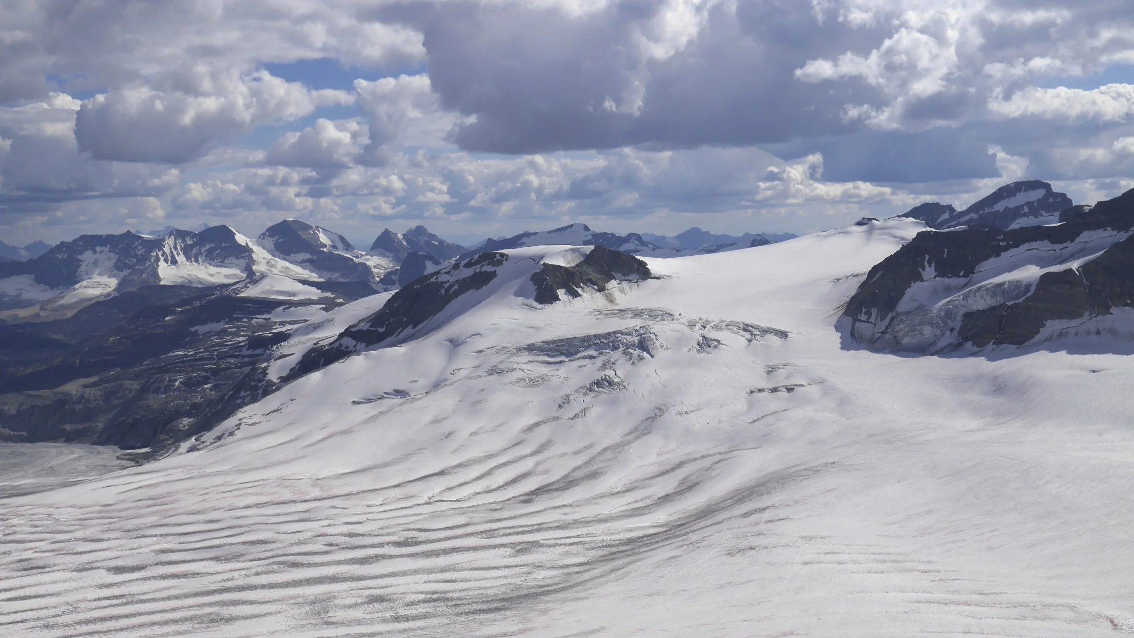
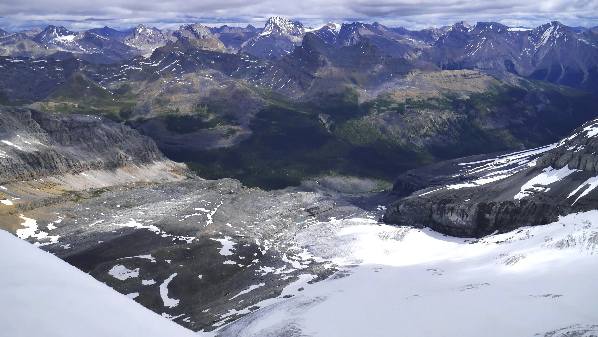
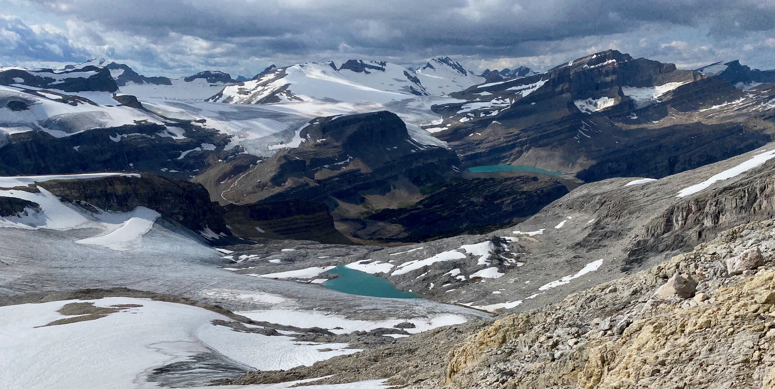
Wapta Icefield

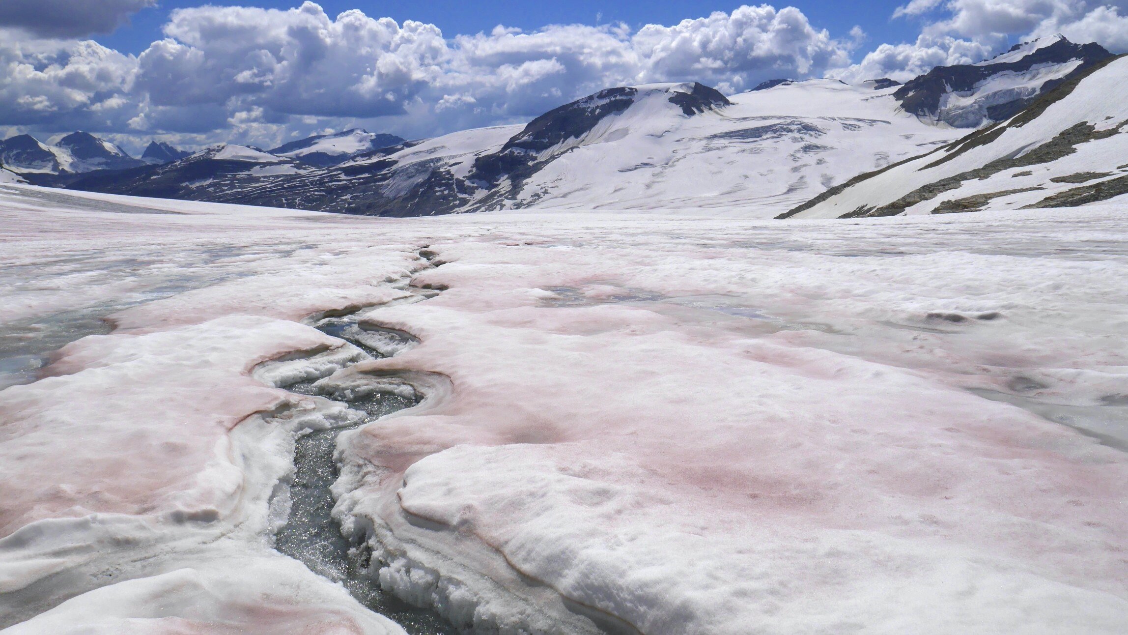
The view of the upper part of the Peyto Glacier


Wapta Icefield

The Wapta Icefield

Peyto Glacier

Peyto Glacier
Peyto Glacier

Wapta Icefield
Peyto Lake

Peyto Lake

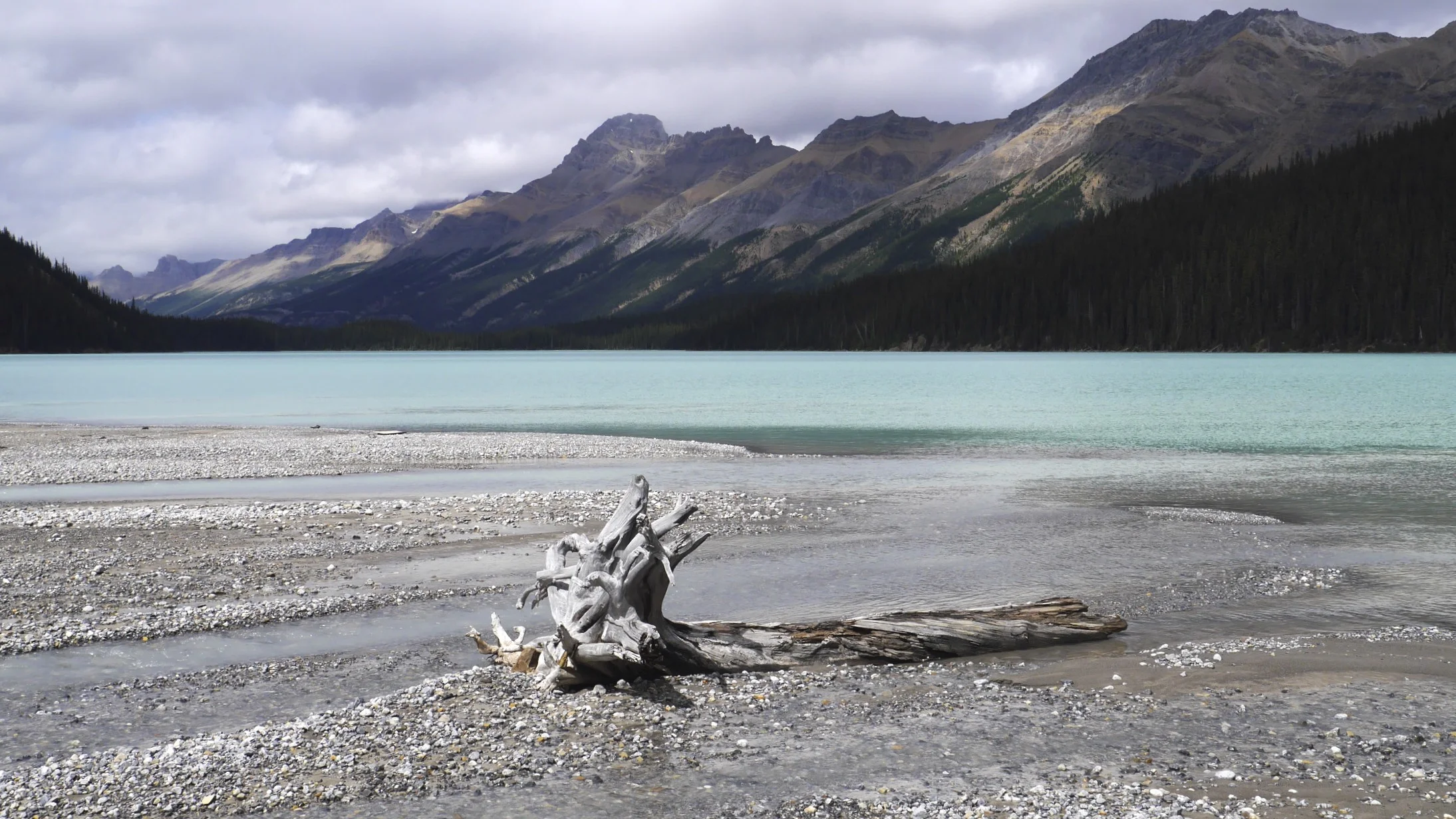
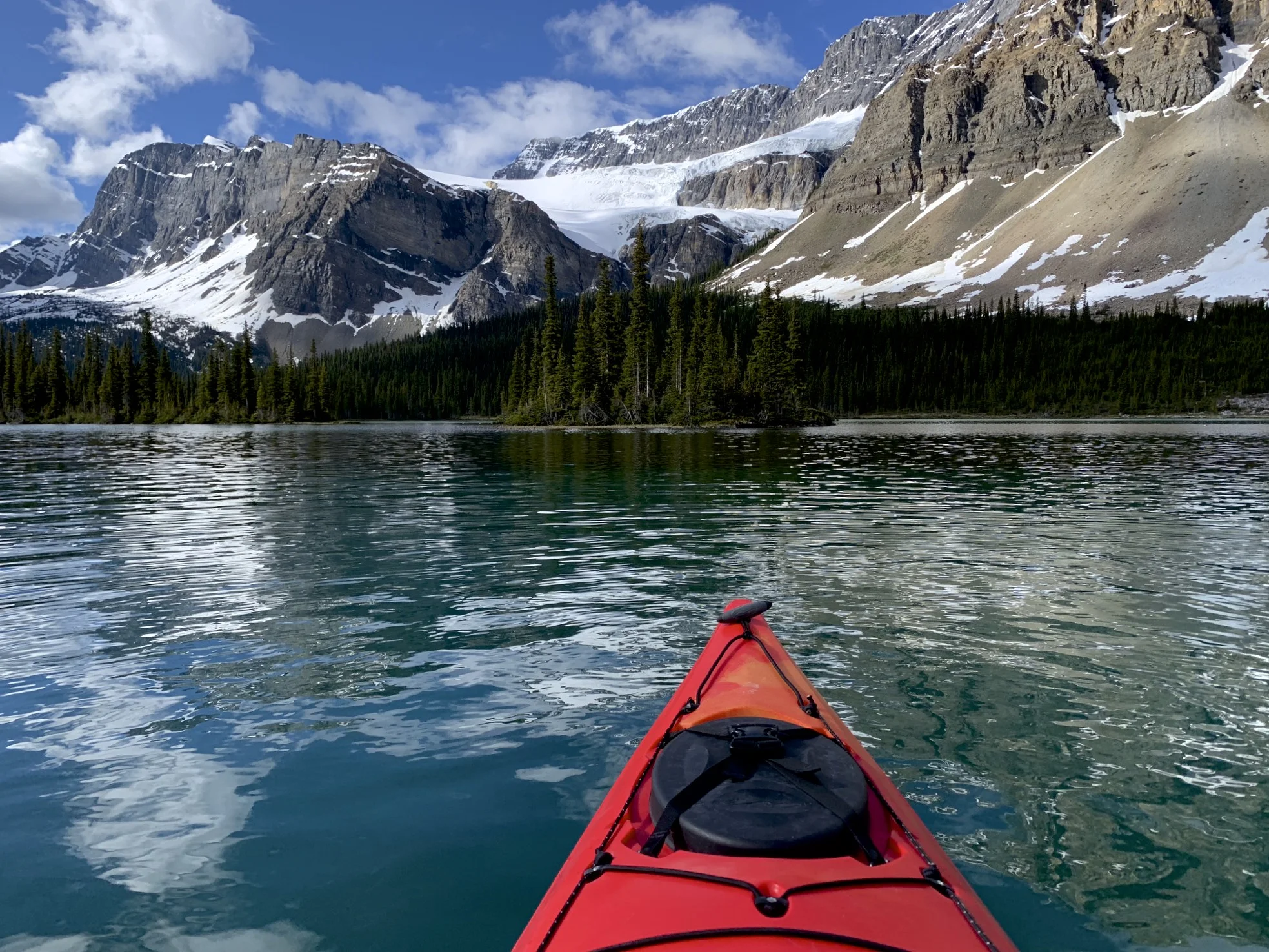
Bow Lake

Wapta Icefield and Bow Falls from the Bow Lake

The approach to the Bow Hut

The stone bridge on the way to the Bow Hut

The approach to Bow Hut

Bow Hut

The view from the Bow Hut. Mt. Jimmy Simpson is on the left

Moving on from Peyto Hut, Crowfoot Mountain is on the left

Approaching Peyto Hut

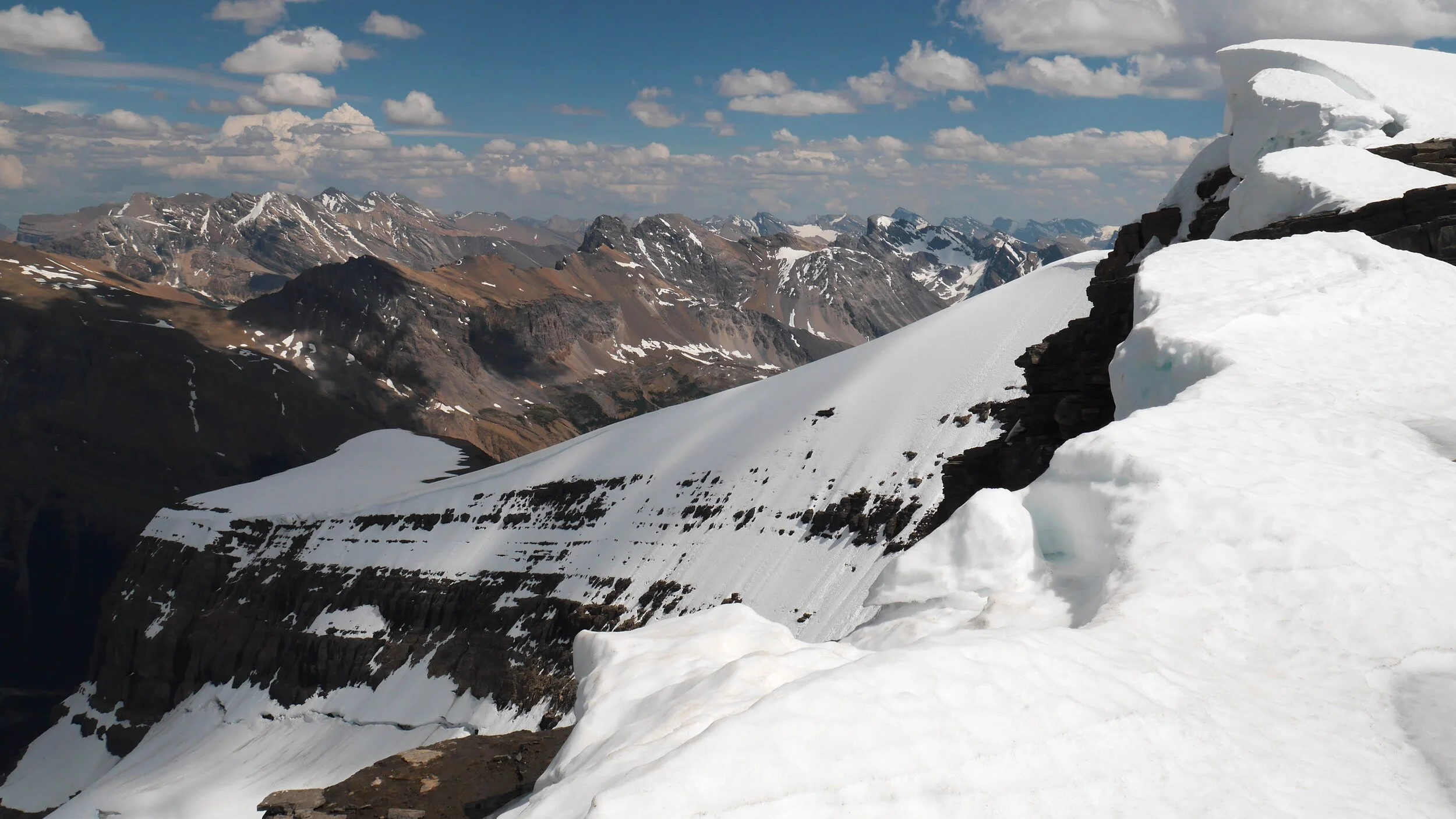
Wapta Icefield

On Wapta Icefield

On Wapta Icefield
On Wapta Icefield


On Mt. Rhonda. Yoho glacier is visible descending to the Yoho Valley. The iceline trail is on the right int he distance.


Summit of Mt. Rhonda

Peyto Lake and the Peyto Hut from the summit of Mt. Rhonda 3,062m

Peyto Lake and Peyto Hut (small green dot) from Mt. Rhonda

Wapta Icefield from Mt. Rhonda
Mt. Collie and The Presidents on the left.

Mt. President and Vice President on the right and the Lake Louise group on the left. Yoho Glacier descends into the Yoho Valley.

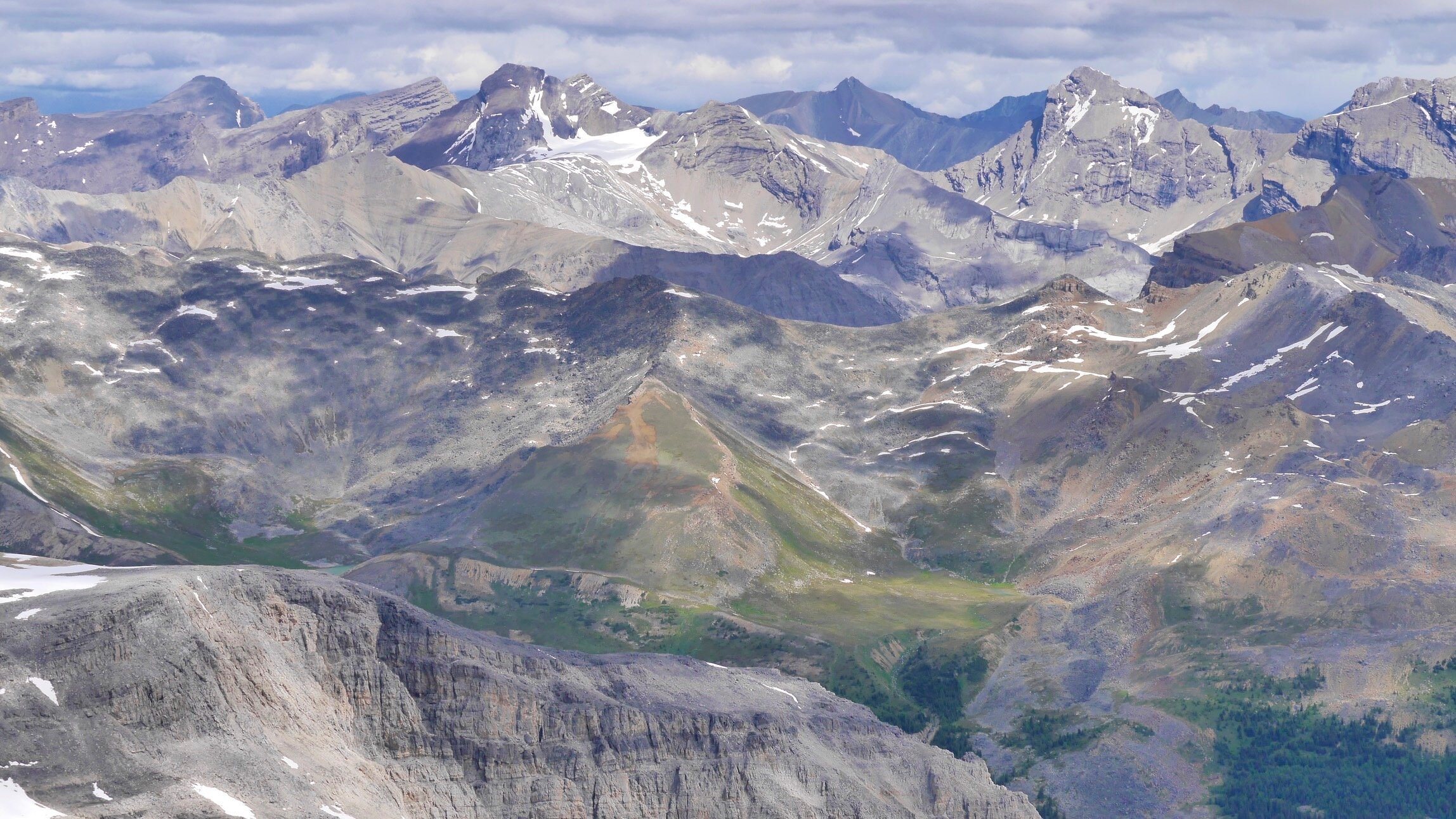
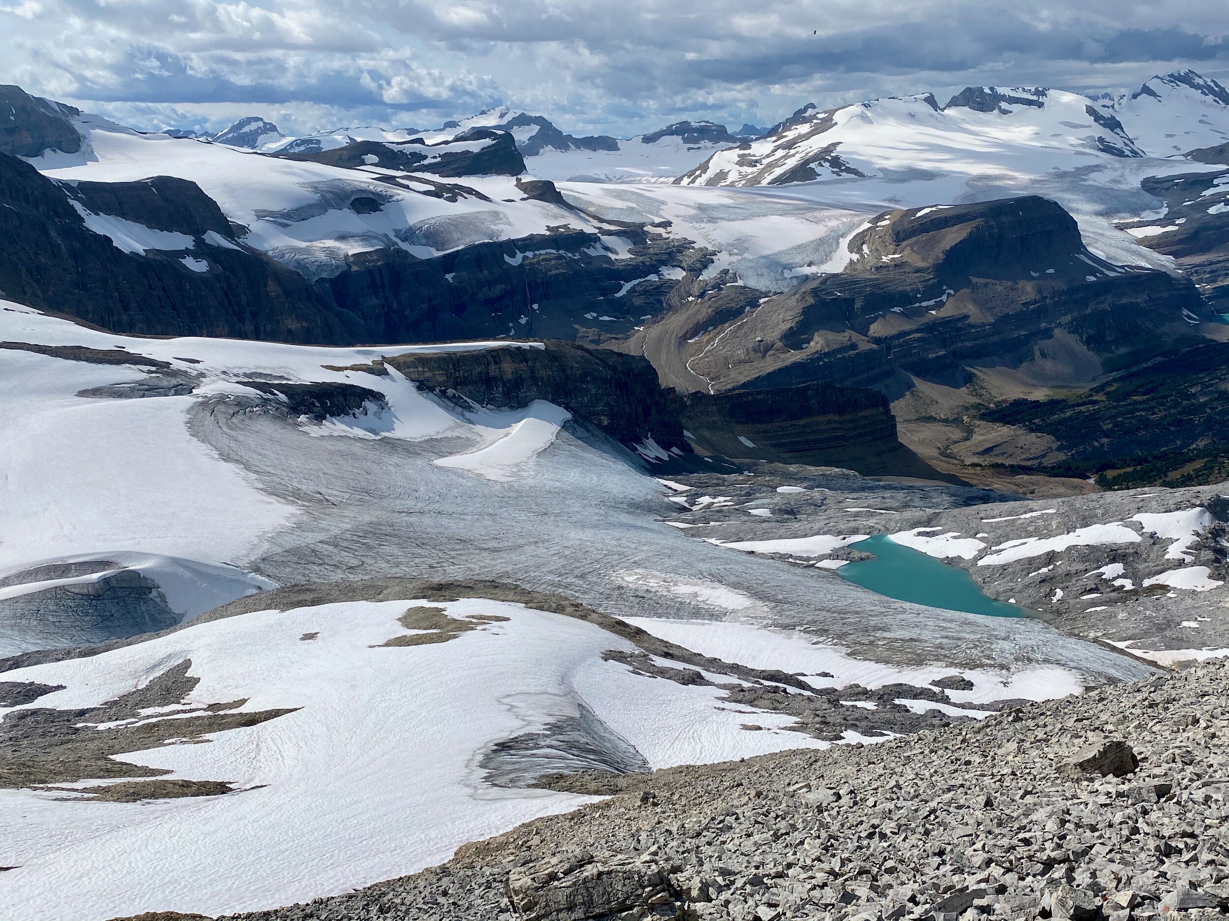
The mountains on the Freshfield Icefield from Mt. Rhonda


Mt. Gordon from Mt. Rhonda

The closeup of the Presidents, Whaleback Ridge and the Isolated Peak


The Corwfoot Ridge is on the horizon.

The Peyto Glacier and Peyto Lake in the distance.

Summit Panorama from Mt. Jimmy Simpson

Peyto Glacier from Mt. Jimmy Simpson

Bow Lake and summit panorama from Mt. Jimmy Simpson

Mt. Jimmy Simpson 2,947m

Peyto Glacier from Mt. Jimmy Simpson

Bow Lake from Mt. Jimmy Simpson


Bow Lake

Crossing Bow River en route to Bow Peak

Early summer on Bow Peak

Bow Peak

Mt. Hector from Bow Peak

Hector Lake from Bow Peak

Mt. Balfour, Hector Lake and the Wapta Icefield from Bow Peak

The view of Bow Lake from Bow Peak

The panorama north from Bow Peak


The panorama from Bow Peak looking South towards the Wapata

Hector Lake from Little Hector Peak 3,124m, The large mountain is the Balforur Peak.

Lower slopes of Mt. Balfour and the Pulpit Peak from Mt. Hector. The Balfour Pass is above the Hector Lake.

Hector Lake

Bow Peak from Little Hector Peak 3,124m with Bow Lake beyond.

Looking east from Hector
Looking east from Hector

Bow Peak from Hector

Mt. Lefroy from Hector

Mt. Hector Glacier

Mt. Hector Glacier and Hector Peak

Mt. Hector from Little Hector


Hector Lake from Mt. Hector


On Observation Peak

The view from the summit of Observation Peak 3,174m. Maramota Peak is to the left of the lake.


Summit panorama from the Observation Peak

Crowfoot Mountain and the Crowfoot Glacier with the Bow Lake from Observation Peak 3,174m


Mt. Hector from Observation Peak 3,174

Mt. Hector in the distance

Bow Peak from Observation Peak 3,174m. In the distance are the peaks of Lake Louise group with Mt. Temple towering above them all.

Bow Lake from the Observation Peak


Bow Lake, Wapta Icefield and Mt. Rhonda from Cirque Peak 2,993m

Looking towards Peyto Lake from Cirque Peak 2,993m

Mt. Hector (in the distance) and Bow Peak (right) from Cirque Peak

Wapta Icefield from the Cirque Peak
Bow Lake and the Crowfoot Mountain

Bow Lake, the Crowfoot Glacier and Crowfoot Mountain

Mt. Balfour (left) and the Presidents in the distance
Wapta Icefield from Crowfoot Mountain

The Presidents in Yoho (far on the left), Mt. Gordon (right)

Bow Lake and Cirque Peak from Crowfoot Mountain

Bow Lake and Crowfoot Glacier

Crowfoot Mountain

Looking north from the summit ridge of Crowfoot Mountain
Wapta Icefield from the Crowfoot Mountain


Crowfoot Mountain - view towards Bow Hut

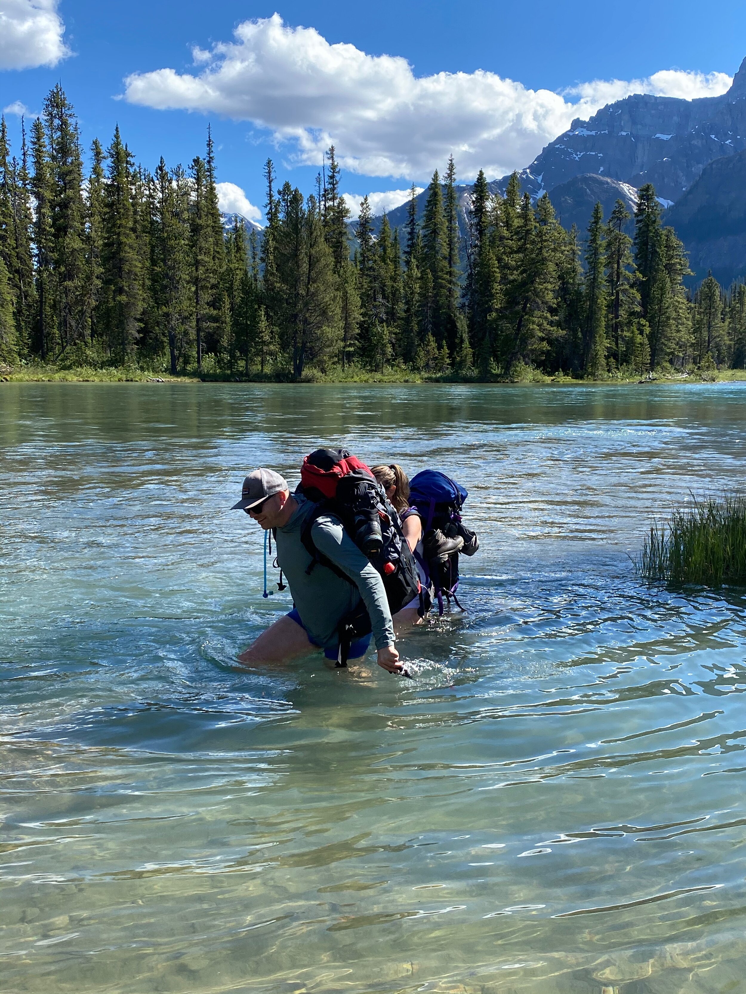
Crossing the Bow River to get to the Pulpit Peak

Hector Lake

Mt. Hector from the Pulpit Peak

View from the Pulpit Peak south-east

Pulpit Peak (left), Hector Lake and Mt. Hector

Pulpit Peak on the right
