Manaslu Circuit, Annapurna Circuit Photos

Thanks to Kumar, Rajendra, Kam and Suri from www.mountainsunvalley.com. I did this trip alone with my Nepali friends. We had a great time and it was a fantastic adventure!

map-manaslu-trekking.jpg
Nepal__Tilicho_trekking_map_general__230.jpg

Manaslu from space.

The Manaslu Range

The Manaslu Range

Manaslu Himal from SSW.jpg
IMG_0299.jpg
Himal Chuli

Himal Chuli

Himal Chuli on the right

Himal Chuli on the right

Manaslu Range

Manaslu Range

Manaslu Range

Manaslu Range

2012-11-15 at 01-52-17_captions (from SSE).jpg
2012-11-15 at 01-50-21_captions (from SE).jpg
IMG_0345.jpeg
Manaslu 8,153m from the south from the KTM - DOH flight

Manaslu 8,153m from the south from the KTM - DOH flight

Ganesh Himal from the south from KTM - DOH flight

Ganesh Himal from the south from KTM - DOH flight

2011-10-28 at 20-56-56.jpg
It was about then when I started to think of doing the whole trail.

It was about then when I started to think of doing the whole trail.

IMG_2016.jpeg
IMG_2006.jpeg
Walking up the steep trail in the Bhuri Gahandaki Valley.

Walking up the steep trail in the Bhuri Gahandaki Valley.

In the Bhuri Ghandaki Valley

In the Bhuri Ghandaki Valley

Bhuri Ghandaki Valley

Bhuri Ghandaki Valley

2011-10-25 at 20-25-57.jpg
2011-10-25 at 23-06-13.jpg
Bhuri Ghandaki and Khutang Himal on the horizon

Bhuri Ghandaki and Khutang Himal on the horizon

Lapuchun Mountain 5,990m and the valley leading to Tsum.

Lapuchun Mountain 5,990m and the valley leading to Tsum.

Ganesh Himal

Ganesh Himal

Village of Namrung

Village of Namrung

2011-10-28 at 20-57-45.jpg
Namrung Village

Namrung Village

Namrung Village

Namrung Village

First view of Manaslu from Lho Village

First view of Manaslu from Lho Village

Lho Village

Lho Village

2011-10-28 at 22-43-10.jpg
2011-10-28 at 22-51-49.jpg
The monastery was built by the Japanese who have a special connection to Manaslu.

The monastery was built by the Japanese who have a special connection to Manaslu.

2011-10-29 at 01-17-43.jpg
Manaslu

Manaslu

Peak 29 7871m

Peak 29 7871m

Approach to Manaslu basecamp - looking towards the Ganesh Himal and down the Bhudi Ghandaki Valley

Approach to Manaslu basecamp - looking towards the Ganesh Himal and down the Bhudi Ghandaki Valley

Ganesh Himal in the distance

Ganesh Himal in the distance

Ganesh Himal

Ganesh Himal

Manaslu basecamp

Manaslu basecamp

Lower slopes of Manaslu North

Lower slopes of Manaslu North

IMG_2672.jpeg
Ganesh Himal

Ganesh Himal

IMG_2678.jpeg
IMG_2682.jpeg
Manaslu Basecamp

Manaslu Basecamp

Manaslu and Manaslu Basecamp

Manaslu and Manaslu Basecamp

2011-10-30 at 00-10-46.jpg
Looking north across the valley from the Manslu Basecamp

Looking north across the valley from the Manslu Basecamp

A local teacher on an excursion with his students.

A local teacher on an excursion with his students.

On the way to the Larkya Pass

On the way to the Larkya Pass

Looking at the Manaslu massif from the north.

Looking at the Manaslu massif from the north.

Syanche Glacier and north side of Manaslu.

Syanche Glacier and north side of Manaslu.

Naka Peak and Syache Glacier. Manaslu mastiff from the north

Naka Peak and Syache Glacier. Manaslu mastiff from the north

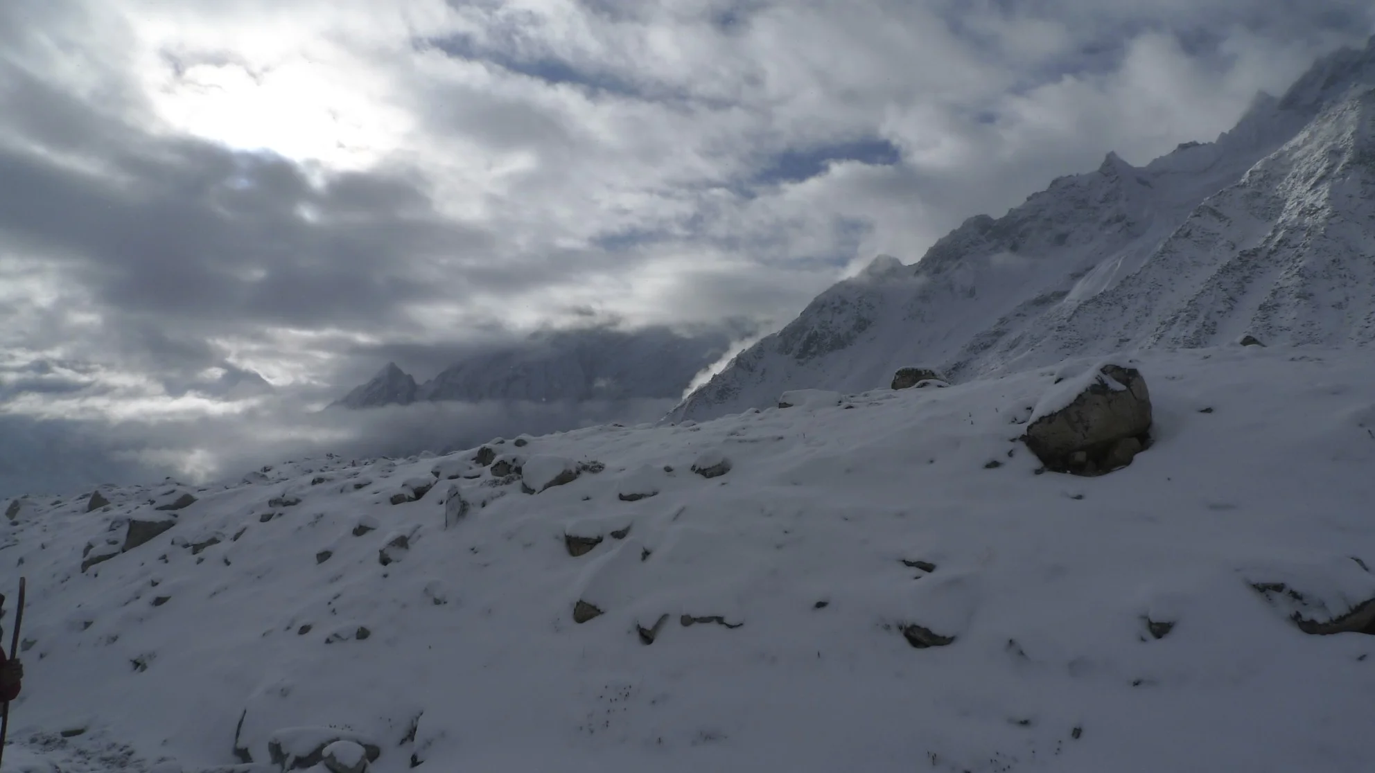
Dharmasala - Larkya Pass basecamp at 4,500m at sunrise. We got snowed at and the entire world turned white overnight.

Dharmasala - Larkya Pass basecamp at 4,500m at sunrise. We got snowed at and the entire world turned white overnight.

Clearing storm clouds on the approach to the Larkya Pass.

Clearing storm clouds on the approach to the Larkya Pass.

Larkya Peak North 6,249m in the vicinity of the Larkya Pass.

Larkya Peak North 6,249m in the vicinity of the Larkya Pass.

Larkya Peak 6,616m and Larkya North Peak

Larkya Peak 6,616m and Larkya North Peak

Larkya Peak 6,616m

Larkya Peak 6,616m

2011-10-31 at 20-43-34.jpg
Larkya North Peak

Larkya North Peak

Approach to Larkya Pass

Approach to Larkya Pass

Larkya Pass 5,100m

Larkya Pass 5,100m

Looking back to where we came from from the top of Larkya Pass at 5,100m

Looking back to where we came from from the top of Larkya Pass at 5,100m

IMG_2995.jpeg
IMG_2998.jpeg
At the pass

At the pass

Larkya Pass: Kumar, Kam, me and Suri at 5,100m

Larkya Pass: Kumar, Kam, me and Suri at 5,100m

2011-10-31 at 23-28-53.jpg
Panbari Himal on the west side of the Larkya Pass

Panbari Himal on the west side of the Larkya Pass

Bimthang

Bimthang

Namjung 7,140m from Bimthang

Namjung 7,140m from Bimthang

2011-11-01 at 19-26-49.jpg
Namjung onthe right 7,140m

Namjung onthe right 7,140m

2011-11-02 at 18-44-10.jpg
Namjung 7,140m

Namjung 7,140m

IMG_3149.jpeg
Phungi 6,738m

Phungi 6,738m

Phungi 6,738m

Phungi 6,738m

Panbari 6,905m and Panbari Himal

Panbari 6,905m and Panbari Himal

2011-11-01 at 21-57-19.jpg
2011-11-01 at 23-19-05.jpg
IMG_3146.jpeg
Panbari 6,905m

Panbari 6,905m

Manaslu and Tchoche Glacier

Manaslu and Tchoche Glacier

West face of Manaslu and Peak 29 on the right

West face of Manaslu and Peak 29 on the right

Manaslu west face

Manaslu west face

Summit Plateau of Manaslu

Summit Plateau of Manaslu

2011-11-02 at 20-59-10.jpg
Phungi 6,738

Phungi 6,738

Manaslu from the west

Manaslu from the west

Hanging out in the tea house in Bimthang

Hanging out in the tea house in Bimthang

Bimthang, Panbari Mountain (right) and Nemjung (centre)

Bimthang, Panbari Mountain (right) and Nemjung (centre)

2011-11-02 at 21-44-04.jpg
Manaslu massif from the west

Manaslu massif from the west

Manaslu from the west

Manaslu from the west

Manaslu’s West Face

Manaslu’s West Face

Upper Pisang

Upper Pisang

North side of Annapurna III

North side of Annapurna III

2011-11-05 at 22-20-46.jpg
Annapurna III in the distance

Annapurna III in the distance

2011-11-05 at 22-45-05.jpg
Annapurna III above Pisang

Annapurna III above Pisang

Annapurna III

Annapurna III

2011-11-06 at 00-21-30.jpg
2011-11-06 at 01-49-55.jpg
Near Barga Village

Near Barga Village

Village of Barga

Village of Barga

Barga and Annapurna II

Barga and Annapurna II