Red Sea
Aqaba Jordan
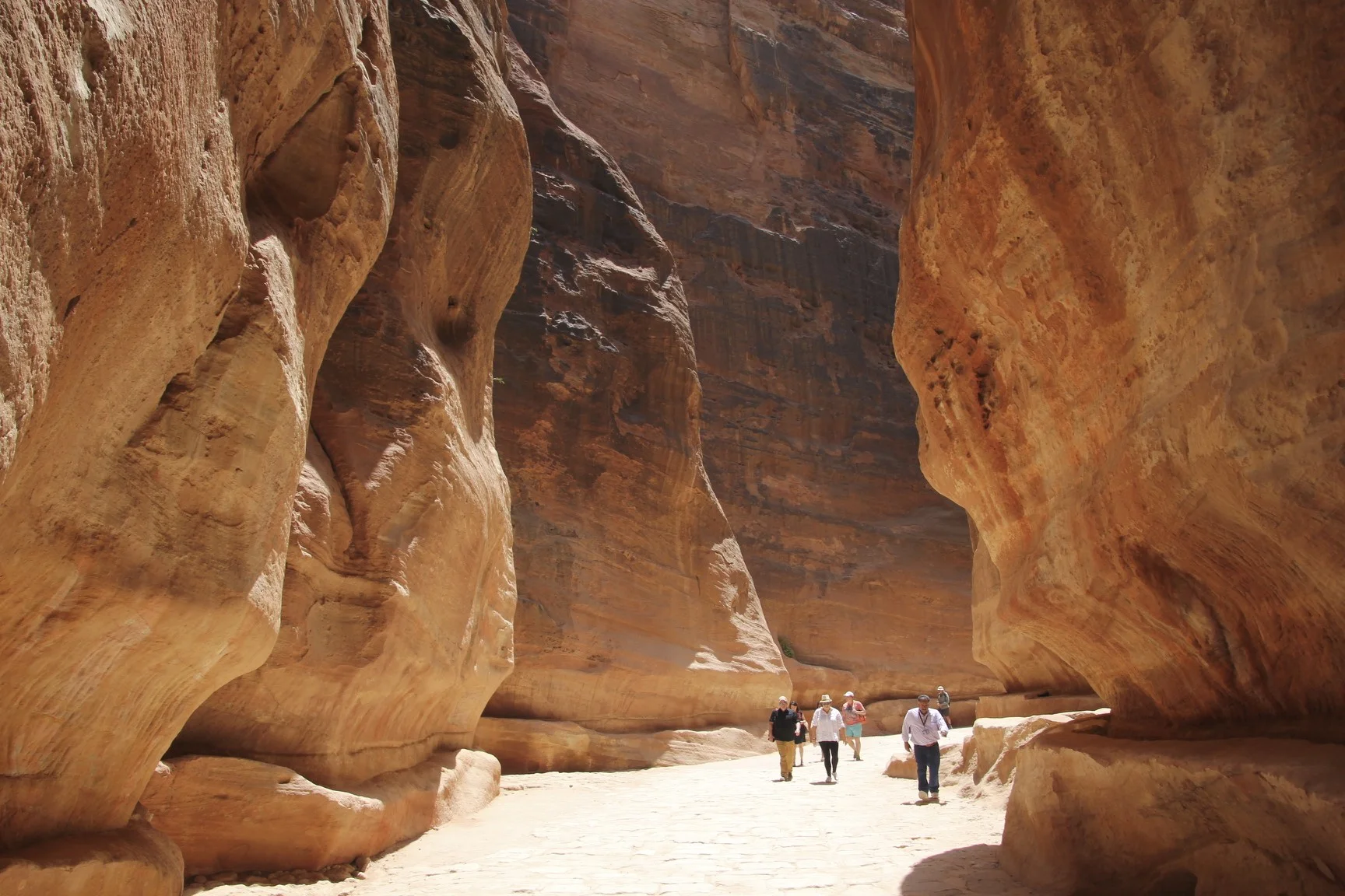
Petra is down below
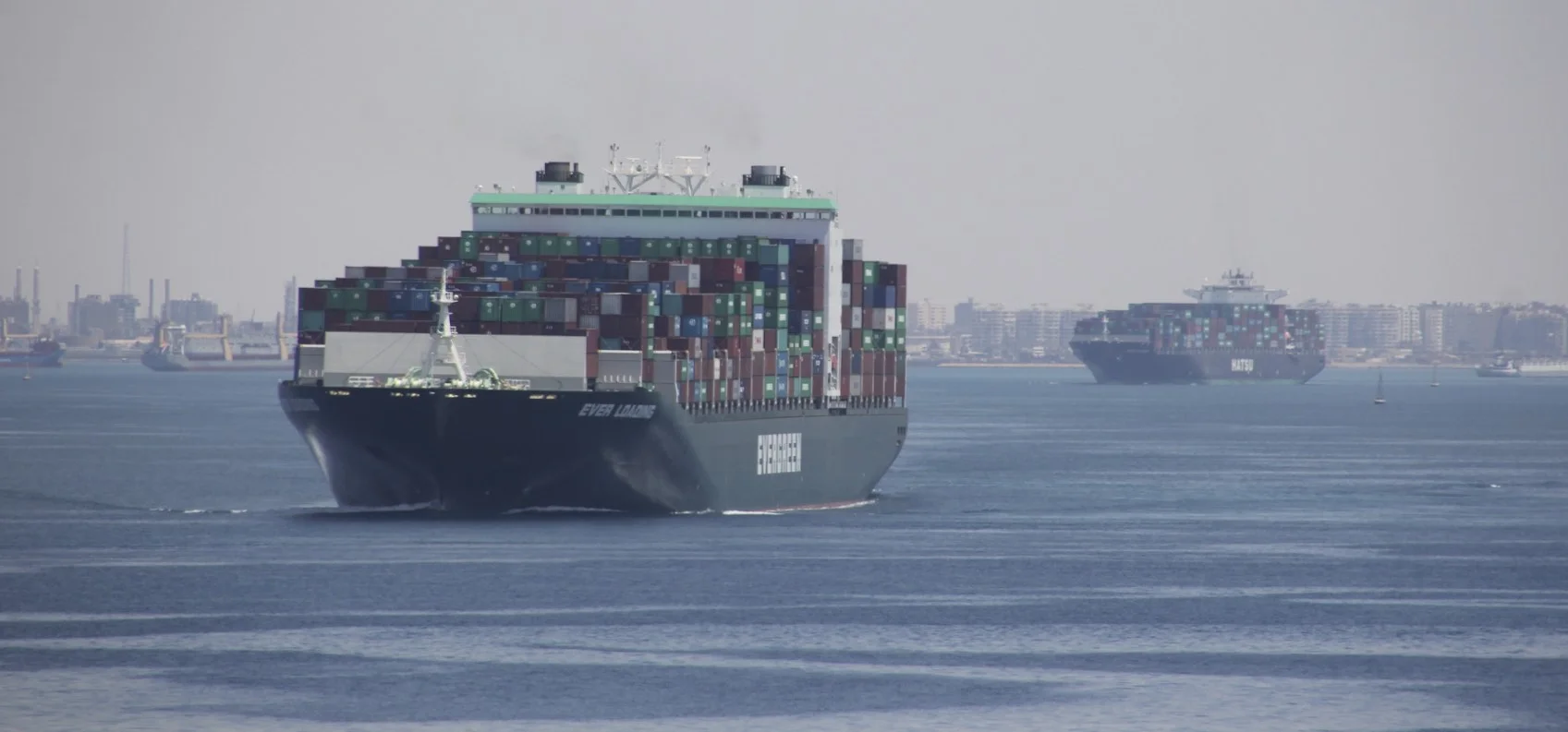
Egyptian Airforce patrolling the entrance to the Suez Canal
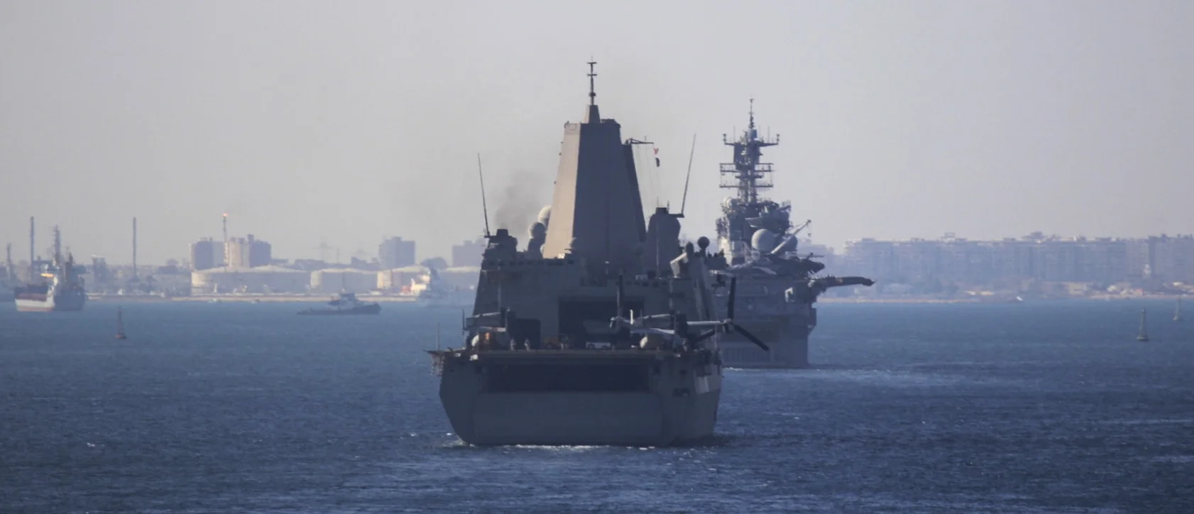
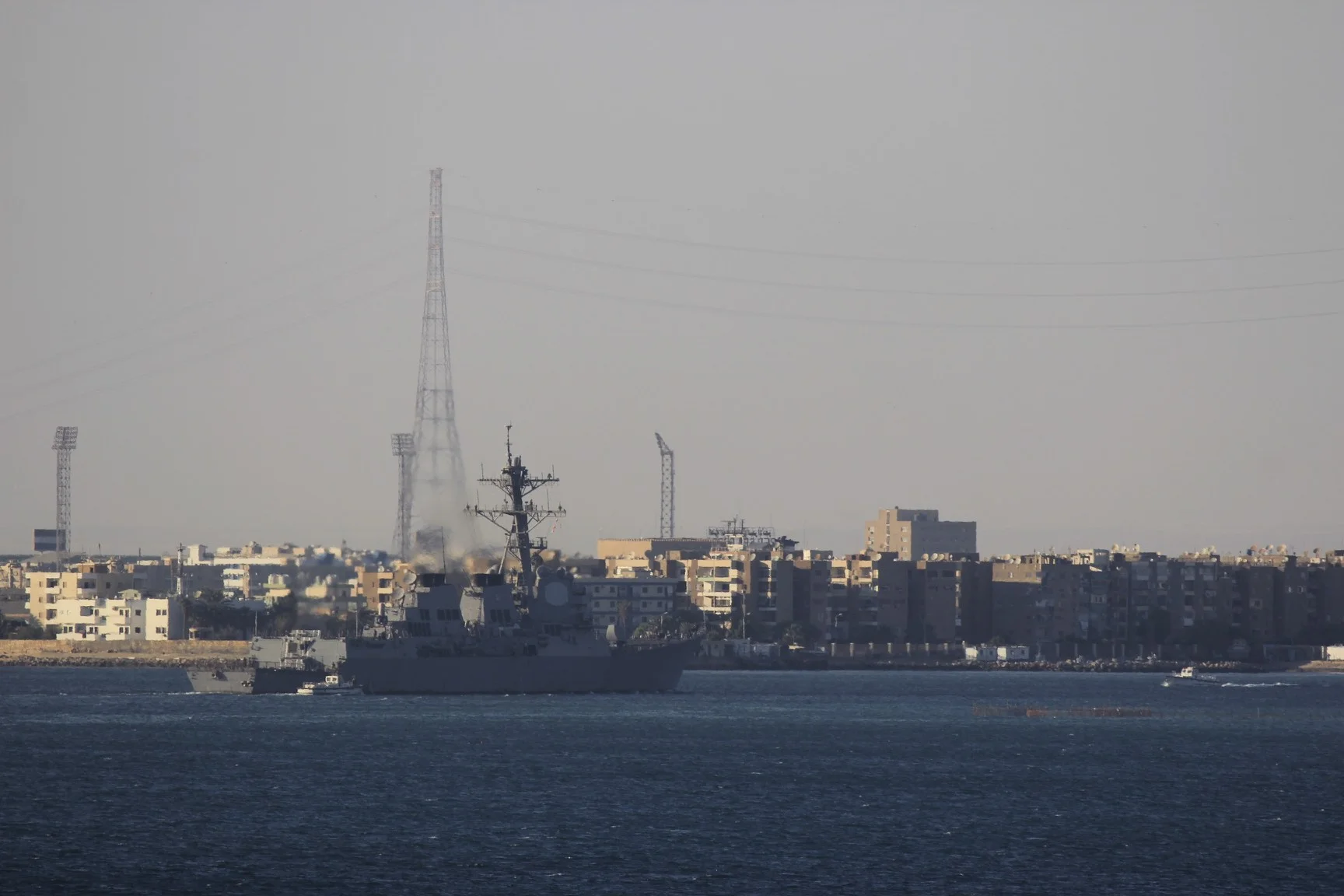
US Navy repositioning from the Persian Gulf
The wall lining the Suez Canal and the guard tower at the entrance
Egyptian guard post


Red Sea
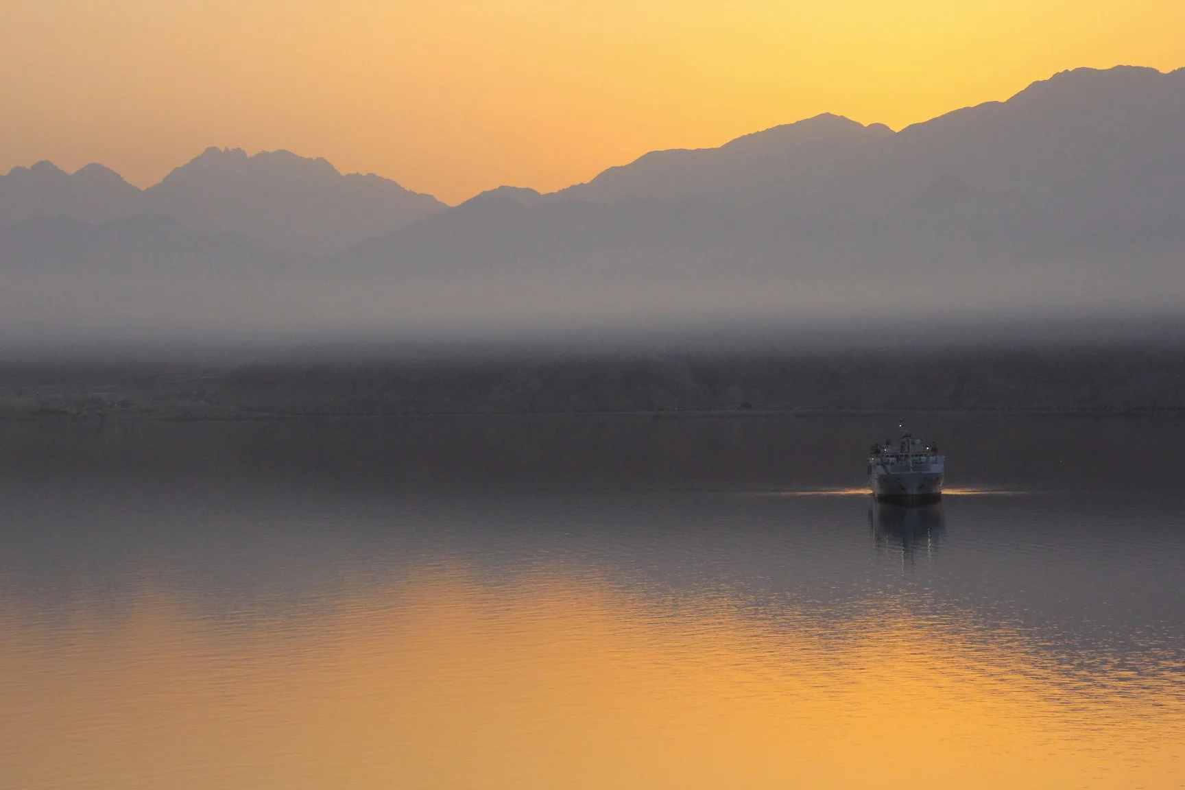
Aqaba Jordan

Petra is down below


Egyptian Airforce patrolling the entrance to the Suez Canal


US Navy repositioning from the Persian Gulf


The wall lining the Suez Canal and the guard tower at the entrance


Egyptian guard post


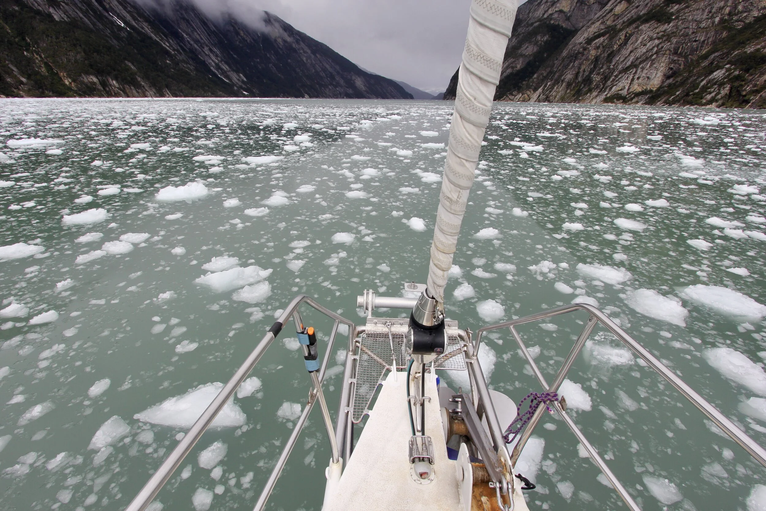
Near Puerto Chacabuco
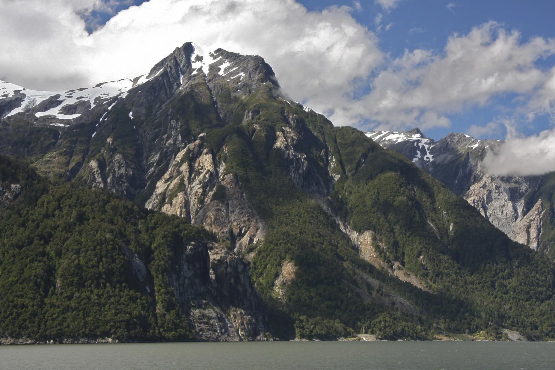

Near Puerto Chacabuco


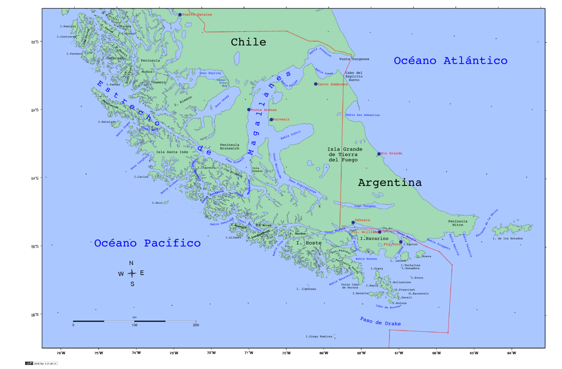
Punta Arenas


Valparaiso


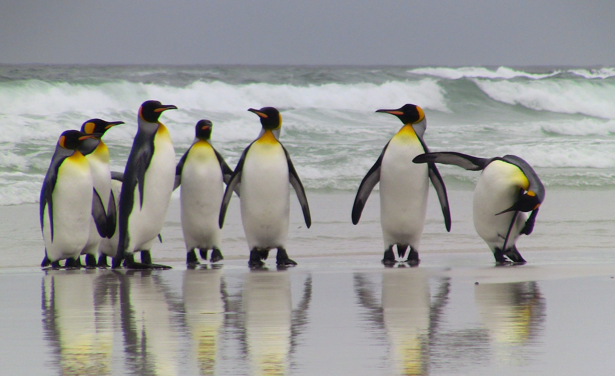


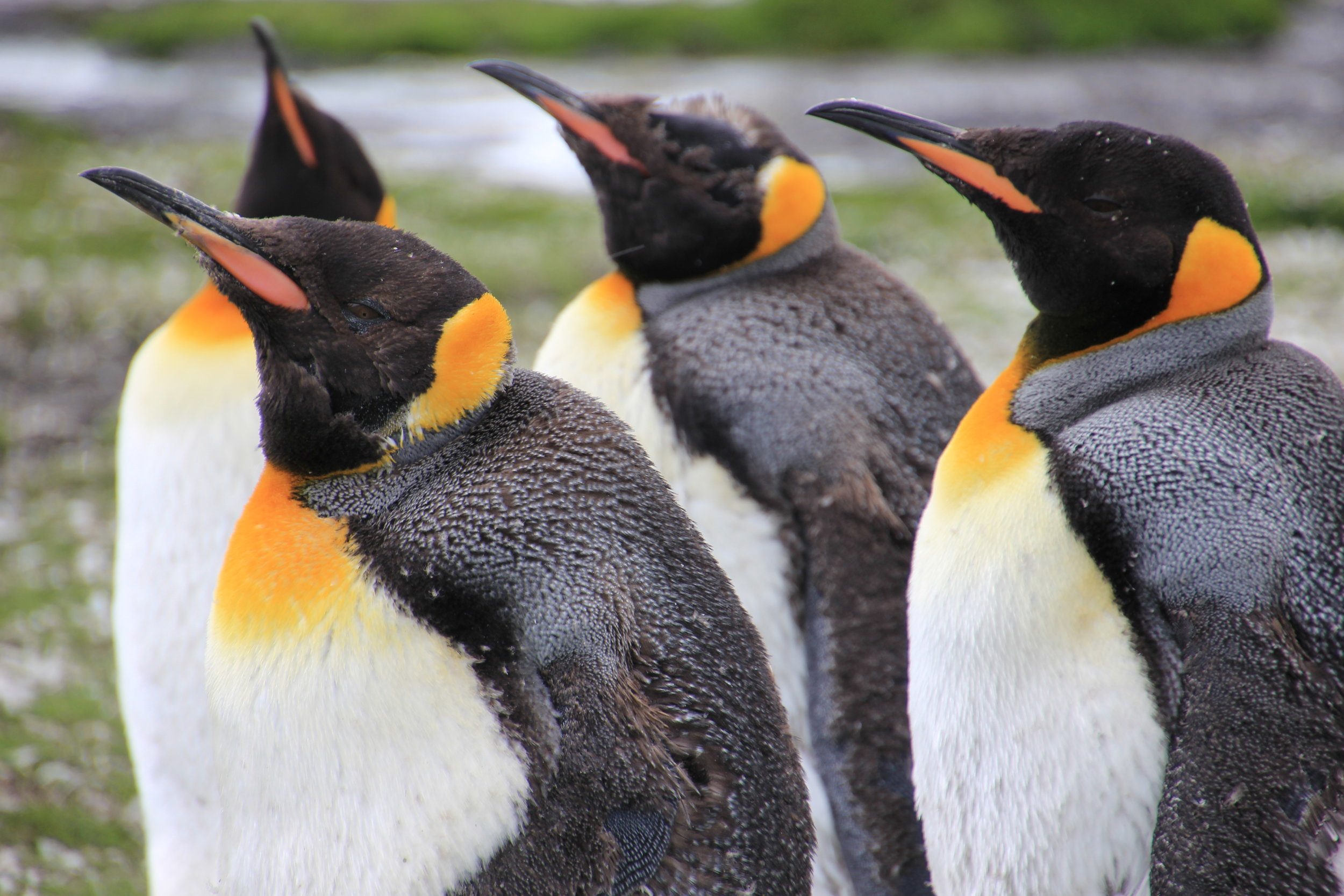


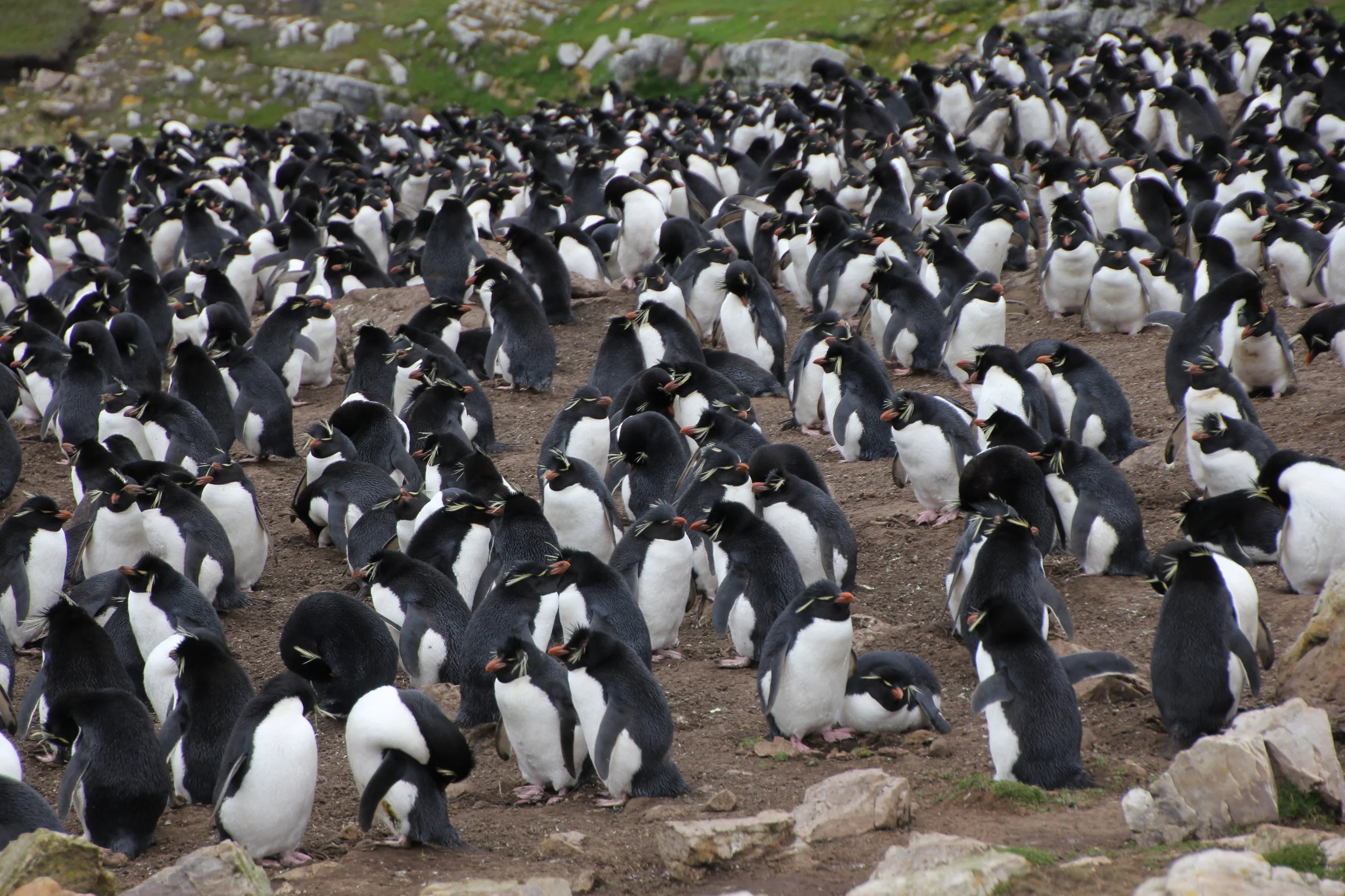
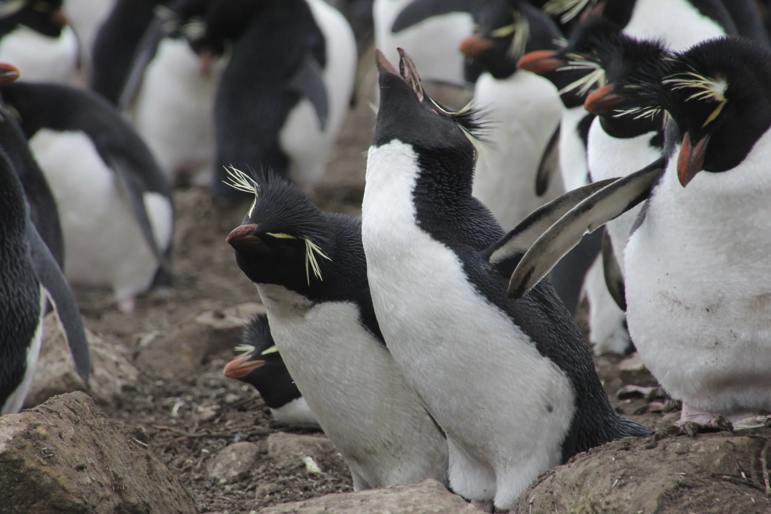


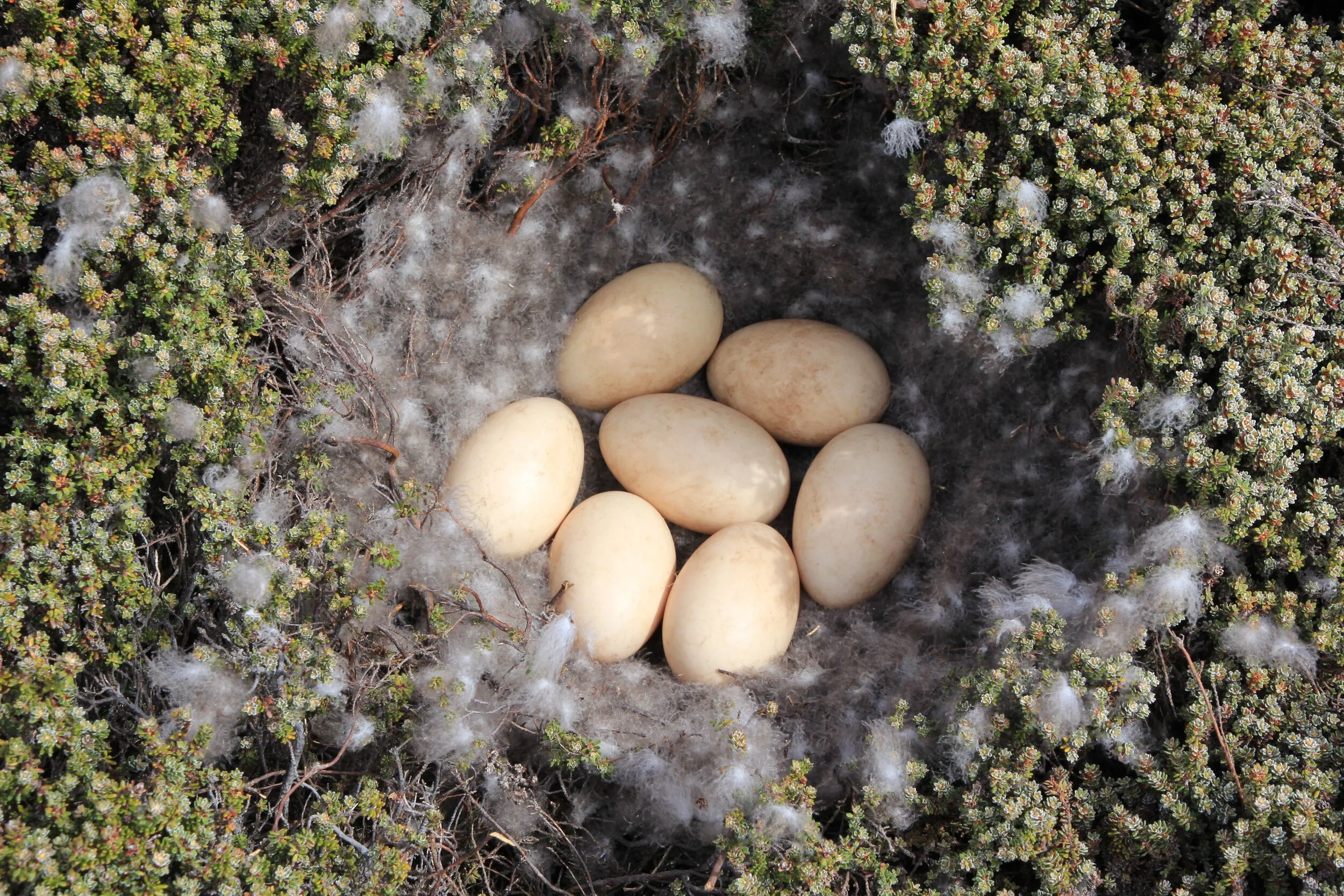


In 1833, during the voyage of the HMS Beagle, Charles Darwin found himself in a corner of the world he didn’t particularly care for, an archipelago near the southern tip of South America called the Falkland Islands, whose windswept moorlands he described as “desolate and wretched.” The local birdlife didn’t help matters. An unusual species of falcon seemed to derive pleasure from tormenting him and the ship’s crew. “A large black glazed hat was carried nearly a mile, as was a pair of the heavy balls used in catching cattle,” Darwin wrote of the avian thieves, “and a small Kater’s compass in a red morocco leather case, which was never recovered.” Crew members complained about the birds’ “boldness and rapacity,” and a lookout was posted to prevent them from picking apart the ship’s rigging. Whalers who had visited the Falklands previously had likewise cursed the creatures as “flying devils” and “flying monkeys,” although science would ultimately settle on the name striated caracara, or, informally, Johnny rook. Outside Magazine


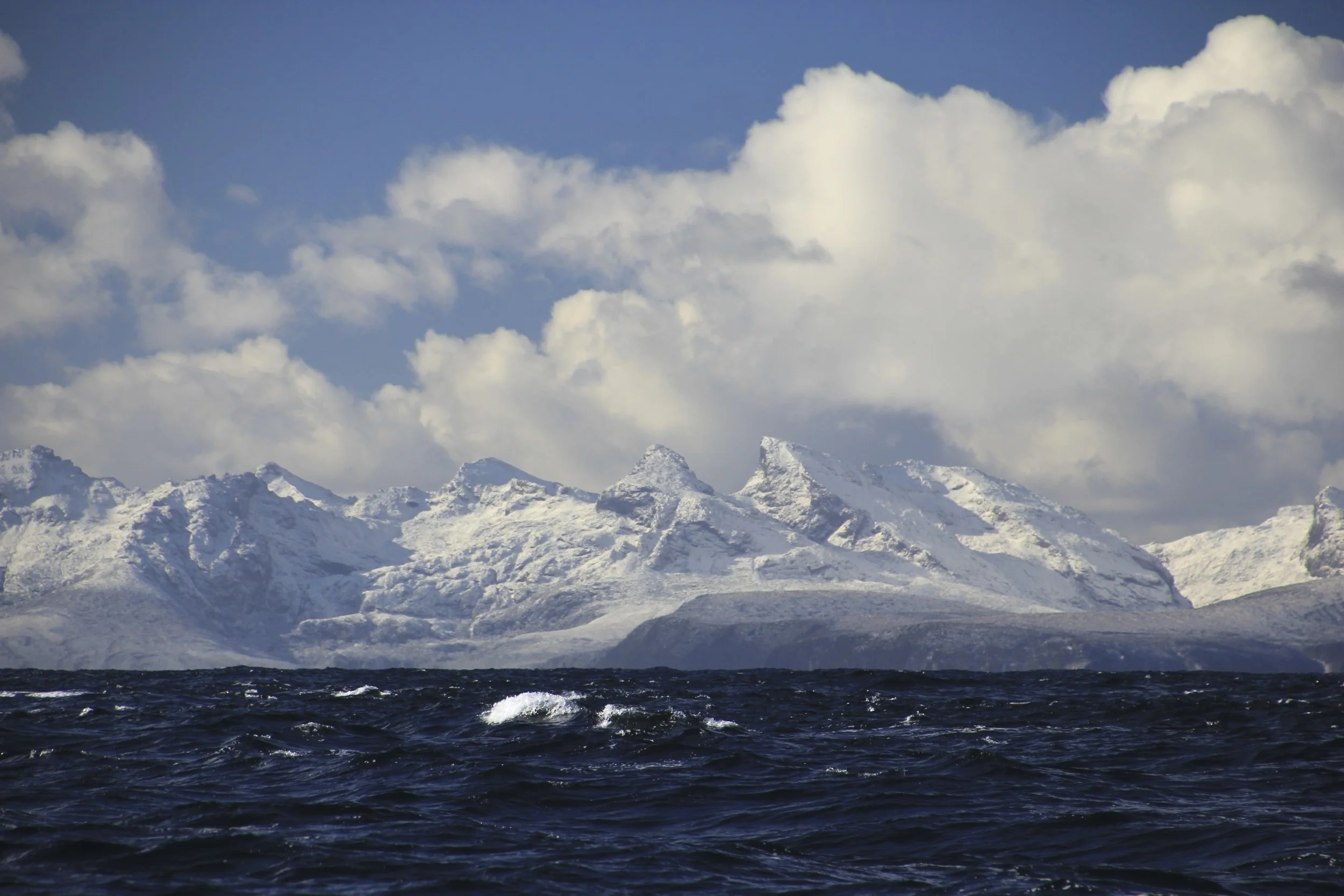
Darwin Range from the air

On the Southern Ocean

Our position on the Southern Ocean - crossing from the Falklands to the southern tip of South America

Our first sighting of South America

Southern Ocean
Southern tip of Patagonia


We are now in Patagonia!

Chile - our destination is Puerto Williams

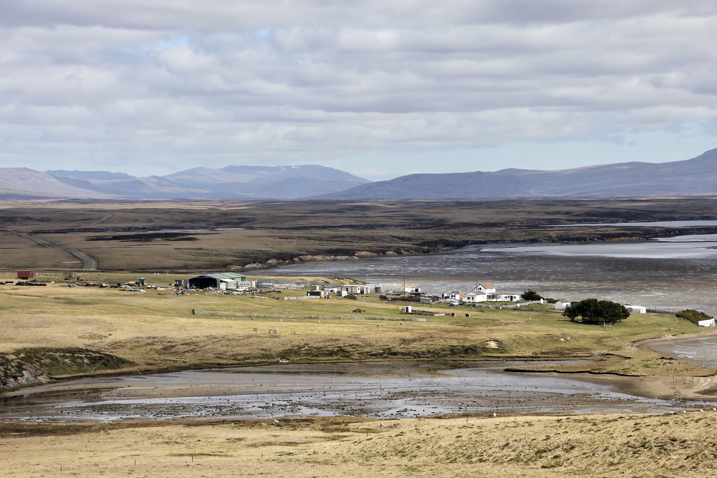
Puerto Williams is a small town at the end of the continent. In the early spring it is a little grim…

The Beagle Chanel
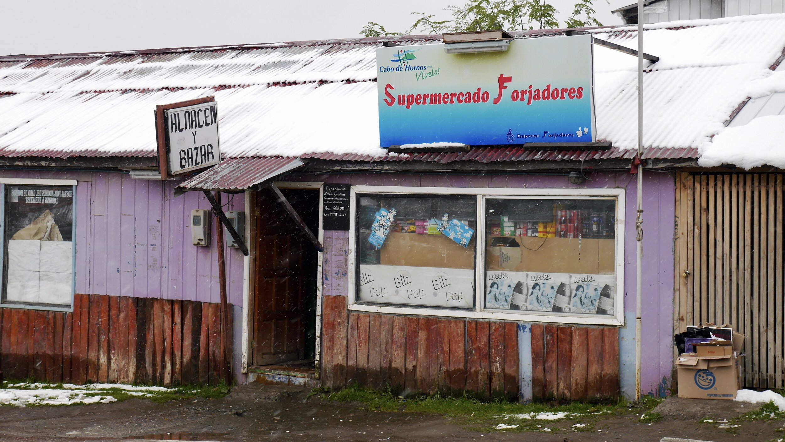
Puerto Williams vibes
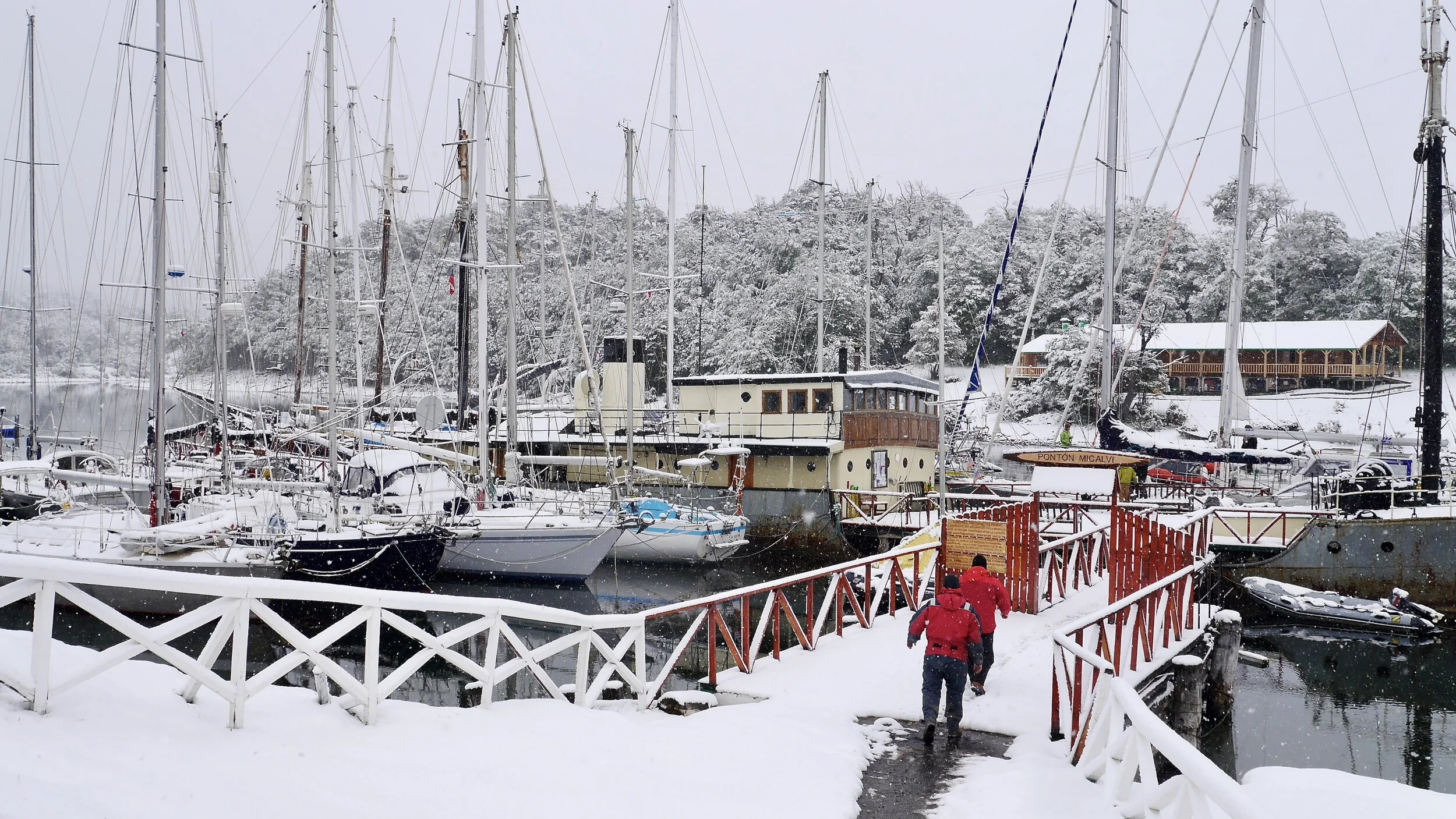
The famous marina of Puerto Williams. This is the staging marina for Cape Horn and Antarctica. Many famous yachts and sailors passed through this place over the decades.

The famous marina in Puerto Williams. We need to get the approval of the Chile Armada to proceed.


Planning our route through Tierra del Fuego. We would sail from Puerto Williams to Punta Arenas over two weeks stopping along the way for hikes and exploration.

I ended up sleeping and living on this shelf. It was literally in the living room of the boat so I had no privacy and could not linger. Furthermore it was rather tight as you can see. First class all the way!

Trail to Los Dientes from Puerto Wiliams on Isla Navarino

Chilean fishermen in the wintery Beagle Chanel near Puerto Williams.

In the Beagle Chanel in Patagonia

Monte Frances. The mountains of Tierra del Fuego - wild and remote

Monte Bove 2,279m above Glacier Frances

Monte Frances 2,261m

Monte Frances 2,261m

An anchorage along the Beagle Channel


Glacier Holanda and Monte Frances 2,261m on the left

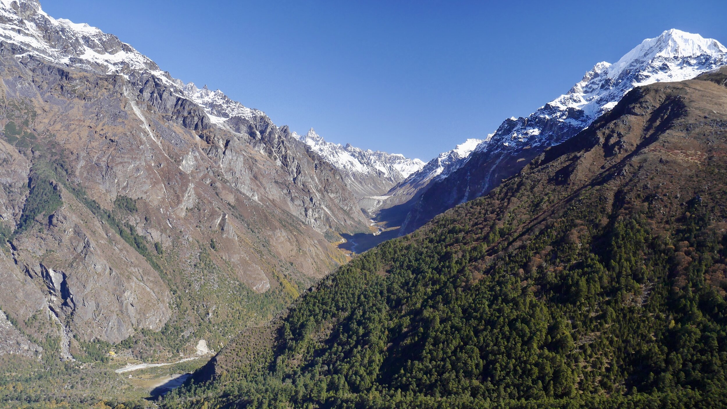
Tierra del Fuego, Patagonia

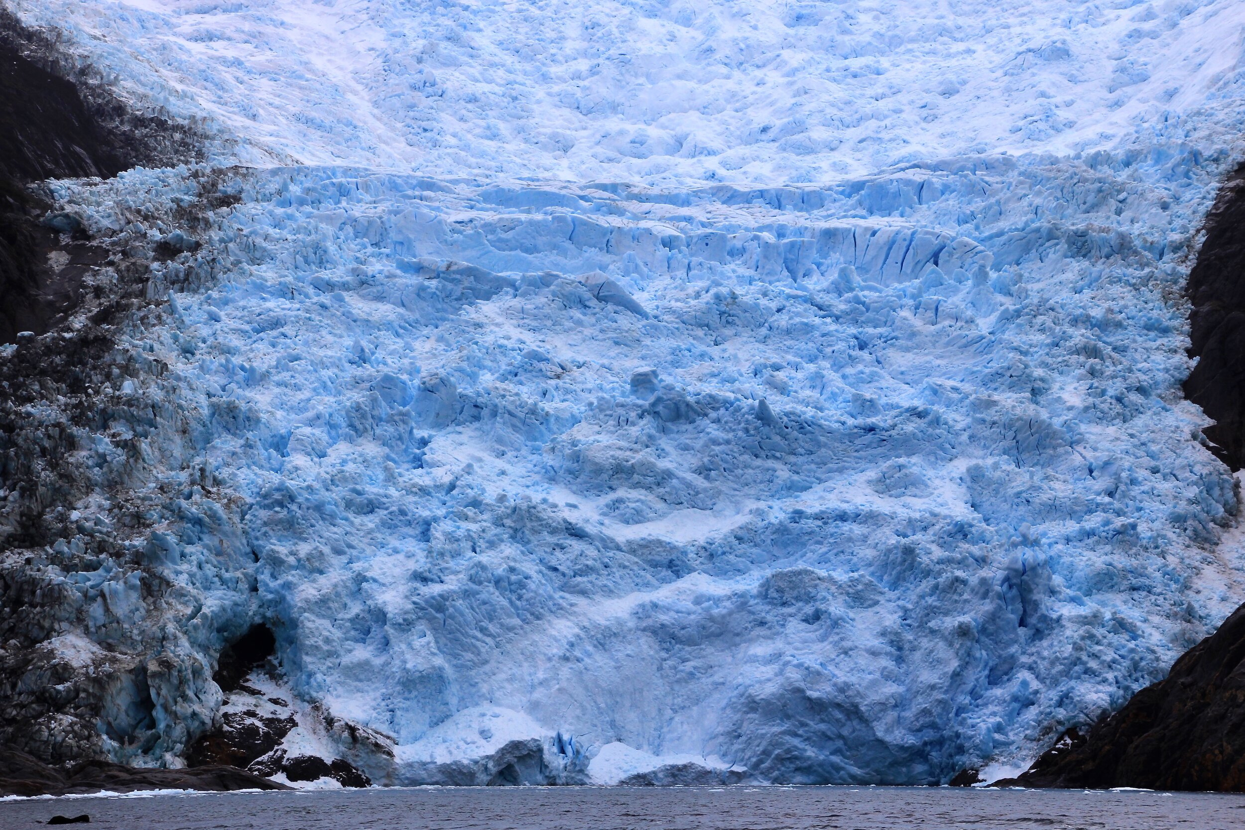
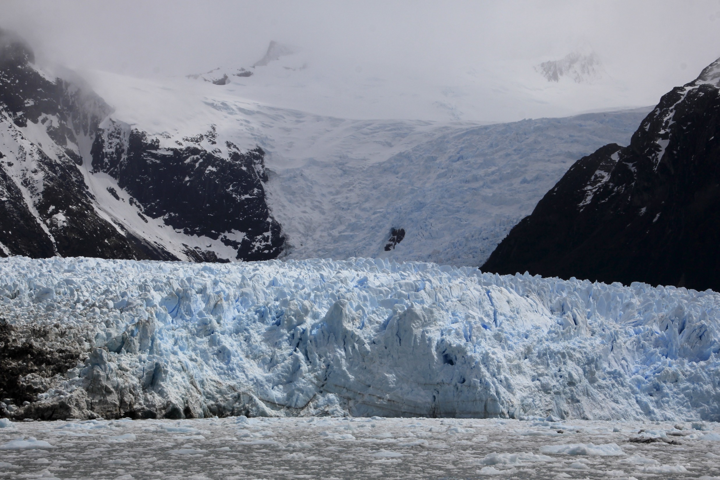
The glaciers of the Darwin Range on the Tierra del Fuego - Glacier Frances

Glacier Frances

Glacier Frances

Darwin Range on the Tierra del Fuego

Condor

In the Darwin Range of Tierra del Fuego


Beagle Channel

Beagle Channel

Beagle Channel and the southern Patagonia


The Darwin Range on Tierra del Fuego. Laguna Frances and Monte Frances


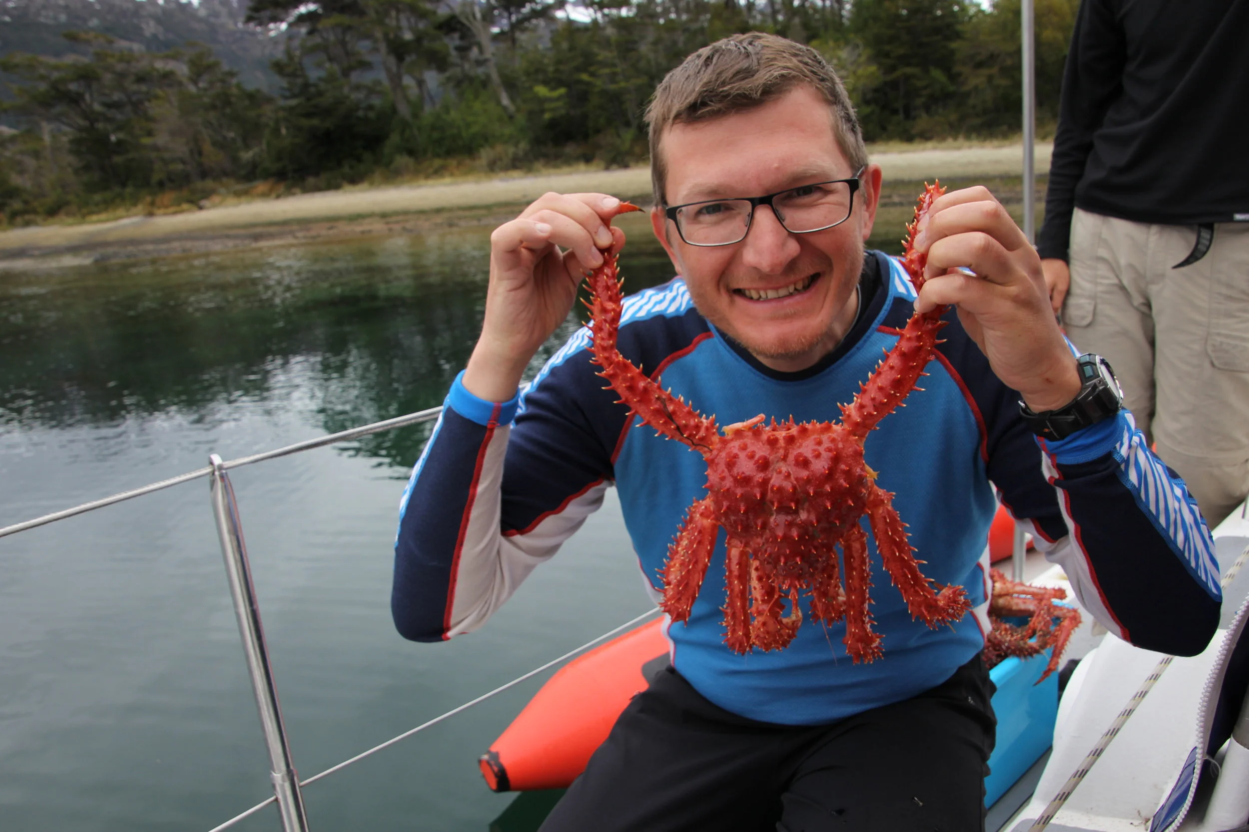
Crabs from the local fisherman


The glaciers of the Tierra del Fuego
Fjord Pia (Brazo Pia Oeste)

Fjord Pia (Brazo Pia Oeste) Glacier Guilcher

Fjord Pia (Brazo Pia Oeste) Glaciar Guilcher

Glaciar Guilcher, Cerro Lady Jane 2,257m and Cerro Iorana 2,020m

The spectacular glacier in one of the fjords of the Tierra del Fuego - Glaciar Guilcher

Darwin Range on Tierra del Fuego - Glaciar Guilcher

Watching the glacier action in the narrow fjord in the Tierra del Fuego

Glaciar Guilcher


Darwin Range in Tierra del Fuego from Brazo Pia Este, Southern Patagonia in Chile

Hiking in the mountains in the Brazo Pia Este

Hiking in the southernmost tip of Patagonia in the Brazo Pia Este

Spectacular Patagonia - the Brazo Pia Este and Glaciar Kalv

Photo by Keri Pashchuk - hiking in the Darwin Range in Patagonia


Glacia Kalv

Seno Fjord and the Darwin Range. Glaciar Porter Oeste is visible.

Seno Fjord

Seno Fjord

In Patagonia in the Seño Fjord


Brazo Pia Este, Monte Darwin on the right

Darwin Range from the Beagle Chanel. Monte Darwin is on the right 2,261m.


Our position in the Tierra del Fuego
Southern Patagonia

Crab fishermen in southern Patagonia

Chilean Armada patrolling the Patagonian Chanels


Looking back at the Darwin Range

Beagle Channel and the Darwin Range in southern Patagonia

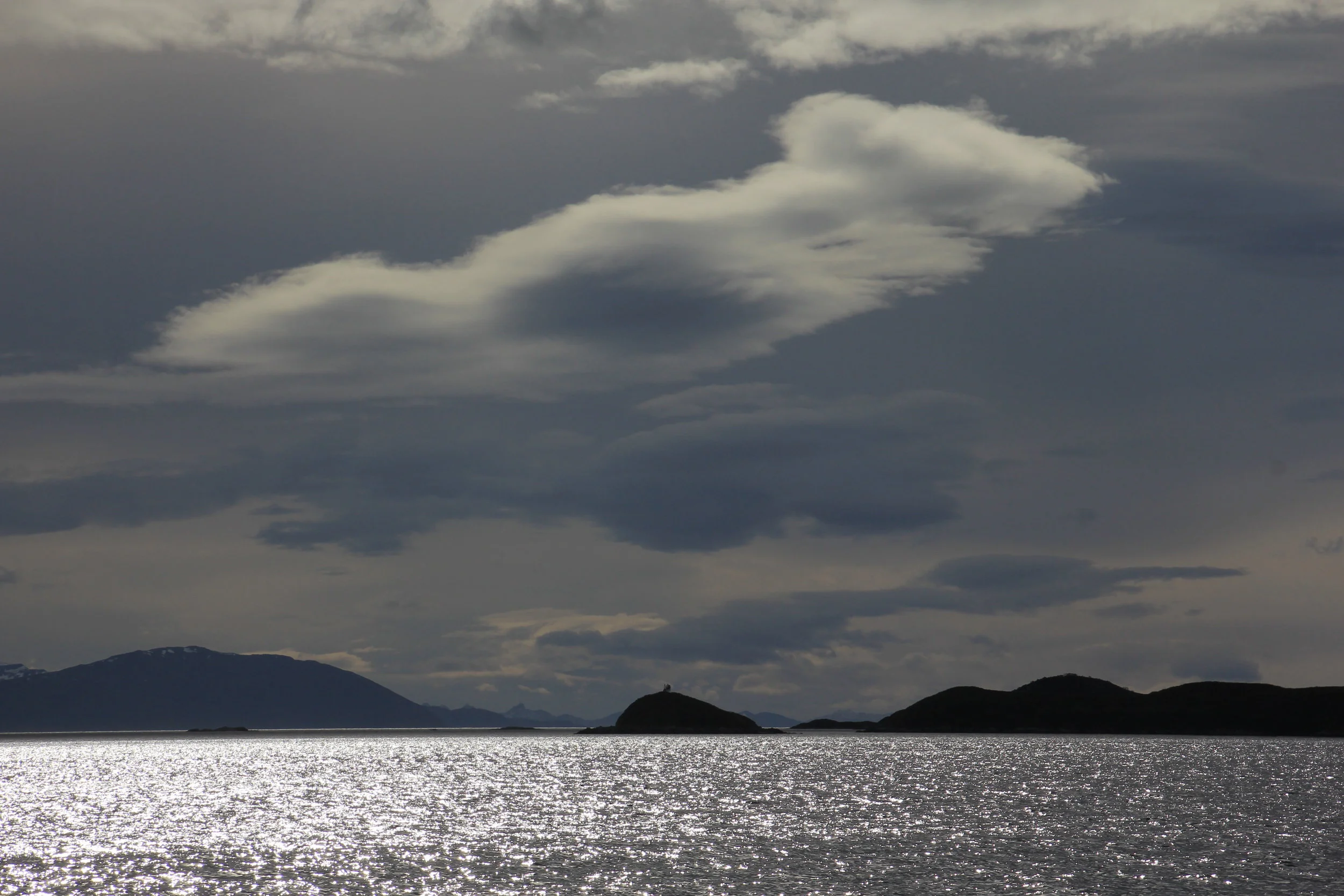
Southern Patagonia


Fickle weather in southern Patagonia


Brockneck Island

Awesome mountains and spectacular hiking in southern Patagonia - Brockneck Island

Brockneck Island

Brockneck Island

The remote and windswept mountains of southern Patagonia - Brockneck Island

Our anchorage in the Brockneck Island

Monte Sarmiento from far away

The glaciers of Monte Sarmiento from Canal Magdalena.

Glaciar Schiaparelli next to Monte Sarmiento from Canal Magdalena.

Glaciar Schiaparelli and Sarmiento

Mount Sarmiento 2,187m, the highest peak of the Tierra del Fuego. Due to very fickle weather in this part of the world, this mountain is often obscured by clouds. We were lucky to see it on such a beautiful day! The view is from Canal Magdalena.

Monte Sarmiento

Mount Sarmiento 2,187m is located within Alberto de Agostini National Park, in the Chilean portion of Tierra del Fuego. It rises abruptly from the east shore of the Magdalena Channel and marks the western border of the Cordillera Darwin.

Monte Sarmiento

The double summit of Monte Sarmiento


Tierra del Fuego, Patagonia. 1000m peaks (Cristal, Taurus, Outland) along Fjordo Keats.


Southern Patagonia

Condor


Southern Andes - Tiera del Fuego

Southern Andes - Tierra del Fuego

Southern Andes - Tierra del Fuego. Monte Backland from Fjord Agostini.

Southern Andes - Tierra del Fuego. Fjordo de Agostini.

Southern Andes - Tierra del Fuego

Southern Andes - Tierra del Fuego


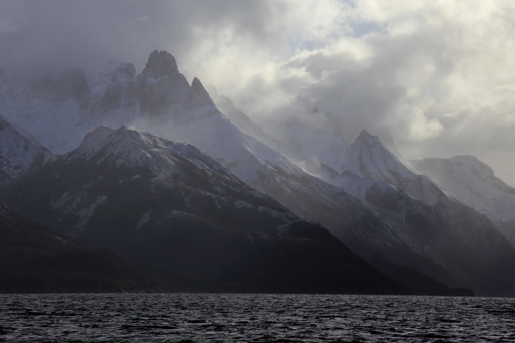
Fickle weather of southern Patagonia

Southern Andes - Tierra del Fuego


Southern Andes - Tierra del Fuego

Southern Andes - Tierra del Fuego


Southern Andes - Tierra del Fuego


Southern Andes - Tierra del Fuego

Southern Andes - Tierra del Fuego. Along Fjord Keats.

Fjord Keats
Fjord Keats


Monte Buckland in the Agostini Fjord - Main summit is 1,800m

Monte Buckland

Monte Buckland

Glaciar Rugidor in Fiordo Hyatt


Straight of Magellan


The wind blown forrest of the Straight of Magellan

Straight of Magellan

Volcanic formations of the Straight of Magellan

Straight of Magellan

Straight of Magellan


Straight of Magellan. The wind makes the trees grow sideways. Tierra del Fuego in the distance.


Ushuaia, Argentina - the Beagle Channel

The Beagle Channel

Ushuaia and the Beagle Channel

Beagle Channel near Ushuaia

Argentina’s shore along the Beagle Channel

Beagle Channel

Beagle Channel

Cape Horn

Cape Horn, Chile Station - the southernmost point of South America

Cape Horn

Chile station on Cape Horn

Puerto Wiliams

Puerto Williams and Los Dientes mountains on the Navarino Island

Navarino Island

Beagle Channel

Beagle Channel


Ushuaia, Argentina

Ushuaia and the Beagle Channel


Along the Beagle Channel

Beagle Channel

Beagle Channel


Beagle Channel

Mountains of Patagonia and the cormorants of the Beagle Channel


Southern Patagonia

Southern Patagonia with the mountains of Tierra del Fuego on the horizon


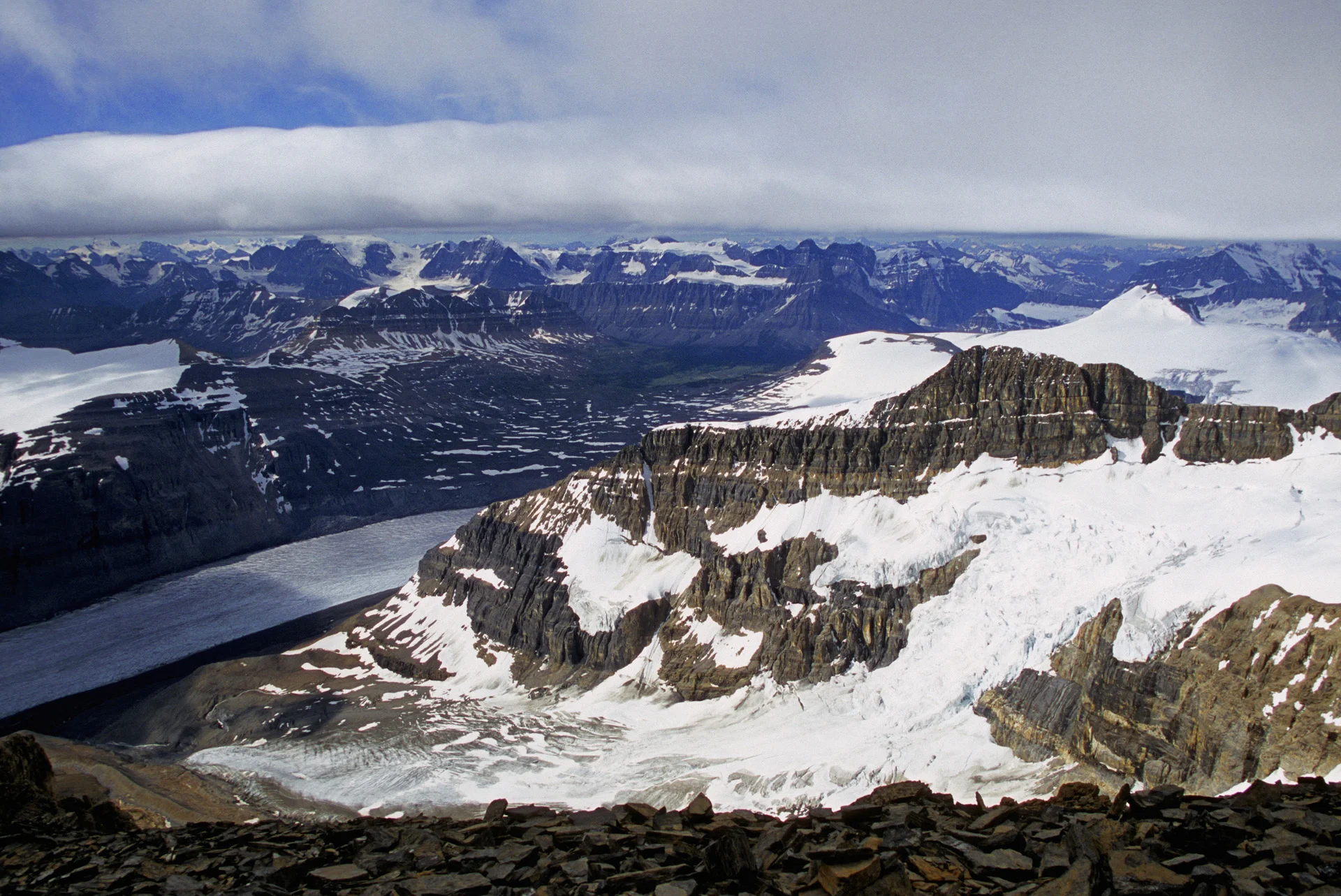
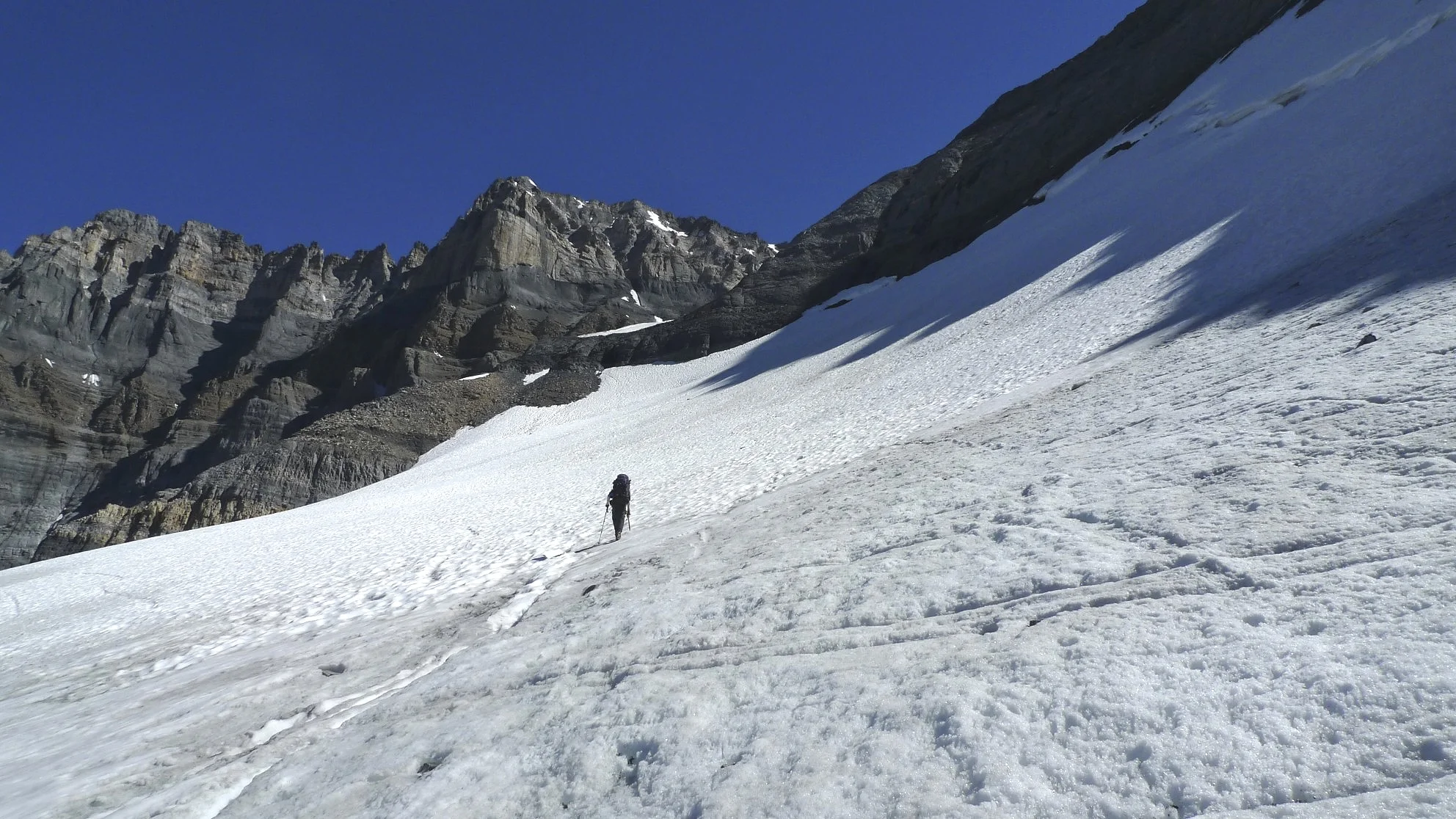
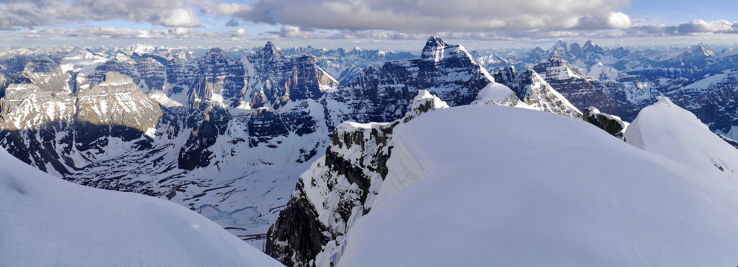
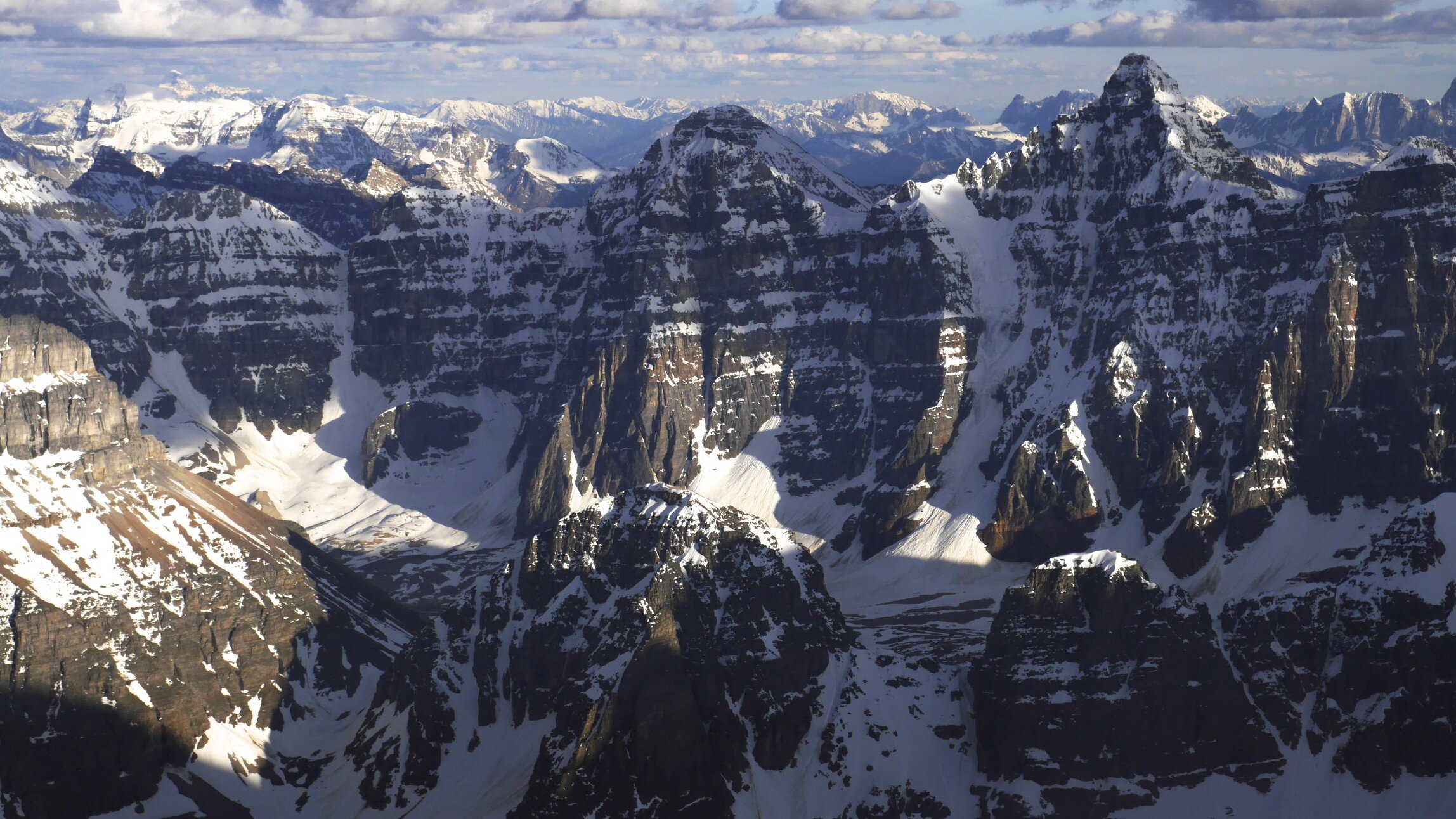
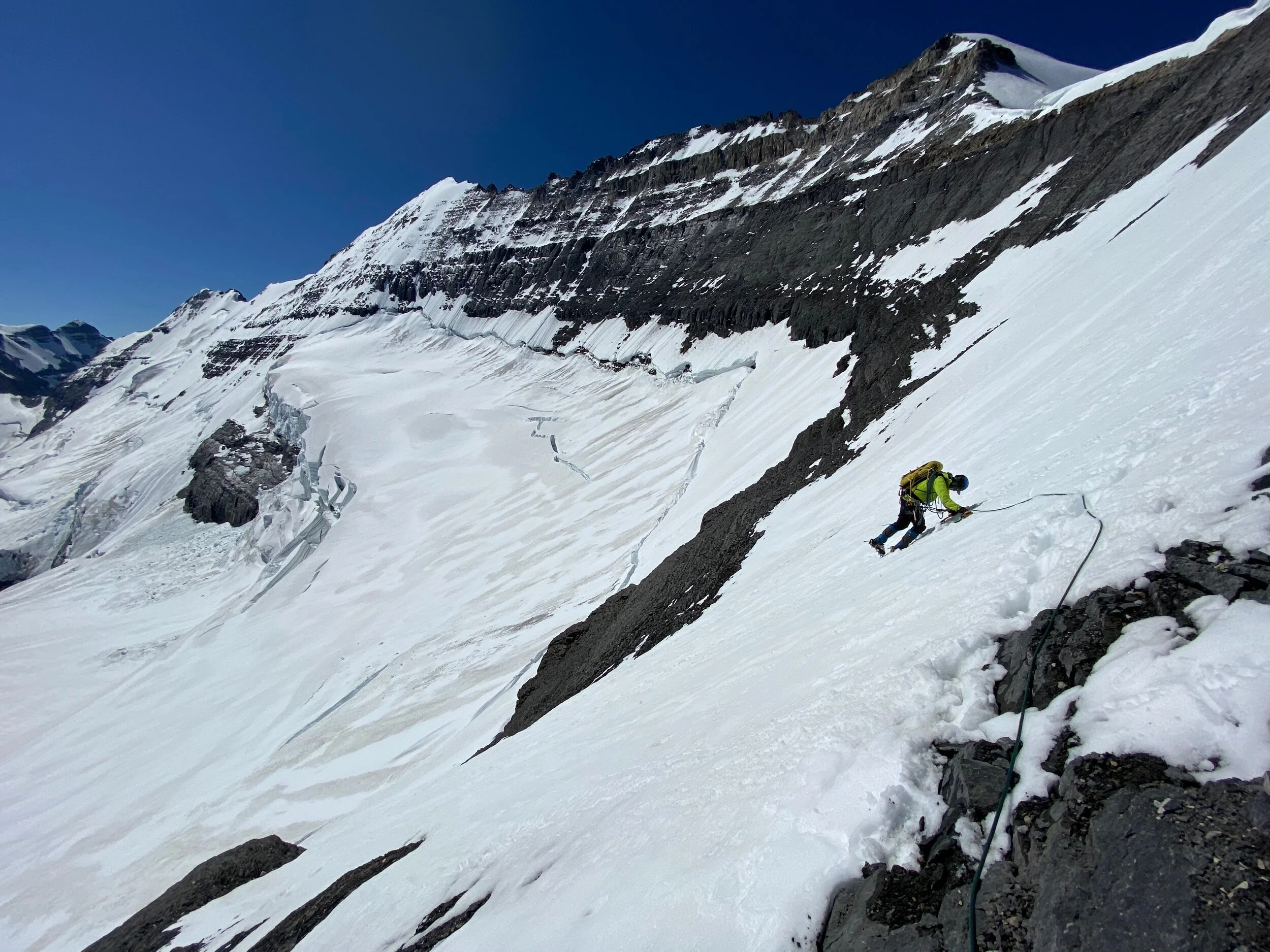
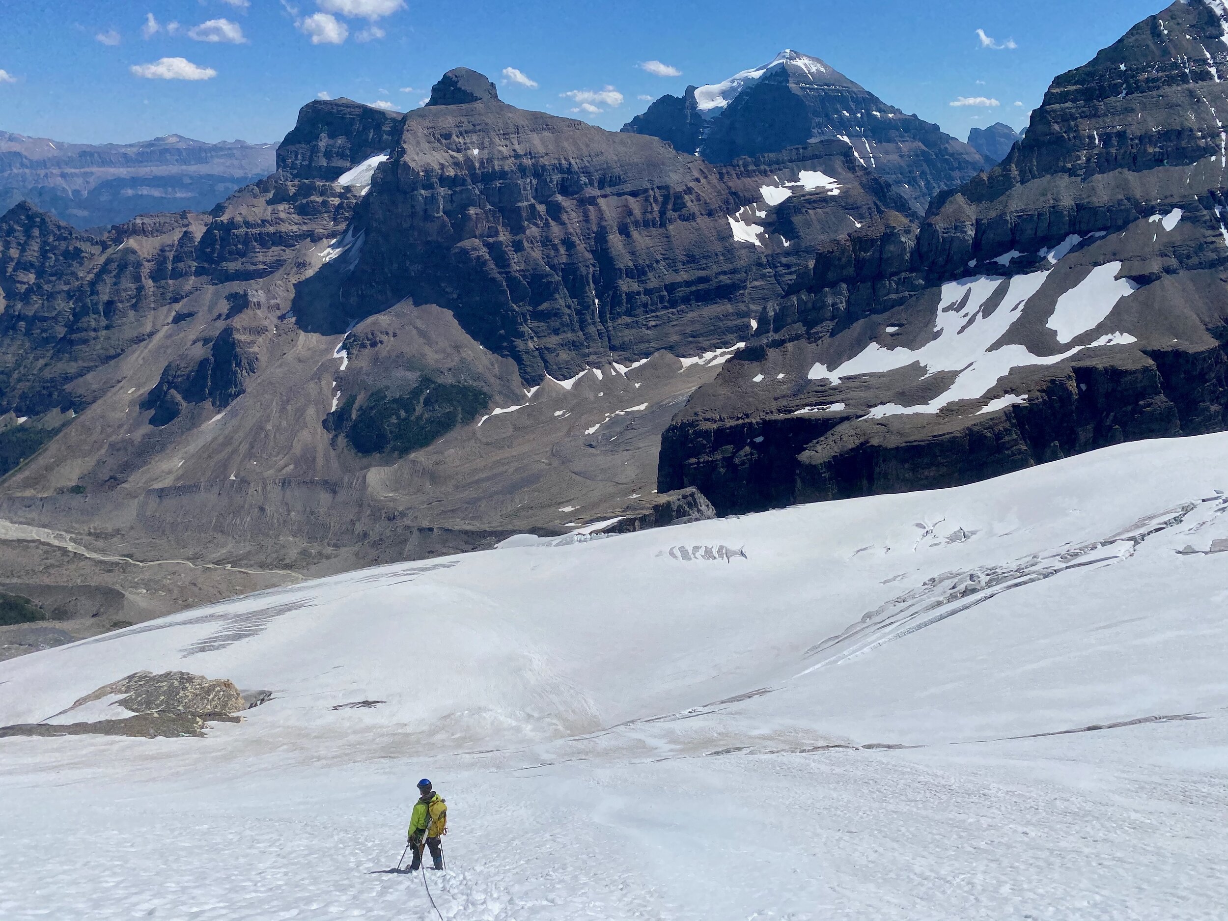
In August 2014 we hiked the 70km trail connecting Banff National Park with the Kootney National Park through the Mount Assiniboine Provincial Park in British Columbia, It was a fabulous week- long trip with quite a few peaks climbed along the way. We hardly had any company and sometimes we had the entire place to ourselves. We started in Sunshine Meadows in Alberta. The trek culminated with epic bushwhacking through the wet and thick BC forest for some 10km.


Citadel Pass


Nub Peak


Nub Peak


Wander Peak

Wander Peak

Wander Peak


Wander Pass


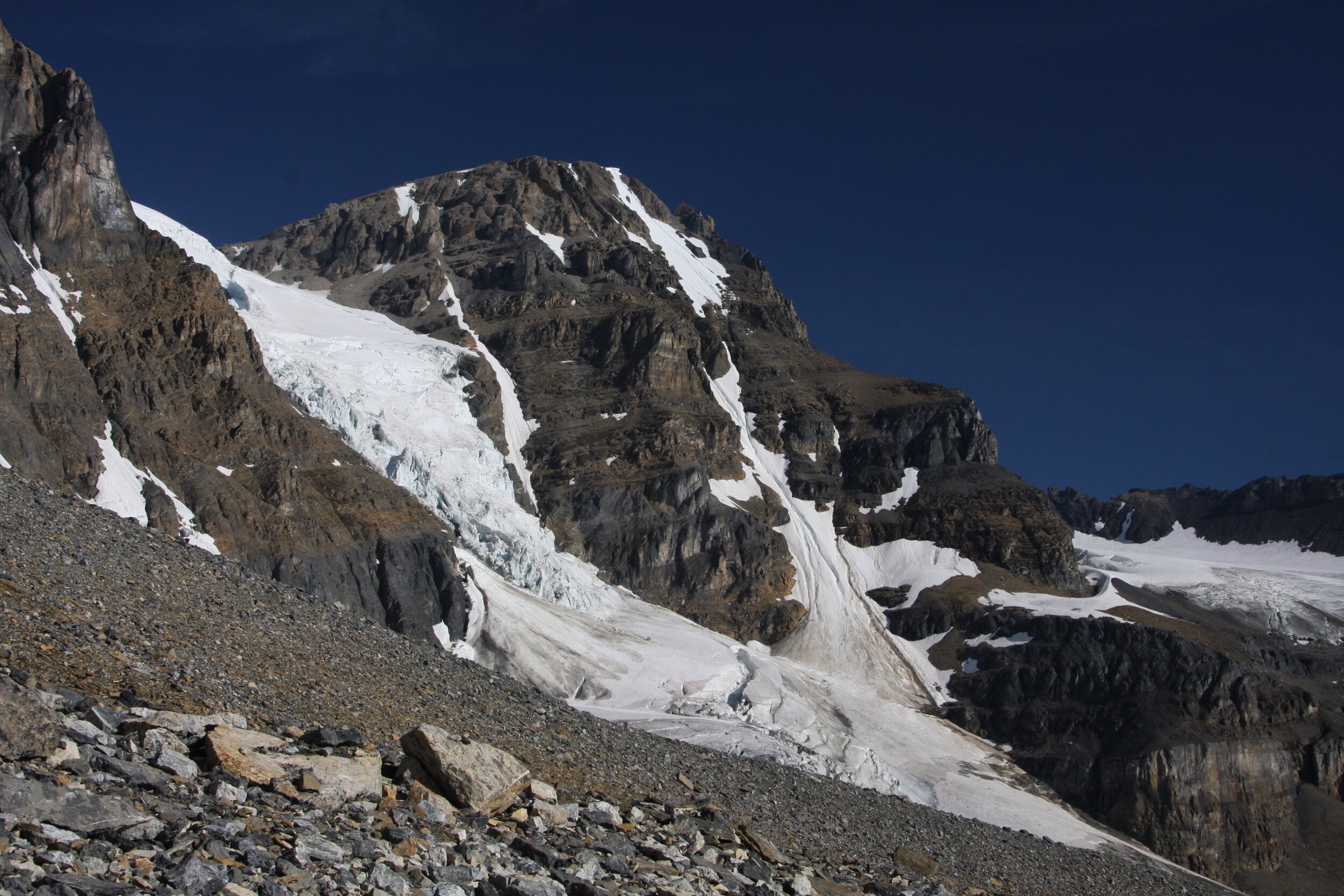
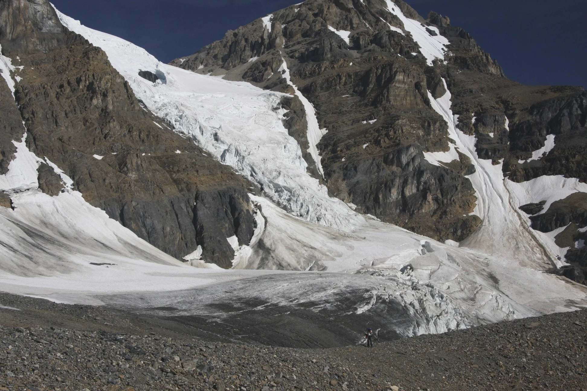
Mt. Athabasca

The summit of Mt. Athabasca
Saskatchewan Glacier from Mt. Athabasca

Mt. Athabasca AA col

Crossing Athabasca River en route to Mt. Alberta area

Crossing Athabasca River


En route to Mt. Wooly and Mt. Diadem base camp


Mt Wooly on the left and Mt. Diadem on the right


Directly ahead is the Wooly’s shoulder, the pass leading to Mt. Alberta. It is a SLOG!

Working our way up the Wooly’s Shoulder

Twins Tower from the Wooly’s Shoulder Pass

Mount Alberta and approach to the ACC hut

ACC hut in front ot Mt. Little Alberta

The ACC hut and Mt. Alberta

The north side of Mt. Wooly

Mt. Alberta from Wooly/Alberta col


Mt. Alberta


Mt. Wooly

Mt. Alberta


The Twins, Twins Tower and Mt. Columbia (on the right)

Mt. Alberta

Mt. Little Alberta

Mt. Kitchener and Snow Dome


Mt. Little Alberta and ACC hut

Ascending Mt. Little Alberta


Mt. Kitchener


Summit of Little Alberta 2,956m and Mt. Wooly behind

The summit of Little Alberta


Mt. Alberta

ACC Hut and Mt. Diadem

The Twins and Twins Tower


Mt. Athabasca

Mt. Athabasca and Mt. Andromeda

On Nigel Peak

Nigel Peak 3,211m

View from the summit of Nigel Peak

Mt. Athabasca from Nigel Peak 3,211m

Athabasca Glacier and Columbia Icefield from Nigel Peak 3,211m

Athabasca Glacier and Snow Dome from Nigel Peak

Mt. Alberta, Mt. Wooly and Mt. Diaden from Nigel Peak

Looking south from Nigel Peak

The Icefield Parkway from Nigel Peak


The summit of Nigel Peak 3,211m


Nigel Peak is the mountain on the horizon on the right


The summit of Sunwapta Peak 3,315m

View to Mt. Brazeau (high peak in the centre) from Sunwapta Peak 3,315m

Snow Dome (left), Mt. Alberta, Mt Diadem (right) from Sunwapta Peak


Sunwapta Peak

Mt. Edith Cavell in the distance (high peak left of centre) - looking north from Sunwapta Peak


Nigel Peak from Sunwapta Peak 3,315m

Mt. Athabasca and Mt. Andromeda from Sunwapta Peak 3,315m

Mt. Columbia from Sanwapta Peak 3,315m

Sunwapta in winter

Sunwapta in winter

Mt. Brazeau from Sunwapta in Winter

Mt. Edith Cavell from Sunwapta in winter

Mt. Athabasca and Andromeda from Sunwapta


Sanwapta Peak from Mt. Brazeau
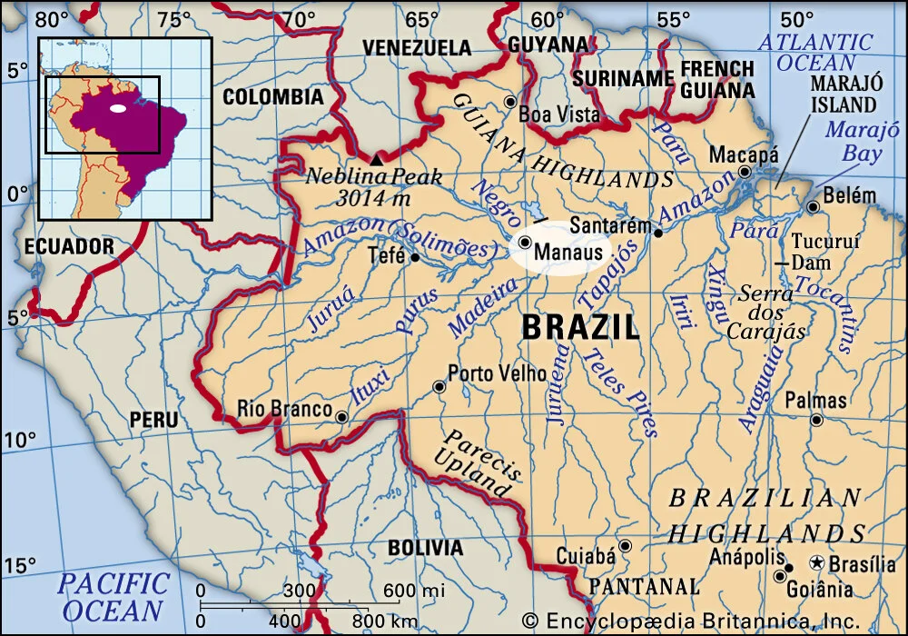
We traveled from the mouth of the Amazon River to Manaus, Not even half-way up the mighty Amazon!


The mouth of the Amazon River. The water is discolored 50miles out into the Atlantic.


Our route was the orange line

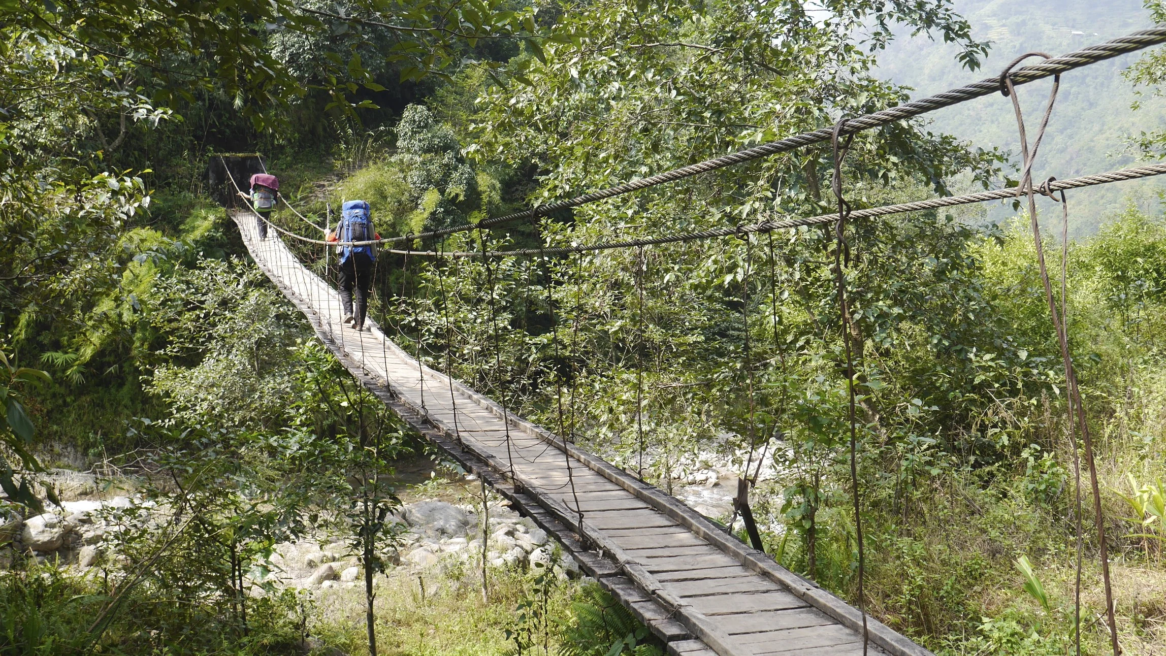
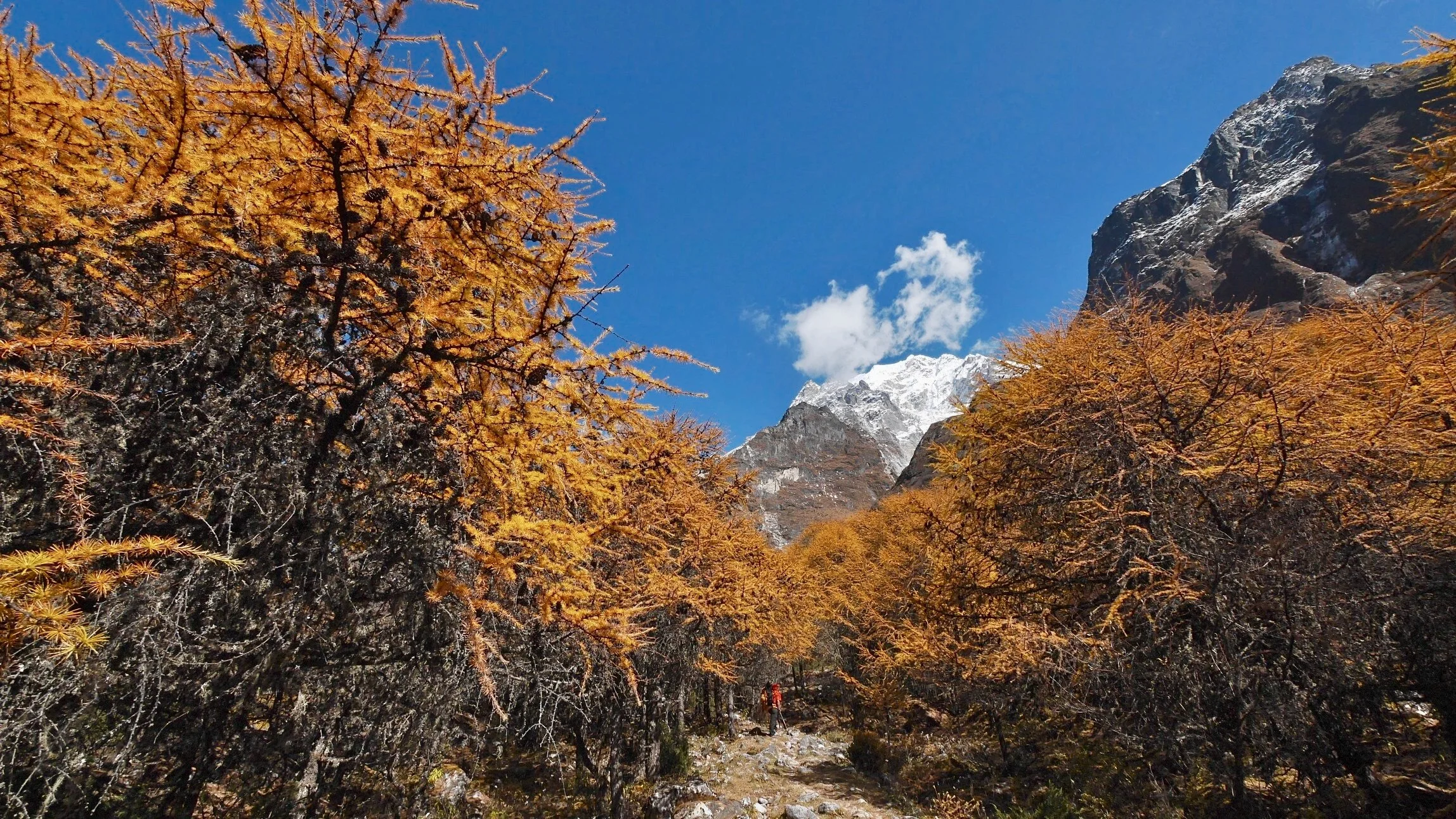
Participants: Derek, Sangey (lot’s of enthusiasm, an angel of a man, did not know the way and understood 15% of what I said, always ready with hot tea), Kamsing (porter and cook, great guy), Dawa (Patrick Swazey of Nepal with his faux leather jacket)
So here I am again, it is hard to believe that a year has gone by so fast. I left Calgary at 9.30 pm on October 8th on a BA flight to London. It took me two days to get to Kathmandu. The flight was much easier than last year due to the Dubai detour. Calgary was hard to leave as always and everyone was sad to see me go for a month again. I was sad to make everyone sad. Johnny was the best about it. He is a great kid and I could not ask for a better blessing in my life. Once we all got over the collective sadness I went to the airport. All went very smooth. In London, I met with David and we went to central London. I seem to experience London in bits and pieces over the years. It is a true anthill. Seeing the mass of grey suits move through the subway tunnels, all the people just running and rushing oblivious to their conditioning, it is like the end scene from the 1st Matrix movie that I just watched with Johnny before I left.
The flight to Kathmandu went quick and at 5pm I was there. Rajendra met me at the airport and we drove to the Nirvana Garden Hotel, my home away from home. The same day, I went to Kumar’s for dinner. He of course made the Dhal Baht. I met with Ashok and Anupa again and gave them the small gifts I brought from Canada. They showed me their schoolwork. They are making good progress with English, as I can actually talk to them now. The kids seem good and I am happy that I can be of help to them. I was very tired so I just crashed and was up at 4.30 am due to the jet lag.
It is 5 am now in Kathmandu and it is Friday. I am sitting in a room in the Nirvana Garden Hotel – the favorite of Rajendra.

Early in the morning I took a walk around the Dubar Square. So it happens that I am here at the same time as last year and the festival of Dashan is taking place. I already saw dead goats and many waiting to die.
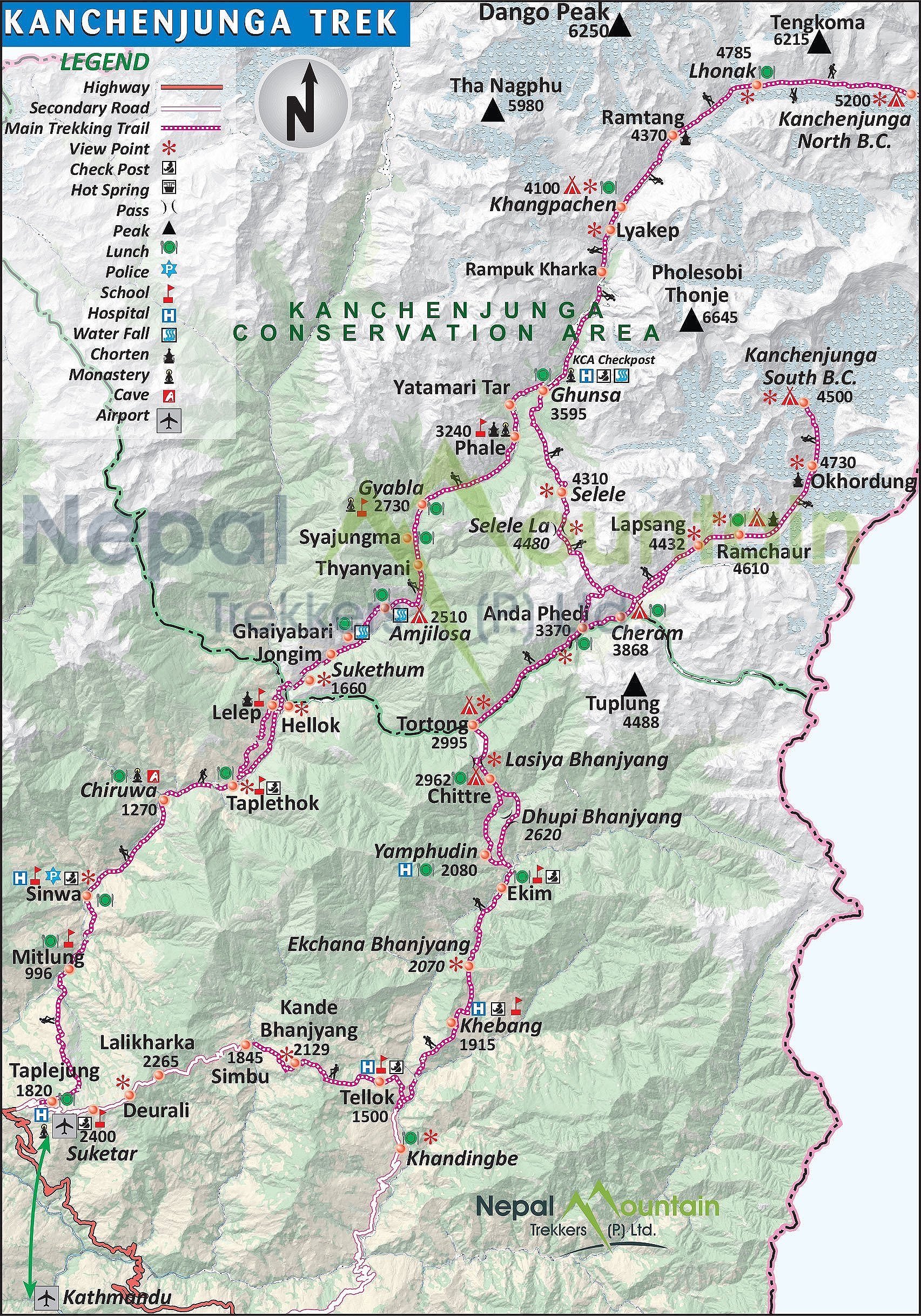
I took an early morning (9 am) Yeti Airlines flight to Briatnagar, the second largest city in Nepal in the southeast corner of the country. I had a beautiful view of the Himalayas again all the way from Shishapagma to Kanchendzonga. The flight takes 25 minutes. It was very satisfying to realize that I walked through a large portion of this distance. I arrived in Biratnagar and I parked myself in the cafeteria at the airport waiting for Sangey who was already 1 hour late. At this point I was not sure what was going on as the guide and the crew were not here to meet me. The good news is that Tapeljung (the starting point of the trek) is only 6 hours away, apparently on a good road.

I also have 100,000 Rs emergency cash from Rajendra for Sangey. It all feels very loosy goosy, not what I am used to but I will go with the flow. Everything seems to be fluid and flexible here this time around. I am used to this by now.
Sangey, Kam and Dawa showed up at the canteen at the airport eventually. It was really hot 35C and humid. We took a rickshaw from the airport to a small guesthouse on the airport road 15 minutes away. We needed to find a way to get to Tumlingtar. The asking price was $350 which was quite expensive so the decision was made to go half way and try our luck from there.
The ride to the town at half way point was 3 hours. It was hot and not very comfortable in a small car but the road was good. The town was like all the small Terai towns I have seen so far. All the hotels were full because of the festival of Dashan so we stayed at a place of last resort. A filthy concrete guesthouse with bed bugs. I had to put the ground sheet from my tent on the bed before I put my sleeping bag on it. The sheets, which are never changed, had bloodstains on them. Kam and Dawa do not speak English. Sangey’s English is rudimentary at best making my conversations very limited. They are all very nice though and Sangey tries so hard to be a good guide. It will be a very meditative month if I do not run into any Westerners.

We took another car arranged by the hotel owner from the small town we stayed in to Suketar, the trek’s starting point (where the old airport was at one point in time). The airstrip in Suketar is still there but there are no more flights. On the way we climbed up the hills of eastern Nepal covered in tea plantations. The beautiful views in clear weather extended all the way to the Kanjendzonga massif. All three Kanj peaks, Janu and other mountains were clearly visible. In the distance, we could see the Everest group, Makalu and Chamlang were well visible as well. It was very hot on the way.
We arrived in Suketar and checked into the Everest View Hotel without the Everest view. Actually in the afternoon, the clouds rolled in and obscured all views. The trip so far was much more relaxed than last year. It all seemed very fluid, we had no fixed itinerary and I was not sure if anyone in my little group knew the way to our destination (they did not). It seemed that we would all rely on the large scale map that I bought in Kathmandu before we left. In Nepal, when it all seems hopeless, somehow it all works out at the end. I decided to let things just happen and we would figure it out eventually. In retrospect, a very good decision.
In the afternoon, after dinner, I took a walk to the abandoned airstrip in Suketar. It was somewhat erie. Next to the airstrip, there was an old Hindu shrine. From the shrine, there was a nice view over the hills of eastern Nepal with green hills spreading below me. For dinner we had momos and chow main. I am glad that I brought my own snacks as eating Dhal Baht every day would get tiring.
We got up at 5 am, and started walking at 7.30 am. The sky was overcast and it started to rain soon after we left. It is one of those miserable days with lots of rain, making the experience not very enjoyable. The trail started on a road, which was quite easy. After an hour or so, the trail descended 1,000m to the river (just like last year). With the heavy rain, the slope became very slippery and 1,000m became a tedious and tiring affair, as I had to watch every step not to slip. All the rain and slippery trail made me want to go to higher elevations. We arrived in the village of Kunjan, a dirty hole. We checked into the only lodge in town. The term “lodge” and “town” are very generous here. The “lodge” was a bed in a room without any windows but at least it was dry (unlike in a tent) as it rained all day. The rain must be related to the low-pressure system in the Bay of Bengal that I was reading about before I left. Later I learned that it was the following event:
“Cyclone Phailin strengthened into a Very Severe Cyclonic storm on October 10, followed by the upgrading the storm to a strong Category 4 status. Continuing its rapid intensification, the storm reached Category 5 status the following day, the first storm to do so in the North Indian Ocean since Cyclone Sidr in 2007. The cyclone prompted India's biggest evacuation in 23 years with more than 550,000 people moving up from the coastline in Odisha and Andhra Pradesh to safer places, 44 deaths related to the cyclone were reported”

We all slept in the same room so my earplugs came in very handy. The kitchen was directly below the bedroom so the smoke filed the room quite fast during dinner. Who puts a kitchen stove without a chimney directly under a bedroom? There was no electricity so after dark it was candles and headlamps only. I do not think that this place sees many tourists, as the facilities were very basic.
Sangey, my guide, cannot communicate well as he speaks very basic English. He leaves me sitting around once we get to a destination. The porters cannot speak English either. Sangey also does not know the route. He did not even read about the route before we left (I sent them the detailed description of the route before I arrived in Nepal).
As we walked today, I asked Sangey to buy some fresh vegetables. He said that he could not buy anything in the villages we passed. How can this be? The fields are full of produce and we cannot buy anything, not even a cabbage or a tomato.
Today it rained all night. It seems that on every trek in Nepal I get lots of rain or a snowstorm. I am curious how long it was going to rain? I was unaware of the Cyclone that parked itself over the Bay of Bengal and was causing all the rain. For breakfast we had chapattis, omelets and tea.
Today seems like a watershed day. It rained all day and the walking in the rain was not good. There we many leeches and slippery rocks. The rain was very heavy at times. It rained all day without a break, relentlessly. We did not reach our destination due to the rain. We stopped one hour short of our destination in a home of a local family. It was just a shitty day all around. At lunch we stopped at a house by the trail. Sangey parked my wet and sorry ass upstairs in a huge room. I sat there by myself. We are in the process of working out how we will interact.
Sangey's lack of English makes our communication difficult and I cannot explain my intent well to him. He is overzealous and checks on me all the time though. He also walks with me through this shitty weather in the rain, leeches and all so God bless him as he is an angel of a man. It feels like I am five and have my dad with me.
On every trek, it is interesting for me to observe how my mind tries to control it all at the beginning, the process, the flow and the outcome. The rain presents a good opportunity to test this attachment to control, as I cannot control the weather. I do not know how long the rains will last and when they would end. My mind tries to grasp some control, it needs certainty. Check the forecast, call someone, do something! It is difficult to just let go and accept the natural flow without the certainty of outcome. I cannot quit this trek, as it would be giving in to the need for control. This process enslaves me at home as all the time I have this compulsive need to control. So there you have it, no quitting despite the continuous rain and the uncertainty.
The conditions here are very poor compared to other parts of Nepal. There are no vegetables or eggs available for purchase even though we walk through farms each day. Perhaps they need to keep all the produce for themselves? I am an outsider here and the people I meet look at me with much curiosity just as I look at them. Two strange worlds collide.
As we were walking today, the leeches made their way into my socks through the eyelids of my boots. It was gross, when I took my boots off, the socks were soaked with blood. The flow of blood is hard to stop as the leeches inject anticoagulant. Apparently the same substance is used in operations to prevent the blood from clogging. When we go higher the unpleasant aspects of the cloud forest will disappear.
This morning the rain stopped around 5am and the fog and clouds started to lift. Slowly at first but as the day went on, the aura improved considerably. It was still foggy in places but considering the 100mm of rain, it would be quite expected. Last night the family killed a large pig. I was lying down in the room so I only heard the desperate screams of the pig. Once the kill was done, the villagers were butchering the pig all night in the rain. This morning, I had a noodle soup with last night’s fired pig. It was quite good and I did not get sick which is a bonus. After breakfast we made our way to a village we were supposed to go to the night before. It was 2.5 hours away. From that point we did a normal stage planned for today. We started at 7.20 am and finished the day a 4 pm so it was a full day.
It was another day of leeches, which got into my boots. Made the socks all bloody. The walk was not particularly hard but it was a long day. I was fortunate that the rain stopped and I did not have to negotiate any slippery steps.
For lunch we stopped in Mymonkie. We finally found some vegetables for sale! Kamsing made a delicious fresh salad from the vegetables in the garden next to the house we stopped at. The vegetables were all fresh; he used salt and lime juice as dressing. Since the white guy was eating, it qualified as a spectacle sport and quite a crowd gathered around me. An old and very photogenic grandpa was making a racket and was talking to me about something with much agitation, to the bemusement of the people that gathered. We all had many loughs and a good time without understanding one another.
After lunch we proceeded to Yampuchin, which was a long way away. On the way, Dawa developed a stomachache and I had to dispense some Imodium so that he could arrive at our destination without shitting his pants. I am shocked that these guys go on a month-long trip with no medications at all. Nothing. I saw something similar last year.
I noticed that the kids here are not pampered at all and are left to their own devices. It sure helps in developing resiliency and self-reliance. It also makes the Western race look rather wimpy. The Nepalese are strong and resilient but the white guys excel in other departments I guess. In the house we stayed in last night, there was a 9 month old baby crawling on the dirty floor almost naked and left to fend for itself. No toys, no clothing, nothing. No baby stuff at all. In Canada, we spend a lot on the shit that no one needs. In Nepal, by age 10, the kids work around the house: clean dishes, clean the house, carry 50 lb bags of rice, and look after animals or younger siblings. In Canada, by age 10, kids learn how to use an i Phone.
After the day was over I had a cold beer: ½ liter San Miguel for $4. It was great! Tomorrow is a hard day. We have to cross two passes with the total elevation gain of 1,860m.

During the night Dawa must have gotten a lot sicker as Sangey slept with him in the same room and in the morning they went to visit a local clinic which was probably not a bad idea.
Sangey cannot speak English well, he mispronounces words to the point that he is just making noise without any sense. He could just say single words and it would make more sense to me. Sangey also hides well what he does not know; I think it is safe to say that for the most part it is difficult to figure out what is going on here. So the best strategy for me is to keep quiet and just go with the flow. He is an angel of a man though!
I went to the clinic with Dawa again. It was not much of a clinic though just a wooden bench and a bloke with a key to the drug dispensary. Lots of health posters but no sink or water and also no lights. Basic is an understatement. Dawa was put on a saline drip and some medication to stop the stomach pain. I sat with him in the clinic as he lied on the wooden bench. I felt like I was a medic again, but I had to take responsibility for my crew. The fact that I am responsible for the well being of the porters and the guide is a fact of the trip for me. I think that if Sangey had his way, he would make Dawa walk with us further (sick or not). Somehow they would force themselves to go on without complaining. I cannot accept this and I will pay him his full wages for the whole trek and hire another person.

I made a decision for Sangey to ask Dawa to go down as he was completely out. He was in a lot of pain as he had a strong stomach infection. He was definitely in no condition to go forward. Porters make 600-800Rs ($8) a day. Dawa’s salary for the entire trek is 18,000Rs. He apparently returned from the Thorong Pass before we left and had only 2 days rest. This was probably not enough and walking in the rain for two days did not help either. I instructed Sangey to pay him his full salary and send him down.
Given the circumstances, we decided to stay put today and let Dawa rest. Sangey was keen for Dawa to continue. It was difficult to get any reasonable information out of Sangey as his just made senseless noise. The Yellow Lodge that we were in was a good place to rest though. It has a great garden by a river and is surrounded by lush green hills. It was also a good day for washing and laundry.
Watching the Nepalese, it was amazing for me to realize what a different flow life has here. They have no sense of urgency, they maintain their cool and are calm in most circumstances. In the West, we are always busy doing something, processing information, reading, etc. They have so little stuff but a lot of time. We have a lot of stuff but no time. The classic “to have or to be” conundrum.
The Kanchenjunga trek has a different feel from other areas of Nepal. The people here are very friendly and nice, very different from the Khumbu that became the Disneyland-equivalent of the Himalaya – just a well-oiled tourist machine with very minimal opportunities to interact with the locals.
After a full day of rest, I have maintained and stressed that Dawa had to go down. This morning he was totally out. His blood pressure was low (I am not sure what blood pressure had to do with food poisoning). He will take with him our excess supplies brought mainly for camping. We have a kilo of lemons, kilo of sugar, one liter of oil, a full big bottle of ketchup, whole log of salami, two or three bags of porridge and a few kilos of macaroni. All that and one tent would be exactly what one porter would carry and we would not need these items as we would try to rely on teahouses along the way. The basic food they serve to the porters would be fine. So tonight we eat well, and tomorrow we go as three-person group.

For the Nepalese Patrick Swayze the Kanchenjunga trek is over. How did he get sick? It turns out that during our last stop two days ago he had some home-made rakshi (local alcohol that I also enjoy). The water in the weak alcohol was obviously contaminated and made him very sick and he is one of the locals. Imagine if I had it! Wow!
How would being part of a big group differ form my solo endeavor? On a group trek one does not worry about anything as it is all taken care of by the western guide. One has only to focus on the walking. No worries. I think the experience is similar to being an employee vs. being self-employed. Here I have to worry about the basic issues and overall logistics. In addition to that, I feel responsible for the people who I employ to help me.
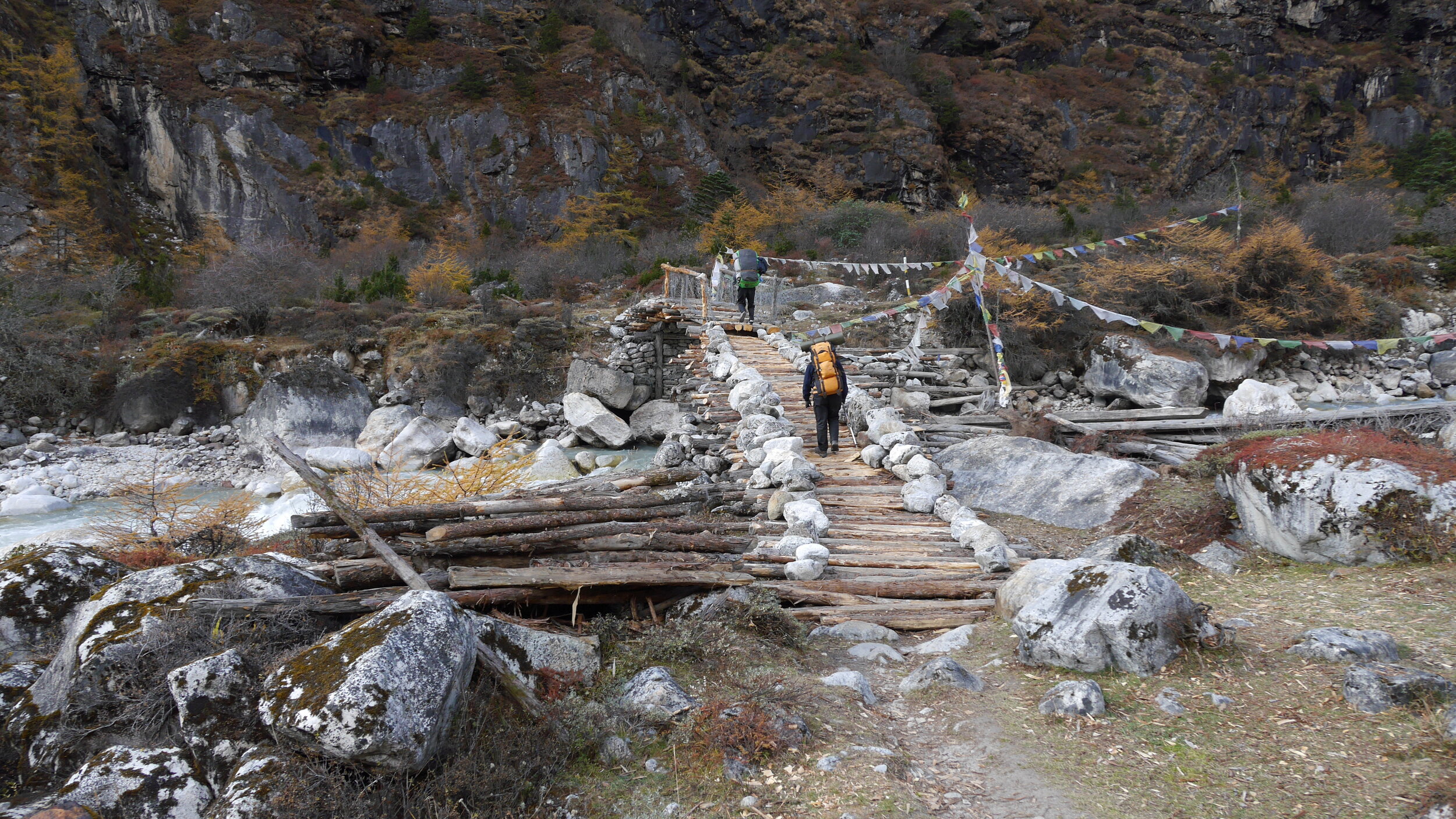
This morning, it was still a toss in Sangey’s mind whether Dawa would stay or go despite my insistence that he goes down. Finally, we paid him and he went down. He crossed the bridge and disappeared into the green hills below.

We went the opposite way at 7am and immediately ascended 700m from the village. Then down a little and up another 1,000m. The total elevation gain in a short time was 1,800m to a kharka and a simple teahouse at 3,350m. During the last two hours of our ascent it started to rain again. The walking in the rain and clouds is getting old. This evening though, there was no rain so hopefully the weather will change.
At lunch we stopped at an animal shelter that was also a camp for an old man and his grandson. It was one of the filthiest spots that I have ever seen humans living in. On one side of the shelter, a stable for the cows. The cows standing and lying in their own shit as cows tend to do. Right next to it, on the other side of the small shelter, the old man’s bed, fire and food scattered all around. We were invited in and it was difficult to find a shit free spot to sit in. The stench was oppressive. Sangey had some water left over form making butter, which gave him stomach problems later. The offer of a lunch or any food in this place was a non-starter for me. The man was very nice and sold us some milk and tea. What a spot though…

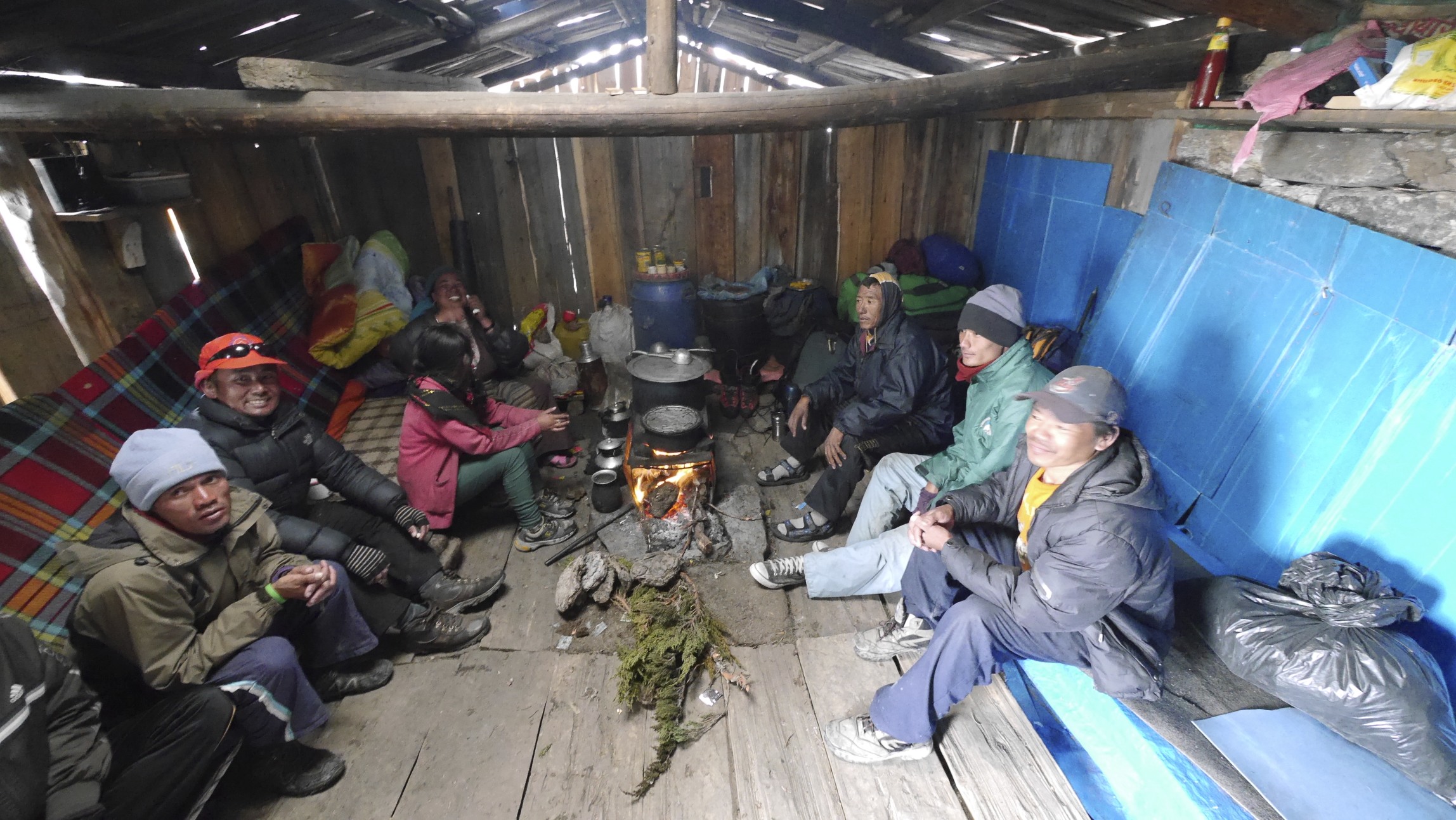
Once we got to the teahouse at 3,350m, we needed to sort out where I would sleep as we had no tent. This was not a standard teahouse but a large barn with a fireplace in the middle for the porters. Since we run into another group (camped outside in the mud and rain) the shelter was full of rowdy porters from that group drinking rakshi in a thick smoke from the fire stove. I had some of the rakshi as well and it was actually quite good, sweet in taste and smooth. The large group camping outside was from the Canadian Himalayan Holidays. They looked rather miserable camped in the rain in the mud in wet tents. Everything was soaked as they camped in the rain we had during the last few days and did not have a chance to dry off. It was nice to speak with someone in full sentences.

I ended up sleeping in the only room that belonged to the teahouse keeper. He was kind enough to rent it out to me for the night. The main hall of the shelter had around 40 men piled into it. In the evening the porters were making quite a racket. The night was loud with snoring, harking, talking. Tomorrow, we apparently have a long day with a 900m ascent.

The day started disappointingly in the fog and rain again. We walked at the top of the nearby ridge half of which was taken down in a huge landslide. It was cool to watch the porters disappear into the fog like the opening scene from Herzog’s Aguirre. We walked in pissing rain for 3 hours to Toronton. The trail was slippery on numerous roots and rocks. We had a short break in Toronton where I run into the Canadians again. I asked them how did they fare on this tricky terrain, as they were older than me by 20 years on average. The answer to this was: with strong painkillers, knee braces and numerous other pills they carry with them. They did not look like they were having a good time.

From Toronton we walked for another 4 hours along the river flowing from the South Kanchenjunga Glacier. The walk was through a really old majestic forest with huge pine trees. The river banks were steep and rugged, battered by water runoffs, that were no doubt, very violent when they happened. It rained all the way with mist and clouds milling around. I would lie if I said that it was magical as at the time it was frankly shitty. I was thinking how done I was with these forest walks in pissing rain for days. We were clearing the tree line and getting into the alpine so my hope was that the aura would improve. So far, this experience has been about rain, clouds, leeches, mud, dirt and thick forests. This reminded my of the trek we did few years back in the western part of Nepal to Simikot. Today is October 18th so I hope that the odds are that from this point on the weather should improve.

The teahouse in Tseram was very nice but crowded. There were quite a few other trekkers there as it is the last major point before the Kanchenjunga South basecamp. The elevation gain today was 800m and the distance between 12-14 km.
Again the rain was pissing all night long. The shelter was loud and full of people, as they would rather sleep anywhere but in the wet tents in this incessant rain. In the evening the shelter got very loud. The “room” was really a big box nailed together from sheets of plywood. Lying in my sleeping bag, a mouse run across it and straight to the slab of cheese that Sangey left out on top of the bag. Since the mice were feasting on it, the cheese had to be thrown out. The shelter patrons were very loud and ill mannered (if I can even use this term in this context). They hork, slurp, burp, fart and behave very loudly. All of the preceding bodily noises increased in intensity with the amount of alcohol consumed. We were stuck here for the time being due to the rain. At least we had the luxury of time to wait it out. Among the captors in the teahouse was a lovely couple from Belgium. Their goal is to attempt the Kanch section of the Great Himalaya Trail. We had a great talk about travels and many other things. Then a nice guy Peter from BC, Canada joined us. He was very knowledgeable about digital photography. All in all the rain day went by nicely in good company with many momos consumed.
As I was sitting out the rain, I thought that this would be my last trip to Nepal. The charm has worn off and I was starting to focus on the negative aspects of the experience. This felt wrong somehow. I thought that, in order to get to the alpine, which was the objective and the reason for coming here, one had to navigate long, deep river valleys for days. Passing through the villages seemed no longer interesting for me.
With the sun, my mood improved considerably! I am sitting outside in front of an incredible panorama of high mountains. We started early in the morning and went up to Ramze at 4,100m. Ramze is a name of a very nice stone shelter where, surprisingly, I was by myself.
The day began, again, in a thick fog but soon after we left the teahouse in Tseram, the fog lifted and an outstanding panorama ahead was revealed. So on we went. Half way up, the fog and clouds reappeared but as we went higher the weather cleared up. After we reached the stone hut at Ramze (where we would spend the next two nights) we took a short break. In the afternoon, Sangey and I left for Oktang viewpoint to see the spectacular south side of Kanchenjunga along with Rotang and Kabru peaks. Although Kanchenjunga seemed like the king of the valley, it was far away at the end of the long Yalung glacier. Right in front of the Oktang viewpoint, where we were standing, was Rotang peak. The mountains around us were shrouded in white wispy clouds that were parting as we arrived. Due to the recent rain and snow the entire area was covered in fresh snow which added to the ambiance of the high mountains.

The Oktang viewpoint is situated on the crest of a moraine of the Yalung glacier. The Yalung Glacier flows from South Kanhendzonga, a short distance away. Getting to the basecamp proper requires a few hours of glacier walking on a route marked with large yellow poles. The Oktang viewpoint had many prayer flags and was surrounded by a wall of high peaks. Sangey performed a small puja with biscuits and chanting. I took many wonderful photos and it was time to walk back to Ramze. Oktang is an awesome spot. It was a shame though that it was such a wet slog to get here!
In the evening, the sunset was spectacular illuminating the peaks in all shades of orange. I had a private gallery to admire the wonderful views all around.

The night was clear with a full moon. The silver light of the moon illuminated the peaks around us. I woke up on my birthday to a clear and sunny day. I called home on the sat phone and after had a great breakfast al fresco with the panorama of the Himalayan peaks right in front of me. I was here by myself again. What happened to all the people from the teahouse below? After the breakfast Sangey and I walked up 300m above the stone shelter for even a better view of the peaks and glaciers below. It took us about two hours and we were now close to the 5,000m mark. The Yalung glacier snaked its way down the valley. In front of us, a wall of peaks formed the border between Nepal and Sikkim in India. It was truly an awesome place and great way to spend my 43rd birthday.

As we walked, Sangey produced a thermos of hot tea at every turn. He is a very nice man and is trying so hard to be of assistance the best he can. After admiring the wonderful panorama for a while, we descended back to the stone hut of Ramze. As were were getting ready to leave, we met the Canadian group again and had a nice chat. We then went back to Tseram and after 2 hours we arrived in the same teahouse, which was much less crowded than two days before. Tomorrow we will cross Sera La Pass to take us to the north side of Kanjendzonga massif.

The climb to Sera La Pass was very spectacular. The trail started right behind the teahouse. We had a nice day again. As we ascended higher the views over the valley got even more spectacular. The view towards the Yalung Glacier was absolutely outstanding with a great panorama of peaks rising behind it. We arrived at the first pass (Sera La Pass consists of three distinct passes), took photos of the Kanchenjunga group and all the other peaks.

The Sera La Pass is not really one pass but a broad mountain that needs to be traversed to get to the north side of Kanchenjunga. We were concerned that we would not be able to find the way due to the recent snowfall as Sangey did not know the way and we were "winging it". Thankfully, there was someone there before us and the trail was already made. We arrived at the second pass with views extending in the westerly direction all the way to Makalu and Everest. I wanted to see this view very much as I probably saw the spot that we were standing on from the Shiphton Pass that we crossed on the way to Makalu in 2012. The weather gods were now smiling at us at last at the top of the pass. We had a good lunch with many servings of tea from Sangey’s thermos.


On the descend, around 11.45 – 12.00, the weather gods stopped smiling. The clouds moved in, it started snowing and the wind was now cold and strong. We arrived at the Selele high camp frozen. The Selele camp is high and cold. During the evening two Israelis gave us an awesome performance of Klesmer music on traditional instruments that they carried all the way here! The Nepalis enjoyed it very much as Daniel (one of the two guys) was a very skilled musician. Then it got too cold for music and we retired to our sleeping bags. At night it was freezing cold. I woke up at 3 am and could not sleep due to the cold.
We got up at 5 am, mainly due to the cold temperature and had breakfast consisting of Tibetan bread and an oily omelet. We then started the descent to Gunsa which is the main village on the trek to the north side of Kanchenjunga. It was an uninspiring walk with nice views but nothing special. In Gunsa, the surroundings were different from the other valley. The fall was already here and the forest of golden trees surrounded us. Gunsa is a lovely village with many traditional houses. We had lunch in one such house belonging to a lovely Sherpa couple. After lunch, we made an arrangement to leave some of our gear behind, and proceeded to Kangbachen.
We also met a Turkish guy who escaped (literally) from the K BC in Pangpema. He got caught in the same storm that tormented us on the south side of the massif. Instead of rain, he experienced an epic snowfall that stranded him and his guide in Pangpema. They went there for a day hike and it started to snow heavily. The teahouse owner left but following the advice from his guide, the Turkish guy decided to wait out the storm. The storm lasted for a few days and produced snow drifts up to the roof line of the teahouse. The situation became quite desperate once the food supplies ran low and they tried to dig their way out. After 500m of digging they gave up and decided to make snowshoes from the wood planks of the teahouse walls. This way they crawled back to Lhonak over a two day struggle making it half way during the first day and all the way during the second day. An experience that shook him up and caused a major fallout between him and his guide.

The walk to Kangbachen was great but long (10km). The sun was hot and we walked passed larches that were changing their colors from green to gold. It was a stark contrast to the jungle we passed just a few days before. After the valley walk, we crossed a river and walked up a glacial moraine of the Janu glacier. As we got higher the spectacular west side of Janu came into the view. It was vertical wall of rock illuminated by the late afternoon sun. Absolutely stunning. We crossed a tricky section of the trail traversing a recent landslide with many loose rocks. I would not want to be on this path in the rain.

It was getting late and the sun was setting when Kangbochen came into view. The settlement is spectacularly located at the entrance to the Janu Glacier. It consists of some simple stone huts and it is clean and tidy. The teahouse was also clean with white sheets! A first on any trail in Nepal. The owner of the teahouse has an expedition drum that belonged to the 1974 Polish Kangbachen team. A true artifact of mountaineering history. Tomorrow we will take a day off as we have been going non-stop for 10 days. I really need a good night sleep without the cold or the noisy Nepalese rising at 4.30 am. After a good night I will feel better for Pangpema and the North Basecamp of Kanchenjunga. It looks like the weather has stabilized.

Today is the well-deserved rest day in Kangbachen. We decided to go for a walk and explore the valley above the settlement. As we walked up higher we got spectacular views of the entire Janu group. It was very hot in the sun, although we were walking in deep snow (the remains of the recent epic storm). Once the wind picked up though the cold was quite noticeable. We walked up quite high (perhaps up to 5,000m or more again) and it just got too tiring to walk up any higher. We spent the better part of the day exploring the valley above the camp.

Pangpema, the Kanchenjunga basecamp is 20 km away and we may try to get there in one day. The food in Kangbachen is mediocre at best. We spent $100 for the 3 of us here and I consider it very expensive compared to other places. The Sherpa woman that runs the teahouse here reminds me of the Khumbu business women. There is a girl in the kitchen that is working all the time form 5 am until the night. Sangey claims that she was the daughter of the owner but he was not clear about it and I would not rely on his interpretation. The Nepalese hiker we met said that she was a hired help from down below and judging by the way she was treated, I would agree.

Every teahouse has a kid my son's age (10). The kid works really hard, like a slave, from the morning until late evening. The work involves fetching water, chopping wood, cleaning, washing, cooking etc. By comparison, mo son has it so easy and he does not realize it. I wander why do these kids do not go to school? We passed a few schools and they were all empty.
Today we walked up from Kangbachen to Lhonak, as apparently there is no room in Pangpema. We started the day early with the idea of walking all the way to Pangpema though. Walking above 4,500m again became hard.

I am not that well acclimatized as majority of this trek so far has been on lower terrain. We had to negotiate some tricky sections across boulder fields and loose moraines. We also walked across frozen rivers and by some spectacular waterfalls. The weather was spectacular and we had great views that were just getting better the higher we went. We met a nice Nepalese guy from Ilam who is walking with us. He was on his own but considering he is a local, it was understandable.


Lhonak is a lovely spot at the foot of a large mountain called Wedge Peak and behind the moraine of the glacier descending from the Kanchenjunga North side. As we approached Lhonak, in deep snow, the scenery was becoming truly alpine. High peaks, glaciers, high above the tree line by now. It is funny, but I felt ambivalent about going to Pangpema (although I was very happy to have gone there).
Sangey’s English was frustrating me. He is a really good guy and always there for me with a hot cup of tea from the thermos that he keeps inside his coat. He tries hard. However, there is no way of communicating with him about things that are more complicated than asking for one more cup of tea. I do appreciate his assistance though and as a facilitator he does well. I think given my relationship with Kumar, it is disappointing not being able to get to know the guy a little better and develop a deeper relationship with the guide. Especially that we spend so much time together.
The prices on the north side of Kanchenjunga are much higher than on the south side. It is a really long way to come to spend some time in the Himalayan wilderness. One has to walk 6 days in the dirt and chaos of the Nepalese lowlands to get to the alpine.

The night in the hut in Lhonak was very cold and it was very cold in the morning too. My boots were a block of ice. My soft boots are quite useless for these conditions (wet and cold). Tomorrow I will try to sleep in the kitchen regardless of the noise from the many porters that sleep there as well.
From Lhonak we went to Pangpema for a day hike. We started at 6.30 am anticipating a long day ahead. It took 3.5 hours to get to Pangpema and in retrospect we should have stayed there are the teahouse was empty. The location of the teahouse was spectacular overlooking the entire north face of Kanchenjunga. I climbed up another 150 - 200m on a hill behind the teahouse. I wanted to go to the top of it but the snow was too deep. The north face of Kanchenjunga is huge.

On the photos it looks small and distant but in reality it is right in front of you. It looks like a very formidable and difficult peak to scale from this side. It is after all the third highest peak on Earth after Everest and K2. I was thinking of Wanda Rutkiewicz who disappeared on the slopes of this mountain without a trace. I am very happy to be here and to have an opportunity to see it.

Above Gunsa, this trek is great with fantastic views. It reminds me a little of Pakistan. Kanchenjunga is as remote as K2 in Pakistan. It is just a long way from the road. On the way back from Pangpema to Lhonak we witnessed a huge avalanche from the peak across the glacier from where we were sitting. The snow dust from the avalanche traveled across the glacier and engulfed us in no time. This is a very dramatic landscape. My boots are completely wet and I hope that I can dry them by the fire tonight.

We returned to Lhonak in late afternoon. By the evening, the weather was clear and I admired the spectacular sunset from the top of the moraine overlooking the glacier. The light was fantastic and the view was grand. Silence, with towering peaks all around changing colors in the setting sun. I spent the night in the kitchen, which was packed with porters sleeping everywhere. The space next to ours was occupied by another group of porters and their kitchen. The porters were up by 3.30 am making a lot of noise. There is no regard for privacy here and no consideration for another. Most of the porters smell of alcohol while walking on the trail first thing in the morning. The Lhonak lodge is very remote and I am grateful of the warm place to sleep no matter how gross it is.
Sangey bought some meat for dinner from the teahouse lady. The slab of freshly butchered yak was hanging off the rafters in the kitchen. It is freezing here so the meat really hangs in the natural cooler. The Canadian group arrived today as well. Only 6 of the 12 participants made it here. The other members just could not make it and went back. The gathered porters started drinking and smoking. They start their day with a drink (maybe for warmth?). By 5 pm they are already half gunned and one can smell alcohol on many of them. Since some of them are still kids, it is really sad to see.

Today I also met a Japanese fellow who is 81 years old. In contrast to all the people I meet I do not feel so tough. I met so many people who seem to do so much. The locals, of course, are tough like oxen. I seem to enjoy and do different kind of trekking from the others, with more focus on the alpine.
We said goodbye to the beautiful setting of Lhonak and walked down to Ghunsa. The weather was great; we quickly descended to Kangbachen through the boulder fields and moraines. In Kangabchen, I bought a carpet from the owner of the lodge for 8,000 RS (original asking price was 15,000) where we stayed on the way up. I also photographed the Polish Kangbechen drum. After a good lunch by the river we arrived in Ghunsa (20km).


We are staying in the Snow Leopard hotel with Dalai Lama looking over me with his angelic smile from the photo above the bed as I sleep. I had a warm bucket shower and is feels great to be clean. I am starting to look forward to the end.
In Ghunsa I went to see an interesting Nepalese guy who mans a collection of remote cameras in the mountains above the village. The cameras are used for research of the Himalayan snow leopard. One of his cameras caught a black panther that has never been seen at these altitudes. It was very interesting.

We started our descent in the frosty morning in beautiful clear weather. A light dusting of snow on hills and peaks all around us signaled the coming winter.

We had a lovely walk by the river down to a Tibetan village famous for carpet production. We conducted some more carpet business with the locals. It turned out that the price I paid to the lady in Kangbechen was about right.

The trail then descended quite steeply into the jungle. The trail was up and down all day like a rollercoaster. I am quite tired now and the day today just tired me out even further. The final push to Gyabla was a big climb and a big descent to the river and then another big climb again. When we go there, the owner of the teashop and his son started killing a large hog. It was a total pandemonium as the local people wanted to kill it with a bamboo stake pushed through the pig’s heart and not with the knife. In their opinion, the knife was not pure or traditional enough. Since they could not poke the pig properly as it was fighting back and it was huge, the animal suffered a lot. The pig did not want to die and the villagers just kept injuring it further. It was like a bullfight with a lot of blood and grandstanding. The ego and pride was now more important than anything. It was all insane and very cruel.


These people were very rough and did not seem to have any sensitivity or compassion towards the animal regardless of their religious believes. Once the hog was finally killed, after an hour of struggling in the rain and mud, they set the animal on fire to burn off the hair. They then cleaned it with cups and butchered it quite efficiently. I was offered the final product later but I could not even look at it.
Everything on me stinks like a wet dog. I cannot wash anything, as it will not dry as it rains every day again. Today it rained and snowed for 6 hours. Yesterday it rained all night and snowed higher up. The snow is literally chasing us down the valley. It is now cold and damp at 2,700m. Usually at this elevation is already hot and humid. Apparently, it is an unusual fall in Nepal this year.
Today we walked in the gorge of the Tamor River. It was spectacular. The nature was explosive all around us with vivid colors and abundant waterfalls of various shapes and sizes. At one point, the trail went right by the river. The trail was built from wooden planks and reinforced by rocks with the raging river flowing right under my feet. The waterfalls were awesome; some of them were 100-200 m tall. This was the most spectacular valley and the river walk I have seen in Nepal so far. I have to admit that Kanchenjunga is one of the most beautiful treks in Nepal.

Yes, the villages and the homes and teahouses are very basic but I will have to say that they are authentic. This is just how the life is here in these remote parts. The nature, the views, and the mountains are some of the most beautiful in Nepal. The region is undeveloped and not trampled by mass tourism like Everest or Annapurna regions. The trek is tough and very long and the walking is difficult.
The trail by the Tamor River went up and down like a rollercoaster for 7 hours. It climbs for 50 m and it drops for 50 m all day long, there are no flat sections. The views of the gorge made up for it, as it was truly spectacular.

We got to the village and the owner of the guesthouse was not to keen to take us in. He sent us up the hill to another place. When we got there, its owner was also not very keen to take us in and offered a cold reception. Sangey was persistent though (we were all tired) and we were allowed to stay.

Wen we were waiting for food I was observing the comings and goings in the kitchen. Everything is done on the floor. Why would they not build a table? They squat and do everything this way. For me, being so tall, it is very uncomfortable. In this guesthouse, the owner, a father of 12 children, is sitting on the floor double fisting the tumba (a local beer like drink served in large wooden tumblers). The locals start drinking tumba at 6 am and go all day, mildly buzzed. The fellow is watching his wife and daughter without lending a hand. I guess, the division of labor is very clearly defined and the kitchen is no place for a man to be involved. This is a remote part of Nepal and it is an interesting to experience how real Nepalese live. I think that it would be very difficult to change these people as the habits are so deeply ingrained and the behaviors are universal among them.

Today was another fantastic day. What a difference nice weather makes. We started at 7 am from Suketum and went down again. We got lost initially as the trail branches off in different directions. We passed Chirwa where we had great lunch of chow main, bamboo pickle and fresh fruit (guava, lemons and oranges). We walked through farms with abundant crops. The lower we got the lusher the forest until it became a thick jungle. On the way, we saw a dead body being carried by the locals for burial. The person died in the clinic in Tapeljung and had to be carried back home for burial. The locals carried the wooden box on a bamboo frame on a very tricky trail. I guess this is the way they would evacuate someone in case of an injury.


We then walked through some thick forest to the village of Sinwa. Sinwa is a typical Nepalese small town. We lodged in a dingy dark hotel. The room was a plywood cell the size of a bed with walls covered in newspapers for charm and atmosphere. It filled up with smoke from the kitchen below, as the stove is not properly ventilated to the outside. This is one of the reasons why everyone coughs here all the time. They must suffer from respiratory afflictions after breathing the smoke from an early age.
Kamsing bought a scrawny chicken and we killed it right away to avoid the meat being tough. After the pig experience a few days before, killing of a chicken does not seem like a big deal. Tomorrow is Tapeljung and an official end to this grand adventure. It was tough and I was upset with the weather many times but overall it was also wild and spectacular. I think this was one of the most beautiful and varied treks in Nepal and honestly, I did enjoy being on my own again. I think that many people would quit especially after the first week of rain. By being alone, I was fortunate to meet many interesting people: Xavier, Marten, Daniel. They are all great and nice people.


This is it! We covered 250km in record time (less than 20 days). This was my last day on the trek. The walk was not so good on a half finished road with a 900m climb from 920m to 1835m in the heat and humidity. I was feeling very strong however and we made the distance in record time. In Tepeljung we stopped for lunch and arranged a hotel where I met Marten form Belgium (we met in Tseram and Lhonak). I insisted that Sangey and Kamsing share the room with me, as they could not find accommodations. We both went to get a first class haircut and a massage for $1.20 and run into Xavier from Spain who I met in Pangpema. He told us that in Gunsa, after we left, there was a lot of snow and higher up even more snow. His plans for crossing to Olangchungnkola will have to wait for another time.

After a restless night due to Kamsing’s snoring and a Nepalese family hosting a reunion at 4am on the staircase of the hotel we got up at 4.45 am to catch a local bus to Ilam. The bus station a far away on the edge of town. We got there around 5.30am. The place had trash all over the place. The rickety bus left at 6 am and after 7 hours of crawling through the hills it dropped us off in Ilam at 12.30 pm. We walked uphill to the Chiyabati Cottage, a nice clean place located among the fields. I hope that the thick clouds life so that we can see the view.


The following morning I went to look at the tea plantations. Tea plants grow on all the hills surrounding Ilam. The tea growing extends into Sikkim in India. The region reminds me of Uganda. I really liked the green rolling hills with perfectly manicured tea plats like a forest of Japanese bonsai trees. In the middle of the tea plantations, a 100-year-old factory processes the harvest using traditional methods and antiquated equipment. I purchased a few bags of tea for gifts. Illam is a nice small town, very quiet and contained. I visited the Nepalese fellow I met on the trail from Kangbachen. He invited me to his house for tea where I met his family. His family runs a clothing store on the main street of Ilam and they live above it. Very nice and kind people.

Last night at the Chibati Cottage, I wanted to be fancy and ordered a pizza for dinner. It turned out to be big mistake as it made me violently ill. I had terrible stomach cramps that culminated with me spending a lot of time on the toilet. We changed the tickets to Kathmandu for an earlier flight that allowed me to get into a clean hotel and a functioning toilet.
It is amazing how clean and organized Kathmandu seems after spending time in the Kanchendzonga area. When I arrived in Kathmandu three weeks prior, it all looked chaotic.
The trek was beautiful but also hard and tiring (perhaps also due to our pace – 19 days for 250km). Last night in Kathmandu there was a festival taking place and Thamel was hopping. Kathmandu is really a great city: vibrant and alive and there is nothing else like it. It definitely has a positive and a negative side to it. I am grateful to have head this experience and thankful that I did not get sick along the way. And yes, I will return…
Thanks to Rajendra and Sangey from www.mountainsunvalley.com for making this trip happen for me! It was an adventure! I did this trip alone with my Nepali friends, I would not have done it any other way.

Kangchenjunga from space. Nepal side KJ north side is on the upper left. South Nepal see is on the lower left. Indian side is on the right.


Mount Janu

Mount Janu

Kangchendzonga
Kathmandu Monkey Temple

Kathmandu Dubar Square

The streets of Kathmandu

Every time I came to Kathmandu, this man sold me some small things. He was super nice. He died in 2015 and now his son sells the same trinkets from he same box in the same spot. Life is hard in Kathmandu.

The streets of Kathmandu

Jannu Peak from Ilam - the spectacular Kangchendzonga massif

Kngbechen and Kangchendzonga 1, 2 and 3 from Ilam. We are not even close to the start point and the mountain already looks HUGE. It is the third highest mountain in the world after Everest and K2.

En route to the BC - we got caught up in an outer band of a big cyclone from the Bay of Bengal.


Rain and leeches. But during brief breaks from the rain, spectacular views.

Misty and wet. Walking through the tropical forest.


an old man enjoying his Tumba - a traditional beer-like drink served in the wooden tumblers.

Having a good time in the teahouse. Sangey, the tea house owner and Kam. There were only 3 of us on this trip.


Taking a break in the farmer’s hut. Sangey ate some cheese here and got quite ill.

More rain. After a few days of constant rain, we started to loose hope that we would see the sun again.

Porters working for another group. This is a typical sleeping quarters for the porters.


Kangchendzonga South BC - surprisingly I was the only guest.

Ridge of Ratong 6,679m, the summit of Kabru South 7,311m is behind

Kanchendzonga 8,586m (left), Kanchendzonga Central (in the clouds) 8,482m

Kabru North (left) 7,338m and Kabru Sounth (right) 7,311m on the border of Nepal and India

Sangey and I exploring the upper Yalung Glacier

Kabru North and South

South face of Kangchendzonga after the snow storm. The same storm dumped a few feet of snow on the North side stranding people for days. Due to the lower elevation of our approach trail, we experienced only rain.

Kabru 7,311m and Ratong 6,679m

Kangchenjunga Main 8,586m, Central 8,482m and South 8,476m

Kanbachen 7,482m

Kokthang 6,148m

Hiking above the base camp to above 5,000m. Yalung Glacier and view to the south.


Kokthang 6,148m and Yalung Glacier

Ratong Peak 6,679m


The view from the Sinjon La Pass connecting the south and north side of the Kangchendzonga trek. The long ridge is Kabru North (left) 7,338m and Kabru South 7,311m. The peak on the right is Ratong 6,679m.


The view from Sinjon La Pass

Kangchenjunga Main, Central and South

Kabru North 7,338m

Kabru and Ratong above the Yalung Glacier


Kanbachen and 3 summits of the Kangchenjunga massif.


The Sinjon La Pass is not very high but the views are spectacular!

Sinjon La Pass 4.646m


Sinjon La Pass 4,646m - looking at mountains India’s Sikkim

The view from Sinjon La Pass to Chulima Himal and its 6,000m peaks.


The view from Selele La Pass 4,480m to Everest, Makalu and Chamlang almost 100km away!

Selele La Pass 4,480m. I am pointing at Mt. Makalu where I was the year before.


Hanging out with the porters at Selele La camp.
The valley to Kangchendzonga North


In Gunsa

The Ghunsa Valley with Janu Glacier ahead. The pointy peak is Sarpu 6,158m.

Looking back down the Ghunsa Valley.

Kumbhakarma (Janu) 7,710m

Pholesobi Thonje 6,645m and Sobi Thonje 6,670m along the Khumbakharna (Janu) Glacier

From left: Sobi Thongje 6,670, Pholesobi Thonje 6,645m and Temachungi 6,044m

Sobi Thongje 6,670m and Pholesobi Thonje 6,645m in the Janu massif


Janu Peak 7,710m, Sobi Thongje 6,670m, Pholesobi Thonje 6,645m and Temachungi 6,044m with the Kumbhakarma Glacier below - hiking above the Nupchu Valley and exploring the area.

The view to Janu 7,710m from Nupchu Valley


Himalayan Blue Sheep


Kanbachen north face 7,802m and Ramdang Glacier from the trail to Lhonak.


Kangbachen 7,802 and Kanchendzonga North Face as seen above Ramdang Glacier

Mera Peak 6,364m

Tent Peak 7,362m and Nepal Peak 7,177m above the Kanchendzonga Glacier.

Gimmigela 6,415m above the Kanchendzonga Glacier

Laser II 6,803m above the Lhonak Glacier. The Laser II peak is on the border with China (Tibet).

Looking down the Kanchendzonga Glacier from the moraine above Lhonak.

Kangchendzonga Glacier Wedge Peak and Gimmigela Peak.

Wedge Peak 6,802m and the Kangchenjonga Glacier.


Beautiful ridges above the Kangchendzonga Glacier.


The camp at Lhonak


Our small team in Lhonak: Sangey (left) and Kamsing (right).

Going from Lhonak to Pangpema.

Gimmigela Chuli and the ridge of the Wedge Peak near Pangpema. The massive Kangchenjonga is starting to appear from behind the ridge.

Gimmigela Chuli (The Twins) 7,350 and Kanchendzonga (on the right)

Kanchendzonga Main 8,586m and Kanchendzonga South 8,476m

Kanchendzonga South 8,476m

The Twins, Knchendzona North Face and the Wedge Peak above the Kanchendzonga Glacier

Kanchendzonga Glacier and Pangpema looking from the slopes above the Pangpema camp.
Wedge Peak 6,802m

Kanbachen 7,802m

Kanchendzonga Main 8,586m

Kanchendzonga South 8,476m


The complex glacier of the Kanhchenjonga massif.


Pangpema


Kangchendzonga north side - a Spanish trekker took this photo of me and emailed it to me after the trip.

Returning from Pangpema

The view from Dromo Ri above Pangpema


On Dromo Ri above Pangpema


Child porters

Preparing the pig for butchering - it is quite a process to see a pig killed by a bamboo stake. I could not eat it after it was cooked.

Going back to Kathmandu

Kathmandu

Kathmandu


Consolation Valley from Taylor Lake Pass

Mount Fay

Consolation Lake

Consolation Lake and Mount Quadra

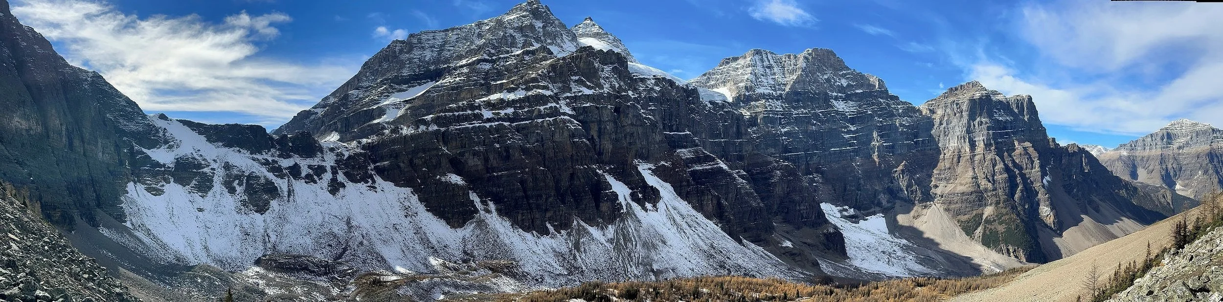
The Valley of Ten Peaks from Eiffel Tower

Paradise Valley and Mount Temple from Eiffel Tower

The Wakchemna Pass from Eiffel Tower

Eiffel Tower - looking back to Moraine Lake

Mount Hungabee and the Paradise Valley from Eiffel Peak

Mount Temple from Eiffel Tower

Mount Hungabee from Eiffel Tower
Mount Lefroy from Eiffel Peak

Moraine Lake

Lake Louise

Lake Louise


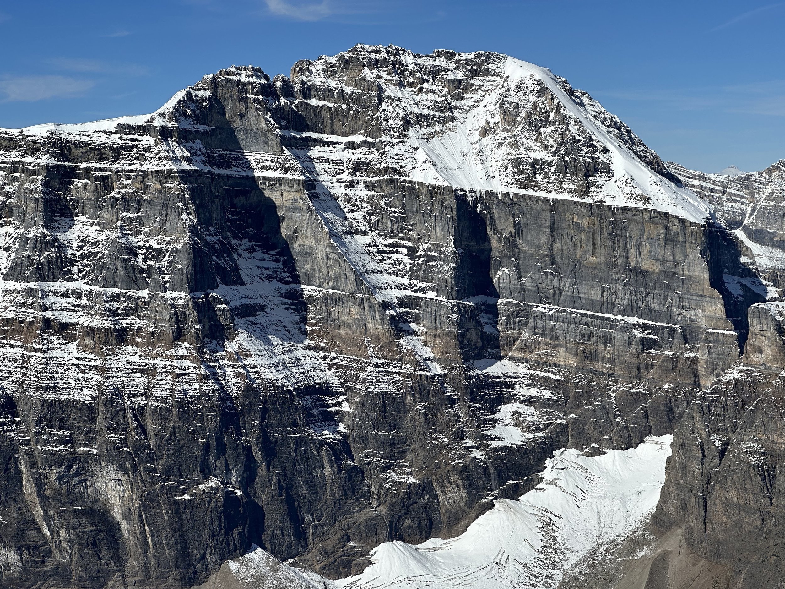
The east face of Mt. Temple

1996, one of my first outings to the fabulous alpine in the Lake Louise area. Mount Aberdeen and Aberdeen Glacier are in the background. Behind Mt. Aberdeen is Mt. Lefroy and Mt. Victoria. Andrzej, the man in the photo with me, is the Polish Himalayan climber from the golden days of Polish alpinism (1980s), full of fantastic stories of, at that time, lands yet to be discovered by me. At that time I could not have possibly imagined in my wildest dreems what would follow and how absolutely fortunate I would be to have the opportunity to do what I am doing. People like Andrzej, among many others have contributed to this wild journey!

The same spot - 25 years later!

Panorama from Mt. Fairview - a million dollar view for the effort

Mount Aberdeen, Lefroy and Victoria from Mt. Fairview

North Victoria Glacier from Mt. Fairview

The ridge of Mt. Victoria and the main summit

Mt. Victoria from Fairview in winter

Mt. Temple and the Paradise Valley from Mt. Fairview

LL ski hill, Skoki and Mt. Richardson from Mt. Fairview

Mt. Lefroy and Abbott Pass

Mt. Lefroy and the Abbot Pass from North Victoria Glacier

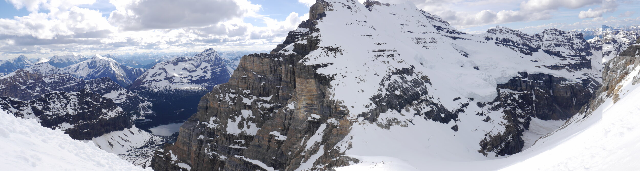
Victoria Glacier and Abbott Pass - notice the small Abbott Hut (the Alpine Club of Canada mountaineering hut) on the pass between Mt. Lefroy and Mt. Victoria.

Paradise Valley from Mt. Temple


The summit of Mt. Temple with Lefroy, Victoria, Aberdeen and the Wapta Icefield beyond.

Valley of Ten Peaks from the summit of Mt. Temple

The summit ridge of Mt. Temple

Mt. Temple summit ridge

The summit of Mt. Temple - the view south towards Quadra, Storm and Consolation Lakes

Looking west from Mount Temple - the Goodsirs dominate the horizon

The east glaciated face of Mt. Lefroy and the entire ridge of Mount Victoria with the main and north summits

Mount Victoria and North Victoria Glacier

The closeup of the North Victoria Glacier

Mt. Fay 3,234m

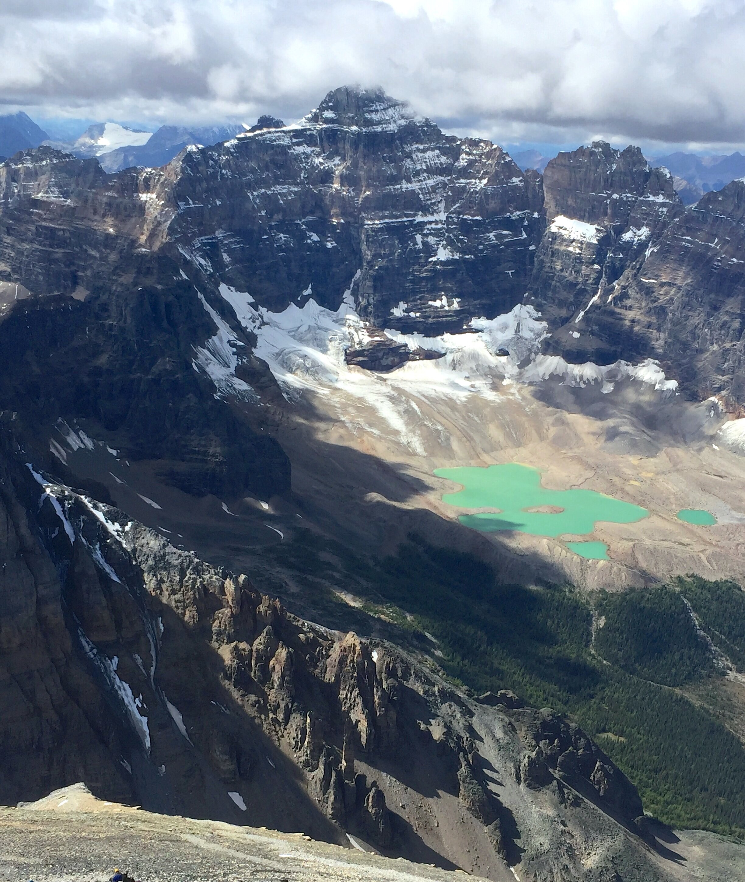
Looking down on the Panorama Ridge and the Consolation Lakes, Moraine Lake is on the right

The glaciated peak on the horizon is Mt. Ball. On the right is Mt. Stanley. Quadra is in the forefront.

Mt. Bident on the left and Quadra on the right

Looking north from Mt. Temple towards the Wapta Icefield. Mt Daly and Nigel Peak are on the horizon on the right. Mount Aberdeen is is the forefront.

The summit panorama from Mt. Temple

Mt. Temple wintery summit

Mt. Temple in the fall


The view from Mt. Temple in the fall

Mount Babel 3,101m

Mt. Bowlen. The mountains of the Rockwall trail are on the horizon


Eiffel Peak

Looking down from the slopes of Mt. Temple, the descent route. Minnestimma Lake is down below.

Looking at Mt. Fay from the slopes of Mt. Temple.

Mt. Temple

Tower of Babel

Consolation Lakes

Lake Louise and Mt. Victoria

Mt. Victoria and Mt. Huber from Lake O’Hara side. The Abott Pass is on the right.

Lake Ohara

Lake Oesa in the Lake Ohara area

On the way to the Abbot Hut

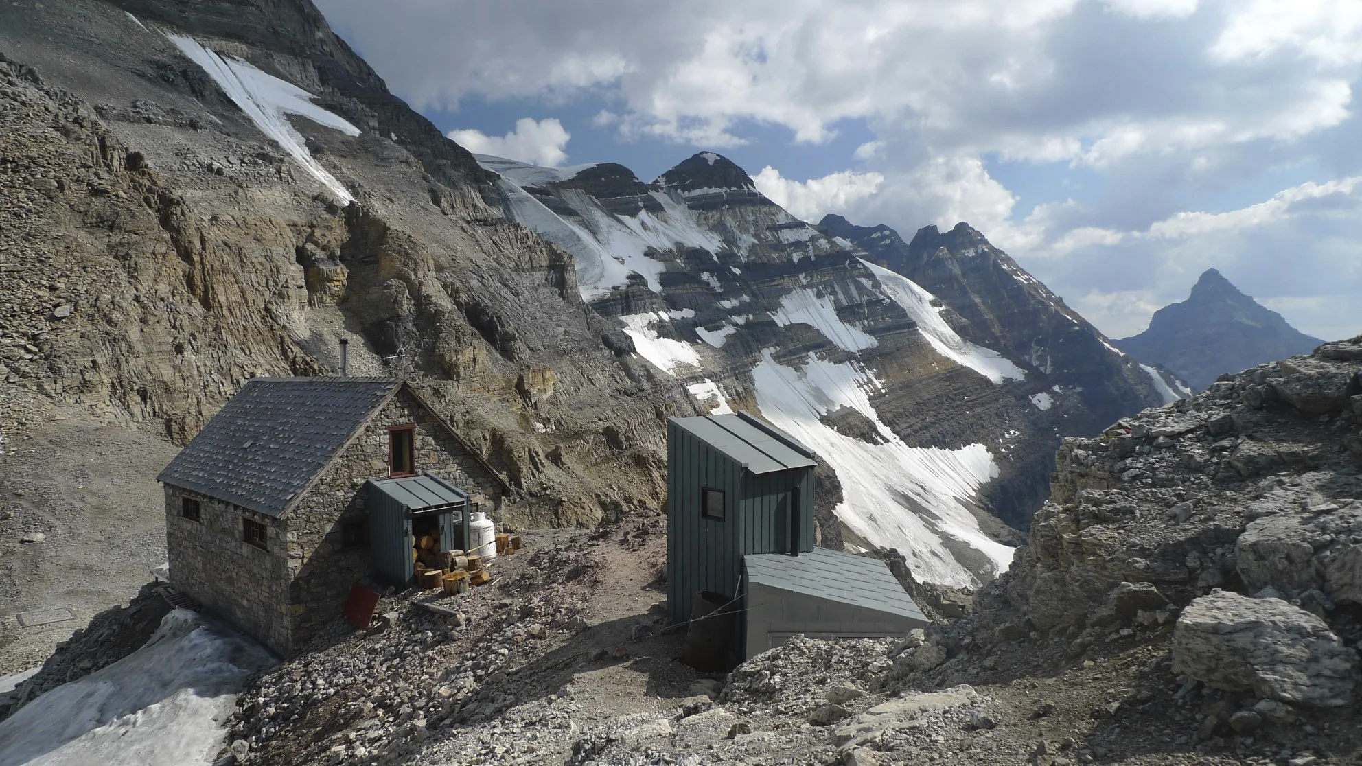
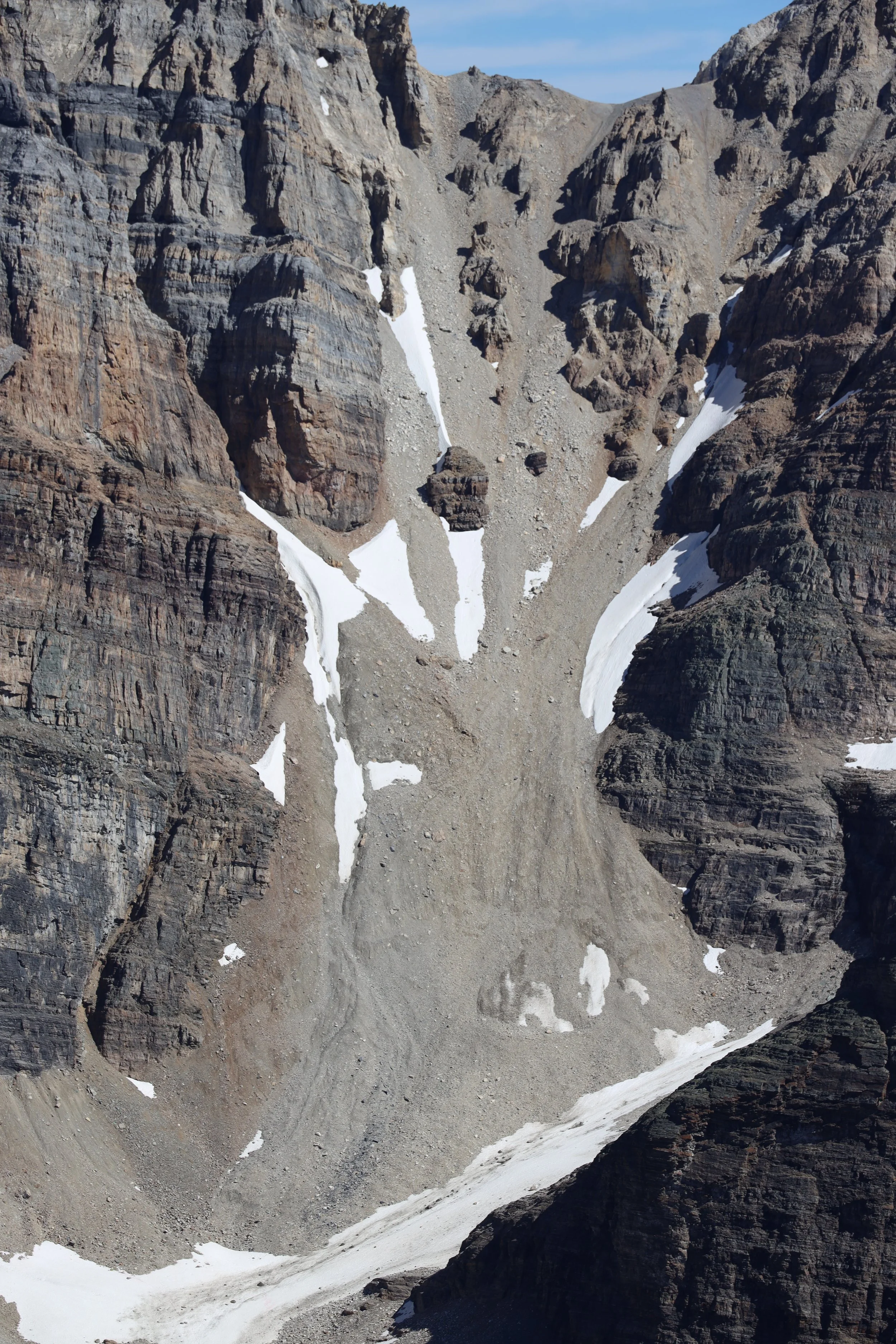
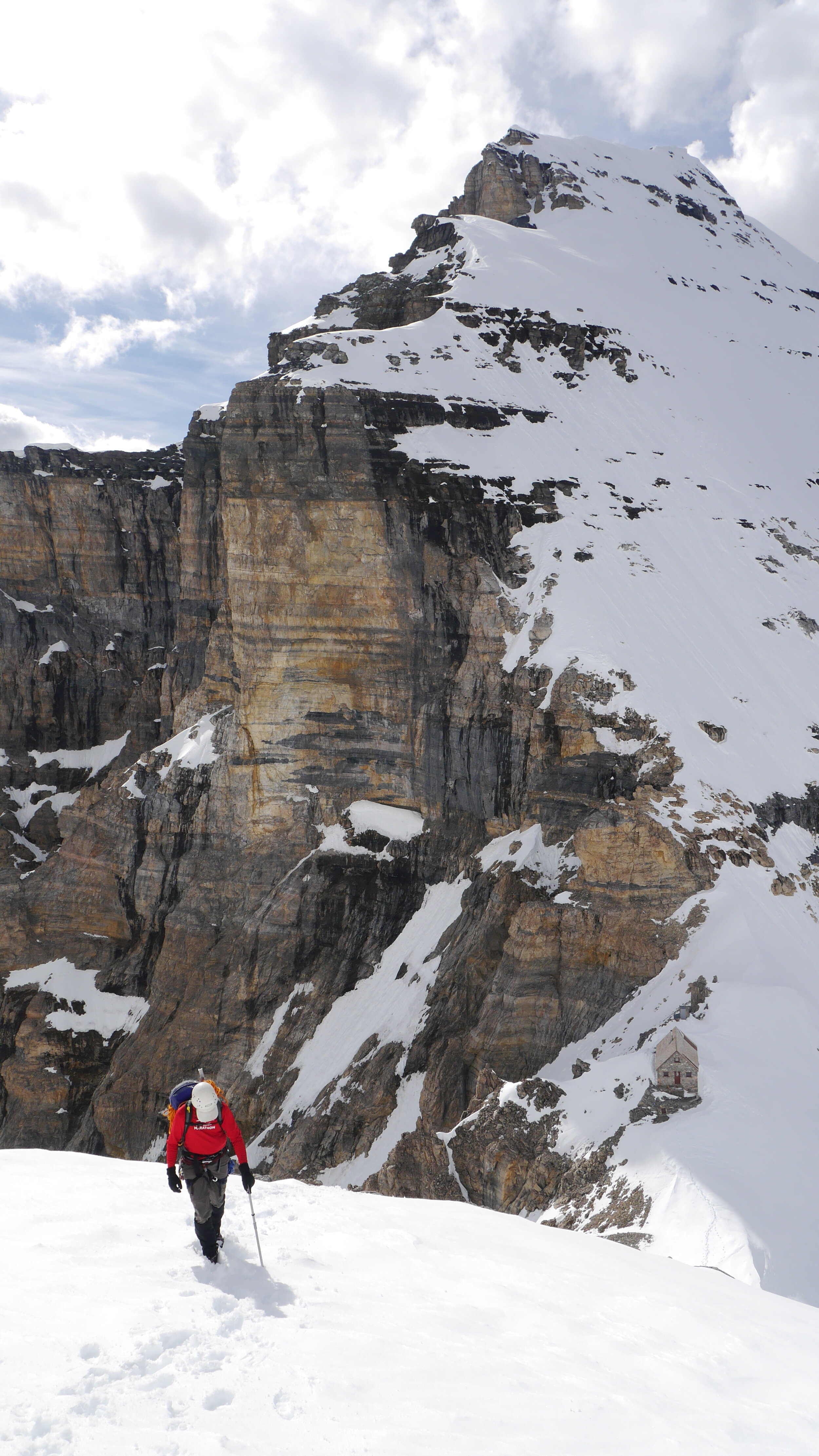
The Abbot Hut 2,926m

The Abbot Hut


Looking down the Death Trap from the Abbot Pass. We came this wain 1996 from Lake Louise on my first try to climb Mt. Lefroy. We had to abandon the climb due to rockfall.

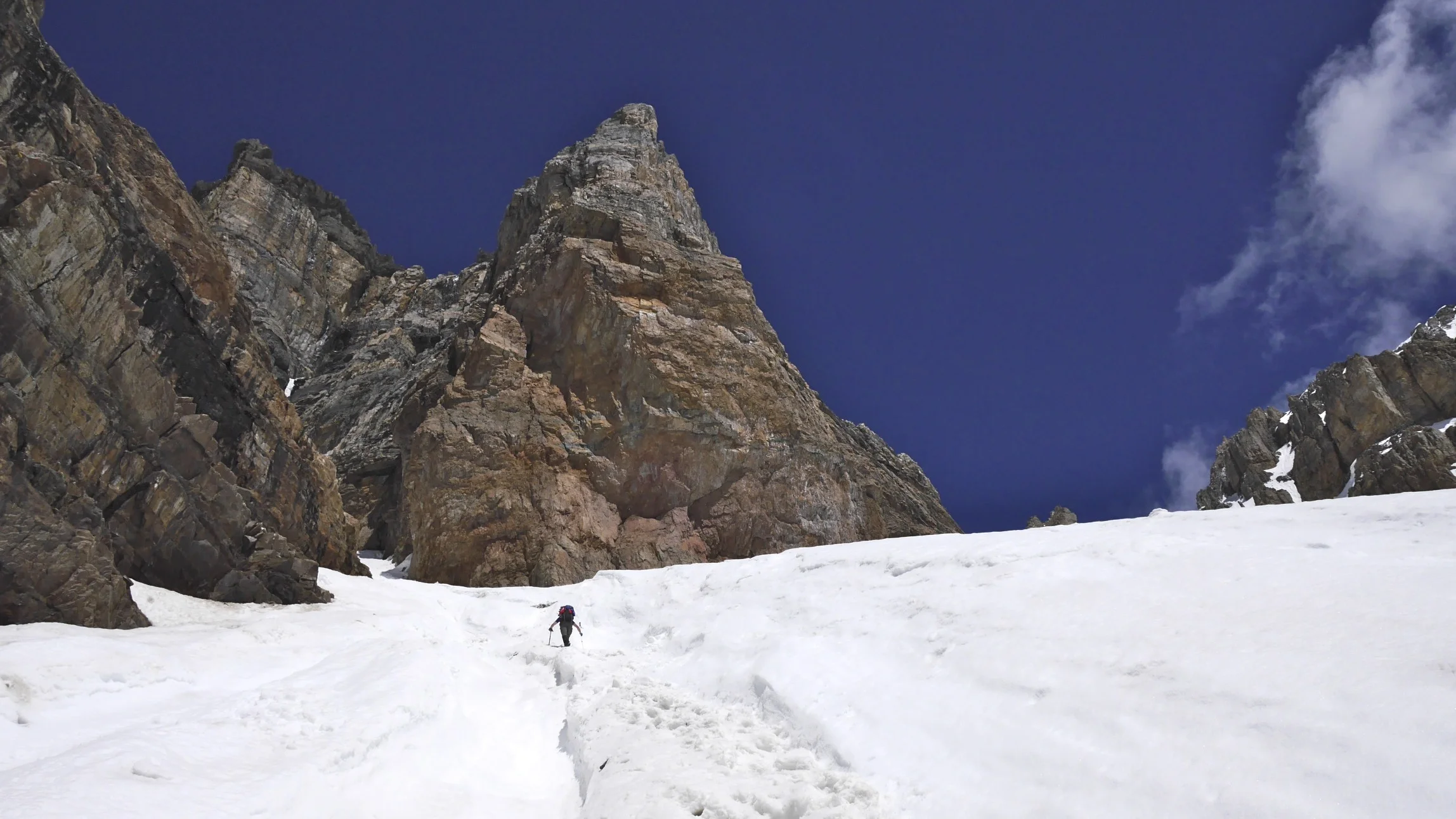
Looking down the west approach gully to the Abbot Pass. You can see a group of climbers down below for scale.

Summit ridge of Mt. Victoria in the terrible smoke from the fires in BC that year.

On Mt. Victoria

Mt. Huber - the Huber ledges

On Mt. Huber ledges

Huber Ledges

On Mt. Huber, Lake Ohara below

Lake O’Hara below - ascending to the Victoria/Huber col

Huber/Victoria Glacier


On Huber/Victoria Glacier

Looking southwest from the Victoria/Huber col

Huber Victoria Col

The view to the Presidents and the Wapta Icefield from the Victoria/Huber col


Mt. Huber 3,348m at sunrise. The Goodsirs are on the horizon.

On Mt. Victoria - ascending the west face

Mt. Victoria summit Ridge

On Vitoria summit ridge

Victoria summit ridge - a walkway in the sky!


he summit of Mt. Victoria

The summit of Mt. Victoria 3,464m

Looking west from Victoria

Mt. Huber from Victoria

The ridge connecting Mt. Victoria main summit and the north summit

The North Victoria glacier and the summit of North Victoria

The Presidents and the Iceline Trail from Victoria

North Victoria Glacier

North Victoria Glacier and Lake Louise from Mt. Victoria 3,464m


Summit of Mt. Victoria


Mt. Temple on the left, Mt. Lefroy in the center and the summit ridge of Mt. Victoria

The ridge of Mt. Victoria

Mt. Huber


The ridge of Mt. Victoria

Mt. Victoria - the Sickle

One of the few steep sections along the ridge of Mt. Victoria summit ridge


In the Sickle

South side of Mt. Huber dropping all the way down the the approach gully to the Abbott Pass

Lake Louise and the Chateau are 10km away long way down

ooking back at Mt. Huber (left) and the summit ridge of Victoria that we just walked from

Steep east face of Victoria

Lake Oesa

Descending to Lake Oesa from the Abbot Pass

Walking up the Death Trap from LL to the Abbott Pass

Valley of Ten Peaks - Moraine Lake to Lake Ohara traverse

Wenkchemna Pass - we traversed from Moraine Lake to Lake O’Hara through the Wenkchemna and Opabin passes

Moraine Lake to Lake Ohara traverse


Wenkchemna Peak and Pass

Ascending the Opabin Pass

Opabin Pass from Mt. Yukness

Opabin Pass


Looking back at the Opabin Pass. The Pass is quite easy with a small glacier. Crampons are required though…
Lake Ohara

Lake Ohara

ACC hut at Lake Ohara. Mt. Lefroy in the centre

Near Lake Ohara. Mt Victoria on the left and Mt. Huber on the right.

Lake Ohara

ACC hut Lake Ohara

Near Lake Ohara

Lake O’Hara

Moraine Lake

Moraine Lake and Valley of 10 Peaks

Valley of Ten Peaks from near the Sentinel Pass

Sentinel Pass

Sentinel Pass

Valley of 10 Peaks from Sentinel Pass

Paradise Valley between Lefroy and Mt. Temple.

Mt. Temple in the fall

Mt. Temple


Summit of Mt. Temple 3,544m

The summit of Mt. Temple

View from Mt. Temple

High on Mt. Temple

View to the valley of 10 peaks from Mt. Temple - Deltaform Mountain

The summit of Mt. Temple

The Valley of 10 Peaks from Mt. Temple

Mount Lefroy and Lake Oesa. We climbed Lefroy in a single push from Lake O’Hara

A closeup of Mt.Lefroy upper section
Abott Pass (with the Abott Hut removed)

On the way to Abbot Pass

On the way to The Abbot Pass

Mt. Victoria and the Abbot Hut

Mt. Vaux in the distance (centre)

The Abbot Hut and the Abbot Pass from Mt. Lefroy

On Mt. Lefroy, view of the Goodsirs

On Mt. Lefroy. Mt. Hector in the distance.


The face of Mt. Lefroy - we climbed it on June 21 (the longest day of the year). We started at 5pm and returned to the hut just before midnight. It was light up to around 11.30pm!


The evening light on Mt. Victoria from Mt. Lefroy


On the snowy ridge of Lefroy

Mt. Victoria


Summit Ridge of Mt. Lefroy with large cornices


Paradise Valley in the evening light from Mt. Lefroy


The cornices on the summit ridge of Lefroy


Summit ridge of Mt. Lefroy at sunset

Summit ridge of Mt. Lefroy on the longest day of the year. 10pm on June 21.

Mt. Lefroy near the summit ridge

Lake Ohara from Mt. Lefroy in the evening light


Near the summit of Mt. Lefroy
North Victoria summit and the North Victoria Glacier with he Wapta Icefield glowing in the late evening light on the longest day of the year!

The sunset behind Mount Victoria from Mt. Lefroy

The entire ridge of Mt. Victoria

Lake O’Hara is a long way down!

The steep face of Lefroy. The small Abbot Hut is far way down.

Beautiful sunset from Lefroy


Inside the Abbot Pass Hut - I just love this place!
Lake Ohara from Mt. Lefroy. This was on another outing. We were engulfed in thick clouds.

On Mt. Lefroy with Lake O’Hara below

The approach gully to the Abbot Pass in cloudy weather.

Storm Mountain from Mt. Whymper

Mt. Whymper from Storm approach

The approach to the summit of Storm is on the left


The view of Goodsirs from Storm Mountain on the left. Mt. Whymper is on the right.

The summit of Storm Mountain 3,100m

Moraine Lake and Lake Louise area summits from Storm Mountain

Looking south from Storm Mountain, Mount Assiniboine is on the horizon to the left.

Mt. Ball from Storm Mountain


Mt. Ball and Mt. Stanley from Storm Mountain

The view to the west from Storm Mountain

The summit of Storm Mountain. The large bulk of Mt. Temple dominates the horizon.


Mt. Assiniboine and the Egypt Lakes area from the summit of Storm

The Egypt Lakes area in Banff NP from Storm. The Whistling Pass from Storm. Haiduk Lake is visible below.

Mt. Assiniboine on the horizon. Healy Pass is visible below (center)

Pilot Mountain and Mt. Bourgeau are in the center of the photo on the horizon.


The Upper Twin Lake is below the east face of Storm

The East face of Storm

Highway 93 from Storm. Arnica Lake is visible below.

Looking towards the Goodsirs, the Lake Louise group of summits, and Mt. Whymper from the summit of Storm Mountain


The Rockwall and the Wolverine Pass from Mt. Storm. Highway 93 is below.

Mt. Saint Piran with Lake Louise below.

View from Mt. Saint Piran with Mt. White on the left.

Lake Louise from Mt. Sanit Piran with Lake Louise and Lake Agnes below. Mount Temple towers in the center of the photo.

The summit of Mt. Saint Piran. Mt. Hector is visible in the distance.

Panorama Ridge

Consolation Lakes from Panorama Ridge. From left to right: Mt. Quadra, Fay and Babel.
Mt. Quadra from Panorama Ridge

Mt. Bident and Mt. Quadra.


Mt. Whymper is on the left. The mountains along the Rockwall trail are on the horizon.

Mt. Fay (left) and Babel (right)


The summit panorama from the Panorama Ridge

Mt. Babel and the Consolation Lakes


Looking north to Mt. Hector from the Panorama Ridge. Mt. Richardson in the Skoki area of Banff NP is on the right. LL ski area is below Mt. Richardson.


Mt. Temple

Mt. Victoria - North Glacier

On Mt. Victoria

Mt. Lefroy from Mt. Victoria

Lake Louise from Mt. Victoria North

The summit of Mt. Victoria North towers above the col

Panoramic view of Mt. Victoria
Mount Victoria’s spectacular east face


The spectacular Abbot Pass and the tiny Abbot Hut between Mount Lefroy and Mount Victoria

Mt Temple and Mt Lefroy from Mt. Victoria North
Mt. Aberdeen and Mt. Temple from Mt. Victoria North Glacier


Mt. Wastach


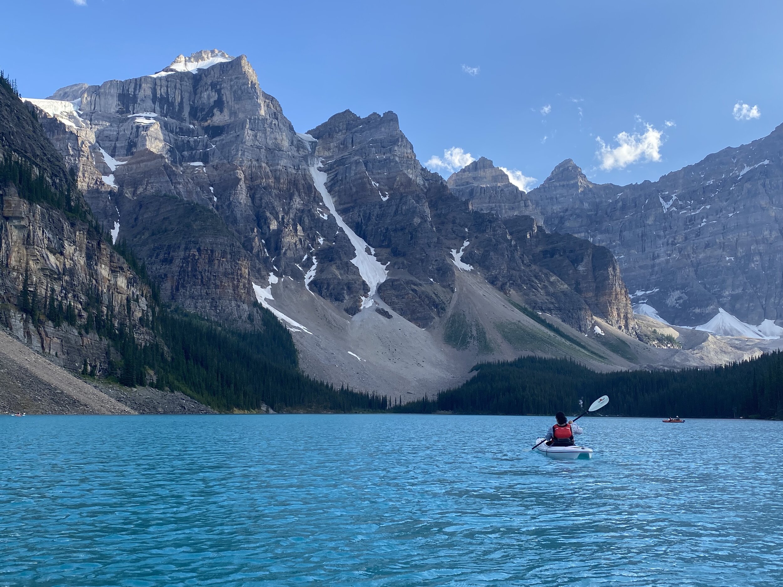


In 2013 we did a 60km trek to the Ramparts area at the head of the Tonquin Valley in Jasper National Park. This area offers many interesting opportunities for exploration off the trail.


Mt. Athabasca along the Icefield Highway on the boundary between Banff and Jasper National Parks.

Athabasca River


Mt. Edith Cavell at the start of the trail to the Tonquin Valley

Mt. Edith Cavell
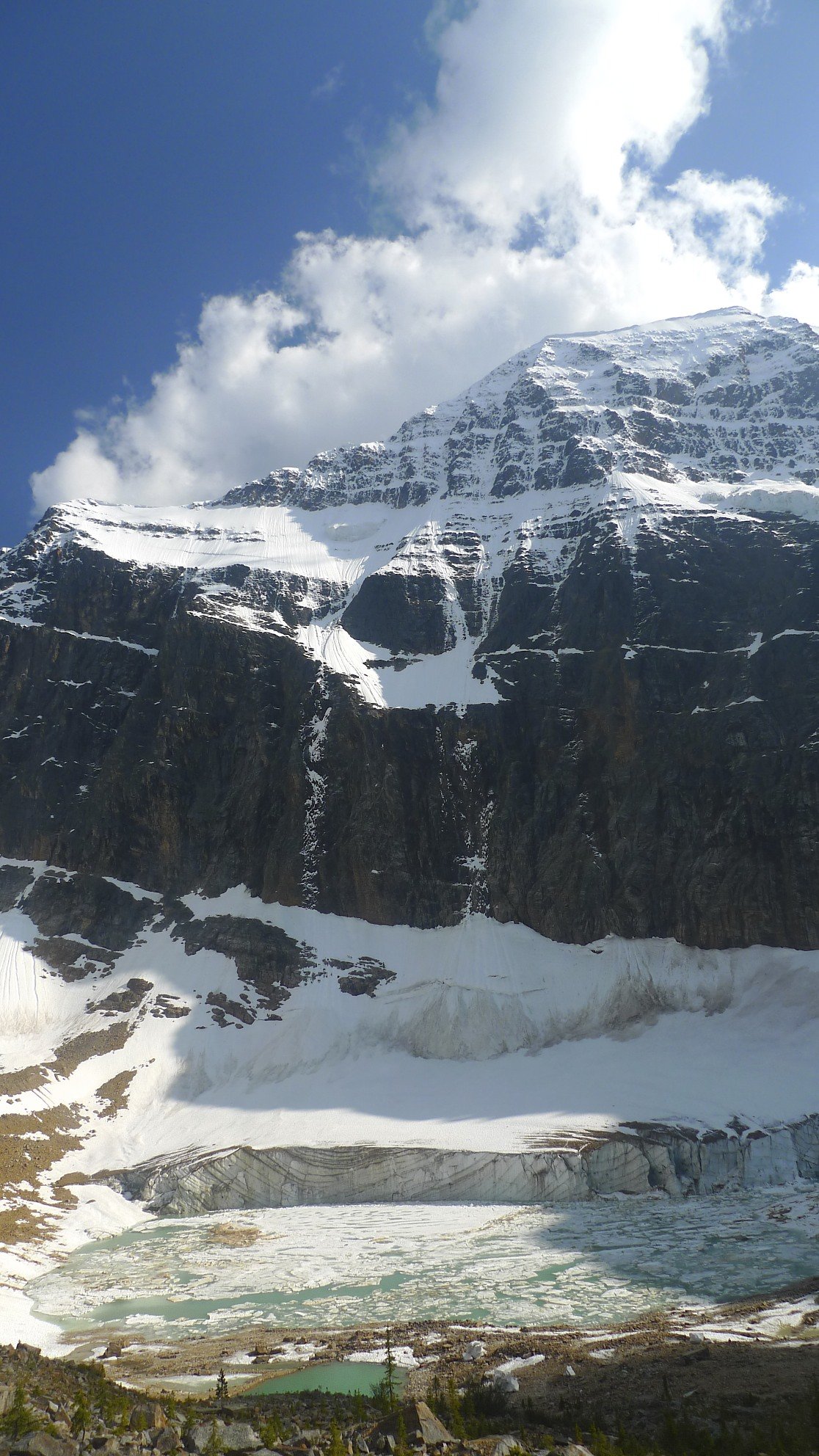
Mt. Edith Cavell

Mt. Edith Cavell

Scrambling route on Mt. Edith Cavell


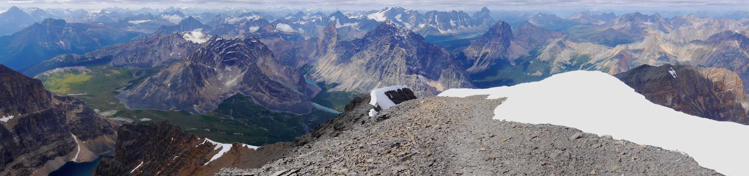


Climbing Mt. Edith Cavell - Summit Ridge
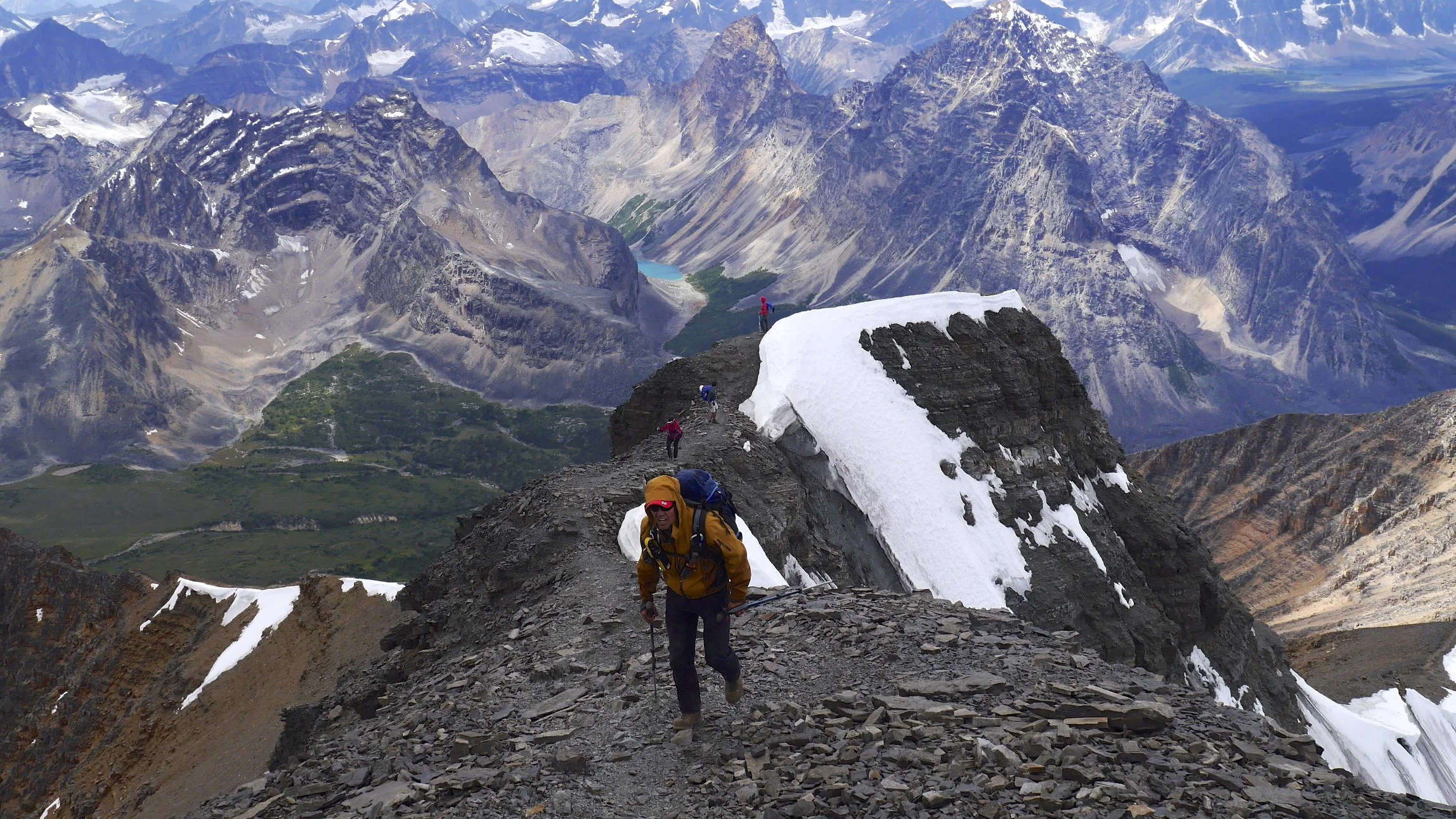
Climbing Mt. Edith Cavell


The Ramparts from the summit of Mt. Edith Cavell


The summit of Mt. Edith Cavell

Looking down from the summit of Mt. Edith Cavell
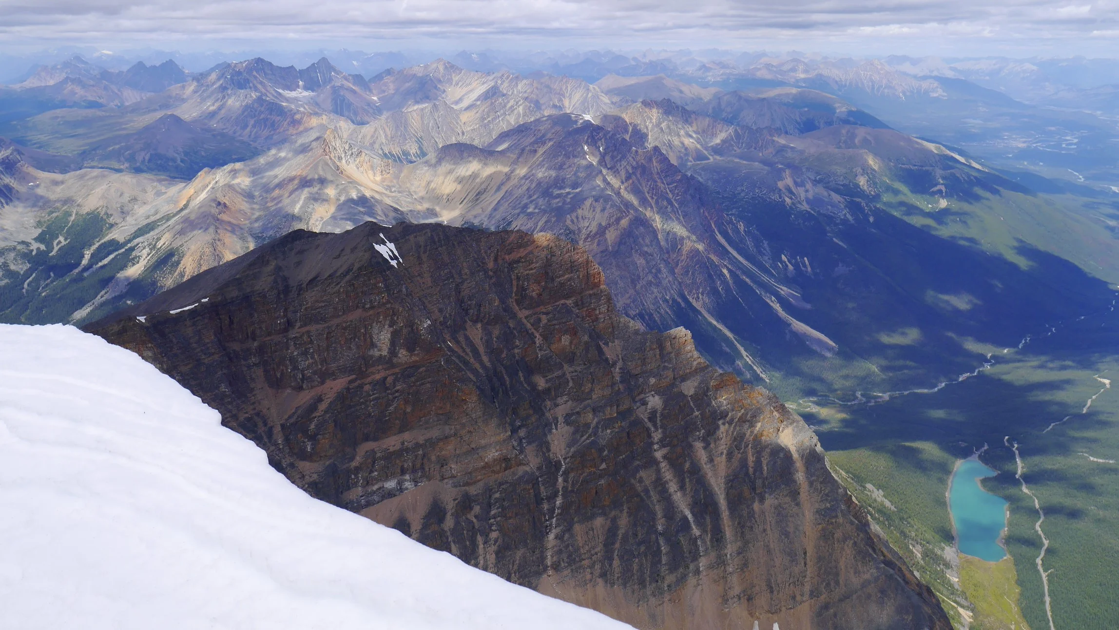


The Tonquin Valley


Near Chrome Lake


The Ramparts

Parapet Peak and Radoubt Peak

The Ramparts


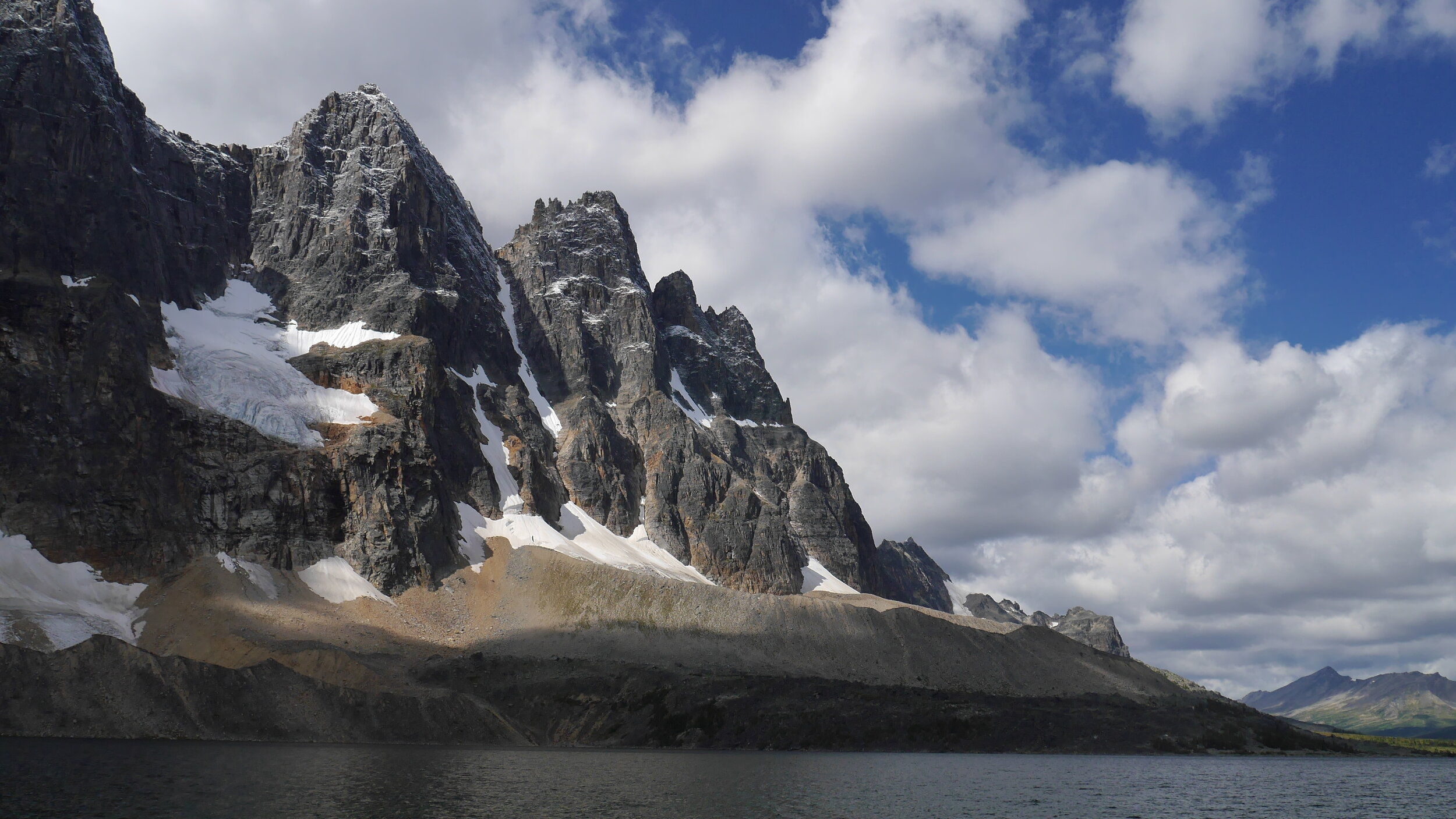

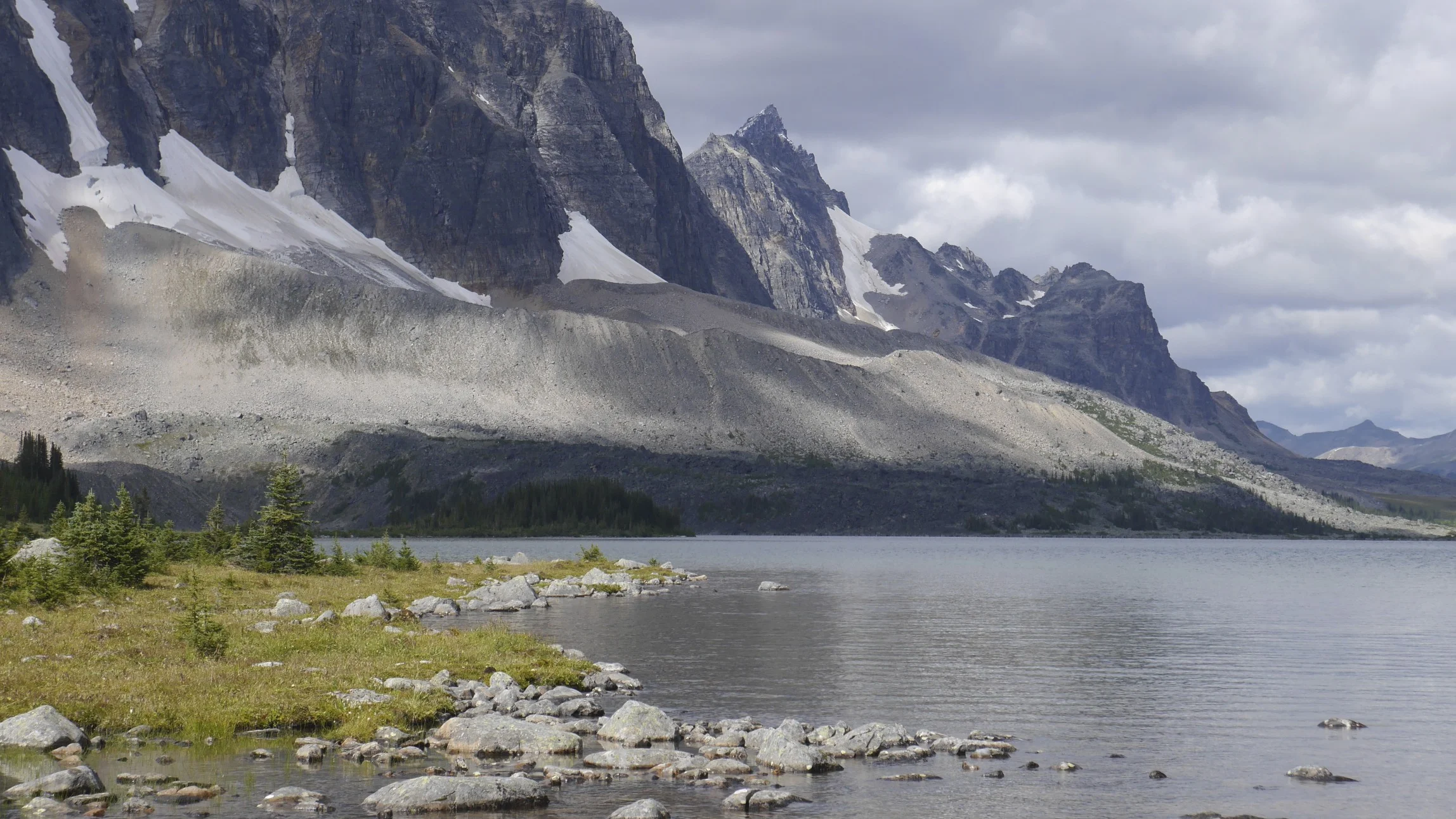
The Ramparts and the Amethyst Lake


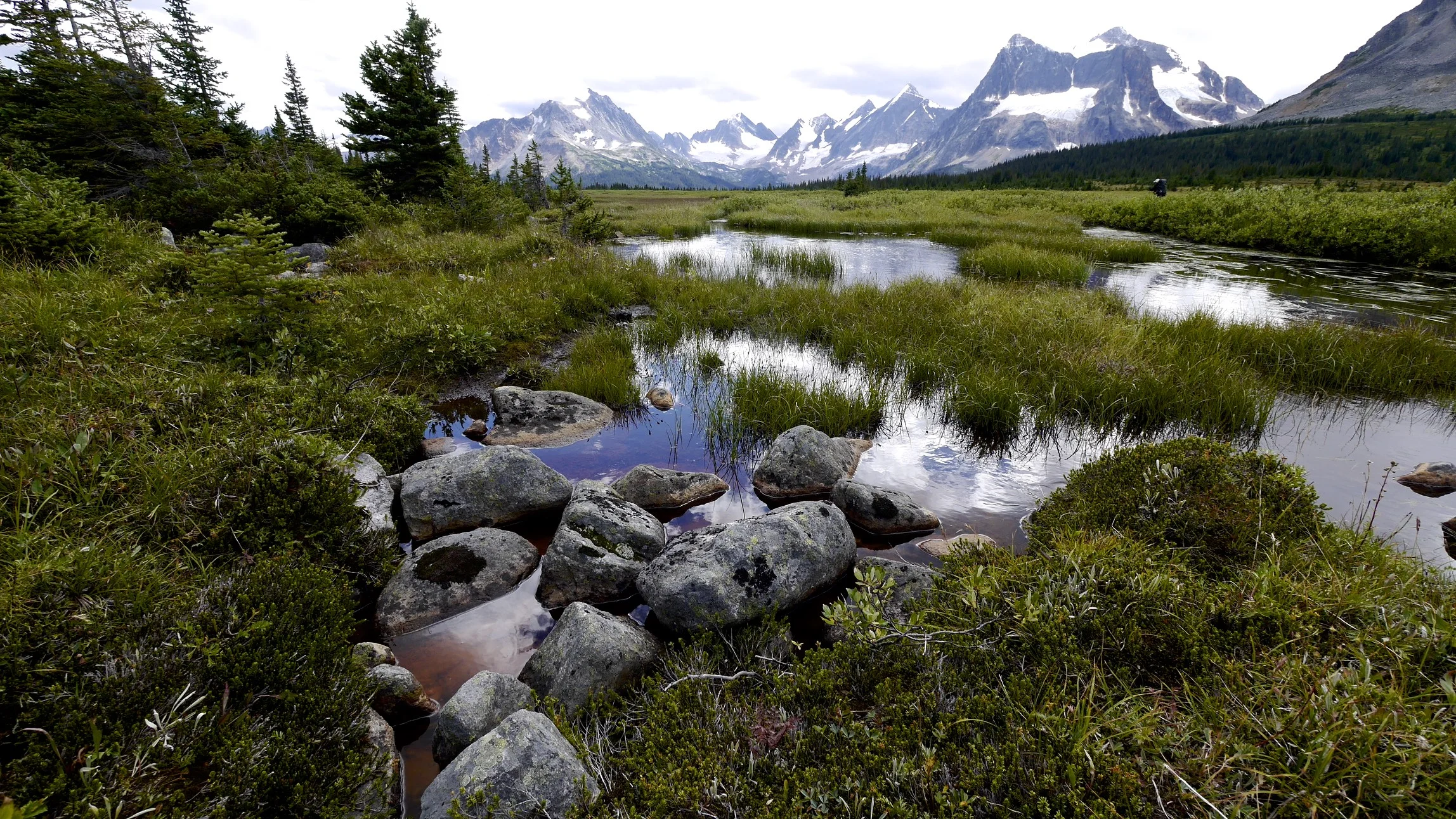


Chrome Lake


Eremite Valley


Eremite Valley and the Arrowhead Lake


The head of the Eremite Valley


Pink Snow
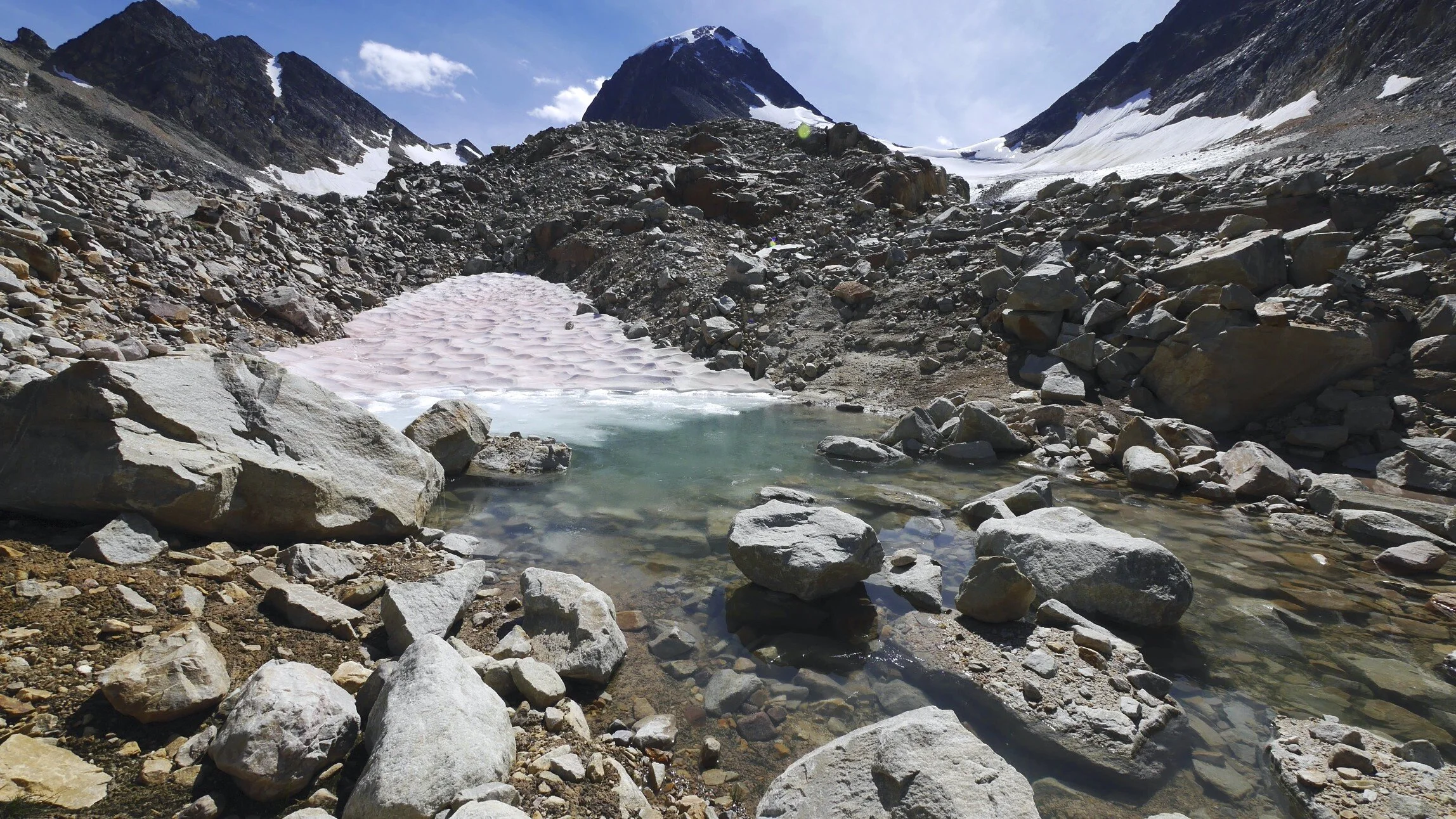


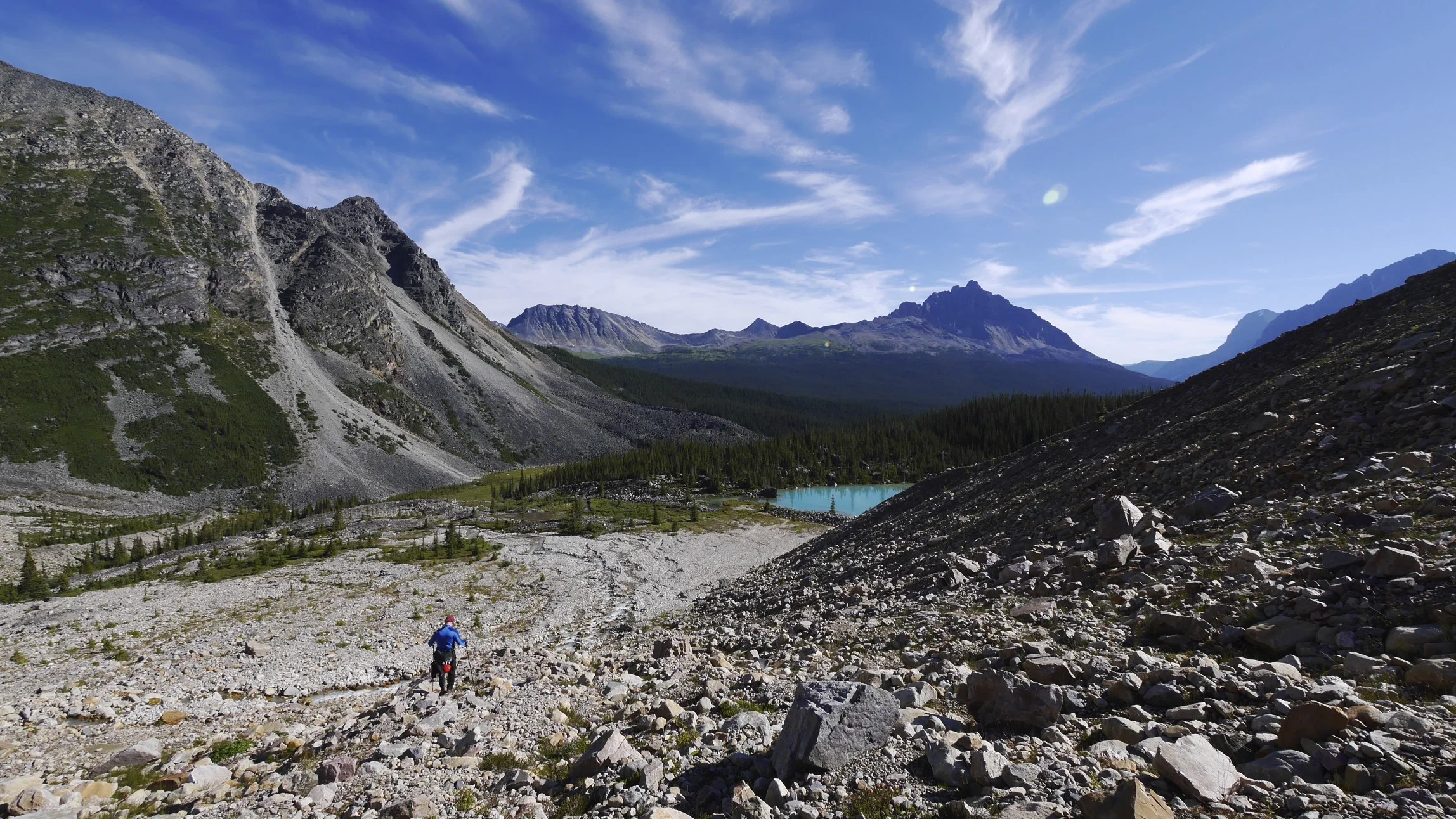

Mc. Donell Peak


Mc.Donell Peak

Parapet Peak
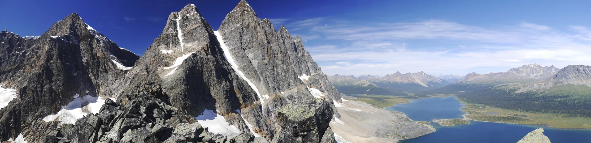


Amethyst Lake


Looking back at the Tonquin Valley. The pointy peak on the left is Mt. Edith Cavell.

The Tonquin Valley and the Chrome Lake


At the Wates Gibson Hut

At the ACC Wates Gibson Hut
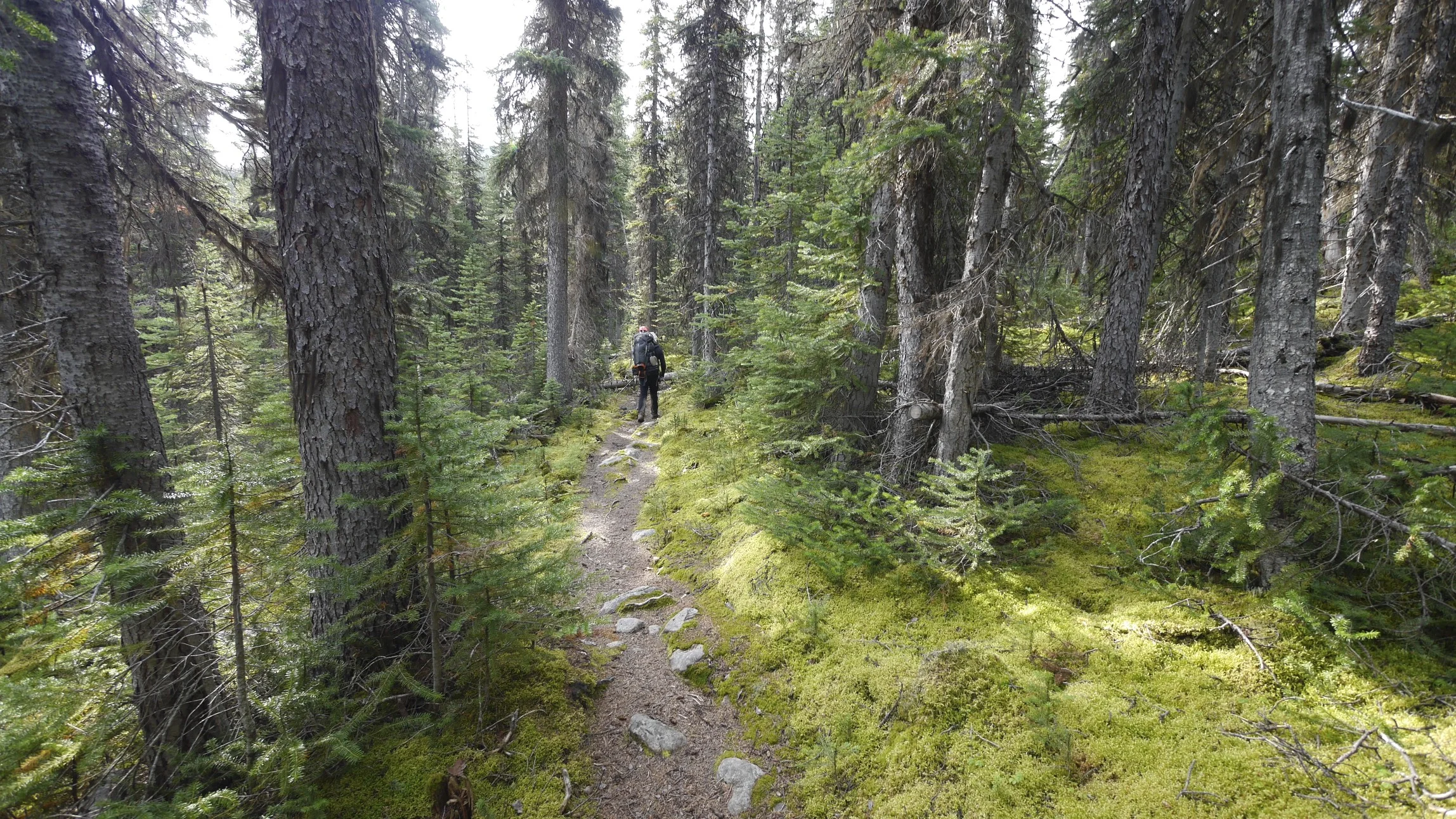
The trail in the Tonquin Valley

Tonquin Valley


The trailhead at Mt. Eidth Cavell

The welcoming committee


Perth - Freemantle


Broome

Broome

Baobab Tree in Broome

The coast of Kimberly near Broome

Kimberly Coast near Broome

Kimberly


In Darwin

Darwin

Daintree Forest north of Port Douglas
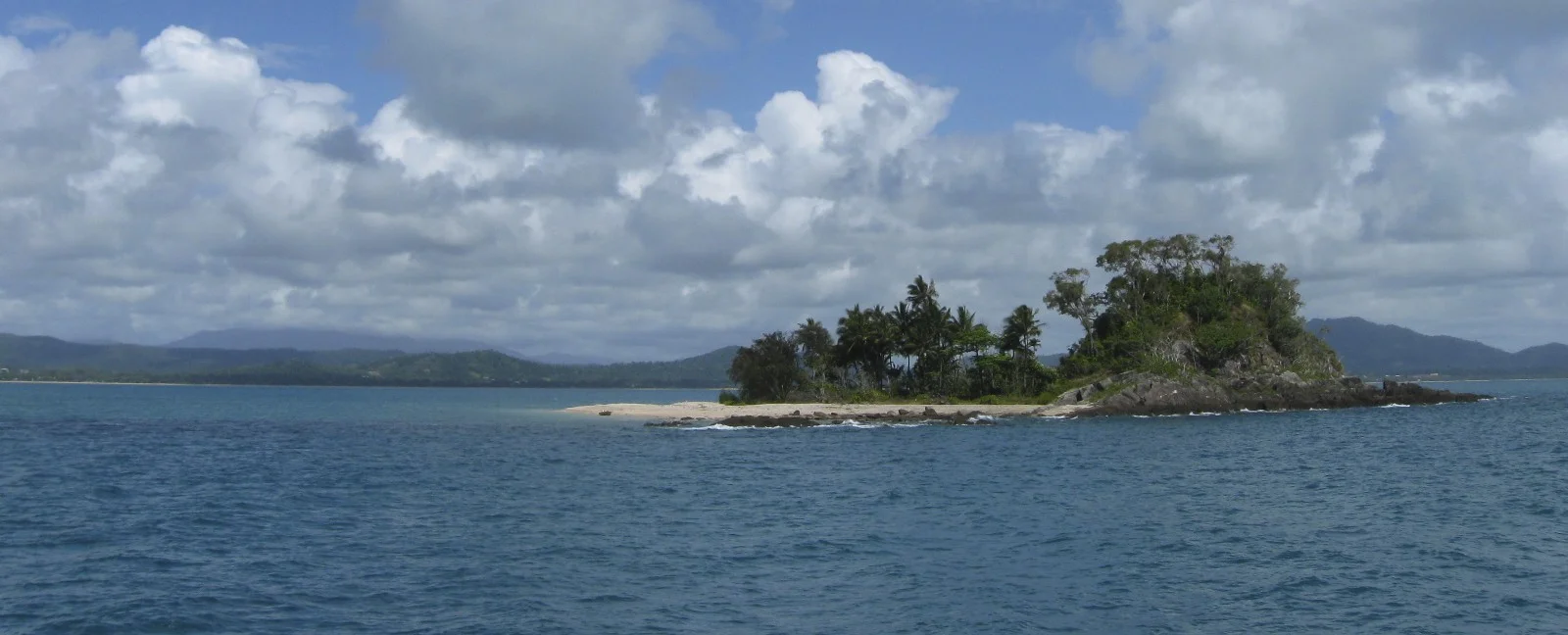
The Coral Sea near Cairns

Near Cairns - Tropical rain forest

Mission Beach

In the Daintree

Salt water crocodile

Perfect camouflage


Crocodile farm near Port Douglas

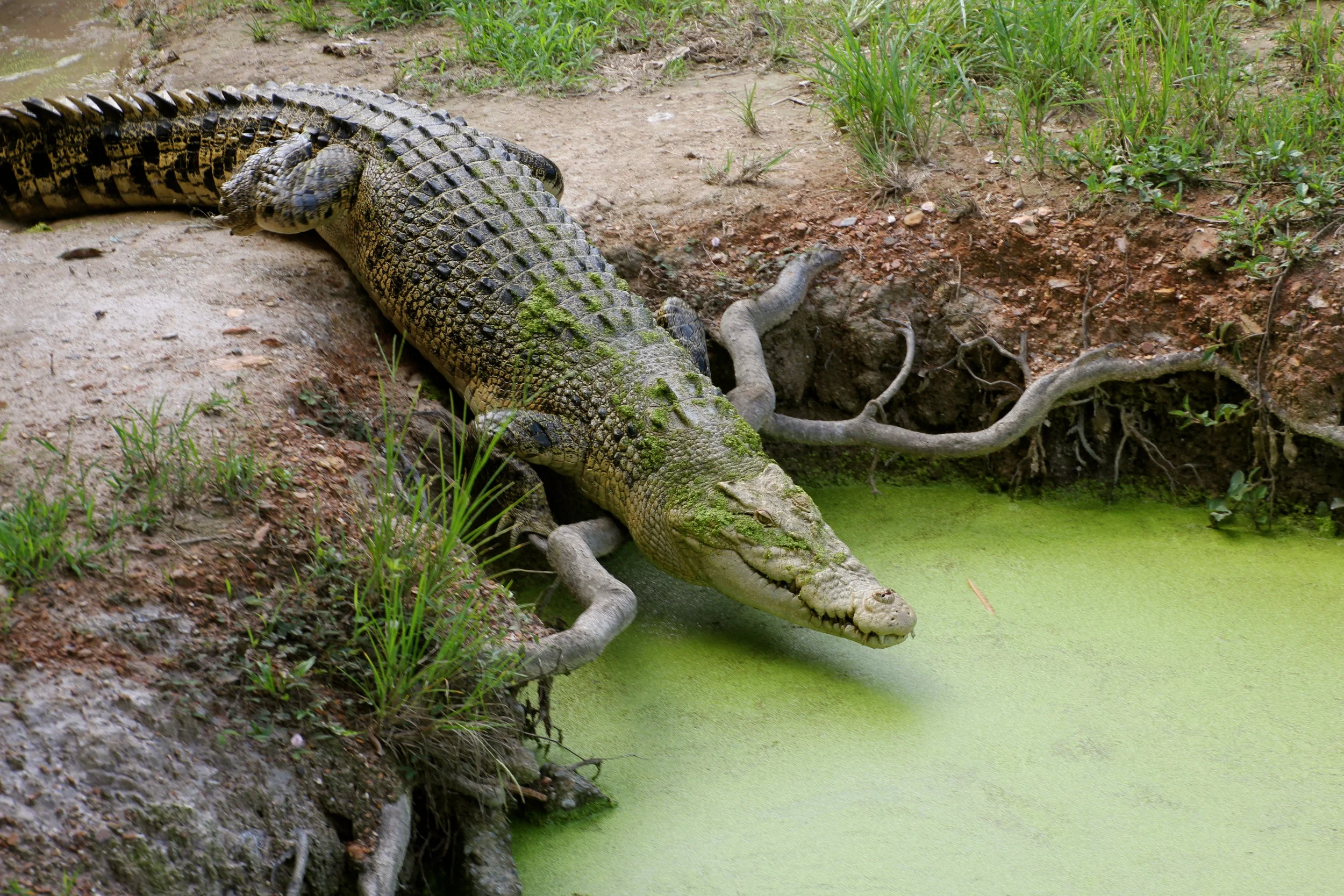

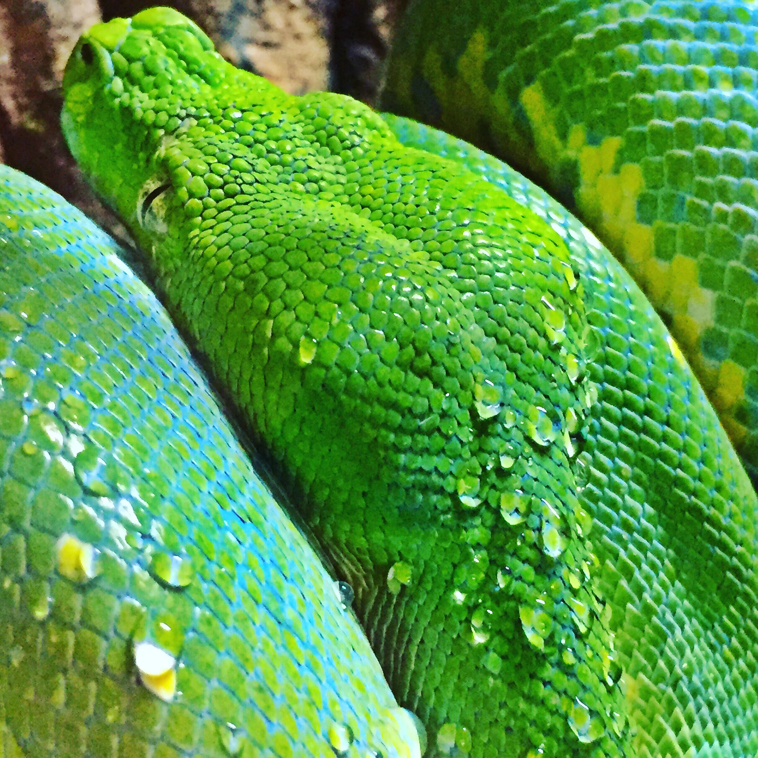
Green Python

Cassowary - a relative of the Kiwi bird


Kingfisher

a kameleon


Australian Emu - a rather prehistoric looking bird


Daintree River

Daintree River

The mouth of the Daintree River, full of large crocodiles

Daintree River and the tropical forest

Cairns

Palm Cove near Port Douglas

Daintree Forest


The Coral Sea

The Coral Sea

The Great Barrier Reef

The Great Barrier Reef


Whitsunday Islands

Whitsunday Islands

The Great Barrier Reef

The huge Great Barrier Reef


Whitsunday Islands


Airlie Beach, Queensland
Thanks to Rajendra from www.mountainsunvalley.com for making this grand adventure a reality! It was the toughest trek in Nepal. It went without any problems and we finished it in less time than we planned.


The Barun Valley from space. Makalu bc is in the lower centre of the photo.

Photo of the Khumbu from space. Sherpani Co, West Col are in the lower right of the photo. Amphu Labtsa Pass is int he centre.
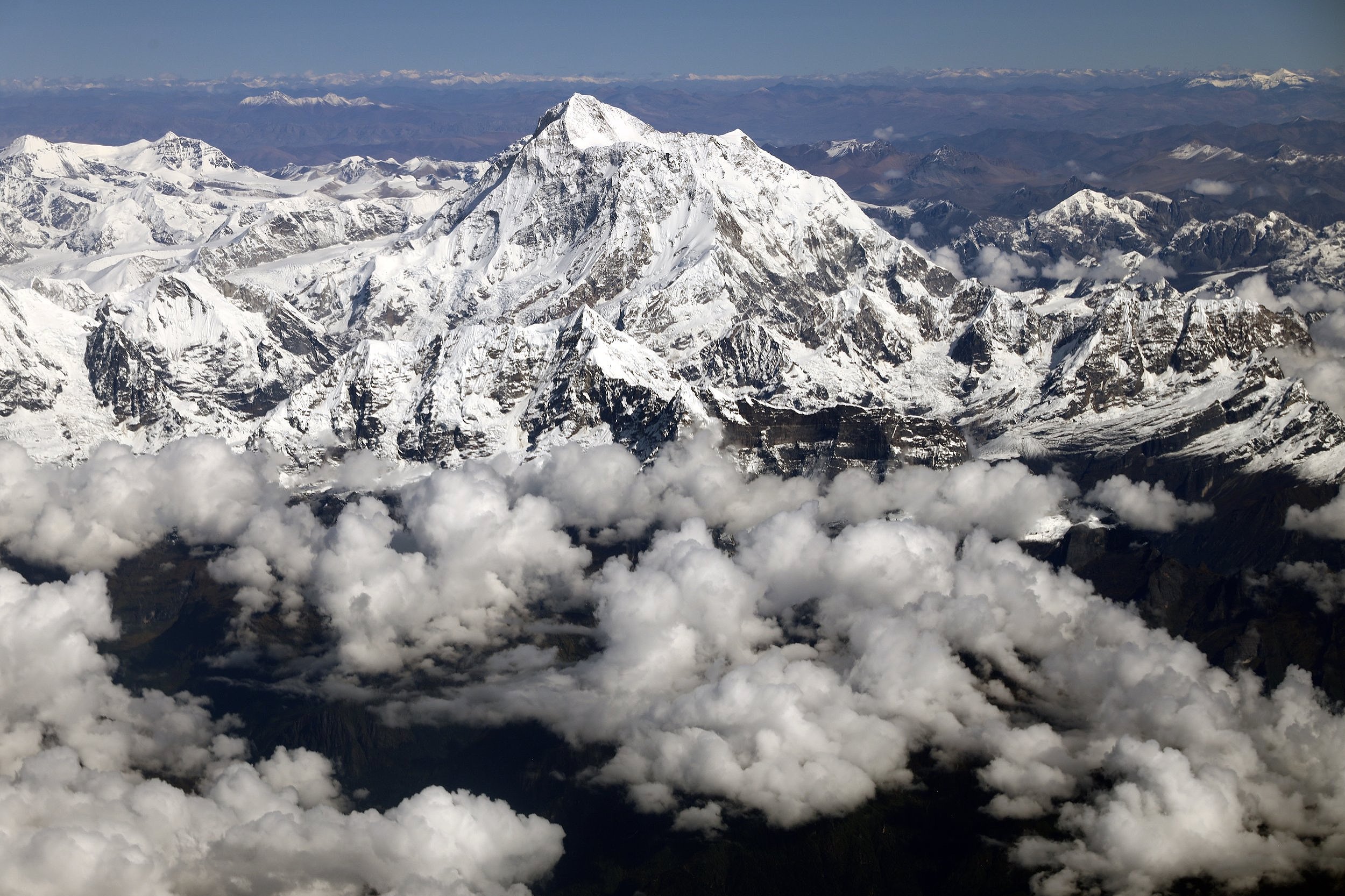
Makalu and Chamlang

Makalu


Everest and Ama Dablam

Everest, Amphu Labtsa Pass

The West Col area, Hinku Valley
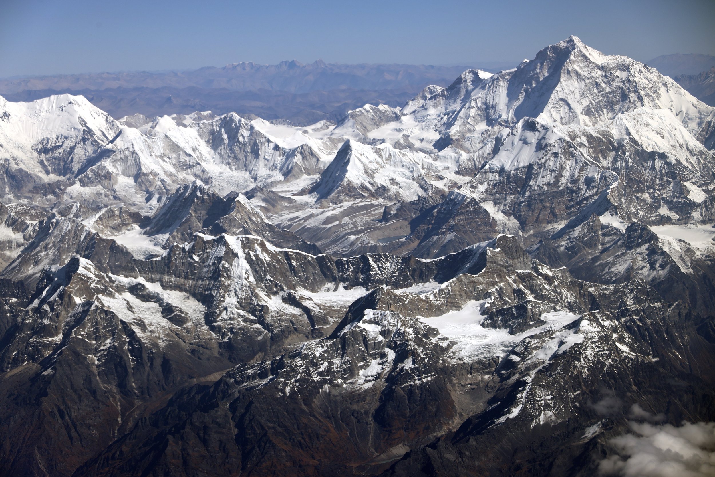
Sherpani Col, Baruntse, Makalu
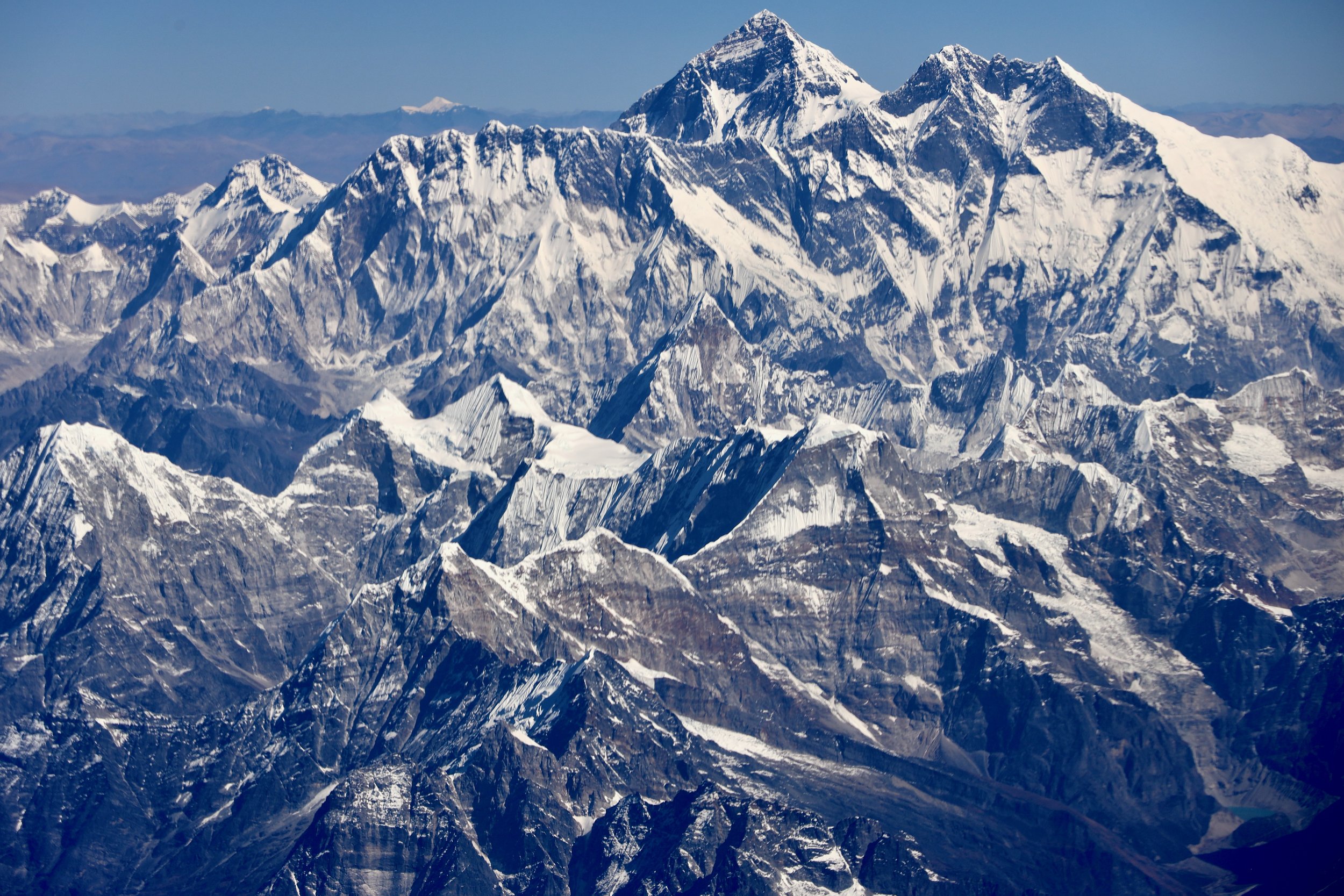


The end of the road, we walk from here
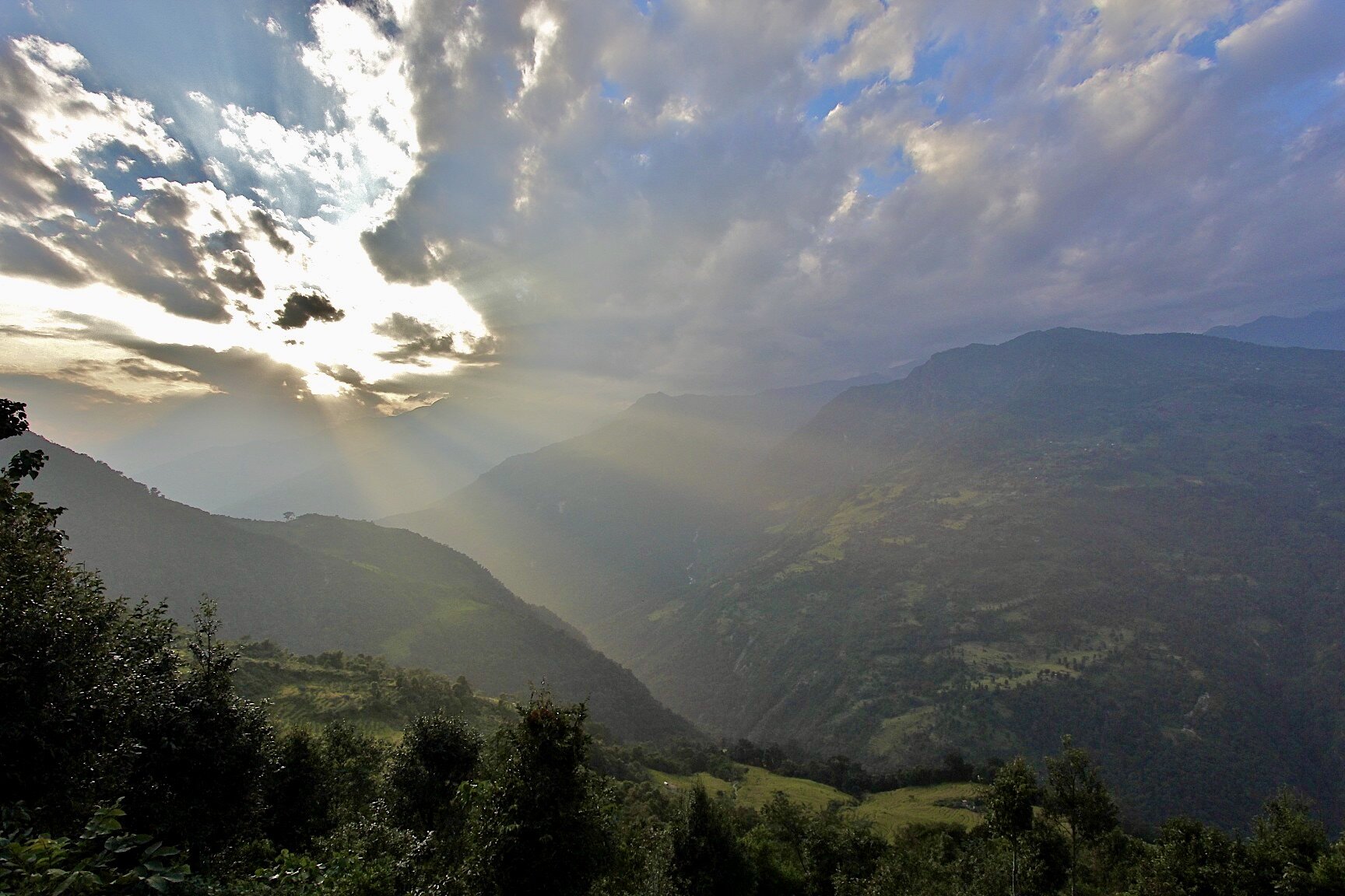

Arun River


Sunrise over Kangchendzonga


Shiphton Pass that we have to cross. The Barun Valley is on the other side of the rocky ridge on the horizon.

The peaks signing up the Barun Valley. The valley is referred to as the Yosemite of Nepal because of its steep granite rock walls.

Shipton Pass and our first view of Makalu

Chamlang

To of Shipton Pass

High pass (over 4,000m) in very cold wind and snow just before the Barun River Valley


In the Barun Valley in Yangre Kharka


Barun River

Brun River Valley

The husband and his wife in this photo were looking after a small herd of goats. They lived alone at 4,500m and a four day walk from nearest village. They were both in their 80s. Amazingly, their daughter lives in Boston, USA. They called her from my satellite phone while we were there.
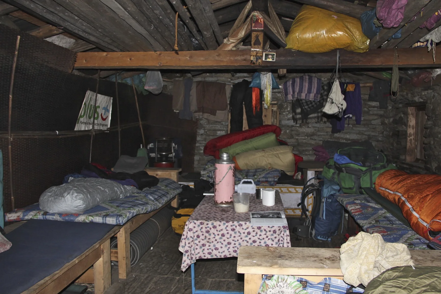
Staying at the friendly farmer’s house.

Approaching Makalu BC, Chamlang


Mt. Chamlang and Lower Barun Glacier

Chamlang and satellite peak of Baruntse on the right
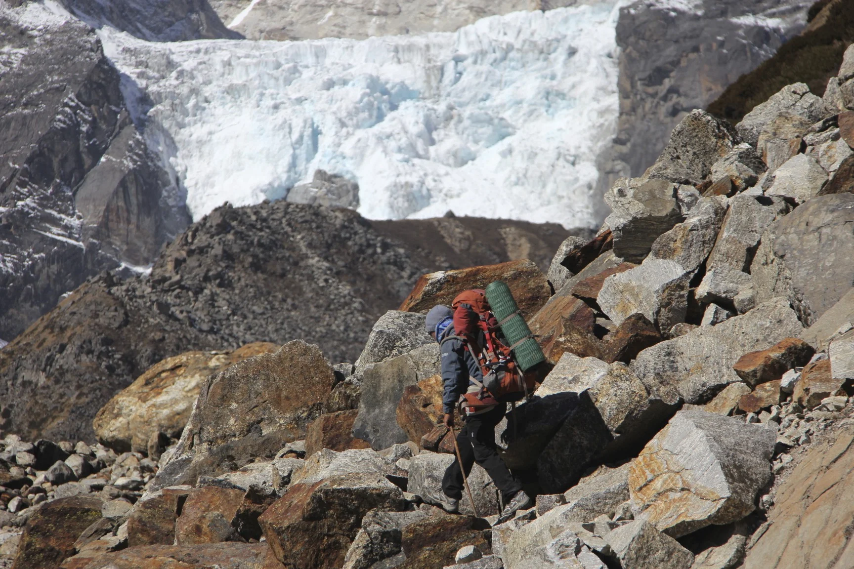
Lower Barun Glacier Icefall

Lower Barun Glacier

Chamlang


Makalu

Chamlang

Makalu

Makalu BC, the proper BC is further up the glacier

Makalu BC

Makalu

Makalu


Makalu

Makalu

Makalu

Sunset on Makalu


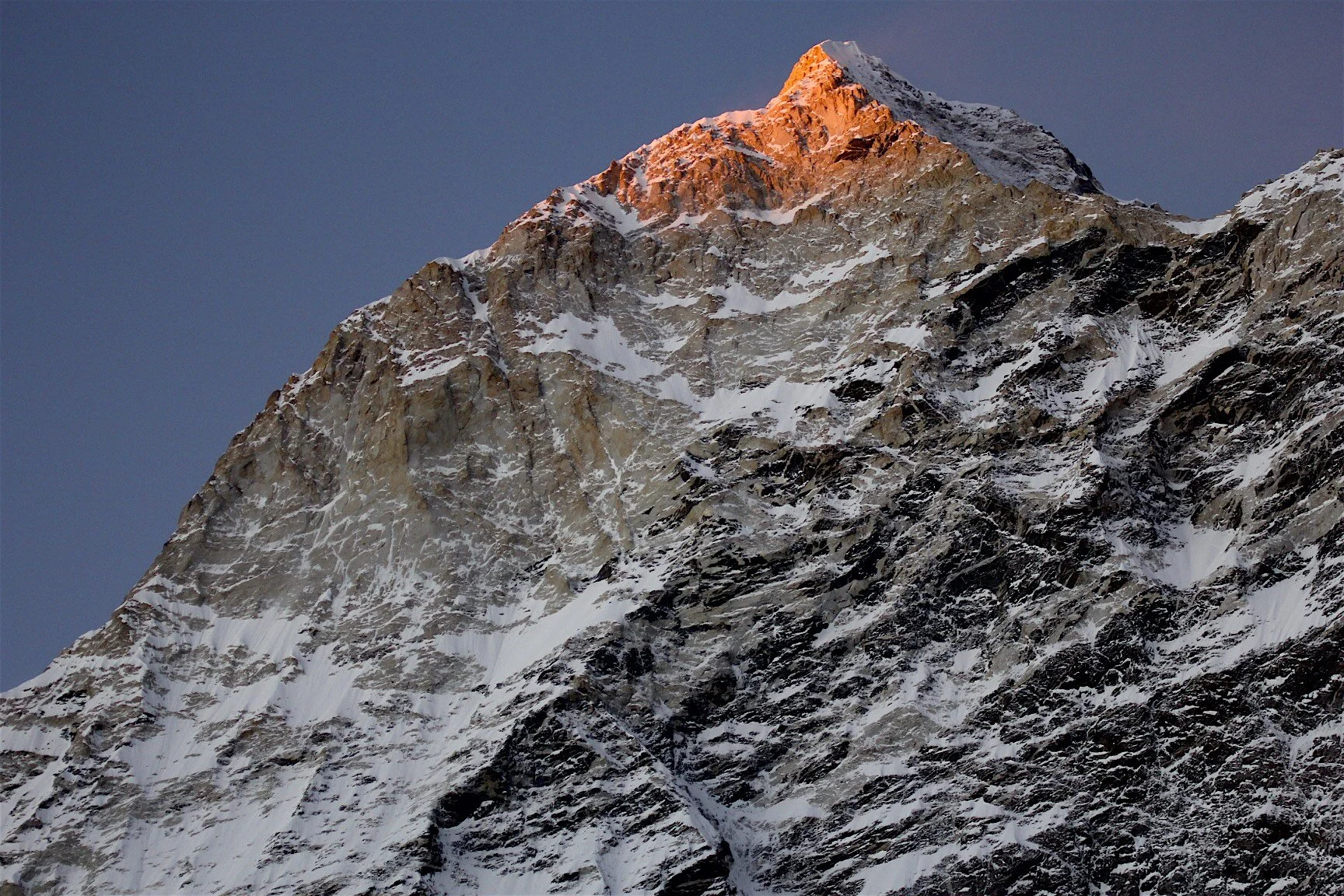

Juan going home from Makalu BC

Makalu BC

The Barun Glacier, at the head of the glacier is Lhotse Shar and the Lhotse/Everest massif. The top of Baruntse is visible on the left.


Lhotse, Everest and Barun Glacier

Lhotse Shar and Lhotse
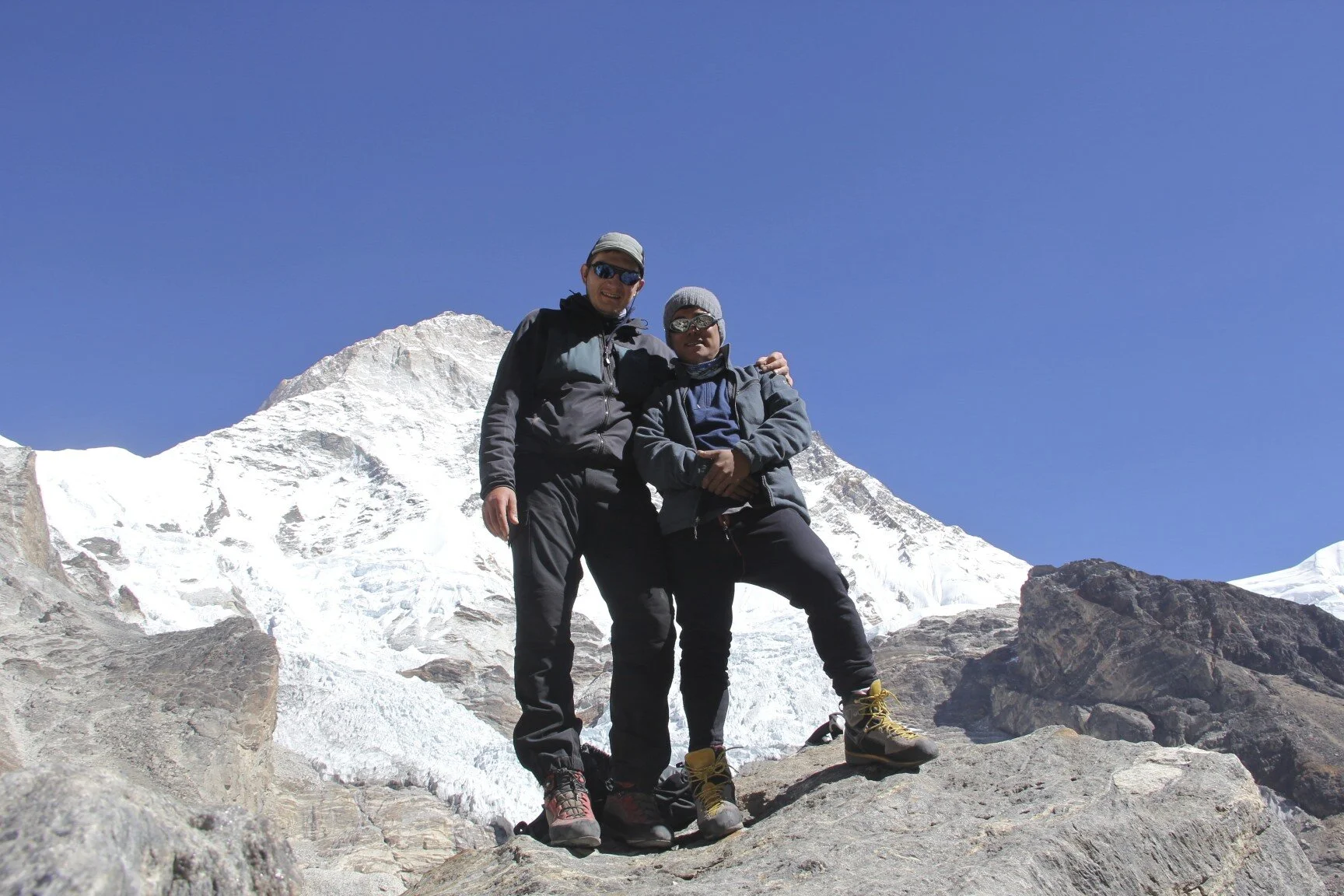

From left to right: Lhotse, Lhotse Shar, Everest


Sandy camp en route to Sherpani Col

Sandy camp

Lhotse/Everest massif from the Sandy camp


Makalu and the Barun glacier on the way from Sandy Camp to Sherpani Col BC

Everest


Sherpani Col BC

Sherpani Col camp and Makalu The prominent West Rib is in the centre


Sherpani Col BC

Sherpani Col BC and the snout of the glacier that we need to ascend to get to the pass.

Approaching Sherpani Col.

Sherpani Col ahead. At 6,000m

Sherpani Col - a small rock climb at 6,100m

Climb to Sherpani Col

The narrow rib of Sherpani Col early in the morning.

The actual elevation is 100m higher.

On the Sherpani Col.

The narrow Sherpani Col and Baruntse.


West Col from the Sherpani Col. The snow/ice plateau is at 6,000m.

Camp 2 for the Baruntse Climb

Peaks of the Khumbu from the Sherpani Col

The snow/ice plateau between Sherpani Col and West Col at 6,000m that we need to cross.

Descent from Sherpani Col


On the ice plateau between Sherpani Col and West Col


Climbing Baruntse
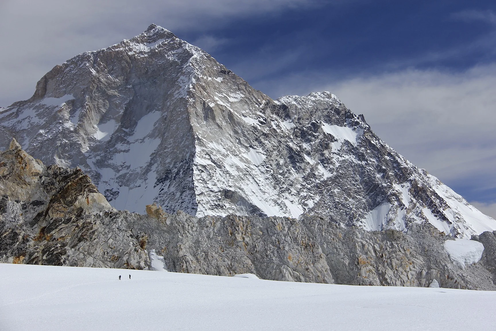
The west rib of Makalu. We are at 6,000m and Makalu is still huge!


Baruntse

The icefall of Barnutse.

Baruntse and the trail to the top - it seems so close (it is not!)
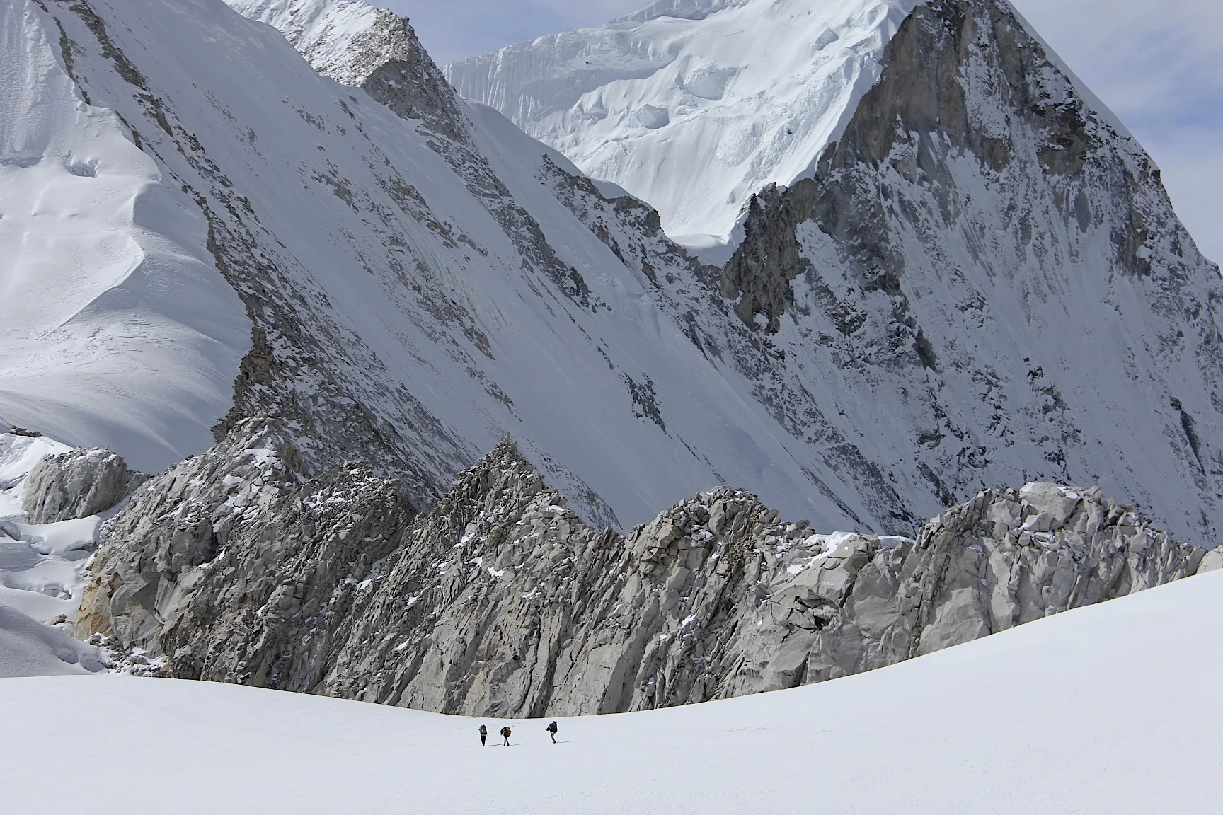
Approaching West Col

Baruntse Camp 2 is now far away.

Baruntse camp 2 at 6,100m


Hinku Valley - Ama Dablam is in the centre.

The massif of Baruntse

The peaks of the Khumbu.
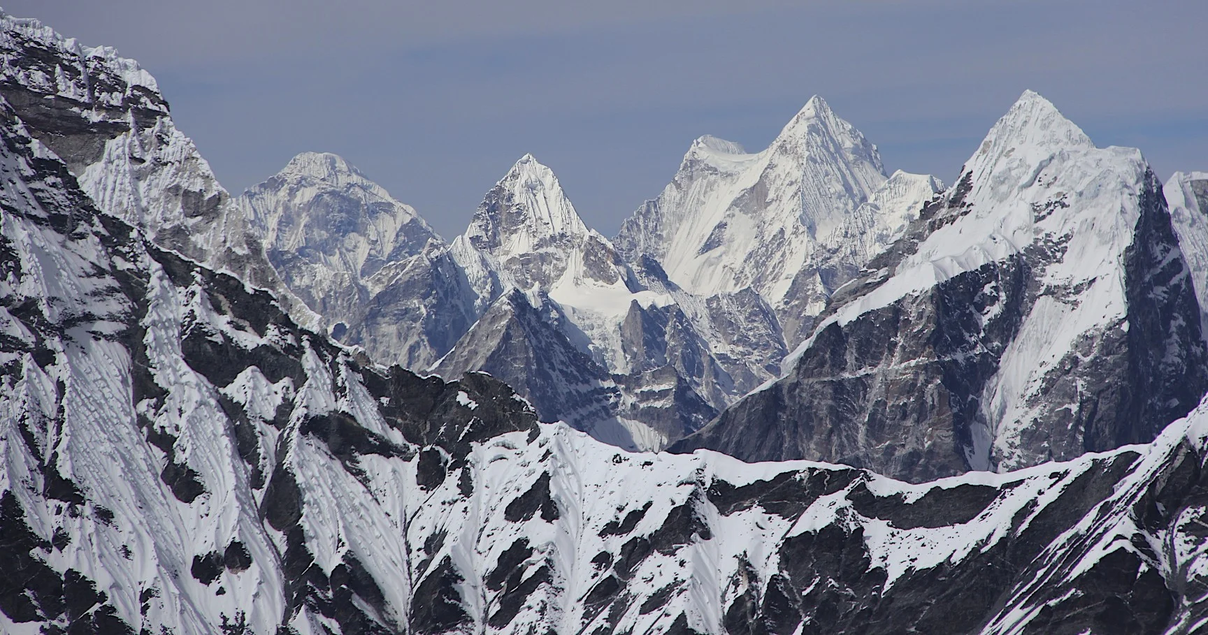
Mt. Menlungtse (looks like a saddle) in Tibet from the West Col.


Looking down from the West Col Pass at 6,150m. Descending from the West Col with a spectacular panorama of high Himalaya. You can even see Shishapagma on the extreme right in the far distance.

Descent from West Col at 6,150m.

The peaks of the Khumbu.

Looking back at Makalu from the West Col.


Descending from the West Col on fixed ropes.

Descending from the West Col. Hinku Valley is below.

The west wall of Mt. Baruntse

Ama Dablam
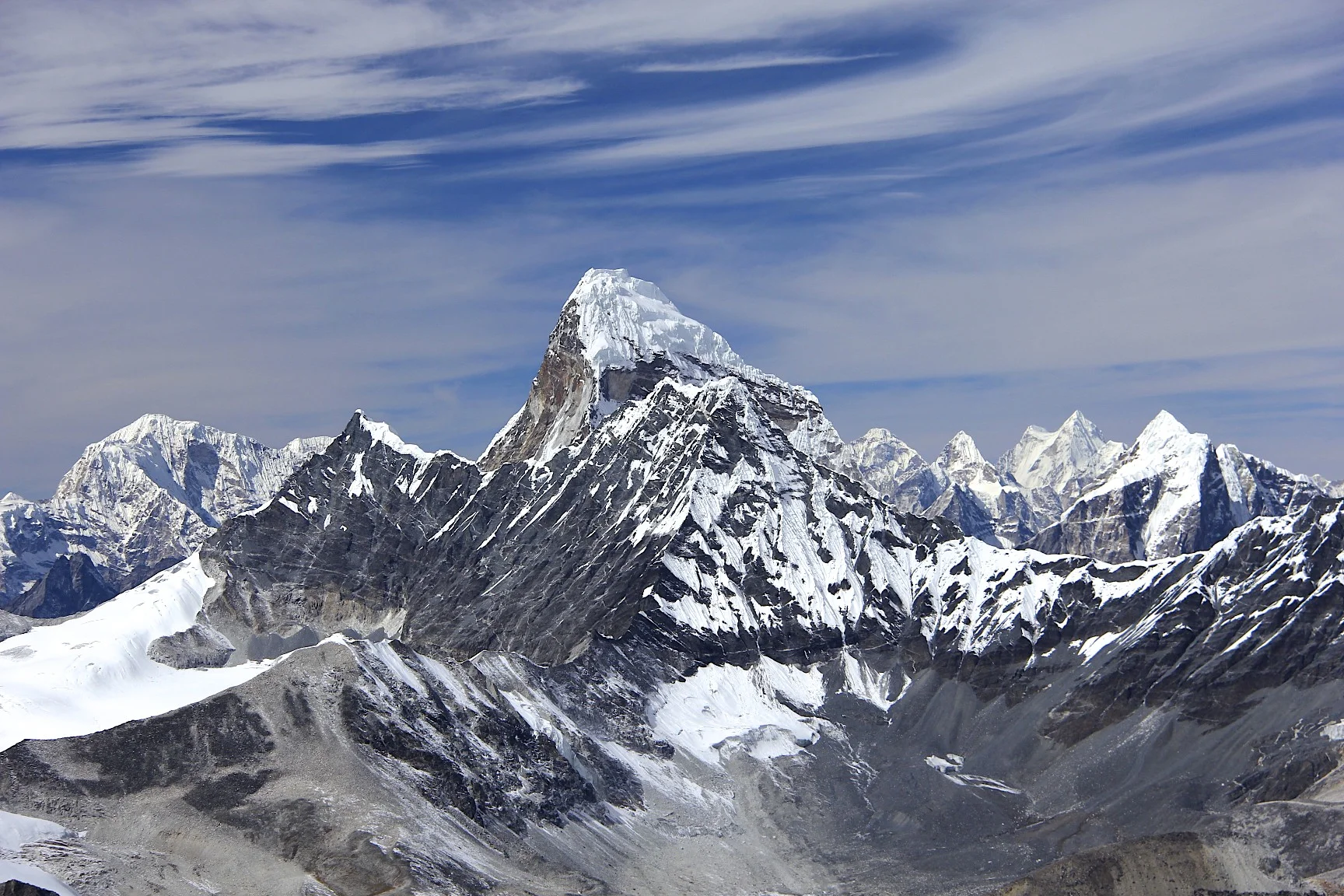
Ama Dablam

My altimeter recorded the height of the West Col. It is in fact a little bit higher. It took us around 4 hours to get from Sherpani Col to the West Col.


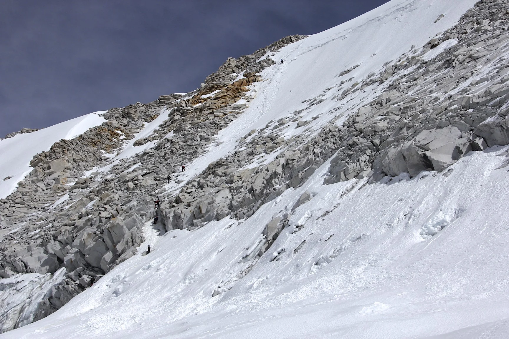
The rocky descent from the West Col from 6,150m to 5,900m


Looking back at the descent slope from the West Col.

Hiking to the Hinku Valley and the Baruntse BC.


Looking back at West Col


Baruntse basecamp at around 5,400m. The West Col is now far in the distance.


Mt. Baruntse from the Baruntse BC


Baruntse


Baruntse

En route from Baruntse BC to Amphu Labtsa Pass camp. The wall of Mt. Baruntse.


Mt. Baruntse


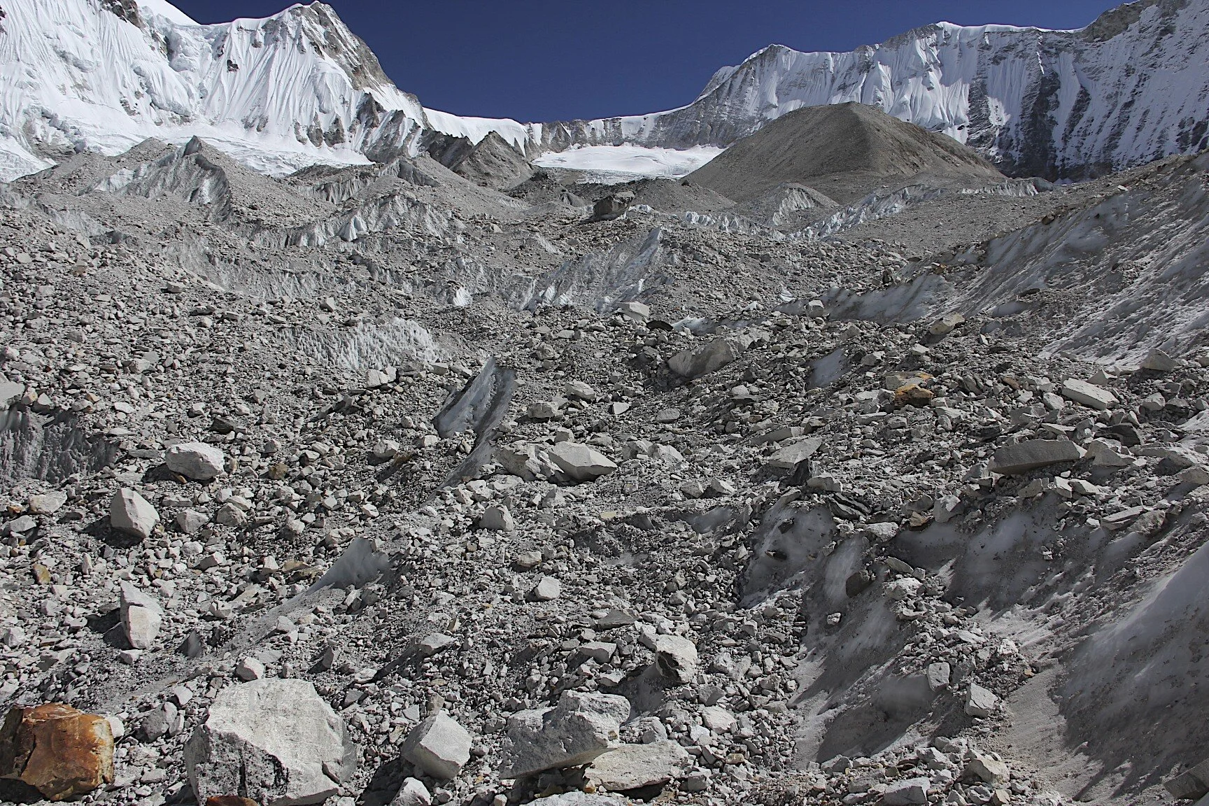


Mt. Chamlang

Chamlang on the left and Hinku valley in the centre.


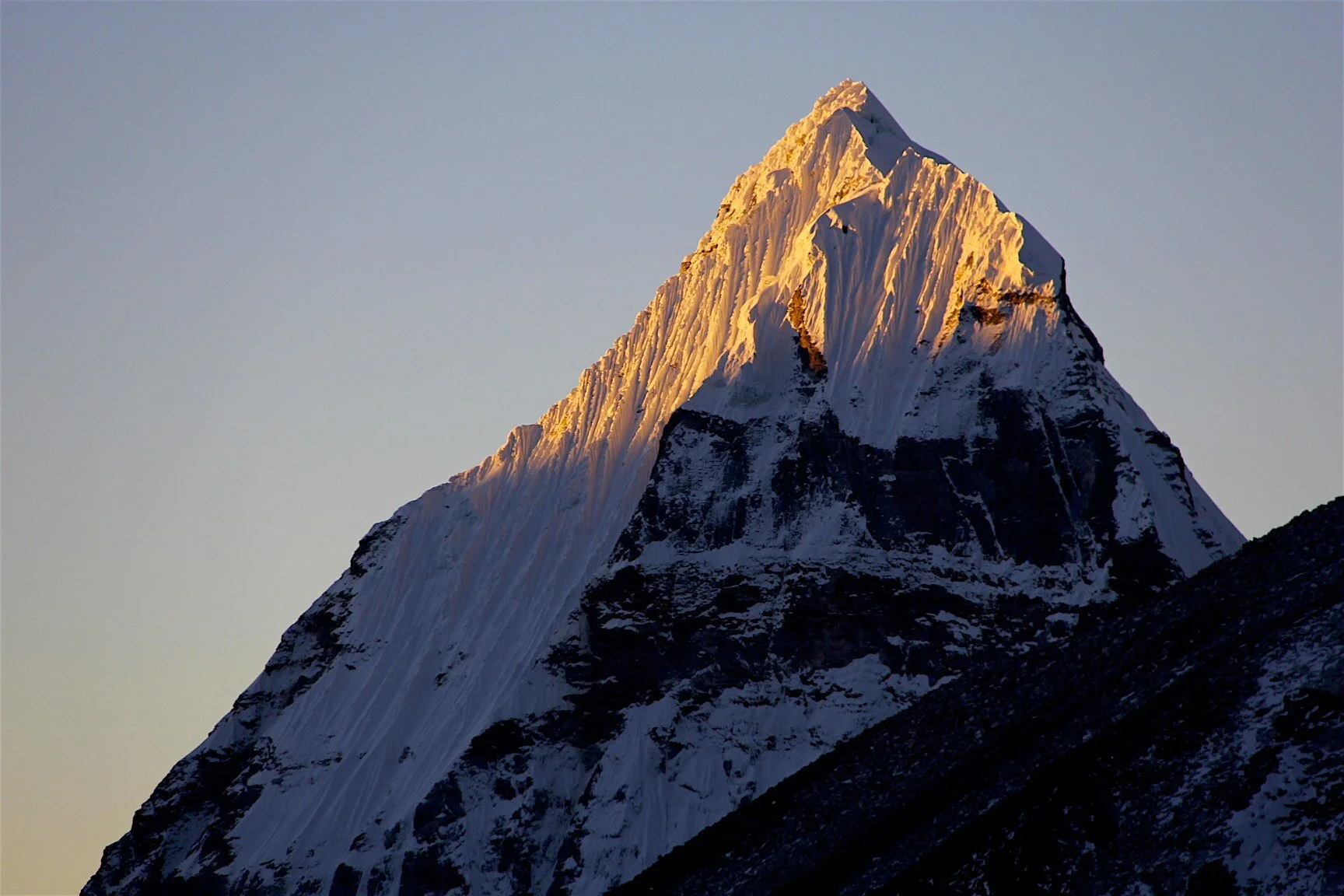

Ascending to Amphu Labtsa pass


Ascending to Amphu Labtsa Pass


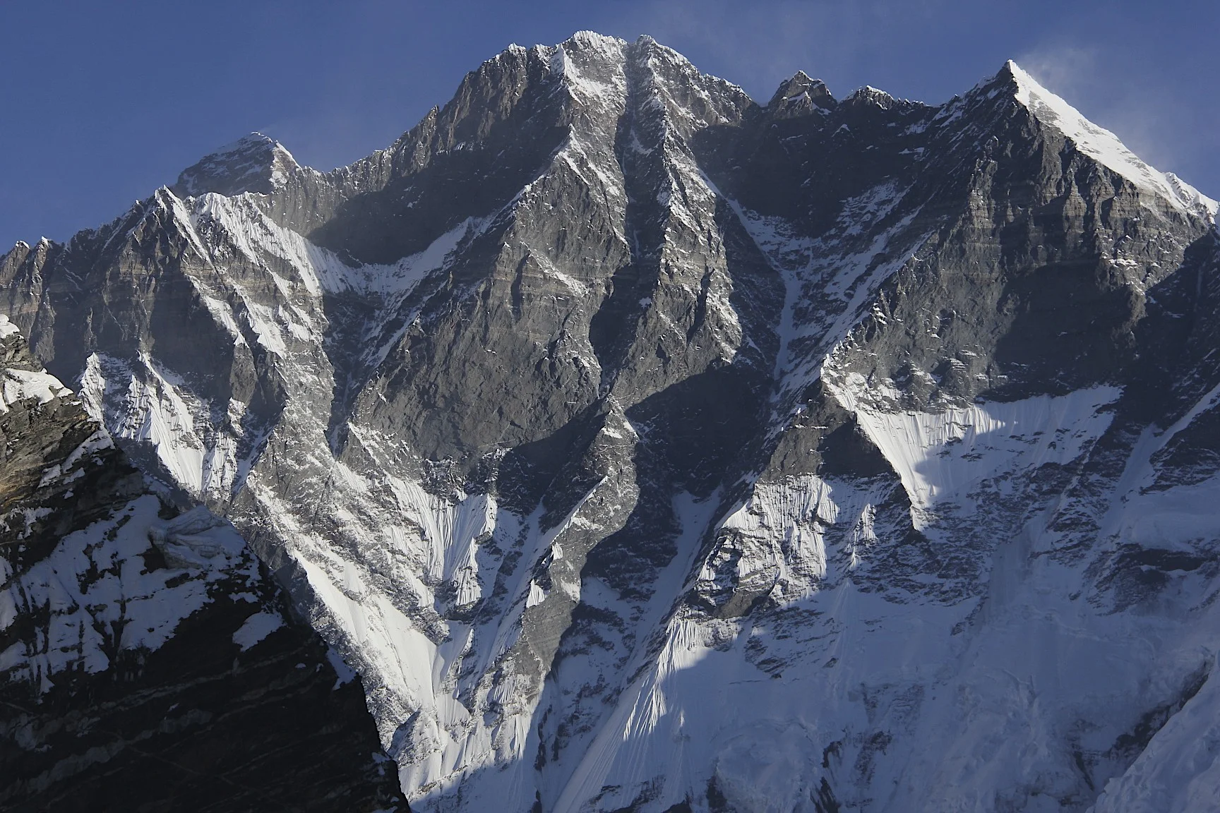
The south face of Lhotse with Mt. Everest peaking from behind the ridge.


Looking back at Chamlang and the Hinku Valley from Amphu Labtsa Pass.


On Amphu Labtsa Pass. The massive south face of Lhotse looms behind us.


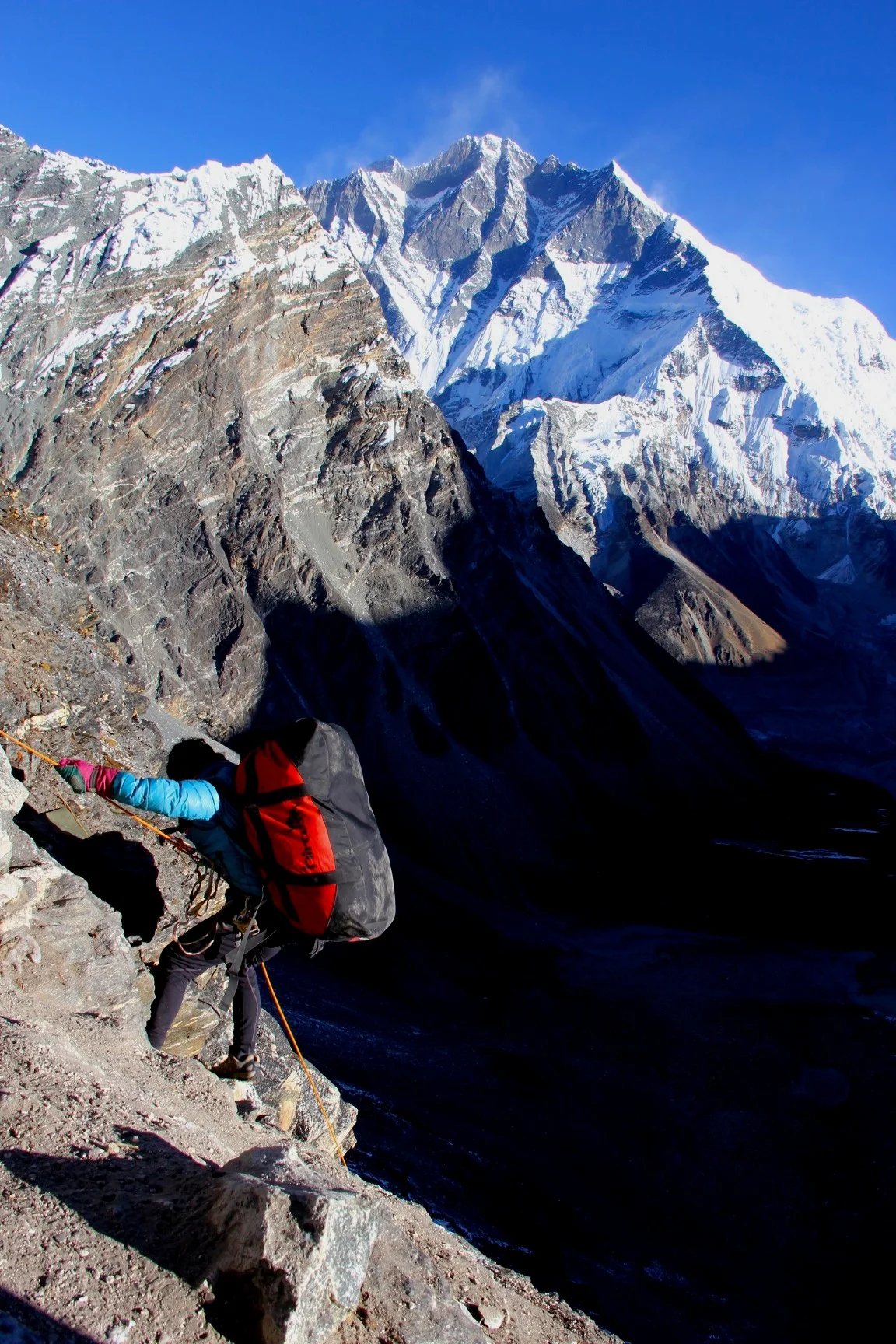
Very steep descent from Amphu Labtsa Pass with Lhotse South wall dominating the skyline.


Very steep descent from Amphu Labtsa Pass 5,900m. It was quite unnerving looking down, almost vertical wall, all the way to the glacier below.

Looking down from Amphu Labtsa Pass, 5,900m.


Photo by Ryszard Pawlowski showing the route between West Col and Amphu Labtsa

Amphu Labtsa from the north


Lhotse and Island Peak

Lhotse and Island Peak


Baruntse from the West

Mt. Cholatse

Mt. Cholatese, Mt. Cho Oyu (in the distance right of centre) and Lhotse massif on the right.

Summit of Lhotse with some wicked wind.


South side of Lhotse


The memorial to the Polish climbers who died on Lhotse in the 1980s.

Pheriche village and Mt. Cholatse.

Ama Dablam from Pheriche

Ama Dablam

En route to Namche Bazar with Ama Dablam behind.

Nuptse, Lhotse and Mt. Everest from Tangboche Monastery


Nuptse, Mount Everest (behind the ridge) and Lhotse (on the right). Notice the strong wind blowing across Mt,. Everest’s summit.

Namche Bazar and the valley leading to Renjo La Pass and Rowaling

Quick way home! An old Soviet Mi 8 cargo helicopter. The pilots make extra cash by taking people to the road head from the Khumbu.


Participants: Derek, Juan (for the first week and a bit), Kumar (for the first week and a bit), Purba, Japanese 65 year old and his Nepalese assistant/guide, 3 Yahoos, the Taxi Driver from Darjeeling, 30 year old virgin, Dorje Sherpa (K2 summiter, interested in any other job but climbing), and the guy that kept staring at me.
October 17, 2012 – October 20, 2012
So here I am a year later: in Nepal again, in Khadabari town in a hotel. After a great experience of solo travel in 2011, I decided to do another trip alone. This was my plan until I got a call from Juan asking me if I had any treks planned. After exchanging emails, Juan decided that he wanted to experience the Himalayas. I sent him many articles and descriptions of this trip as I was apprehensive of inviting him on the most difficult trek in Nepal for his first visit to the Himalayas. I did not want any surprises or regrets in case something happened to him. Having assured me that he was ready and fit I accepted him to join me. So the plan of a solo trip did not really work out, kind of…
We are here to do the most challenging trek in Nepal. It is high, remote, and very technical with elevations over 6,000m. It is more of a mountaineering expedition than a trek really. Later, Dorje, my Sherpa guide told me that doing this trip was equivalent to climbing Cho Oyu, an 8,200m mountain. I read a lot about this trip and looked at some spectacular photos from the passes that we were planning to cross on a few websites. I trained hard for it and psyched myself up for the effort. Having experienced the ferocious weather on the Teshi Labtsa Pass in 2010, I was aware that trekking across high remote passes could be risky too.
I left Calgary on Thursday Oct 17, 2012. I had a lot of loose ends to take care of. It seemed that this time I had all the little things just piling up right until my departure. When I showed up at the airport, I was informed that I needed a visa for Dubai, as Canada and UAE were involved in some pissing match about airline business. In retaliation, UAE introduced visas for Canadians. I did not know about this change and I had to buy another airline ticket to fit into the visa free 24-hour transit rules. I had to buy the ticked on the spot, at the airport in order to be let onto the flight to London.
The flight to London was not full. In London I visited David (my usual English travel mate who would not be joining me this time, unfortunately) in his new home. His new house is located outside of London and it is very far from the LHR airport. The only way I could save money on the criminally high taxi fare back to the airport was to engage a one-armed taxi driver from David’s village. David assured me that the driver and his driving were perfectly safe.
In London, David and I had dinner with Debbie (our mutual friend who lives in London and loves Arctic travel) in some Lebanese restaurant in Soho. She invited me to join her on the sailing trip to South Georgia the following year.
The flight from London to Dubai was uneventful and uncomfortable as the seats were small and there was no legroom. Dubai airport is very large but the shopping is surprisingly poor. Everything is expensive with a 15% premium. I had a long layover there (over 8 hours) due to the visa confusion. At the airport, there were a lot of people from Africa and Pakistan returning from the Haj. The flight to Kathmandu was via Doha, where the airport was small, cramped and in total chaos. It was a long journey to get to Kathmandu. This time it felt like a true trip around the world.
At the airport in Kathmandu, I met Rajendra who presented me with a lei of marigolds and a welcoming scarf. We took a taxi to the now familiar Nirvana Garden Hotel where Juan was already waiting for me. I got to the hotel around 6pm. I did a quick repack and went to Rajendra’s office to pay him the fee for the trip. In return, he handed me a brick of 200,000 Nepalese rupees to take to Kumar, our guide, who was already waiting for Juan and me in Tumlingtar (the starting point of our trek). After the formalities, Juan and I went to the Pilgrim Bookshop cafe for my favourite dosa masala and momos. I felt very tired from the journey and the time change.
Kathmandu was not new to me. Since the festival of Dashain was taking place in Nepal, Thamel (the tourist section of Kathmandu) was very busy. Not much has changed from the year before: the same shops and wares, the same service staff working in them (some of them even recognized me). I went back to the hotel soon after as we needed to get up at dawn to catch the flight to Tumlingtar. I was looking forward to getting out of Kathmandu as soon as possible.
October 21, 2012 Khadabari
We got up early at 4 am mainly due to the jet lag. I repacked and went to the bakery with Juan for some overpriced dry muffins. Then off to the airport for the flight with Buddha Air to Biratnagar. The flight to Biratnagar was pleasant and smooth with great views of the eastern part of the Himalaya range from Ganesh to Kanchendzonga. We could see Everest, Makalu, Gaurisankar, Kanchendzonga, all of them. It was magnificent and we were excited with anticipation of going to those peaks.
In Biratnagar we had 2-3 hours of waiting for the next flight. The next flight was in a very small plane that could land on the remote grass airstrip of Tumlingtar.
In Biratnagar, to kill time, I took a walk to town. It was very hot and humid as the city is located in the lowland section of Nepal at an altitude of 100m, next to the Indian border. The town looked dirty and chaotic. I bought some apples and bananas and went back to the airport. The next flight to Tumlingtar was only 20 minutes long. We had a great view of Makalu thorough the cockpit window. The bulk of Makalu seemed right in front of the plane.
Once we landed, the bags were dispatched onto a metal trolley in the middle of the grass landing strip and everyone picked their own.
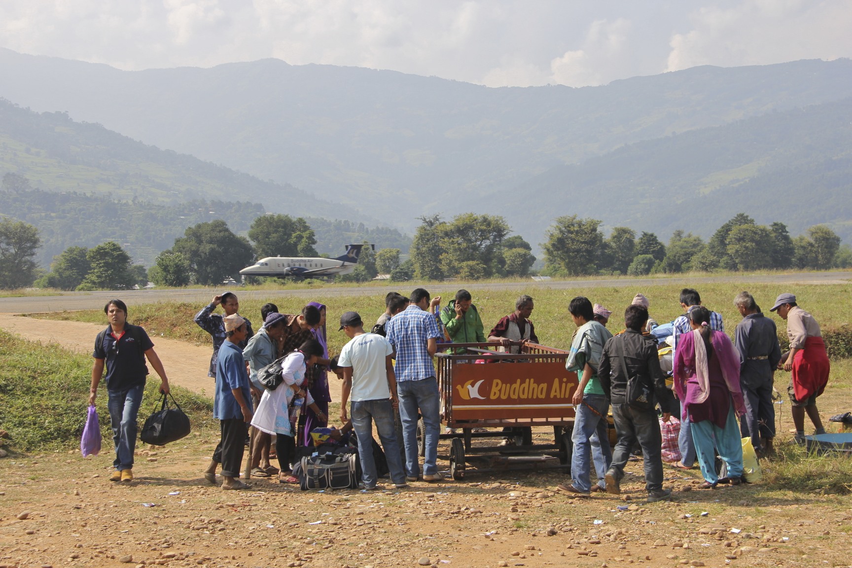
We met Kumar at the airstrip who was waiting for us with the jeep that would take us closer to the trailhead. We met our crew for the first time. Our climbing Sherpa, Dorje, is from the Makalu region. He climbed K2, Makalu, Everest, and Manaslu three times. The sherpas who climbed the main Himalayan peaks do not make a big deal out of it while for the foreigners it is an ego-boosting source of pride. Dorje seemed like a nice guy. He showed me some great photos from his recent K2 climb. For him it was an easy peak except the Bottleneck part, but he seemed very proud of his accomplishment and aware that it improved his marketability as a guide for other climbs in Nepal.
We all piled into the jeep and went to Khadabari on a dusty road. It was a short drive but better than walking. Khadabari is a regional capital and there were no tourists other than us in town. We were told that there were some other groups ahead of us so I was sure that we would run into them later. The hotel was quite nice. I had a corner room with a patio and a view of the surrounding hills. In the evening, the clouds rolled in and it cooled down nicely. It was also my birthday.
October 22, 2012 Num
Today we drove to Num. It took seven hours of shaking and jolting. On the way we saw many animals killed for the Dashain festival as is the custom here. Celebration by communal slaughter. We saw many goats with heads chopped off and blood gushing out. When we stopped for lunch we came across a group of people holding down a large pig. One guy was driving a wooden stake through the pig’s heart. The pig and the tormentors were freaking out, a total pandemonium. After the pig died, the villagers set it on fire to burn the hair off. They scraped the scorched carcass off with teacups and old rusty cans. They cleaned the pig off, gutted it and cut it into four pieces.
For lunch we had dhal baht of questionable quality (even Kumar and the porters were not impressed with the quality of the food). However it was the only available option for lunch along the way. In Num, our final destination on this road, we stopped in a guesthouse belonging to a Nepalese man who worked in Japan and saved all his earnings to open this business. The room was built from sheets of metal so there was no insulation from the noise outside or the noise from other rooms. It was a typical Nepalese shoddy hotel. The sunset was spectacular over the valley below. The sun looked magical with the long rays of light shooting in all directions from behind a dark cloud.
The hotel was located at the end of a long ridge. From the ridge, the views extended over the green foothills of the high Himalaya. To the east, the valleys led to the Kanchendzonga region. To the west, to Lukla in the Khumbu region. Directly across the valley, to the north, we could see the village that was our destination for the following day. It looked so close. A deep gorge separated us from it though. We could see the large Arun river snaking its way through the deep valley that we would have to cross in order to get to the village across from us. We went to bed by 7:30 pm excited for the start of the walk. All through the night we could hear a symphony of harking and spitting from other rooms and wailing dogs and roosters from the outside. We were up by 5:30 am with all the local roosters and dogs.
October 23, 2012 Seduwa 1,710m
We got up early and had breakfast at 6:30 am. We left at 7 am. First the trail dropped 700m straight down a slippery stone stairway overgrown with vegetation. The lower we got, the more hot and humid it became. Right out of the gate, Juan had problems with his knees and by the time we got down to the river, the guides started to worry whether Juan would be able to continue. I never considered that going down could present a problem. The slippery steps however, can be a treacherous trap for bad knees.

Once we descended to the bottom of the valley, we crossed the Arun River across a hanging bridge and immediately needed to regain all the elevation. We climbed 1,000m up in the heat and humidity eating fresh guava on the way. When we arrived at Seduwa, our destination for the day, we decided to stay put and not to continue on to Tashigaon another 3 hours away. This meant that we would need 7 days to get to the Makalu basecamp from here. In two days time, we had our first high pass to cross. The pass is called Shiphton Pass and it is 4,000m high. We arrived at a guesthouse with dorm sleeping arrangements reminiscent of a Kashgar teahouse. I was anxious to see what the next day would bring.
October 24, Tashigaon
Today was a short day, only 3-4 hours of walking with a two-hour lunch break.
While we were having lunch, the weather started to turn for the worst. The cloud cover was increasing and it looked like it was going to rain. The following day we would have a big elevation gain of 1,400m. Today on the trail we saw many orchids growing on trees – it was very beautiful. We met a German fellow that had hair like Copernicus. It was Mr. Copernicus who showed me the orchids.
The valley to Tashigaon was very beautiful with views extending far away into the Kanchendzonga region. This is a very underdeveloped region of Nepal from the tourist infrastructure perspective, it is not a “Coca-Cola” trek at all. The teahouses are very simple if they even exist, with no choice of foods available. Sleeping arrangements are dorm style on wooden platforms or on the floor, so I needed to use my sleeping mat. The food was quite bland, rice cooked without salt, local vegetables, spinach and some other greens. No spices. I should have brought more of my own snacks if I knew. I was starting to get apprehensive about the high passes ahead. The crossing from Makalu basecamp to Chukung in the Khumbu usually takes five days. I anticipated this trip much more than any other (with the exception of the trips to Pakistan in 2001 and 2005) due to the high elevations involved.
It was raining by now, heavy grey clouds descended on the surrounding peaks around us.
We ran into a large British group going to the Makalu basecamp. Their leader developed sharp pains in his lower abdomen and was supposed to be evacuated by a helicopter the following day.
October 25, 2012 Karma Kharka 3,635m
Today we started in the jungle and it was steaming hot in the morning. It was quite humid after yesterday’s large rainstorm. It rained hard until midnight and snowed higher up. In the morning the sky was clear and the rocky peaks above Shiphton pass looked great, covered with a fresh dusting of snow.
After leaving the teahouse, the trail started to climb steeply right away. It started traversing thick moss-covered forest with clouds swirling among the trees. We literally hiked through the clouds with a lunch break in the mist. The first snow appeared around 3,000m. The snow got progressively deeper as we climbed higher. The daily altitude gain was large, 1,400m or so. The Karma Kharka teahouse appeared at the end of the steep climb, at the end of a rocky staircase covered with ice and slush. We got there around 2.30pm.
Dorje told me that Sherpa children are named after the day of the week on which a child is born. I would have to ask him to write it down for me. The teahouse at Karma Kharka was quite simple, a dorm room that we shared with Mr. Copernicus and his German wife. It would be cold there but the hot bottle trick works great (a Nalgene bottle filled with hot water and put inside the sleeping bag). It was the a hot bottle night as it was getting really cold. Today we also met our Japanese companion that we would be crossing the high passes with: Mr. Marimoto. He is an older Japanese fellow, 65 years old who apparently comes to Nepal every spring and fall. He always hires Dorje’s uncle for all of his trips. We joined forces with his small group to streamline rope fixing on the high passes.
Mr. Copernicus told me today about his mountaineering exploits: 14 times in Nepal, Peru, Muztagh Atta, Gurla Mandata, Ama Dablam – quite a nice guy. Mr. Copernicus is German and according to Kumar’s idiosyncrasy scale, he is goal oriented and determined. Most Germans I meet make proud pronouncements of their mountaineering accomplishments like children showing off their school prizes. It is the summit that excites them not the experience. Without the summit, there is no valid experience.
I was looking forward to crossing the Shiphton Pass the following day!
October 26, 2012, Friday Dongla 3,855m
Today we started at 6.30 am. We had beautiful clear sky in the morning. We had a great view to the east (Kanchendzonga region) from the ridge ascending to the Shiphton Pass. Shortly after 8 am, the clouds started to roll in. After breakfast I walked up the hill fast and ahead of everyone else to Keke La (a viewpoint before the Shiphton Pass) to catch the panoramic view of Makalu, Peak 6, Peak 7 and Chamlang. All those peaks were waiting for us ahead. I had to move fast up the hill to beat the ascending clouds which by now were rolling in thick and heavy. I was surprised that I could run up to the top of the pass at the altitude approaching 4,000m. Shortly after I took some photos, we were engulfed in thick clouds.
Once everyone arrived at Keke La, we regrouped and moved across the Shiphton La. The weather was changing again. Dark clouds started to envelop us and the wind picked up. It was quite cold, cloudy and very windy. This made the walking unpleasant and required full on gortex, gloves and hat. It was definitely winter with blowing snow, ice and cold temperatures.
At one point I had to wait for Juan and Kumar for an hour and I got really cold in the wind (hot tea helped though). Juan was slower than me and I could feel that he was starting to appreciate how serious the weather could be in the high mountains. Also the terrain was becoming icy and challenging. We were not following any trail as everything was covered by wet snow.
In the mountains, and especially during bad weather, being slow is not good as it prolongs the time in the elements and makes the cold much more acute. The Shiphton pass is 4,200m high and it was snow and ice covered when we got there. It was full on winter. At an elevation of 4,200m the snow was blowing horizontally and it got quite cold fast when I stopped. The clouds were milling around in the strong wind. I could make out our guys in the distance among the sharp rocks. There were no views and we had to walk with our heads down due to blowing snow and wind. We stopped for quick lunch in the cold (some soup and tea). The Japanese fellow was sticking to himself, as he probably did not speak English. True to my Himalayan curse, the worst weather was on the pass. I was seriously hoping that this would not be the case on the passes ahead at 6,000m.
We arrived at our campsite at 3,800m on the other side of the Shiphton Pass. The campsite was snow covered and located by a small shack-like teahouse. We pitched our tent, as the teahouse did not have beds. I was expecting a cold and long night (but the time seems to go fast here). This was our night number 6 already on the trail. It was definitely a two hot bottles night.
The teahouse was very small and tight barely fitting our crew. We had some simple food and hot tea. There was no place to sit and relax so we retired to our tent soon after the supper.
October 28, 2012 Langmade Kharka 4,450m
Last night was the coldest night so far. The tent was frozen inside from the condensation. We were now in the Barun Valley, way on our way to the Makalu basecamp. Barun Valley is fairly remote and does not have any permanent villages. There are two seasonal pastures and the locals who stay there cater to the few passing trekkers and climbers.

Yesterday we descended from the Shiphton Pass camp at 3,800m. The rocky "steps" from the pass to the Barun Valley were covered in ice due to the snowstorm the day before. Juan had a really hard time coming down as he was now experiencing the effects of altitude. Along the way, we had to cross a rocky landslide area with large loose boulders piled on top of one another. Juan's altitude sickness was getting worst and we made a collective decision to get him out of the Makalu basecamp by helicopter. He would continue with us to the basecamp though as there was no other place for the helicopter to land before we would get there. I was planning to call Rajendra on the SAT phone and arrange the helicopter evacuation for the 30th of October at 9 am. We were now in a deep valley and I could only use the SAT phone when we had the open southern sky. This limiting aspect of the SAT phone made it somewhat limited in its usefulness as an emergency communication devise.
October 28, 2012 Yangle Kharka
Last night we stayed at Yangle Kharka and it was very decent. In the morning, the frost covered the meadow outside the teahouse and the streams surrounding the teahouse were frozen. The rising sun illuminated the large peaks behind the ridge at the bottom of which the teahouse was situated. We left around 8 am and walked to a higher camp at 4,450m. We had great views all around along the way. We were now in a wild and remote area of the Barun National Park. It was hard to believe that we were on the trail for only 6 days at that point. It felt much longer. I was sending the SPOT messages (locator messages via satellite) and I was hoping that they were being received back home. It looked like Kumar would cross the passes with us as he was quite determined but unsure of his ability to do so.

I was apprehensive about them as well but they were trekking passes after all. If all went well, it would take 5 days to cross the 3 of them. The following day we were going to the Makalu basecamp and it was supposed to be only 3-4 hours of walking.
October 29 and 30, 2012 Makalu BC 4,850m
Yesterday was a great trekking day. We had outstanding views all along. The Makalu basecamp is spectacular with the south face of Makalu rising for 3 km straight above the teahouse. It is a huge and bulky mountain and we were right under it. The wall of granite was too steep for the snow or ice to stick to it. The bottom of the face was surrounded by large icefalls. In the evening the setting sun turns the entire face yellow and then bright orange making the sunset a spectacular event.

On the way to the basecamp I called Rajendra on the SAT phone to confirm the helicopter for Juan. All was good to go. The flight from Makalu BC to Lukla via the nearby pass is only 20 minutes. It would cost $2,000 US.

The helicopter came at 7 am today (we were expecting it at 9am) and basically shook us out of our sleeping bags. We pitched the tent inside an animal shelter to protect us from the cold wind. The teahouse was very nice and not busy. We were still in our sleeping bags when the roaring noise of the landing helicopter shook the walls and literally came on top of us. We scrambled like mad and got Juan’s bags packed. I swapped my yellow duffle with him since I had more gear and needed the space. He also left me his first aid kit for the crossing of the high passes, as it was his contribution to the group kit.
Dorje, the Sherpa guide also insisted that Kumar go down with Juan. Kumar was asking everyone along the trail for the last few days whether he could do the passes or not. It was a local plebiscite for Kumar. People would discuss and vote while Kumar evaluated the results carefully. Everyone told him that he could not do it but in Kumar’s head, the results were inconclusive and he was willing to give it a try.
Everyone’s opinion about Kumar’s inability to do the passes was apparently due to his lowland caste. The entire caste is labeled as weak and not efficient in the high mountains. The final decision was made by Dorje and it was of course the opinion of the Sherpa who are the kings of the high Himalayas. I do respect Dorje’s opinion, as his resume is very impressive.
Consequently Kumar joined Juan on the helicopter flight to Lukla. He was of great assistance to Juan all along and it was safer for Juan to rely on Kumar's guidance until the end.
Personally I felt very good. I was not tired in any way. Once Juan left, it started to feel like my solo trip from the previous year.
We had a rest day at the Makalu basecamp. That day, we walked to 5,150m for an acclimatization walk. I felt fine and had no altitude-related issues. I was curious though about how I would feel at 6,200m which was the altitude record for me, Dorje and I walked up to a viewpoint from which we could see the northeast aspect of Everest and the south face of Lhotse. It was brilliant.

As usual at the high elevation for me, I had some sleep problems. I would wake up in the middle of the night and I had a hard time falling back to sleep. My mouth got really dry during the night and I needed to drink a lot of water (2 liters during the night). Because of all this drinking I had to go and pee 5 times during the night as well. This became very tedious as leaving a warm sleeping bag was not very comfortable and it was disturbing to Dorje, with whom I shared the tent.
The following day we were planning to move to a higher camp at 5,600m (known as the Sherpani Col basecamp). It was a large gain in altitude in one day and hopefully I would feel good. I was most concerned about the West Col camp at 6,200m. The camp is remote and high. It would be hard to go down from there fast in case of any altitude issues. A helicopter evacuation would be tricky if the weather was not good. The helicopters can fly up to 23,000 feet according to the pilot who evacuated Juan.
It was quite amazing to me that the crossing of the high passes would take only 5 days yet it took me months of training and mental preparation to get there. Also, such a short time in terms of days but I would remember it forever. Everyone was ready, the weather was clear, it was cold and we seemed to be ready to take on the three passes.
During our rest day at the Makalu basecamp, Dorje told me some interesting things over dinner. He makes between $5,000 and $6,000 for the Everest climb. It is very dangerous work especially in the Icefall. For other high peaks (but not the 8,000m high ones), he makes between $2,000 and $3,000. The work in high Himalaya is always dangerous: weather changes, avalanches, etc. He is going to climb the Gasherbrums this winter and Shishapagma or Dhaulagiri next spring. For Dorje, the coming passes are nothing, I guess it is all relative. He said that in the Baruntse West Col camp his friends should be there. Dorje climbed all these great peaks in the Himalayas. Yet, the pragmatic side of life overshadows his accomplishments. Despite his great achievements in the Himalaya, he would have difficulty adjusting to the life in the West. We do live in different worlds. He would like to come to Canada or the USA and work in a kitchen or doing yard work, basically anything to escape the work in the Himalaya. For him is it not fun at all. He dreams of a normal life for himself and his family, He dislikes his job in the mountains. It is physically and mentally draining and he is always unsure whether he will return to his family alive.
A testament to the dangers of the Himalaya was a memorial plaque to late Christopher Lafaile one of the greatest high altitude mountaineers of recent times. He disappeared on Makalu in 2010. The high peaks are literally gravesites, littered with frozen or disappeared bodies of the greatest climbers. The basecamps are full of memorials and chortens commemorating the bravery or lamenting the idiocy. It is sometimes hard to decide which it is?
October 31, 2012 Sandy Camp 5,180m
Today was a great day again. Brilliant weather, blue sky all day without the usual afternoon clouds. I had a great night's sleep without the nuisances of the dry mouth and waking up. We started late, at 9 am. For breakfast we had a really good dhal baht. After breakfast we walked to the sandy camp for 4-5 hours. What a great spot, overlooking the Barun glacier and the west face of Makalu. In the distance, to the northwest, Lhotse and Everest tower over the head of the long Barun glacier. For some time during midday, the clouds did not look promising. I am very aware that everything here is weather dependent. I always remember the Teshi Labtsa crossing and how fast the weather went from sunny to full-on blizzard. On these passes, the storm of Teshi Labtsa intensity would be very dangerous due to possibility of disorientation and avalanches. Such a storm would basically end the trip.
November 1, 2012 Sherpani Col High Camp 5,700m
Today we climbed 650m from Sandy Camp to the Sherpani Col basecamp. There was no obvious path and the going was over large loose rocks. We had to take great care not to trip on the boulders. as they were just piled on top of each other. The trail crossed a moraine of the Sherpani Glacier with a steep descent and then a steep climb back up all the way to the basecamp. The climb up was hard work at this altitude.
The camping spot is right in front of the Sherpani Glacier with its high and vertical snout 50m away from the tent. The glacier has spectacular icicles hanging off the wall of ice. I had a good time waking around and exploring the area and taking great photos with Makalu as a backdrop to this spectacular scene. We went to bed early, as we had to get up at 2.30 for the crossing of the Sherpani Col Pass. I was on a lookout for any altitude related problems but so far so good.
November 2, 2012 crossing of Sherpani Col and West Col 6,150m to Baruntse Base camp at 5450m
The wake up call was at 2.30 am. It was the middle of the night, the clear sky was full of stars and cold. We scrambled to pack and put our stuff away. The camp was a swirl of activity. The events of the day were directly related to poor planning and communication. We had no breakfast, no lunch and I did not take enough food or water. I was under the impression that today we would cross Sherpani Col only and camp at the Baruntse camp 2 at 6,200m. This was the plan per the itinerary. Instead we went all the way to the Baruntse basecamp some 12 or more kilometers away and climbing 600m in the process. It was all at an altitude of 6,000m with two high passes of 6,120m and 6,150 in between.
We started by ascending the side moraine of the Sherpani Glacier by headlamp in the full moon. The moraine was covered by loose rocks piled on top the ice. Again, we had to take great care not to slip in the dark. After one hour, we descended the moraine to the glacier proper. We started our ascent on the glacier towards the Sherpani Col that was directly in front of us. The head of the glacier was a circular wall of rock culminating in a snow peak on the right hand side. The scenery looked rather shrunken as we were very high and the top of the ridge and tops of peaks around us were not too far away.
The first pass, the Sherpani Col 6,120m, was at the top of the rock wall at the head of the glacier. On the glacier, there was very little fresh snow and the open crevasses were visible in the moonlight. It was hard work walking on the glacier above 5,700m. I had to stop from time to time to rest. I did not feel any specific muscle pain; it was just difficult to walk uphill at this altitude. After about 1.5 hour of glacier walking, we arrived at the bottom of the rock wall leading up to the Sherpani Col Pass. The altitude was now about 6,000m and the first orange rays of the sun just started to hit the very tops of mountains surrounding the glacier. The ascent to the Sherpani Col was on an ice and gravel slope of 45 to 50 degrees incline and then on solid rock. It was not the technical difficulty that made this challenging but the altitude. It made going up very hard: my lungs needed more oxygen. The pass itself was on a narrow ridge, enough for one person to stand on.

The altitude was now 6,120m. It was very exciting as I have never been above 6000m before! The ridge dropped steeply on both sides. The sky was overcast but the sunny blue was visible on the horizon in the distance in front of us. From the Col the view extended over a large icefield formed by a glacier descending from Baruntse (a 7,000m peak near us). Chamlang was on the left hand side raising steeply from the icefield. On the west end, the icefield terminated with a steep dropoff over the West Col to the Honku Valley below. Right across the large ice/snow field was the West Col, our next destination.

From Sherpani Col, we could see the tents of the camp 2 of Baruntse, our original destination for the day (or so I thought). Looking back towards the camp we came from, Makalu dominated the skyline. Its bulk filled the view with the prominent West Ridge rising to the sky directly behind us. Being at 6,120m, the surrounding mountains, although some of them were 7,000m high or even higher, did not seem so big.
The Sherpa fixed the ropes for the porters to descend to the ice plateau below us. The descent was a steep abseil over rock and ice at the bottom of the slope. It was now around 7.30 am and the wind was strong and cold. I got chilled fast waiting for the porters to descend and my hands froze. There was not much space to move on the narrow ridge. I took a lot of photos and waited for my turn to go down. Since the porters had the right of way, my wait was long and cold. Finally, my turn came (third, last person) and I descended with some difficulty due to my now half frozen hands. I could barely operate the descender and changing of the fixed ropes at the anchor point halfway down was awkward with my frozen hands at 6,100m. The nylon fixed rope does not go well through the figure 8. Finally I got down somewhat exhausted from fiddling around with ropes at this altitude.
As I waited for the crew to pull down the ropes and wrap up the descent, one of the young guns fell on the ice and cartwheeled down over rocks and ice to the glacier below. It looked quite scary from the distance but thankfully he only scraped his hand badly. Juan’s first aid kit came in handy and now I had to become a medic. I had an unfortunate conversation with the leader of the Japanese man’s group. In the heat of the moment and under the influence of adrenaline, I criticized the disregard for safety in front of everyone (no first aid kit, no helmets, running without looking where they step, etc.). In retrospect, considering the importance of “face” in this culture, I should have held back my criticism. But the situation looked serious, the other young Sherpa were laughing hard as their friend was falling. They all made it into a big joke. In my eyes, this could have been quite serious with limited access to help. They had no way of communicating with the outside world and any help was far away and weather dependent.
After the quick fix of the injuries, we went on. Nepalese crew did not rope up on the glacier but I insisted that we did. I always remember the trivial terrain on which Piotr Morawski died on Dhaulagiri, an accident that could have been easily prevented with a rope. Dorje and I roped up and we walked beside the spectacular Baruntse Glacier and the ridge leading to the summit. We could see the trail in the snow leading to the summit 800m higher, crossing very serious crevasses and snow bridges. We could see the Nepalese climbers ascending that way to fix the ropes for the others to follow.

It was hard to walk at 6,000 even on the rolling terrain. We walked right by the 2nd Baruntse camp. Had we camped there, the day would have been easy. It took some time to traverse the ice field. What does not seem far is actually quite far as the distances here are very deceiving due to the scale of the terrain.
Finally we arrived at the West Col Pass at 6,200m. The wind was quite strong and cold. The view from West Col was very spectacular and the sky was now clearing. The beautiful mountain called Ama Dablam dominated the skyline across the valley below. Many other peaks over 6,000m surrounded it. We could see all the peaks of the Khumbu group and all the way to Shishapagma and Menlungtse in Tibet some 100 km away. To the east, we were looking at the ridge of Sherpani Col we just came from and the pyramidal bulk of Makalu behind it.

The weather improved with blue sky above us and some light clouds. The Sherpa had to fix the ropes again for the descent of the 200m slope from the top of the West Col. The slope dropped off steeply at a 60-degree angle to the glacier below. The porters needed the fixed rope to descend safely.

Once the ropes were fixed, everyone went ahead of me; I had to wait until the end in the cold wind. The descent was straight down a snow slope with large sharp rock outcrops at the very bottom. It looked quite different from the photos I saw on the internet. The abseil ropes were thin nylon ropes attached to anchors of questionable quality (single aluminum snow picks). I had to change ropes a few times at the anchor points. At one point, there were porters coming up (belonging to another climbing group attempting Baruntse). They were ascending on the same thin rope that I was descending on. Not only that the rope itself was thin, the anchor was a single aluminum snow pick. It made me feel uneasy seeing many people putting weight on the same thin rope and anchor. Again, Nepal at its best.
I abseiled down more and changing ropes at anchor points was hard work at 6,000m. At one of the anchor points, I saw a Czech climber coming up from below me. He could have been easily hit by falling ice or rock but he did not want to wait. He was part of a large 17-person Baruntse climbing group. The porters which we just passed belonged to his crew. The Westeners looked different in contrast to the Nepalese: determined, focused and serious. You could smell the thirst for combat, the desire to conquer the mountain. All dressed in their top end brand new gear. I was comparing this visible display of the testosterone-driven machismo to my Sherpa guide, Dorje. Dorje climbed many 8,000m peaks including K2, Makalu and Everest. He was quiet, did not have an attitude of any kind but had a lot of humility. The contrast between us, the westerners and the porters was also quite sharp. My porters just strapped crampons to their running shoes and climbed up with a smile. Even the porters of the Czech group had nothing, not even a harness or proper boots to go above 6,000m.
Finally, we descended to the flatter ground. Below the final outcrop of rocks, there was a large splatting of blood on the snow. Dorje said that many people fall from this slope with disastrous consequences as the slide from above ends on the rocks just above the bottom. I can understand why the fall here could easily occur: no safety, poor ropes, bad anchors, no equipment and numerous people ascending and descending the same fixed line at the same time. Apparently, average porters do not want to do this route and I can understand why.
Since we did not stop at the Baruntse camp 2 above, we had to descend to the Panch Pokari campsite which was still 8 km away. We were effectively doing two days worth of travel in one long day. At this point, I could use a break and have some food and water.
We passed the West Col basecamp (an exposed spot in the middle of the glacier right below the West Col). The crew became excited about the end of objective difficulties and just took off for the final camp leaving me behind. I had no water left and no food, as I did not anticipate that we would be going all the way to the Baruntse basecamp. Since my crew left, I had no way of melting water as they had the fuel and the stove. Paradoxically, I was surrounded by water but it was all frozen.
I started walking down along the moraine of the glacier descending from the West Col. My energy level dropped to a notch above zero. I hit a personal brick wall probably from the mixture of altitude and lack of food and water. The lack of water and food just pushed me over the edge. I had to take it really slow. I had to rest every twenty paces or so. I could not move; it was almost scary and really strange for me. I had never experienced this before. Physically I could not find any reserve energy. The tank was empty and I was just propelled by the momentum of the descent.
At the end, as I approached the campsite, it got so bad that breathing was difficult. I was starting to cough which just added to the fun. Since my guide also left, I did not really know where to go as the terrain undulates making the camp invisible from behind the moraine. Thankfully one of the porters appeared beside me and we found the way down together.
I found out that, going too fast or too far in the high elevations was a bad idea. I wished that we broke up the day and took it slower. We could have enjoyed the scenery more and avoided the tiredness. On the positive side, I also found out my limit.
Finally I made it to the campsite around 4 or 5 pm. It was a 15-hour day at 6,000m. I was so tired that I could not even eat for an hour or so after arriving. I just sat on my ass, had tea and waited to for the adrenaline to subside.
The basecamp had a large communal “bunker tent” (a square wall built from glacier rocks covered by sheets of blue tarp propped by some large sticks. The blue tarp roof give the space inside a blue hue).

The people running the bunker had some basic foods for sale and provided sleeping places for the porters. The sleeping arrangements for the porters were on rocky platforms with a small area for cooking. Dorje helped to set up my tent near the kitchen. All I wanted to do was to rest. My cough eased once I took some Tylenol and used an asthma puffer I found in Juan’s first aid kit.
I really did hit the wall physically and almost mentally. I felt like shit after this long day. I have never had this experience before but then I have never walked for 15 hours without food at 6,000m before either. I did have a good night's sleep though, and in the morning the cough went away almost completely. I had some wild dreams at this altitude and during the night: I laughed hard at my own jokes and dreams.
November 3, 2012, Baruntse basecamp 5,450m
The next day was a beautiful sunny day, not a cloud in the sky. I asked Dorje to take the day off as I needed a break from the workout of the prior day. I wanted to go and explore the area that we were in but any effort beyond few hundred meters left me without breath. I was just too tired from the day before. I decided to just take it easy, stay in the tent in the horizontal position, as I really had no energy.

It was warm, sunny and the surroundings were spectacular. The plan was to advance to the Amphu Labtsa Pass basecamp the next day. It was near and the walk to it was very spectacular. I was hoping that I would feel better. For a moment, I considered getting out by walking out via the easier Mera La Pass.
I was quite determined to see the original plan through though and really wanted to cross the most difficult pass of the three: the Amphu Labtsa. It is very steep and high (although not as high as the previous two). It is very technical though and involves climbing a glacier on one side and repelling from some steep rocks on the other side. It is the most difficult pass in the entire Himalayan range in my opinion. I came here to do the crossing and I would be disappointed with myself if I did not. Once over the Amphu Labtsa Pass and in the Khumbu region, I was hoping to feel much better. The Khumbu region is lower and the food there would be better as well.
I thought that the lack of good food here was also slowing me down. I did understand the reason for our skinny rations, though. We were in a remote area and had to carry all of our supplies. We basically ate rice with a watery sauce for dinner and shitty porridge for breakfast (I hate the pasty chalk-like porridge). Sometimes, when pressed for time, we ate Chinese or powder soups only. Occasionally there was an odd can of sardines or a real treat: fried spam with hot chili sauce. Understandably, there were no vegetables or canned fruit.
By the time we would cross the Amphu Labtsa pass, we would have camped above 5,300m for a week. At that point, I really wanted to descend from this altitude.
The rest day was great. The sunset at the Baruntse basecamp was spectacular. The entire west face of Baruntse turned orange as the sun set at 6 pm. The night was cold, I had everything on and I was still freezing as usual in these high mountains. I am used to this though and it does not bother me. The hot Nalgene bottles in my sleeping bag helped, though.
November 4, 2012 Amphu Labtsa basecamp 5,700m
I got up at 6 am and went to the tea bunker. It was very cold in there as well and some porters were still sleeping while others were just sitting in the cold talking. No one made any tea until I showed up.
We left in late morning. The walk to the Amphu Labtsa Pass basecamp was short but spectacular. Once I started to walk, the cough came back. We left the Baruntse basecamp in brilliant sunshine, blue sky and no wind. We crossed a large glacier flowing from the Baruntse west flank and walked by some small lakes with great views all around among high alpine scenery.

We ascended back above 5,700m and I could feel the altitude with a small headache. Everything is much harder at this elevation. When we arrived at the camp, I was quite tired again. Dorje and his crew climbed to the top of the pass 200m above in no time just to find the easiest way for the next day. For them, the elevation and this environment is nothing. Dorje told me that he does not feel the affects of the altitude at all up to 7,000m.
Dorje did not want to share the tent with me. It was due to my cough and getting up 5 times during the night to pee. He would rather be squeezed with four other guys in a three men tent than share a tent with me. I guess I was just that gross and unbearable to the Sherpa (although they are accustomed to roughing it).
Coughing was a big problem for me at that campsite. I was suspecting some sort of lung infection or bronchitis but in retrospect it was all due to the altitude. I had to force the phlegm out by coughing it out hard on all fours so I could breathe. It felt like I was giving birth to some alien creature. The effort and the convulsions reminded me of the cafeteria scene in the movie “Alien”. After that experience, I would never take clear breathing for granted again. I could just imagine how horrible asthma would be. I felt sorry for all those people suffering from it on daily basis. Every breath that is deep and clear must be appreciated and thanked for. After this experience I now carry the asthma inhaler in case of an emergency.
At night I took some heavy dose of Advil hoping that it would ease my cough. Having the cough like that would make the crossing of the Amphu Labtsa Pass a challenge.
November 5, 2012 Amphu Labtsa pass 5,800m
We got up really early again and started walking at 4 am in the dark. The walk started on loose moraine on relatively good trail. I hate walking on loose rocks by a headlamp. By the morning my lungs cleared up nicely and I was happy that the cough eased. But again, as soon as we started walking the annoying dry cough returned.
We started ascending the icefall that rose right in front of us. The icefall consisted of series of shelves than needed to be climbed one by one.

The climbing was technically easy but the altitude made it hard again. Each of the shelves was about 20-30 feet tall and had many icicles hang off it. The continuous daytime melt and night freezing produced these wonderful ice formations. The porters required some help ascending the icefall, as they had no crampons. We arrived at the top early in the morning and the sun was up already.

Once we crested the top, the drop to the other side was quite incredible. It was literally straight down for a few hundred meters. What I did not see initially was the shelf to which we would repel to, and from which we would make a sharp turn to the left to an easier ground.
We spent little time on the top. The view was quite incredible, to the west, the massive south face of Lhotse looked like a giant wall of black rock. This is the wall on which Kukuczka died in 1989. To the south, Chamlang, Mera Peak and the entire Honku basin. We could also see the West Col and out entire route from two days before. I took some photos and it was time to descend. The repel was on a nylon rope attached to a snow picket again, this time jammed between some rocks. It was unnerving to rely on such tenuous setup given the drop under my boots. We repelled down to a rocky shelf and traversed the slope to the easier ground from where we could just walk down.
As we progressed, my cough got worse and I had to go really slow to avoid breaking into coughing fits. We walked into freezing wind that was coming straight at us. As we rounded a corner, we could see the climbing route on the Island Peak and the climbers ascending the small glacier to the summit. The climb seemed crowded and the Island Peak looked very small in front of the massive Lhotse face immediately behind it. One would wonder why is everyone going to the same mountain while all the other peaks around it are empty. I followed a yak in front of me and basically walked at his speed, which was just right under the circumstances.

The distance from Amphu Labtsa to Chukung was 8 km. Chukung is a collection of small hotels where Dorje’s relative runs Makalu lodge. There was no room at the Makalu Lodge so I was put up at the Chukung Resort. I was so tired that lying down was my top priority. I arrived in Chukung totally exhausted due to the cough. I just could not move. I went to bed, lied down with a tube of Pringles and had fits of violent cough. I felt really sorry for the people in the next room. I had to take pills again and really used Juan’s asthma inhaler. When one is so spent, the enjoyment of the mountains, the beautiful scenery just do not matter. I just lost interest in the mountains around me and could not care less.
The Khumbu area lodges are money machines. They charge for everything and usually do not rent rooms to single guests like me as groups bring more money and require more meals. I guess this is how they roll around here. According to Kumar, the Sherpa people are greedy and have a lot of money. This is all very surprising as they profess to be very religious and are stringent followers of Buddhism. I have the next few days in the Khumbu Valley so I will enjoy it. Today, one of the porters left (the Darjeeling taxi driver). Only Dorje and Phurba are left from the entire crew.
November 6, 2012 Periche 4,200m
The walk from Chukung to Periche is only 1 hour (all down). We walked by the memorial to Kukuczka overlooking the Lhotse face from where he fell. In Periche I said my goodbyes to Phurba and the Virgin. They are great guys and it is unreal that they do what they do. Without their support I could not be here. They took my climbing gear to Lukla. My initial plan was to go to the Everest BC and then return to Lukla. Given how tired I was though, I was not sure whether this will be possible as the BC is at 5,500m. This would involve climbing 1,300m and spending additional nights above 5,000m. I would rather avoid it at the moment. On the other hand, I would rather not come here again (to this particular valley full of tourists and money hungry Sherpa).
In Chukung, I met a small group of great Iranian guys who came to Nepal to climb the Island Peak. They are all members of the Iranian Mountaineering Association and gave me their contact in Tehran. They offered their assistance when I am ready to go there.
In Periche I went to the medical clinic to get my cough checked out. The medical clinic in Periche serves climbers and trekkers. It specializes in issues related to high altitude and mountaineering. It is well run and staffed by volunteer doctors from around the world. It receives good supplies of drugs and materials from the West. To my surprise, the clinic doctor was from Poland. Bartek is 31 years old and is from Opole. He is in Periche on a three-month stint. We had tea and dinner together. He gave me some antibiotics and confirmed that I had bronchitis. His advice for me was not to go higher. I therefore abandoned the plan to visit the Everest basecamp.
The lodge we were staying in was located across from Ama Dablem with a terrific view if its face. The visibility was great and I took many great photos of it in the afternoon light.

Today I also took a bucket shower and the Taxi Driver washed my clothes. I did not even ask him, he offered. He is such a great and kind man. Nepalese, in general, are such amazing people, hard working, never complain. I feel like a shmuck feeling sorry for myself with the silly cough while these guys did all the heavy lifting.
November 7, Periche 4,200m Tangboche 4,000m
From Periche it was a walk down the valley to the monastery of Tangboche. I still found the walking hard even on the flatter ground. The trail was dusty which exacerbated my coughing. In general, in contrast to where we came from, I found this trail very tedious. The trees are bare as the fall has begun. The trails were full of yaks, tourist such as me, and dust. It was not a pleasant walk. However, given what I have just seen, it was difficult to get excited about this trail. I am sure that had this been the approach, I would be in awe of the beautiful scenery around me. I was lucky as on this trip most of the time was spent in the high Himalaya.
After a long descent towards Tagnboche on the boring trail, we crossed a river and started climbing to the monastery. I was wondering why did the Nepalese build a village and a monastery on top of a hill that requires a climb? I am sure that for them, the climbing is not a problem.
The teahouse we stayed in was located across from the monastery. It was run by a very devout old fellow who was chanting Buddhist mantras under his nose as he milled around the dining hall. The room was very tiny like a cell and it had a rancid stink to it. The momos however, were fist class. The old fellow showed me a photo album of the memorabilia from his wife’s father. The father was a sidar for the 1953 British Mt. Everest expedition that resulted in the first climb of the mountain. The album contained awesome old photos of the Sherpa. It also had a Christmas card from Edmund Hillary to the Sherpa family. The hotel was very interesting and the owner was a very nice man.
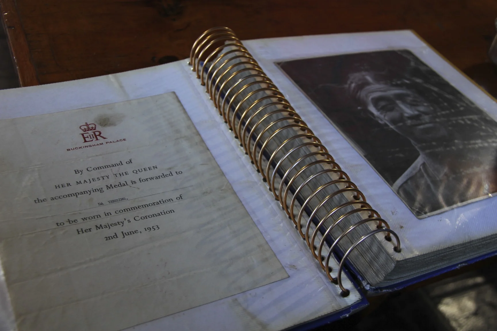
The Tangboche monastery across from the hotel had a puja at 4pm. I thought of going but once I peaked inside, there were 10 monks and 200 tourists crowded in a small space. I decided to try the rhododendron tea and a stale cake from the nearby bakery appropriately priced for the mass tourist market. We were now in the Disneyland of the Himalayas as the Nepalese call the Khumbu Valley.
November 8, 2012 Namche Bazar 3480m
We set off from Tengboche towards Namche Bazar. The trail dropped 800m to the river below and immediately regained the entire 800m elevation on the other side just like Num and Seduwa at the start of this trek. With all the dust, the crowds and being tired, it was awful. I was really thinking how I am not going to do this ever again, at least on this trail. After a relatively short walk we ended up in Namche Bazar. I felt a sense of accomplishment as this connected the two sections of the Great Himalaya Trail: the Baruntse and the Rowaling. On the way to Namche it was all new for me as we approached it from a different side.
Namche is still hopping and has all the trappings of the civilized world. All for sale. Compared to 2010, Namche felt empty. This was confirmed by a bakery owner who said that there was a 30% drop in visitors that year. I had a chance to check the internet, which put me back in real world, which for me is not bad at all. We stayed at the Himalayan Sherpa Lodge. The plan was to go to Lukla the following day.
November 9 and November 10th Kathmandu 1360m
Well, it turned out that Lukla did not happen. Thank God! After last year’s disaster of 2,000 people stranded in Lukla, I did not want to take a chance.
As we were sitting in the Himalaya Sherpa Lodge last night, the owner mentioned something about the cargo helicopter that takes the local people down to Jiri where the road starts and that it is possible to catch a bus to Kathmandu from there. Peter (an Australian fellow who I met in the lodge) asked him what the deal was with the flight? The owner made some calls and said to be at the Namche airstrip at 6 am the following morning. The charge was $165 US and 3,000 Rs for the guide. I was especially concerned about the Lukla flight situation as AGNI airline just went out of business. Furthermore, we enjoyed the fabulous weather for so long that it was bound to change at the most undesirable moment. Peter called his agent in Kathmandu and arranged for a car and a driver to meet us in Jiri. It all seemed very good. The prospect of walking to Lukla with hundreds of tourists in the dust was not appealing. Compounding all the reasons for not going to Lukla, was my lingering cough and the shortness of breath when walking up.
We got up at 4.30 am had some tea and a toast and off we went to the airstrip. As we were walking up I saw the rising sun hitting the tops of mountains. There, in the distance, was Pancharmo and Teshi Labtsa pass from the year before. I can honestly say that I did not get excited even one bit. I did not care to see another mountain and I just wanted to get out of the Khumbu.
The old Russian cargo helicopter brought heaps of building materials. The beast was loaded up to the rafters with lumber and other things.

It took a large group of men 40 minutes to unload it. Once the lumber was taken off, we and the group of locals boarded the cargo bay. We sat on our bags and off we went. The beast started to shake and vibrate, once the rotor speed was reduced it slowly lifted off the ground and we went on. It was a cool experience; we flew over Namche and by the giant peaks surrounding it.

After a smooth and very stable flight the beast landed in Jiri. The sea of green was a big contrast to Namche that sits barely at the tree line. We had to carry our bags to town and ended up in some hole in the wall teashop that Peter visited on the way up to Namche. After some time we transferred to another Sherpa guesthouse where Dorje’s sister was the owner. We drank a few morning beers (if it was up to Dorje we would have drunk much more). He was quite adamant that we stay the night in Jiri but Peter and I wanted to move on.
After great dhal baht we pilled into a small DW car and hit the road. After 7 hours and 158km we ended up in Kathmandu in the Nirvana Garden Hotel where we started out on October 21 exactly 20 days before.
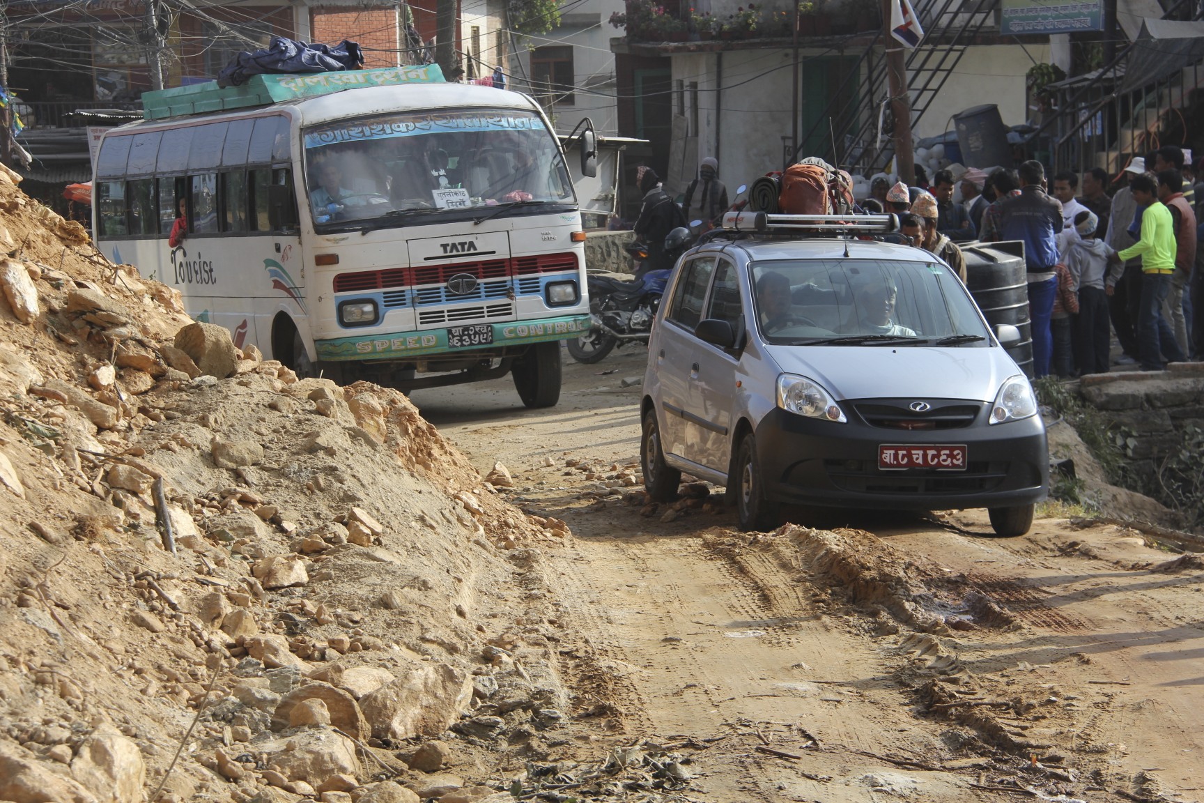
My progress on this trek was much faster than the itinerary. We shaved off 5 days from the original plan. We did not take advantage of the spare days higher up. This was due to the cold and good weather. If the weather is good, everyone wants to move on not to risk crossing the passes in a whiteout. Another problem was the lack of supplies. We basically did not have enough food and needed to get to Chukung to eat. After the desolate and wild Barun Valley, the Khumbu region was not pleasant. Too many tourists packed the trails and villages. Since I had spare time, I decided to visit the Chitwan National Park. I always wanted to go there but did not have the time. It is famous for rhinos and tigers. I thought that it would be like a safari in Africa! And most importantly, there was no altitude!
November 11, 2012 CHITWAN
This morning at seven am I took a bus from Kathmandu to Chitwan National Park. When I asked Rajendra to book the trip to Chitwan for me, he laughed. Apparently I am not the type. I was genuinely interested in the experience and I always wanted to visit this part of Nepal, as it is so different from the mountains. Riding the bus through Kathmandu reminded me that the city was in the total state of chaos.
We got out of Kathmandu after one hour of choking traffic and only at the edge of the city, the smog lifted a little. The road out of Kathmandu to Chitwan was the same one that we took to Arugat on the Manaslu trip.
At 1 pm we arrived in Chitwan 160 km from Kathmandu in the area called Terrai (in Nepal’s lowlands). Terrai reminds me of Uganda a little with its misty forests, rivers and exotic animals.
The village closest to the park where my hotel was located is actually quite nice. The bus stopped in the field and an old dilapidated jeep took me to the hotel. The hotel itself had a half finished feel to it. The room was clean though with a hard bed and shower that did not work. I felt like I was camping again.
After lunch I had a nap. I was so tired from getting up early. I got up at 4 pm and went for a short walk around town and to the Chitwan visitor center. A sad dilapidated exhibit. After, I had a beer on the banks of a river that flows through the national park.
November 12, 2012
Today we started early and after breakfast we took a jeep to the elephant station. Each elephant takes 4 persons into a small basket mounted on top of the animal. We were going to look for the ellusive rhino. The basket is quite small. I really enjoyed the forest: green, and full of life. It was such a great contrast to the lifeless world of snow and ice. When we were crossing the Honku Basin in front of Baruntse, I had a feeling of desolation and lifelessness. Nothing lives there and the glacier has a hollow and empty feeling about it. I think it would be quite natural to die in the forest while a death in the high mountains would be desolate and lonely. The dead organisms in the forest just decay away and rejoin the circle of life. High in the alpine, things just dry up and mummify.
The elephant moves through the forest with an ease of a ship in the ocean. Slow, steady and quiet. Sitting up high, I can see a lot, having a commanding view over the tall grasses and shrubs. The elephant driver and the animal have a deep connection.

They are lifelong friends and each elephant has only one driver. The driver controls the animal by kicking it with bare feet behind the large ears and by talking to him. Sometimes, the elephant gets a poke with a stick and a metal hook to stress a command. The elephant is a very obedient creature and follows the driver. We went on an obvious and well-used path and came across two rhinos. It was great to see such majestic creatures in the wild. The elephant riding was very special as well.

After the ride, we went back to the hotel. I went back to the village, bought some local honey and walked around. I really like the quiet and sleepy feel of this place.
After lunch, we went for river “cruise” in a dug-out canoe. We glided silently on the river in a beautiful thick jungle. We came across crocodiles in the river and on the banks. We also saw may birds. The canoe driver pushed the dug-out boat with a long sick. Eventually, we got off on a bank and had to walk back to town through very tall grass. To my surprise, the guide, who was carrying a long stick and a book, announced that we needed to be fast and quiet as the Bengal tigers live in the grasses. I was a little apprehensive but also amused by the situation. We ended up in an elephant-breeding center that was very interesting. The animals seemed well taken care of and genuinely loved by their keepers. It was a full day that I enjoyed very much.
November 13, 2012
Today I took the bus from Chitwan back to Kathmandu. I bough an extra seat for 400Rs as one seat was too tight for me. After six hours of rattling we ended up back in the chaotic Kathmandu. There was a festival of lights, Tihar going on today. It is an important festival and people are doing puja in front of their homes and businesses. They also put garlands of marigolds on their shops and homes. I met with Peter the Australian for a pizza at Fire and Ice. He was not feeling well but had a flight back to Australia at 11.30 pm. After a coffee at the Himalayan Java, we said our goodbyes and parted ways. Another full day, tiring but very eventful. Tomorrow. Sangey invited me for lunch to his home. I am ready to go back home.
November 14, 2012 Kathmandu
Today was my last day in Kathmandu. Sangey, my cook from the Mt. Kailash trip in 2007 invited me to his home for lunch. He said that he would pick me up at 9am. These affairs are long and take up the better part of the day. I could not refuse as they are very nice people and mean well. They put their heart and soul into these events. And, Sangey is a very nice man.
We went to his home at 9.20 am and he lives very far from where I was staying. The taxi to his place was 500Rs (which is a lot by Kathmandu standards). Once we arrived, Sangey had to make the lunch, which would take two hours. He parked me in a dark room and brought a large beer (at 10am) and insisted that I drink it, as there was another waiting for me. His son was keeping me company. I sat in the room for an hour listening to a really bad rock band practicing really loud music next door. They made up for the lack of musical talent with volume. The noise was really loud. At 11 am Sangey reappeared with chicken curry, which he served to me in the dark room. I later moved myself to the kitchen to join the others.
The entire affair was over by the afternoon and I quickly took the taxi back to the city. I wanted to do some last minute shopping before flying home the following day.
November 15, 2012
At the last moment the Darjeeling taxi driver dropped off my bag with all the gear. I was very happy. The poor men walked for 5 days with it and made it back just in time. What an awesome fellow. I can not say enough how absolutely amazing the Nepalis are. I departed Kathmandu loaded up like a camel.
The flight from Kathmandu to Doha was absolutely spectacular. It went along the spine of the Himalayas along the Manaslu, Annapurna and Dhaulagiri. The plane was only 33% full so I had a choice of a prime window seat. Just when I was ready to say no to any future trips to Nepal, I was exposed to this! The most spectacular scenery ever.


Nepal can be hard, chaotic, random and sometimes even dangerous. The mountains are spectacular, the people are kind and super nice, and the wilderness is awesome. Because of the chaos, Nepal is full of surprises around every corner. It is unpredictable. It is a total adventure and a communion with the most spectacular scenery on earth.
The trek was hard due to the altitude and my cough. I can handle the walking and climbing in the cold, the cough though was too hard, and I felt like I was suffocating at the Amphu Labtsa base camp.
After I got home, I looked at all the spectacular photos and wanted to go back! The photos are of course spectacular when one sits in the warm and comfortable kitchen. I seem to have forgotten the cold, altitude, the cough and exhaustion quite fast. So soon after my return I started to plan the Kangchendzonga trip for 2013. I planned to take my own food, cough medication, etc. It seemed that I would go alone again as I could not find anyone interested. When I am in Calgary I really want to go to the Himalayas, when I am in the Himalayas, I really want to be home. Go figure!
