Nepal Khumbu and Kangchendzonga from the Air
November 26, 2022


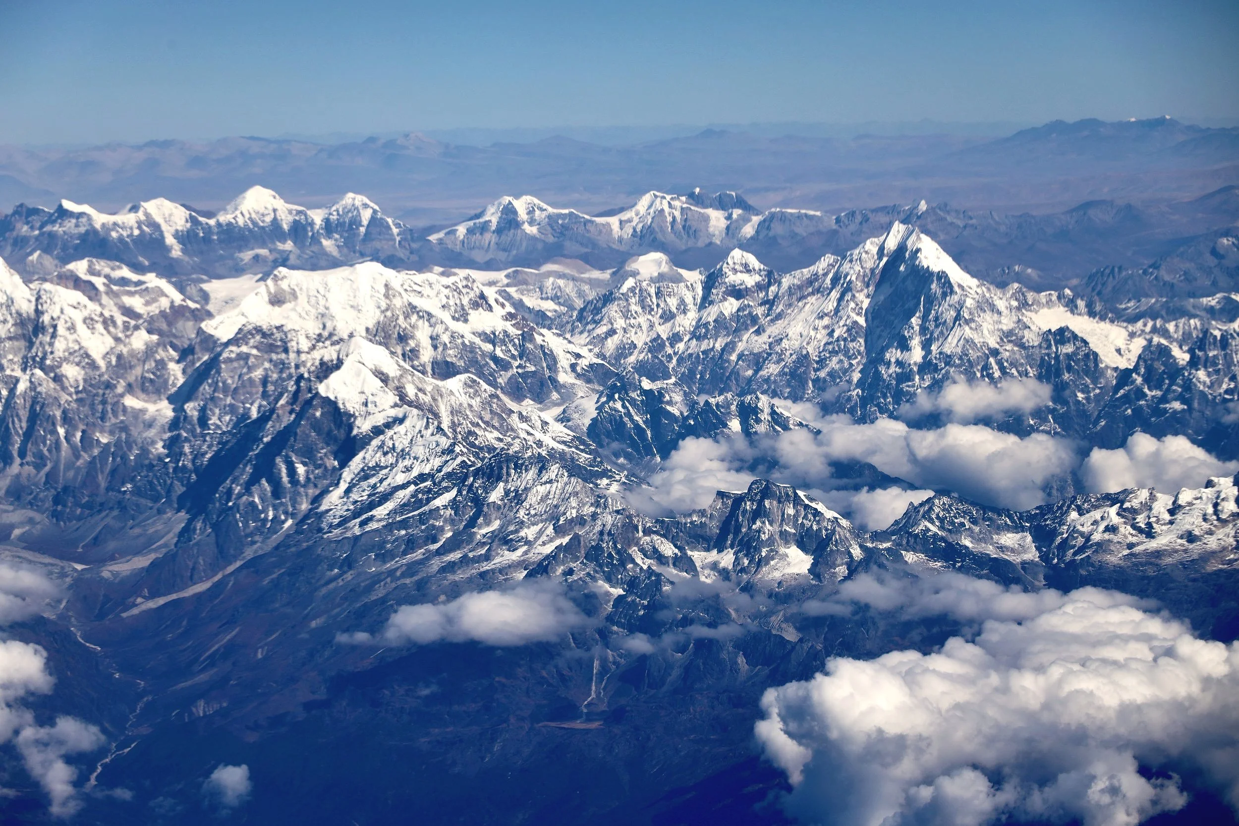
During the COVID shutdowns I had doubts whether I would ever visit Nepal again which was rather depressing. One of the regrets I had, was not doing a helicopter tour of the Khumbu area. Helicopter flyovers provide a completely different perspective from climbing or trekking and provide fantastic opportunities for mountain photography.
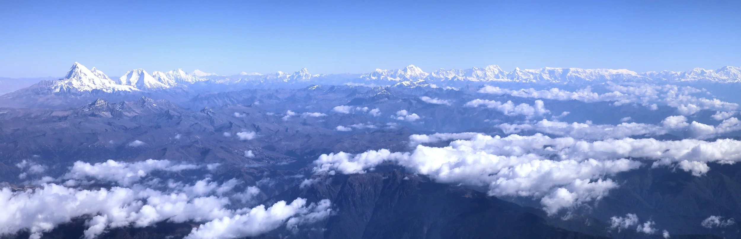
Thankfully, the COVID shutdowns relaxed and I could again travel to Nepal in 2022. The Khumbu was not busy and definitely not at tourist levels as pre-Covid. Thanks to Rajendra from Mountain Sun Valley, I was able to do the helicopter flight. When I contemplated doing this, I had a very specific route in mind which surprisengly was not easy to organize. Normally, the helicopter flyovers focus on Everest and Everest BC but I was interested in the area of the Nangpa Glacier and along the West Khumbu bordering Rowaling Valley. I also wanted to fly along the Cho Oyu - Pumori wall. We later covered the entire helicopter route on foot.
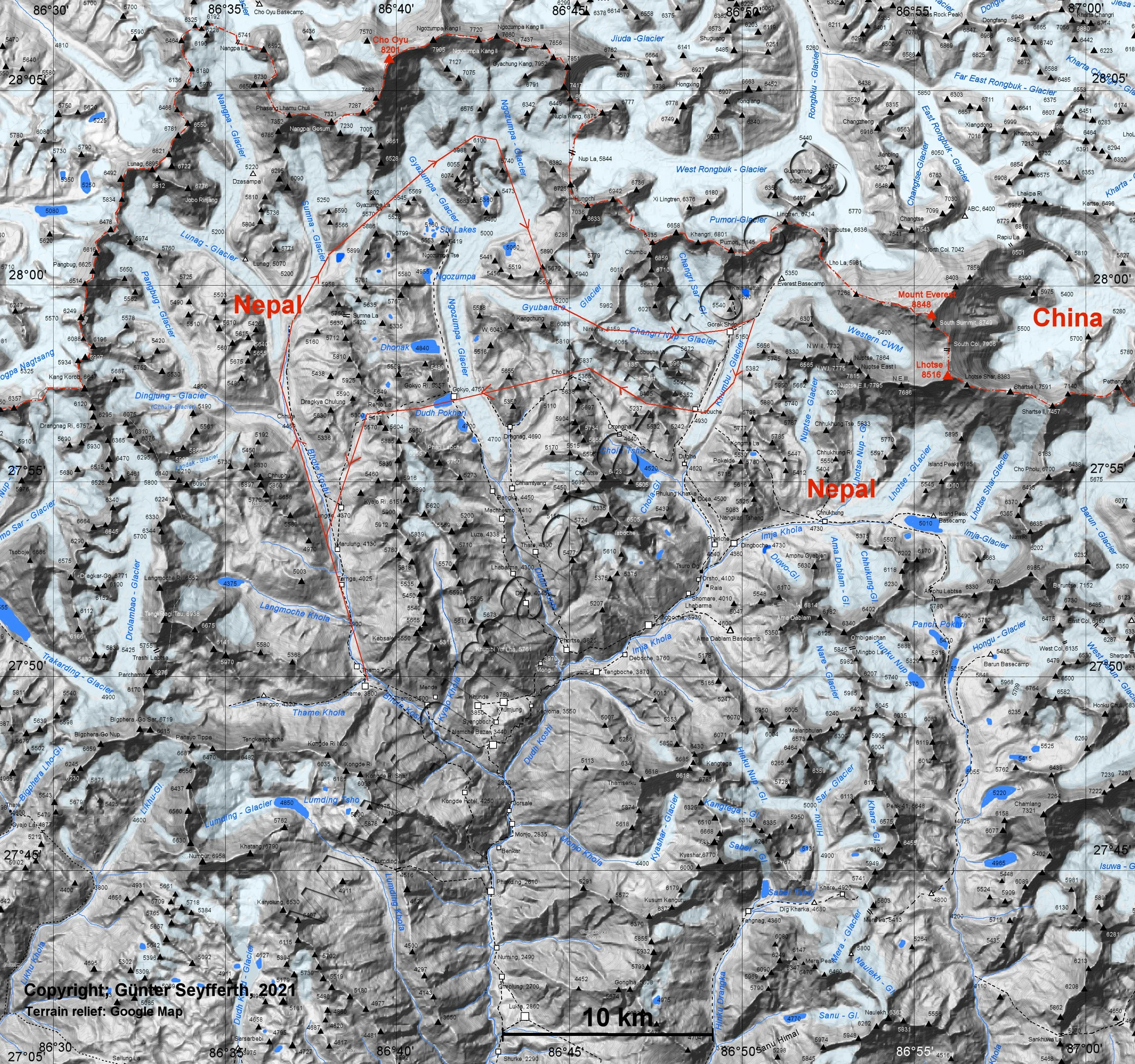
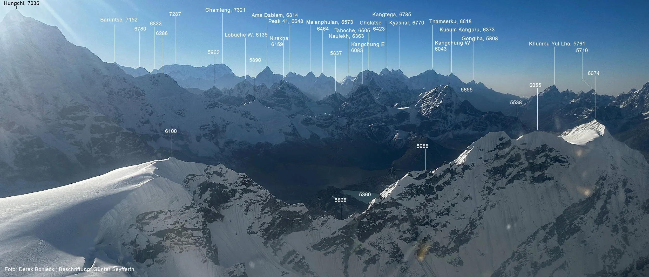
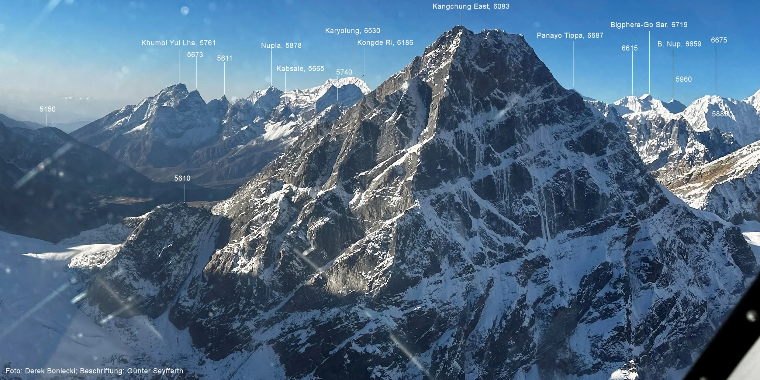
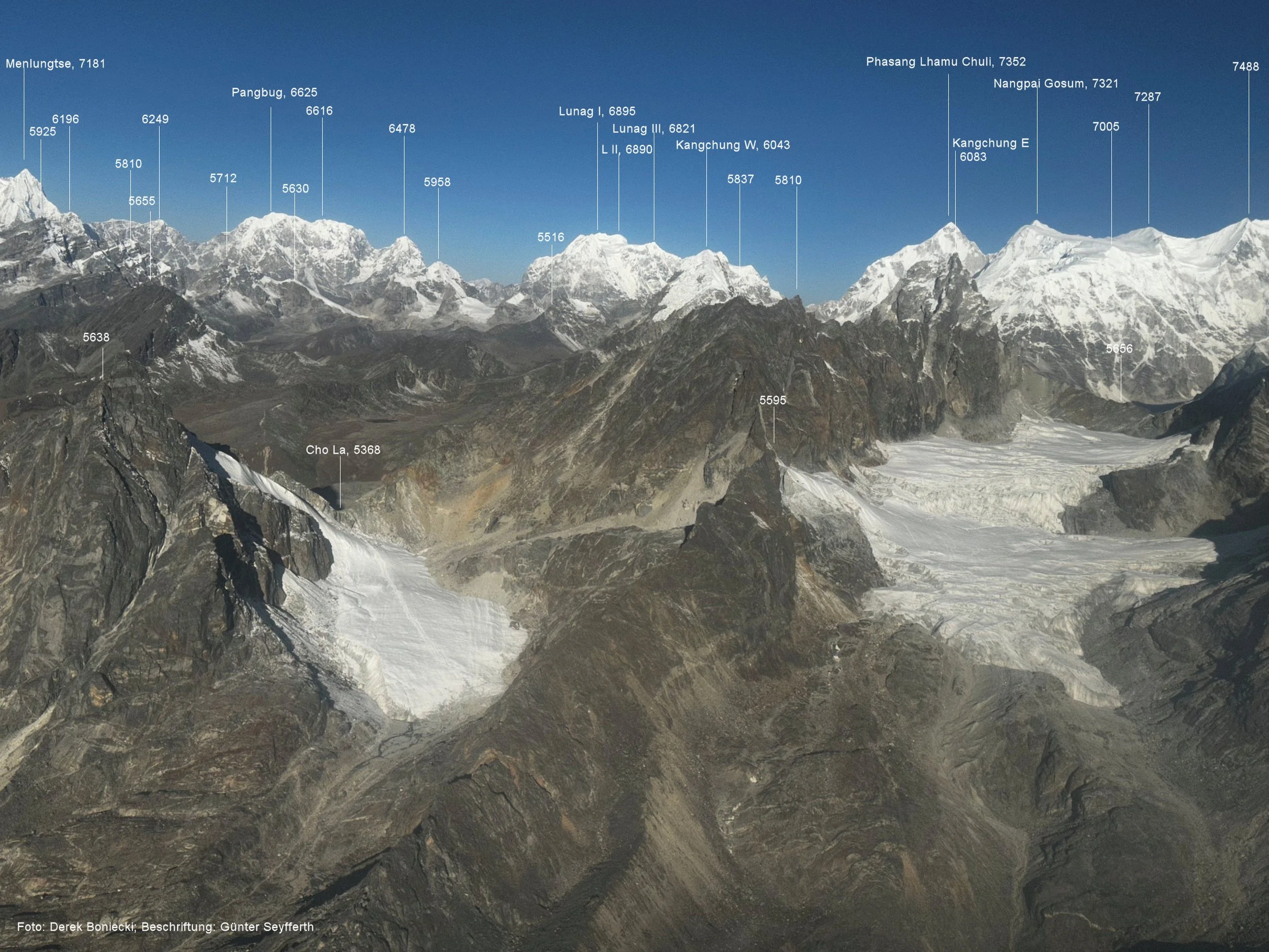
You can see the annotated photos here: www.himalaya-info.org/Khumbu_Helicopter.htm
The flight route. Map curtesy of: www.himalaya-info.org/Khumbu_Helicopter.htm
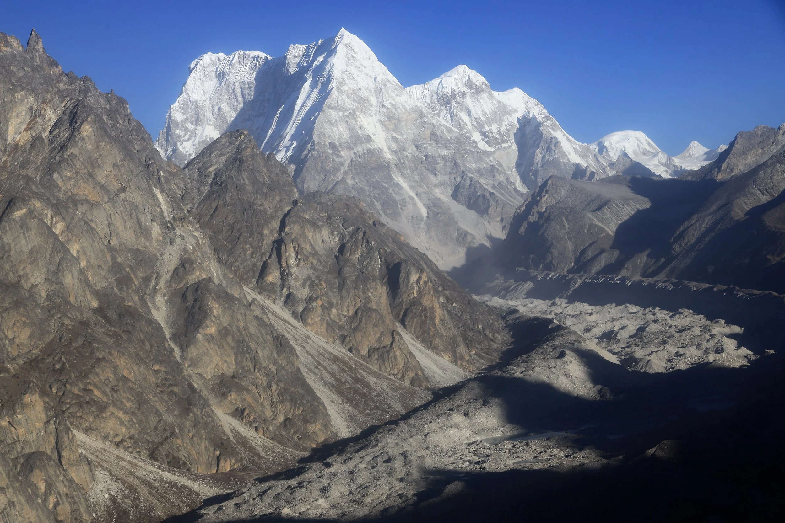
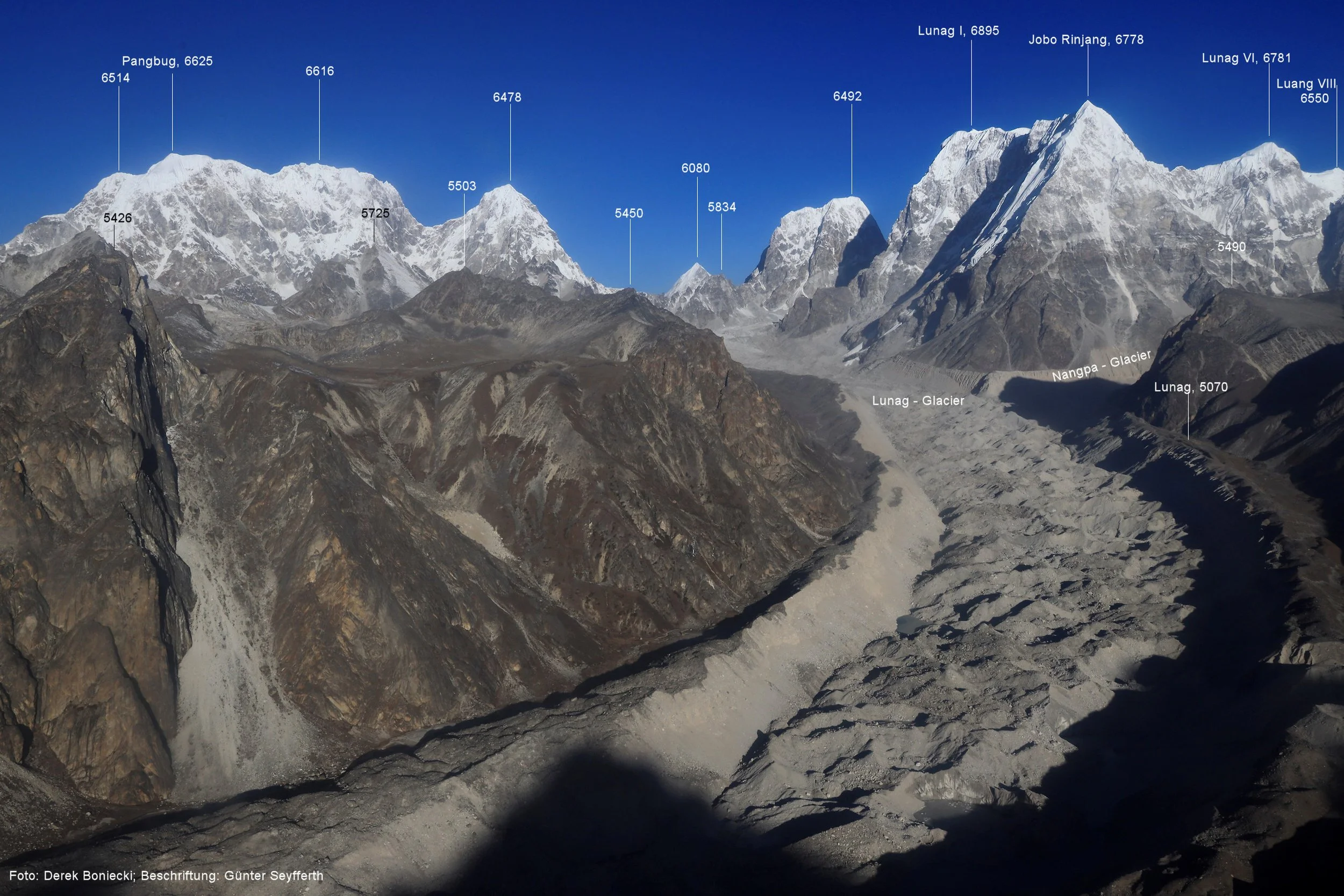
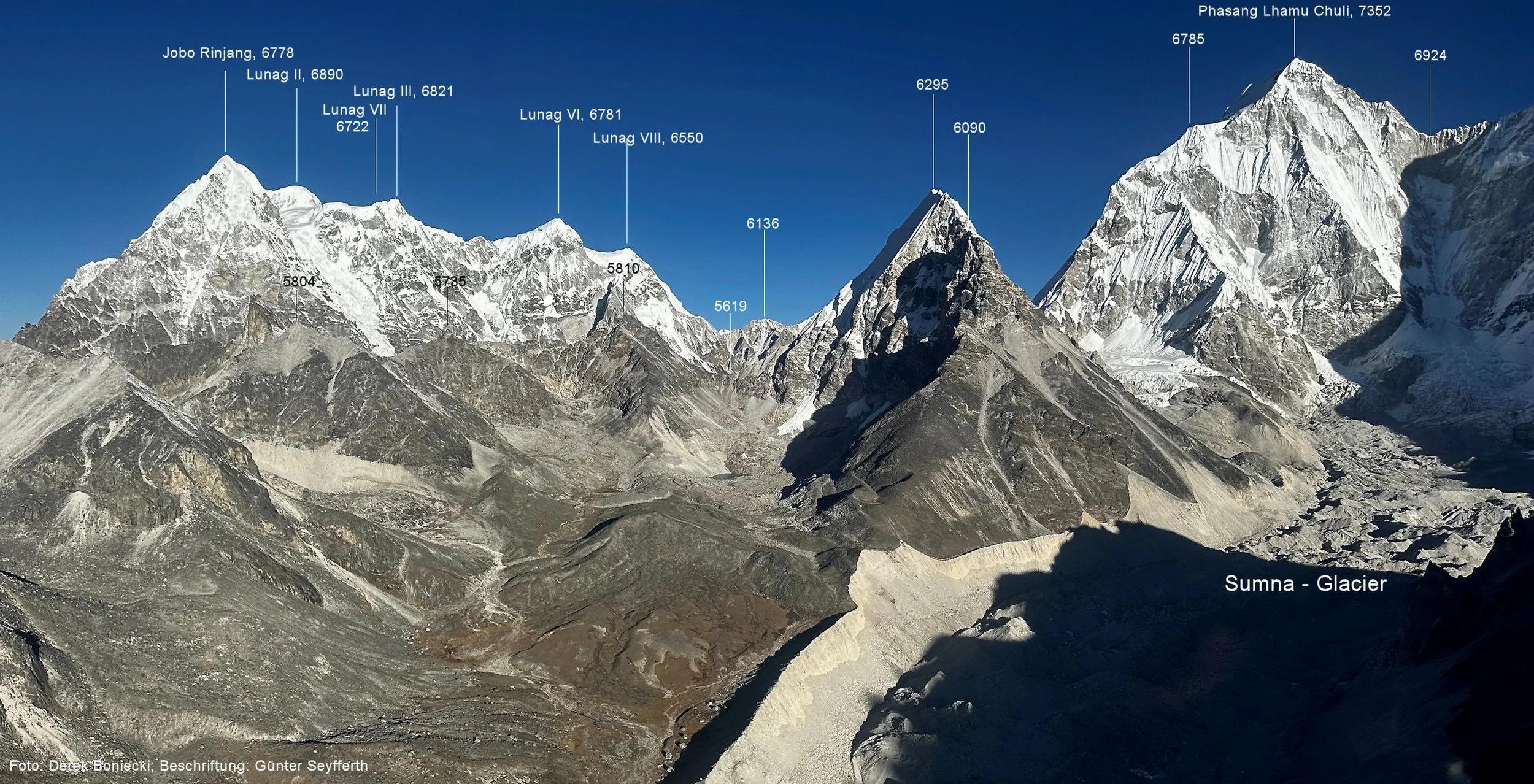
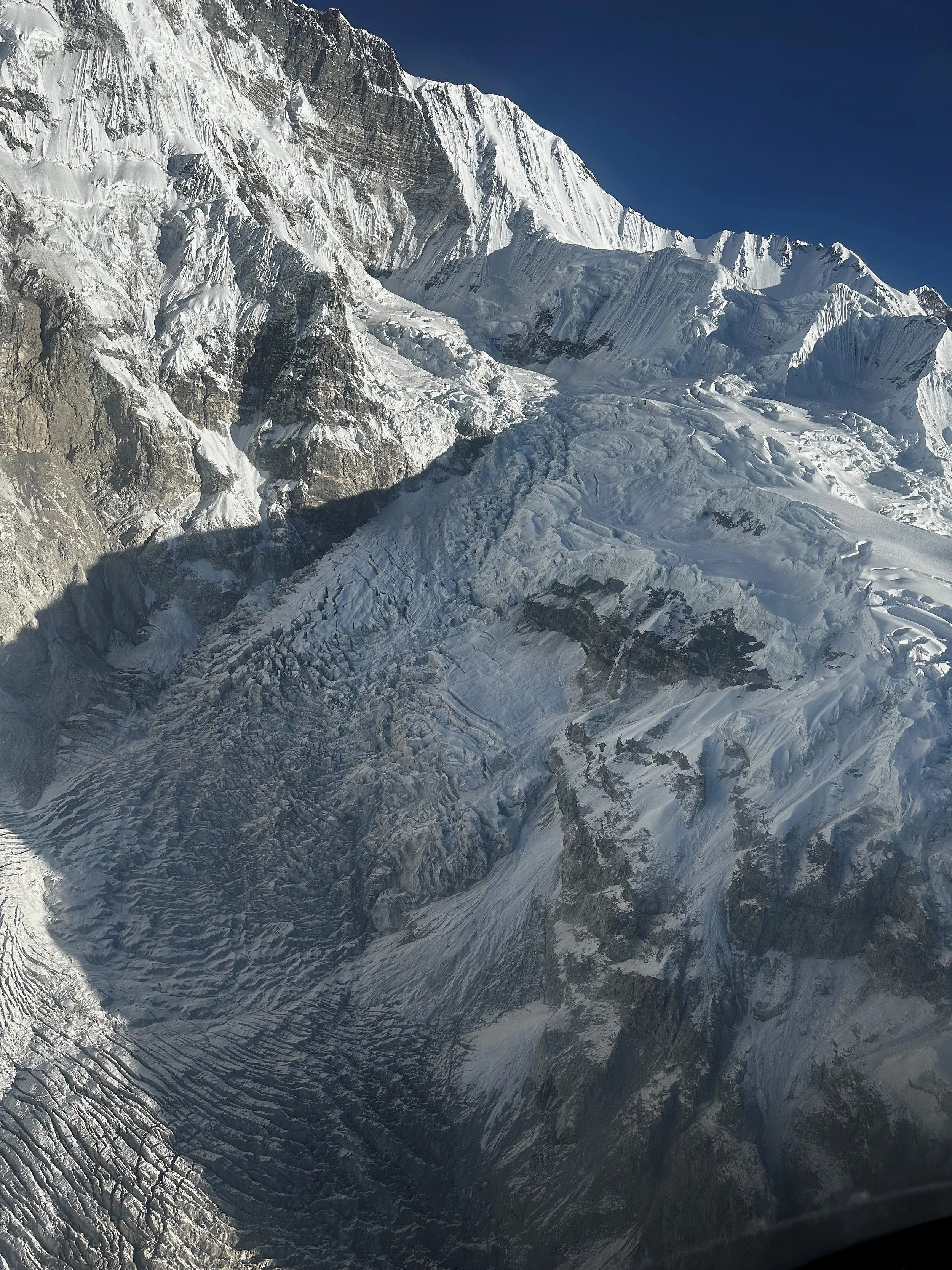
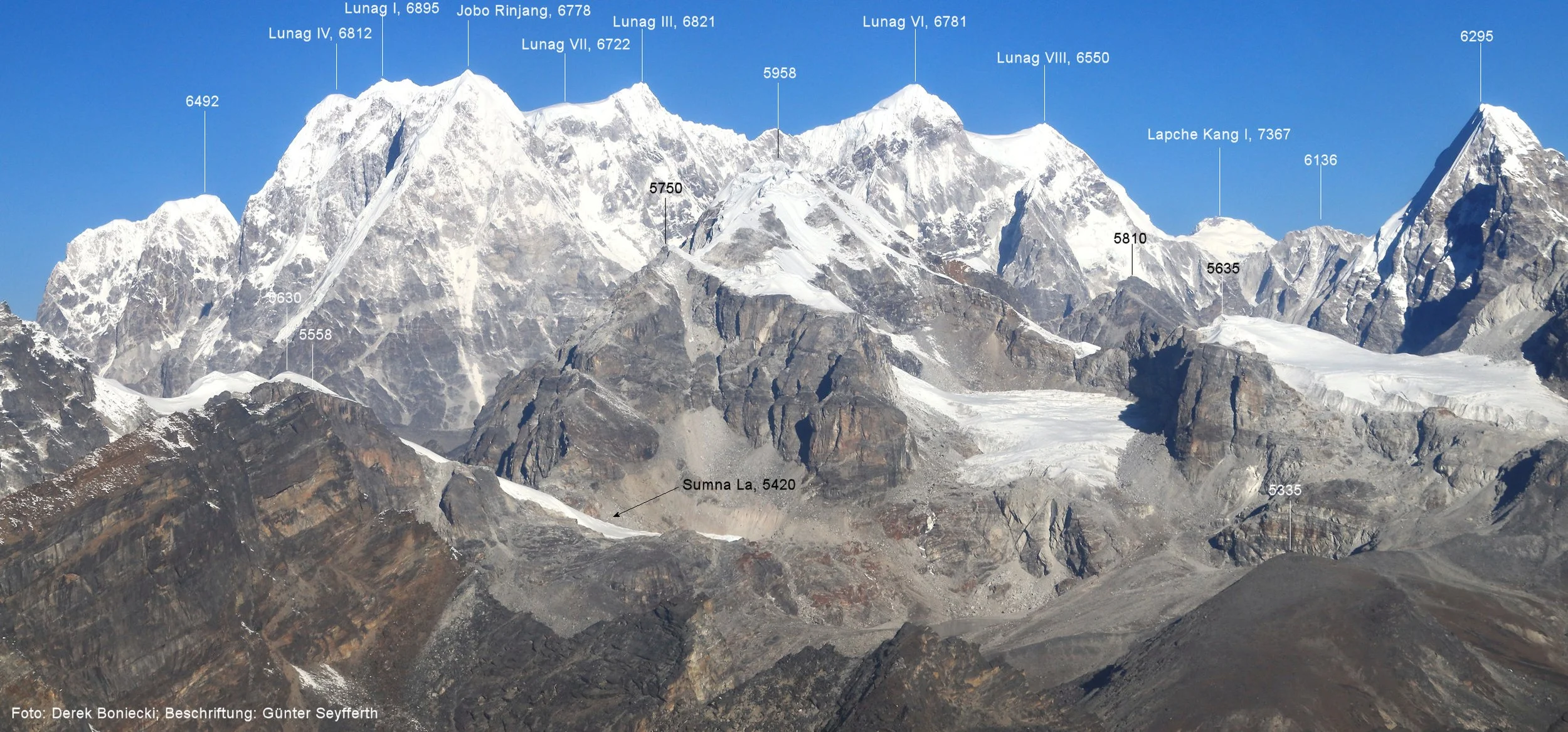
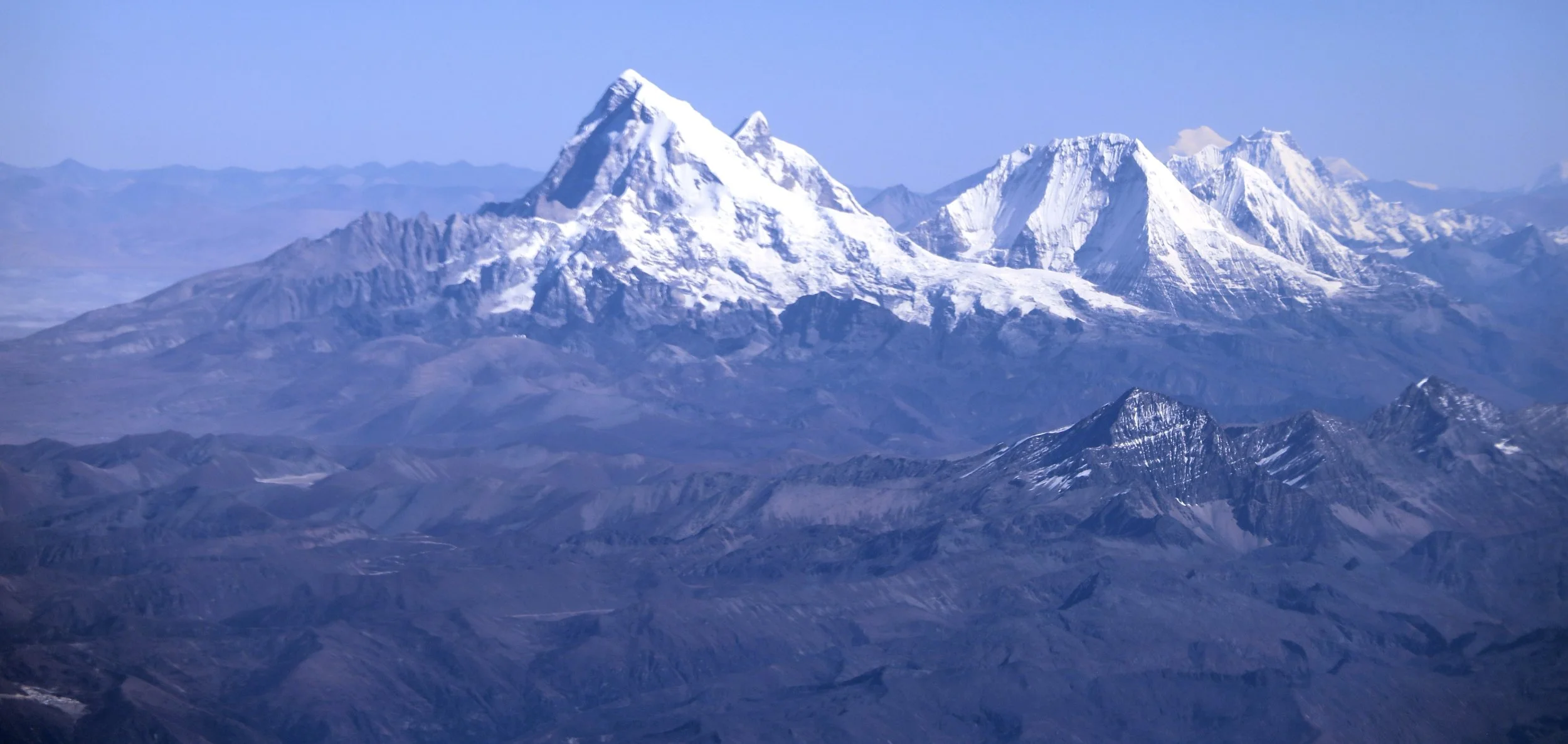
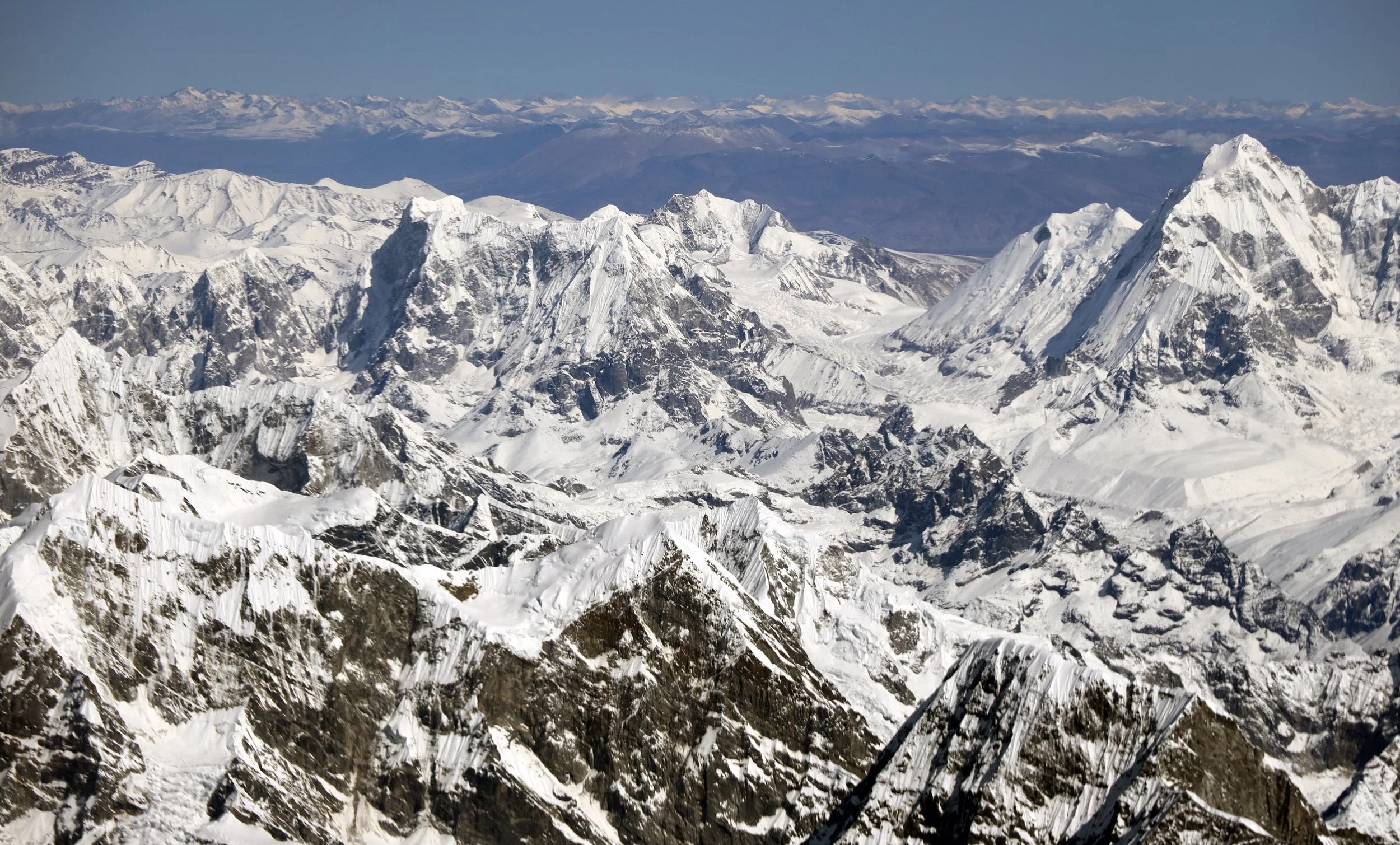
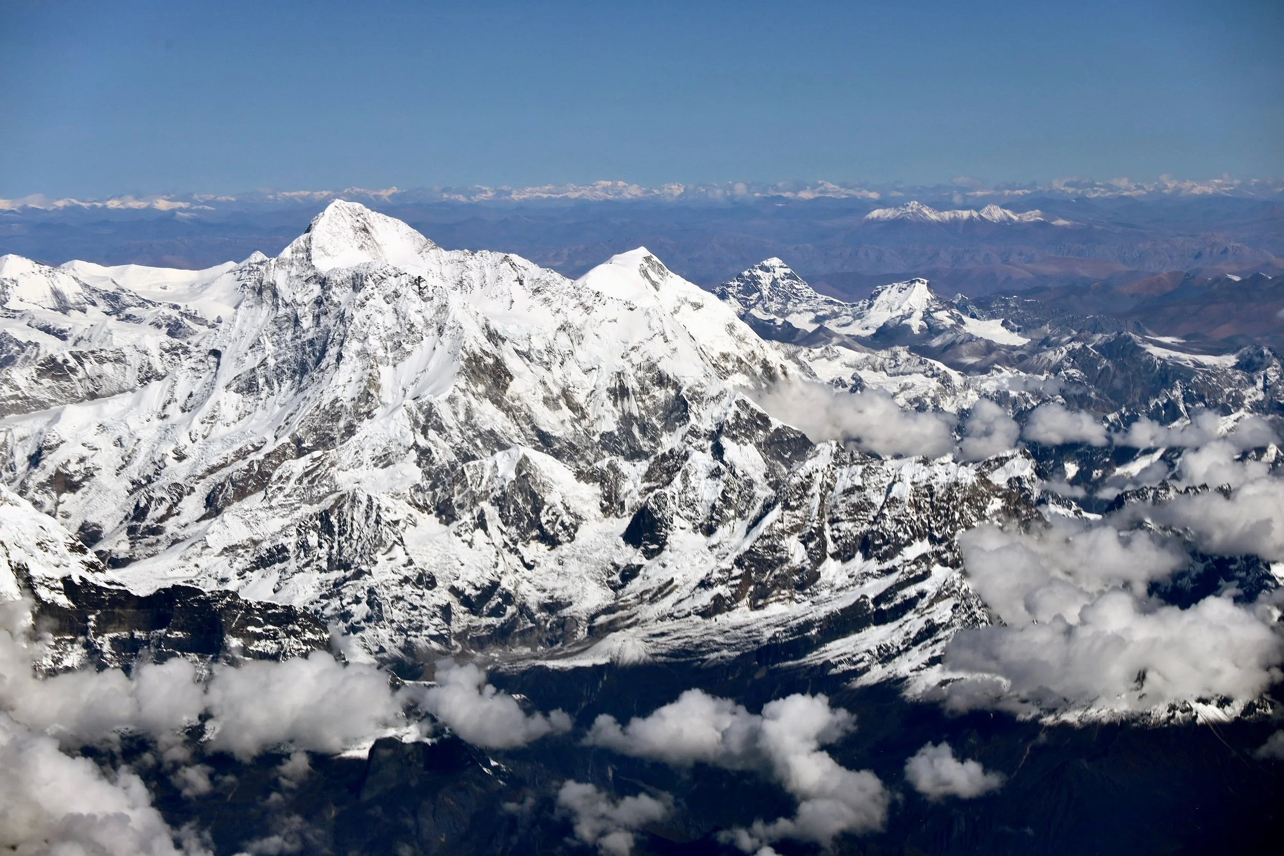
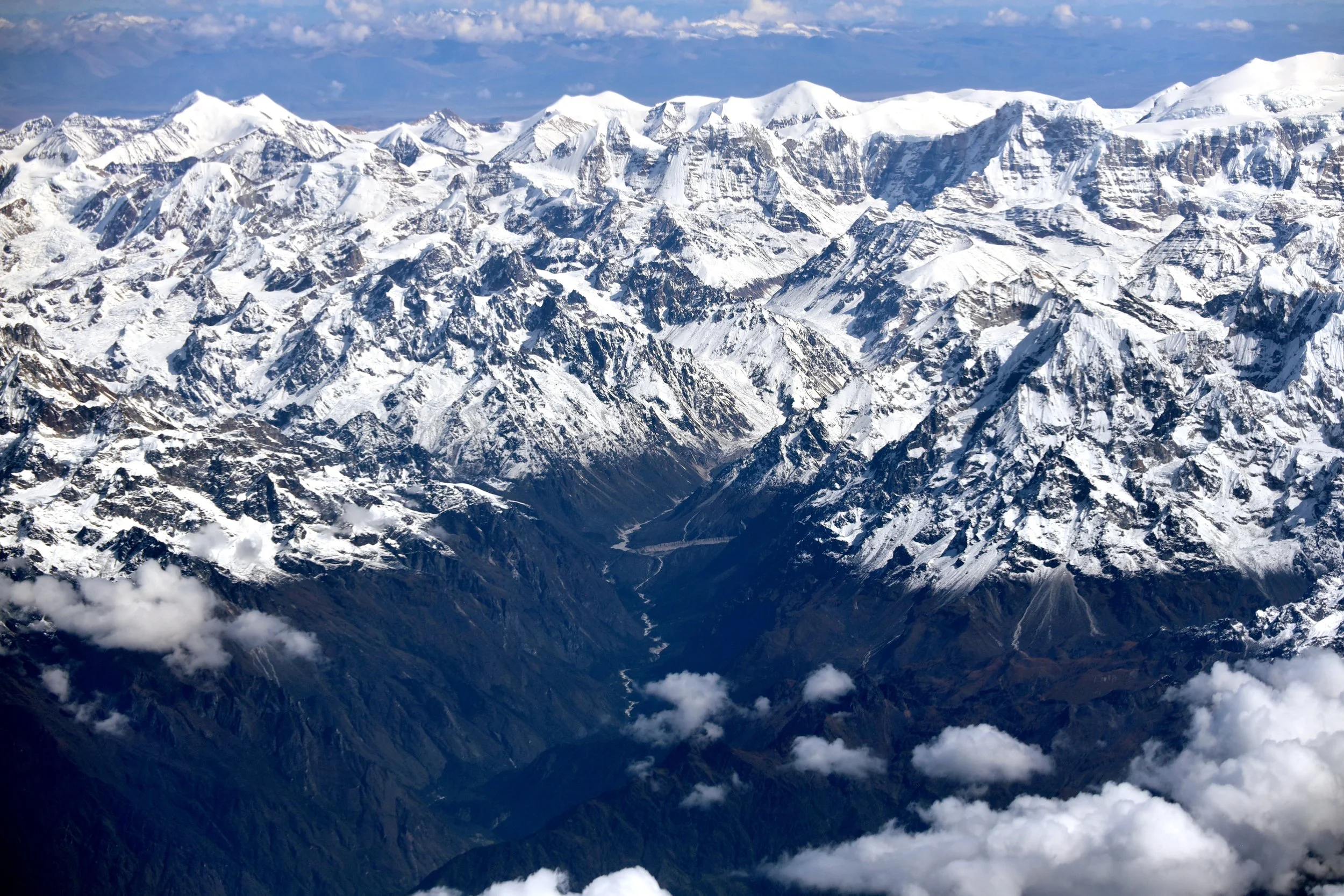
Moving up the Thame Valley towards the confluence of the Bhore Glacier and Lumsumna Glacier. The tall point mountain is Lunag 1 6907. The mountain behind Lunag is Nzacampa 6797m. Nangpa La is visible on the right.
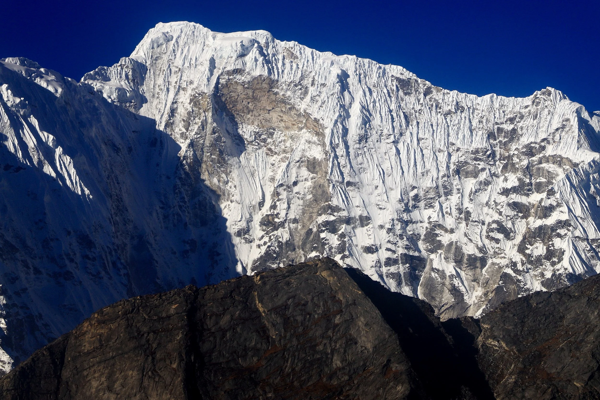
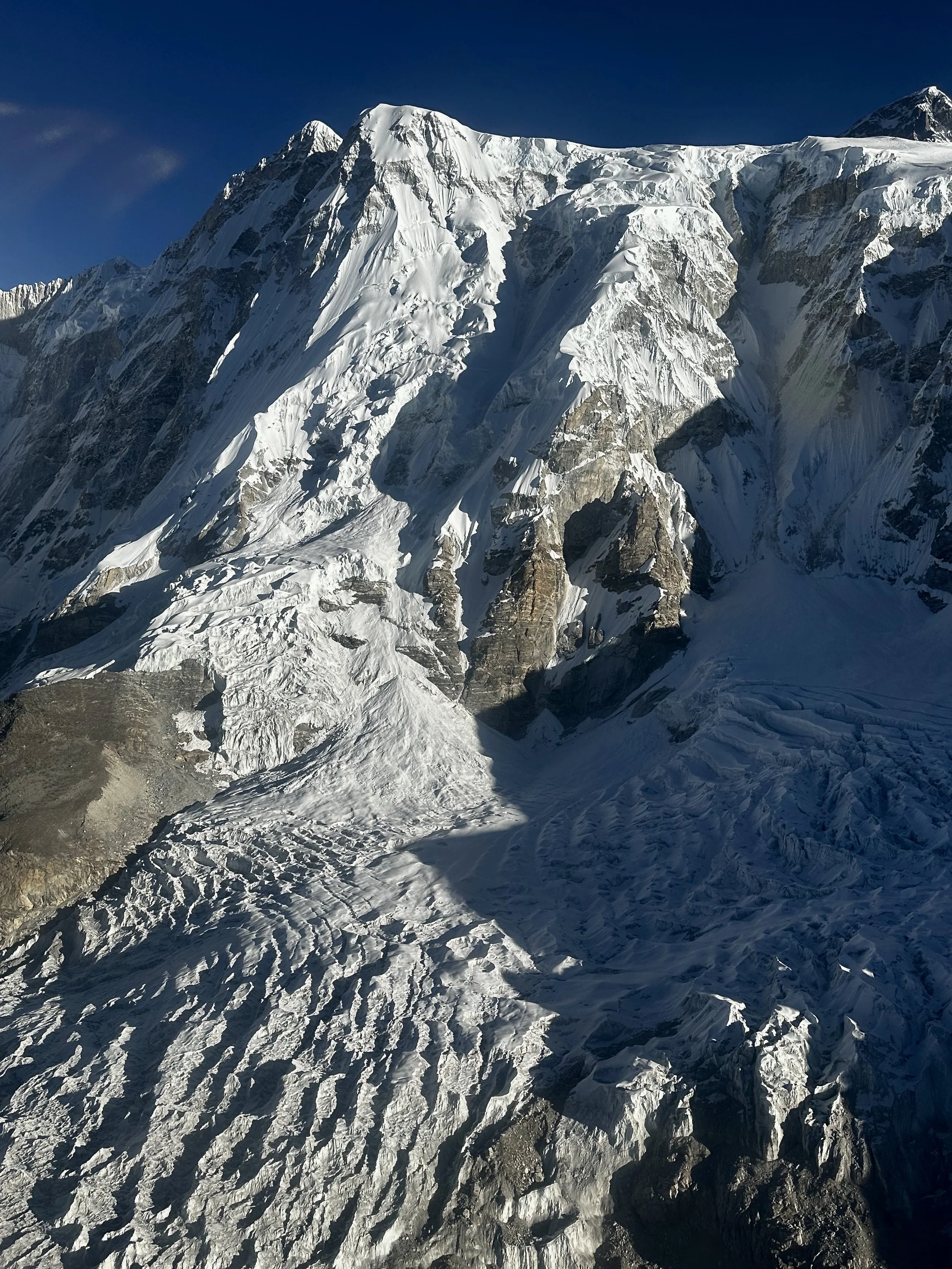
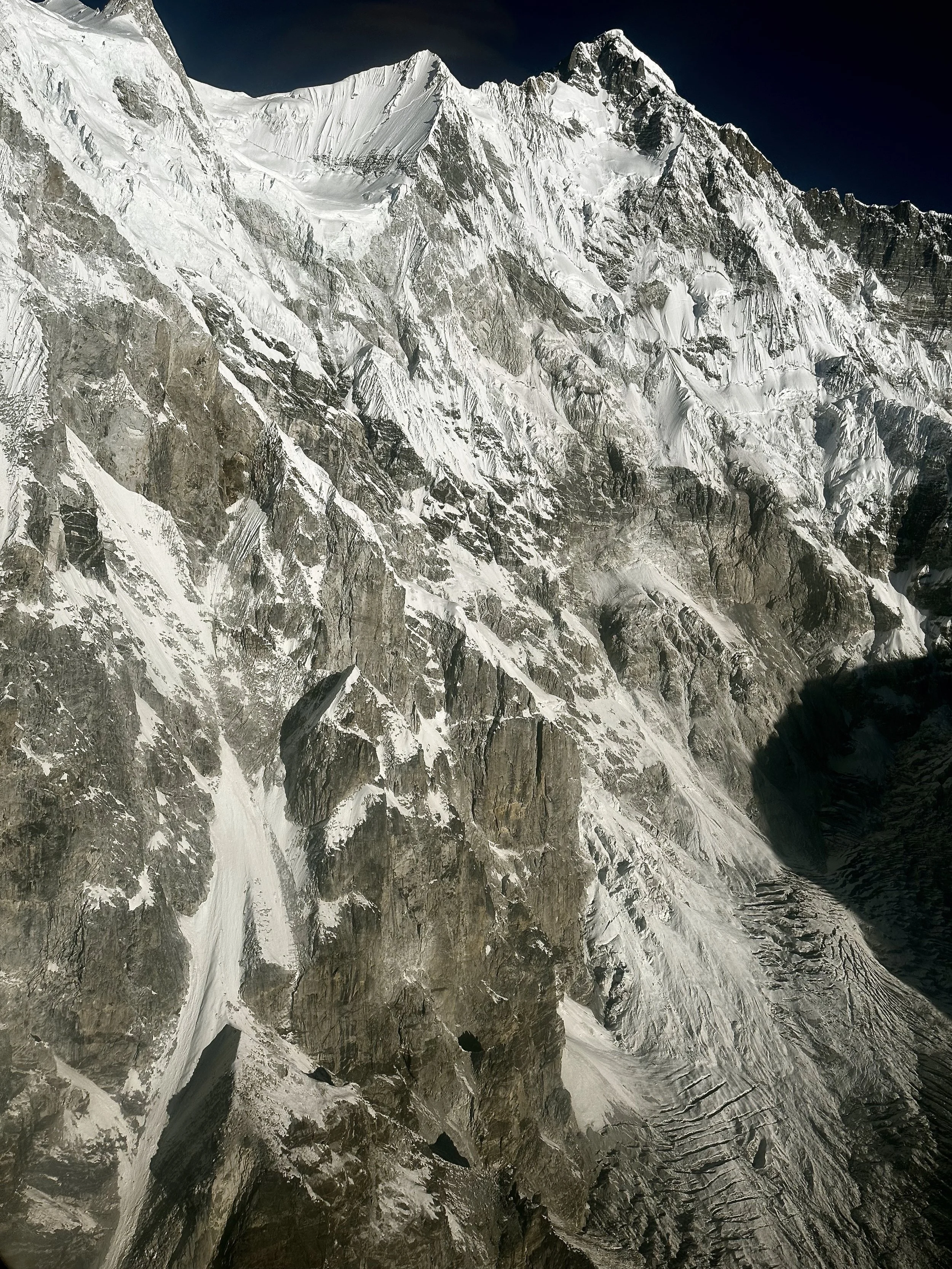
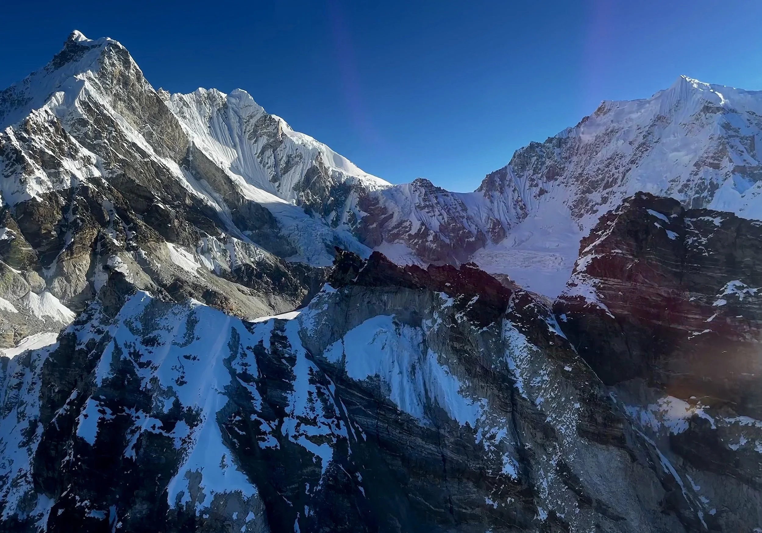
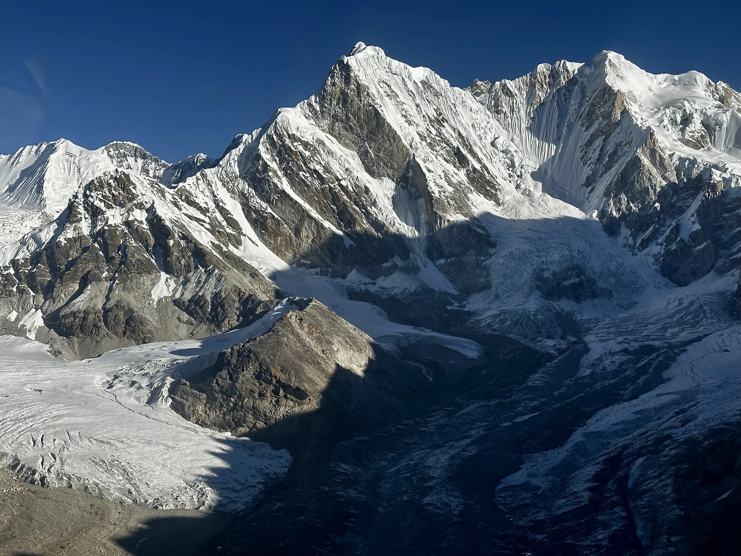
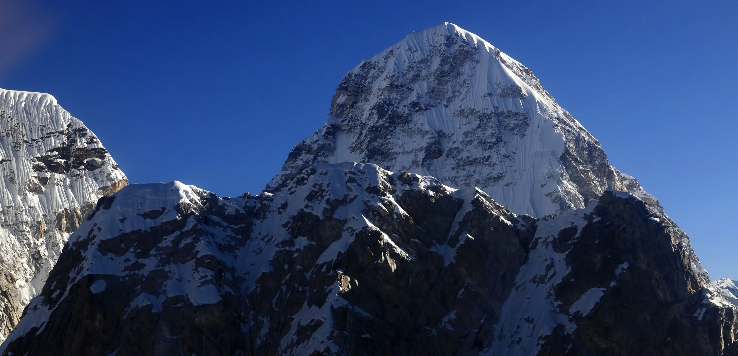
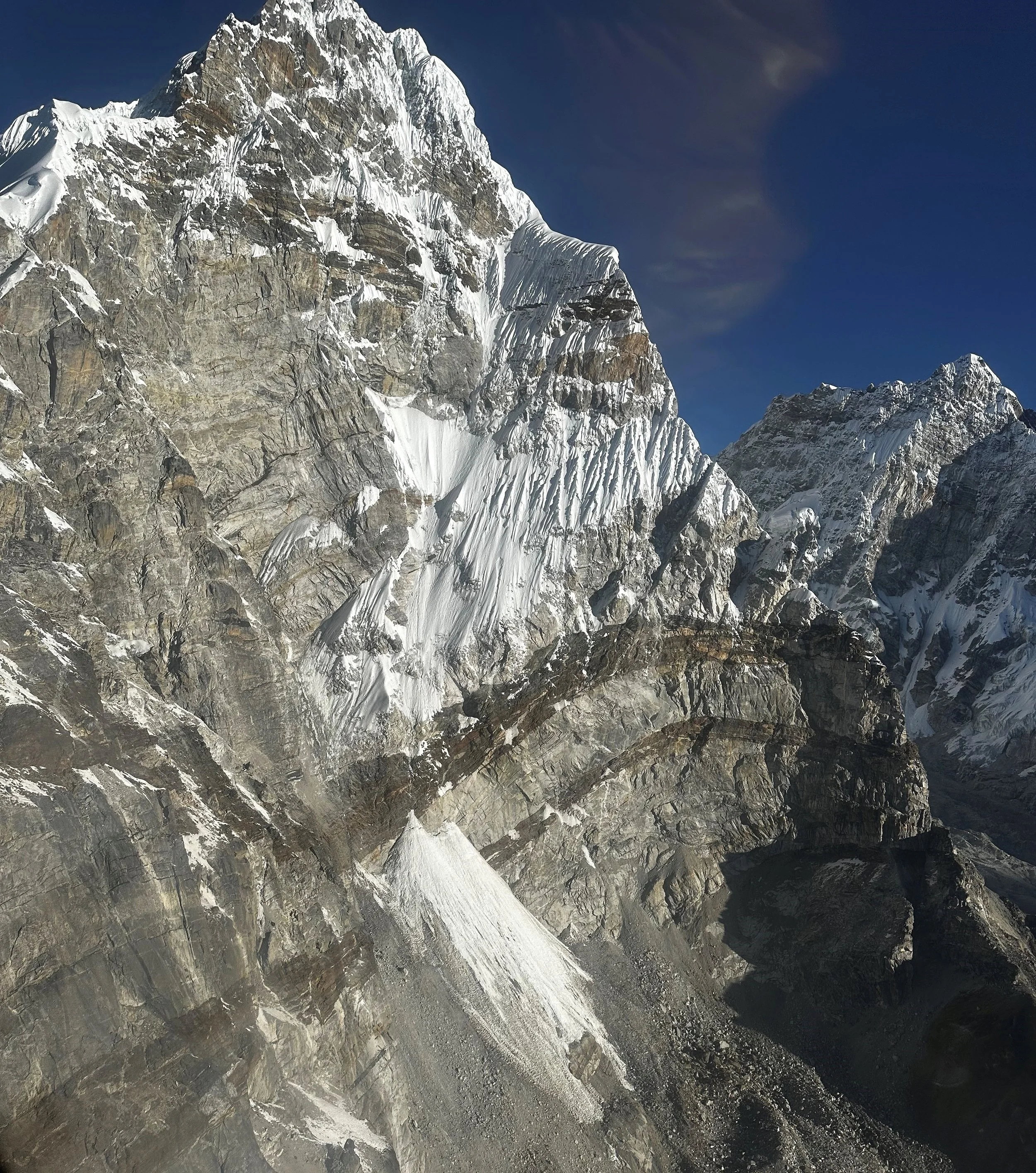
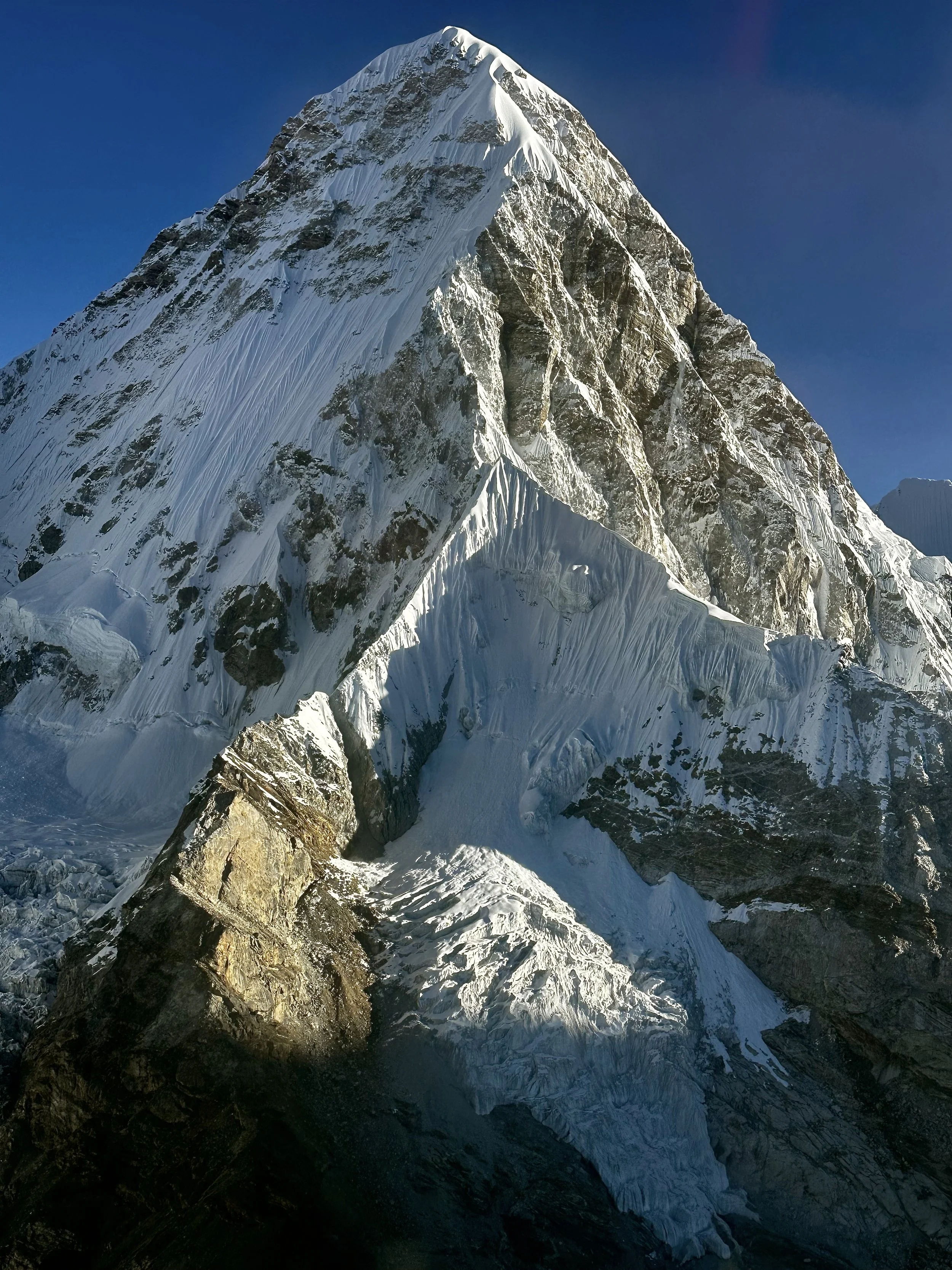
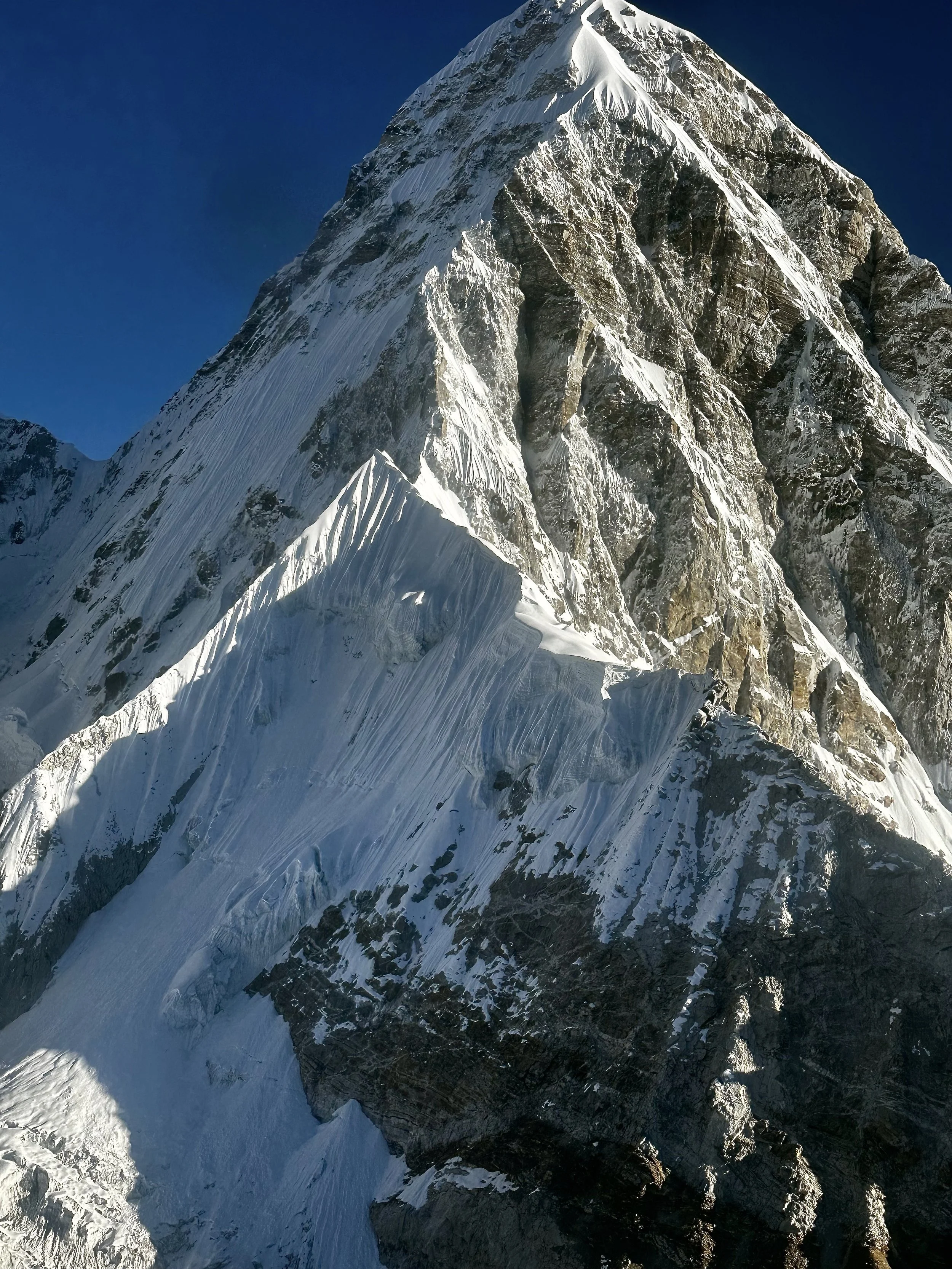
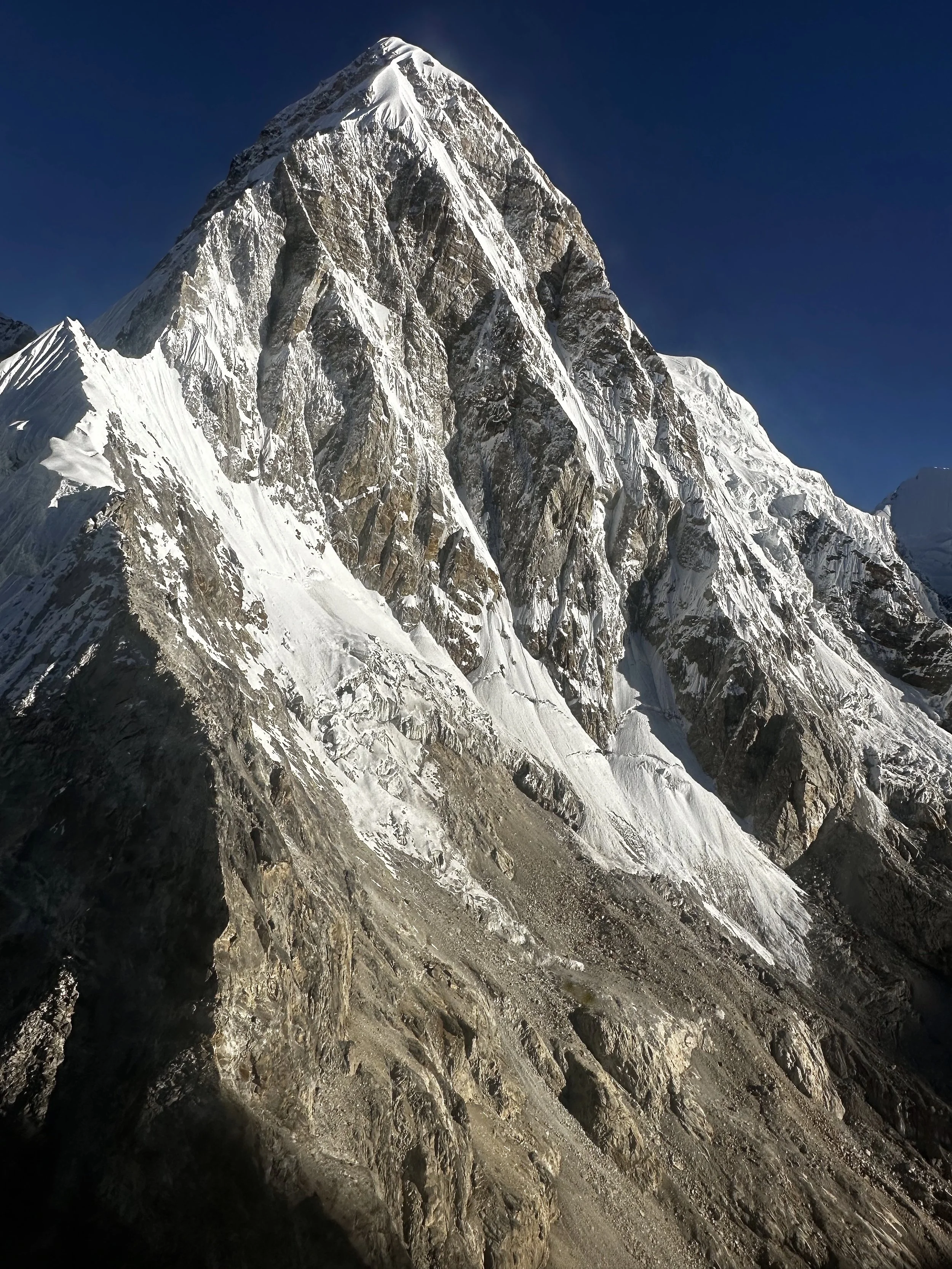
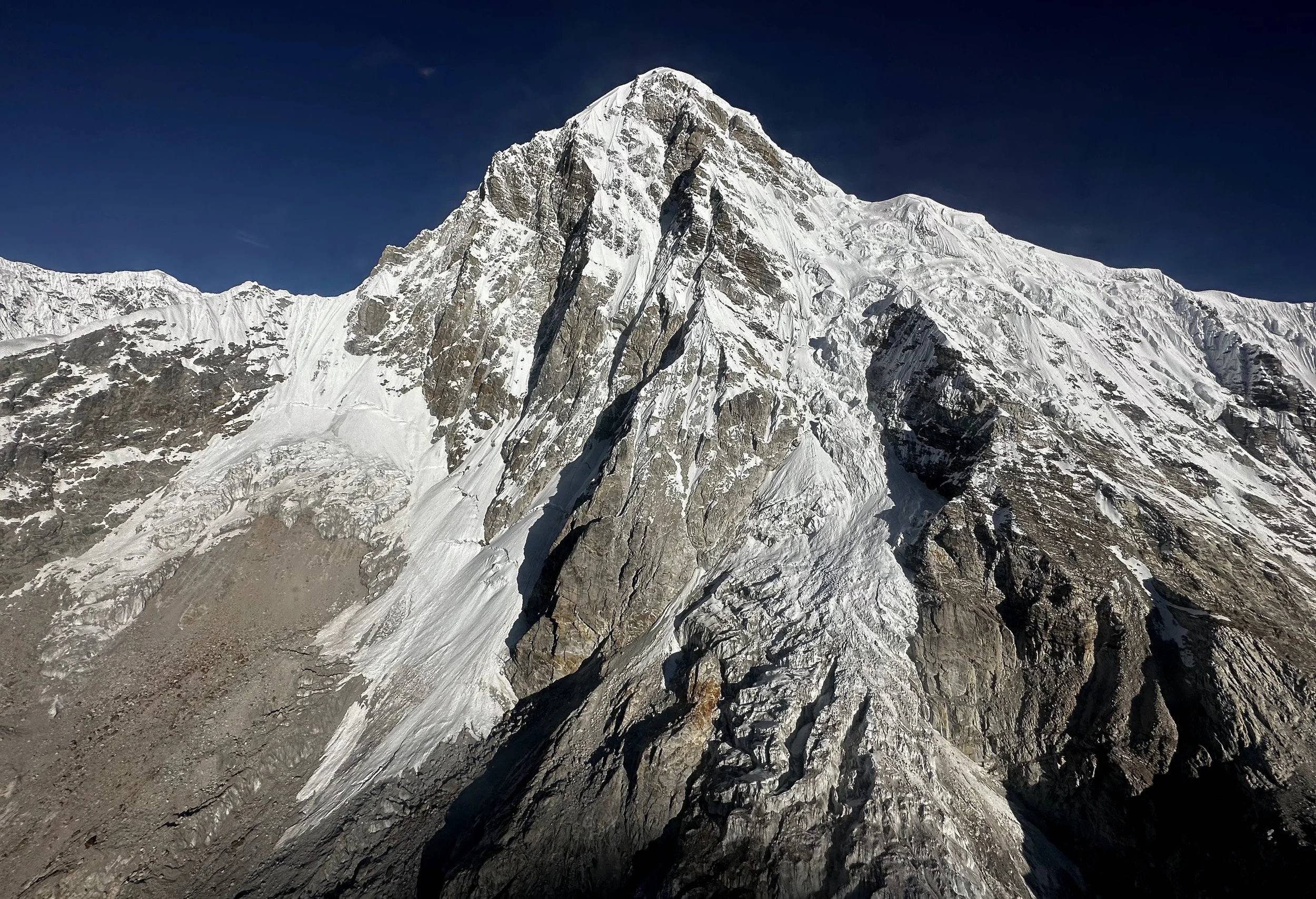
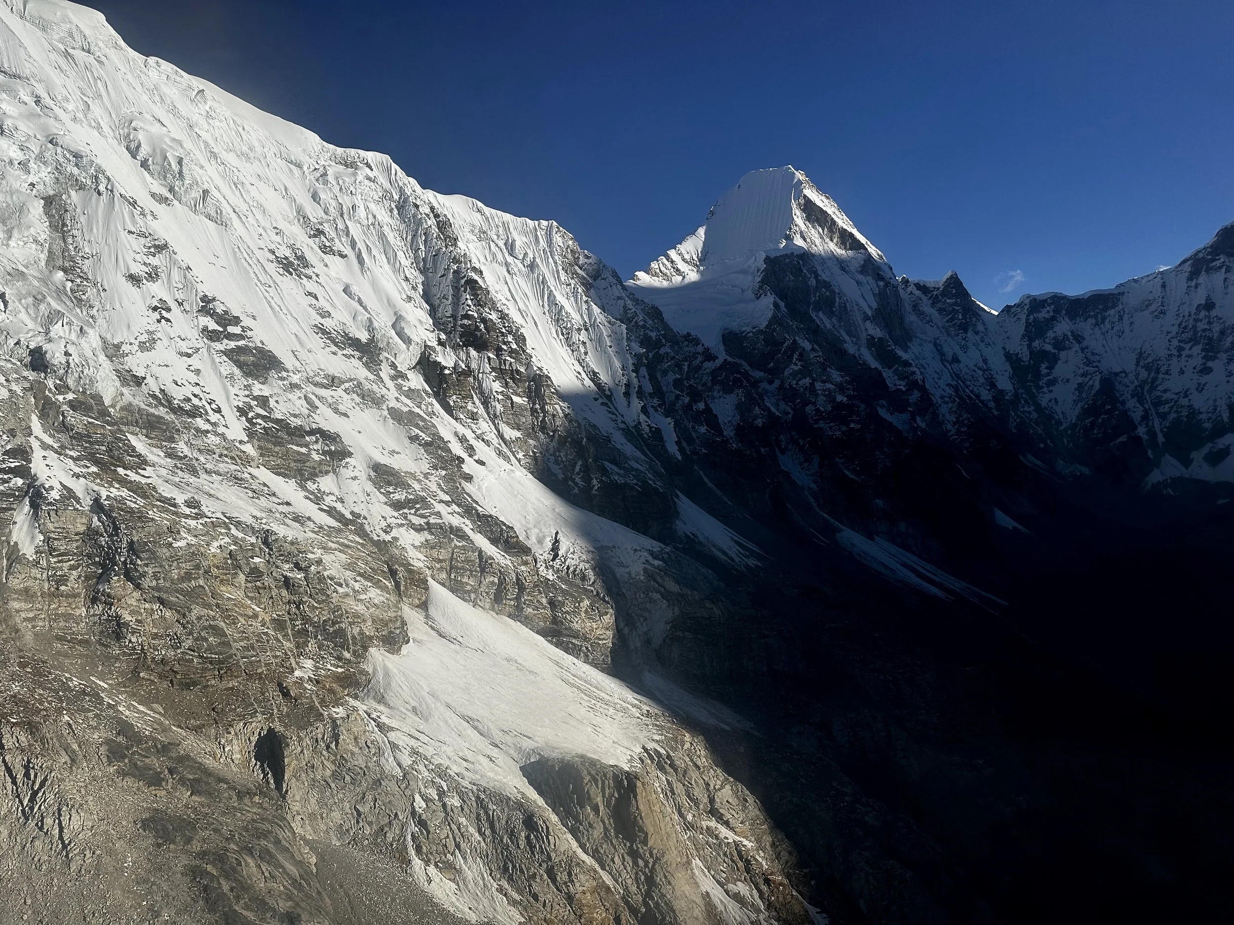
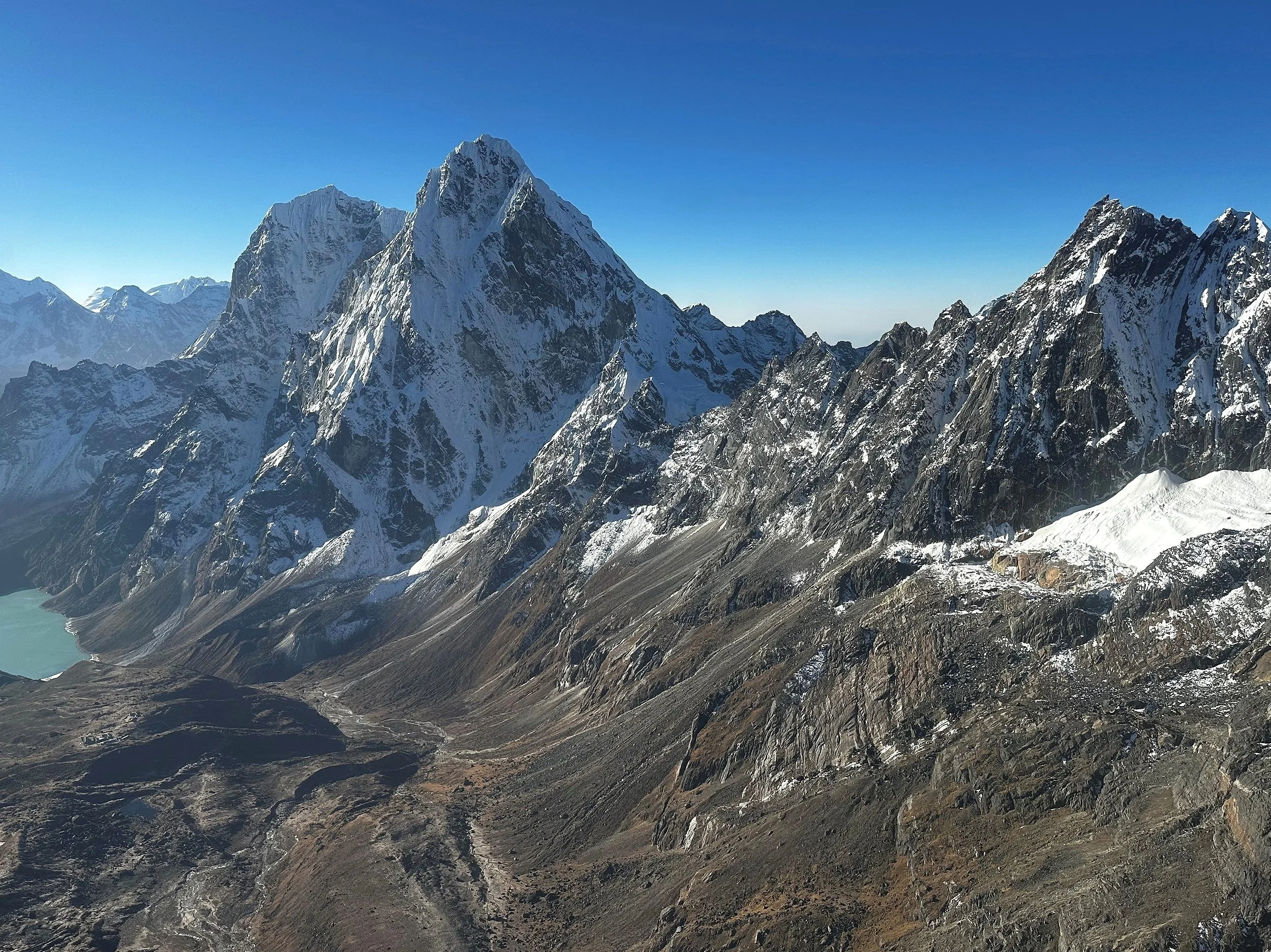
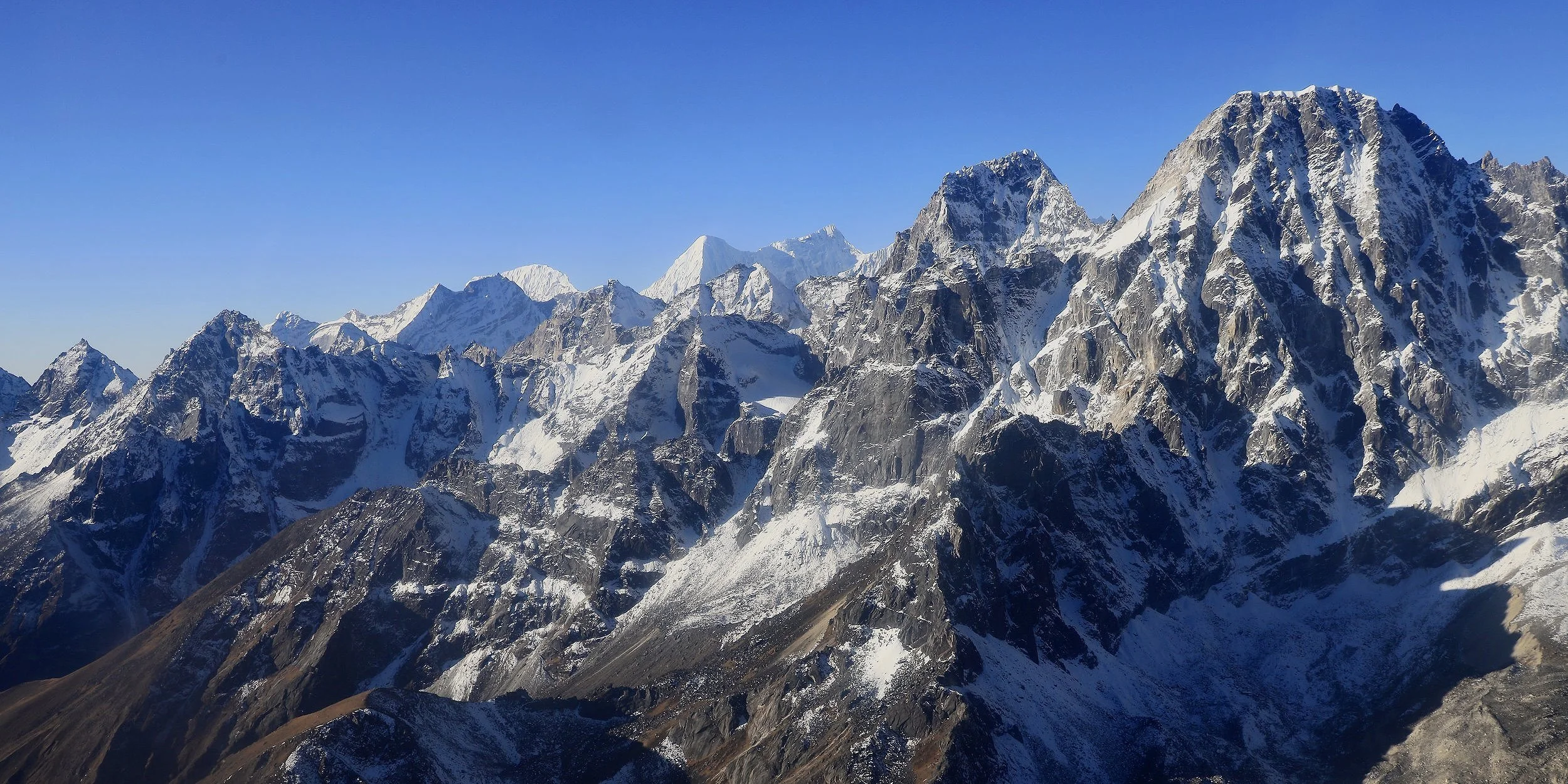
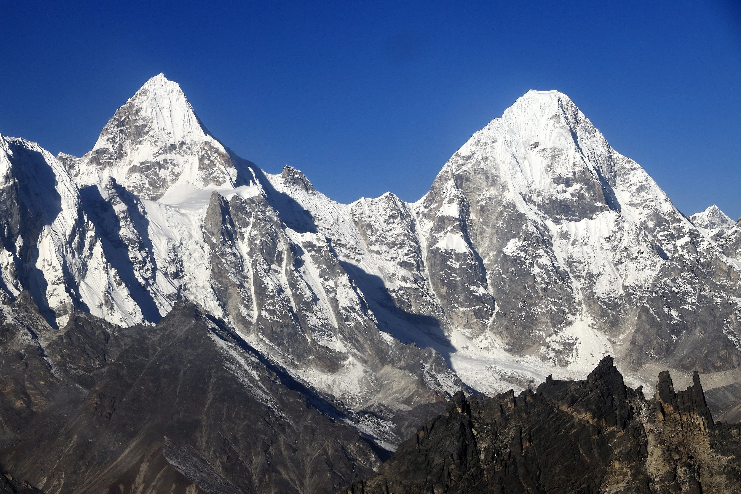
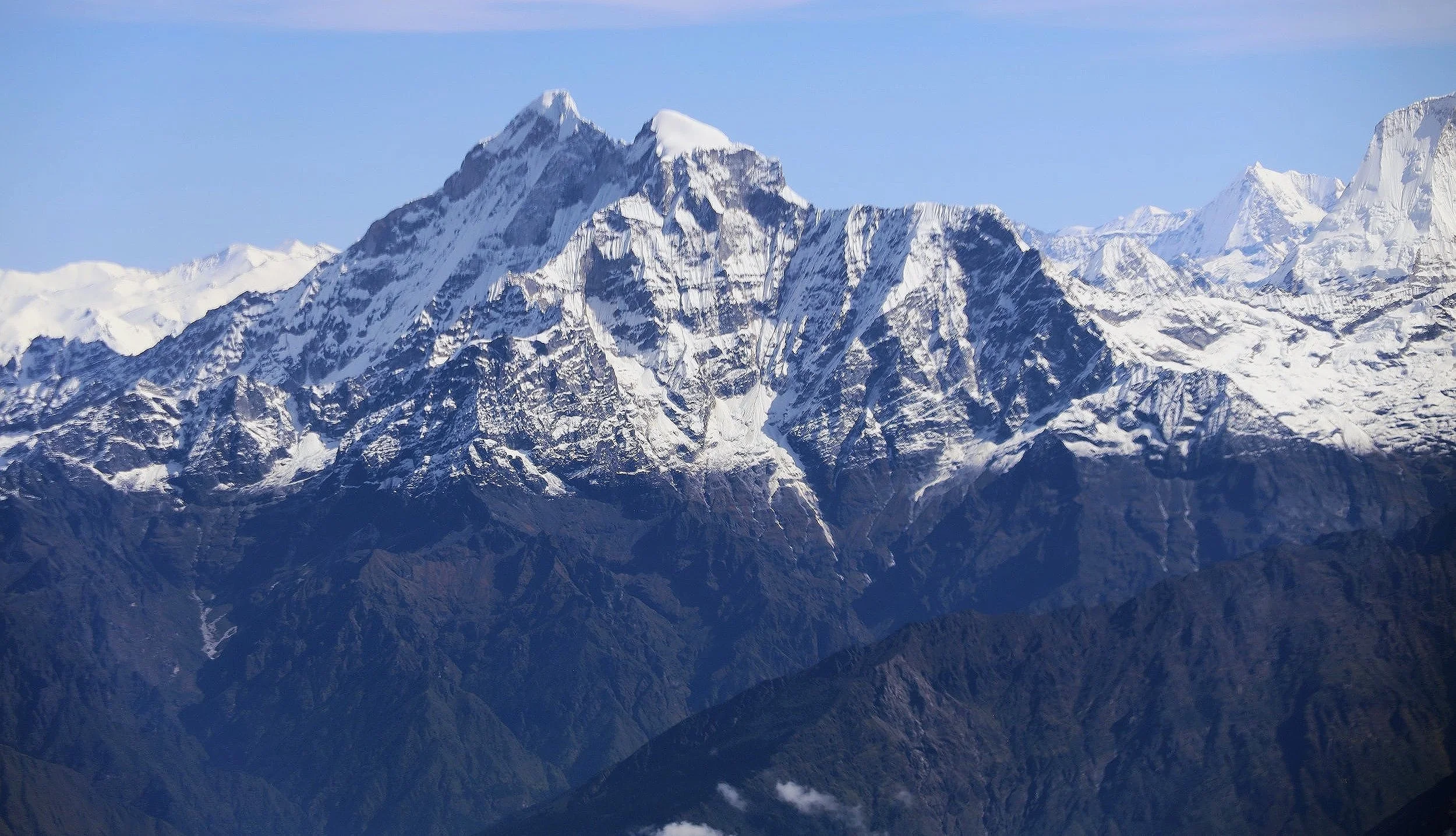
Tengi Ragi Tau from the east
Tengi Ragi Tau
Tengi Ragi Tau
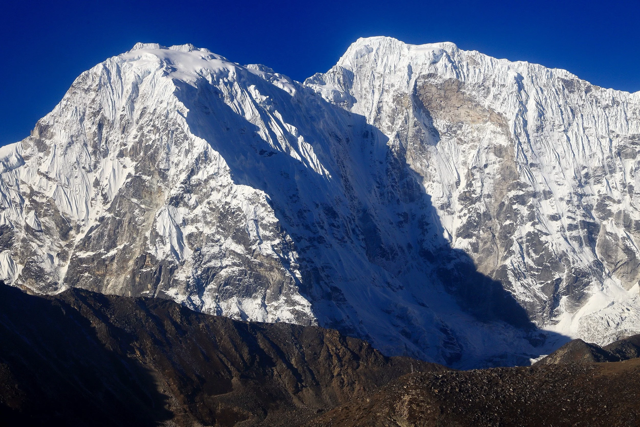
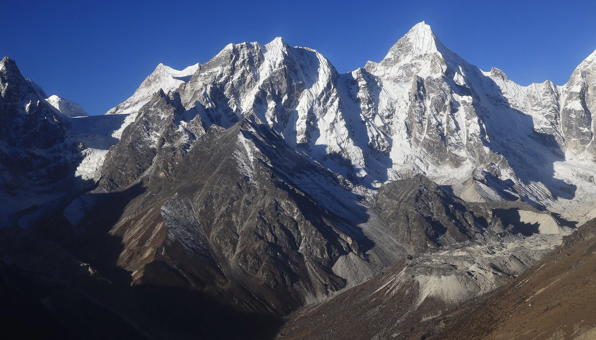
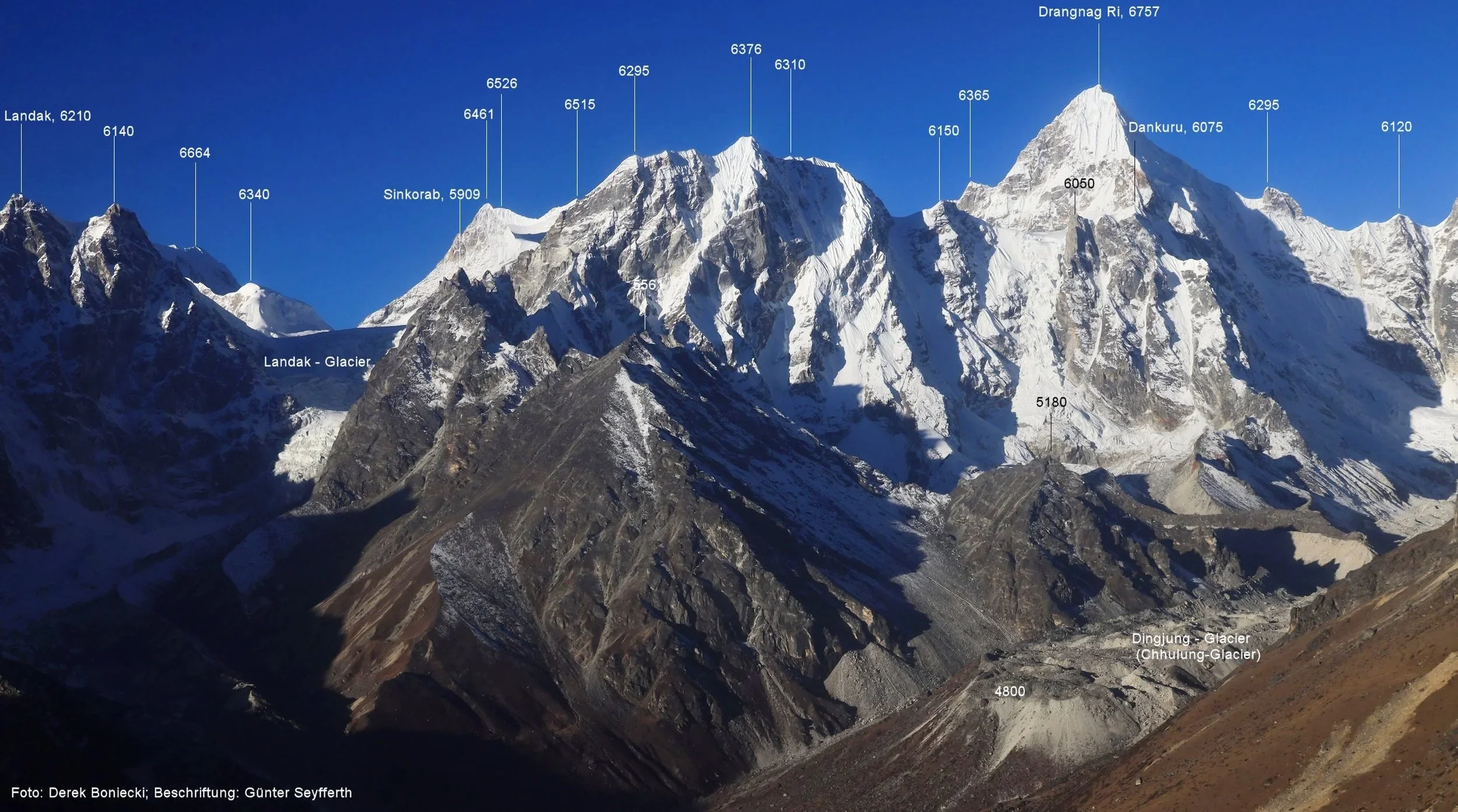
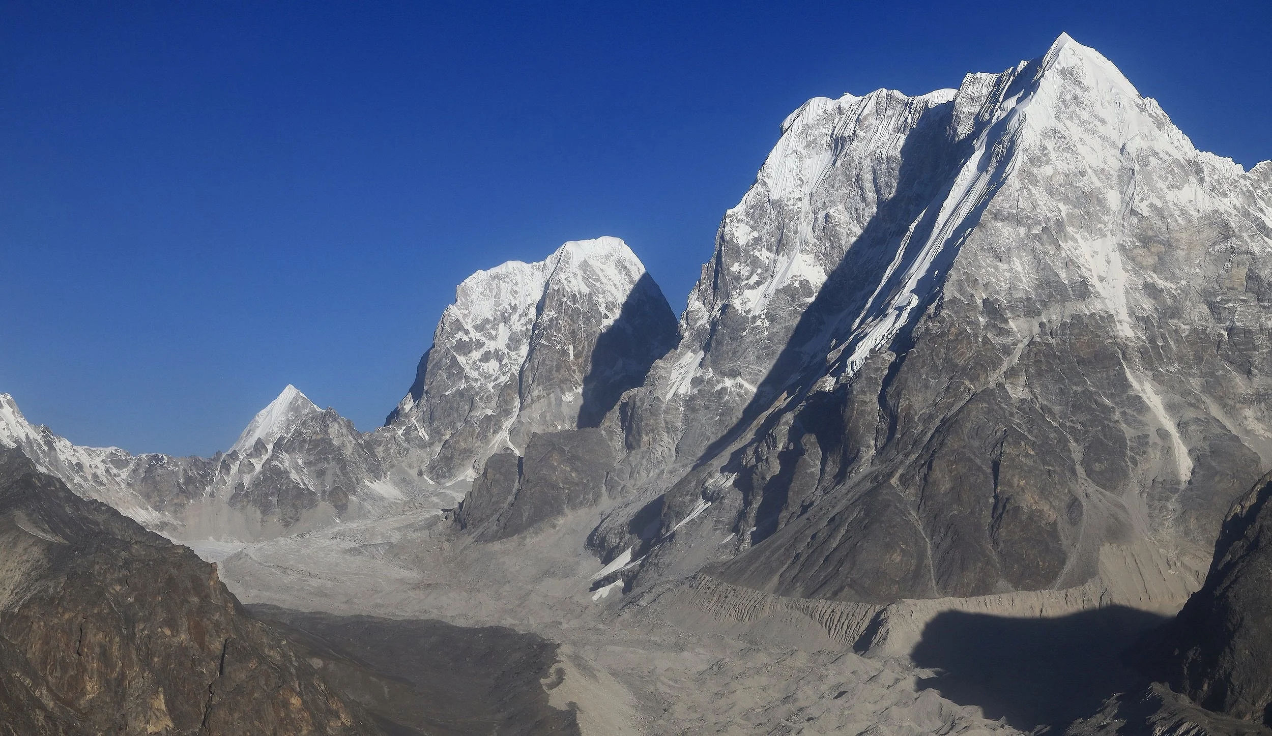
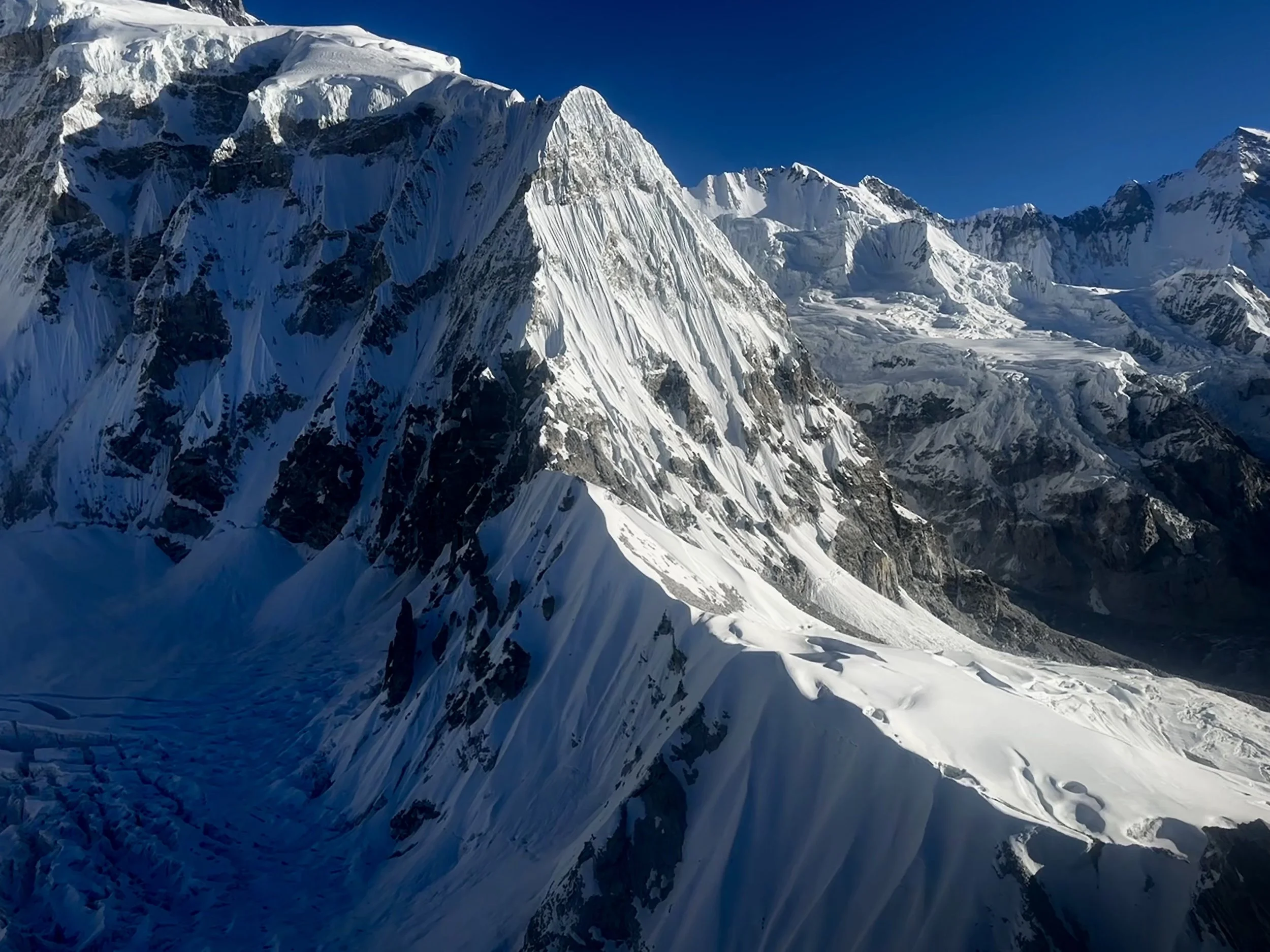
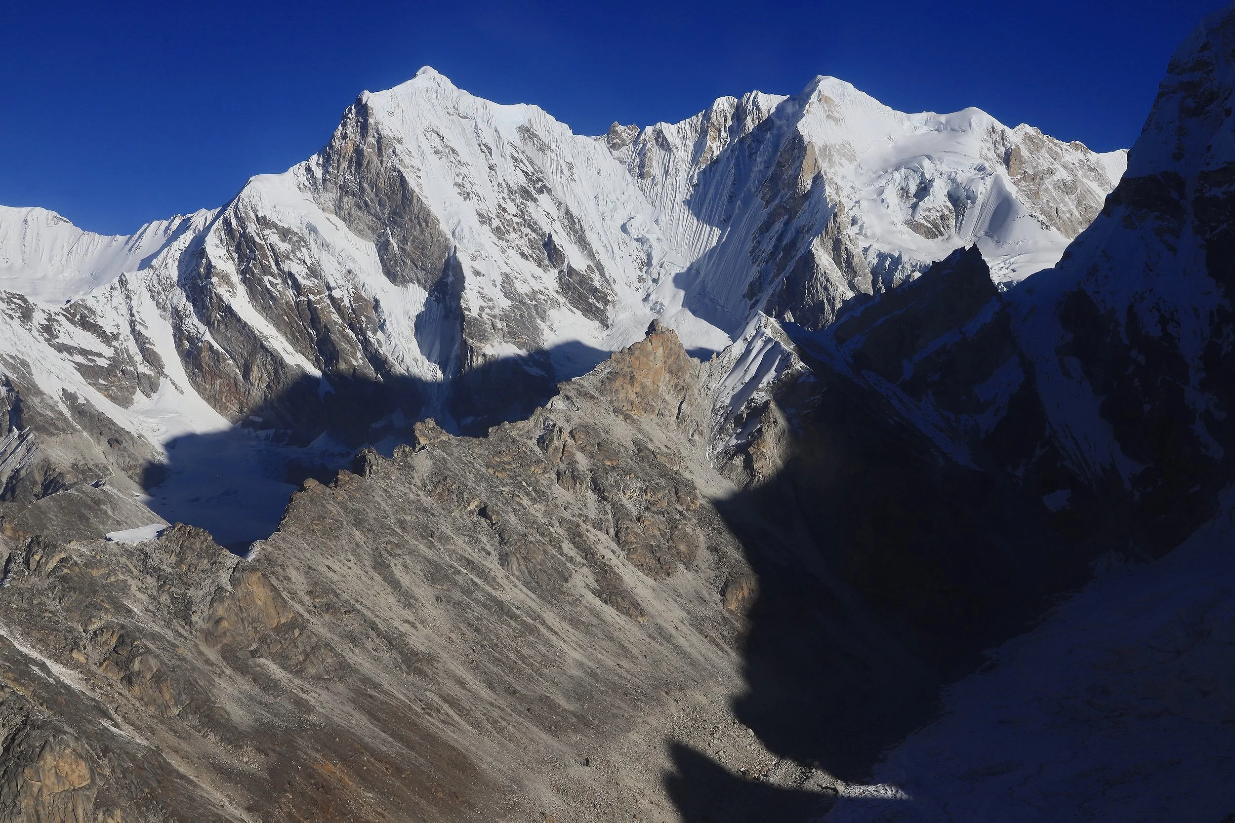
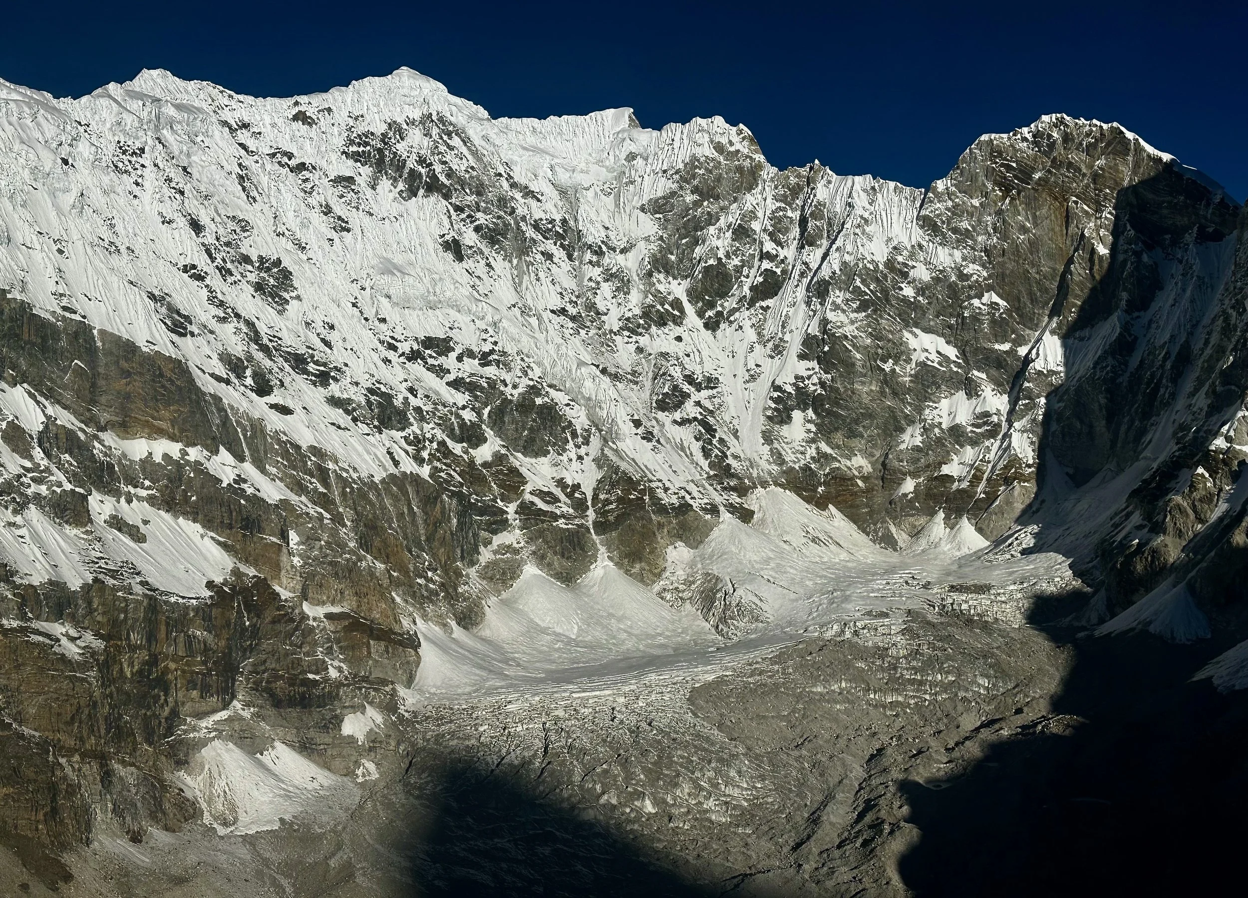
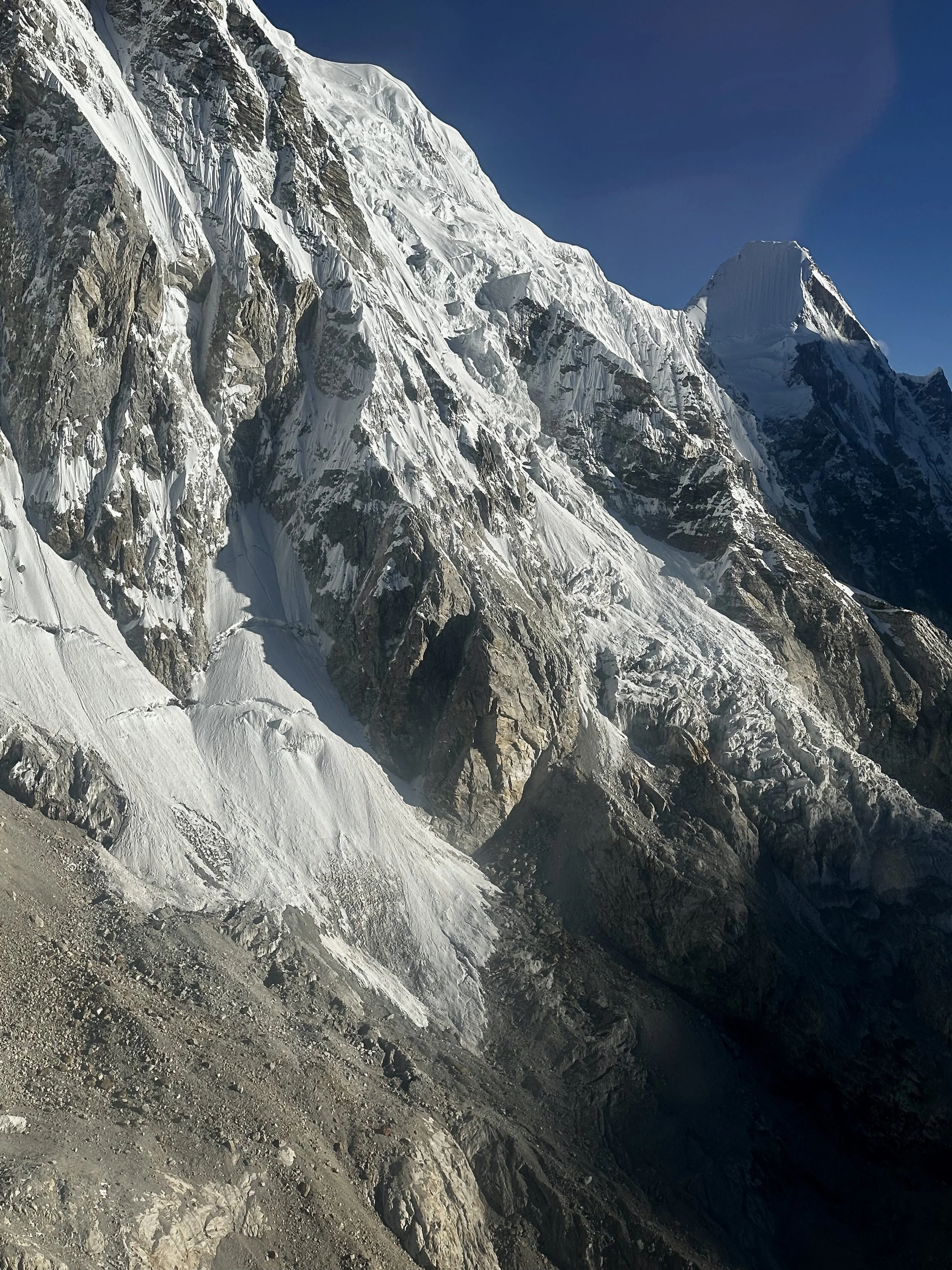
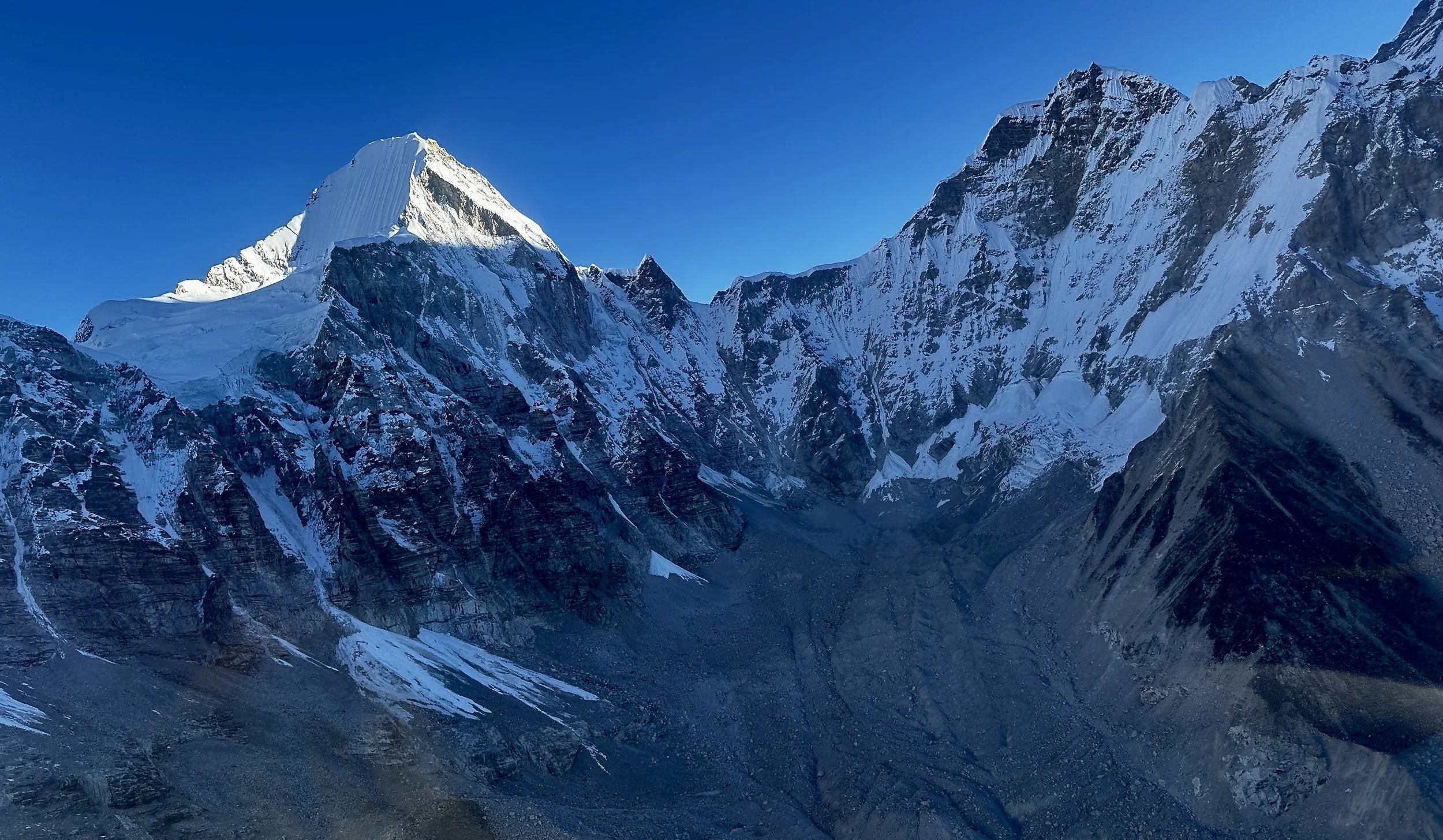
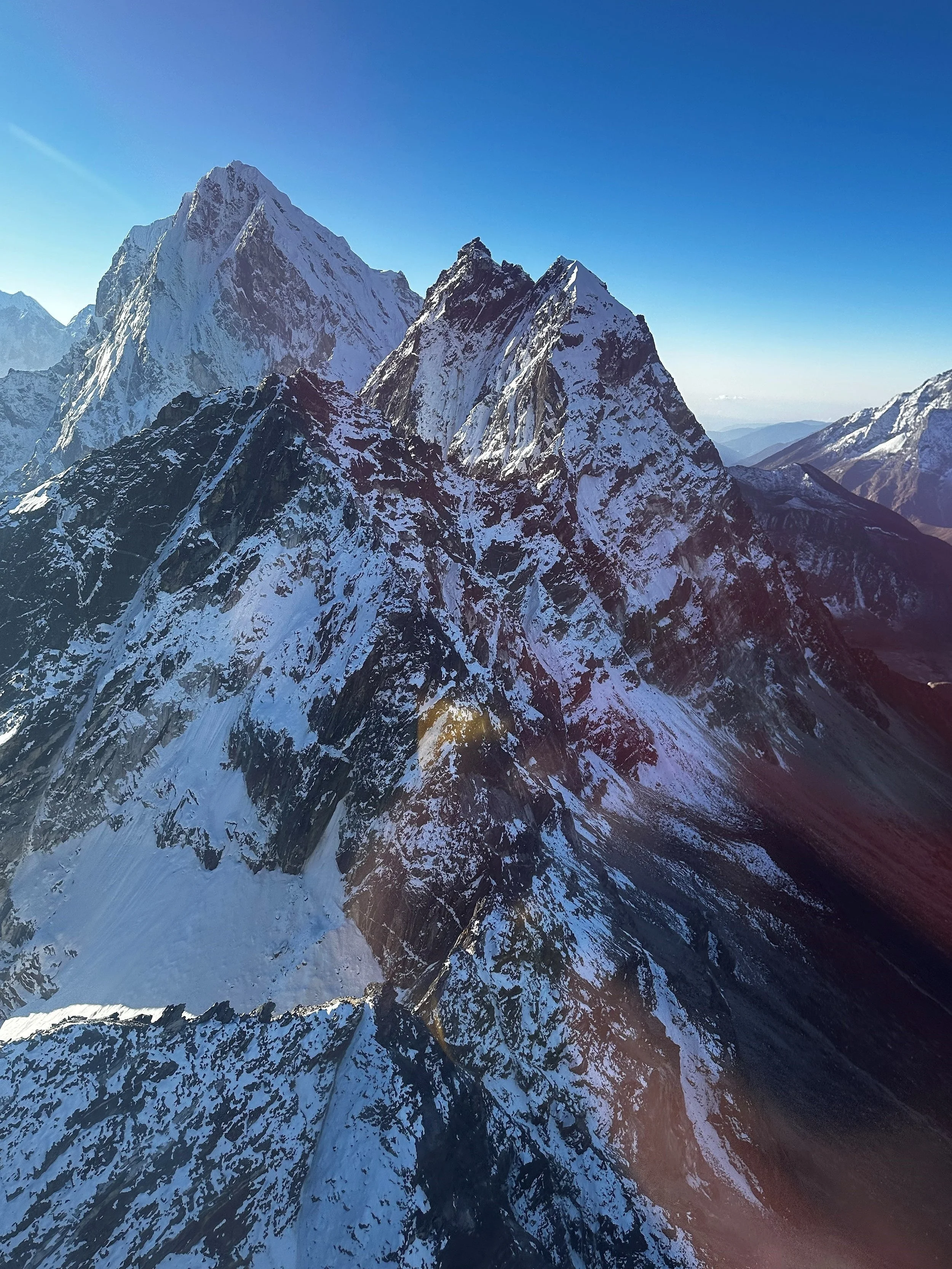
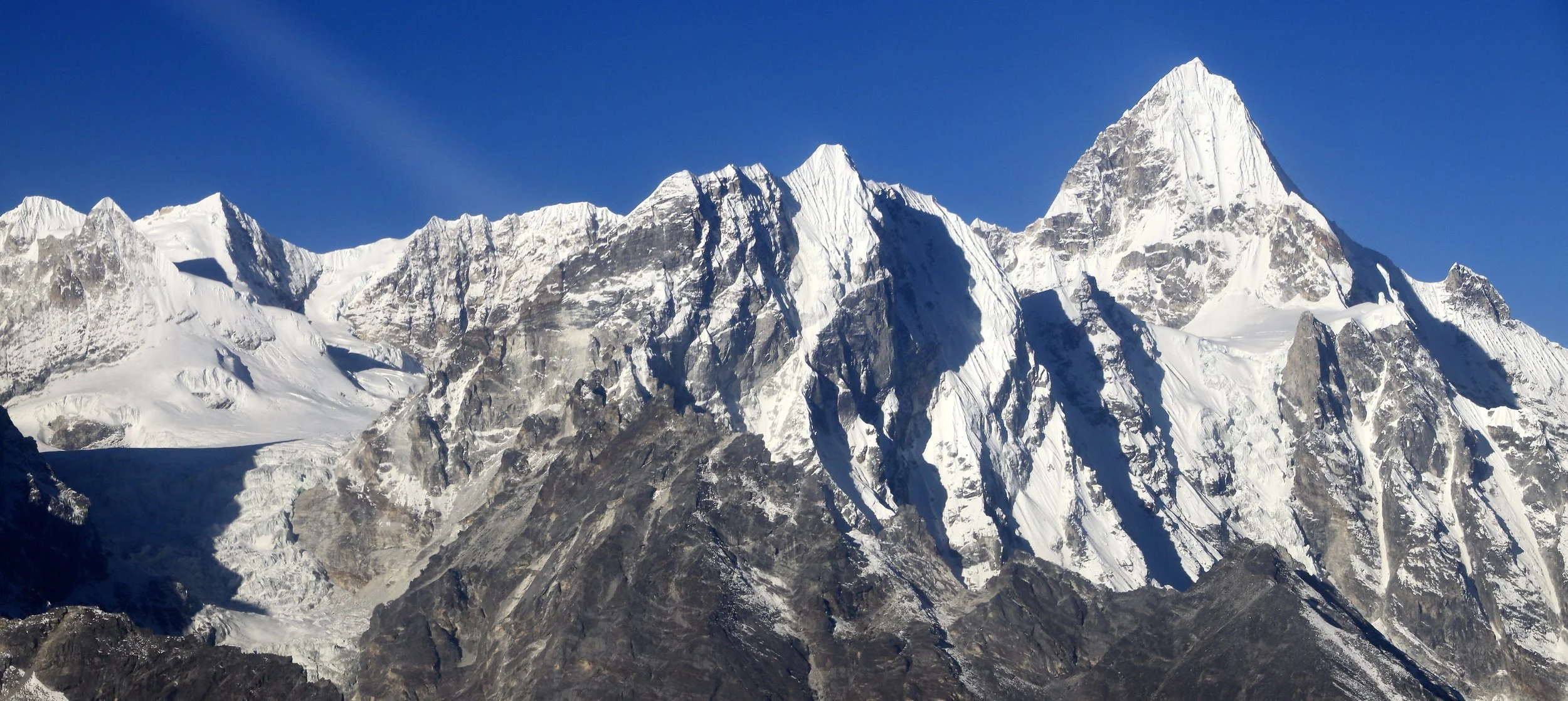
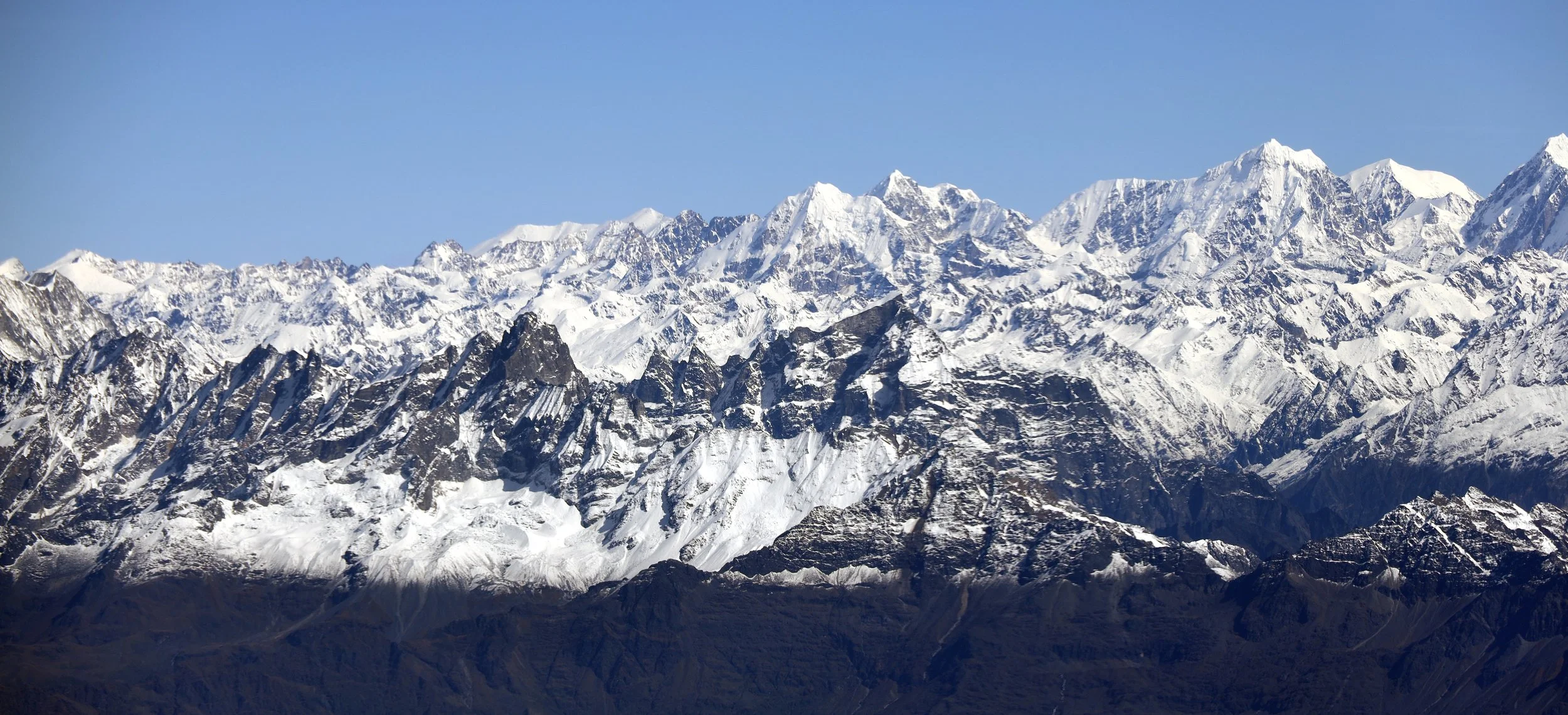
Dragnag Ri 6757m
On the left is Khang Karpo 6646m. Chule Glacier and Menlung Glacier.
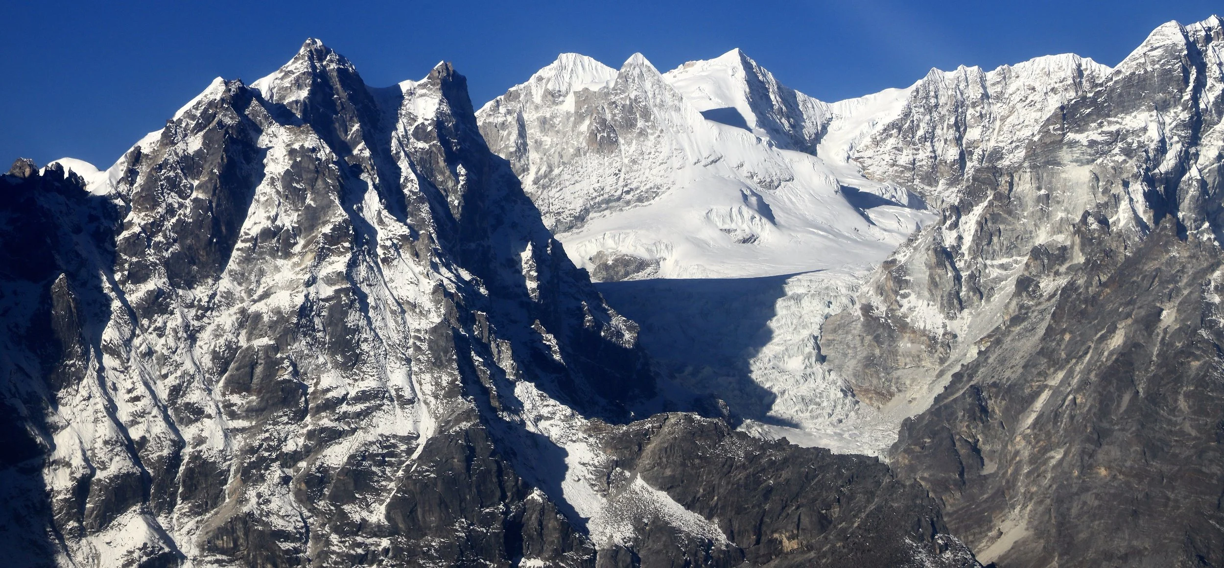
Lunag Glacier and Mahalangur Himal. The pointy mountain is Lunag 1.
Lunag 1 (on the right)
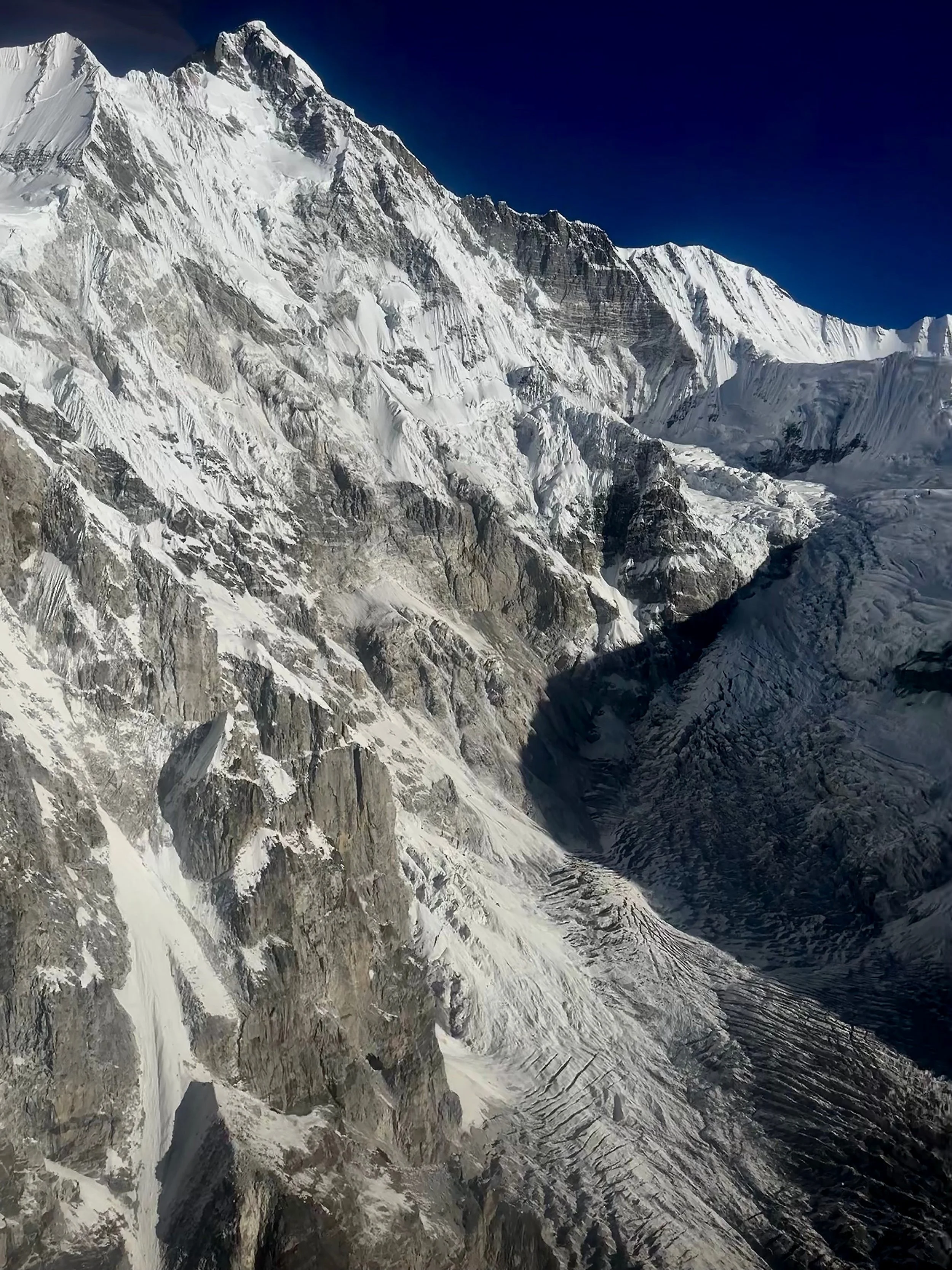
Awesome rock towers along the Nangpa Glacier
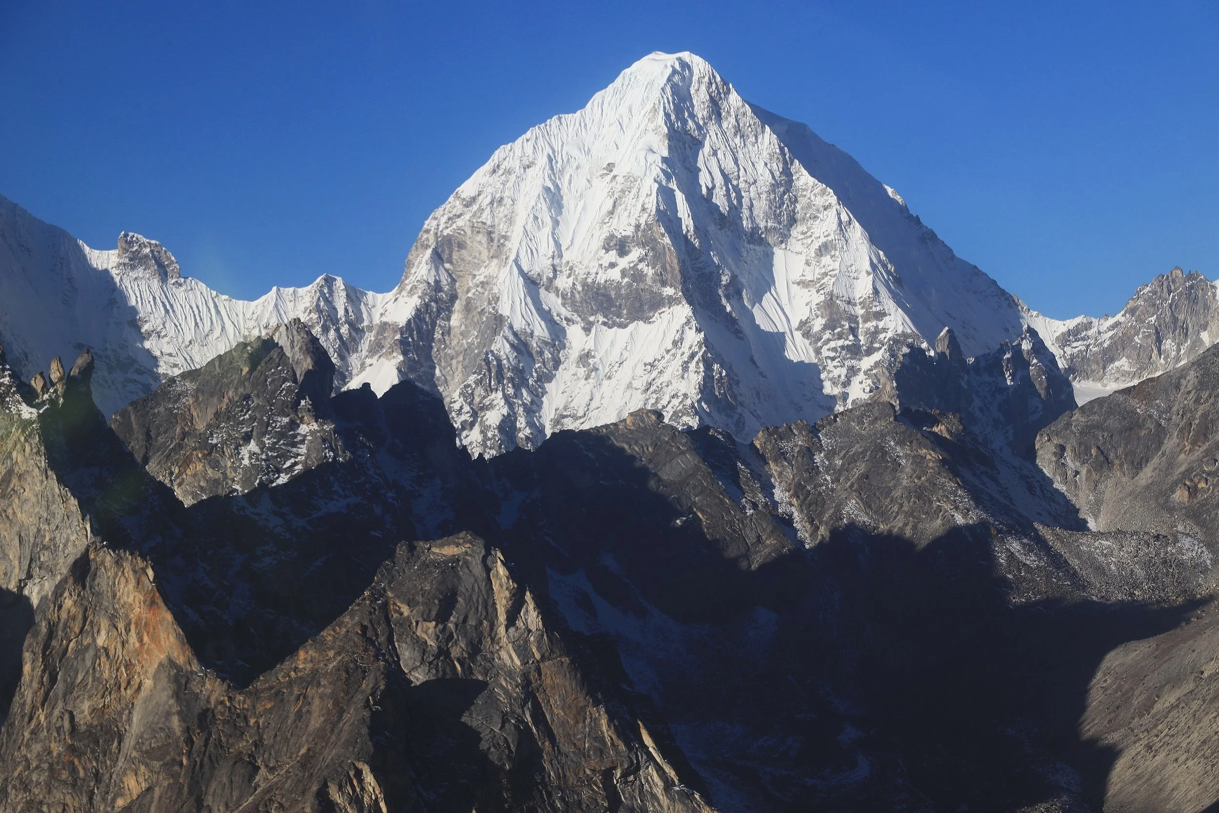
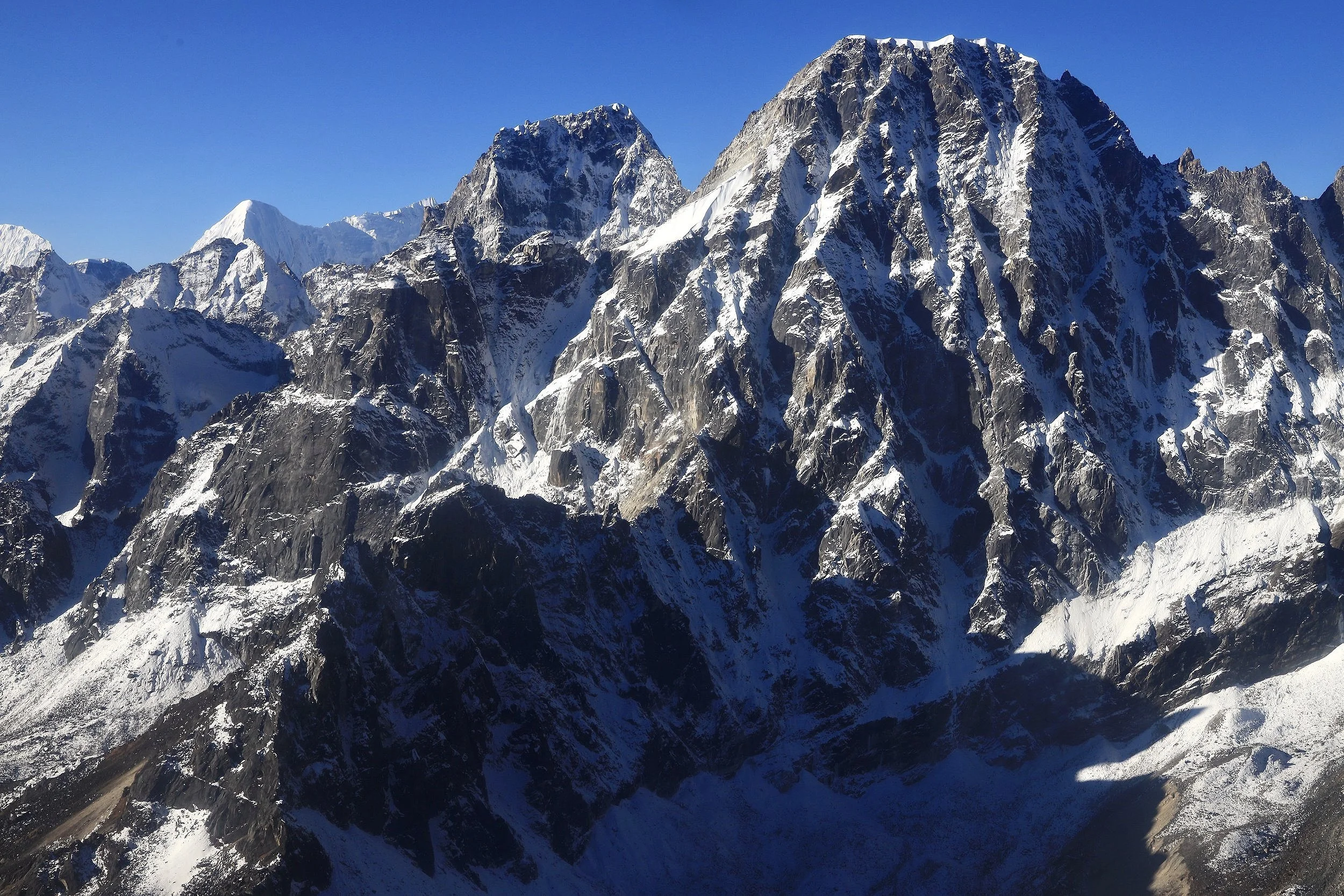
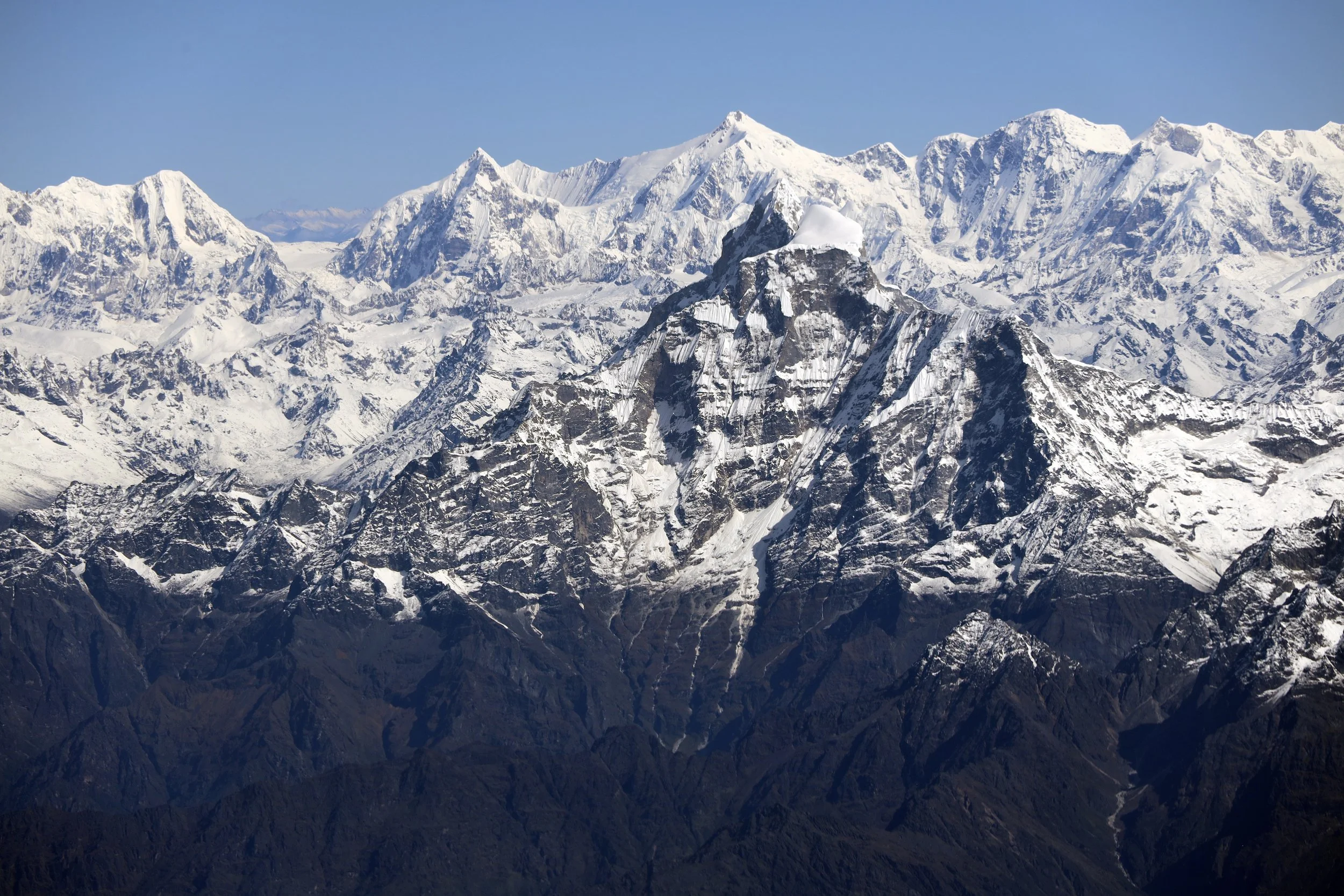
Khang Karpo 6646m
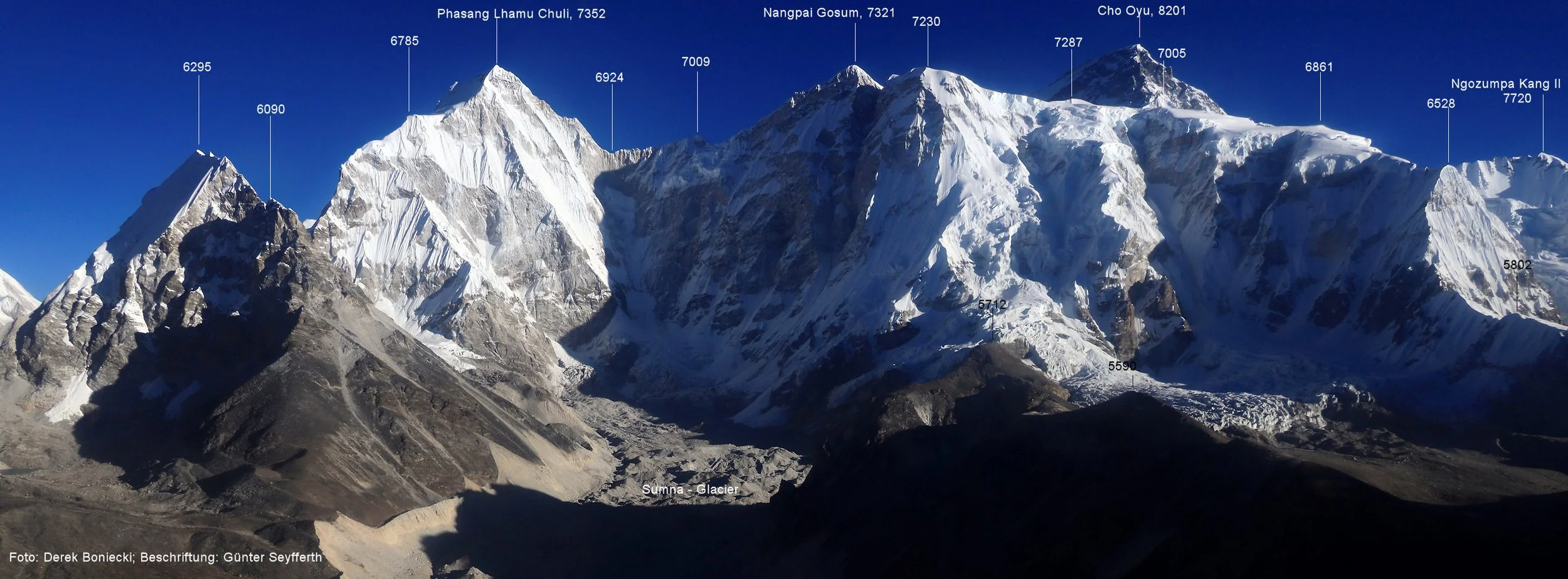
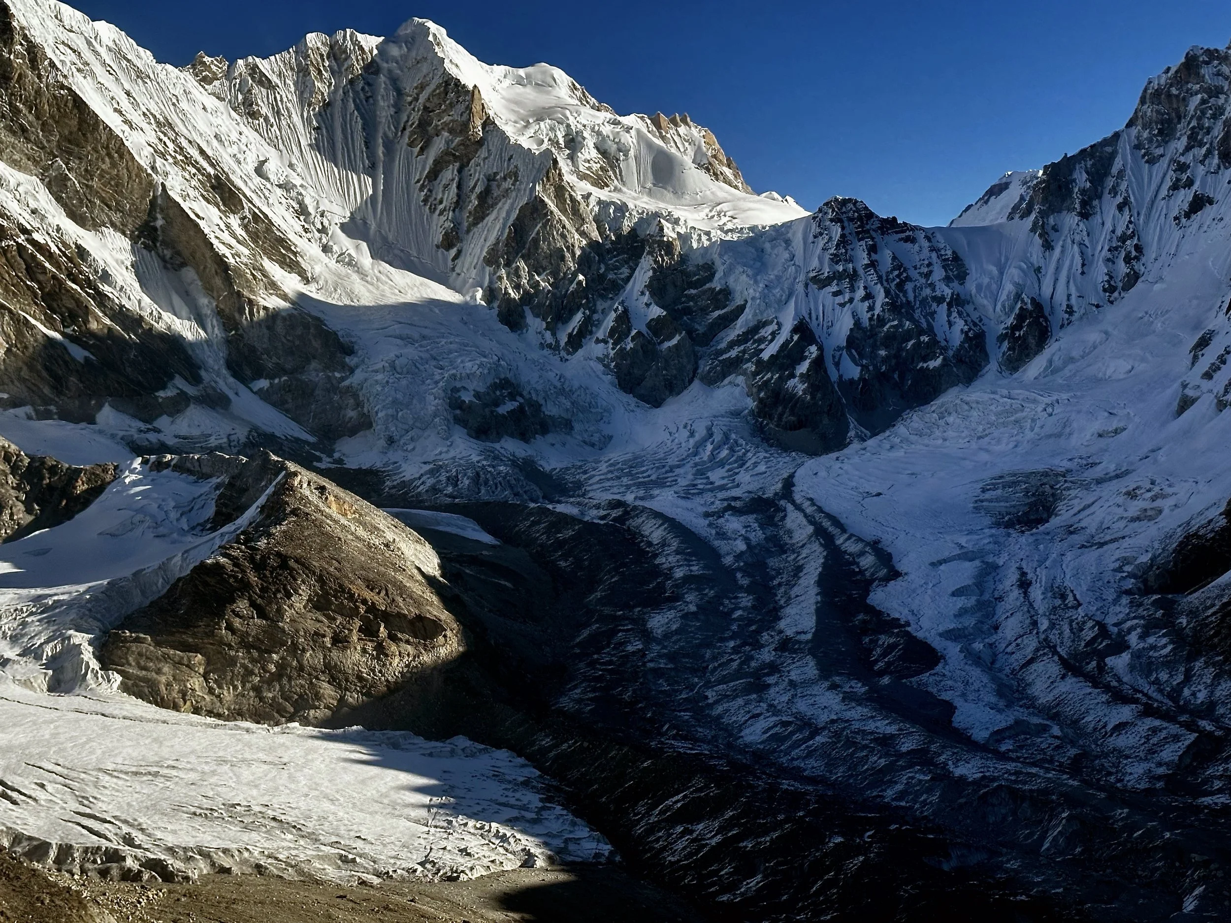
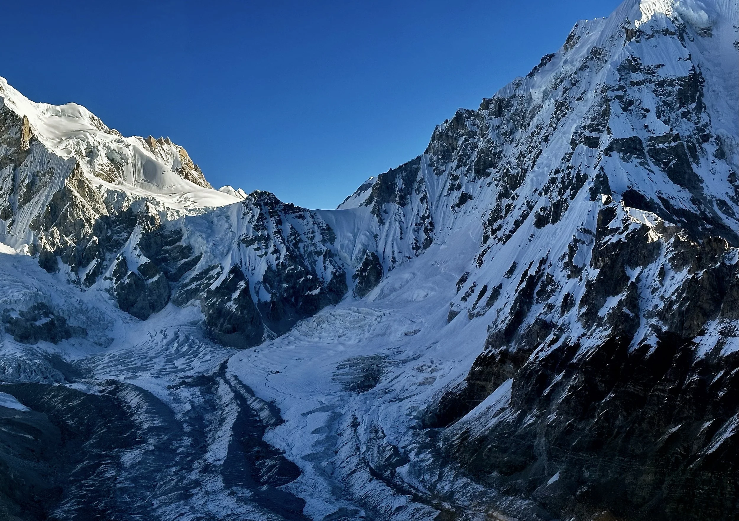
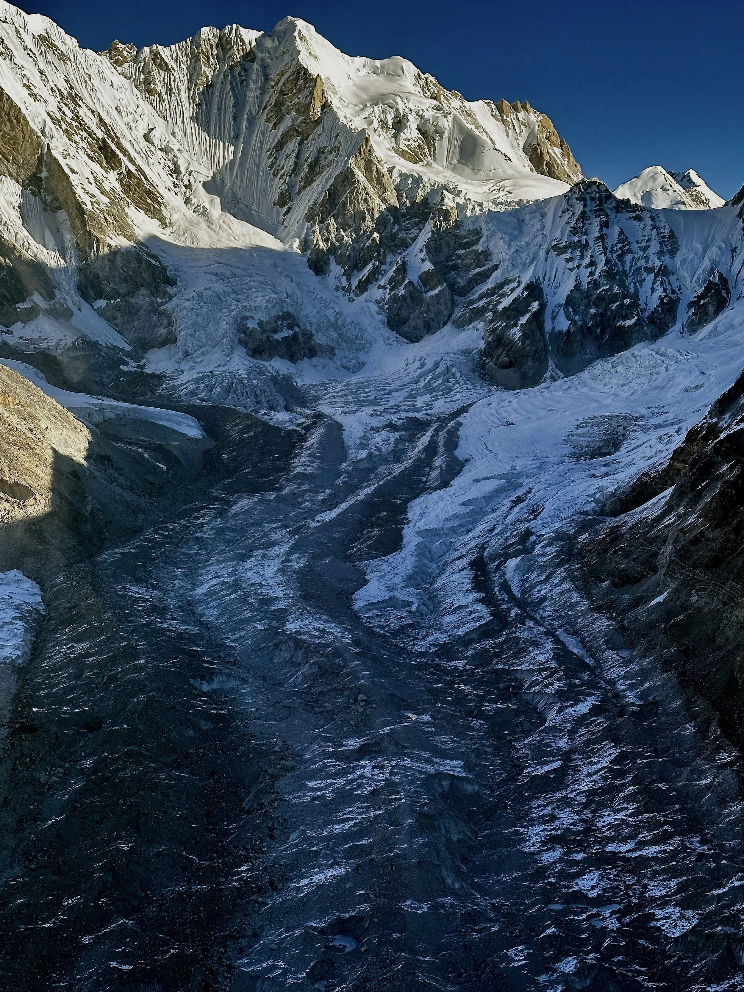
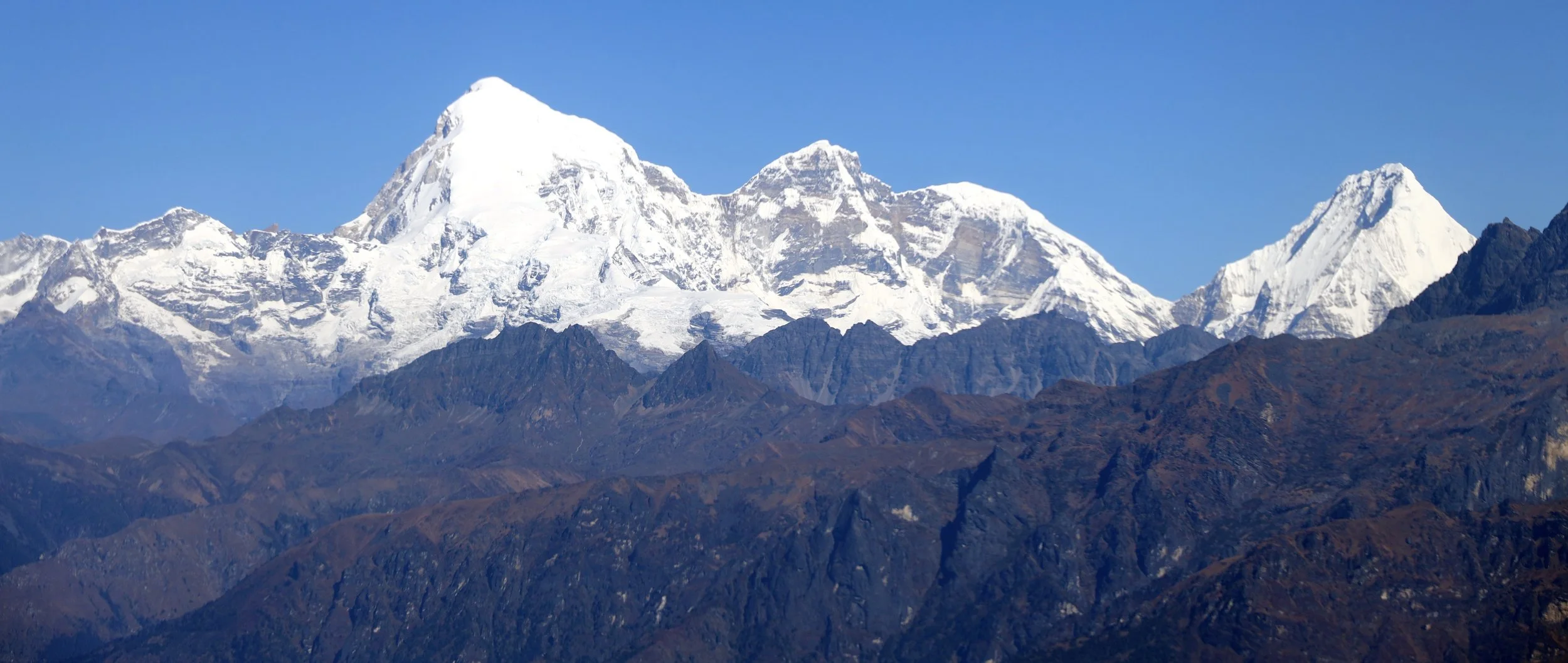
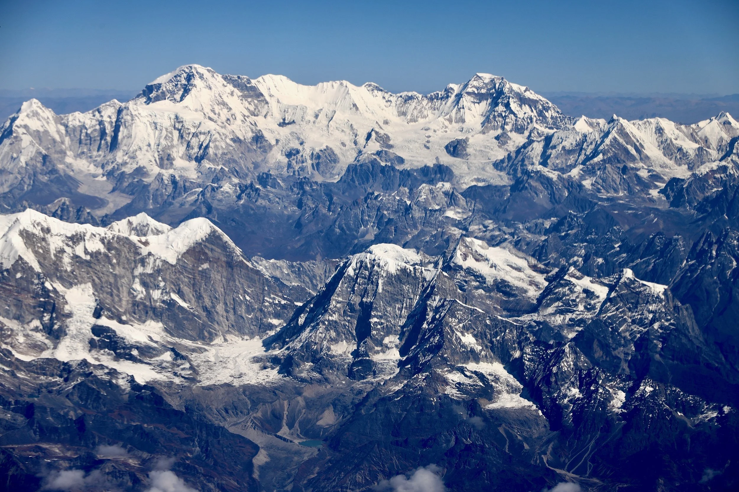
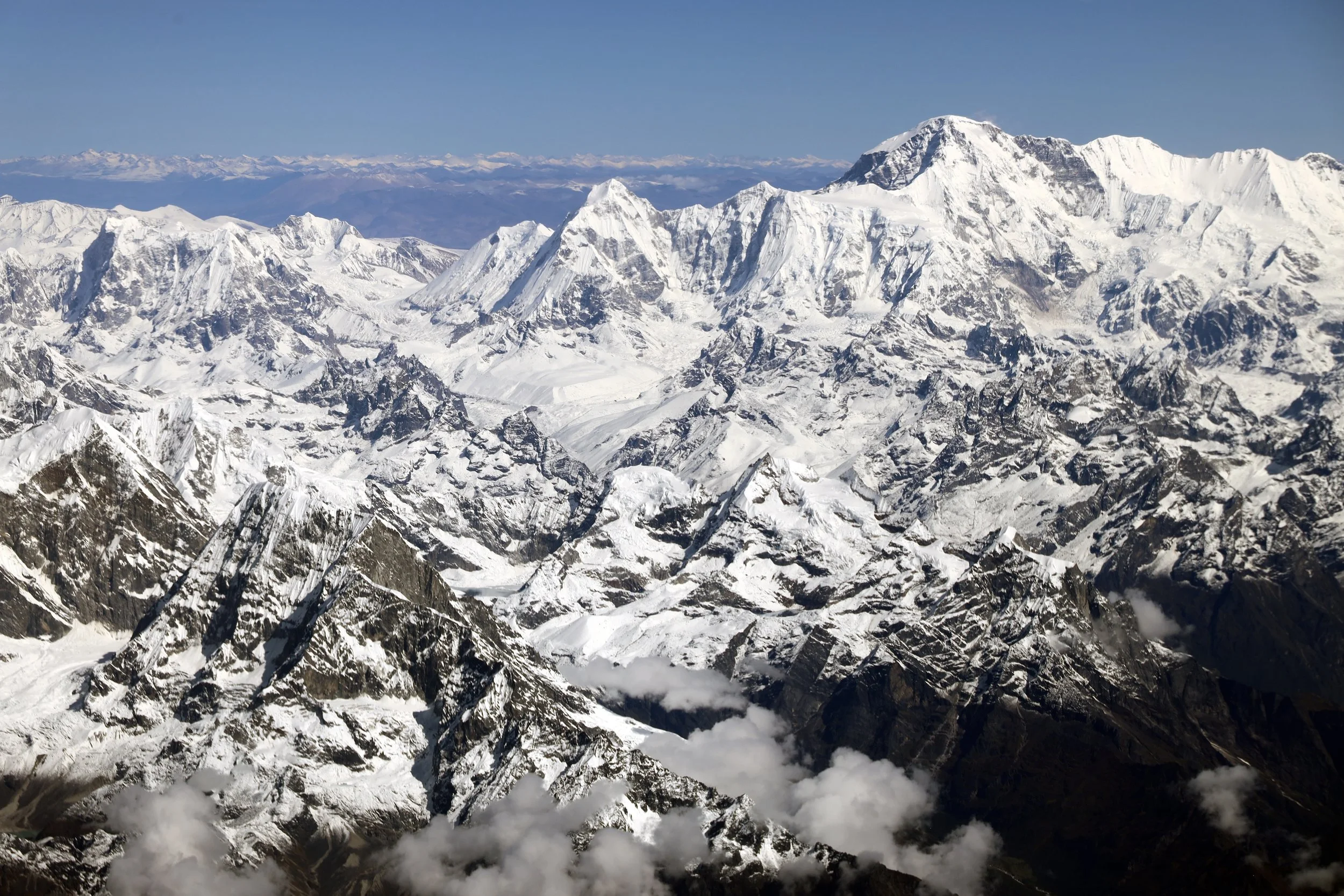
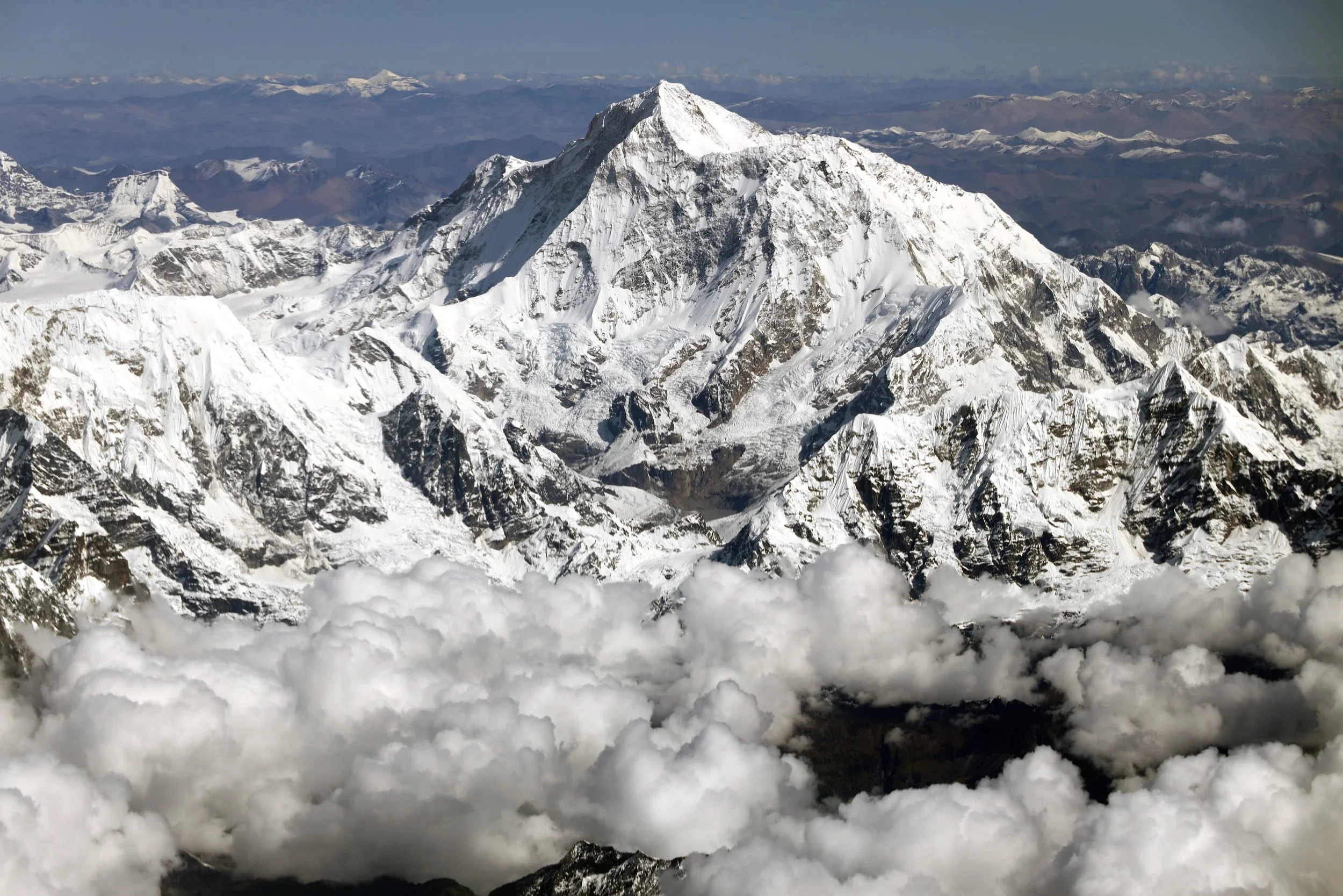
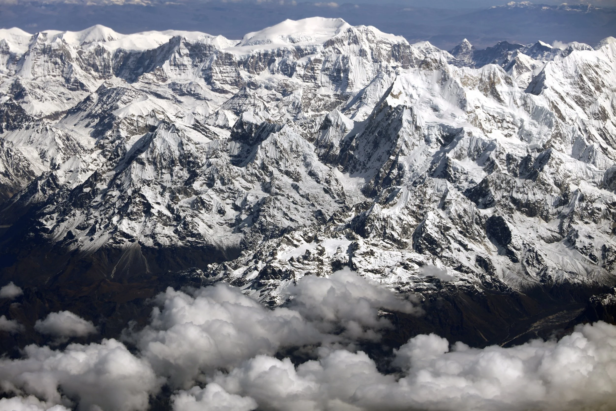
Jasemba (left 7350m), Chamar 7287m (centre) and Cho Oyu 8201m (pointy black peak on the right)
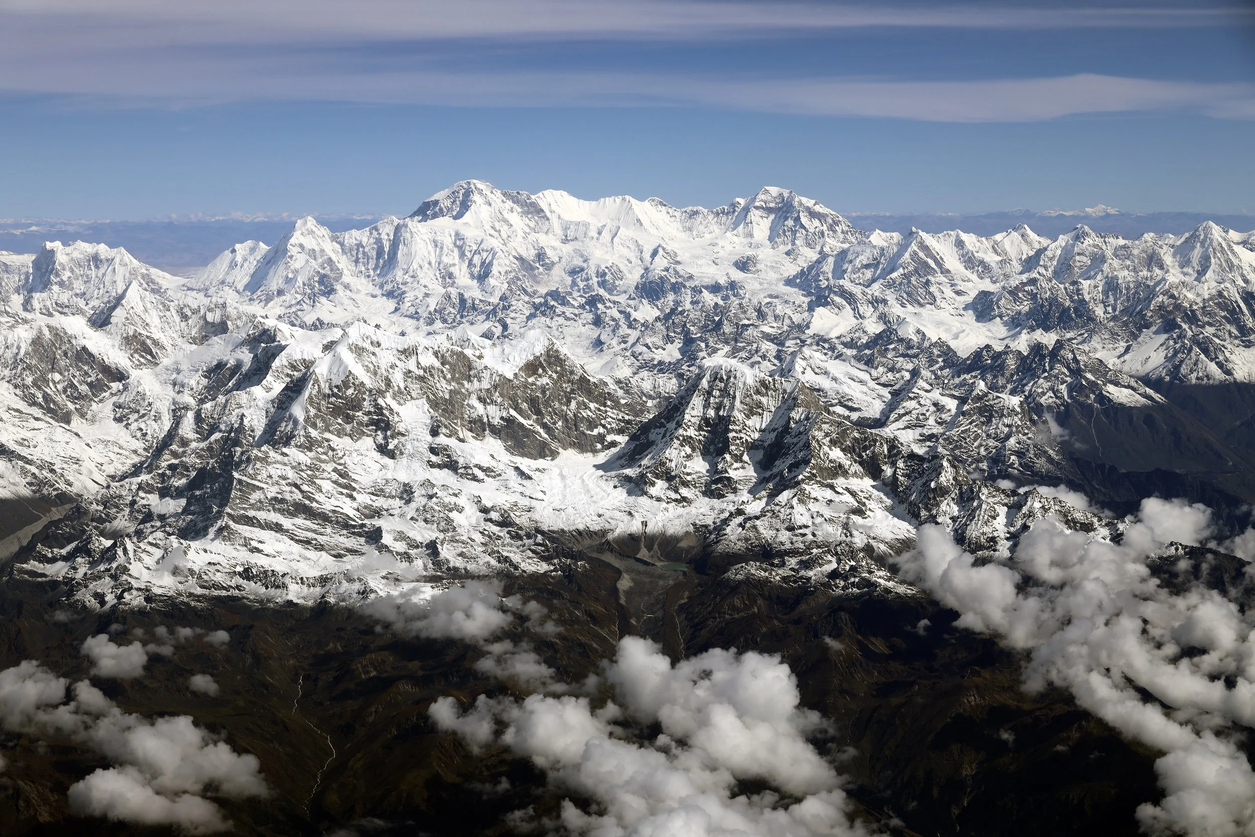
Lunak Glacier and Jobo Lecoultre 6,590m. The peak in centre left is Pangbuk 6750m.
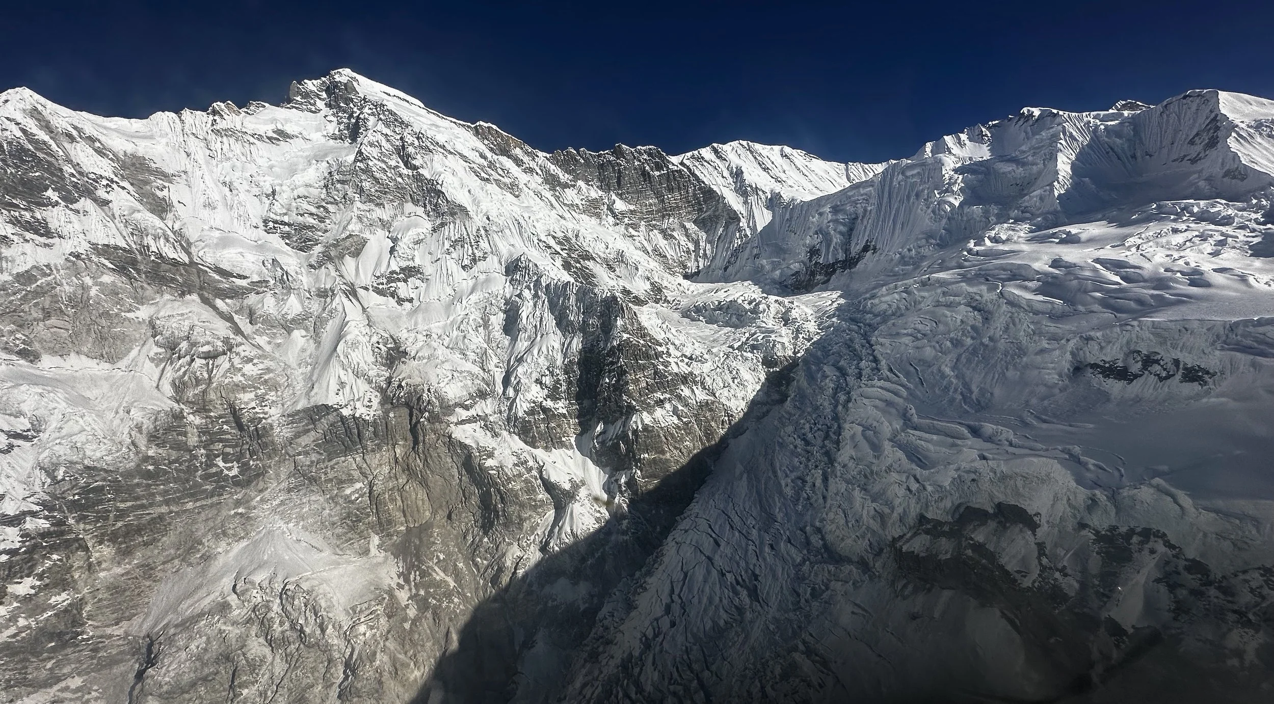
Confluence of the Nangpa Glacier and Lumsumna Glacier. The basecamp of Sumna Pass is in the shadow on the right.
Lumsumna Glacier, Jasemba and Cho Oyu
Bhole Koshi Glacier, Lunag 1 and Little Lunag.
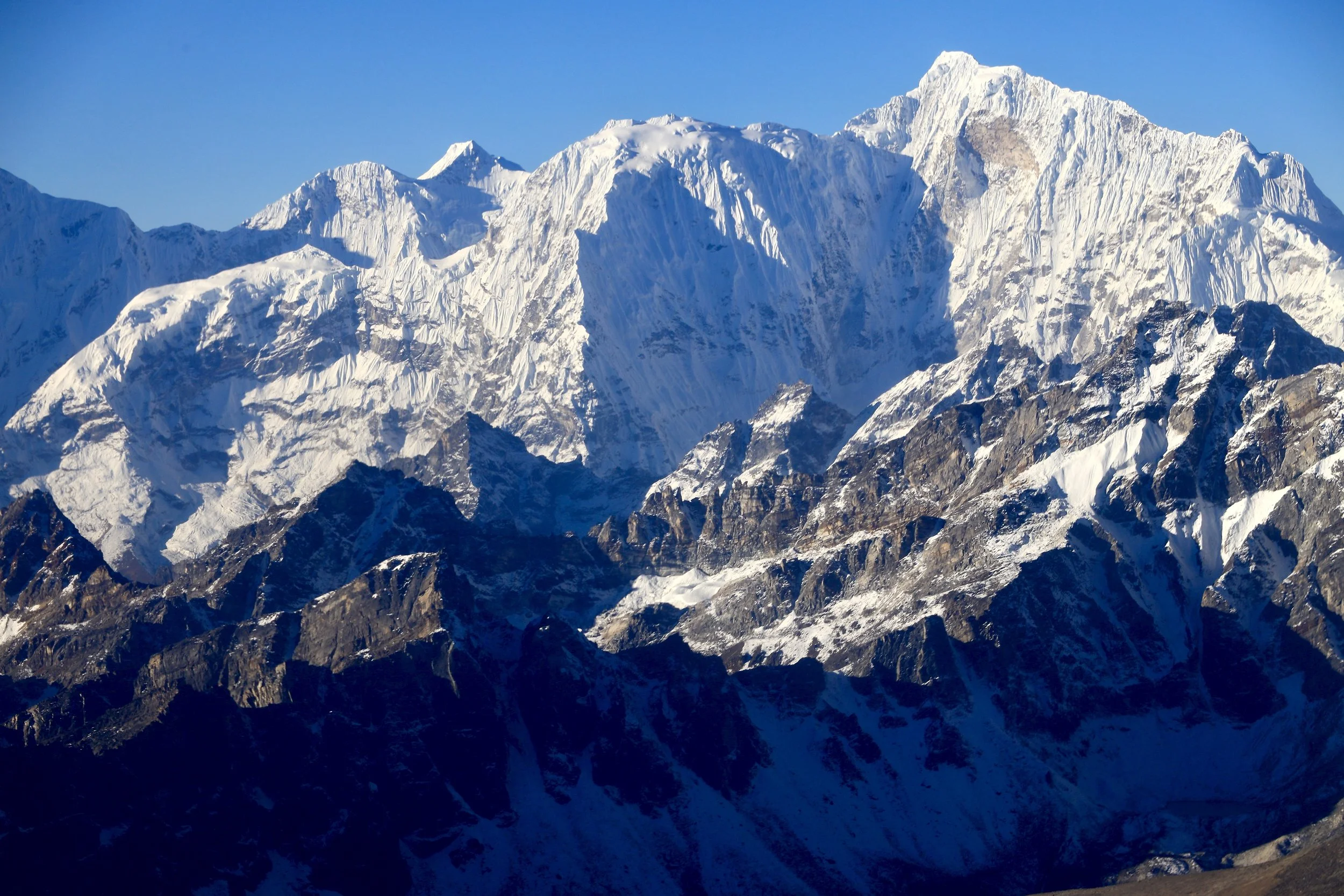
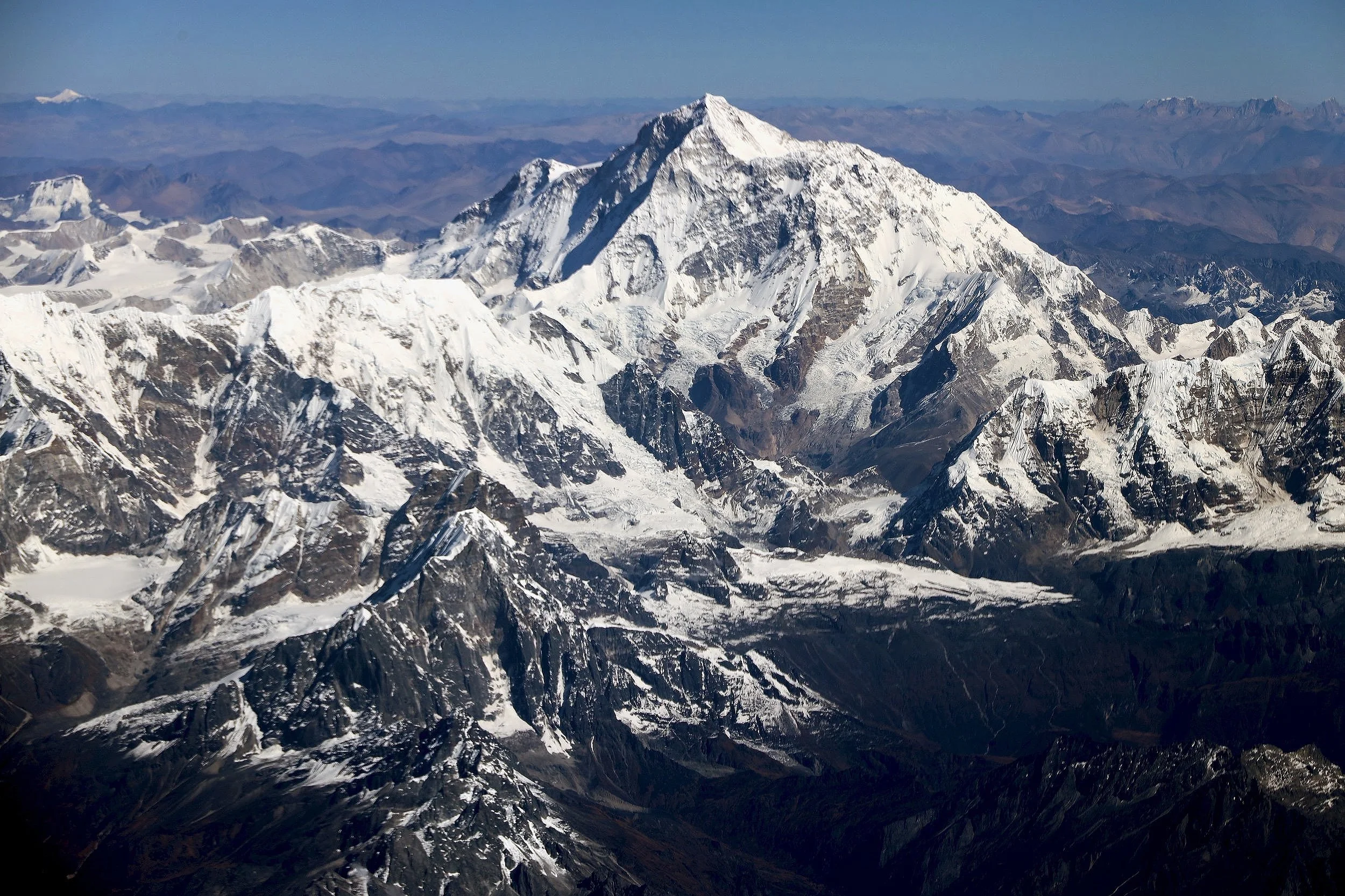
Chamar and Cho Oyu 8201m
Jasemba and Chamar
Chamar 7287m
Jasemba, Chamar and Cho Oyu
Jasemba
Jasemba 7350m (on the right)
Mahalangur Himal on the left and Jasemba on the right
Jasemba
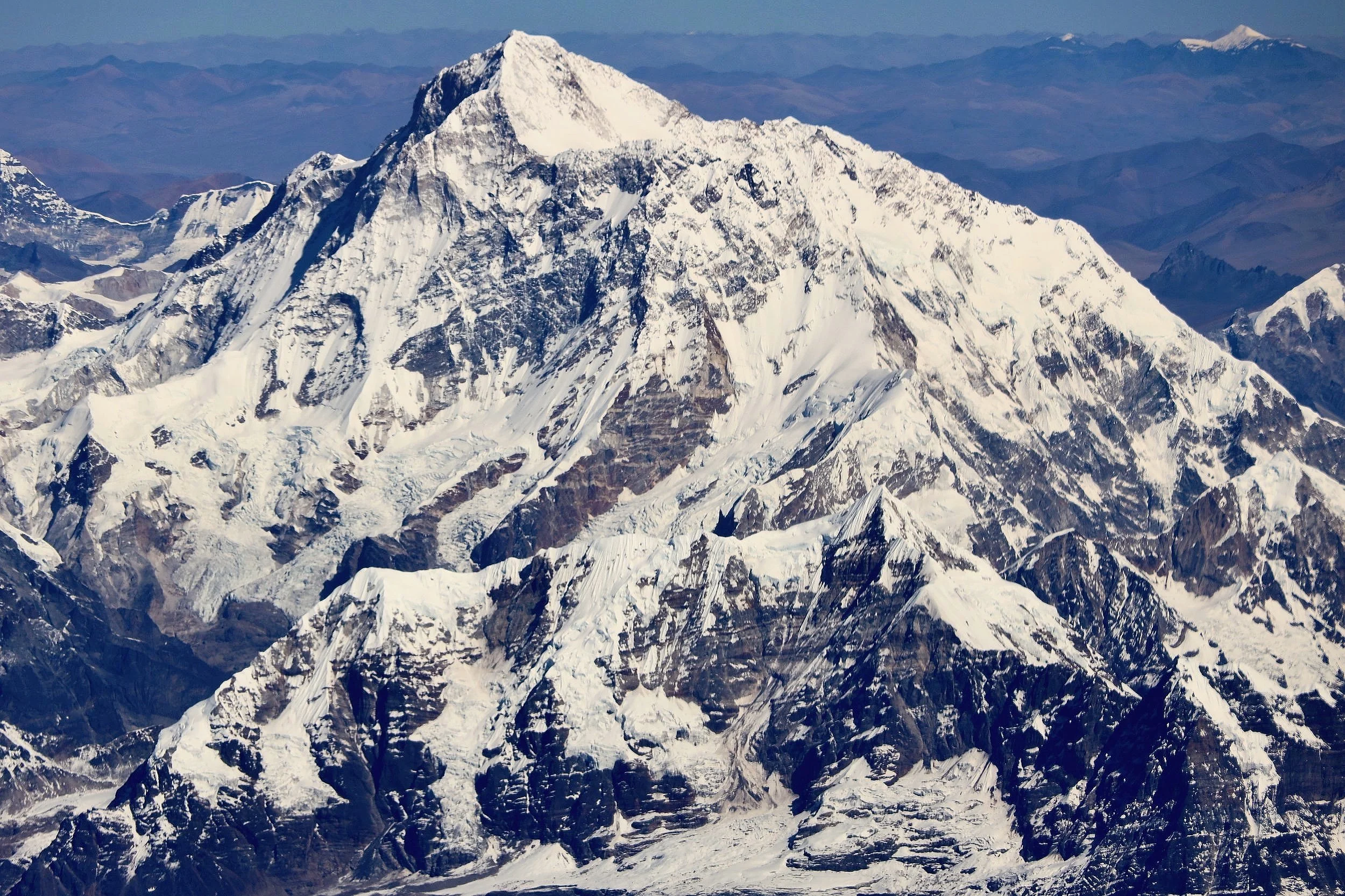
Chamar 7287m and top of Cho Oyu on the right
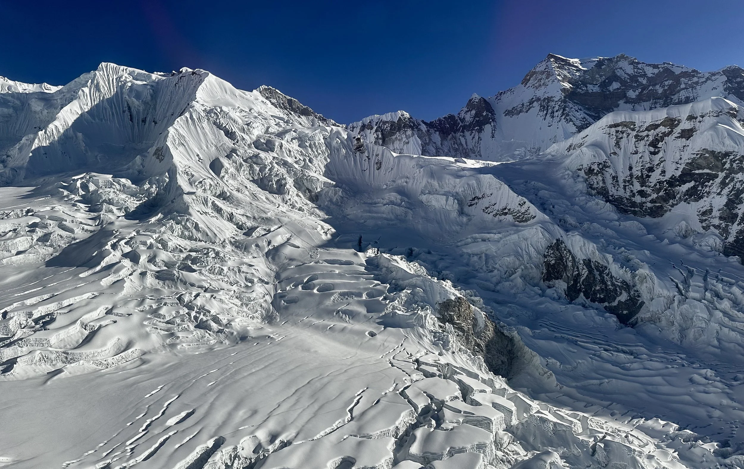
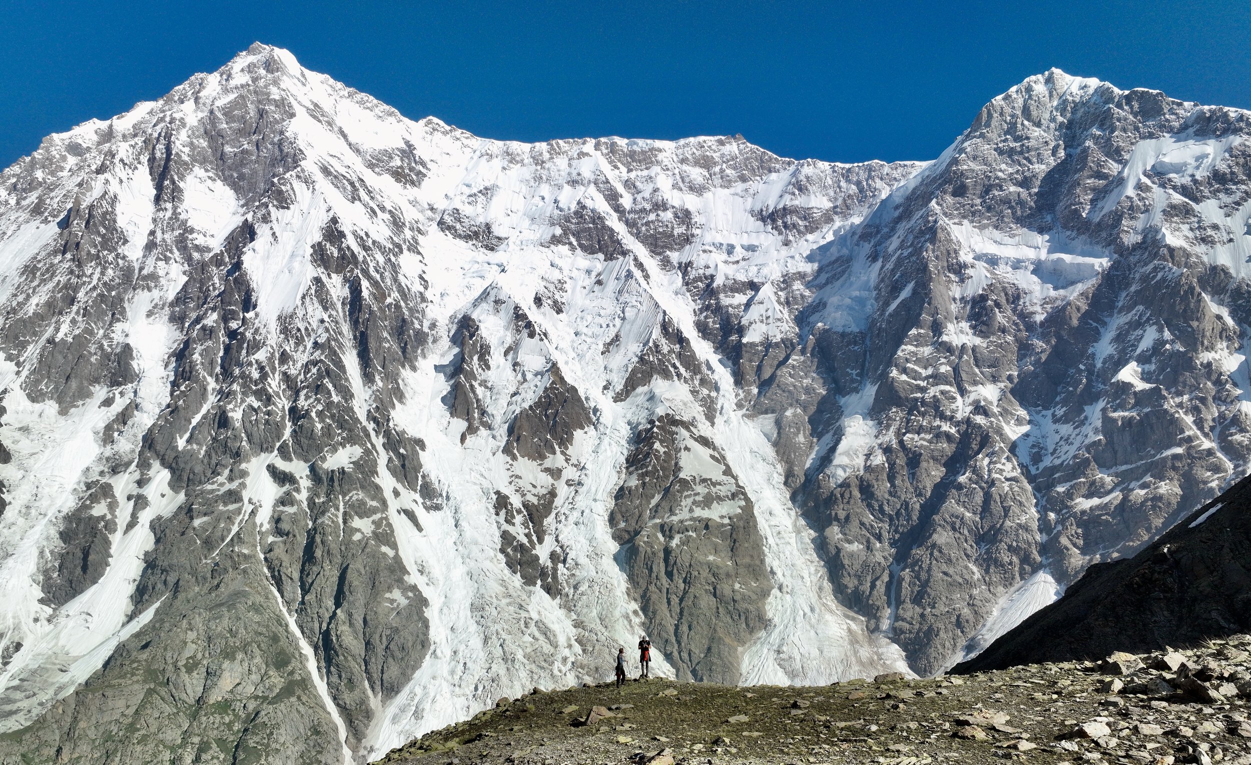
The pointy ridge end is 5802m high. It is the start of the south summit ridge of Cho Oyu.
Lower section of the south side of Cho Oyu (Nepal side).
Massive south wall of Cho Oyu. This is the winter assent route of the Polish (Kukuczka).
South side of Cho Oyu (left).
Cho Oyu south wall - Polish winter ascend route.
Cho Oyu south wall
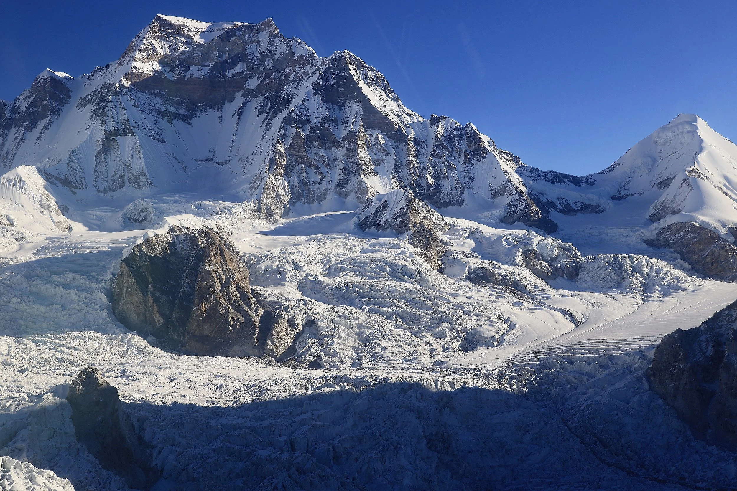
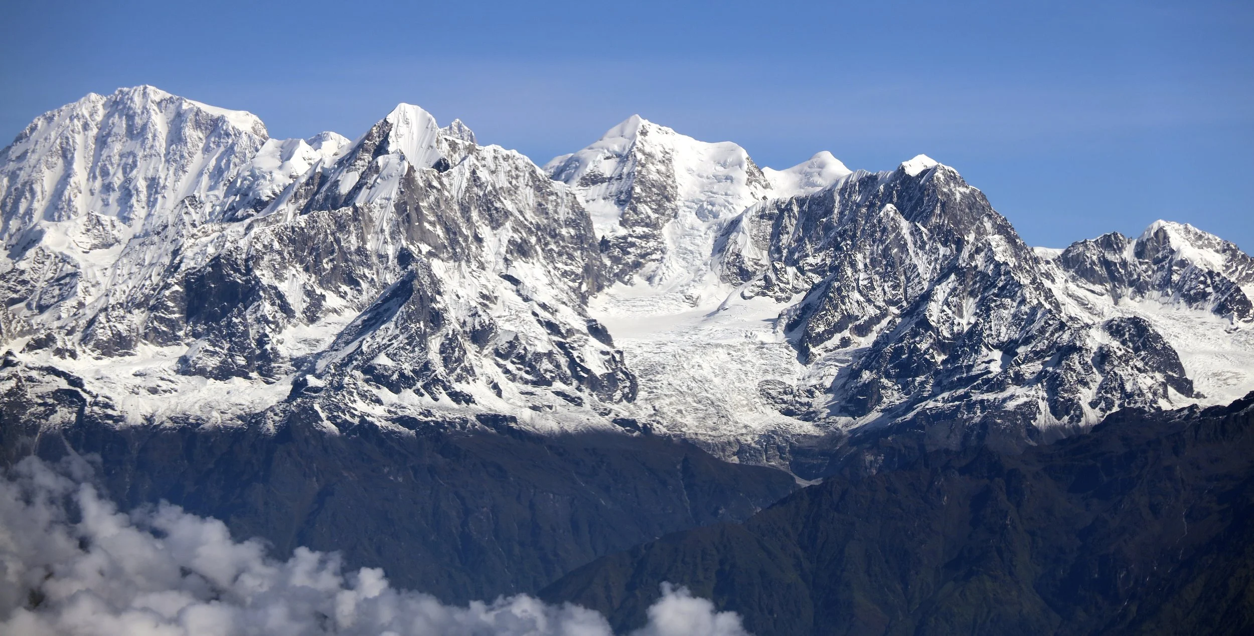
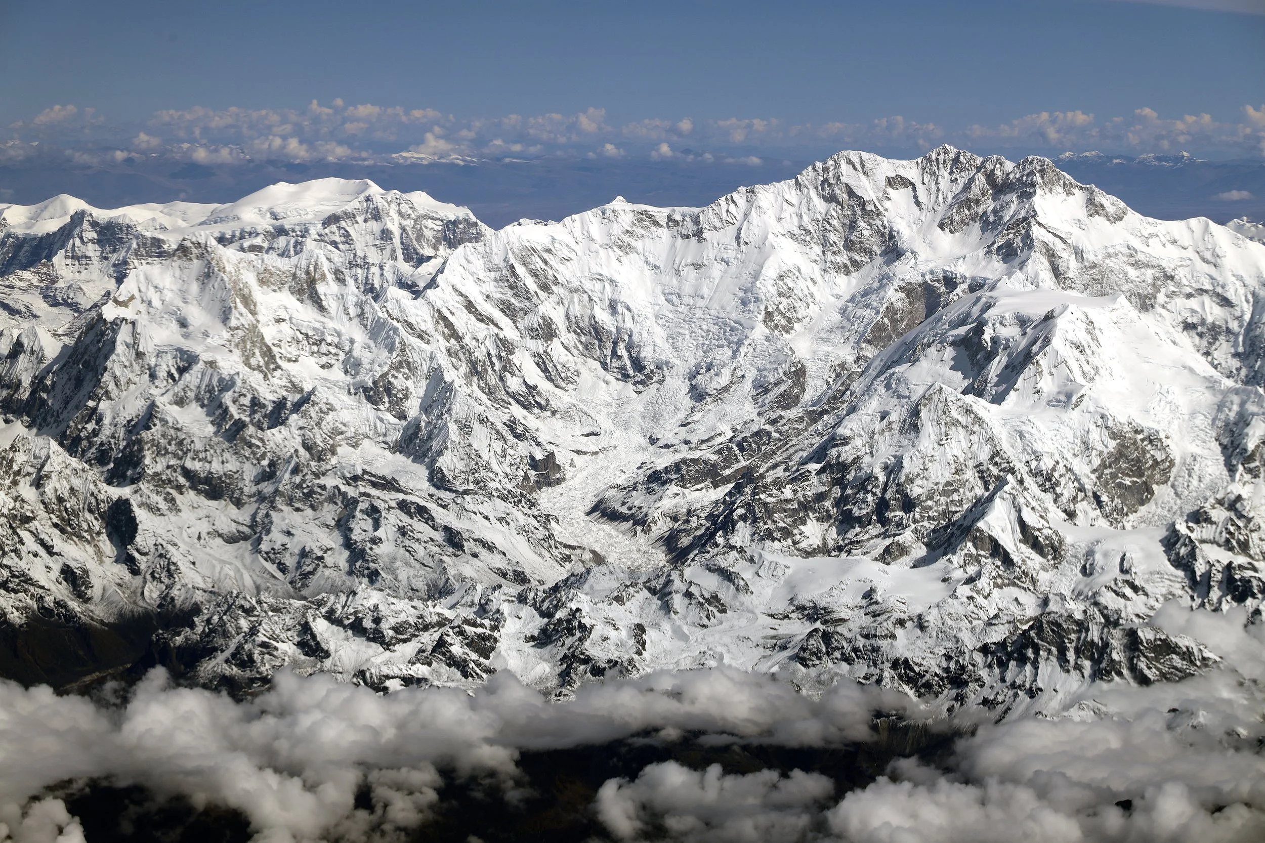
South side of Cho Oyu. The mountain on the right is Ngo Jumba Kan 7664m.
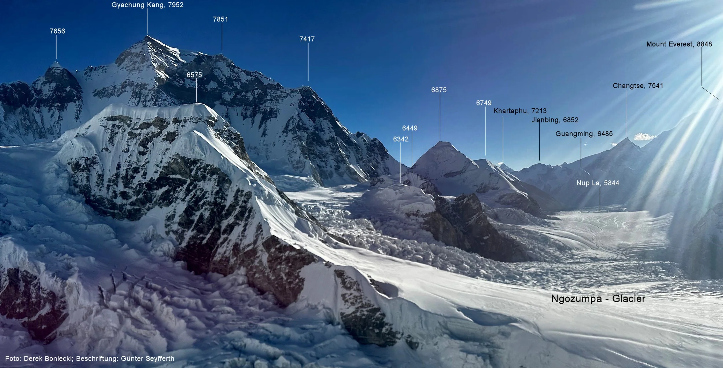
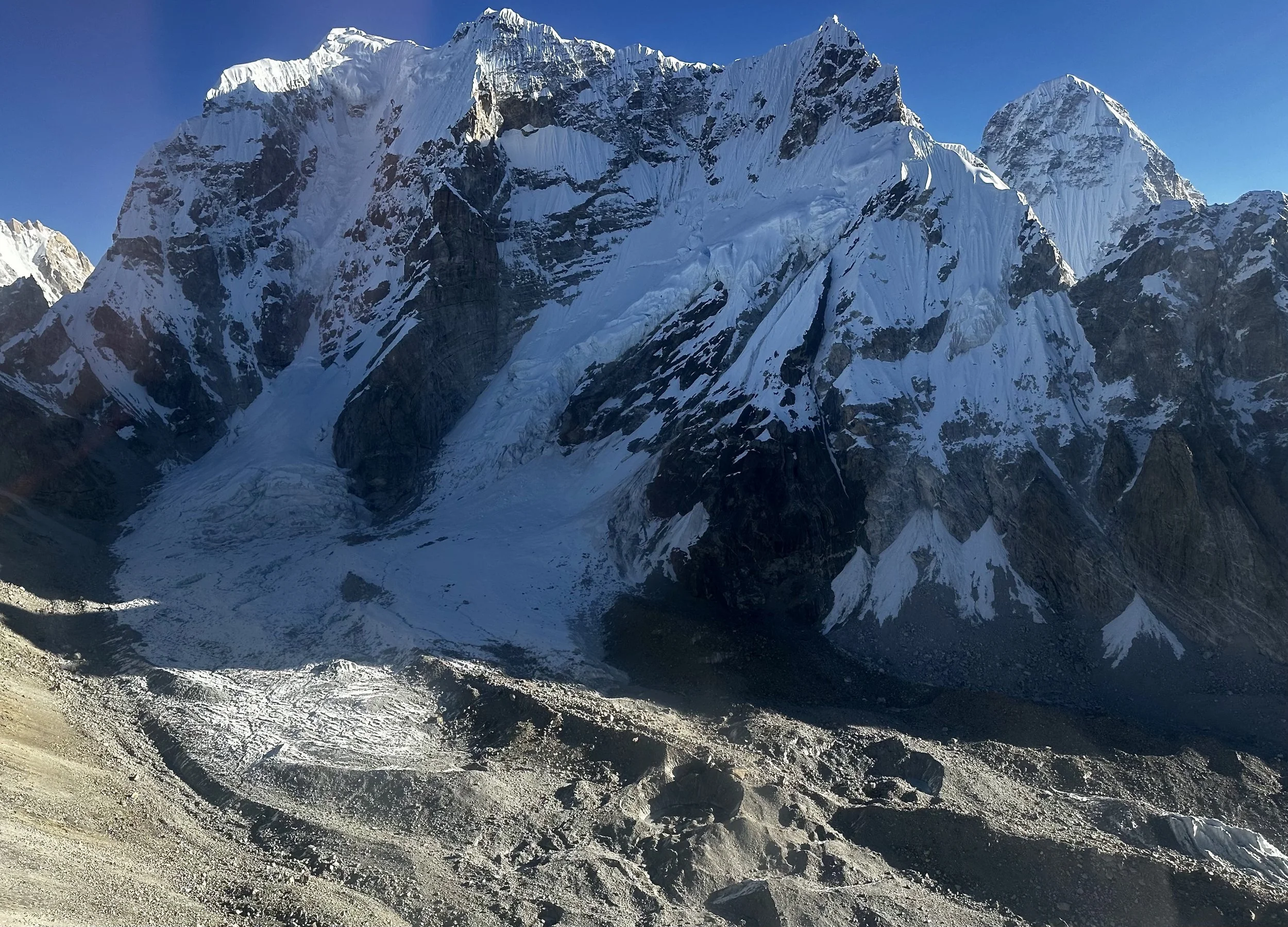
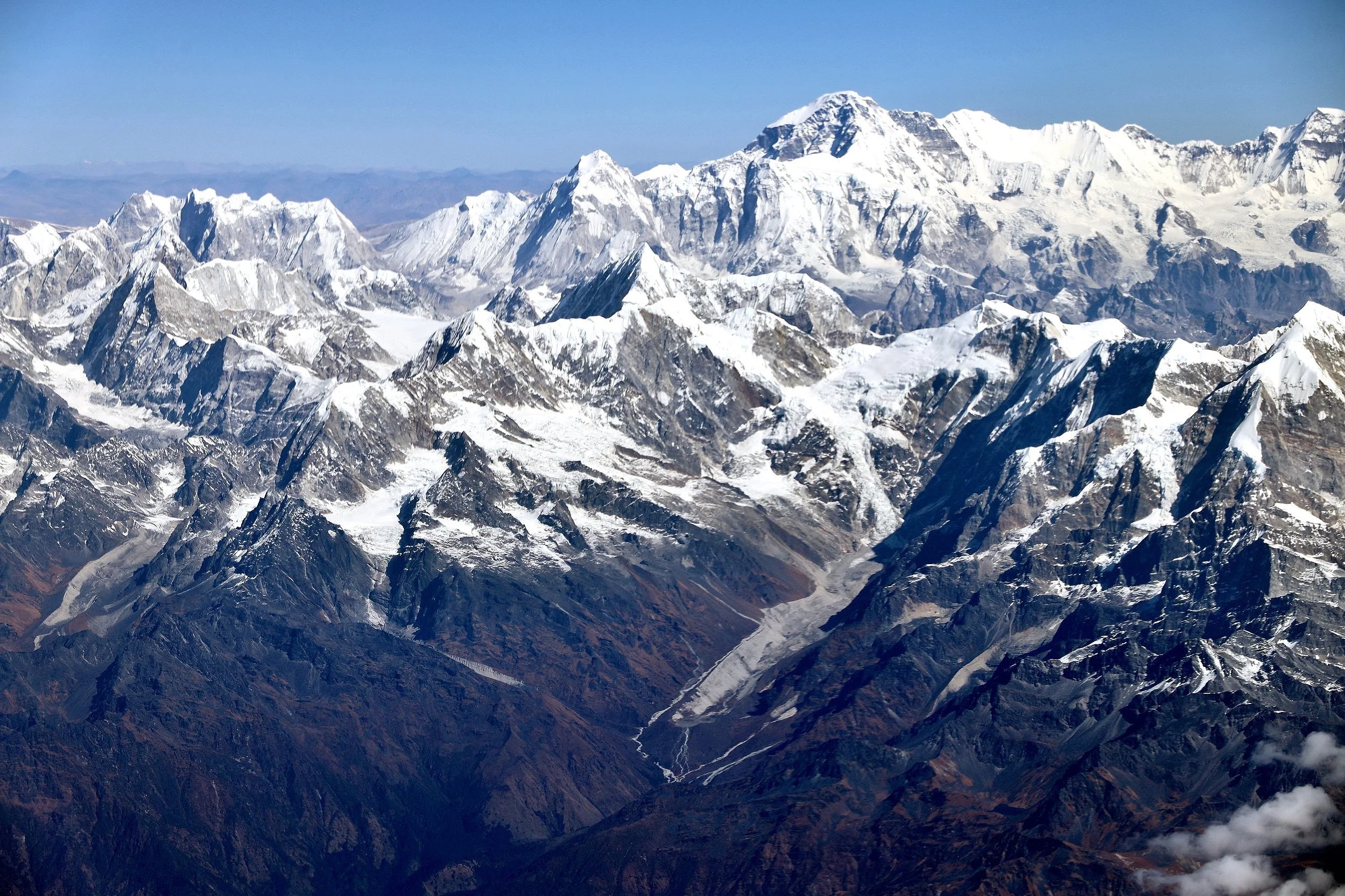
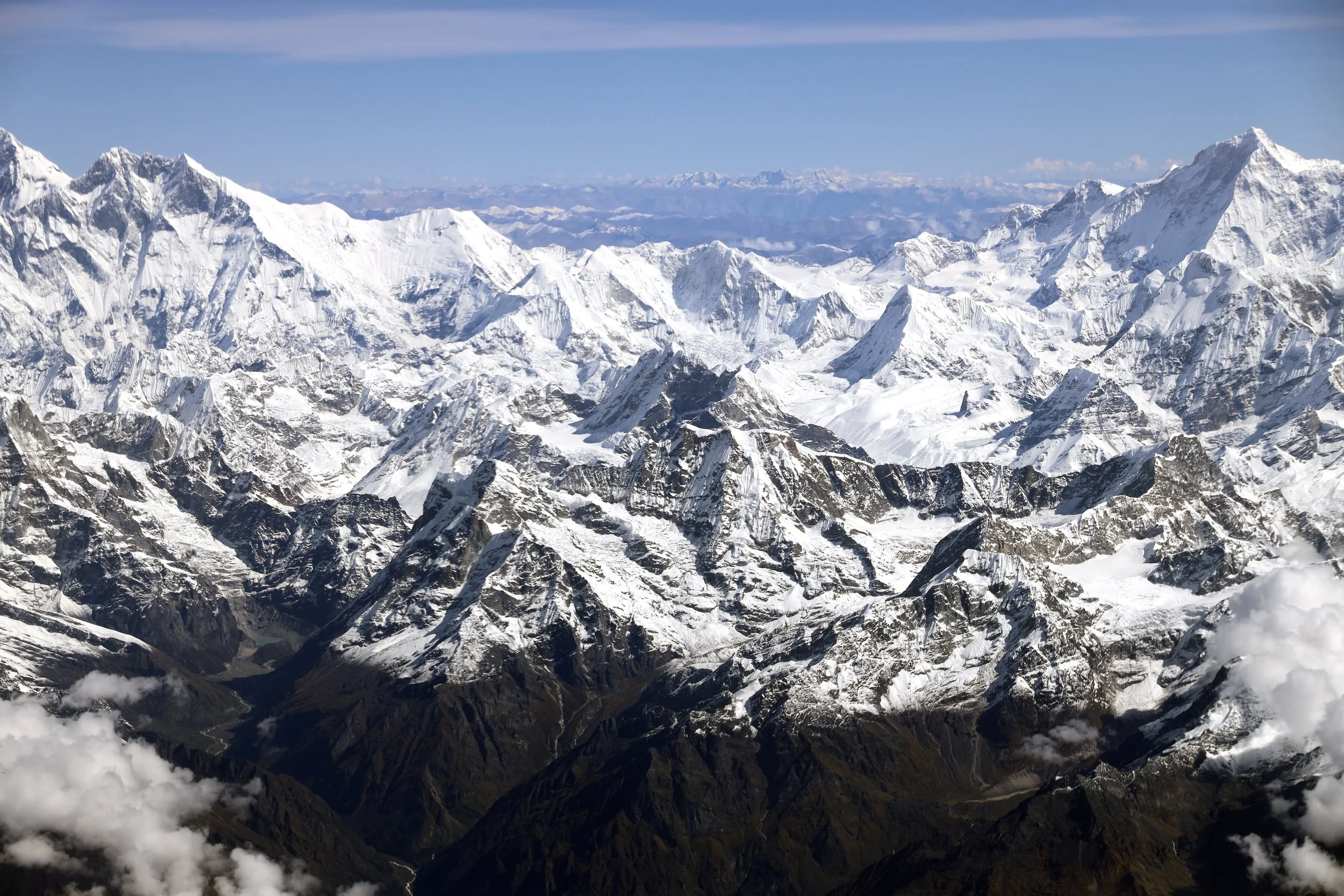
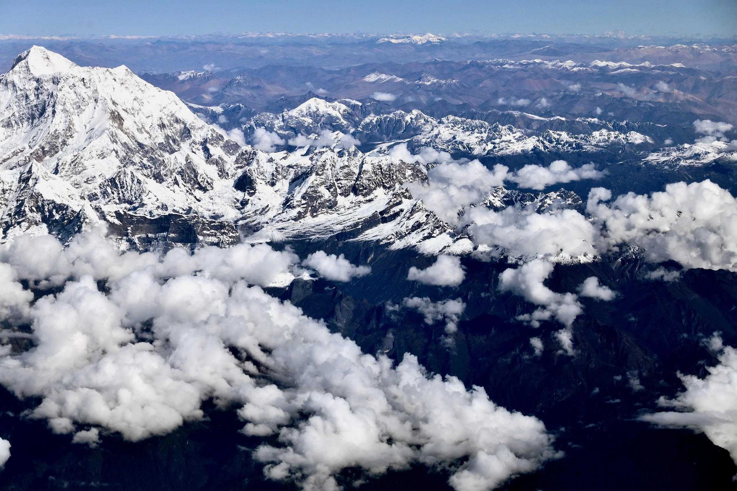
We gained some altitude and are now at 21000 feet. The mountain on the right is Gyachungkang 7922m.
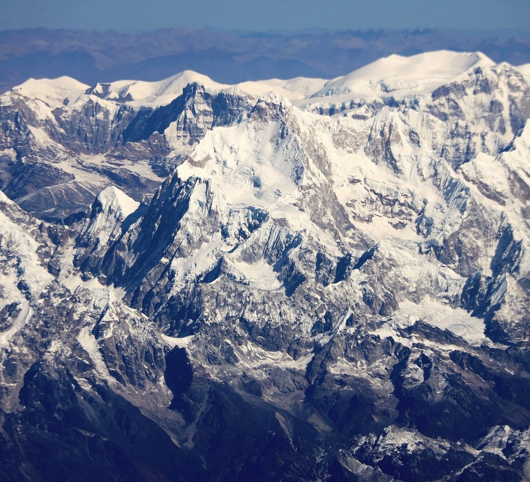
Gyachungkang 7922m
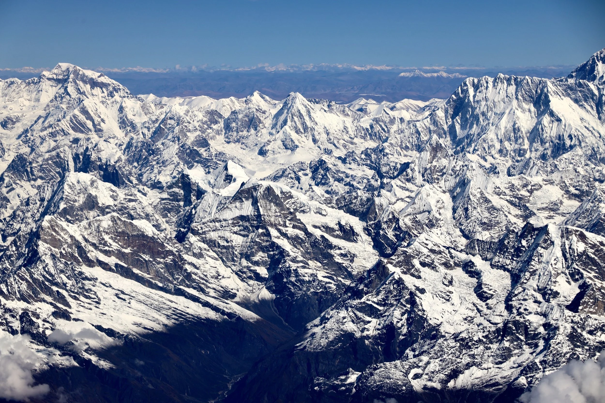
Gyachungkang on the left, West Rongbuk Glacier and Chakung on the right (lower part of it)
Gyachungkang 7,952m
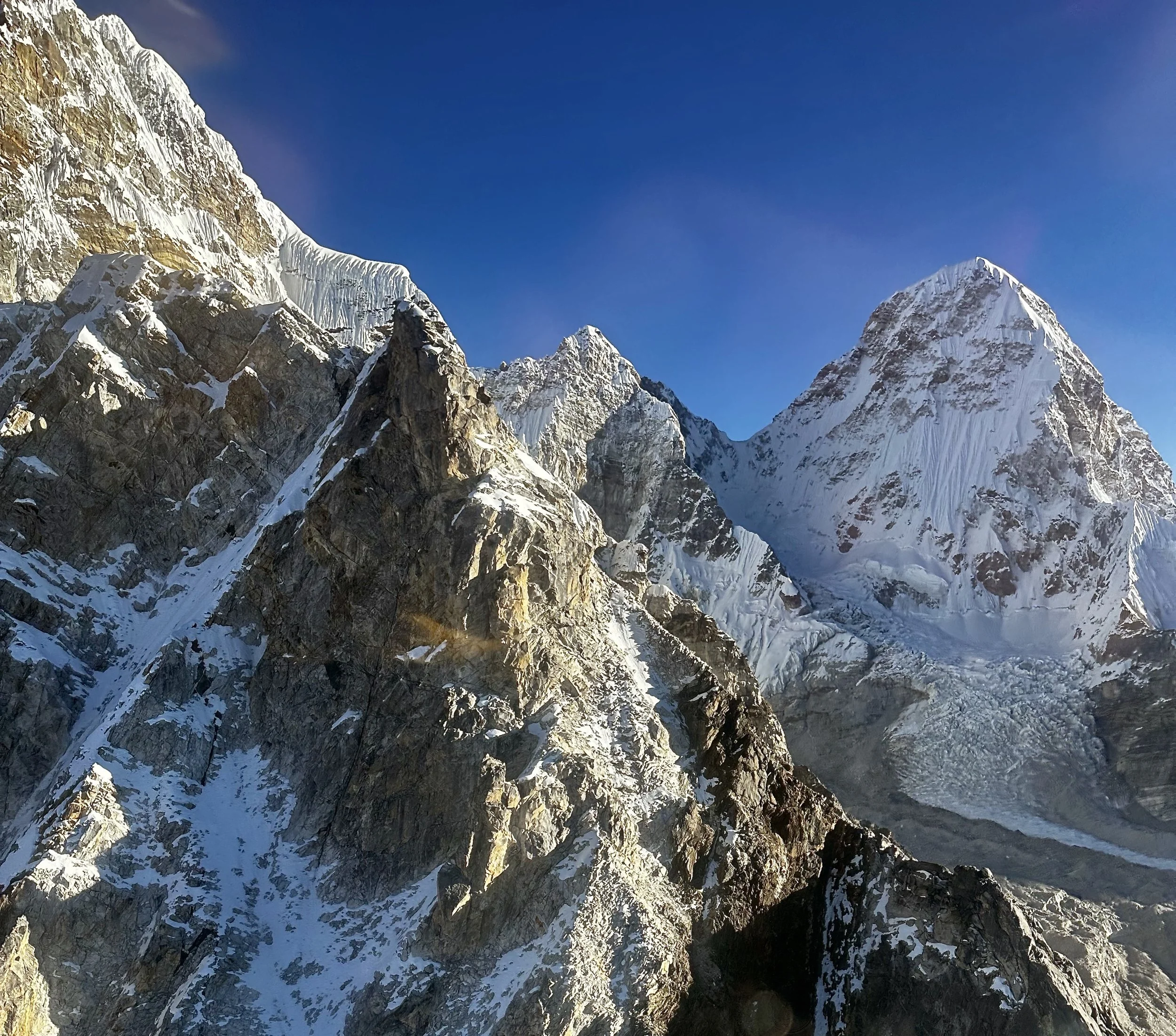
Chakung 7029
Chakung 7,029 on the left and Chumbu 6859m on the right
Chakung 7029 on the left/centre. Upper section of the Gaunara Glacier.
Gaunara Glacier and Chumbu 6859m
Chakung 7029m and Gaunara Glacier
Chakung and upper Gaunara Glacier
Chumbu 6859m
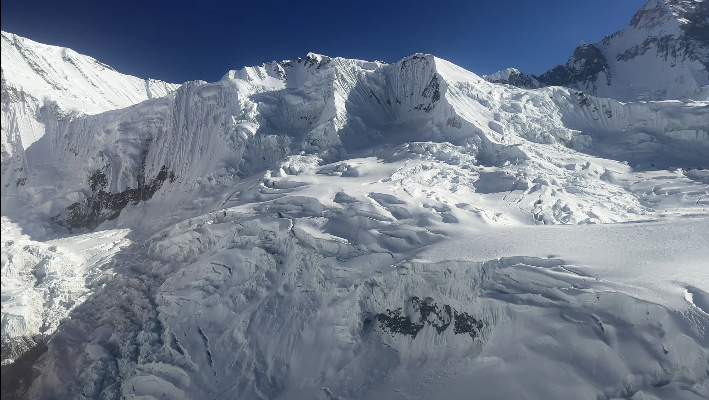
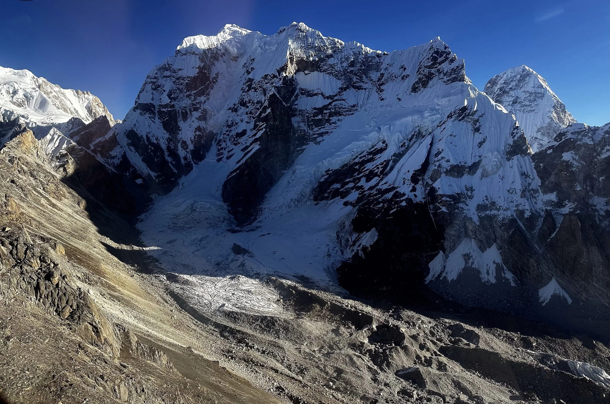
Chongri Pass and Chumbu 6859m. Pumori can be seen on the right. The glacier is Changri Nup.
Chumbu
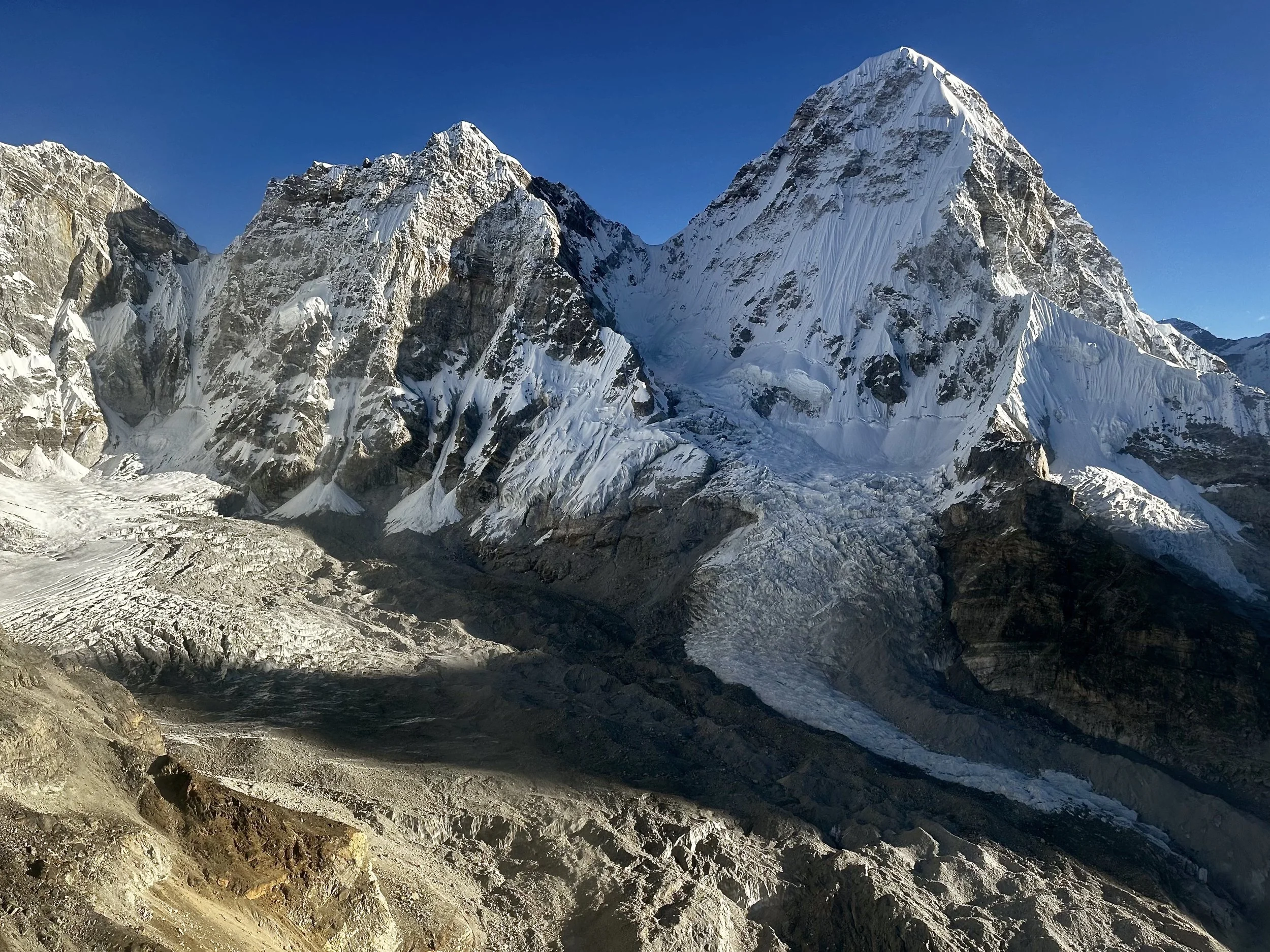
Pumori
Changri Pass
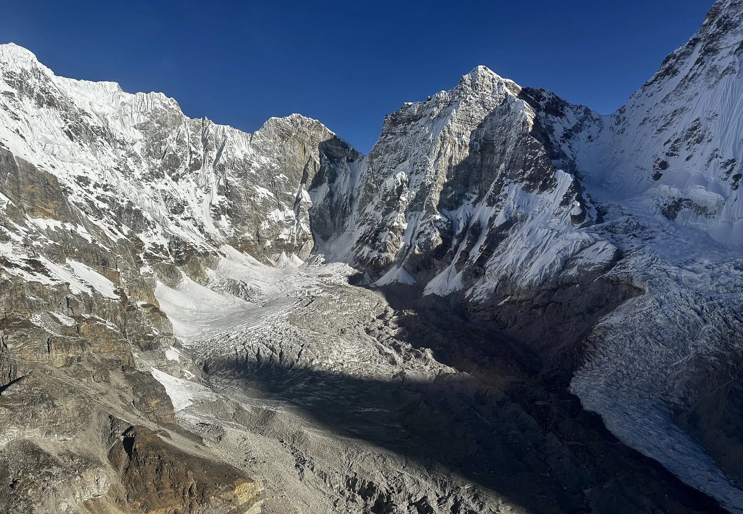
Chumbu and Pumori tower above Changri Nup Glacier
The rocky ridge of Chumbu. Pumori 7165m on the right. The glacier coming off Pumori is Changri Shar Glacier.
The wall of Chumbu
West aspect of Pumori
Changri Shar Glacier. Lower section of Pumori is on the right.
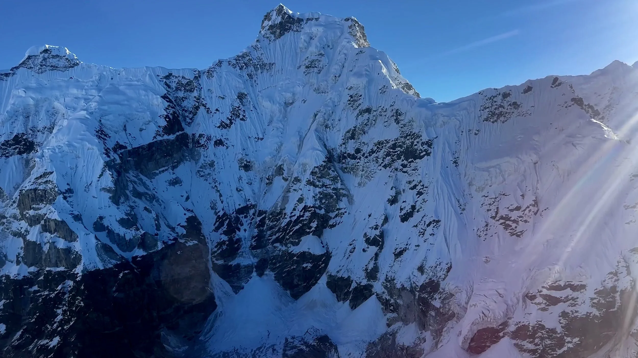
Pumori 7165m
Pumori 7165m
East aspect of Chumbu and Changri Shar Glacier
The glacier between Chumbu (left) and Pumori (right)
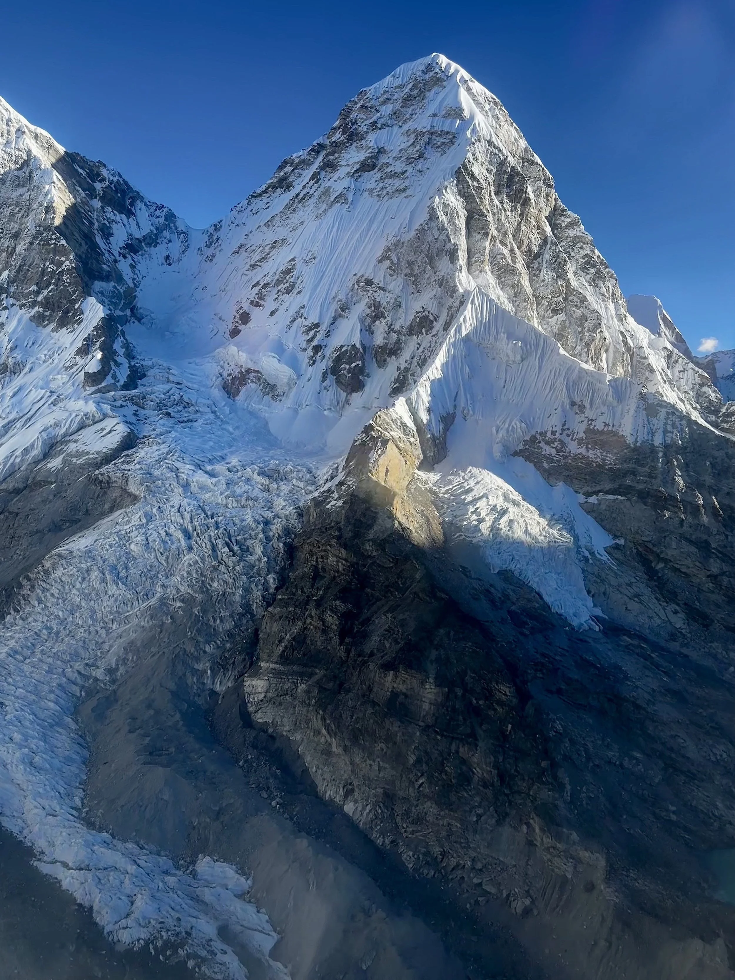
Pumori
Pumori
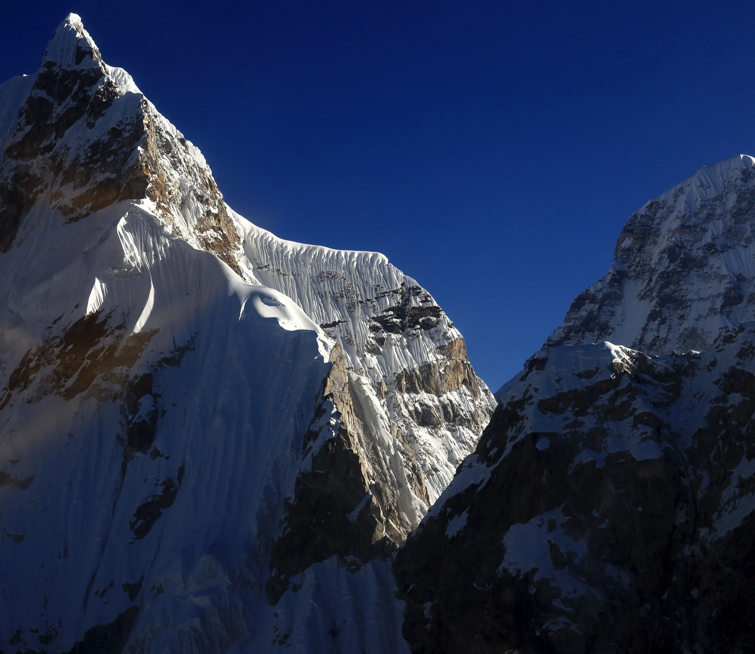
Pumori (left) and Lingtren 6749m
Pumori 7165m
Pumori
The ridge of Pumori and Lingtren 6749m
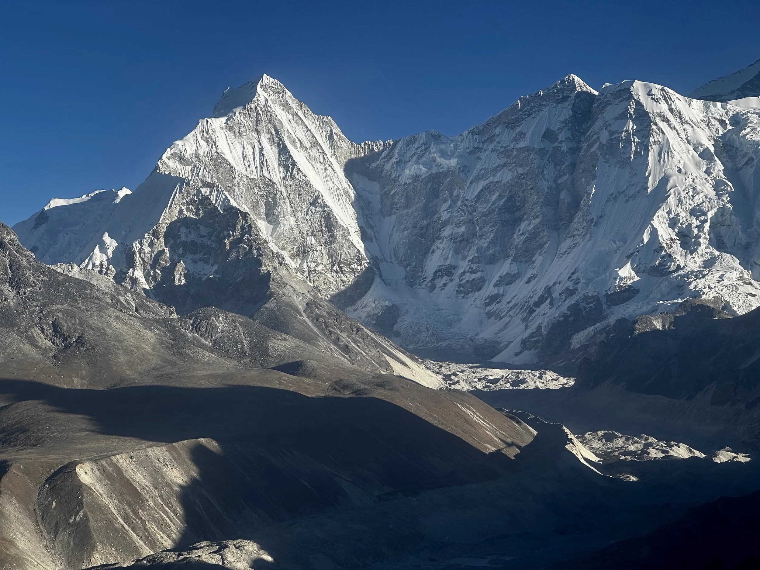
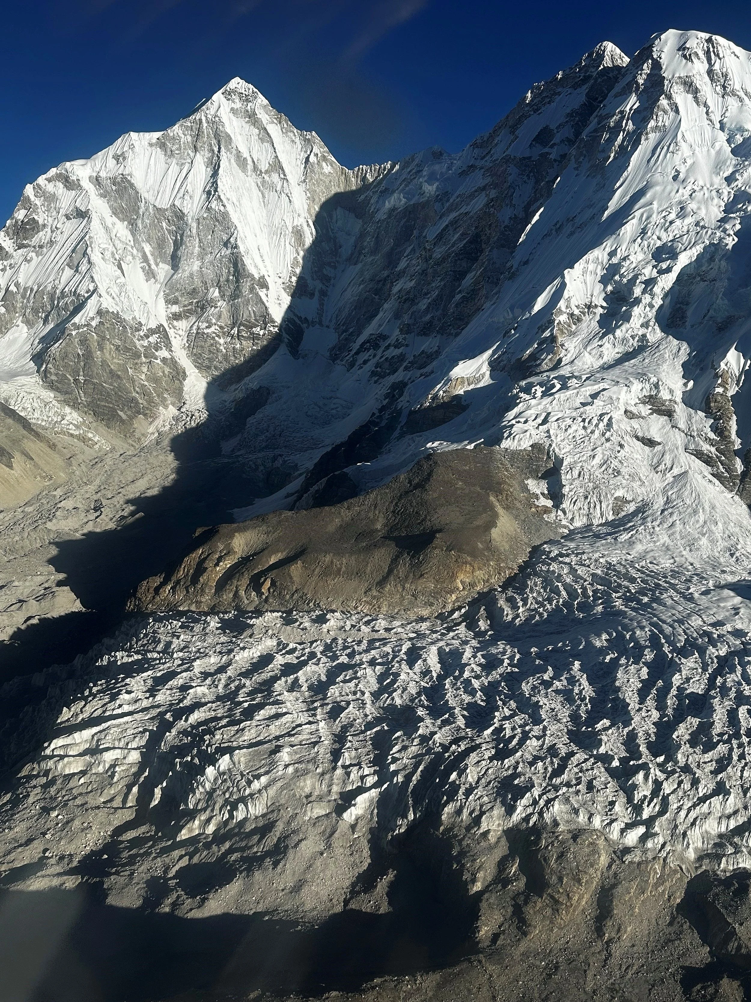
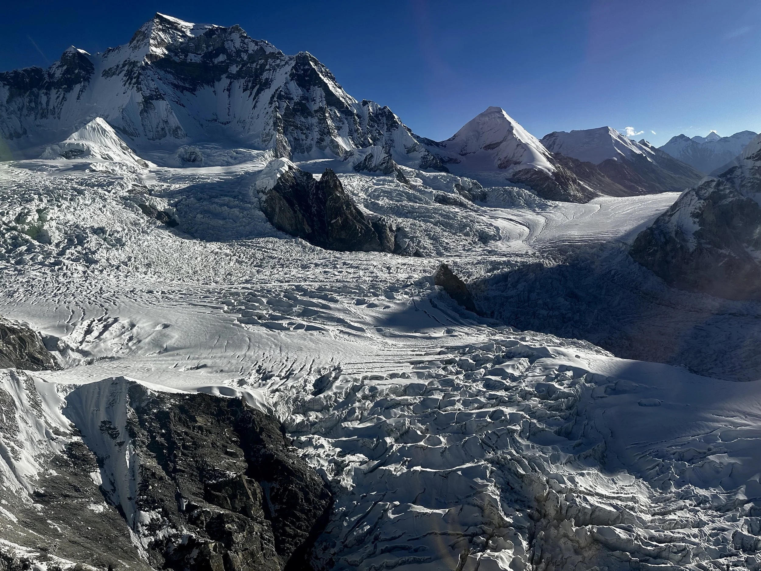
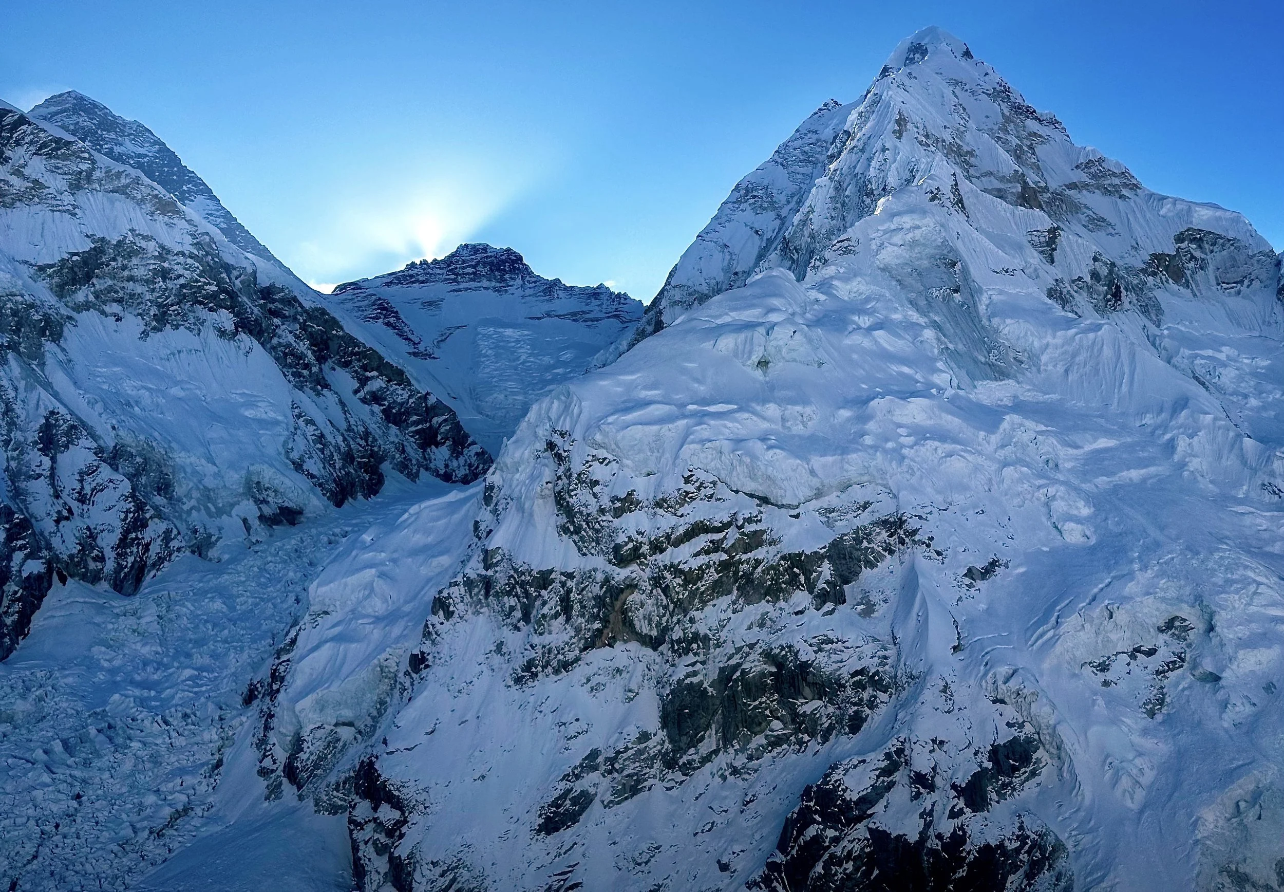
Lingtren and Everest BC
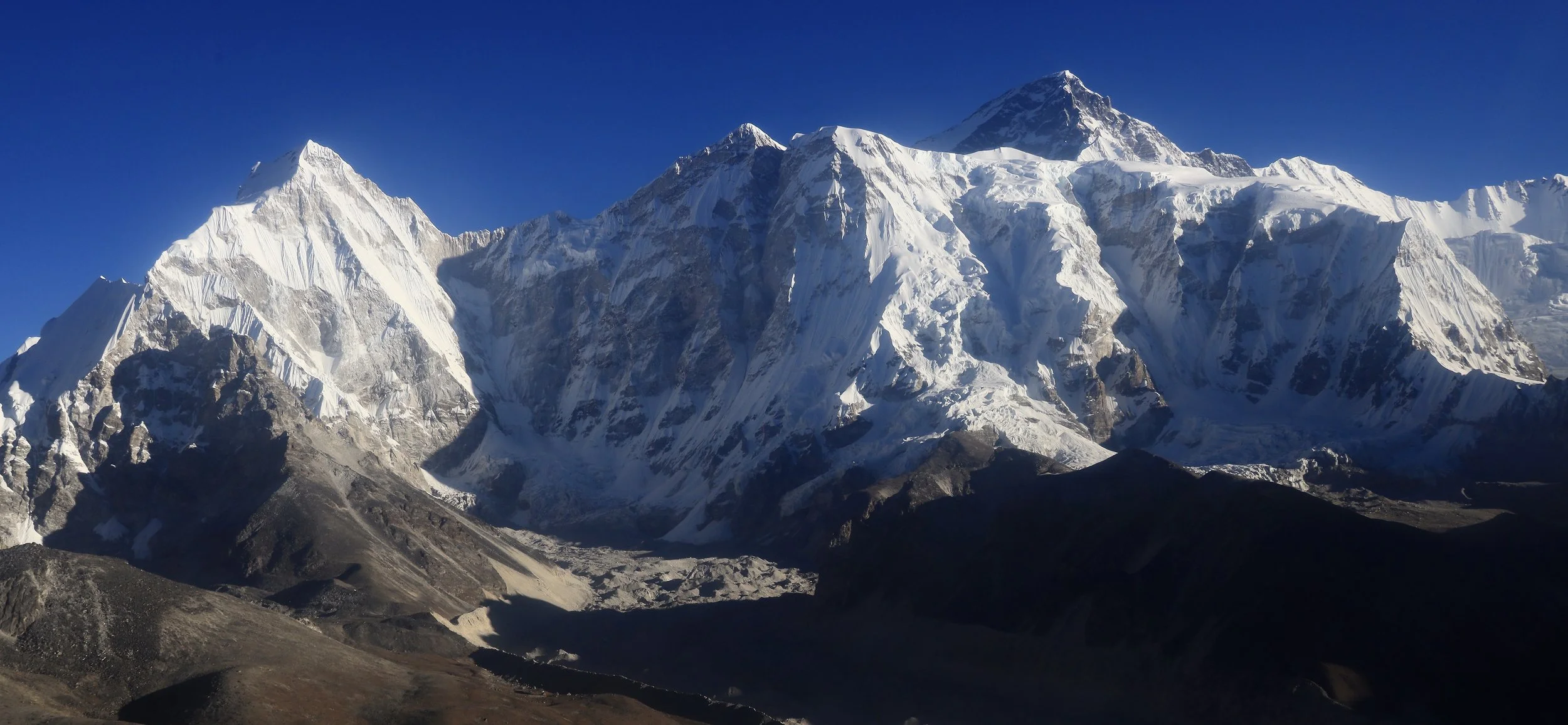
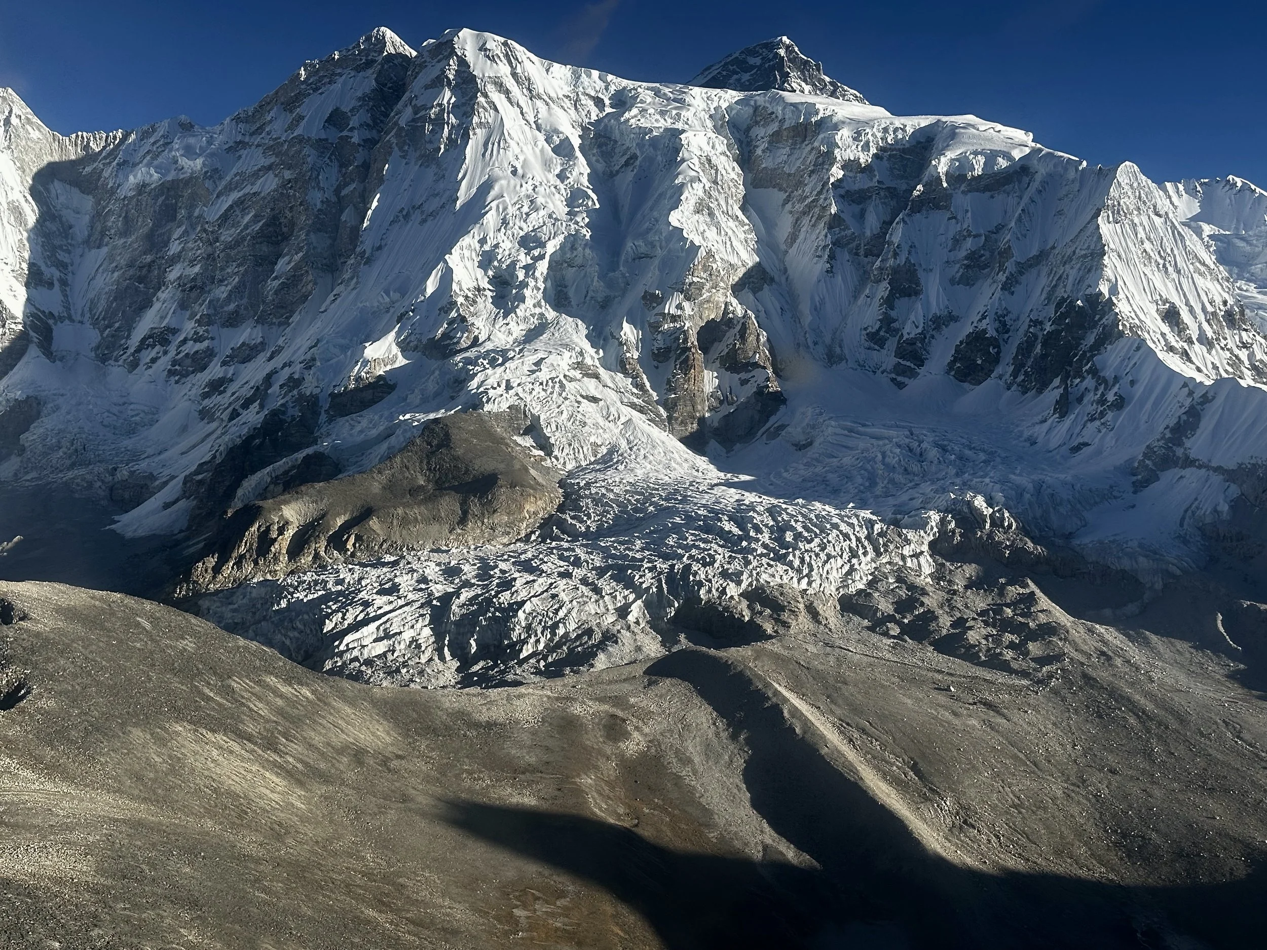
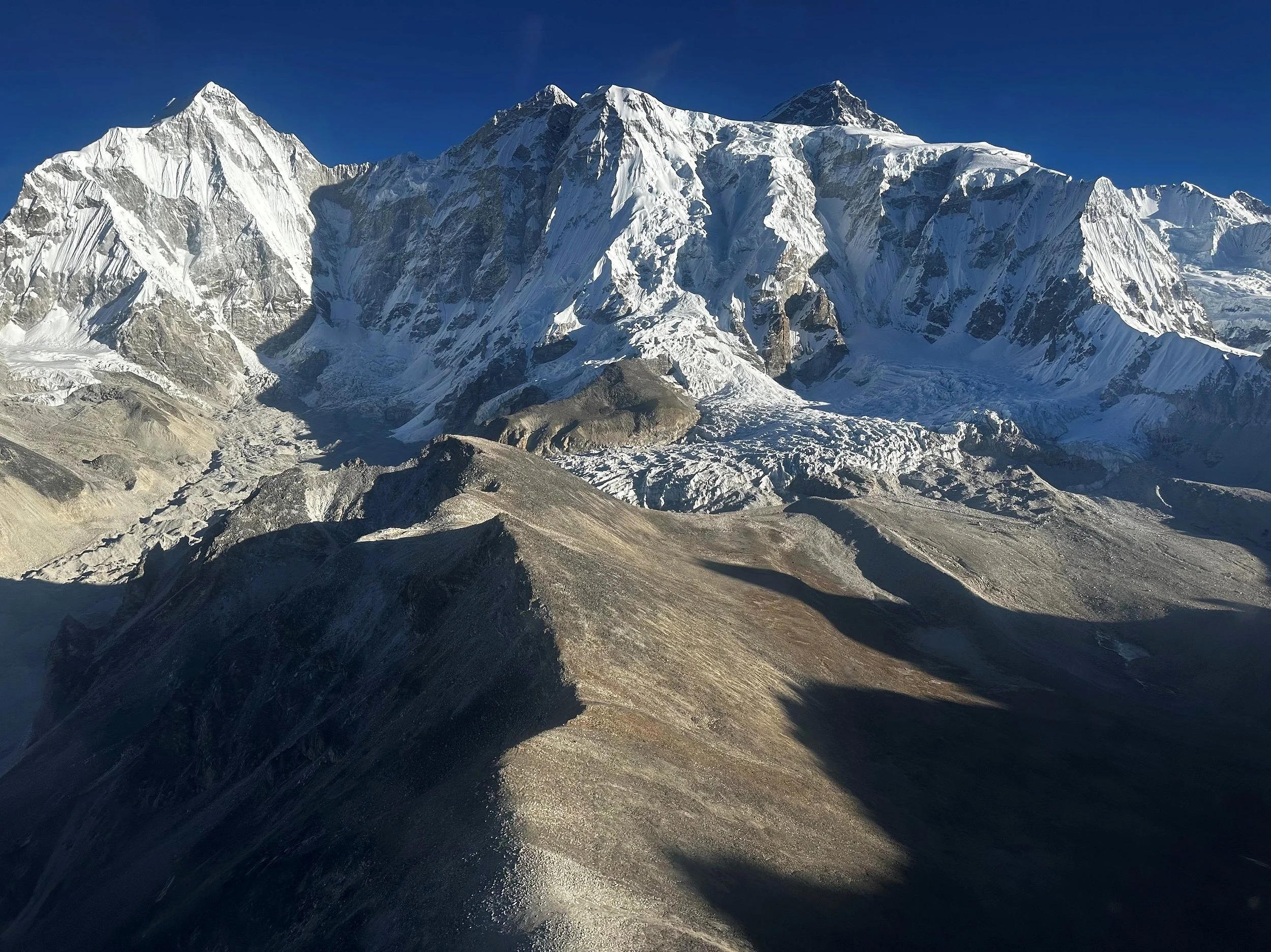
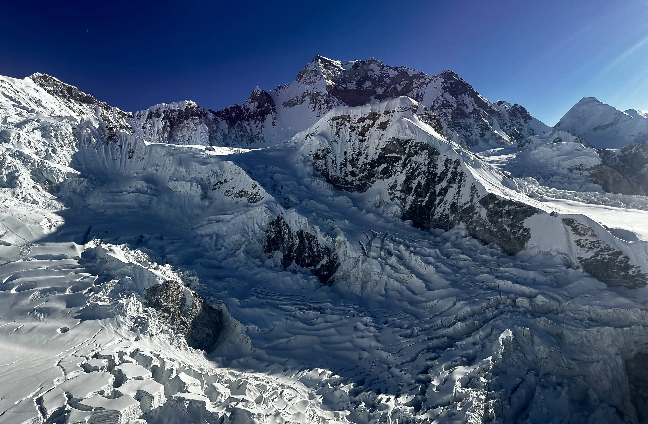
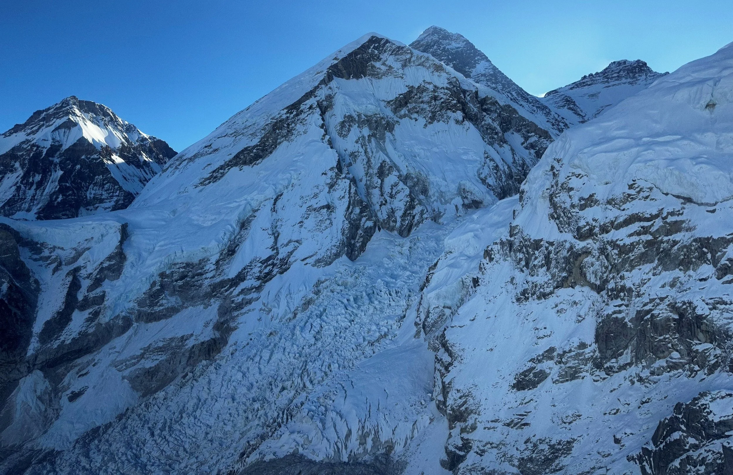
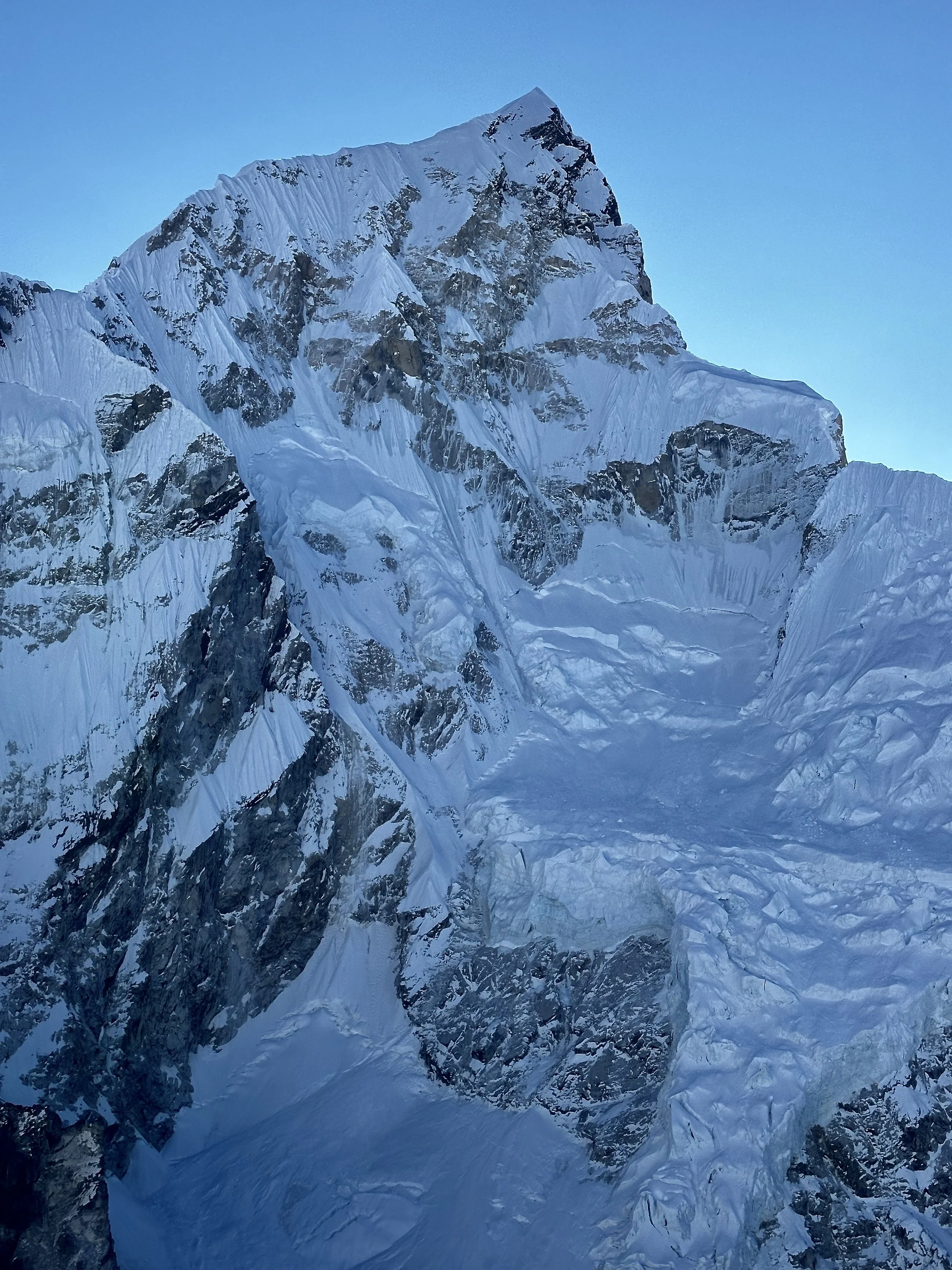
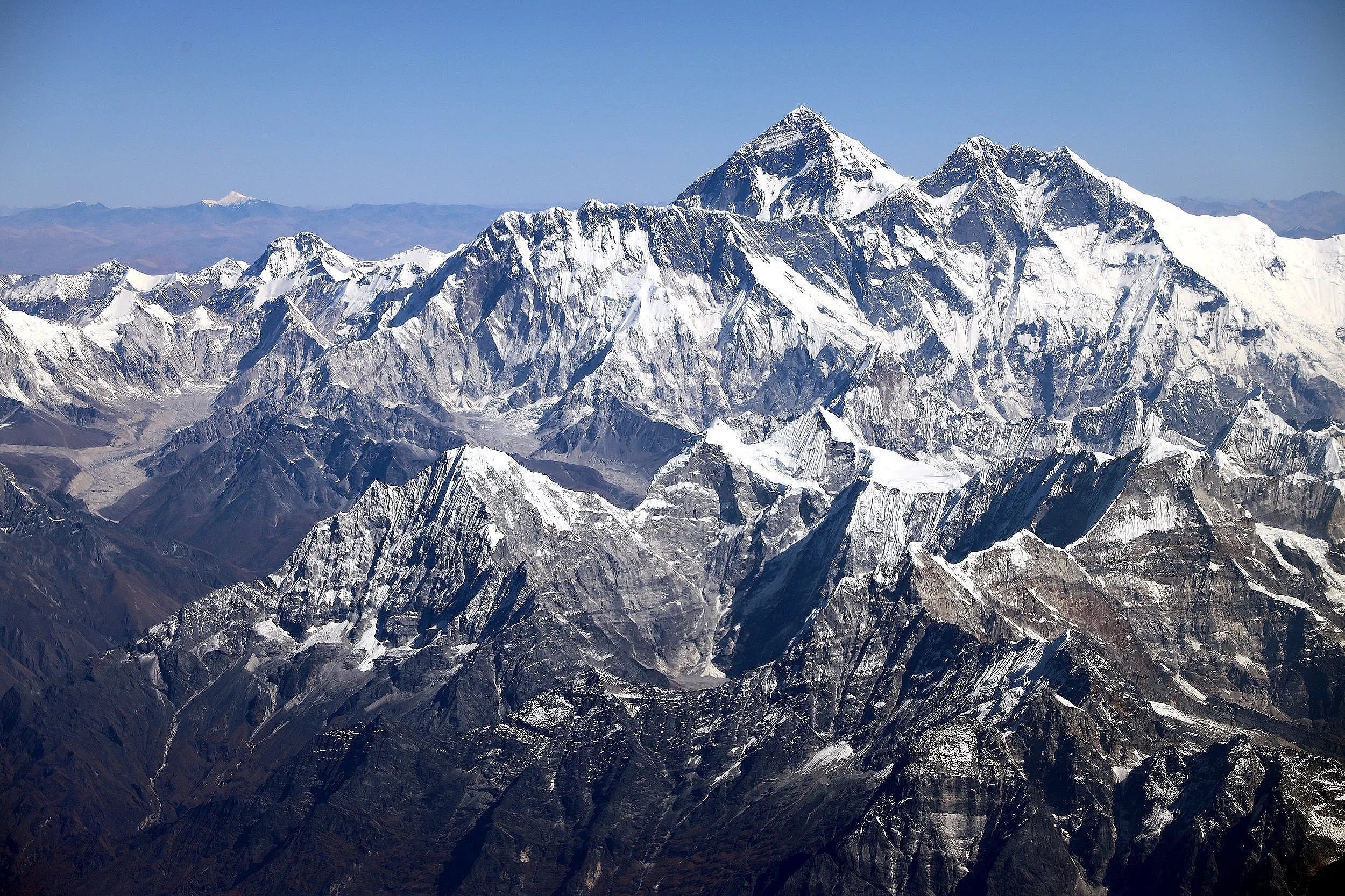
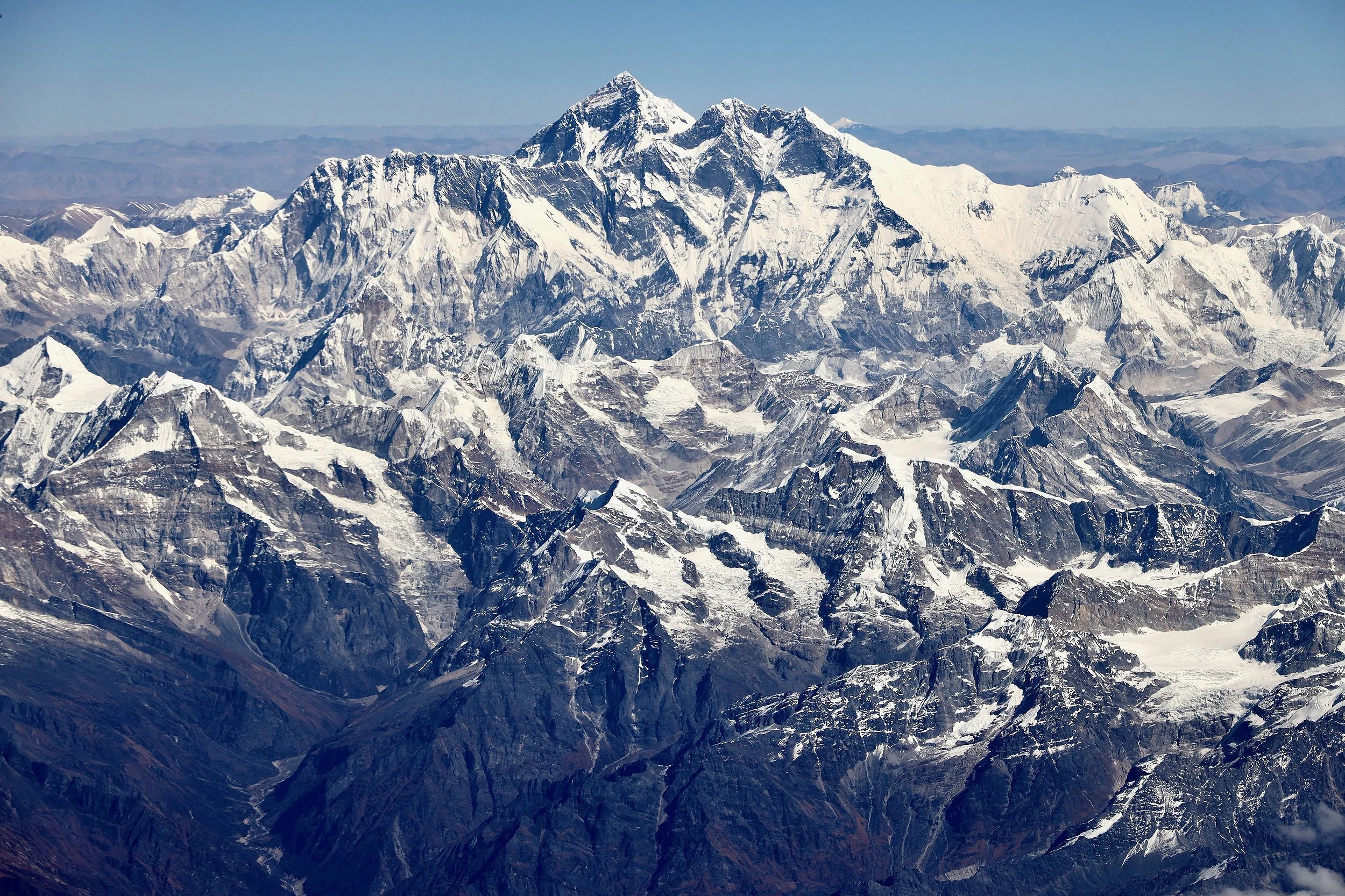
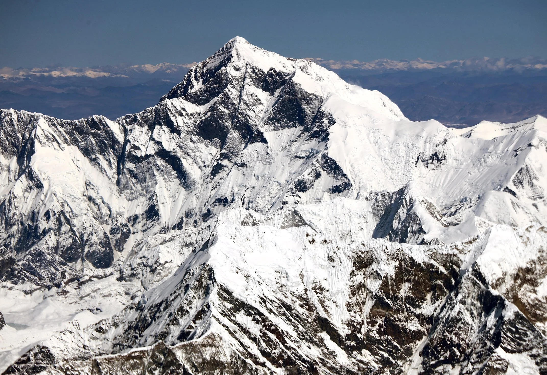
Everest, Everest Icefall, Lhotse and Nuptse - the giants of the Himalaya
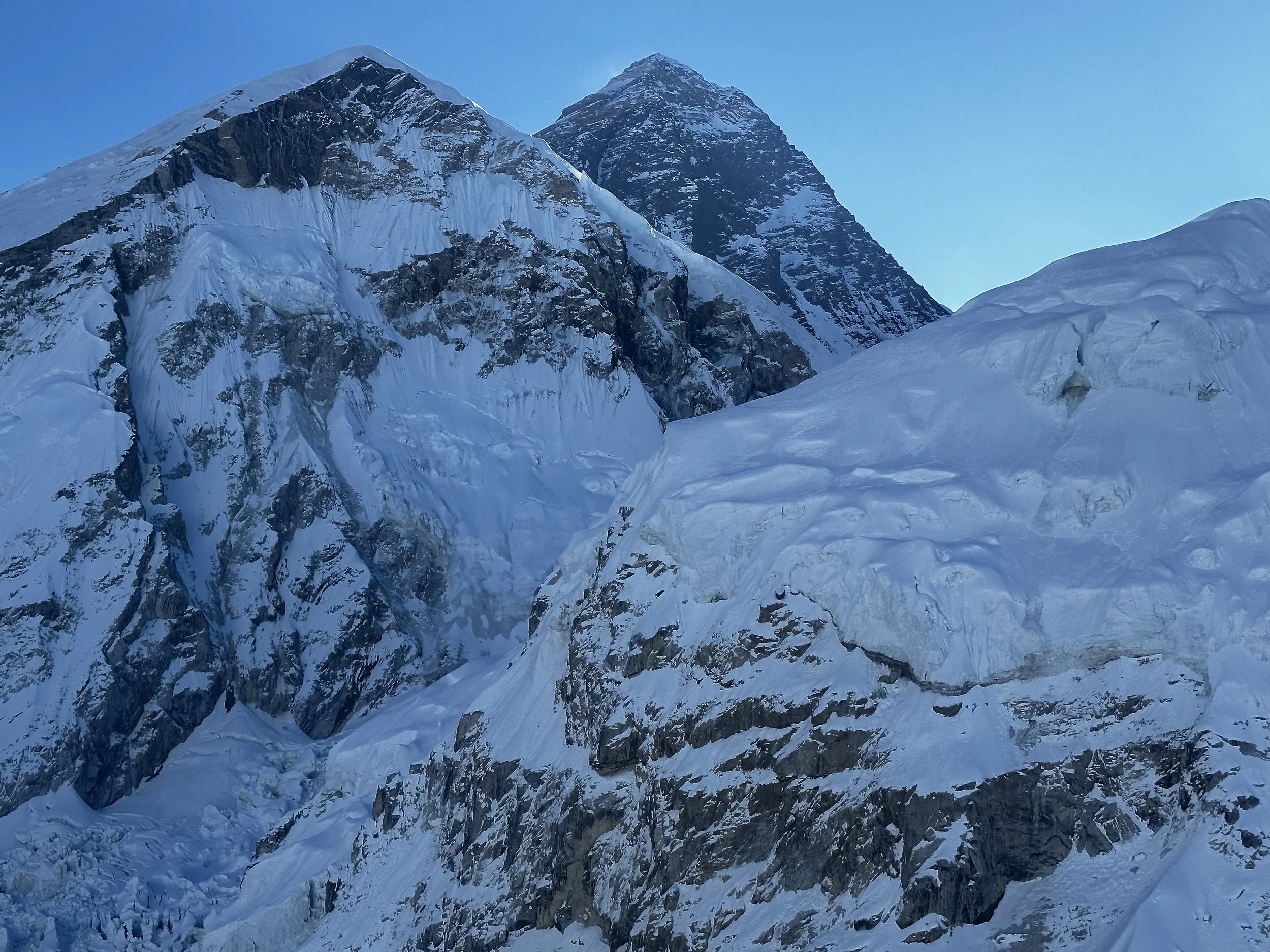
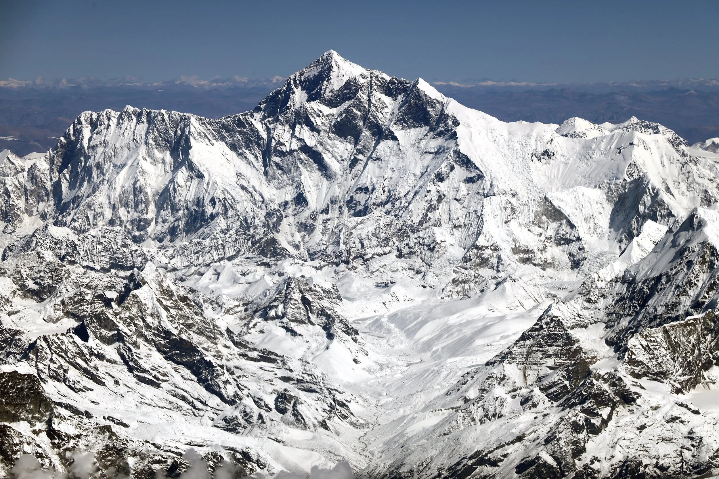
Mt. Everest
Everest icefall. Everest summit, south col and Lhotse are also visible.
Nuptse 7861m
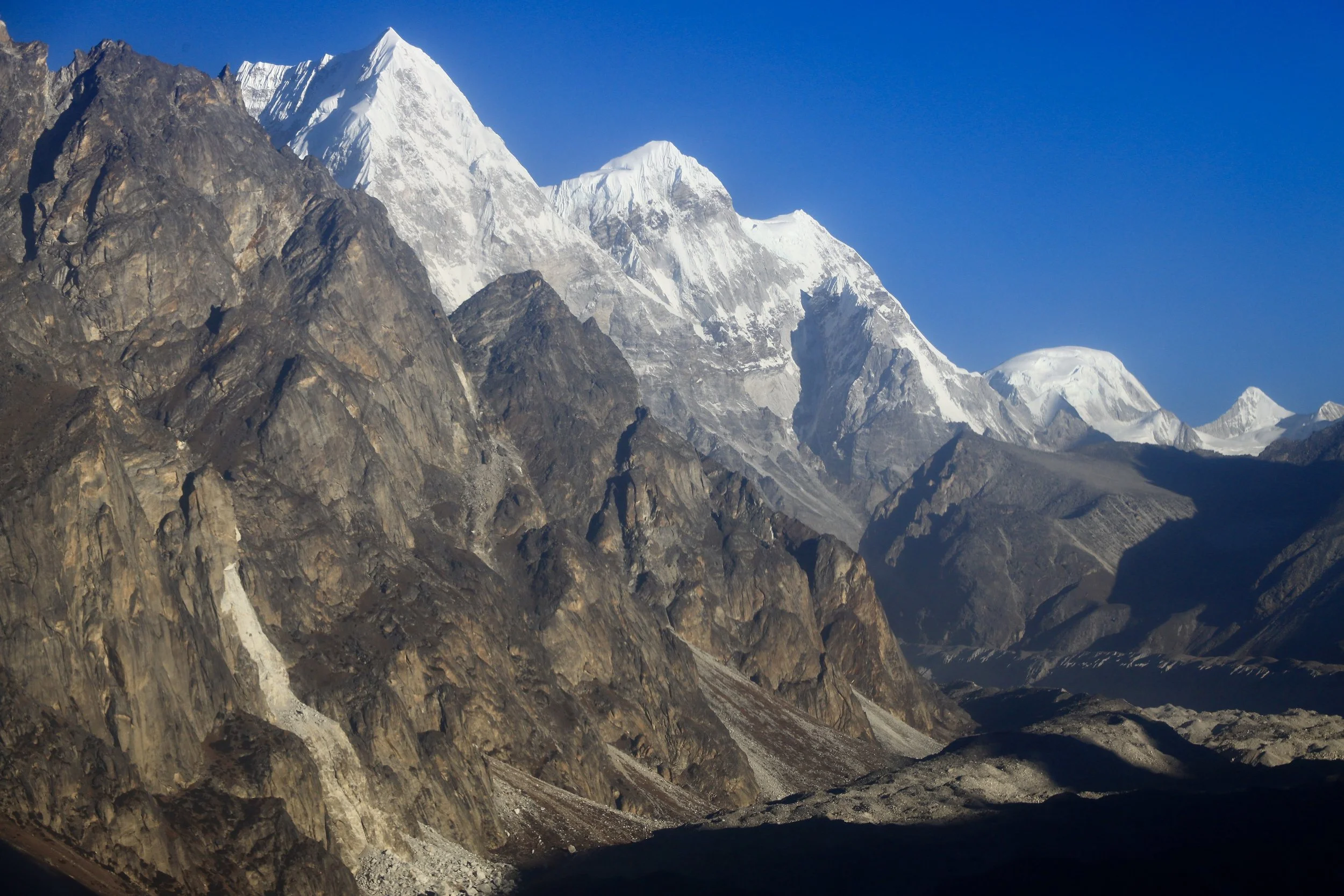
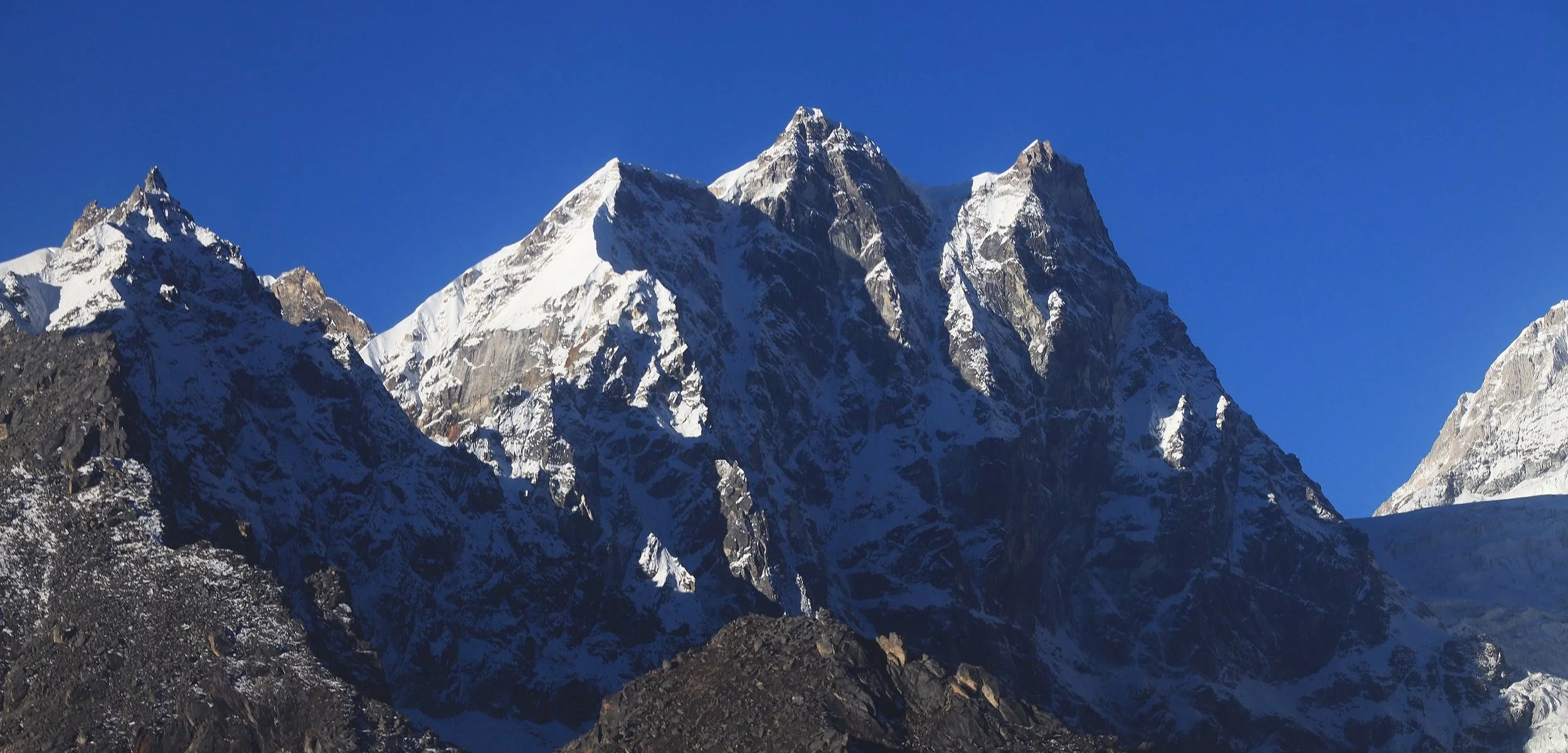
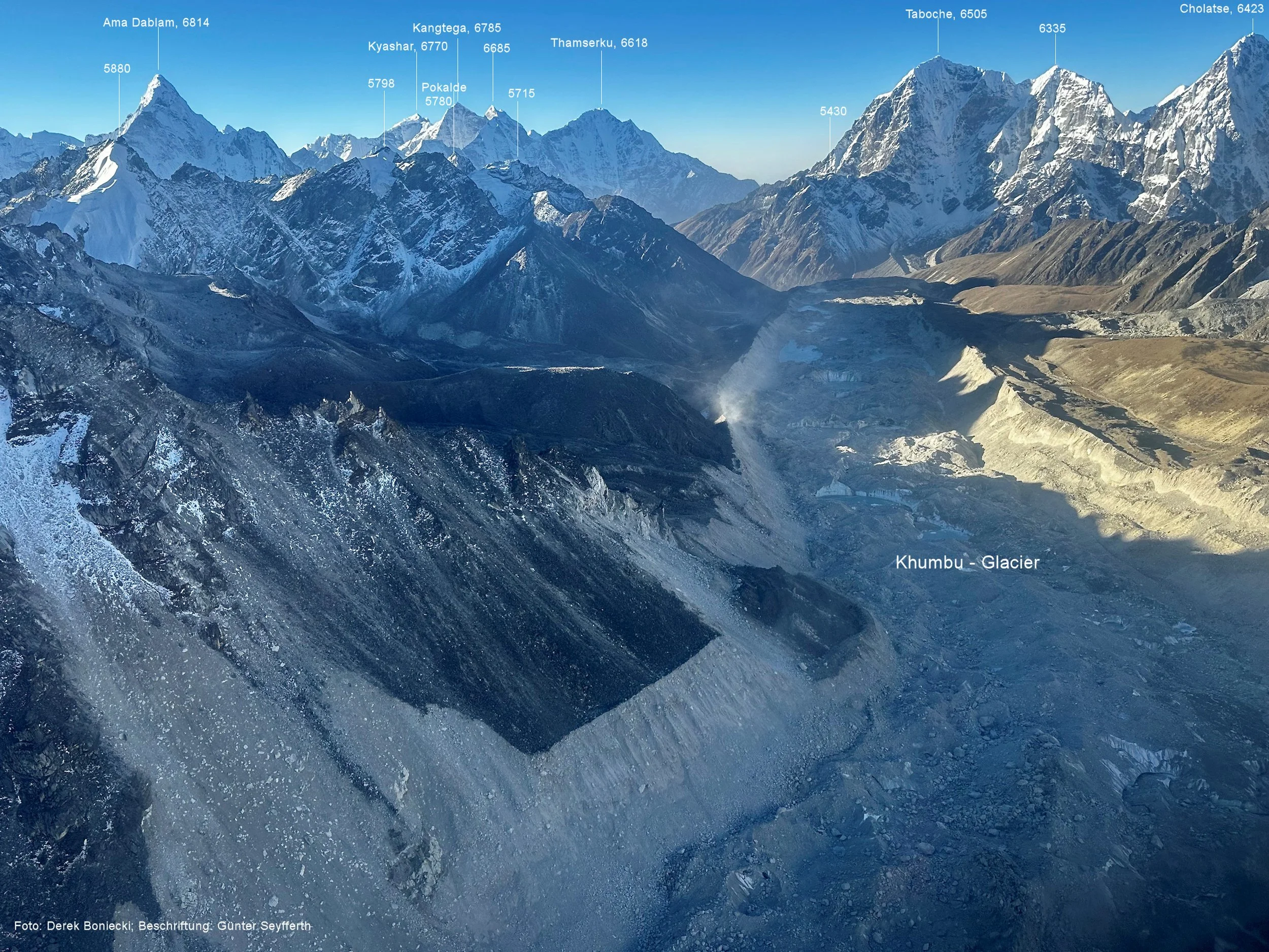
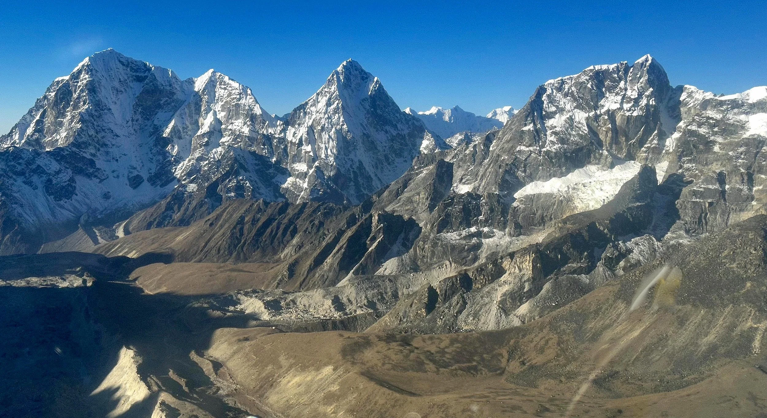
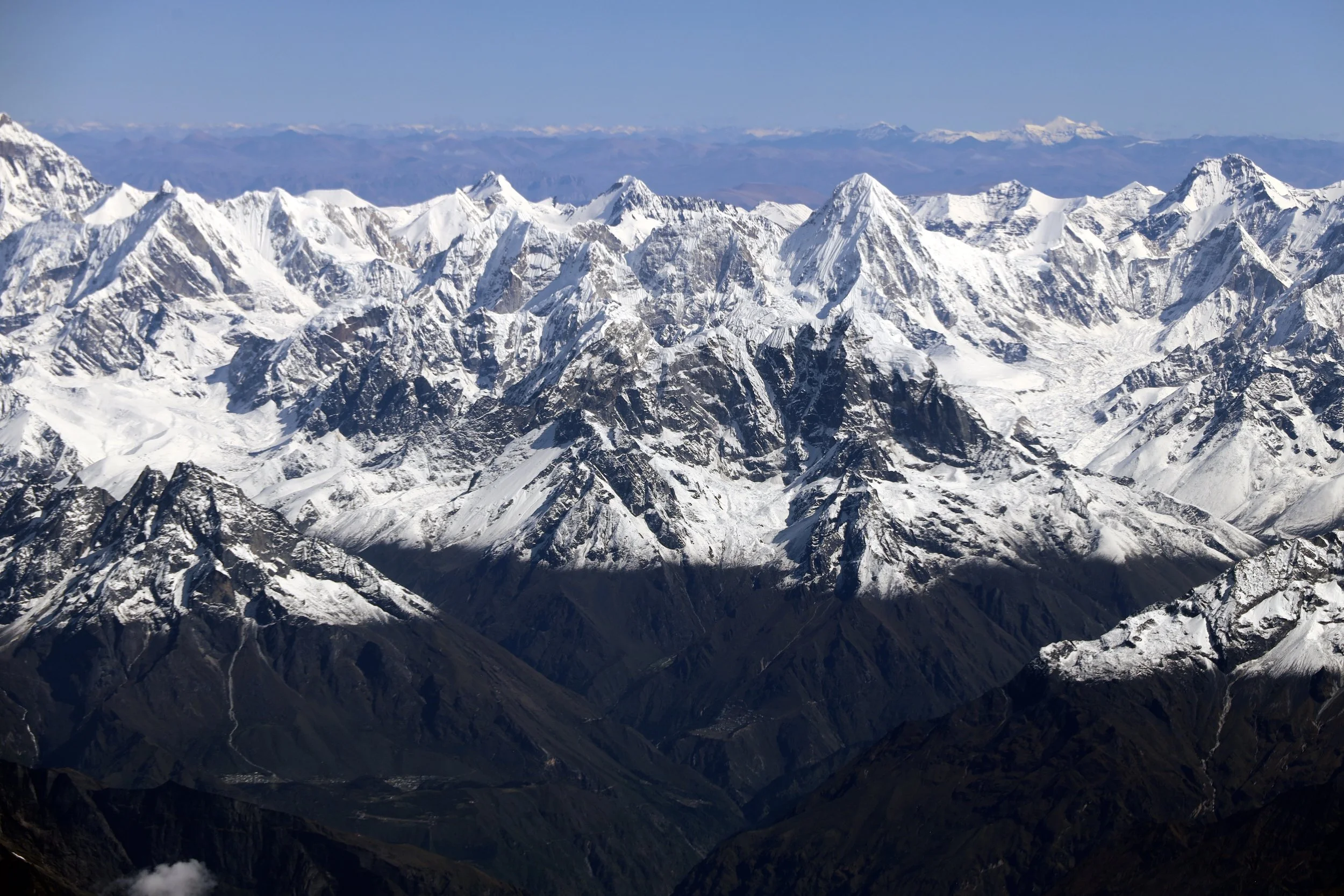
Taboche (left) 6367m, Cholatse (centre) 6335m and Lobuche East 6,119m
Renjo La (in the distance) and Chola Pass area
Chola Pass 5420m (the trail on the glacier is clearly visible).
Mountains to the south of Chola Pass
Cholatse and the trail down from Cho La Pass
Cholatse (left) and the rocky spires above the Cho La Pass
Looking north towards Jasemba and Cho Oyu from above the Cho La Pass
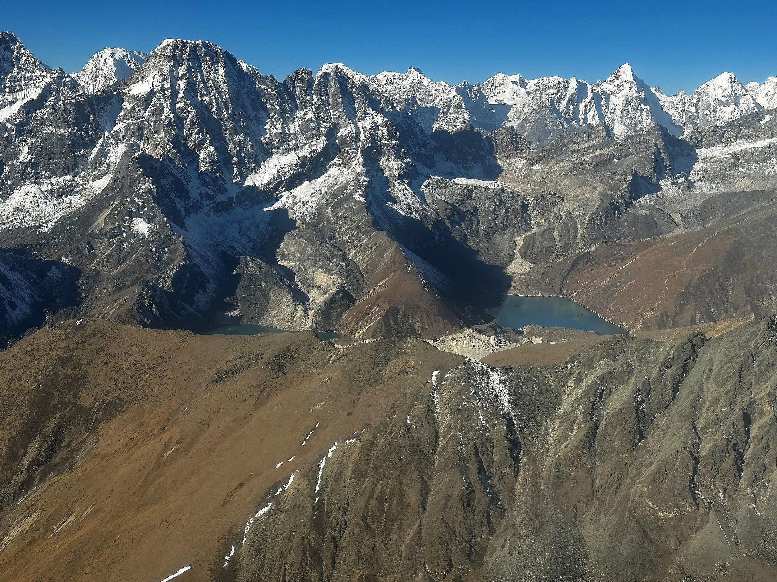
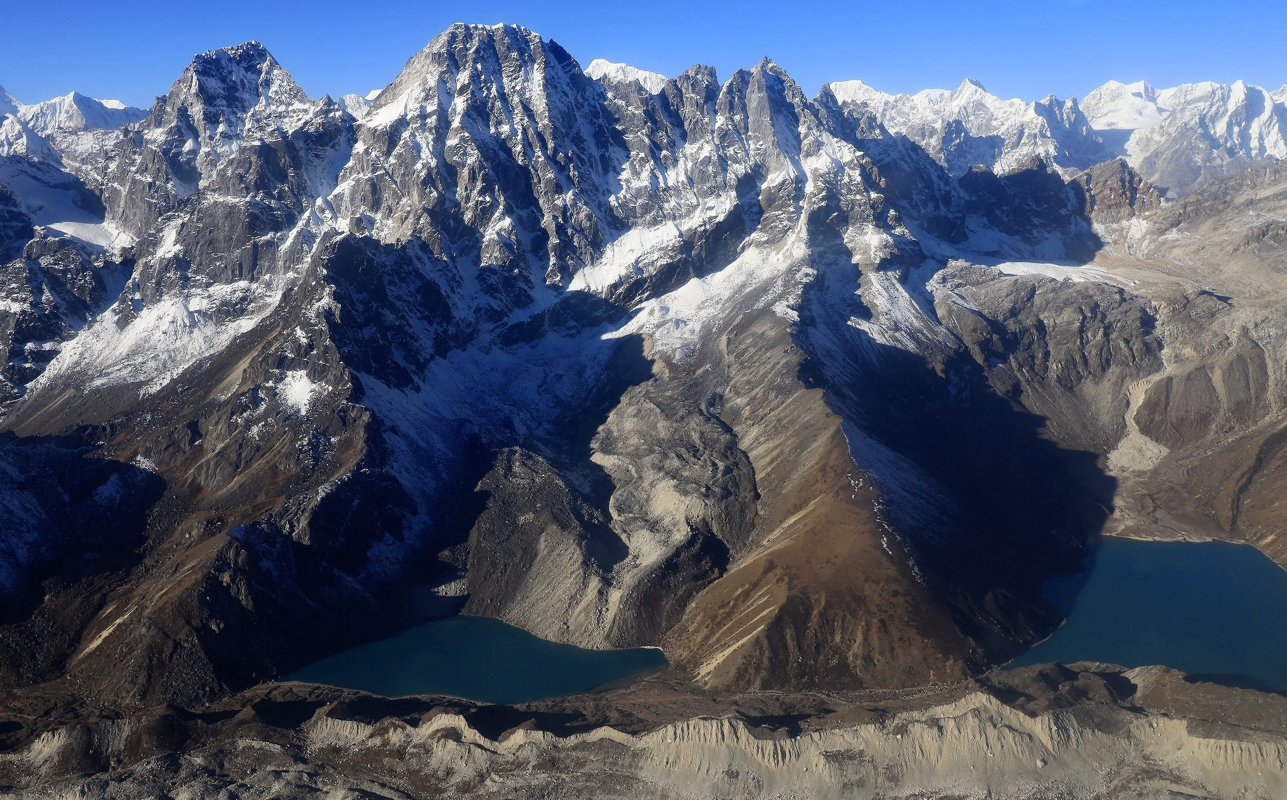
Gokyo Lake and Renjola Pass
Gokyo and Renjola Pass
Renjola Pass
Renjola Pass
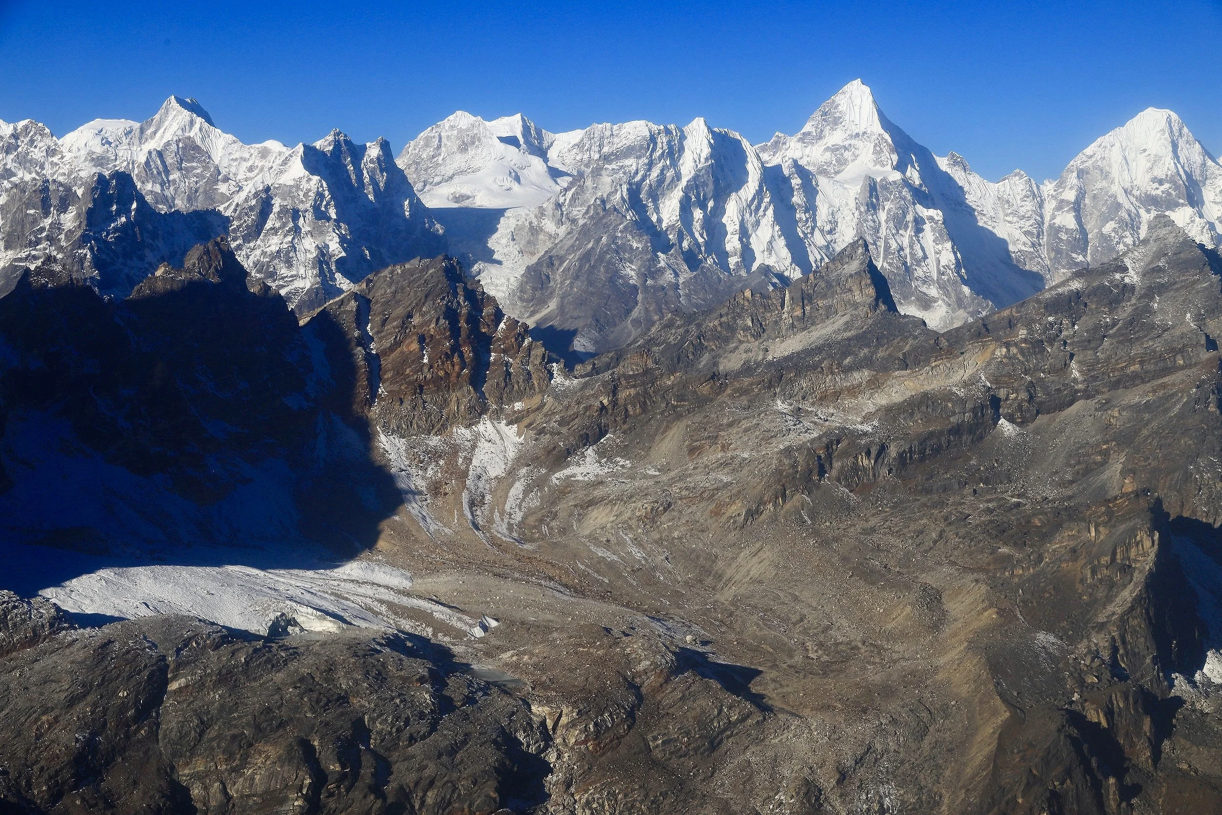
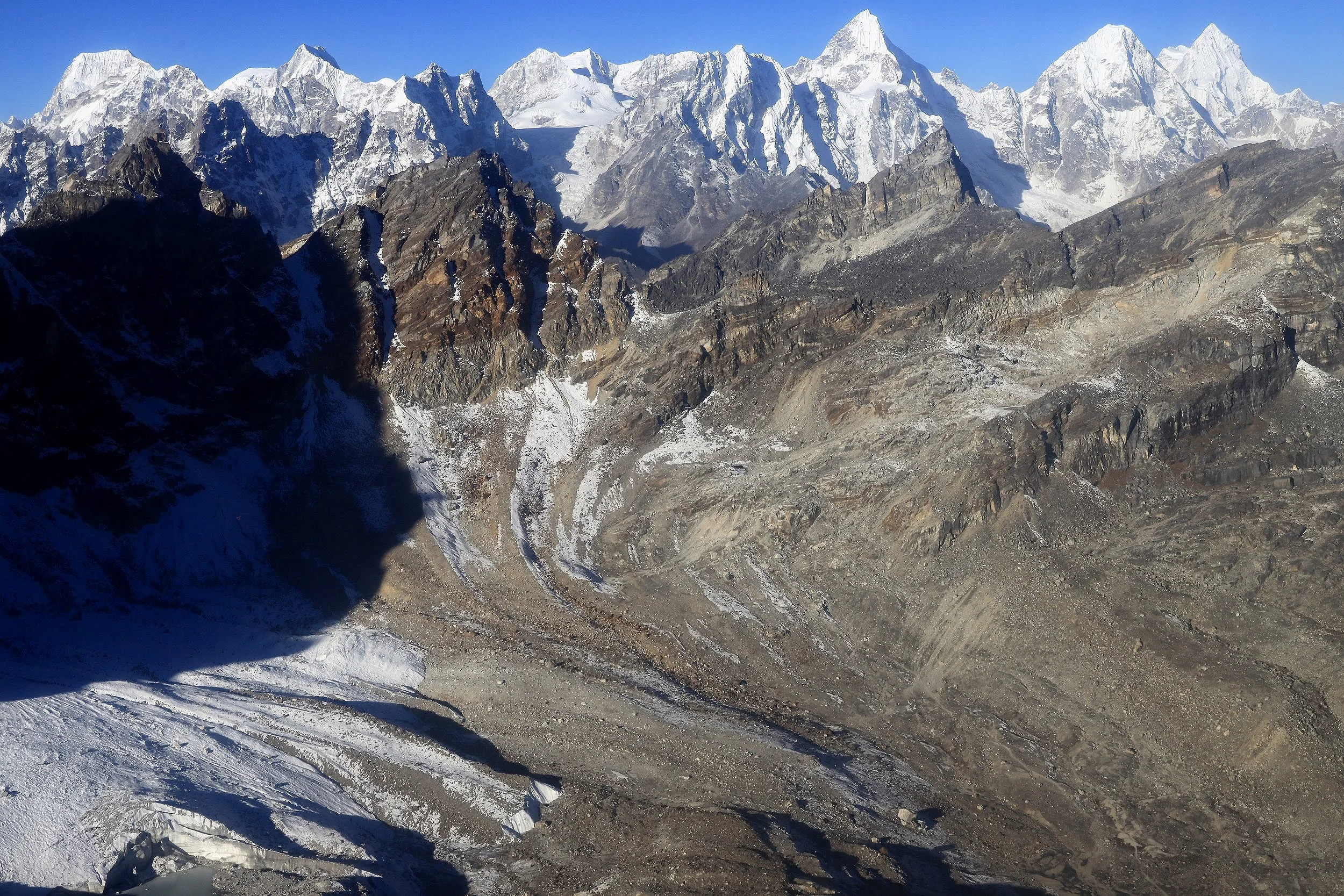
Mountains above Gokyo Valley south of Renjola
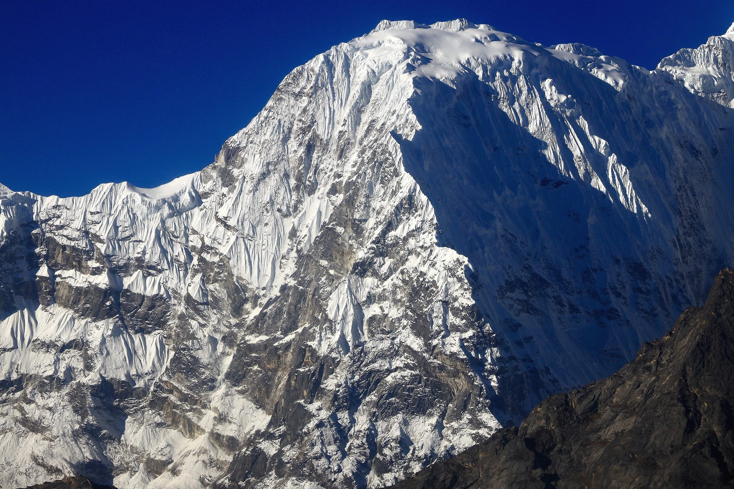
Phari Lapcha 6077m south of Renjola Pass
Phari Lapcha 6077m
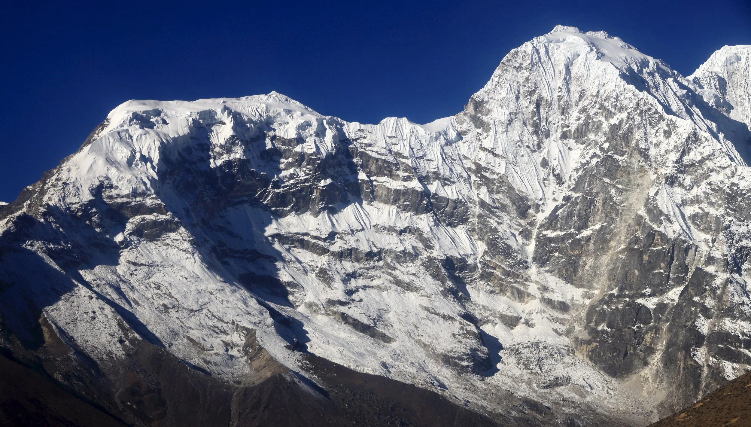
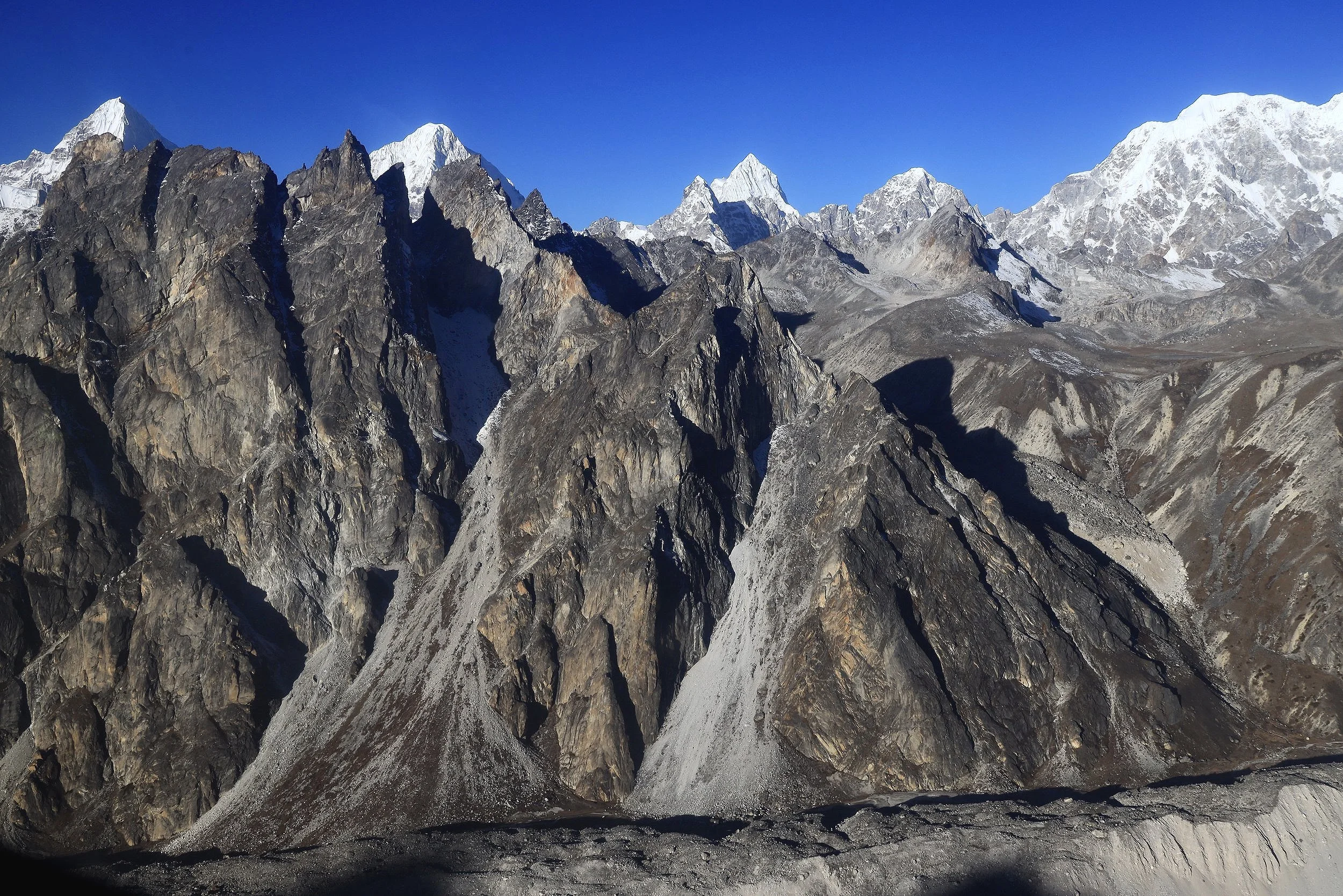
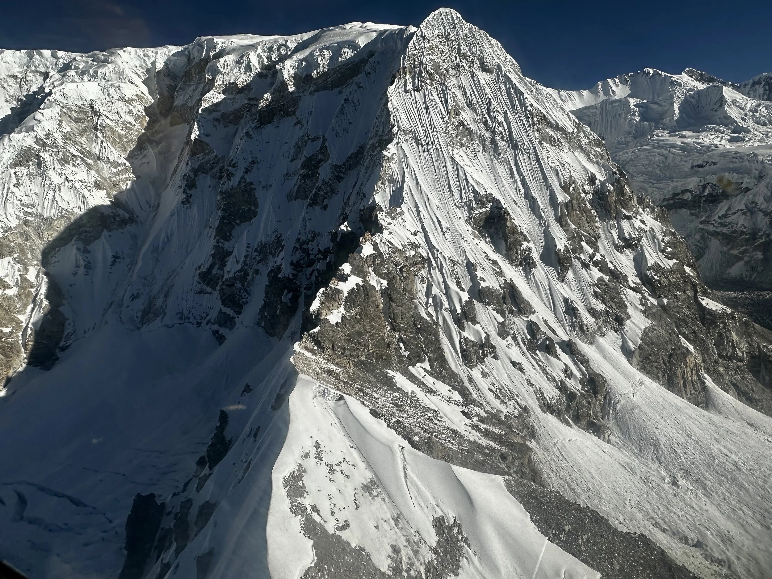
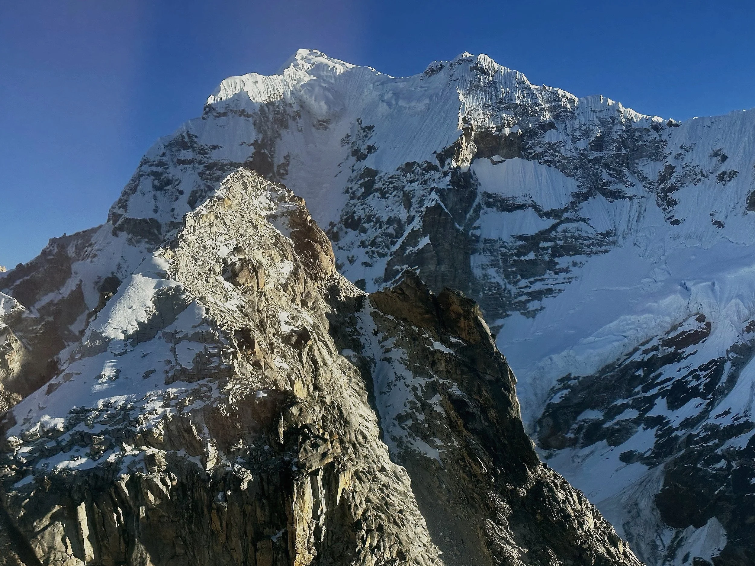
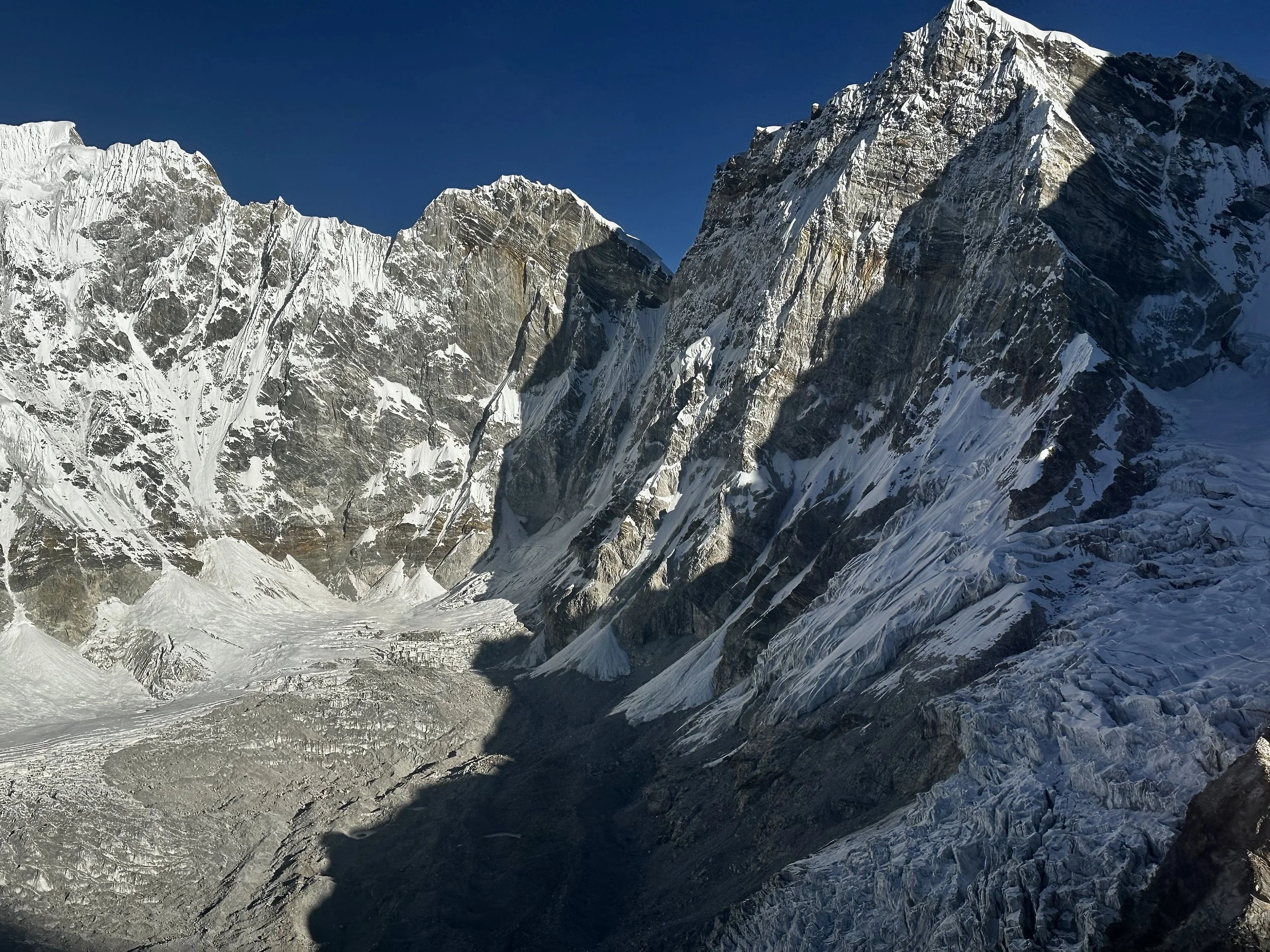
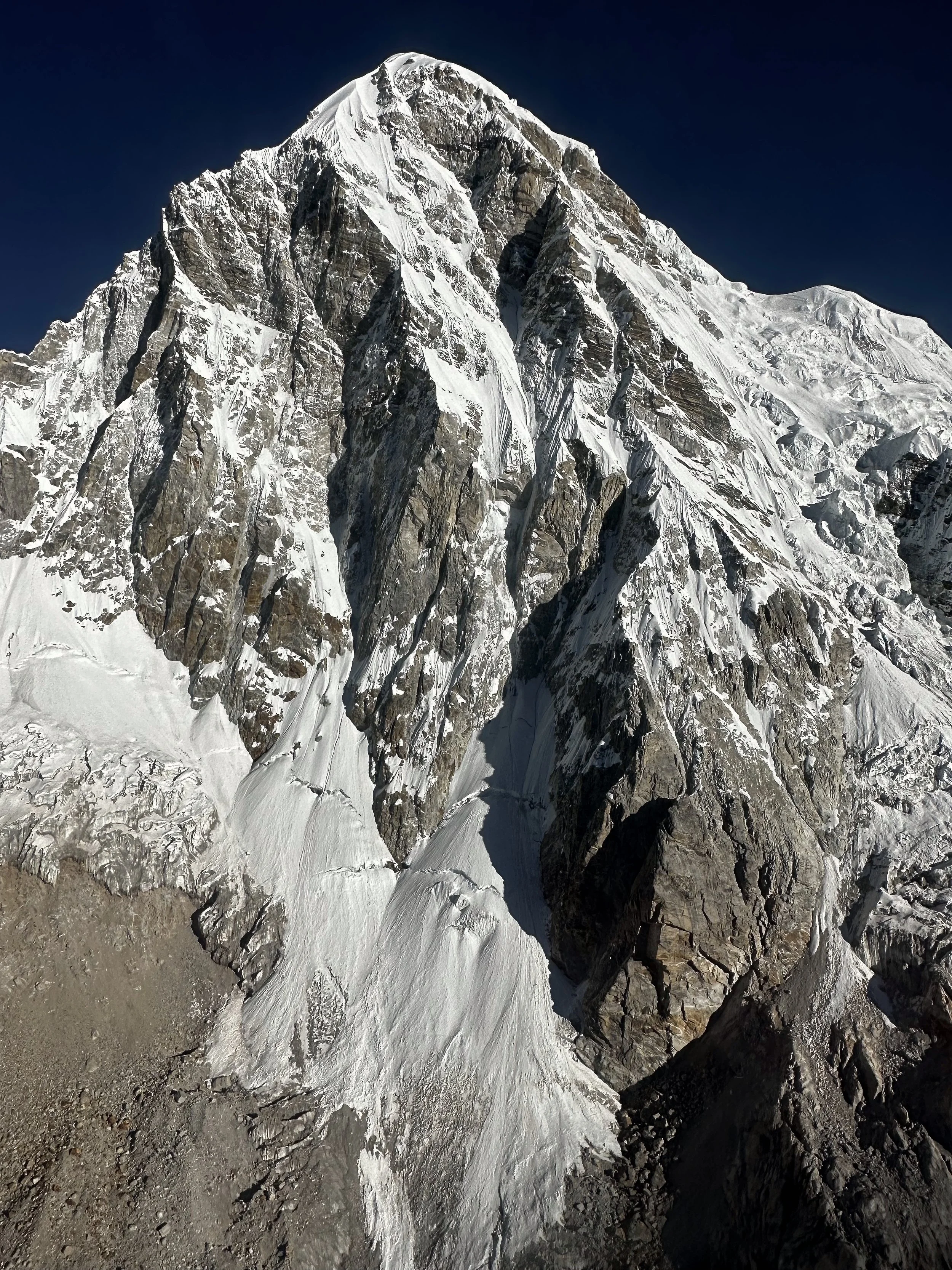
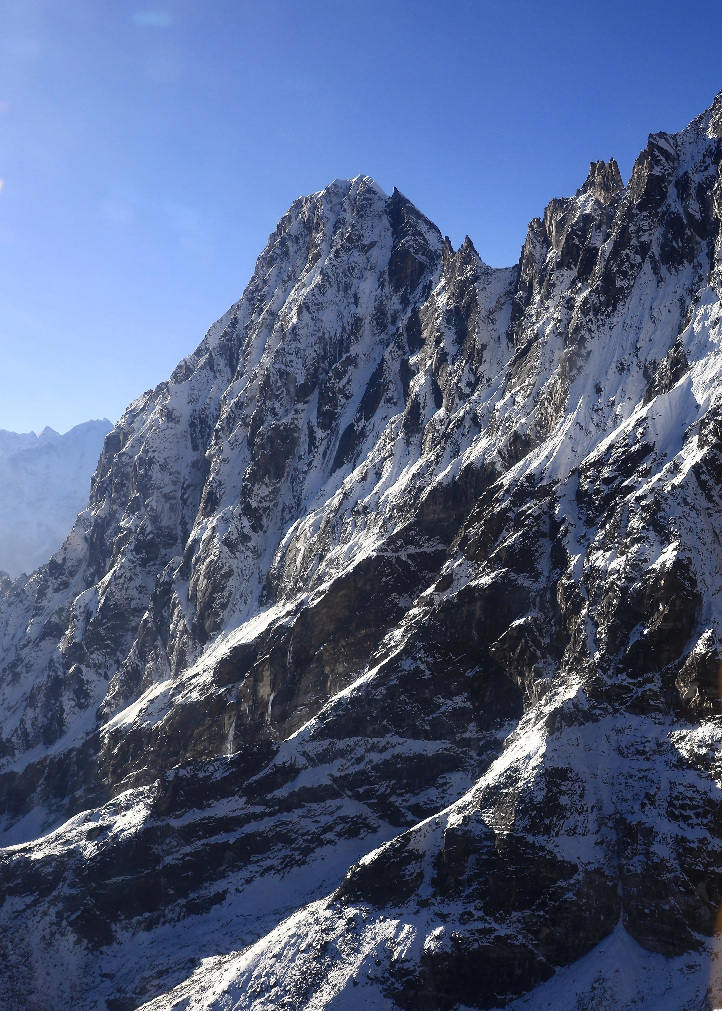
Tengi Ragi Tau
Dragnag Ri (left) 6757m and Khang Karpo 6646m
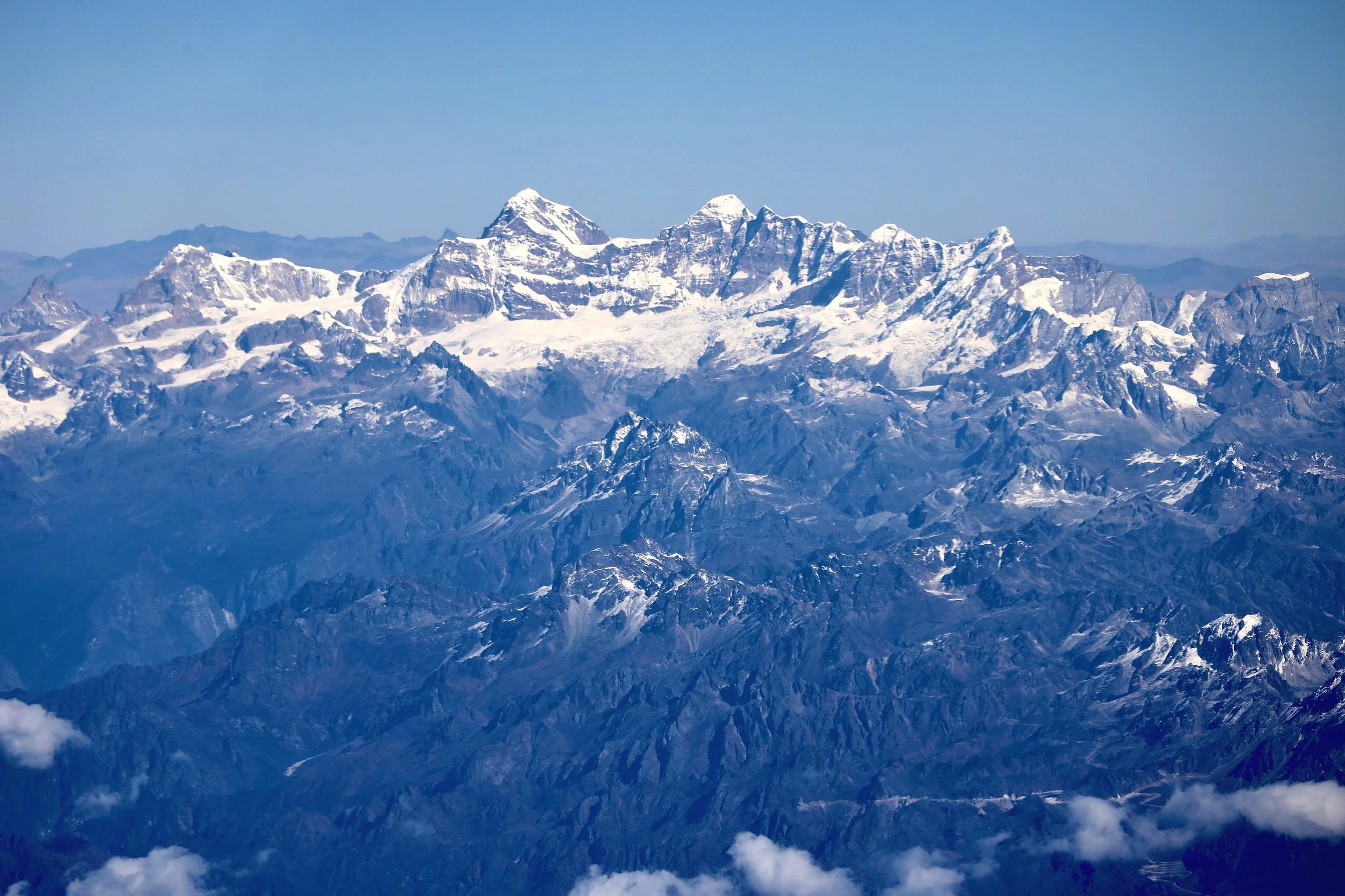
The Himalayas of Bhutan. This is the entire range of Bhutan. On the left if Chomloari, On the right Table Mountain and Gangkhar Puenseum (the highest peak of Bhutan) 7400m.
Chomolari 7315m, Chomolari 2 6935m, Jitchu Drake 6850m and Takaphu 6526m in Bhutan Himalaya
Chomolari, Chomolari 2 and Jitchu Drake in Bhutan Himalaya
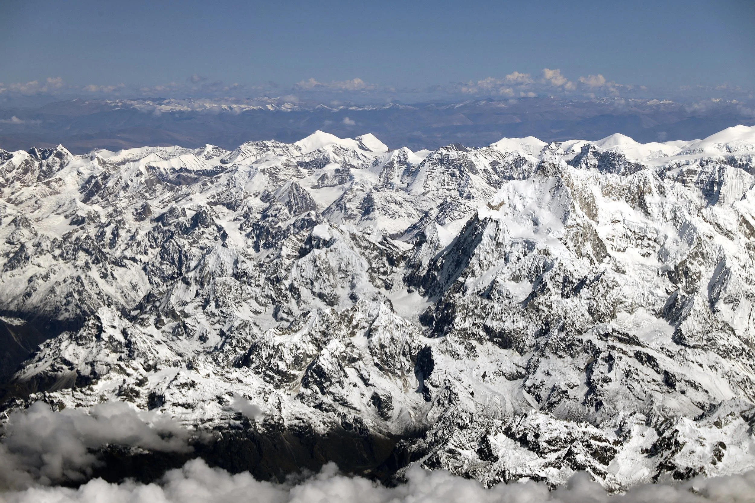
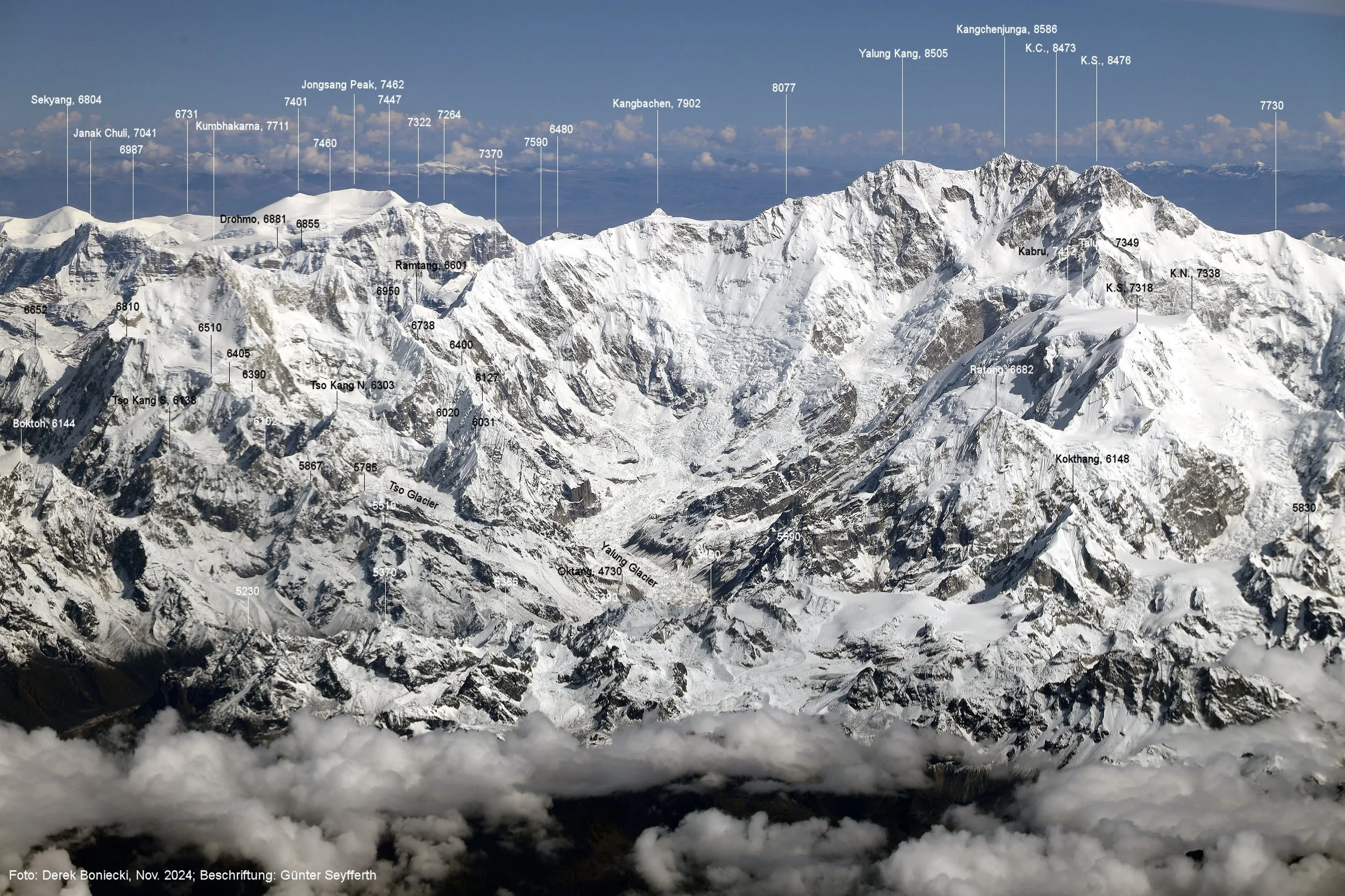
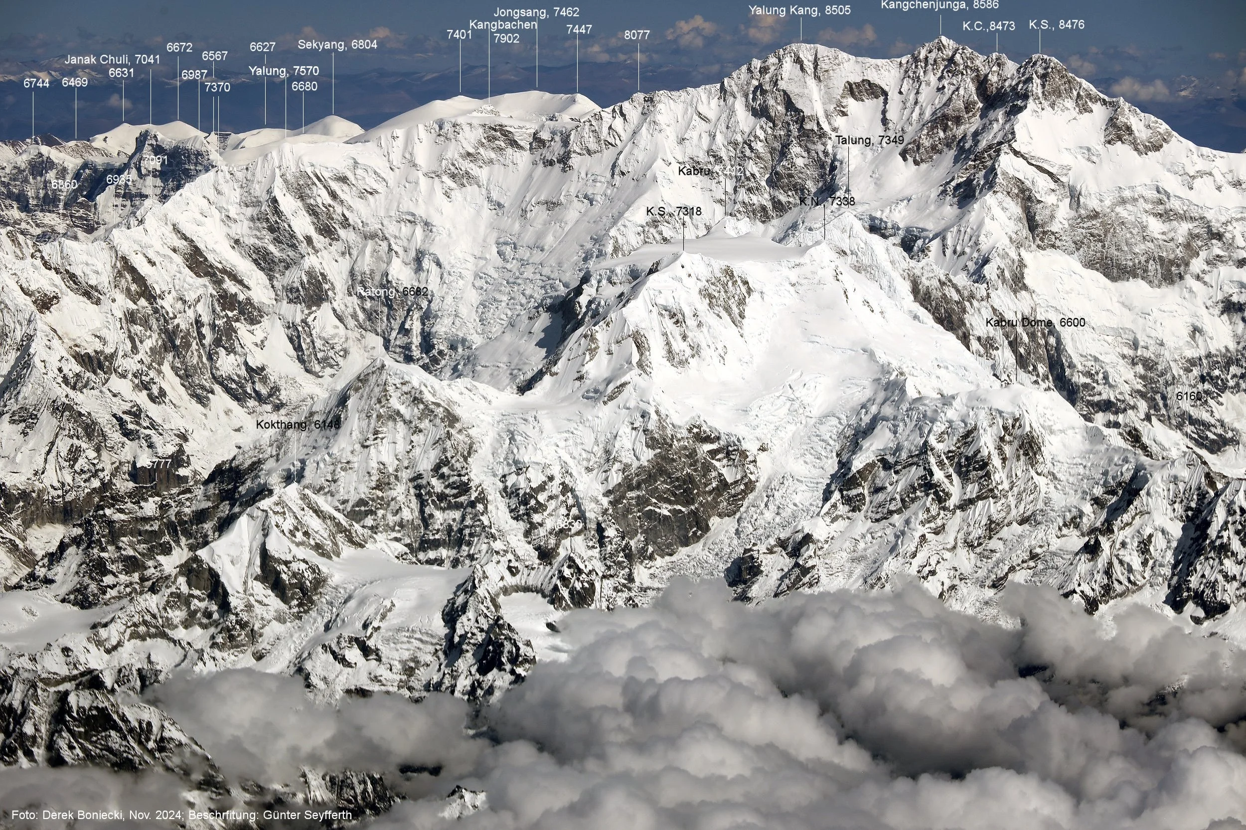
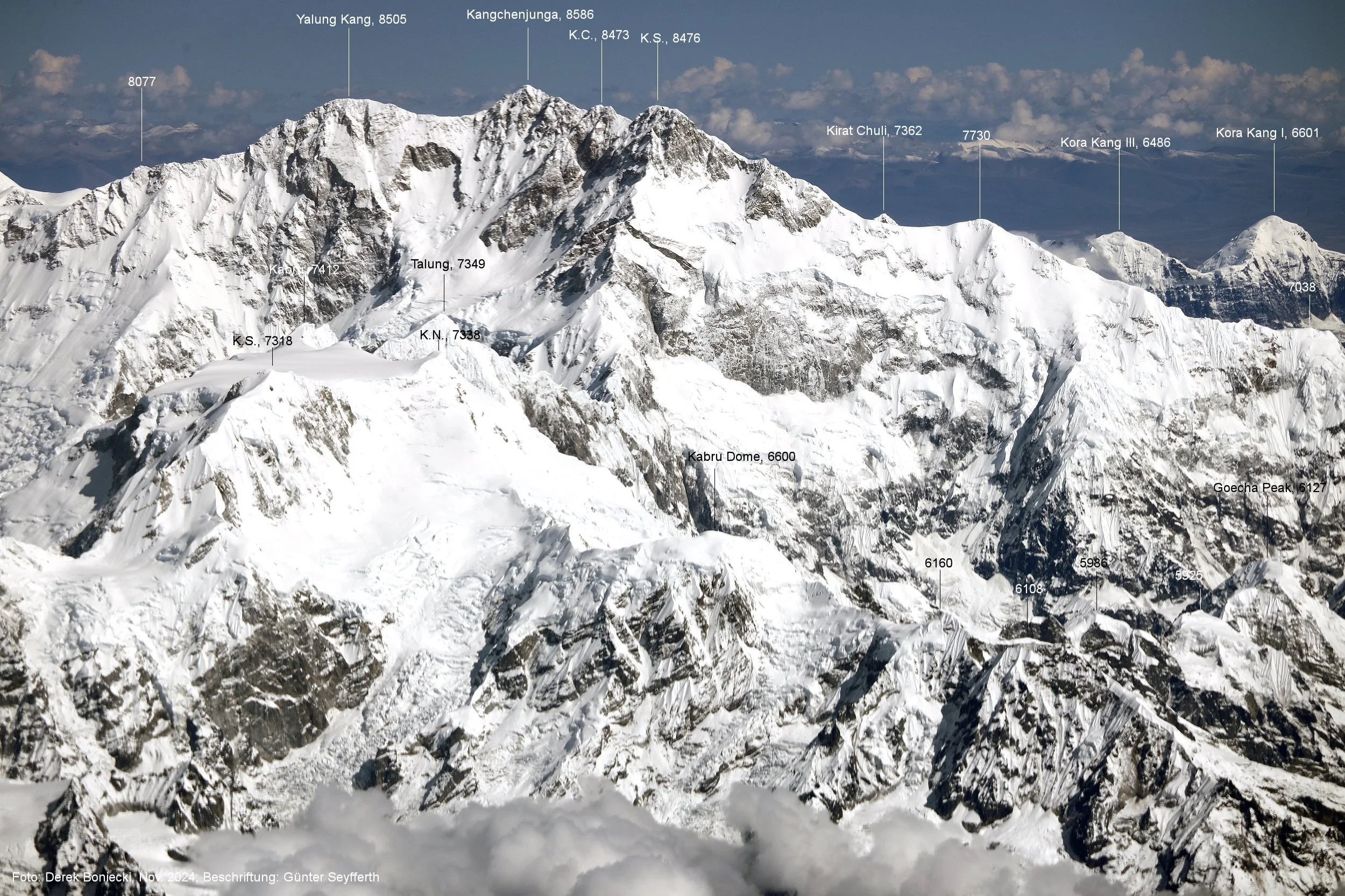
Kangchendzonga from Skikim side (from the East)
Langatang Himal, Shishapngma is on the left
Gauri Sankar 7314m in Rowaling Himal Nepal
Jugal Himal, Nepal/Tibet
Gauri Sankar in the Rowaling Himal
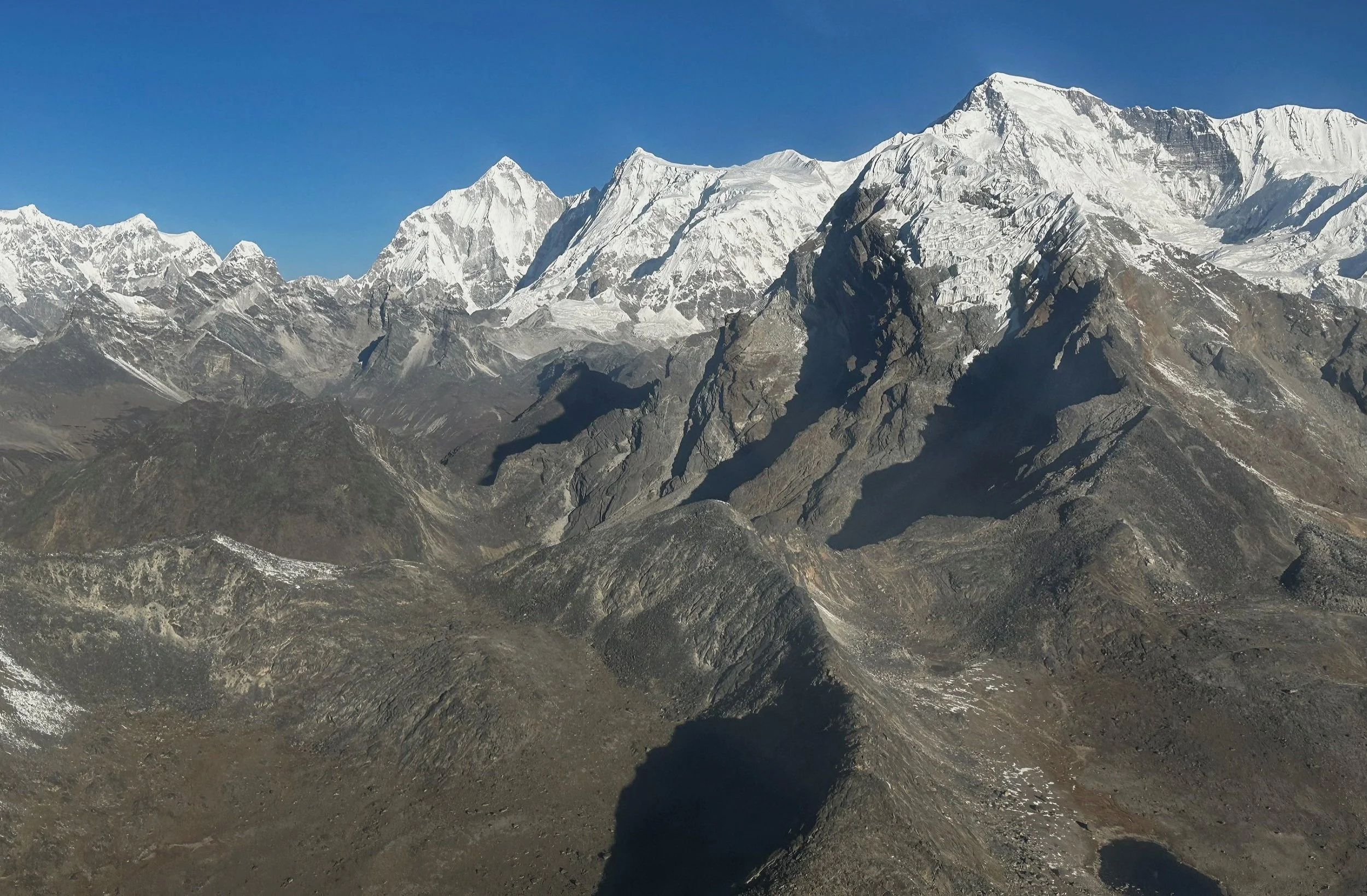
Looking towards Cho Oyu from the southwest. Rowaling Himal is in the foreground.
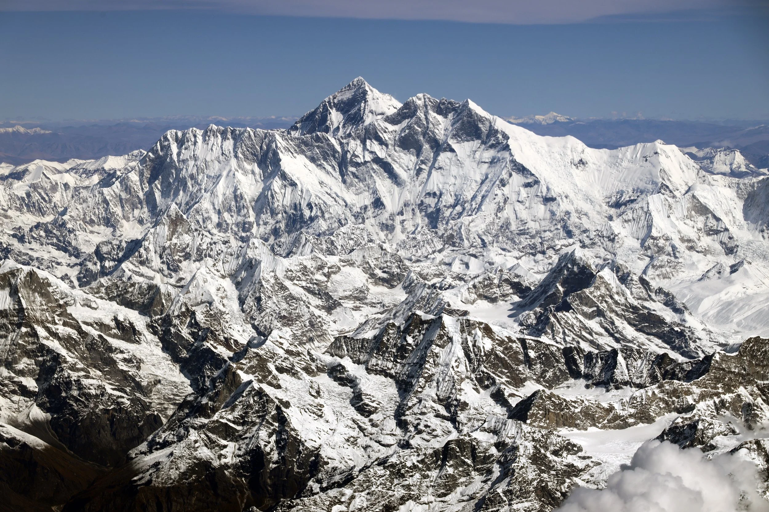
Mount Everest
Rowaling Himal with Cho Oyu
Rowaling Himal with Cho Oyu
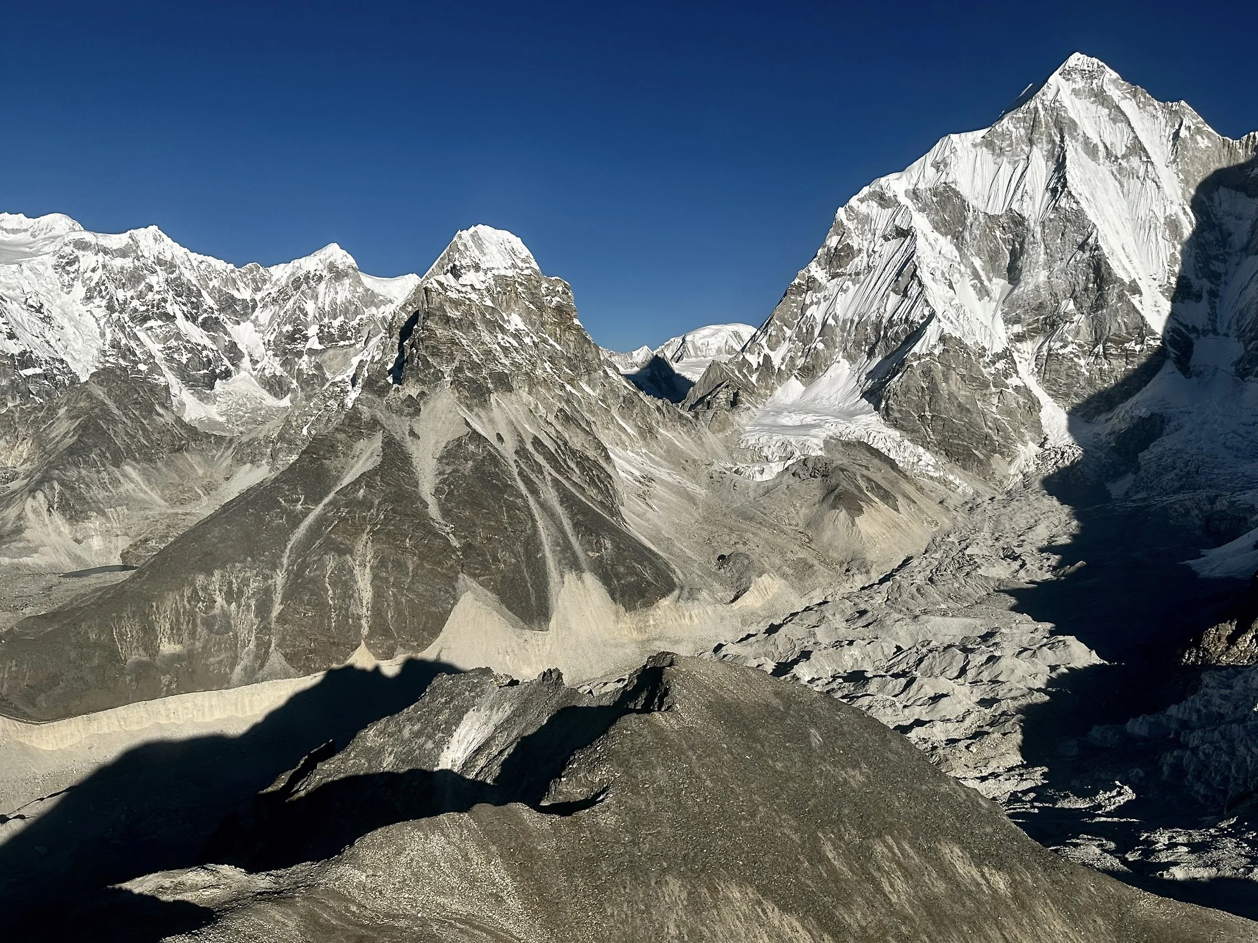
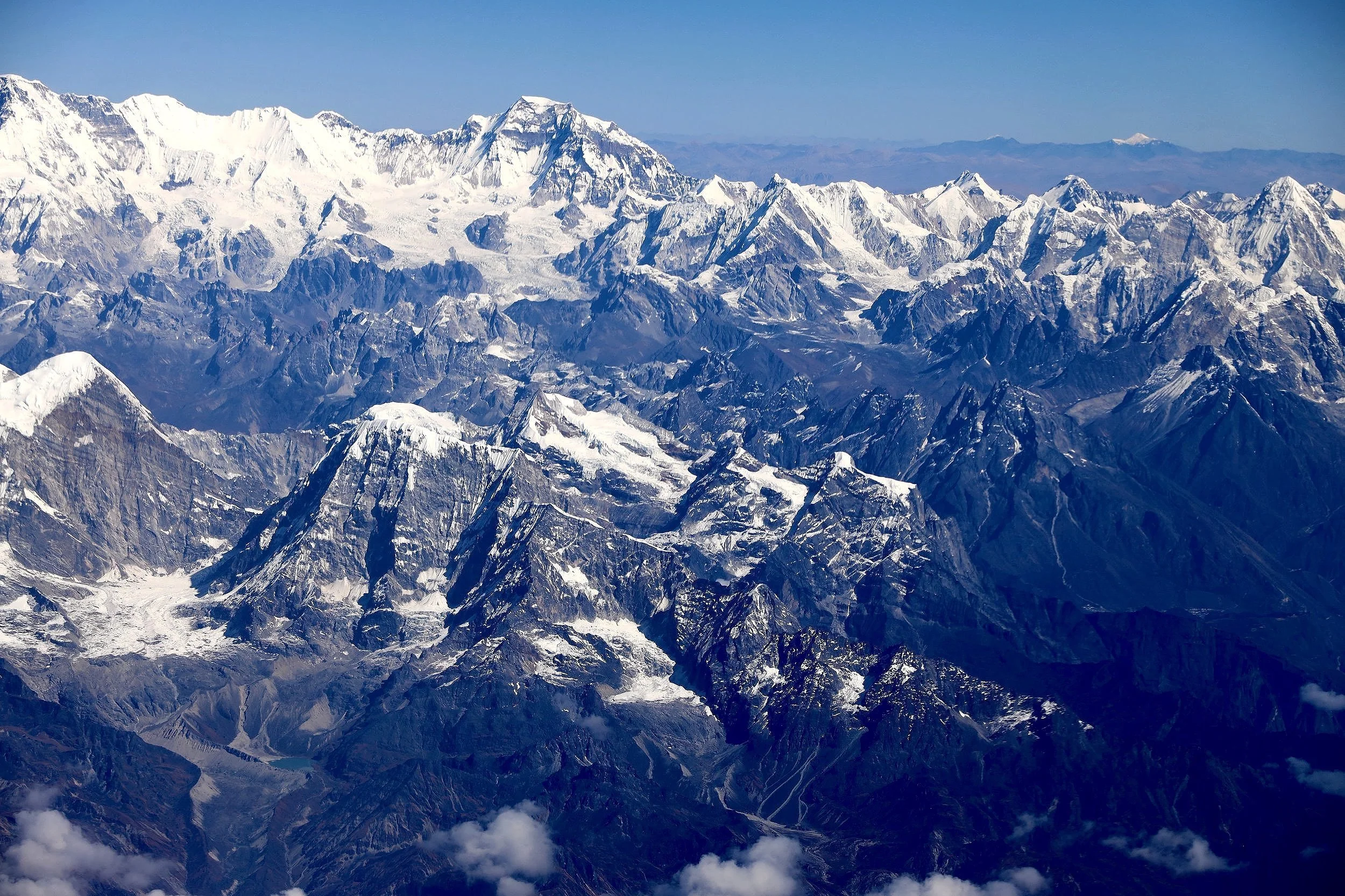
Pumori and the Khumbu central
On the right is Jasemba, than Nangpa La, Lunag 1 and Khumbu west
Jasemba in the centre and Cho Oyu is on the right
Mountains between Everest and Makalu
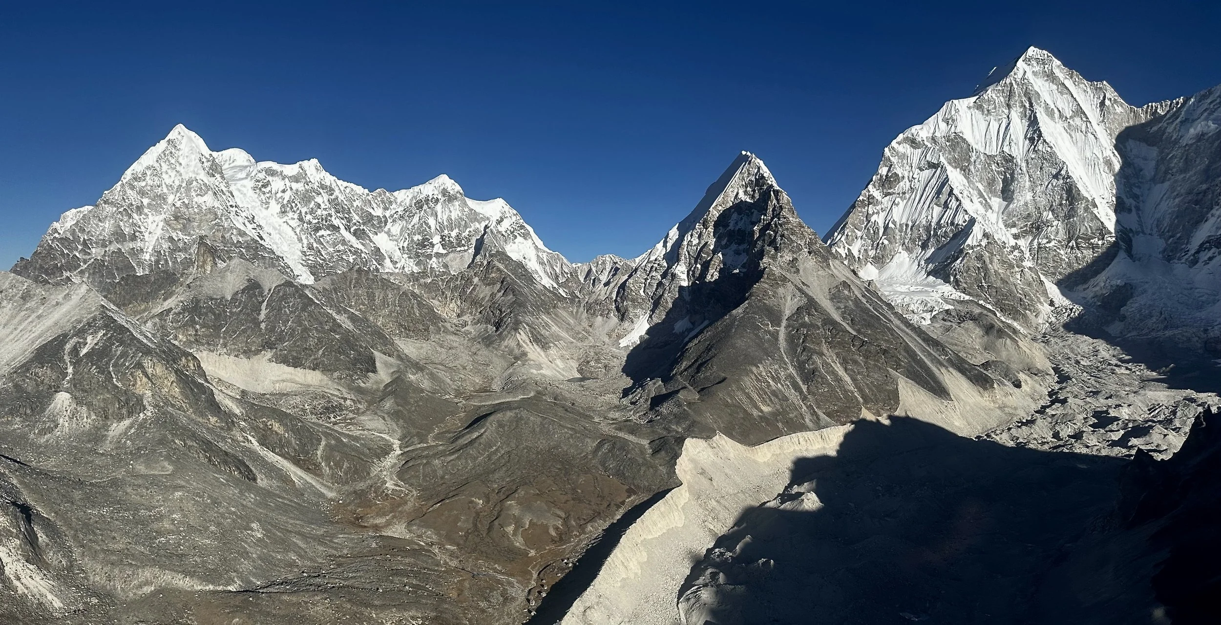
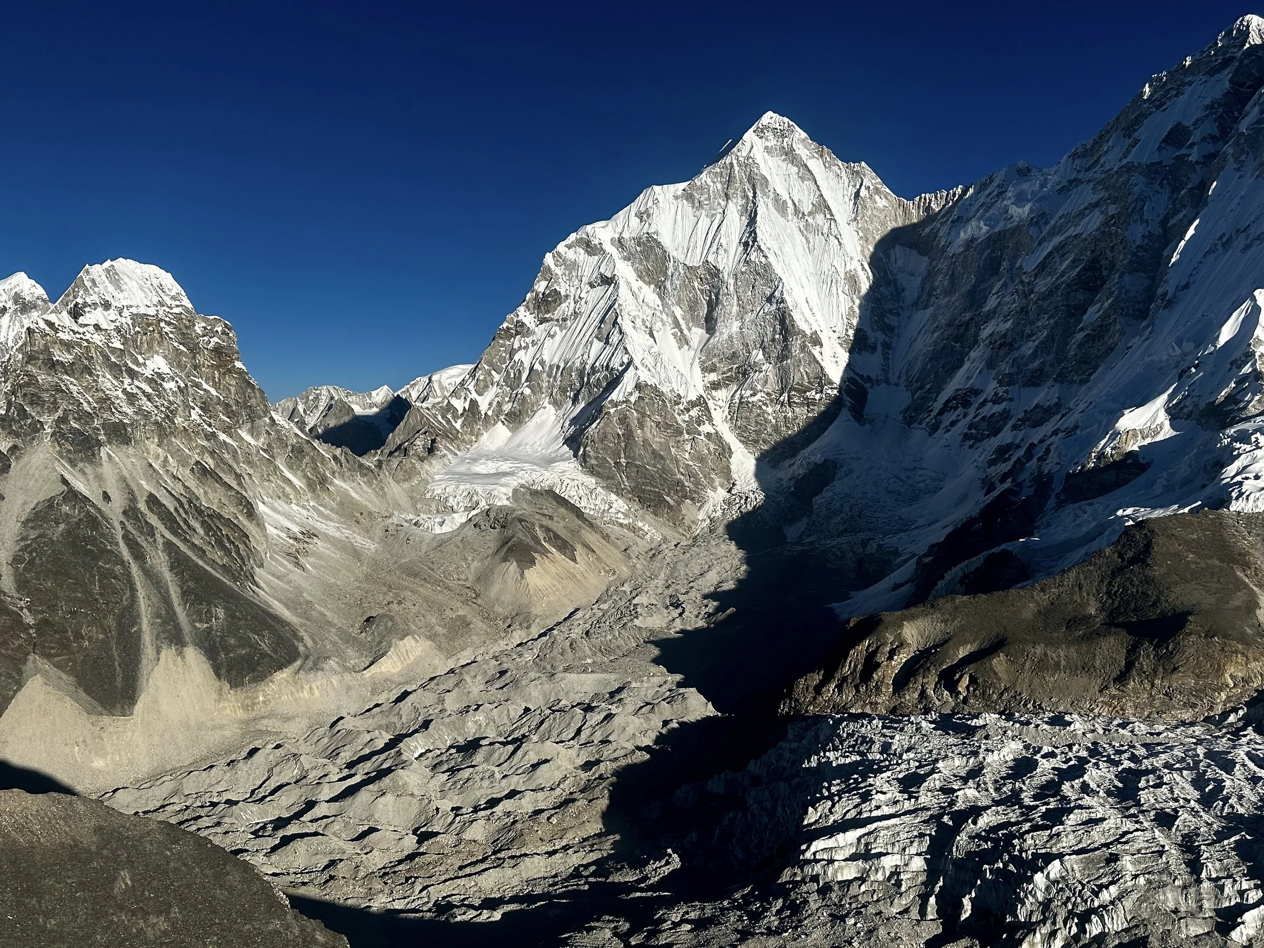
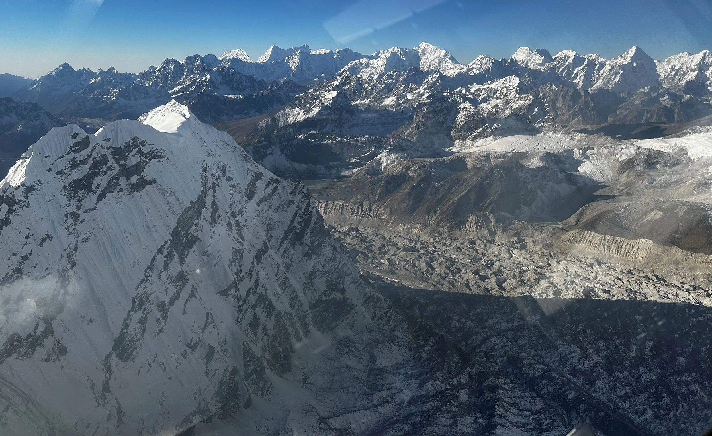
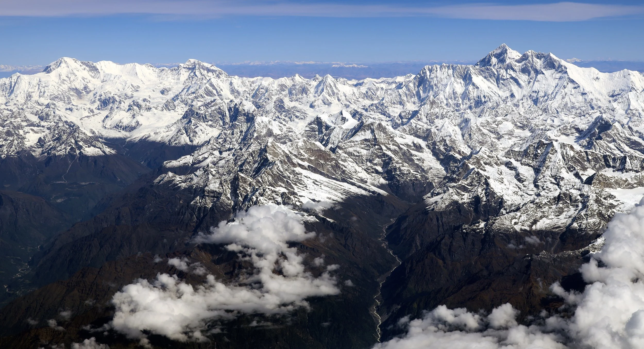
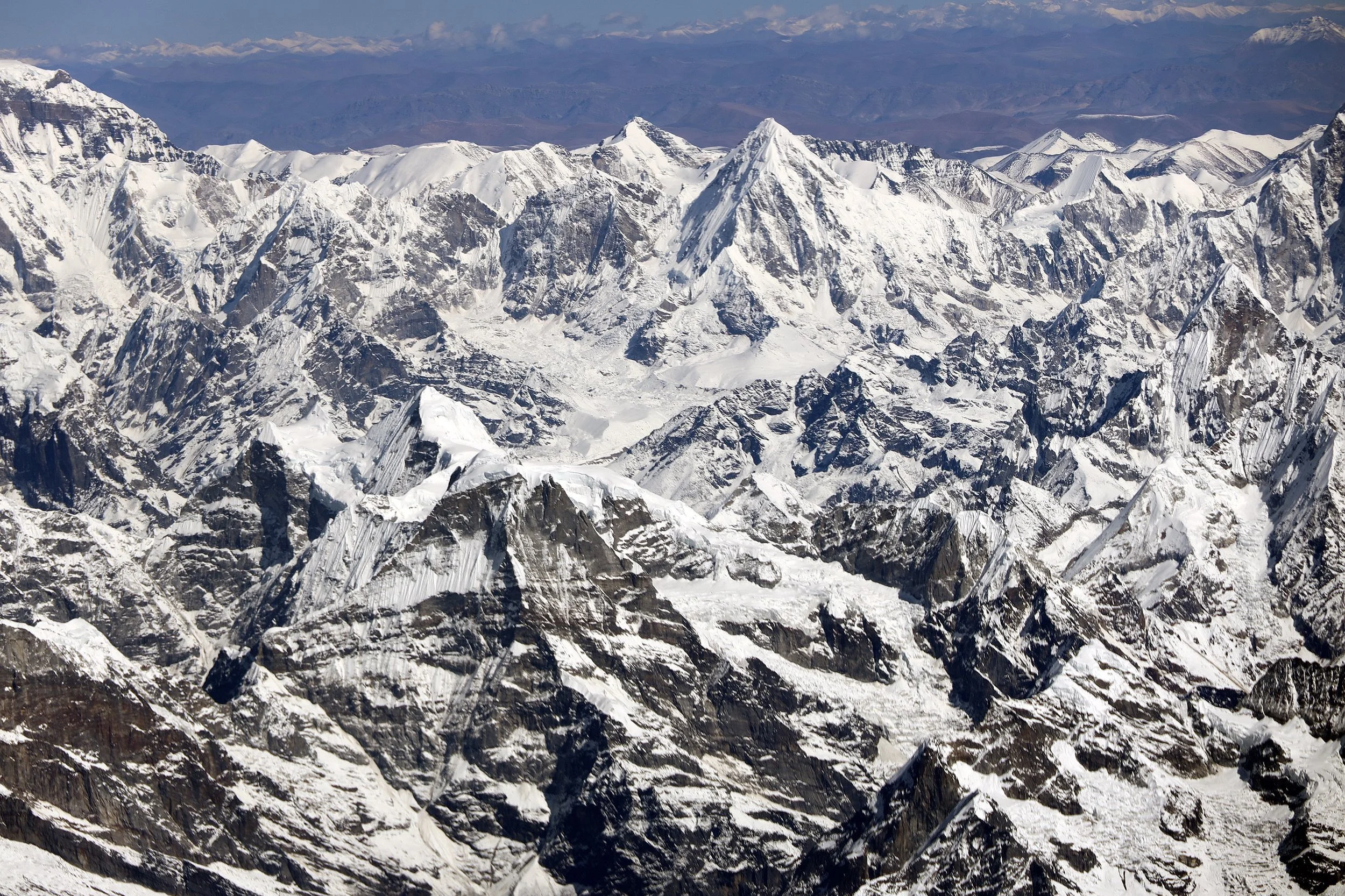
The Khumbu
Mount Everest
East Khumbu
The Khumbu. Cho Oyu is on the left. Everest is on the right.
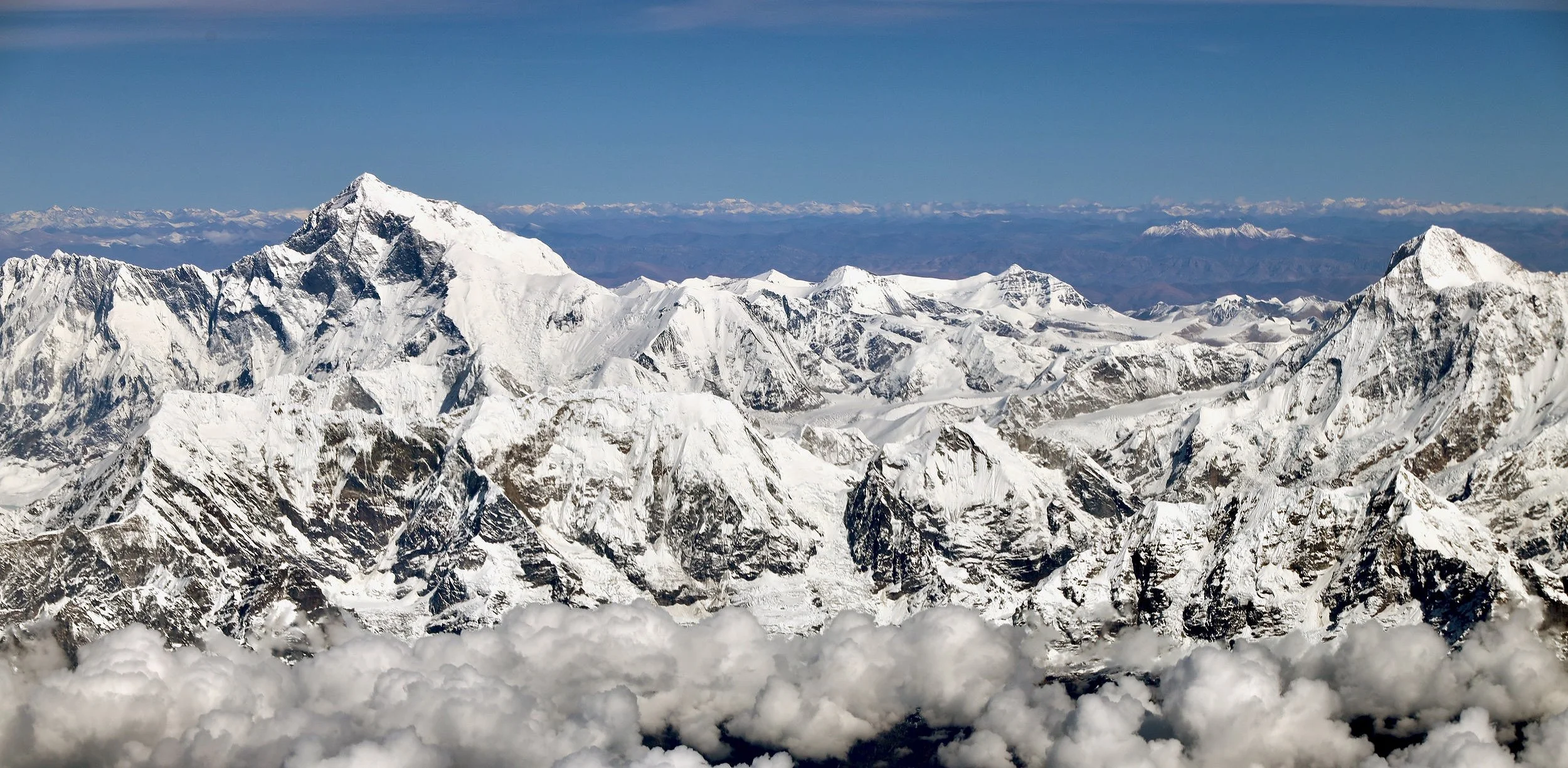
Everest is on the left, Makalu on the right.
Mount Everest and Lhotse
Everest, Nuptse and Lhotse
Pumori (the pyramidal peak in the centre)
Mount Everest
Mount Makalu
Chamlang (left) and Makalu
Makalu and Chamlang
Barun Valley and Makalu
Makalu
Mountains north-east of Makalu
Kangchendzonga region with Janu on the right
Kangchendzonga Himal. The valley of Gunsa is on the left.
Trail to Gunsa, Kangchendzonga
Kangchendzonga Himal. Janu is on the right.
Mt. Janu
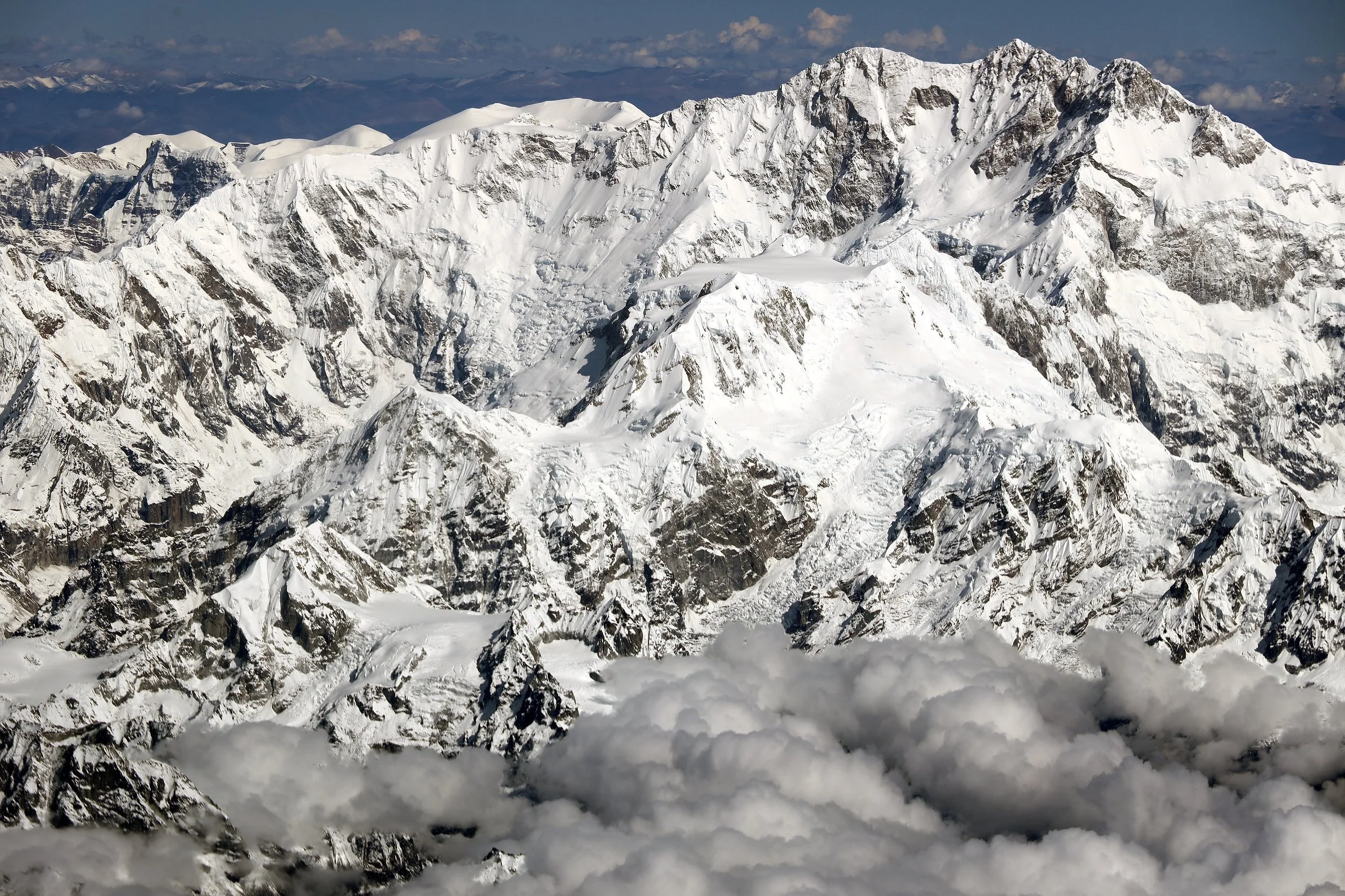
Kangchchendzonga south
Kangchendzonga Himal. Janu is on the right.
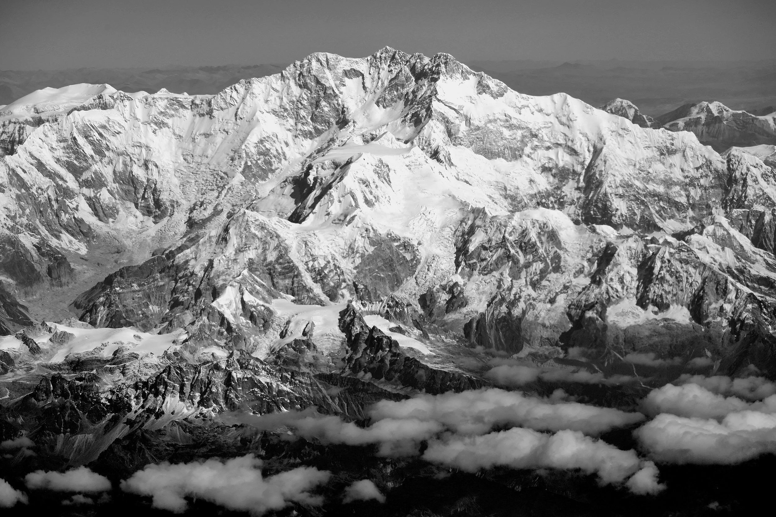
Kangchendzonga south
Kangchandzonga south
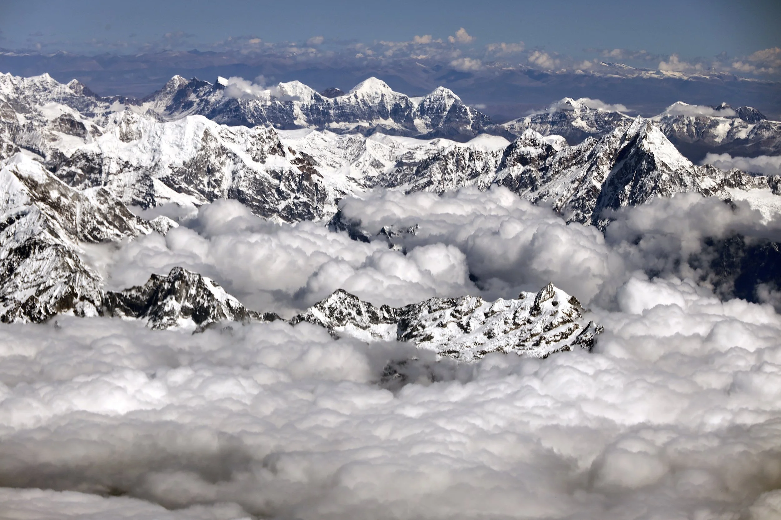
Sikim side of Kangchendzonga Himal
Sikim
Sikim
Join the discussion
Share thoughts, tips, or questions about this trip.
Please keep it kind and relevant.
All Trips and Adventures by Year
A chronological archive of trip reports, photo essays, and route notes across decades.
2026
2025
2024
- Mon - Bhutan
- Bhutan - Snowman Trek Part 1
- Bhutan - Snowman Trek Part 2
- Bhutan - Snowman Trek Part 3
- North of 60º - Polar Adventures
- East Greenland 66º North
- On the Trail of Teutonic Order Castles in Northern Poland
- Wolfsschanze Hitler's HQ, Ketrzyn Poland and Peenemunde WW2 V1/V2 Research Centre in North Germany
- Central Mexico - Mexico City, Puebla and Teotihuacan
- Venezuela - Orinoco River Delta
- Venezuela - Mount Roraima Trek 2810m
- Venezuela - Angel Falls
2023
2022
- Nepal Solukhumbu - Sumna Pass and Lobuche East trip summary
- Nepal Khumbu and Kangchendzonga from the Air
- Nepal Solukhumbu Sundar Peak 5000m and Sumna Pass 5400m
- Nepal Solukhumbu Chola Pass 5450m Lobuche East Ridge 6090m
- Renjola La 5360m Gokyo Ri 5450m, and Cho Oyu BC Photos
- Iceland - Hellismannaleid, Laugavegur and Fimmvorduhals Trails
- The Yukon and the Alaska Highway
- Mount Robson
- Yellowstone National Park
- Grand Teton and Glacier National Parks
2021
- The Rockies of Alberta, Western BC and the Yukon
- Columbia Icefield from the Air
- Waterton Lakes National Park
- Colombia
- Los Nevados National Park Colombia
- Colombia Tayrona National Park
- Colombia Teyuna - Ciudad Perdida Trek (The Lost City)
- Mexico Pico de Orizaba 5,630m
- Mexico - Sierra Negra 4,650m and Izaccihuatl 5,350m
- Chitwan National Park Nepal
2020
2019
- The Grand Mustang Circuit - Part 1: Chame to Kagbeni via Thorong La Pass
- The Grand Mustang Circuit - Part 2: Kagbeni to Lo Mantang
- The Grand Mustang Circuit - Part 3: Lo Mantang to TeriLa Pass
- The Grand Mustang Circuit - Part 4: Terila Pass to Chame via Naar and Kangla Pass
- Kamchatka Trip Report
- Камча́тка, Russia - The Mutnowski and Gorely Volcanoes
- Камча́тка, Russia - The Tolbachik Volcano Circuit and Volcano Bezimienny
- Russia Far East - Sakhalin, Vladivostok, Petropawlowsk-Kamchatsky
- Taiwan
- Ancohuma 6,427M Bolivia
- Huayna Potosi 6,088m Bolivia
- Ausangate Trek Peru
- Yellowstone National Park in Winter 2019
2018
- Calgary Mountain Film Festival
- Langtang, Tilman Pass and Ganjala Trip Report
- Langtang Trek - Tilman Pass
- Langtang Trek - Ganjala Pass
- Paria River Wilderness - USA, Utah
- Slot Canyons - USA, Arizona
- Bryce National Park - USA, Utah
- Zion National Park and Cedar Breaks - USA, Utah
- Norway
- Poland - The Slav and Viking Festival in Wolin
- Iceland
- Bolivia Cordillera Real and Sajama National Park
- Bolivia - Tiwanaku and La Paz
- Togo and Benin
- Benin - Egungun Masquerade
- Benin - Voodoo Festival
- Ghana - The Gold Coast and the Land of the Ashanti
2017
- Annapurna Basecamp and Annapurna Sanctuary Photos
- Annapurna Sanctuary Trip Summary
- Dhaulagiri Basecamp Trek, Dhampus Pass - Trip Summary
- Dhaulagiri Circuit Photos - Nepal
- Peru Central - Huaraz, Cordillera Blanca and Chavin de Hauntar
- Peru South, Sacred Valley - the Land of the Incas, Rainbow Mountain and Lima
- Mt. Brazeau and Maligne Lake in Jasper National Park in Alberta, Canada
- China Shanghai Beijing Wuhan
- Papua New Guinea
2016
- China Far West - Kashgar and Shiphton Arch
- China Far West - Pamir and The Tajik Games
- K2 Basecamp North, Shaksgam Valley Trip Summary
- Chinese K2 (BC North), Shaksgam Valley - Chinese Karakoram
- North Peru Chachapoyas Trip Report
- Peru North - Kuelap, Chachapoyas and Royal Tombs of Sipan
- Wapta Icefiled Area, Alberta, Canada
- The Caribbean and the Panama Canal
- China Far West - Ancient Silk Road Trip Summary
- China Far West - Ancient Silk Road
2015
2014
2013
2012
2011
2010
2009
2008
2007
2006
2004
2002
2001
1996
Get new trip reports when they land
One email when a new story is published. No noise. Just the trail.